


Loopysue
Loopysue
About
- Username
- Loopysue
- Joined
- Visits
- 10,020
- Last Active
- Roles
- Member, ProFantasy
- Points
- 9,874
- Birthday
- June 29, 1966
- Location
- Dorset, England, UK
- Real Name
- Sue Daniel (aka 'Mouse')
- Rank
- Cartographer
- Badges
- 27
Latest Images


-
Area measurement tool
No one is fantastic at CC3 right at the outset ;)


-
Area measurement tool
It's an area in square map units. In an overland map that will be miles if it is imperial, or kilometres if its metric. In city or dungeon maps map units are always either feet in imperial, or metres in metric.
-
Top down symbols for overland maps.
The thing about top down mountains is that they are pretty inflexible as symbols. Hill shading means they can't be rotated or mirrored, and that means you need maybe a hundred symbols instead of just the usual 20 or so.
You might think that using a map file would be the solution, but at the current time if you have a faded edge all the way around a symbol as would be desirable for a top view mountain or hill to blend it into the background properly, the map file doesn't work properly. Faded edges upset them quite badly to the point where you end up with strange white strips of missing rows of pixels in the resulting symbol. I haven't worked out how to get around that problem myself, which is why I haven't yet done a top view overland style.
![[Deleted User]](https://secure.gravatar.com/avatar/c75d9a245b74d9c59be0999ea81ca541/?default=https%3A%2F%2Fvanillicon.com%2F92add7f8c954488718110edc4896ad39_200.png&rating=g&size=200)


-
Winter Trail Project
Thanks Julian :)
And you're right - the assets have been handed over so Ralf has time to do his bit of magic making it all work properly for you. Myabe if I have time I might do something, but I've just started a new much larger project so I don't know when that might be.
-
Winter Trail Project
Well, I finished the more simple map as one of the example maps, and I think it shows the style more clearly. One of the other examples is a conversion of Ranger's Hill from Forest Trail part 2. It should be reasonably easy to convert Forest Trail maps to Winter Trail maps.
Winter Trail is due out as the March issue this year.
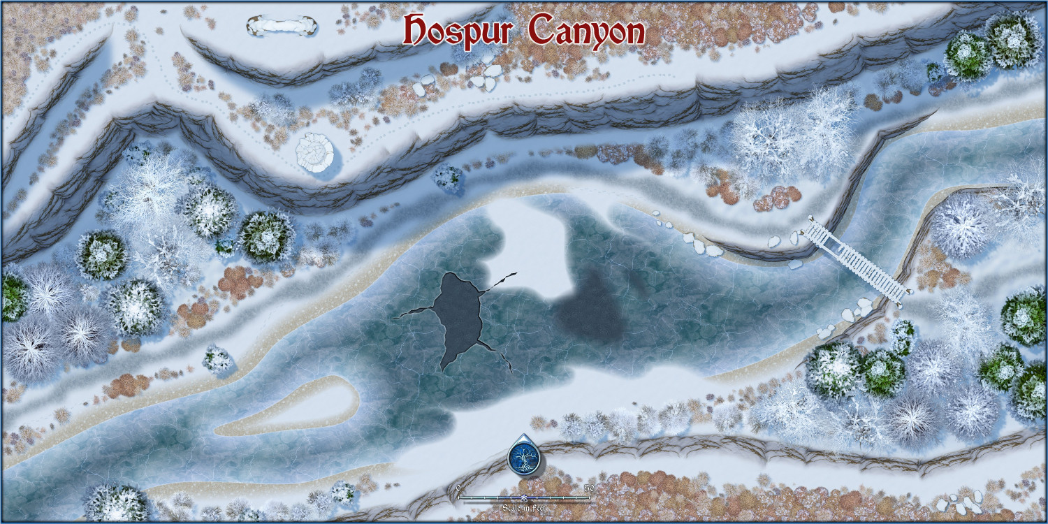
Both of my example maps can be viewed at much higher resolution in my New Style Example Maps gallery.

