


Loopysue
Loopysue
About
- Username
- Loopysue
- Joined
- Visits
- 9,972
- Last Active
- Roles
- Member, ProFantasy
- Points
- 9,853
- Birthday
- June 29, 1966
- Location
- Dorset, England, UK
- Real Name
- Sue Daniel (aka 'Mouse')
- Rank
- Cartographer
- Badges
- 27
Latest Images


-
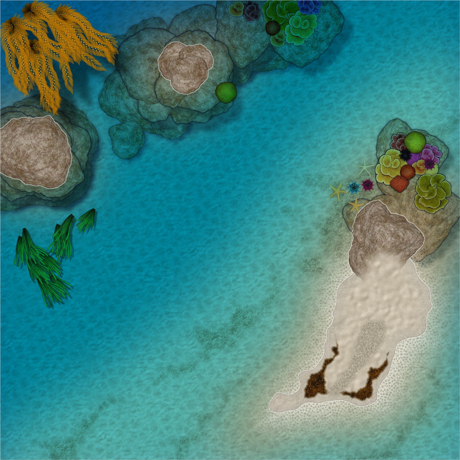
Marine Dungeon - a Cartographer's Annual development thread
When the world gives you loads of noise at 4am, use it to do something useful and sleep later in the day.
How am I doing for colours, rocks, and overall appearance?


 and 5 others.
 -
A couple maps
Well... maybe, on the font size.
It's bit hard to tell when the map is so small in all that white.
If you want to get rid of it and get the maximum map for the minimum MB, try using the "JPEG Bitmap file" save as type, and making your settings a bit like this:
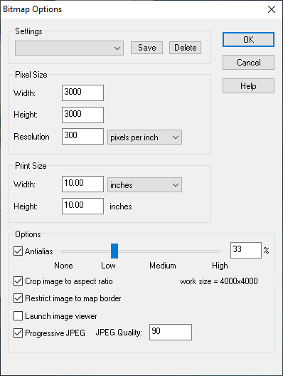
The area of the map is then automatically rendered within the map border, and trimmed on the short side so that the long side is 3000 px.


-
And another small map, this time in SS2 / CSUAC2
You're making some really pretty maps, Daniel :)


-
WIP: Cartographer Guild May Challenge
Nice work on the rivers so far :)
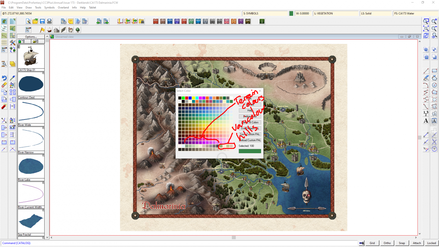
The way the terrain textures are designed, it may be easier to add the rest of the various greens and browns before the mountain background, though it depends on your personal taste. All of them (the colours - including the mountain background) are just polygons drawn on the same sheet and massively blurred, then blended with the paper, so whatever you add first tends to diminish beneath later colours that overlap. If this happens to your map just use the bring to front tool and grab the mountain background colours (there are 3 of them in fact in various shades of increasingly dark grey) to bring them forward.
You may find that doubling or trebling the size of the blur on the TERRAIN Colour sheet will improve the overall appearance of the map, since it is quite a large map. The colours are meant to work like a smooth gradient across the map without any noticeable edges. Edges are for the scrub and farmland textures, which are on different sheets to the terrain colour.
The colour palette with this style contains all the terrain colours in a single row. Towards the right hand end of that row of colours there are a range of colours for the varicolour hills so that you can match them with the terrain colours a little better when you have finished colouring the terrain. You can change the colour of a varicolour hill using the change properties tool if you end up with any mismatches by the end.


-
Live Mapping: Darklands Annual
Hi Everyone :)
In this week's Live Mapping session on Thursday 6 May, Ralf will be demonstrating the use of the new Darklands Annual, published as this month's issue of the 2021 Cartographer's Annual
Come along and join in the fun :)
