


Loopysue
Loopysue
About
- Username
- Loopysue
- Joined
- Visits
- 9,975
- Last Active
- Roles
- Member, ProFantasy
- Points
- 9,854
- Birthday
- June 29, 1966
- Location
- Dorset, England, UK
- Real Name
- Sue Daniel (aka 'Mouse')
- Rank
- Cartographer
- Badges
- 27
Latest Images


-
breaking up repetition with bitmap scale variations
Yes, I remember there being something myself but I can't find it now either. We must both be using the same 'wrong' search words.
But never mind - I can possibly help you here.
Make a new sheet immediately above the one with the repetition issue (under it in the sheet listing because the sheet listing is upside down to most people's way of thinking).
Either:
- use one of the semi transparent fills (denoted by having a 'T' in the fill name in DD3) in patches on that sheet, or
- add an Edge Fade Inner sheet effect to the new sheet, and then draw patches of similar textures on that. When you refresh the drawing the EFI will blend the edges into the old sheet.
It's more effective to use similar textures rather than the same one. For example if you have several shades of grass use one of the other shades of grass to patch the original grass.
It can take a little practice to get the second method to work correctly, but I've found it more effective than the first one.
...
EDIT: It is also worth remembering that repetition becomes far less obvious when there are more objects in the map, so if you are staring at just the background with nothing else at the beginning of a map you will inevitably see the pattern. It might be worth finishing the map before you decide to go through the process of patching.


-
Live Mapping: New Isometric Cities
Hi Everyone! :D
In this week's Live Mapping session Ralf will be demonstrating all the beautiful new symbols Mike Schley has made to expand the Isometric Cities style. All such free monthly sets can be downloaded from your account page listed under your "Campaign Cartographer 3 Plus" registration list as a single combined installer.
Come and join in the discussion live here on YouTube:
https://www.youtube.com/watch?v=MvJC8OMXCDo
Or if you prefer you can watch it later right here:
We look forward to hearing from you in the chat :)
If you miss the live session a recording will be available on the Profantasy channel, and if you want to chat about it after the event feel free to use this thread.

-
Live Mapping - Hilltop Fortress (3)
Hi Everyone! :D
In this week's live mapping session Ralf will be returning to the Hilltop Fortress map for a third and final time to finish up the surrounding swamp and add finishing touches. He will also be taking a look at preparing the map for use as a battle map in a virtual tabletop setting.
Come along and join in the chat on YouTube here:
https://www.youtube.com/watch?v=63sds-xnzow
Or watch it here on the forum if you prefer.

-
Live Mapping: Hilltop Fort 1
It's tomorrow, Jim. Thursday, not Wednesday.
-
Change the contour of a landmass to a predefined path on another sheet
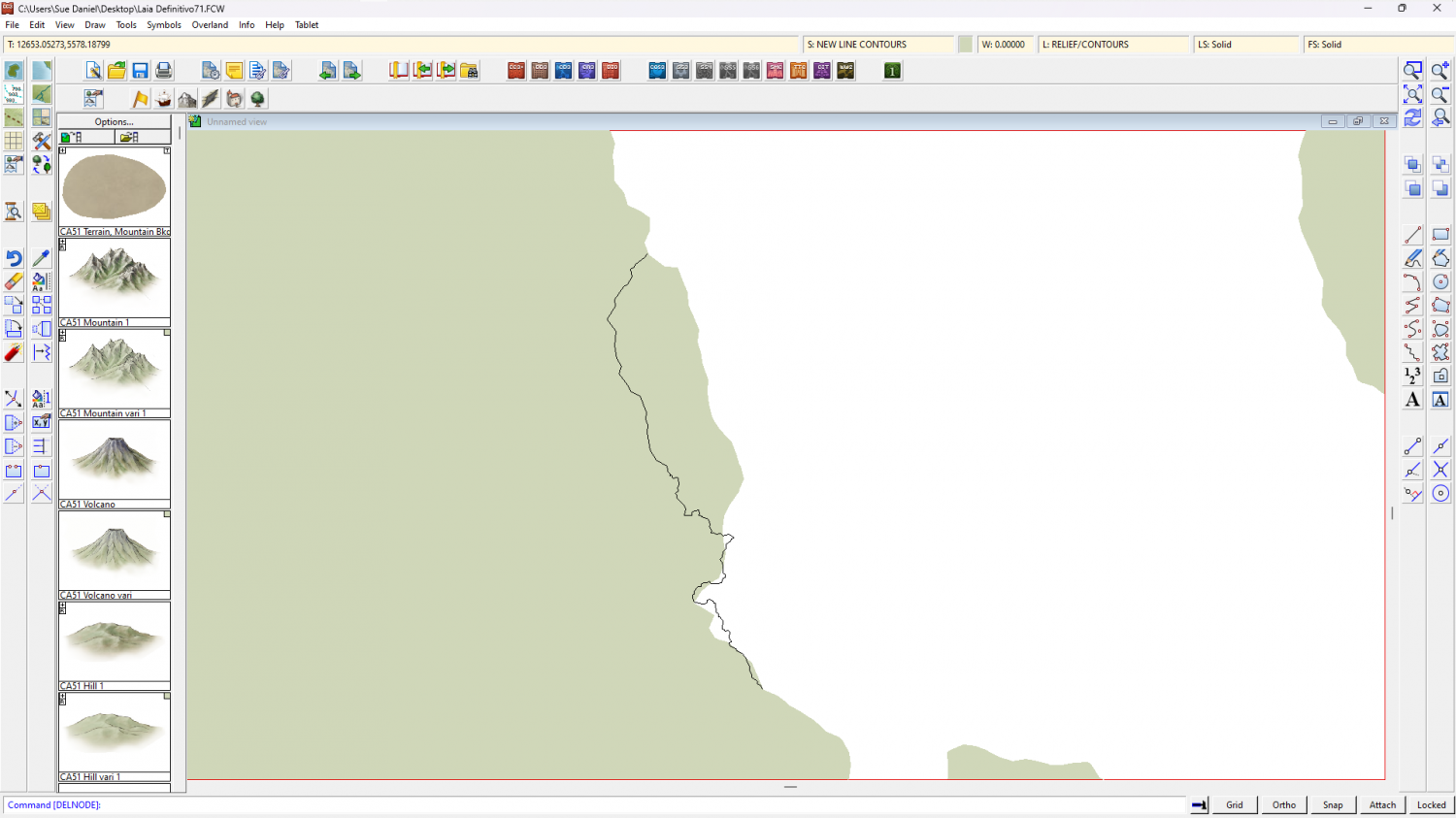
Stage 1
I exploded the land polygon because as an export from FT3 it was automatically a 'multipoly', which means you can't edit it or trace it. Then I hid the land and trimmed that black line down to just the wiggly side so I could see what I was doing.
As a side note to that simplified instruction - although I had picked the properties of the land before I exploded it, so that the exploded polygons would have the same properties as the original multipoly, they had a line width greater than zero, so became outlines rather than solid polygons. I put that matter right using Change Properties on all the bits of land to reset the line width to zero.
Stage 2
Next (and because I'm not great at using the editing facility of drawing tools) I decided to use the Land, Default drawing tool to trace the original landmass, breaking off the tracing at either end of that wiggly black line and tracing that instead of the original coastline in that area to close the polygon. The default land drawing tool uses a different fill colour to your original land mass, which is coincidentally convenient to show the result.
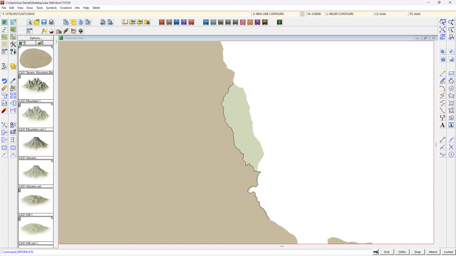
I then deleted the original landmass, hid the black line, changed the colour of the newly traced landmass to match the rest, and picked out the lakes in solid magenta (colour 6).
Another side note here. FT exports are notoriously full of far too many nodes, which makes the drawing sluggish. Since this map has only just begun I used the SIMPLIFY keyboard command at a distance of 5 units (you are prompted for the setting in the command line), which greatly improved the responsiveness of the drawing.
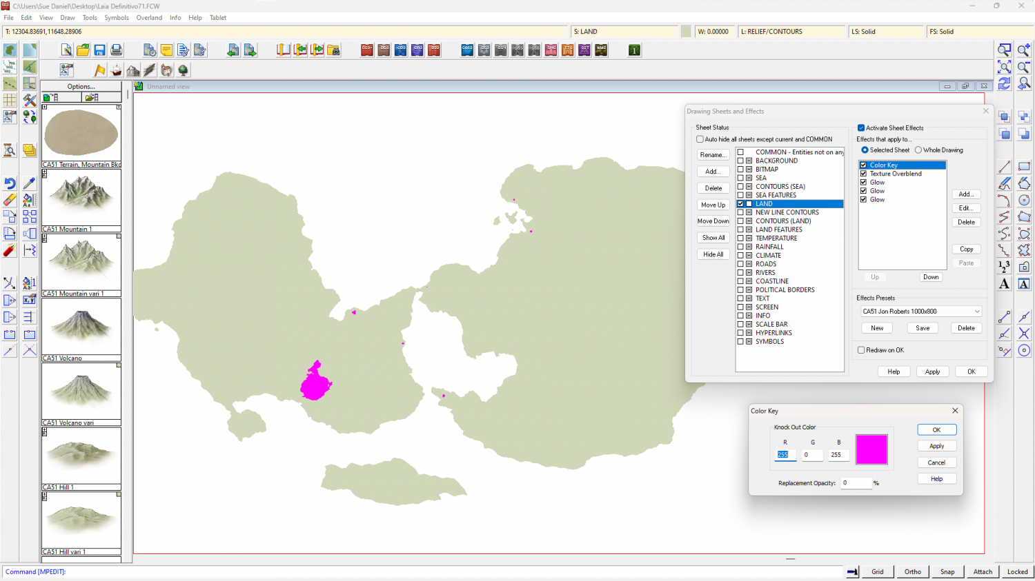
The reason for turning the lakes magenta is to use an alternative method for drawing them so that you don't have to re-multipoly the land. If you look I have added a new sheet effect to the land sheet called a Color Key. The Color Key knockout colour is magenta, so where the lakes are magenta they will become holes in the land when the sheet effects are turned on, like this.
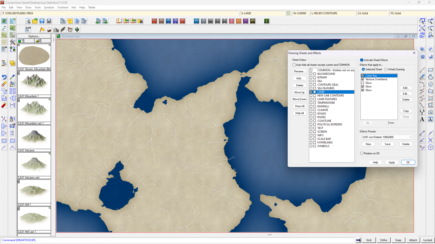
Other adjustments I made to speed up the drawing just a bit were to change the units of the LAND sheet effects to 'map units' and switch off one of the glow effects. You may find it faster to work with effects off in this very large map unless you really need them on to see what you are doing.
The full process was quite involved, so I've uploaded the end result if you want it here.

