Loopysue
Loopysue
About
- Username
- Loopysue
- Joined
- Visits
- 9,966
- Last Active
- Roles
- Member, ProFantasy
- Points
- 9,852
- Birthday
- June 29, 1966
- Location
- Dorset, England, UK
- Real Name
- Sue Daniel (aka 'Mouse')
- Rank
- Cartographer
- Badges
- 27
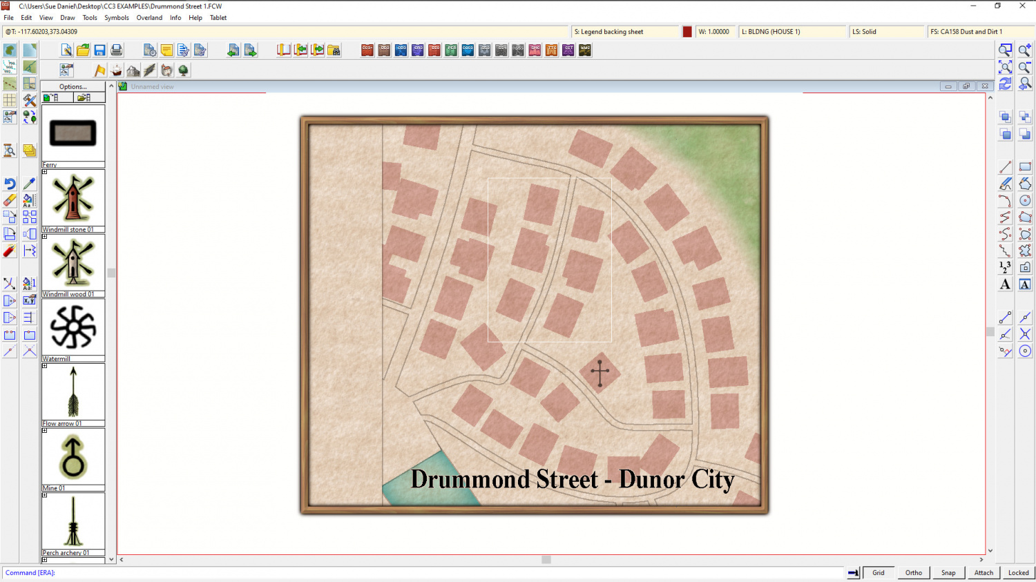
Latest Images


-
October challenge: Drummond Street WIP
I think I'm more or less done with this map now.
I'm open to suggestions if you have any :)
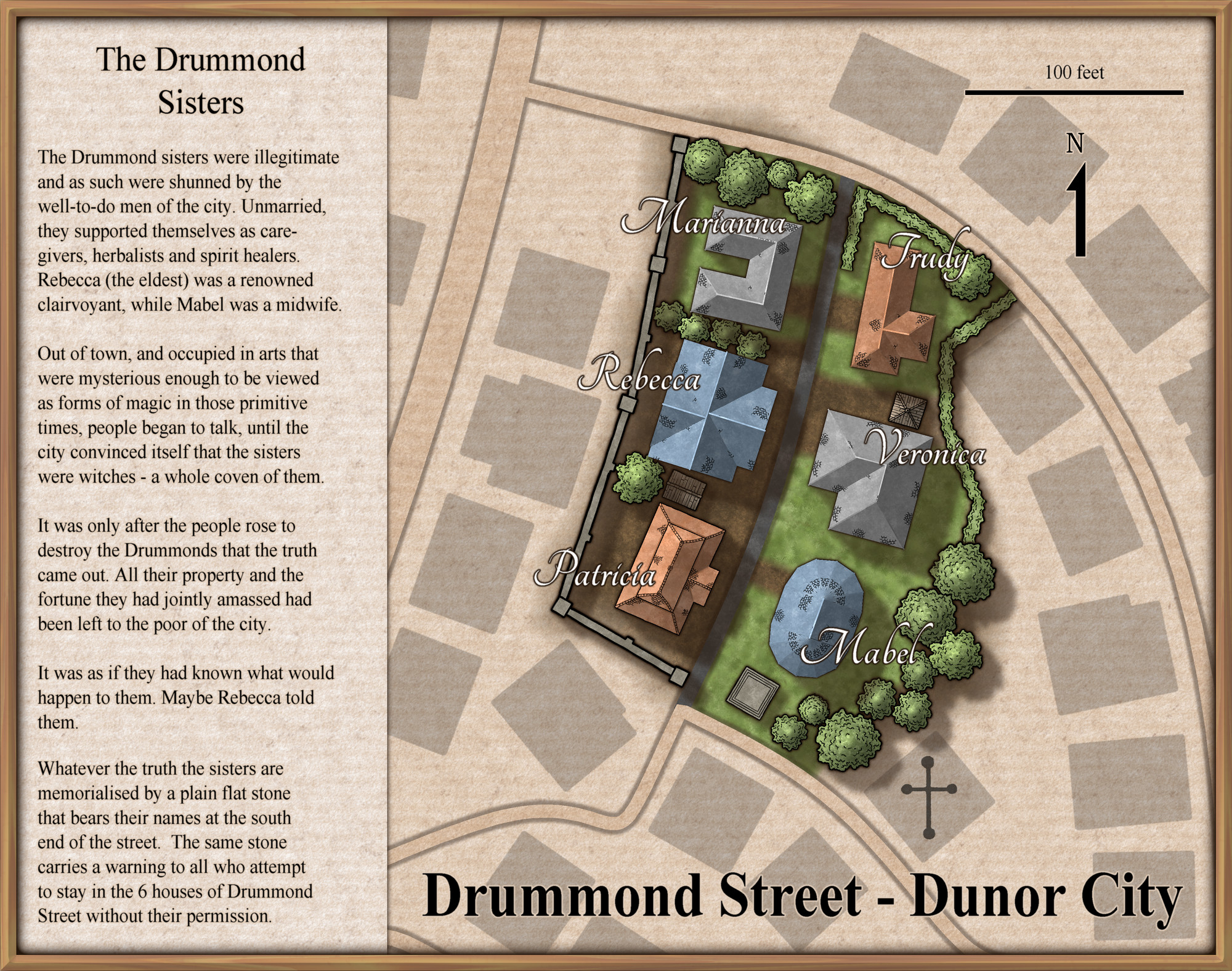
@Monsen Should I do anything special to the FCW before I put this on your main thread?
![[Deleted User]](https://secure.gravatar.com/avatar/c75d9a245b74d9c59be0999ea81ca541/?default=https%3A%2F%2Fvanillicon.com%2F92add7f8c954488718110edc4896ad39_200.png&rating=g&size=200)


-
October challenge: Drummond Street WIP
Ok, the trimming down has started, and I'm not even sure that I won't trim it some more. I've used the simple but lovely Ryeland annual issue to do the street itself, which isn't finished yet. I've also got the history to finish. I was going to use SS5, but decided that since I had already used the Ferraris Style parchment it would be nice to use another issue of the same annual - this year's annual. That way, people who want to use it only have to own the 2020 annual.
I've taken the liberty of modifying a couple of the building outlines to make them more interesting. This isn't as outrageous as it may sound. Most map series leave out details that are too small to show at the scale they are drawn, so you wouldn't expect to see garden sheds and porches or bay windows in the parent city map.
-
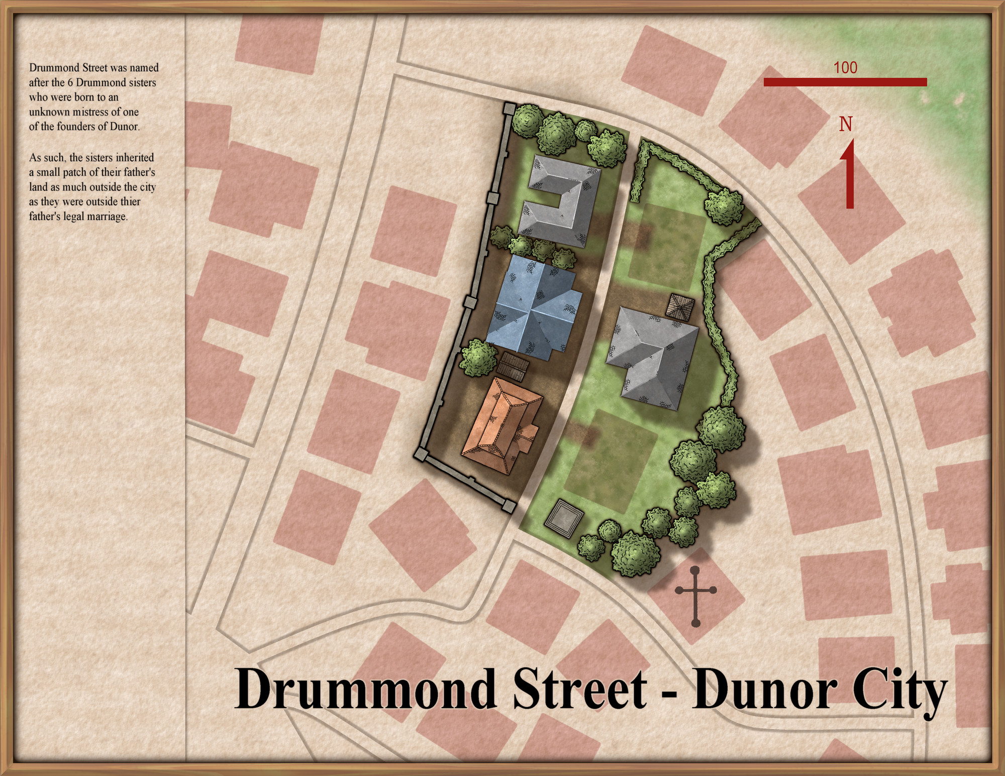
October challenge: Drummond Street WIP
Well, After messing around for several hours (it seems) with conversions from metric to imperial, I've decided to map an area 160m square... that's 525 ft square... in a very general sense - giving more shape to the blockish buildings with little extensions and bay windows and sheds and things like that. Then I will map the actual street of 6 houses in much greater detail as if the street is popping up out of a conventional paper map.
So just to kick things off to a start here is the Ferraris Style paper base with the original Dunor City map details pasted into it and trimmed and altered to match the style. This is only the large part. I will be doing the smaller area in a much more detailed way to make it pop up out of the map, and may need to make the larger map even more subtle than it is to get the effect I want.
Not entirely certain about the overall extent right now, so this may change quite a lot.
I'm not even certain if I will keep more than just the paper from the Ferraris Style. I may swap styles - especially for the street itself.
-
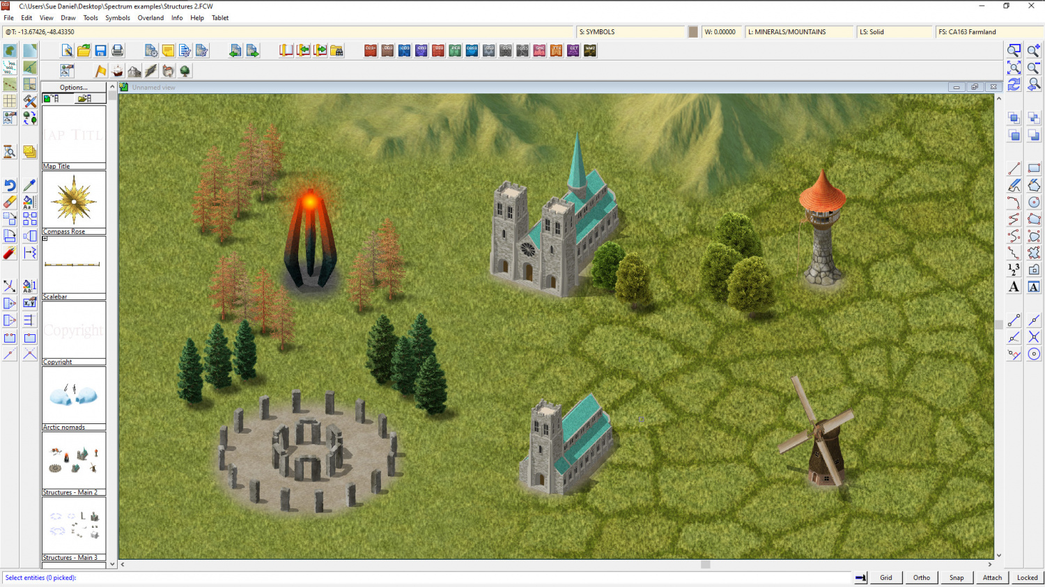
Project Spectrum - Part 2
Well its a... it's a.... well... it's a... tower. Yes, that's what it is on the record :)
It's meant to be an 'evil tower', but it can be whatever you want it to be. My thinking about a tower of (or for) evil is that since evil is an inanimate thing of some kind it doesn't really need a house with windows and walls, but just a place to exist in a greater concentration. That greater concentration is symbolised by the glow.

-
Project Spectrum - Part 2
No, it's not just you, Medio. It does look better zoomed in. I think this is probably one of those styles that suit small regional maps more than world maps, but you can use it either way.
Here are the last few symbols for part 2. There are a few more in progress, but the completion date is today/tomorrow, so these are (officially at least) the last ones shown with a few of the existing trees and hills for scale. It might be worth noting that I have reduced the inner opacity on the edge fade of the farmland to 80 from 100. That makes it easier to see the symbols.