


Loopysue
Loopysue
About
- Username
- Loopysue
- Joined
- Visits
- 9,966
- Last Active
- Roles
- Member, ProFantasy
- Points
- 9,852
- Birthday
- June 29, 1966
- Location
- Dorset, England, UK
- Real Name
- Sue Daniel (aka 'Mouse')
- Rank
- Cartographer
- Badges
- 27
Latest Images


-
The Lakes of Michigami (Jerry's Map) - WIP thread
Is this better?
The reason I'm adding the real world names is to give us a reference for further instructions. It's easier if you say change "Fred" to "Burt", than if you give me a lengthy description of where you want a label that doesn't exist yet.


-
The Lakes of Michigami (Jerry's Map) - WIP thread
EDIT: I think I was working on this comment before you posted yours, so didn't see it till I'd done my own.
No - I'm not sick of it. I'm quite enjoying myself. I haven't used this style before.
Original comment below
...
Ok. I've only done a bit more and some tweaking on effects, but I want to pause and see if you feel this is going the right way.
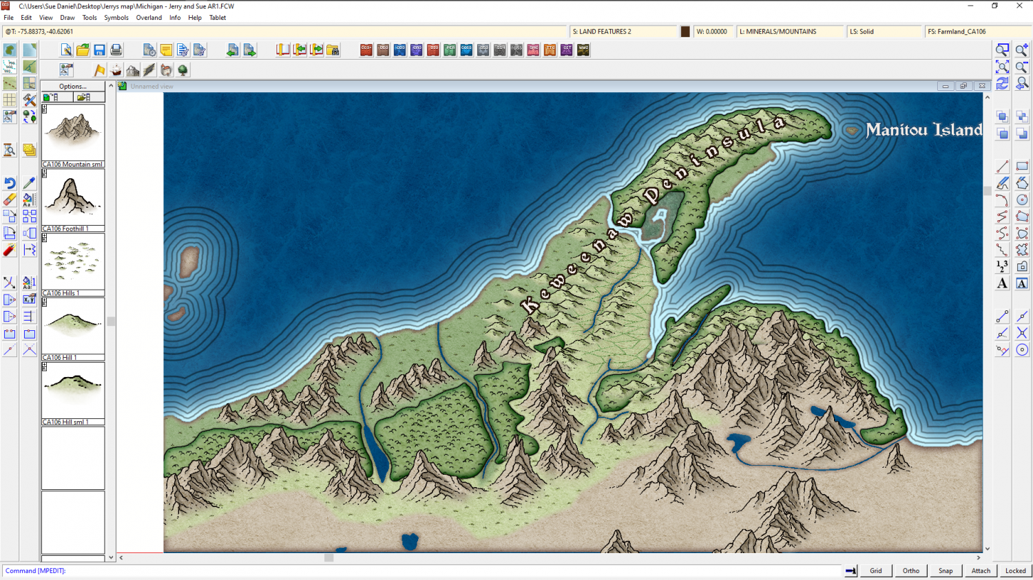
Just to the south of this green area is what appears on the real world map to be an extensive low plateau with mixed farming and forest. There are loads of kettle lakes here. In the real world its all very green and lush. That's all I can make out from the various maps I have.
Do you want me to do something similar, or go for Mordor? A desert would be somewhat out of place because of the lakes. Maybe just a straightforward moorland?

-
The Lakes of Michigami (Jerry's Map) - WIP thread
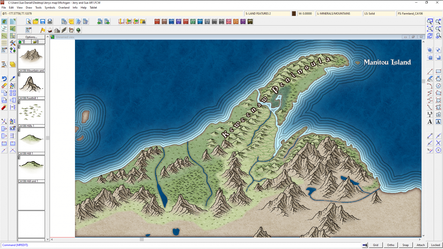
Something a bit like this?

I took the lazy option with the coastline and ran TRACED on the mask from the heightmap so that it matched the bitmap I'm using of the entire area as a guide for where to put the mountains and hills, but I think the Old Mission Peninsula is more of an island than a peninsula the way it appears in the original map. I will have a closer look at that one but this is just a taster to see if you like the style for the map.
-
The Lakes of Michigami (Jerry's Map) - WIP thread
After thinking about this for some time I think I might change style to use Ancient Realms style from the 2014 Cartographer's Annual. This style has several qualities that make it suitable for small scale mapping of very large areas like this one. Firstly there is a good collection of attractive mountains and hills, the fills are about the same colour and tone as the fills in your original map, Jerry, the woodlands are a fill rather than millions of very tiny individual tree symbols, and there are those very attractive circular points of interest markers that will be really handy for things like the salt mine, where they would be too small to show as other than a dot in other styles.
I know you won't see this for a while, so I will mock up a small section of the map for you.

-
The Lakes of Michigami (Jerry's Map) - WIP thread
You're awesome, Jerry. Thank you for letting me have a go with your map like this :)
