Loopysue
Loopysue
About
- Username
- Loopysue
- Joined
- Visits
- 9,967
- Last Active
- Roles
- Member, ProFantasy
- Points
- 9,852
- Birthday
- June 29, 1966
- Location
- Dorset, England, UK
- Real Name
- Sue Daniel (aka 'Mouse')
- Rank
- Cartographer
- Badges
- 27
Latest Images


-
The Lakes of Michigami (Jerry's Map) - WIP thread
Thank you, @Raiko :)
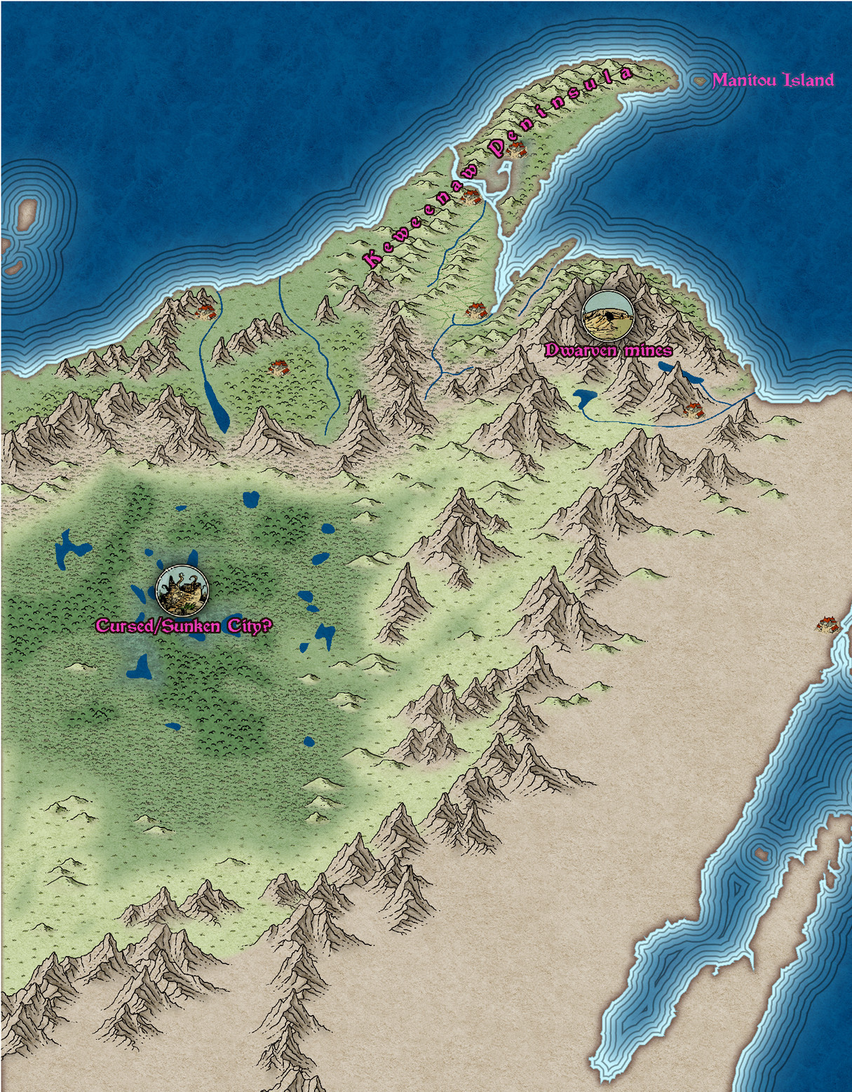
@mahler - thanks :) I have no idea. I think this is probably too small a scale to show anything but the location of the settlements. Maybe Jerry will have the answer for that when the larger scale city maps are drawn.
I've done a bit more work - adjusted the river system according to the US Geological Survey maps and then adjusted the mountain ranges and terrain around them. The locations labelled in pink are only vague suggestions from me, and may not appear in the final map.
And I've just noticed that by repairing the shoreline where it was missing bits (I did a trace from a heightmap from Tangram if you remember), the labelling of the water bodies in the south east now needs a bit of attention.


![[Deleted User]](https://secure.gravatar.com/avatar/c75d9a245b74d9c59be0999ea81ca541/?default=https%3A%2F%2Fvanillicon.com%2F92add7f8c954488718110edc4896ad39_200.png&rating=g&size=200)


-
The Lakes of Michigami (Jerry's Map) - WIP thread
I'm really loving this style. I can't think why I never tried it before. But if I had you might not have had Spectrum.
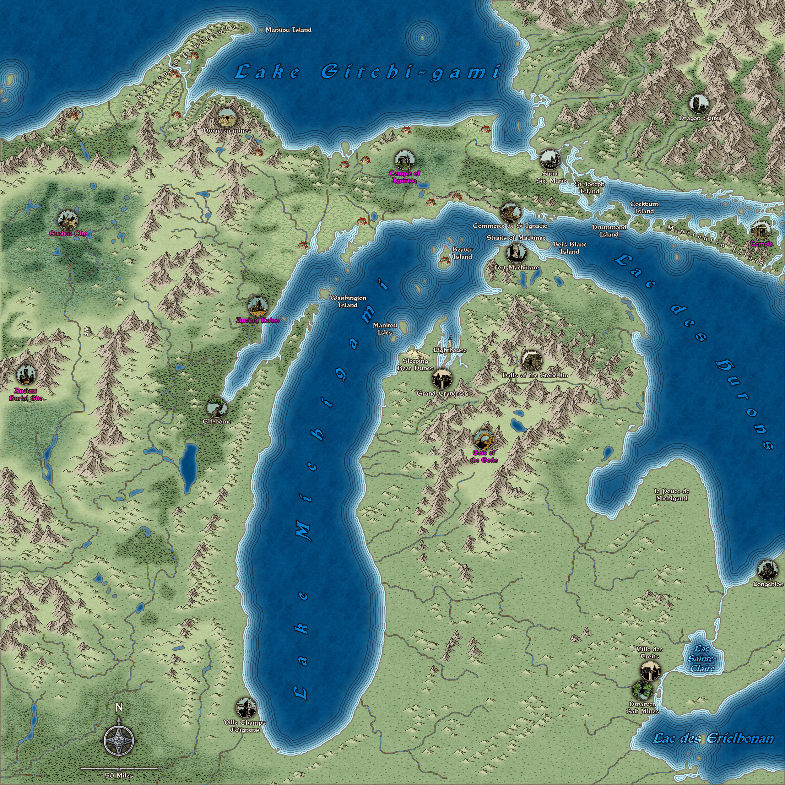
Here is a bit more work. I've added quite a few more places from Jerry's notes, and attempted to sort out that north east block of higher land. I know it's not really a mountain rage, so I can take it out again if you don't like it, Jerry :)
This image is 2/3 full size and slightly more compressed than is usual for a jpg, so apologies if there are any artefacts.
-
Edge Fade and SS4/5
You're welcome :)
This is one of the only ways for now.
There are possible solutions in the pipeline, but they are quite a long way ahead just yet.

-
Edge Fade and SS4/5
It didn't work on this one. But I got it to work with a backing sheet instead. For some reason the usual purple didn't do the trick. Sometimes you have to try different colours.
-
The Lakes of Michigami (Jerry's Map) - WIP thread
I'm doing a lot of thinking about different things right now. First things first - you say you have to have everything planned out before you start a map. I'm the opposite way around. Very "Bob Ross". Things just happen in a map because they happen. I've put a cursed/sunken city in the middle of that humungous swamp area. It's just an idea. Maybe it helps - maybe it doesn't. You choose if it stays or goes away. Please let me know what to put there instead though if you want it gone.
The other thing I'm thinking about is scale. How big are you planning to export this map? This is the area I've been working on today between other jobs, extracted from a full export at 3000 px on the longest side. At this scale the structure symbols may be a bit small to do their proper job as symbols. 3000 px at 300 dpi is a print that is 10" in both directions when printed out. I think that's probably already too big for an A4 sheet.
I've been using a lot of artistic licence on the design. If that's not ok, please say.