


Wyvern
Wyvern
About
- Username
- Wyvern
- Joined
- Visits
- 3,240
- Last Active
- Roles
- Member
- Points
- 5,519
- Rank
- Cartographer
- Badges
- 24
Latest Images


-
Community Atlas: Embra - Travelling Places
Travelling Place 1 is Toll Cross, which as we see, is an unusually heavily built-up area, surrounded by dense greenery, beyond which is open grassland or moor:
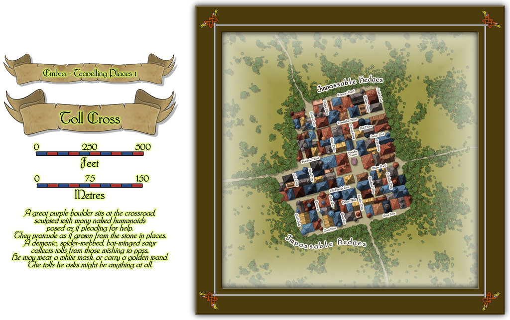
While the base-map was a similarly heavily-urbanised area, the nature of Toll Cross (and indeed even its final name) derived chiefly from the accompanying featured text, and especially that demonic satyr figure. The Impassable Hedges mean anyone wanting to visit the shops or houses here, or even just pass through it directly as a crossroads, is channelled into using one of the four access-routes. Then I adjusted the layout of the buildings slightly in places so those on foot can get to only a fraction of the properties inside unless they pass through the central Boulder Square, where Guess Who waits, like a spider in a web... This view is with the labels turned off to get a better impression of the settlement:
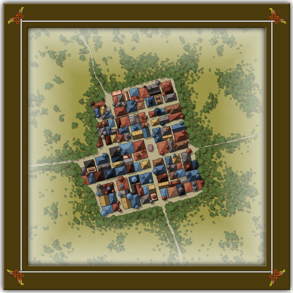
This looks a bit odd (or at least, it's meant to), with some strange rooflines, and what seem to be many towers. An extract from the accompanying text and PDF file may help explain:
There are...many tall spires and tower-like structures of different sizes and forms, some of which are visible above the trees from outside the settlement. These features are all entirely solid, and appear to have simply grown from the roofs and upper walls of the buildings. Few are straight, and many could pass for horns. Quite a number of roofs overhang their properties as well, and can give the impression of being ill-fitting, or as if they were worn as wigs that have slipped slightly. The whole can be quite unsettling for those not used to Faerie, and even those visitors with Faerie blood may feel there is something a little off-kilter about Toll Cross.
Despite the range of building shapes and sizes, they all have just a single accessible storey at ground level inside, as the toggled view to show the building interiors indicates:
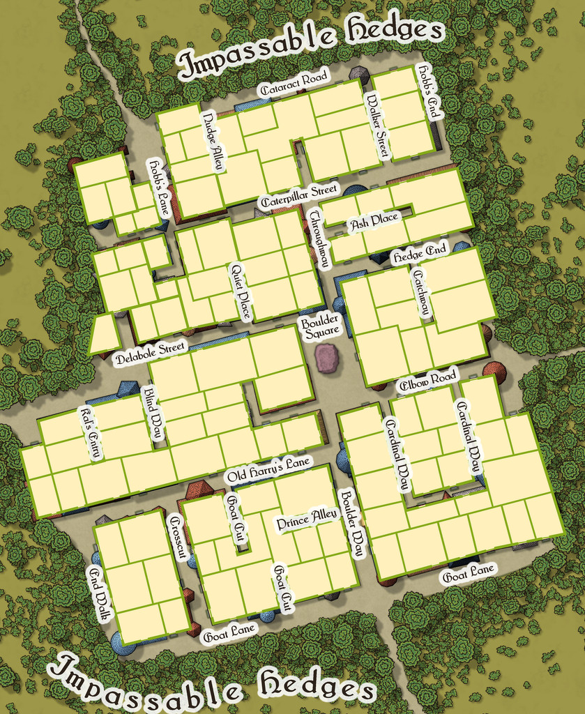
This also shows just how much some of the rooflines, and particularly those horn-towers, don't marry-up with the building outlines, yet the buildings, thanks to their lack of internal connections, further help block any attempts to avoid using Boulder Square. And if you try to fly in, it turns out those roofs aren't so immobile as they may appear...


![[Deleted User]](https://secure.gravatar.com/avatar/c75d9a245b74d9c59be0999ea81ca541/?default=https%3A%2F%2Fvanillicon.com%2F92add7f8c954488718110edc4896ad39_200.png&rating=g&size=200)

-
Community Atlas: Embra - Travelling Places
Fourth in the sequence of Embra's "Places" are the Travelling Places of Interest, as usual, accessed from the relevant part of the inner circle on the "Official Guide" map:
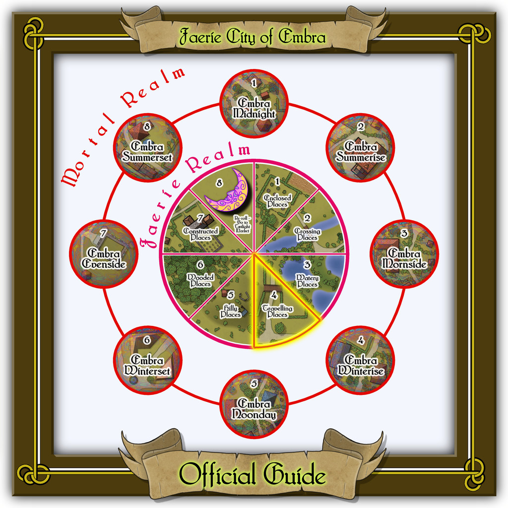
This takes us to the link-map, though this time there are just three link-spots on the diagram, two individual locations, and a group of eight "ways", rather than streets, as here, one of the "roads" is actually a railway (which features as the backdrop extract for all eight, primarily because it was a handy size and shape, and in the correct orientation without needing any adjustments):
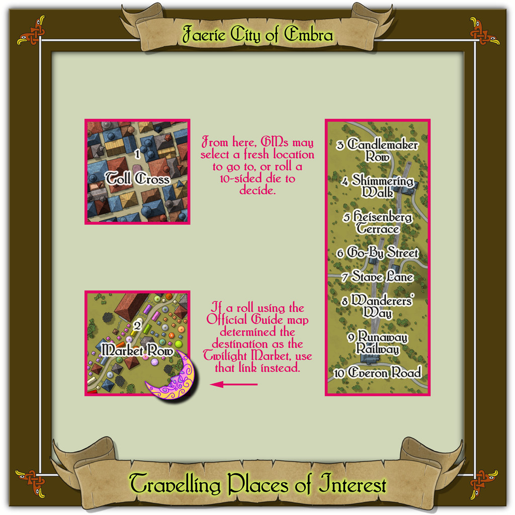
The map border decoration was kept quite simple, as it seemed best to highlight the "Travelling" concept with something quite clean and direct. I toyed with drawing something quite severe of my own devising for the knotwork, though all that survived of that here was the simple, single line linking the corners (yes, I know, not much to show for it!). The basis for the little knotwork eagle heads - again seeming apt for "Travelling" - came from that famous Dover Clip-Art "Celtic Borders on Layout Grids" book once more, which were handily linked by a single line there too.

-
dd3+ crashing combining paths
It should be possible to carry out the command sequence as described Jim; you can combine arcs like this, as far as I'm aware.
I have sometimes found, rarely, that CC3+ will crash repeatedly on a specific event for no obvious reason, and that this can be overcome by simply adjusting the view on the map slightly, and/or drawing the item after which the crash has happened in a slightly different place. If you need to change the shape of a simple polygon afterwards, it's usually easy enough to move a node or two.
Not sure if that's what's happening here or not. If this doesn't help, then as Jim suggested, letting others more technically adept here try out your problematic FCW file might be the way forward.
-
Community Atlas: Embra - Watery Places
Next is another curiously isolated hamlet, this time closer to the River Clack, so it appears on the map as well, although the hamlet's existence is presumably due to the fortuitously-discovered, naturally enough magical, Crimson Rose Well:
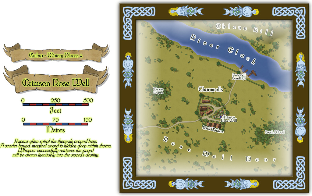
As might be guessed, the odd appearance of the settlement and its riverine landing-stages resulted from the original random base map being one showing a small castle and a defended landing on a river. This being Faerie, the defensive walls become high "walls" of thorny vegetation sporting great, heavily scented, crimson rose blooms, and the castle becomes a hamlet-sized community dedicated to looking after the Well and those who come here seeking its magical aid. The fact there could be a powerfully magical sword hidden away within the thorns somewhere (from the featured text) merely adds an extra note of interest. Plus GMs can have fun accounting for why this bit of Embra is so apparently isolated from the rest of the city it needs a substantial landing area all its own on the Clack!
Buildings on the non-streets maps means interiors, and again these are all of just the one storey:
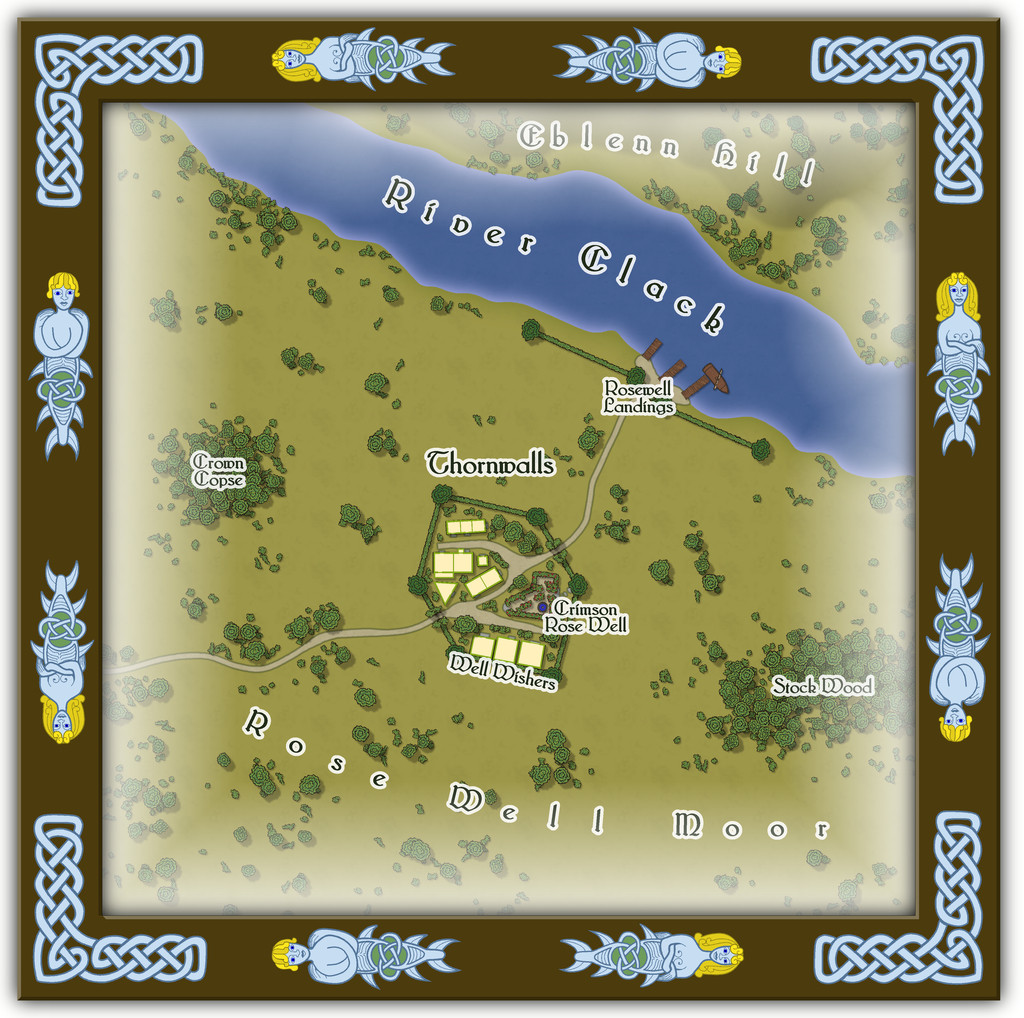
Some of you may recall Eblenn Hill has featured before among these Embra Places maps, as it's the substantial hill the first of the Enclosed Places was set upon, the Freed Haven Floral Garden. Whether the version here is the same or not, and how - or if - it may relate to the "other", is left for GMs to decide.

-
Community Atlas: Embra - Watery Places
The first two Watery Places were drawn as smaller maps than usual, based on the reduced-size template designed for the Lawn Market map. This was because, as with Lawn Market, both base maps were generated from randomly-selected maps in the old Judges Guild "Temples Book I". As noted previously, this book used a much smaller scaling than the other old JG works I was drawing on for inspiration in creating the Embra maps. The first of the Watery Places then is the Bittersweet Basin Swimming Pool:
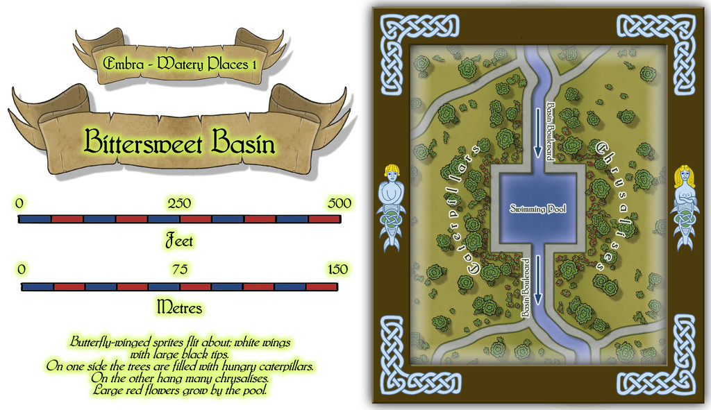
This is a remarkably simple area by comparison with many of the previous Embra Places maps, though of course variety is important in constructing an array of maps of this kind, to prevent things becoming too predictable. The featured text notes were used to add to the details shown here, without taking away any of their oddness. It's perhaps worth noting that as a mapper, it's equally important to have a few maps that are easier to produce like this, again helping avoid things becoming too stale and "samey". Especially as not all the Watery Places maps were going to be so "quick and easy"...

