


Wyvern
Wyvern
About
- Username
- Wyvern
- Joined
- Visits
- 3,240
- Last Active
- Roles
- Member
- Points
- 5,519
- Rank
- Cartographer
- Badges
- 24
Latest Images


-
Community Atlas: Embra - Constructed Places
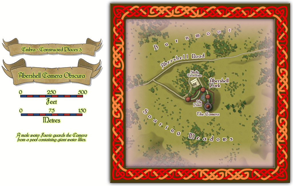
The third Constructed Place is the Abershell Camera Obscura, set in an apparently unlikely open zone, more suited to an observatory, one might think:
As ever, despite the random selection of base-maps for this series of drawings, the choice of what went where was solely my own, all of which decisions were made with the aim of providing additional puzzles for anyone trying to explore the city, when working to ordinary (i.e. non-Faerie) norms.
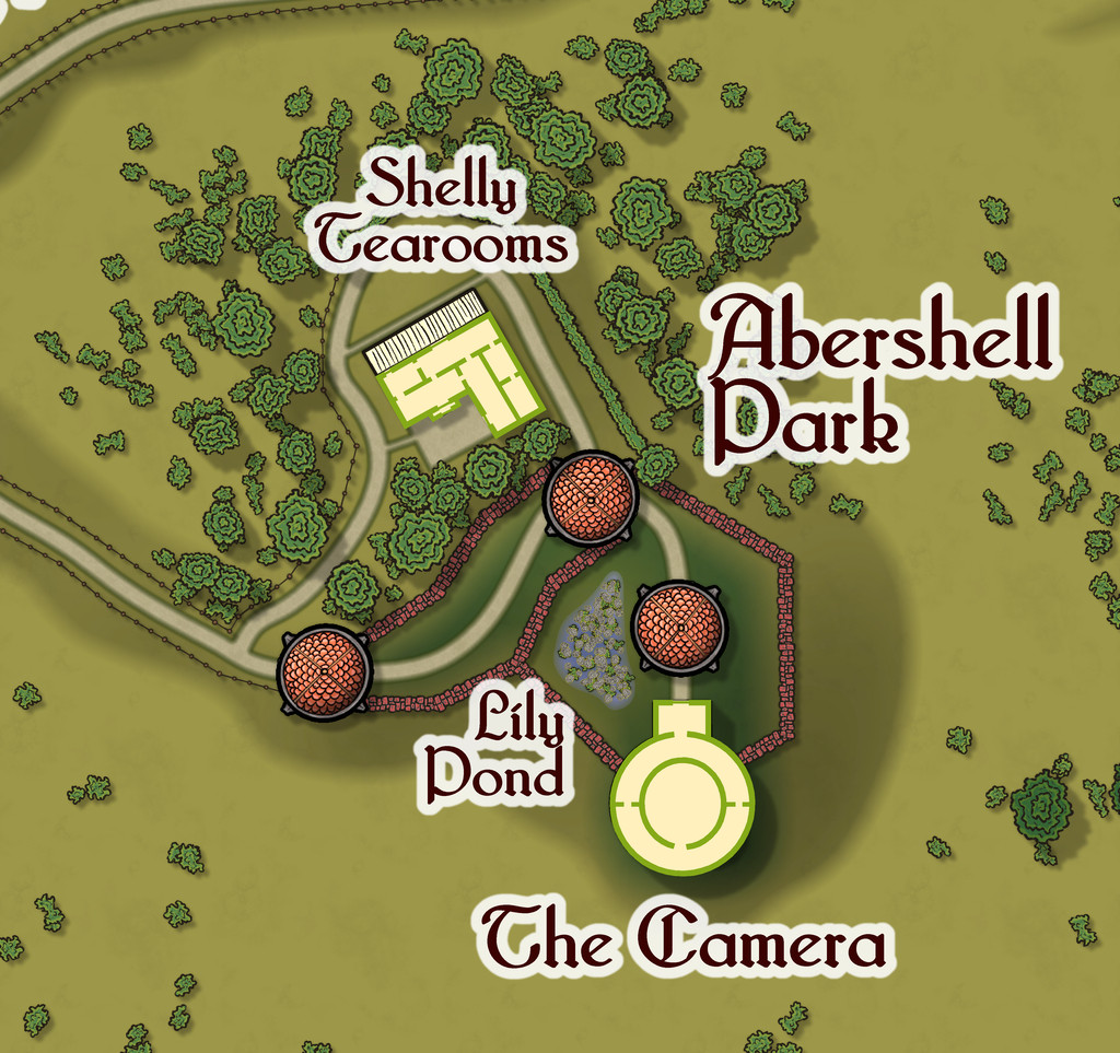
There are just two actual buildings here; the rest are open domes over the paths. Oh, and for those who might be interested, the Shelly Tearooms are famous for their exquisite range of ice-creams:
While the Camera shows views of the surrounding scene from its darkened inner chamber, as might be expected, under the care of the featured text's magically-skilled Water Faerie operator, it can show many other things and places too. And when you step out the door, that might be where you'll be. Only if the scene changes, the Camera building won't be there to take you back...

![[Deleted User]](https://secure.gravatar.com/avatar/c75d9a245b74d9c59be0999ea81ca541/?default=https%3A%2F%2Fvanillicon.com%2F92add7f8c954488718110edc4896ad39_200.png&rating=g&size=200)

-
Community Atlas: Embra - Constructed Places
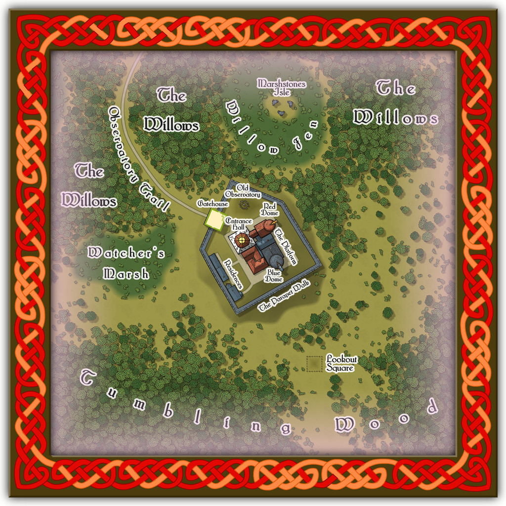
Place 2 is the Willow Observatory, inspired loosely by the real-world astronomical observatories at Edinburgh, Royal Observatory Edinburgh (which is some distance from the city itself) and Calton Hill Observatory, which is right in the city centre, and the consequent long tradition of watching the night sky from there. While some of that tradition was used to inspire what happens at Willow Observatory (including the annual summer activity of looking-out for dragon ghosts in the all-night-twilit northern sky; you'll have more luck trying a search for "noctilucent clouds", should you wish to learn more before the PDF and text files are available), the setting is purely Embra, as the misty marshes and woods nearby would scarcely seem conducive to dedicated sky-watching if anywhere else. And who knows what you might see on the planets of the Nibirum Solar System using one or other of the great magical telescopes here:
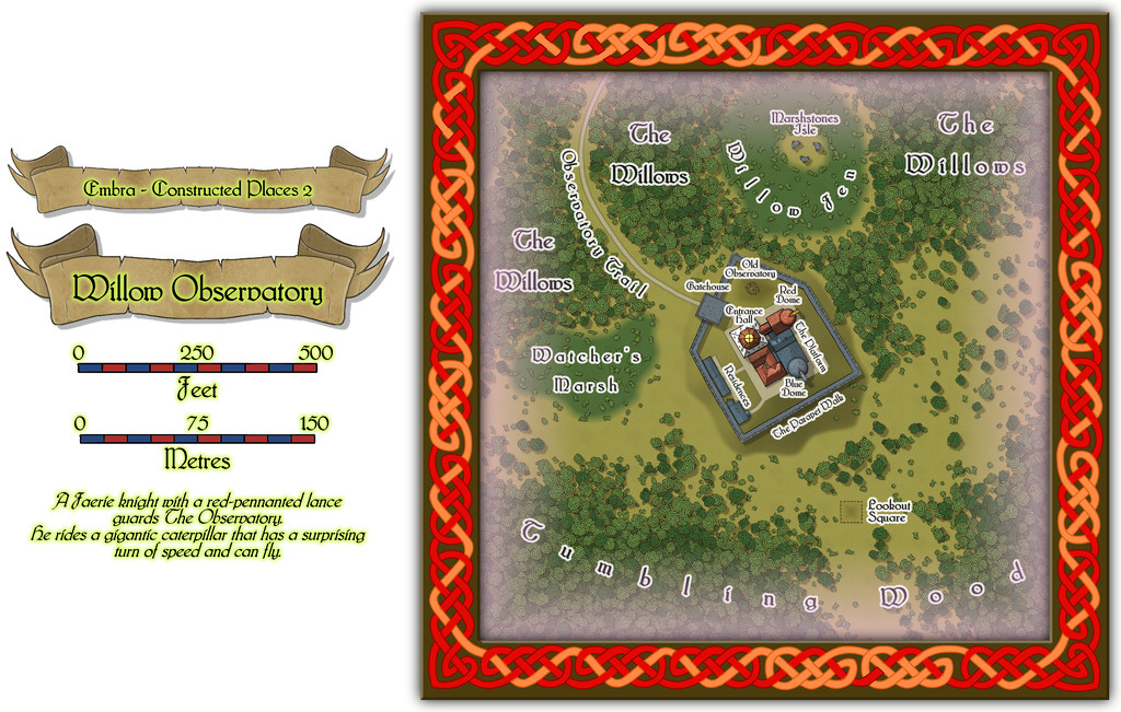
Building interiors:

And the upper interior floor for the Gatehouse:
Plus there are oddities nearby, all of which receive at least some discussion in the accompanying notes.
-
Community Atlas: Embra - Constructed Places
Constructed Places map 1 is that for the ruler's Crepuscular Palace at Embra. Well, I say "ruler", but she's actually more the physical embodiment of Embra made magically real and living, The Verdant Sorceress, who flies on wings made of summer flowers. Something like the Archfey of D&D, though really more like the deity of/being who is Embra in power and abilities here. The name and flower-wings came from random rolls using tables in A Wanderer's Guide to the Feywild, by Heavenly Spoon, available on the DM's Guild download site (Pay-What-You-Want). The rest is more "me", however. I'd added some details to the PDF and text files for the Crepuscular Palace map before I realised it would be feasible to provide a CA3 drawing of the Sorceress for the Atlas as well, something that needed quite a bit of late revision of both texts and the Palace map. Although there wasn't space to add the full CA3 drawing to the Palace one, I did want to add a suitable link-spot by it. So this is the final Palace map:
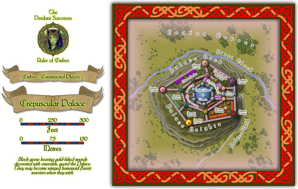
And this is the lady herself:
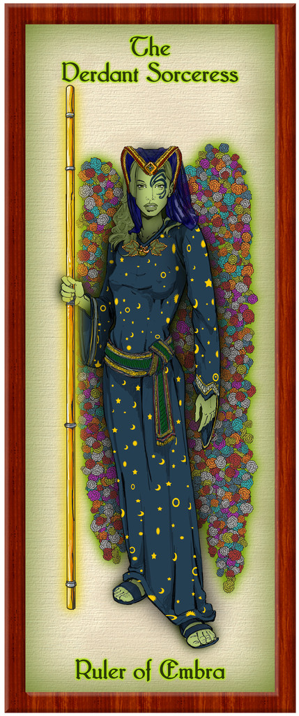
Of course, this is only how she appears in her Elf-like humanoid form, when out and about meeting people, and not trying to terrify visitors unnecessarily. She could seem equally to be anyone else in Embra, or anything at the city - such as a flower, a shrub, a tree, a building, a pond, a floral meadow, a path, a hill, a forest, a cloud, a rainbow, colours in a cloud, the River Clack, or a blade of grass. In a real sense, she IS Embra, in all its aspects, positive and negative. (Oh, and this means the final tally of Embra drawings for the Atlas is now 58, not 57...)
Those who've been following this lengthy series of posts regarding my Embra mapping closely may recall the Palace Heights map among the Hilly Places, and spot the resemblance to this Crepuscular Palace one. That would be scarcely surprising, as they're the same place, here with the Palace a living, still fully extant, building, rather than grassed-over ruins. With an interior:
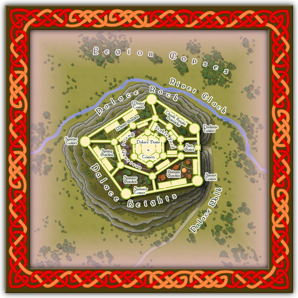
However, the interior is shown only for the ground level. The upper storeys - which all the towers, walls and great central dome have - are left for GMs to determine, if required, as the elements in it change from time to time.
-
Community Atlas: Embra - Constructed Places
The last set of Embra "Places" maps is that for the Constructed Places of Interest, linked from central segment 7 on the "Official Guide" map:
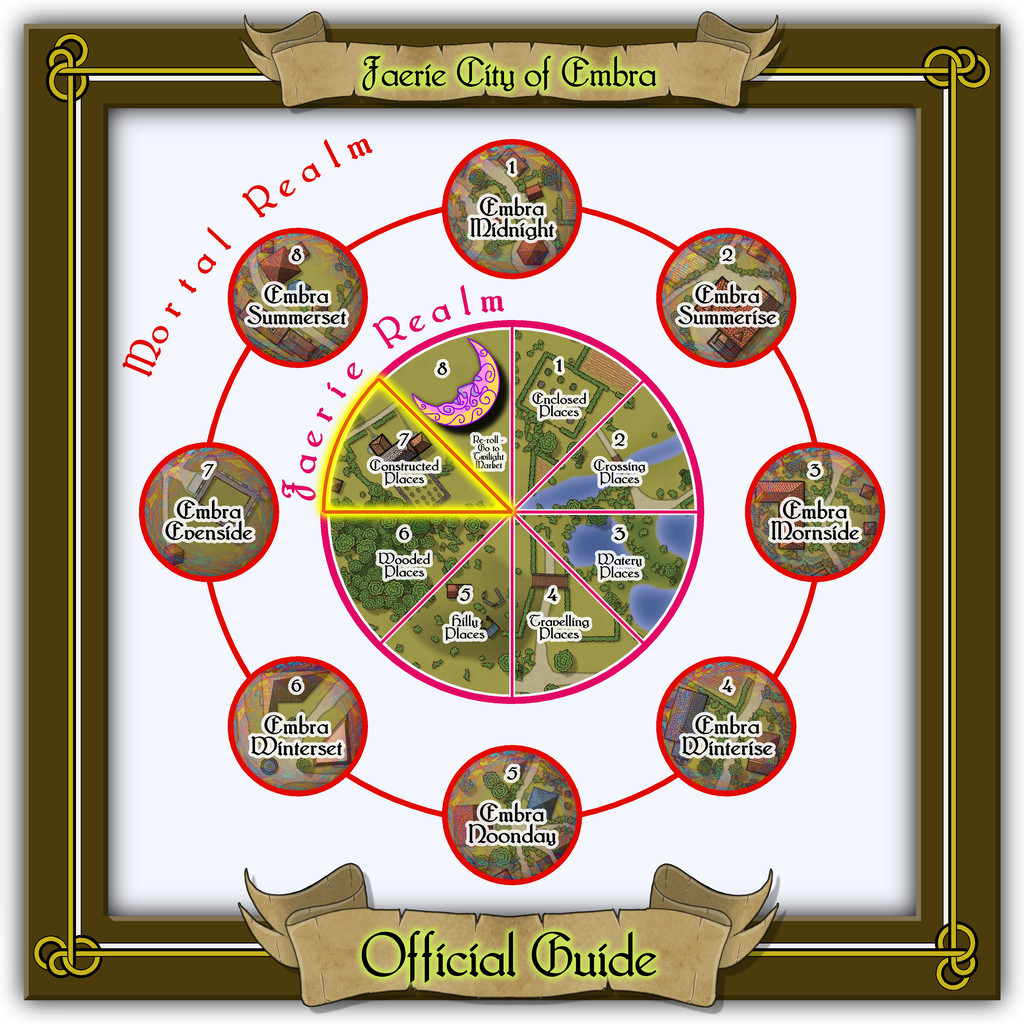
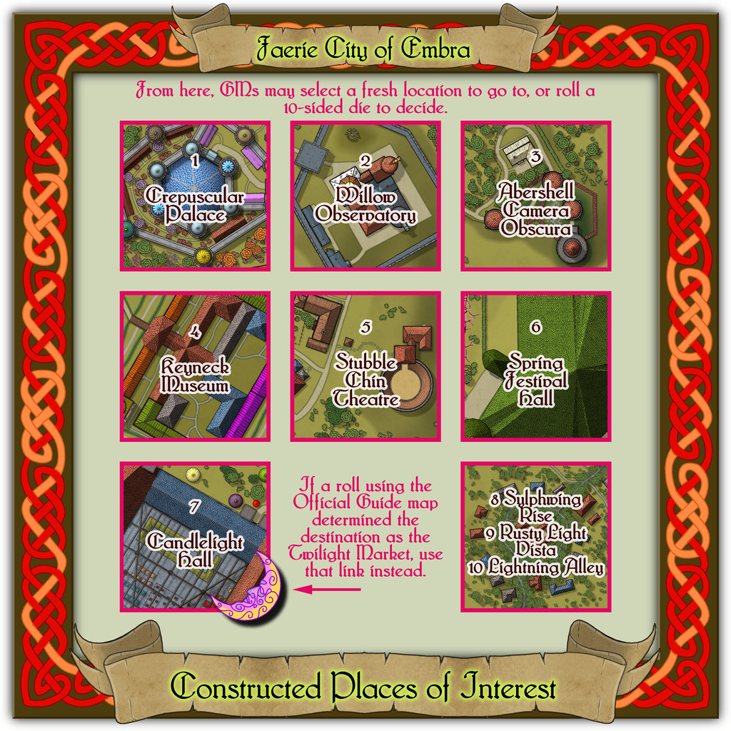
This is the busiest set for individual locations of any of the Places groups, with seven, leaving a mere three to be condensed onto the eighth "Streets" map.
The Celtic knotwork border was adapted from one in the, by-now-famous, Dover Clip-Art "Celtic Borders on Layout Grids" book, providing a completely connected square, to complement the original circular design used for the Village maps. That seemed an appropriate method of "book-ending" the entire set, as well as tying-in with the idea of both being constructed places, if of somewhat different sorts. In altering the design from what had been a vertically-elongated rectangular one to the required square here, I discovered when looking at the finished piece with its colouring, that I'd accidentally produced an asymmetry in the patterning. I did wonder briefly about amending that, but liked the look of something slightly off-kilter as apt for a Faerie setting, and so left it. The hours of effort it would have taken to change it had, of course, nothing to do with that choice...

-
Live Mapping: Modern Atlas
Oh dear; sorry to hear that. Good luck avoiding the gods of thunder! 🌩️
