Wyvern
Wyvern
About
- Username
- Wyvern
- Joined
- Visits
- 3,240
- Last Active
- Roles
- Member
- Points
- 5,519
- Rank
- Cartographer
- Badges
- 24
Latest Images


-
Community Atlas: Embra - Constructed Places
Thanks very much everyone!
And on Quenten's point, the odd thing is the Character Artist portraits take hardly any time at all, by contrast to other types of map.
It is a shame that Character Artist doesn't get the same kind of updates and additions other parts of the CC3+ program suite do; some variant body and face shapes would be interesting, for instance, though I appreciate that would add a lot of extra work, fitting the various costumes and weapons, etc., to such alternate forms. Still, if you don't ask...

![[Deleted User]](https://secure.gravatar.com/avatar/c75d9a245b74d9c59be0999ea81ca541/?default=https%3A%2F%2Fvanillicon.com%2F92add7f8c954488718110edc4896ad39_200.png&rating=g&size=200)


-
Community Atlas: Embra - Constructed Places
Last of the individual sites is the Twilight Market setting for this group of Places, Candlelight Hall. The Hall has a huge, pale-blue, glass-tiled roof over much of it, and while that was straightforward enough to draw - CD3 tiled roof shaded polygon with added Sheet Transparency Effect - the support structure took rather more thought and effort, albeit "Trim To Entity" does work wonders in cases like this, for all those roof beams. The view complete:
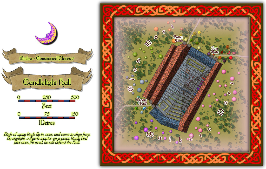
Even this view indicates the interior had to be quite heavily detailed while the roof was left in place, and for once it was prepared normally with fills and symbols, not just the cream-and-green plan sketches all the other Embra interiors have received. The "normal" image above does allow the focus to be a little more on the scatter of other stalls and tents outside the Hall itself, before plunging inside. And so to that interior:
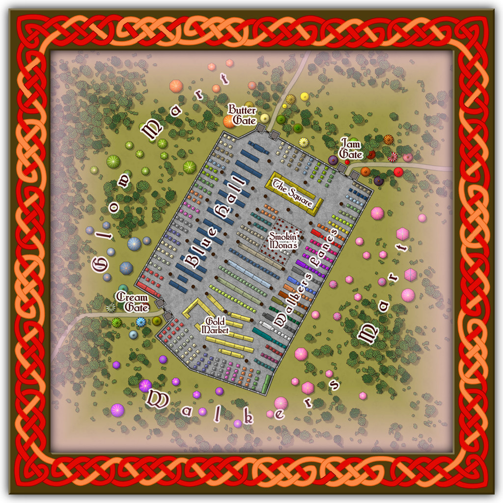
Peering closely suggests there are a lot of windows piercing the walls, all narrow, high, point-topped, and painted with a great assortment of subjects and scenes, which with the huge see-through roof area, means that at twilight or in the dark, the lights from inside shine out like a beacon from here, partly hence the name. And just in case you couldn't guess, Smokin' Mona's is THE restaurant for this part of the Market.
Comparing the two views here, one other element becomes clear. The internal labelling can be turned on or off separately to the other map labels this time. If all goes to plan, that should be via toggles in the Atlas' FCW version.

-
Community Atlas: Embra - Constructed Places
However, the sixth built Place is one more suited to indoor musical performances without such adaptations, Spring Festival Hall:
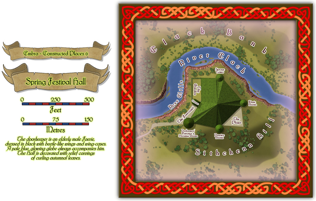
The bright green roof tiles are all made in the shapes of unfurling, fresh, spring leaves, to contrast with the walls and ceilings of the Hall, that bear relief-carved autumnal foliage instead (Embra; what else would one expect by this stage?).
Inside, only the layout plan for the surface-level is provided. Most of the towers have higher, and lower, floors too, which are not illustrated, and which also like to change at times, as the accompanying written notes indicate:
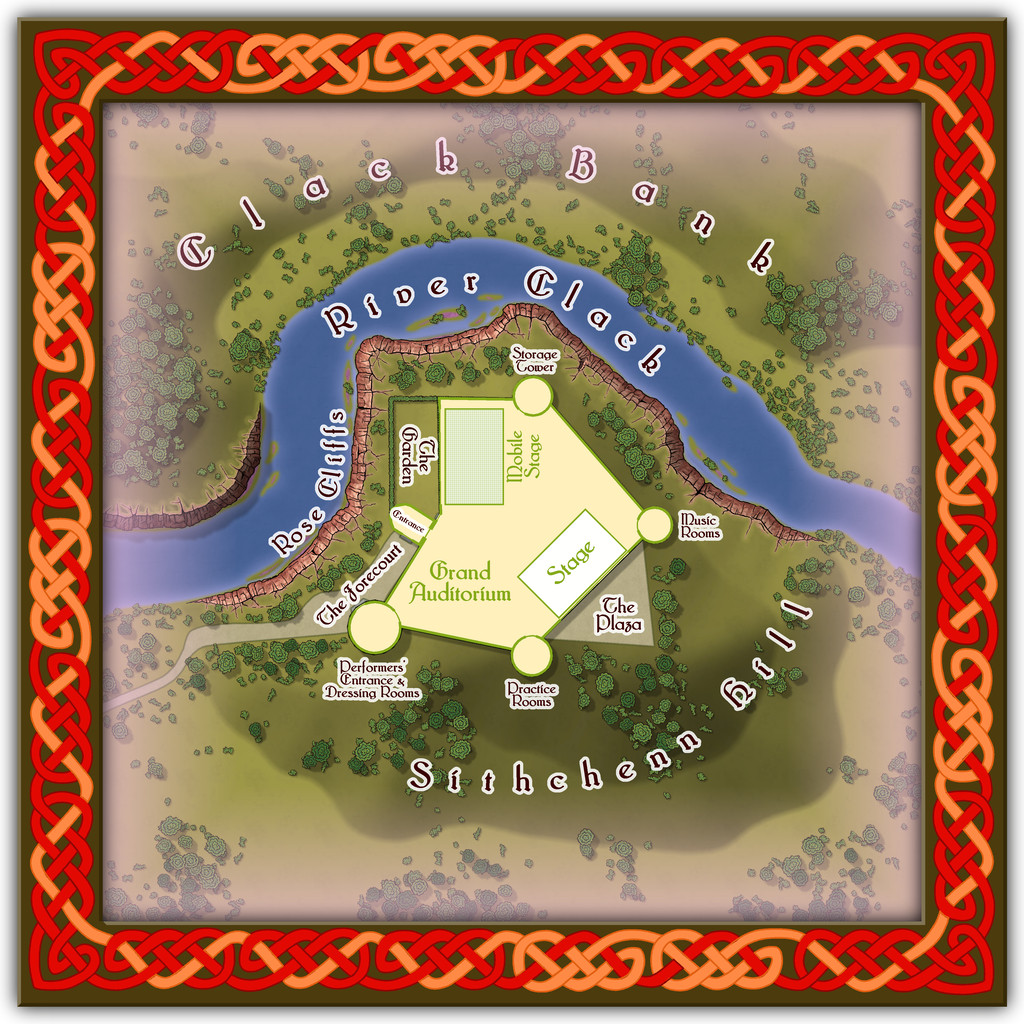
Folding doors allow performances to be enjoyed outdoors on The Plaza or in The Garden, while the Mobile Stage can be raised or lowered to allow more seating in the Grand Auditorium. Despite its odd shape, the internal acoustics are excellent. If you want to perform here - and have the skill to do so - it might help to have befriended some of the musicians from Glass Harmonica Way first (see the Watery Places Streets map). Plus of course, any excuse to use some more of Sue's wonderful red sandstone cliffs!
-
Community Atlas: Embra - Constructed Places
The fifth Constructed Place moves us into the "entertainment" quarter (if Embra had such a thing, at least), the actors' village of Stubble Chin Theatre. Subtlety isn't really in it, with Sorceress' Hill and Verdant Wood adjoining one another, but theatricals often feel the need to make a clear statement, it's said...
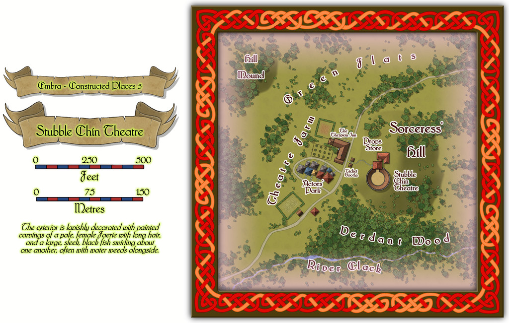
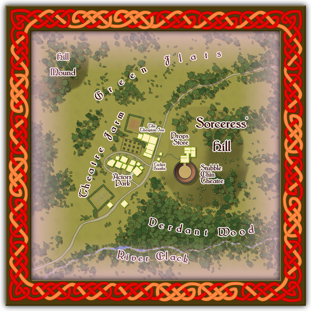
The Theatre itself is an open-air one, though it has a concealed clamshell cover that can be raised to move everything indoors when required, allowing for a greater variety of performances, not necessarily all of a theatrical nature.
-
Community Atlas: Embra - Constructed Places
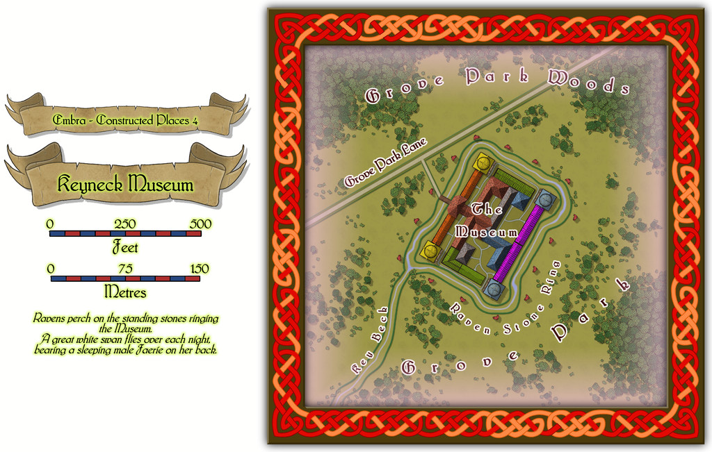
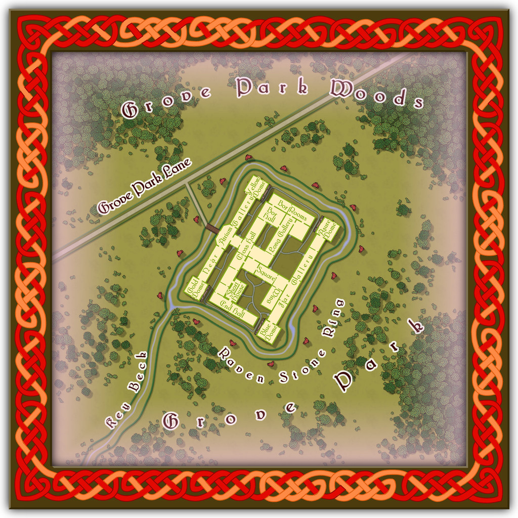
Next is the Keyneck Museum, full of wondrous artefacts gathered from across Nibirum and beyond, with displays that change from one visit to the next, although there seems nowhere here to store whatever isn't currently on show. Key Beck might intrigue visitors as well. The water flows in along the west side of the channel from the southwest, round the circuit of the Museum, and then out again down the east side of the channel. Narrow, isn't it? And maybe the name relates to the layout of the Museum buildings in relation to that channel. Possibly.