Shessar
Shessar
About
- Username
- Shessar
- Joined
- Visits
- 202
- Last Active
- Roles
- Member
- Points
- 590
- Rank
- Mapmaker
- Badges
- 9
Latest Images
Reactions
-
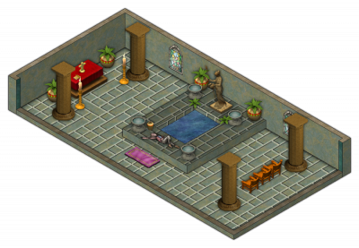
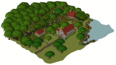
Top down symbols for overland maps.
Just popping my head in to say that I agree with you Quenten!
The disparity between flat terrain/rivers and front view mountains and hills often looks out of sync to me; like I'm seeing the map from 2 different perspectives (because I am). My solution has been using terrain fills to denote biomes and lighted bevels to denote mountains and hills.
These are the best examples I have using ProFantasy fills. Having top down symbols instead would be a great addition. I'm wondering how they could be done.

![[Deleted User]](https://secure.gravatar.com/avatar/c75d9a245b74d9c59be0999ea81ca541/?default=https%3A%2F%2Fvanillicon.com%2F92add7f8c954488718110edc4896ad39_200.png&rating=g&size=200)

-
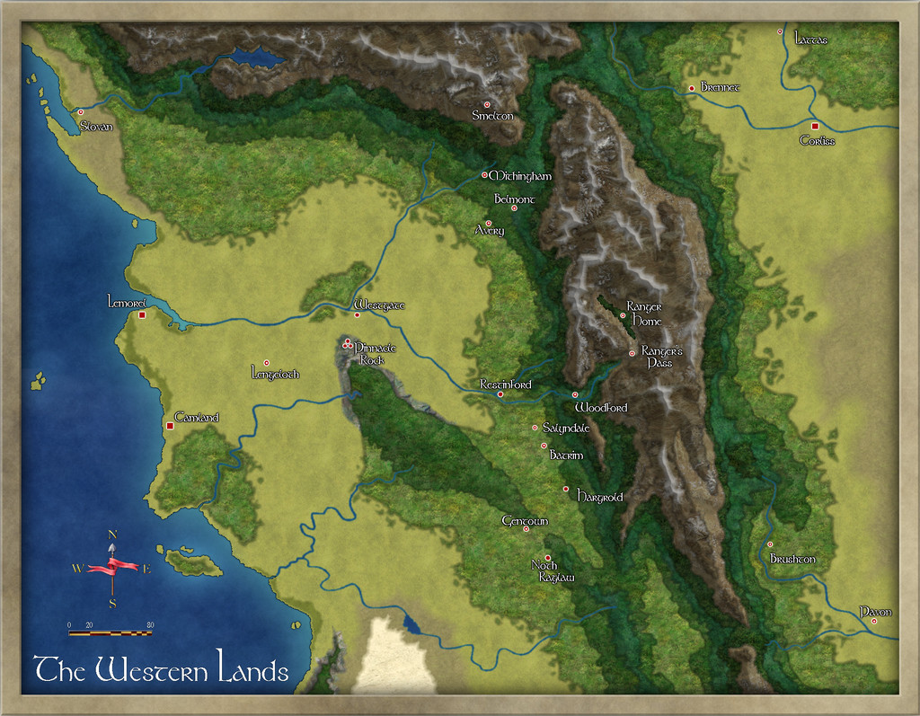
SS6 - Northern Scar: Village of Orin
As I was playing around and testing SS6, I decided to create a map for the Atlas. This is the village of Orin from the Northern Scar map (to the east of Bryn). I'll consider any advice or suggestions before submitting it to Remy for inclusion in the Atlas.


 and 2 others.
 -
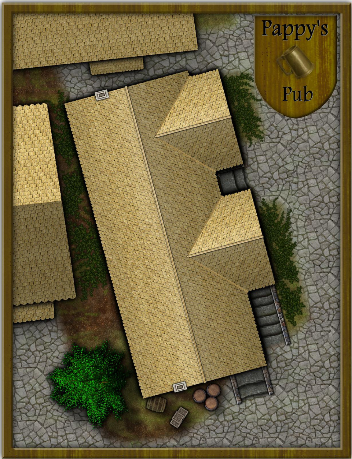
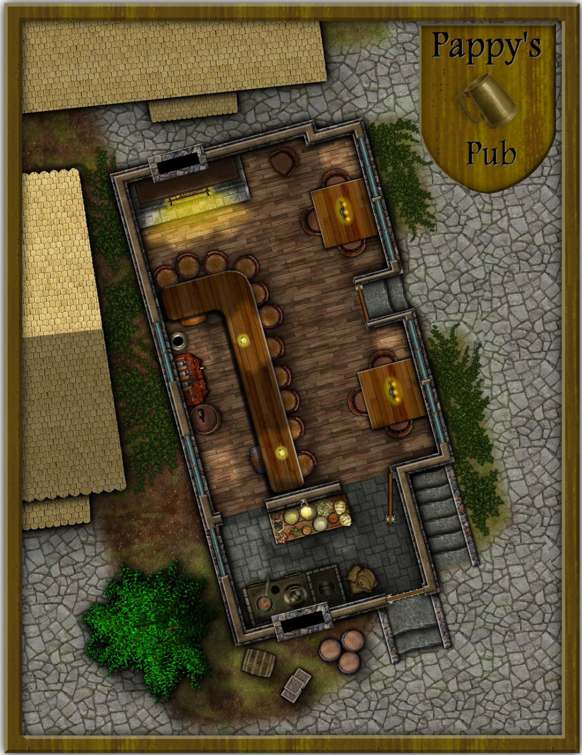
August Mapping Competition - Building Floorplans - Win Prizes
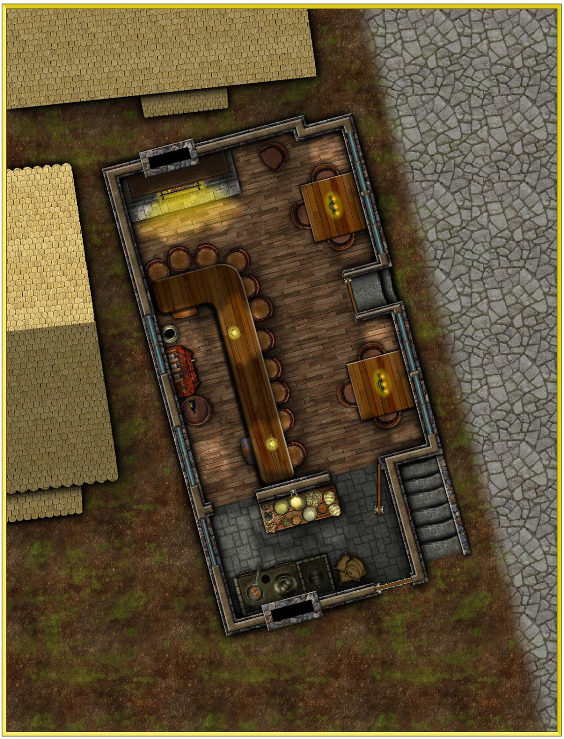
Here's my entry: Pappy's Pub. I'll hand the .fcws for the atlas to Remy when I have a few spare minutes.


-
[WIP] August Competition - Pappy's Pub
Thanks for your kind words AleD!
I'm mostly done with the first floor though I may tweak things here and there before I'm finished. I also need to define the scale somehow with out it looking more 'mappy' than I want. To be figured...
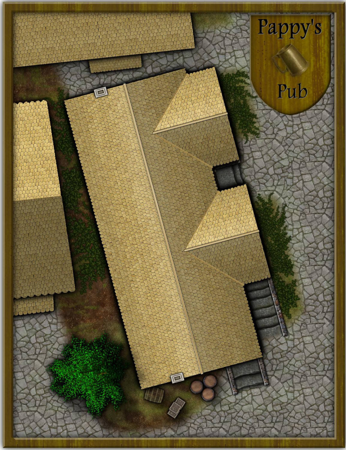
Again, the Pub roof is simply a Sheet that can be hidden or not.
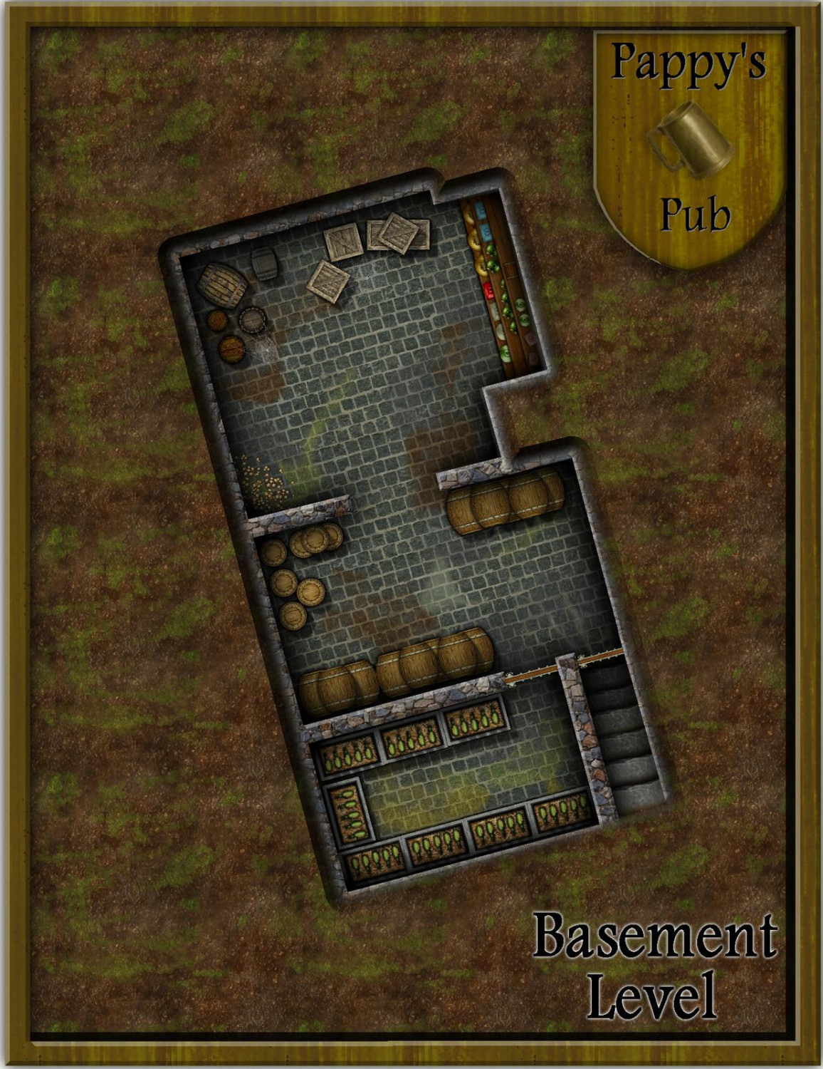
Next up is the basement level.

-
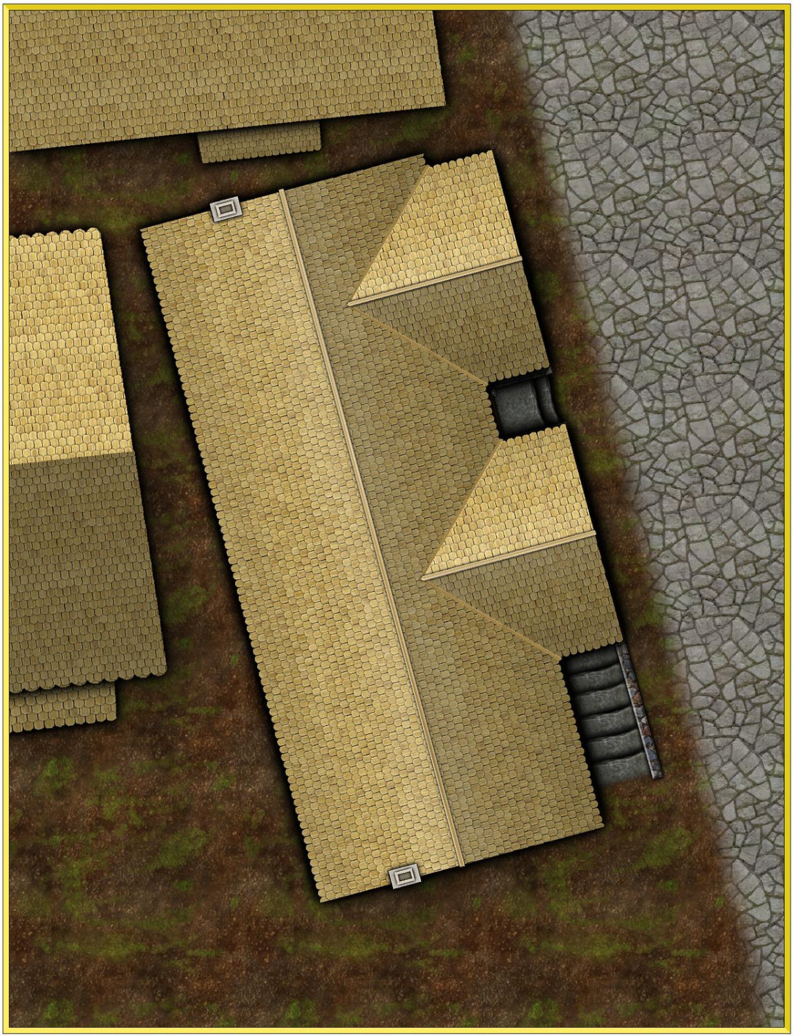
[WIP] August Competition - Pappy's Pub
Next round of updates.
After looking at the original map again and noting where the chimneys and street are, I've decided to move things around a bit. I liked @DaltonSpence idea of moving the kitchen door to the side wall and had to move the chimney's to the side more. The chimney location looks wrong to me now but fits with the city roof so...blah!
The Pub roof is on its own sheet so can be shown or hidden at will.
Still lots to do...