Monsen
Monsen
About
- Username
- Monsen
- Joined
- Visits
- 660
- Last Active
- Roles
- Administrator
- Points
- 8,858
- Birthday
- May 14, 1976
- Location
- Bergen, Norway
- Website
- https://atlas.monsen.cc
- Real Name
- Remy Monsen
- Rank
- Cartographer
- Badges
- 27
-
please help. Annual Herwin Wielink text giving me big problems.
You need to change the scaling of the effect. Just find the effect on the Text sheet, and change the Range of it.
The reason it changed when you rescaled the drawing is that it is set up to be a percentage of the size of your drawing so it can work seamlessly with all map sizes, so when your map got larger, so did the effect.
-
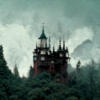
WIP Mad Wizard's Tower based on an adventure by MT Black
-
Free symbol pack - Tentacles
-
Live Mapping - Sewer Encounters
You all like sewers right? That's where we're headed on Thursday, so mark the time in your calendars. I'll be handing out XP penalties for anyone who is late or absent.
As usual, it starts 18:00 CET, to figure the time in your local time zone either just start the video below and YouTube should tell you, or look over at the left forum sidebar, it should provide the time in your timezone provided you are a logged in user.
Remember that while you can of course just watch the video in the embedded video player here at the forum, a far better option is to hit the video title in the top left of the video or the large YouTube logo in the bottom right to be taken to the YouTube page where you'll also find the chat where you can interact with us during the stream.
-
About map printing
The only difference between regular image exporting and rectangular section is that after you have clicked save in the save as dialog, instead of starting the export immediately, you will be prompted (on the CC3+ command line) to pick two opposite corners of your export (by clicking your mouse in the drawing or typing in the coordinates, either works). CC3+ will then export only the parts that is within the area defined by those points instead of the entire map.
The export process is explained in detail with images in the user manual, starting on page 47.


