Royal Scribe
Royal Scribe
About
- Username
- Royal Scribe
- Joined
- Visits
- 9,538
- Last Active
- Roles
- Member
- Points
- 3,353
- Birthday
- February 5, 1968
- Location
- San Francisco, California
- Website
- https://legacy.drivethrurpg.com/browse/pub/31814/Royal-Scribe-Imaginarium
- Real Name
- Kevin
- Rank
- Mapmaker
- Badges
- 16
Latest Images


Reactions
-
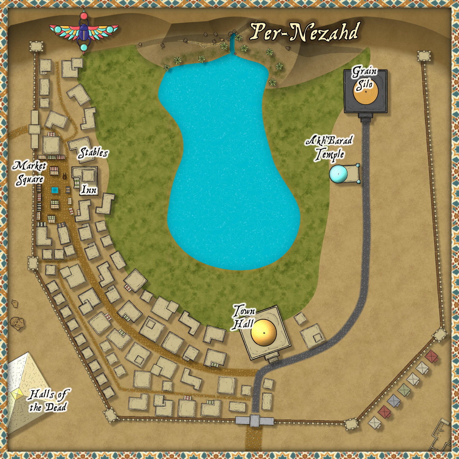
[WIP] Per-Nezahd
Working on a desert village using the Desert Oasis style, but now I'm wondering if it's turning more into a town than a village, even though it's only 500 feet x 500 feet.
I added a wall around it because I figured they'd be pretty protective of their water source and the crops it's able to sustain. Added an inn and stables because I figured that traders would be coming through. And a pyramid outside of the walls as the Halls of the Dead (either tombs or a columbarium). All of this is making it feel a little big for a village -- which is fine, I can always add it to the Atlas outside of the competition and do another desert village for the contest.
Thoughts?


-
The map of GnoccoCON '24, a local gaming event
This is great! I love the idea of using CC3 for non-battlemap purposes. Street fairs, for example, could use it to show which streets are closed off, where vendor and food booths are located, and the location of performance stages.

-
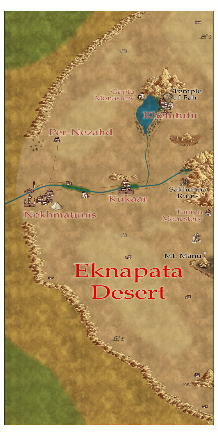
[WIP] Community Atlas - Gold Coast, Doriant
Here's an area map of the Eknapata Desert region on the northeast corner of the Gold Coast map. I decided to do it in the Scorching Sun annual. The mapping guide for the annual recommended Mike Schley Overland as a complementary style for additional symbols, so I used that for the pyramid at the city of Nekhmatunis, the ziggurat at the city of Khemtufu, and the half-buried statue and obelisk at the Sakherma Ruins. I also threw in a few of his camel-with-guide symbols to represent nomadic tribes, and a sandworm just for fun. There are a few more villages, too, and another monastery that I figured were too small to be on the parent map for the entire Gold Coast region. I also added a volcano, but figured that would be on the parent map. Since the parent map hasn't been submitted to the Atlas yet, I went back and added it to the parent map, too.
I'm enjoying the opportunity to try out different map styles with this project. I plan to design one city with Mike Schley's Mideastern symbols from SS5, and another with the Desert Oasis annual.

-
[WIP] Community Atlas - Gold Coast, Doriant
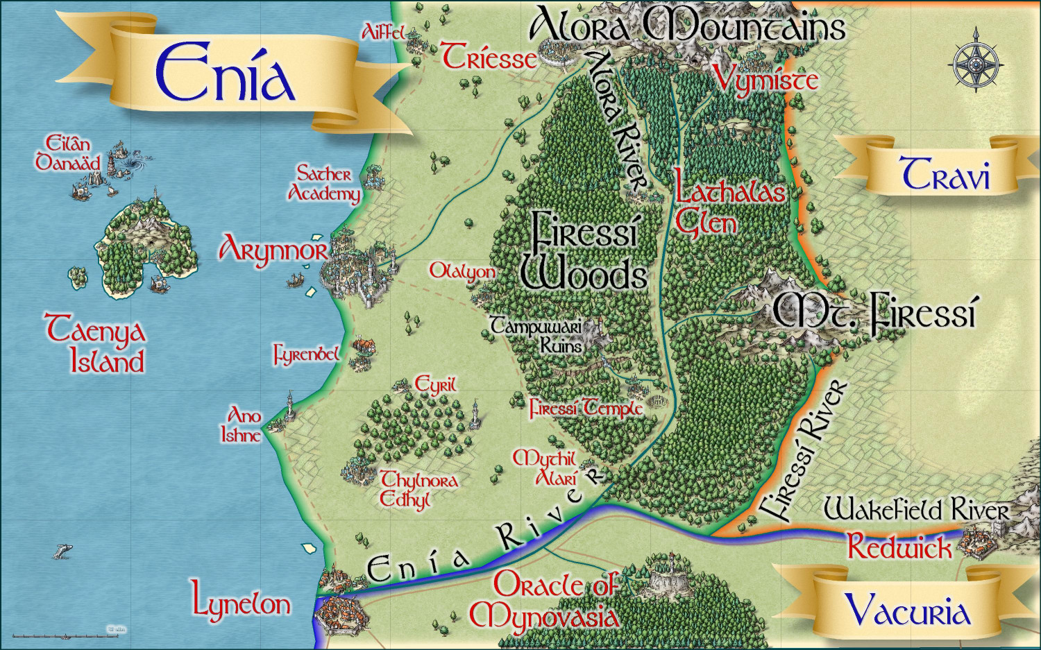
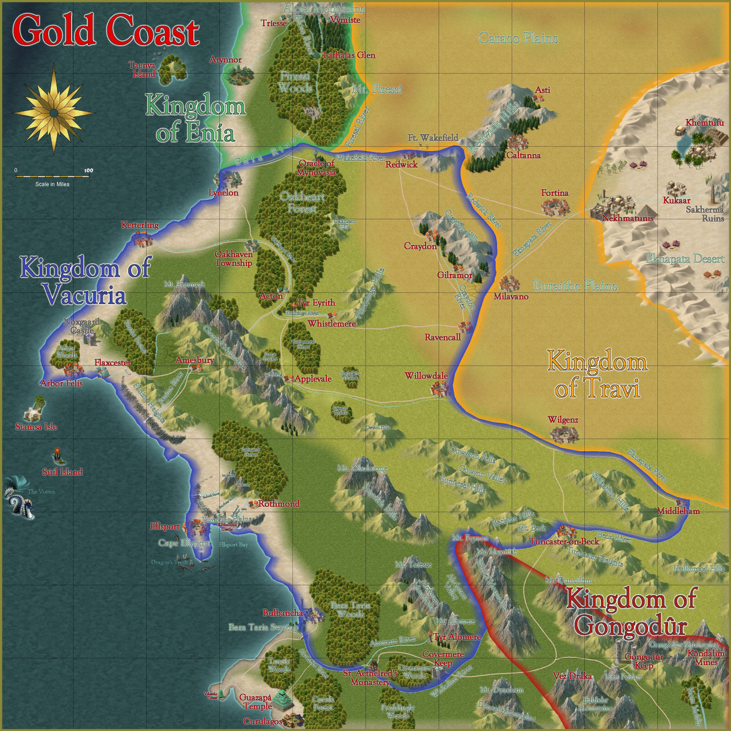
Oh, here's a version of Enia with the political borders shown:


-
[WIP] Community Atlas - Gold Coast, Doriant
Remy said two things about the 1000th map contest that I have taken to heart:
- We can submit more than one map, but will only be able to win one prize; and
- We can make our own local map anywhere in the world to create a place for a village we want to design (but only the village map is eligible for the contest).
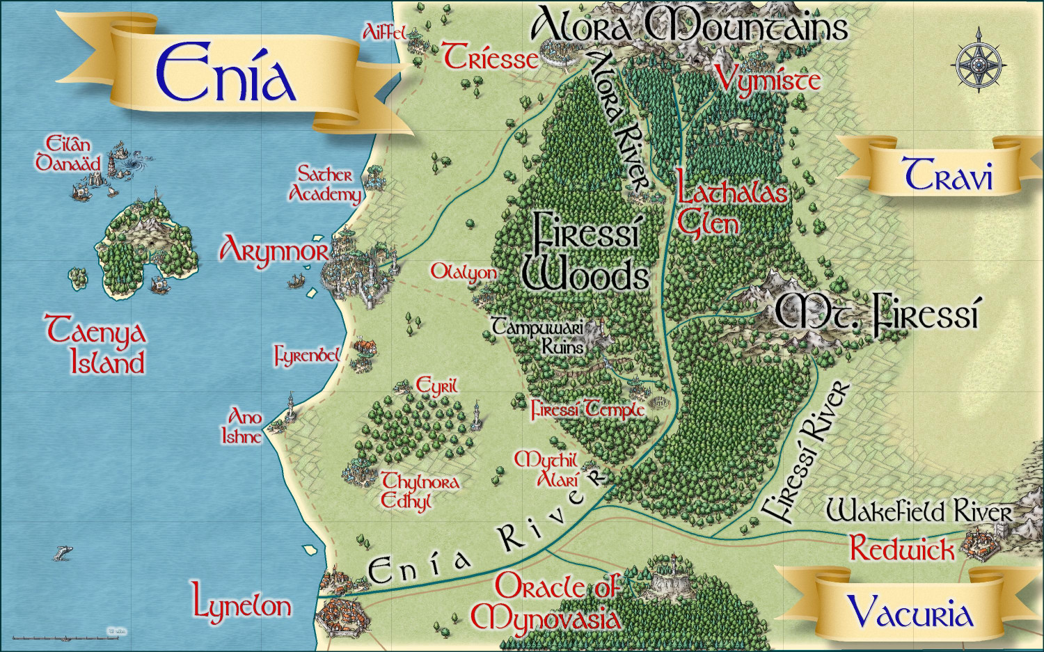
With that in mind, I have been working on this Gold Coast map as well as an area map for the Kingdom of Enia, an elvish kingdom on the northern side of the coast. I have two villages in Enia that I will submit. If this works best for you, @Monsen, I will create a thread for all of the non-contest Atlas submissions once they're finalized, and then the actual villages for the competition will be posted in the competition thread when they're ready to submit.
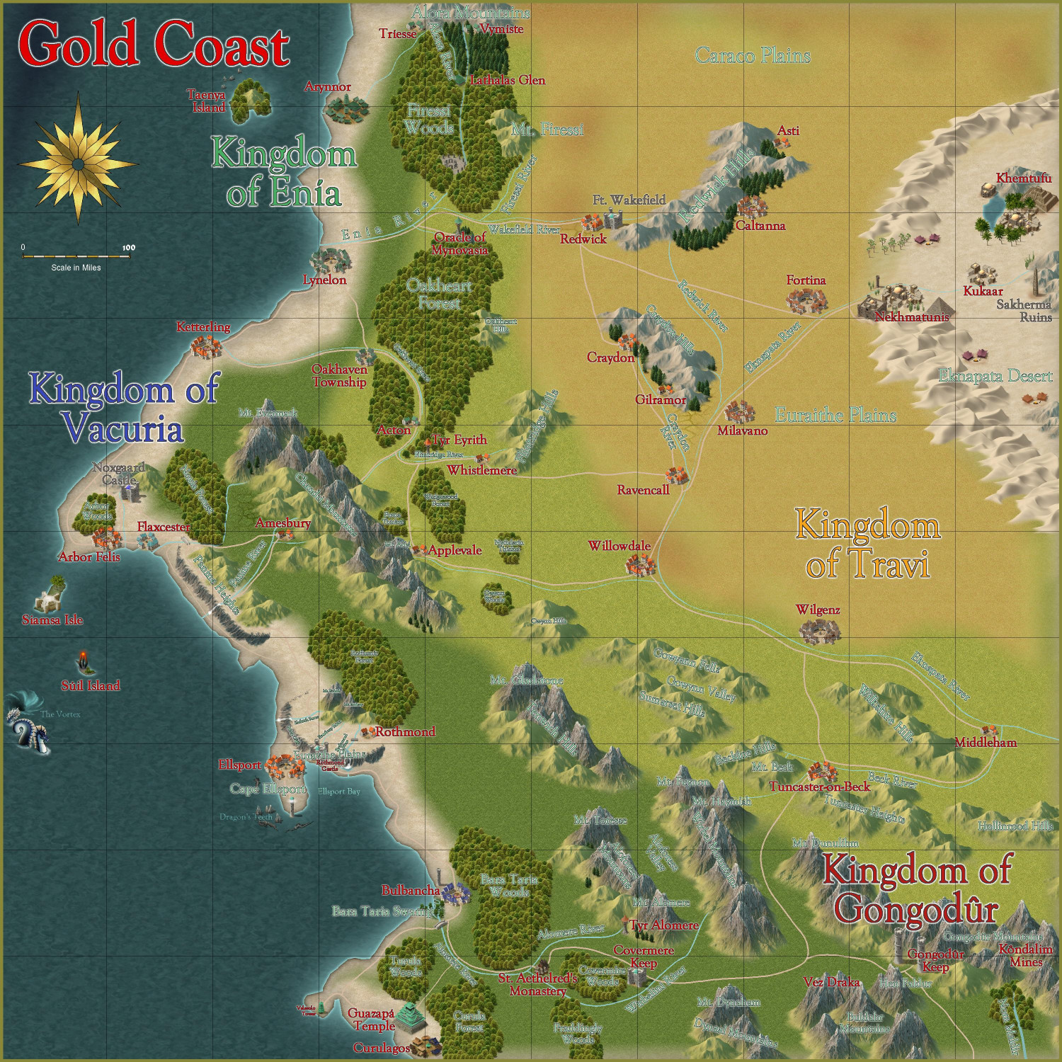
Gold Coast
Here is the Gold Coast region, first without and then with political borders (which can be toggled). I am writing up the description now.
Without Political Borders
With Political Borders
Thoughts?
And then here's a map of the Kingdom of Enia, with more smaller hamlets and other small details added, this time in the Mike Schley style: