Royal Scribe
Royal Scribe
About
- Username
- Royal Scribe
- Joined
- Visits
- 9,531
- Last Active
- Roles
- Member
- Points
- 3,353
- Birthday
- February 5, 1968
- Location
- San Francisco, California
- Website
- https://legacy.drivethrurpg.com/browse/pub/31814/Royal-Scribe-Imaginarium
- Real Name
- Kevin
- Rank
- Mapmaker
- Badges
- 16
Latest Images


Reactions
-
[Atlas Submission] - Doriant - Gold Coast - Eknapata Desert - Kukaar
For those who didn’t know, this is designed in the beautiful Ancient Cities style that @C.C. Charron designed for the 2024 annual.
-
[Atlas Submission] - Doriant - Gold Coast - Eknapata Desert - Kukaar
Hi Remy @Monsen!
I have discovered an Atlas submission for the city of Kukaar that I either failed to tag you in or quite possibly failed to submit at all. My Apologies! This is ready to be added at your leisure.
This is for Doriant - Gold Coast - Eknapata Desert - Kukaar. You'll find Kukaar in pretty much the center of the Eknapata Desert map. It does not have an unusual toggles.
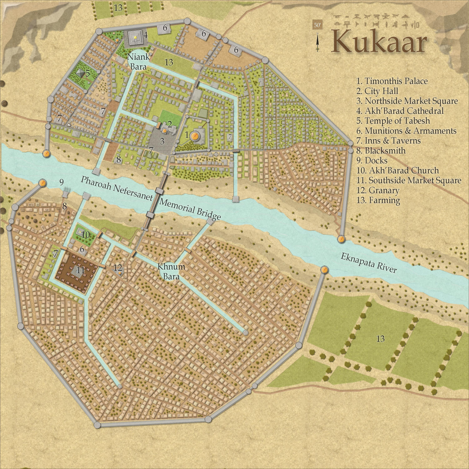
Thank you!


-
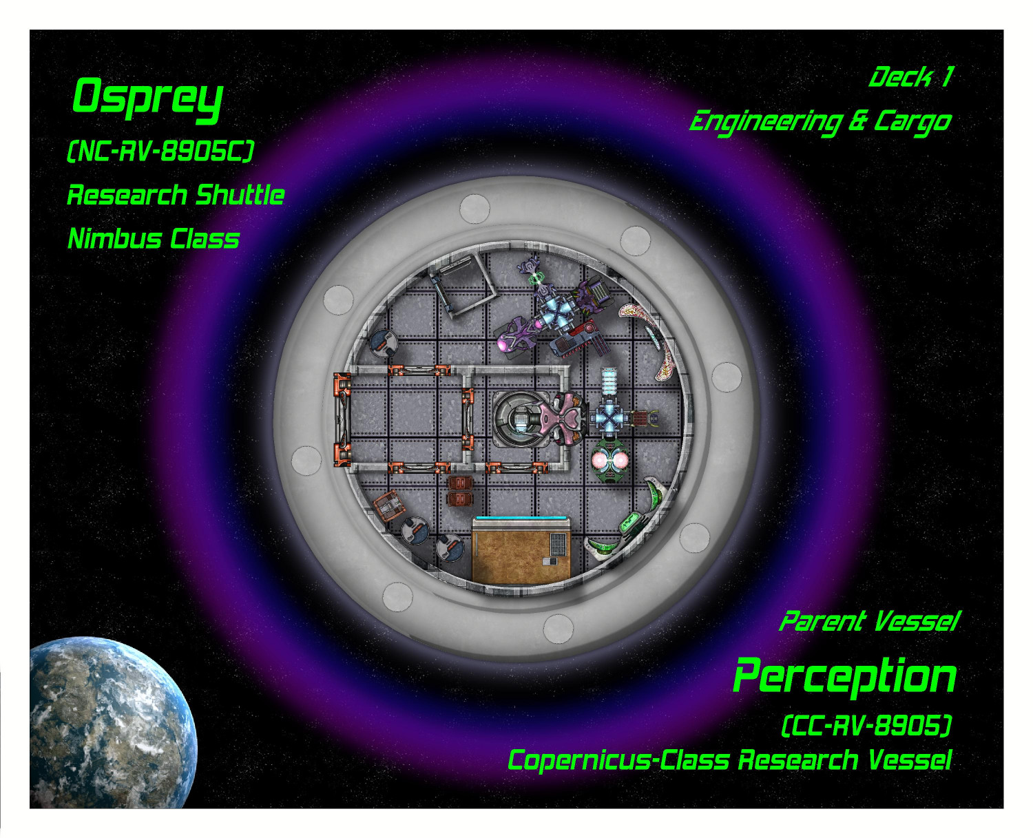
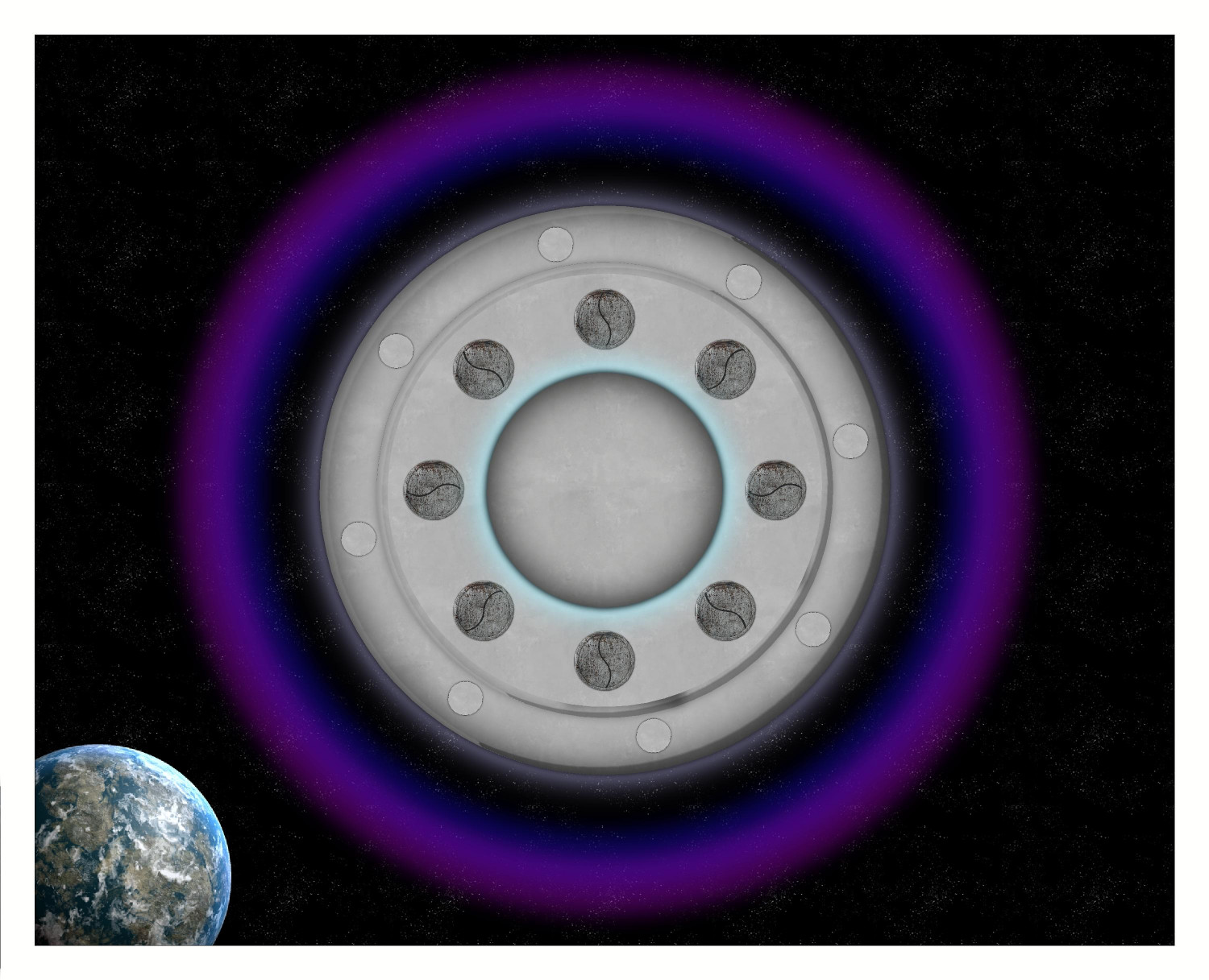
[WIP] Research Saucer Shuttle
I intended to have three decks, but ended up pushing it to four because it was hard to squeeze medical and living quarters into a single deck. And even then, I had to make compromises (like bunk beds, and deciding to have a standard crew of six rather than eight).
Deck 1: Engineering & Cargo
This is the lowest deck. On the left side is an airlock door with an (unseen) retractable ramp, for planet surface landings. The center has a ring hatch for connecting with other space craft. A tractor beam can also pull objects into the craft from here. The ship's main computers and engineering systems are here, including life support, artificial gravity generators, shield deflectors, the cloaking device, propulsion systems, sensors, weapons, communications, and more.
Cargo (mostly specimens collected from the planet) can also be stored here wherever there's a little spare space.
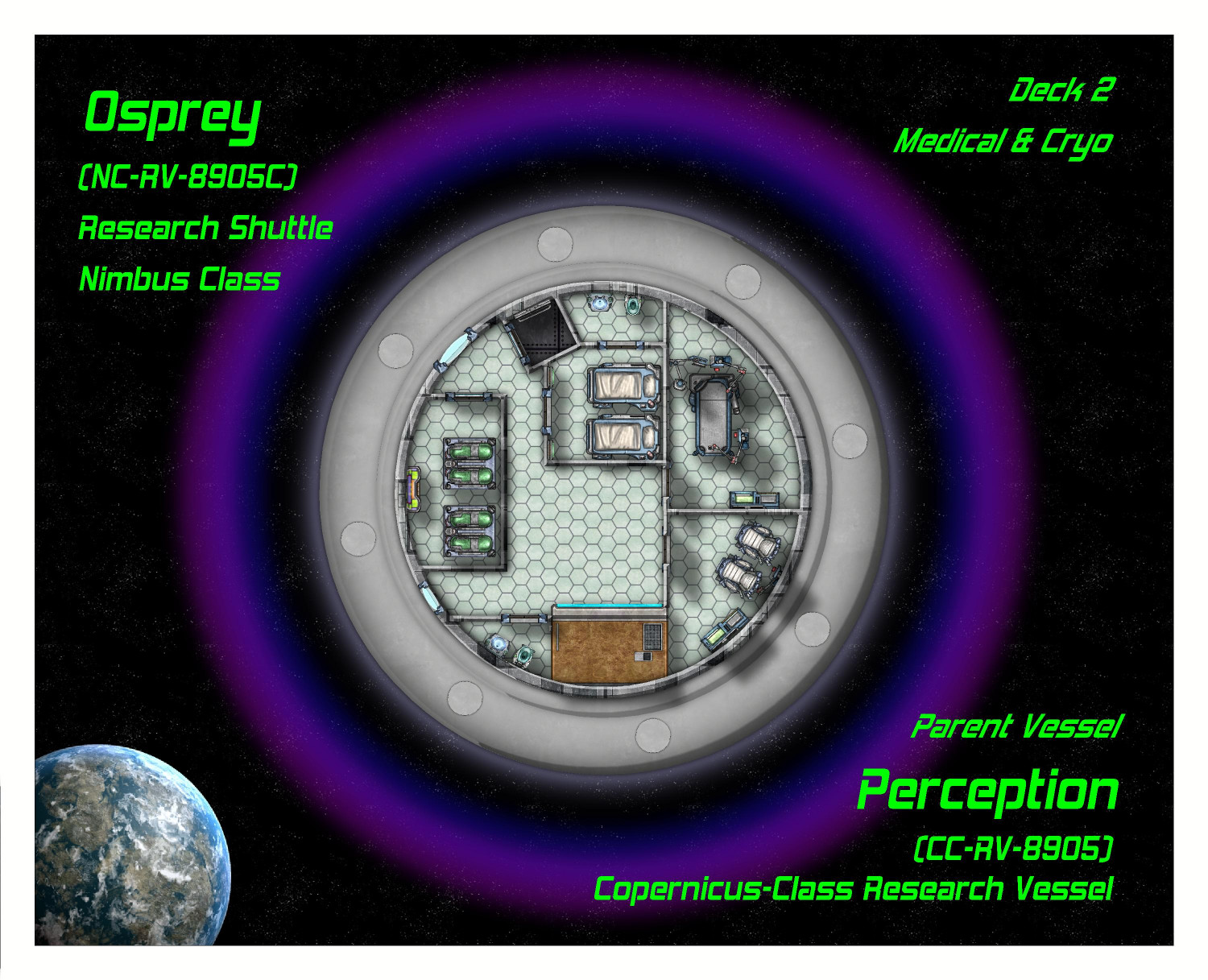
Deck 2: Medical & Cryo
This floor is dedicated to medical care and biological research (including a lab table where local fauna can be...examined). There are four cryogenic tanks here for emergencies -- not enough for the entire crew because this is not an interstellar space craft and the cryo tanks are for emergencies. Usually that means keeping an injured crew member on life support until the ship can return to the parent vessel or space station. Sometimes if a shuttle is stranded, it can keep the crew alive (in rotating shifts) until help can arrive.
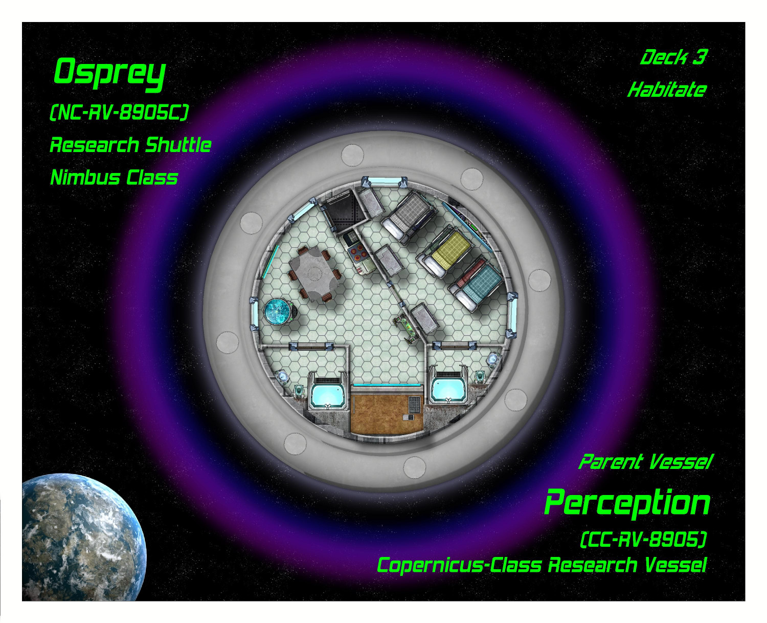
Deck 3: Habitat
This is where the crew lives when they aren't on duty. As this ship is only intended for short missions of a day or so, sometimes a week, the living quarters can be more cramped than on their parent ship. The crew even has to sleep in bunk beds in a shared room. There are two bathrooms with showers.
The other floors were already posted and haven't changed. I'll see if there's any feedback and then post the final set.


-
[WIP] Research Saucer Shuttle
I've never really used Cosmographer much, other than borrowing starfield bitmaps or planets as backgrounds for other maps. Here is the beginnings of my first spacecraft.
It's a small saucer shuttle, 50 map units in diameter. (I think the map units are in feet but not entirely sure.) My thought is that it's capable of flying through a solar system but not capable of interstellar flight. Usually attached to a space station or larger interstellar vessel, used for getting a closer look to study planets, entering the upper atmosphere or even landing planet side, collecting flora and fauna for closer study.
So far, I've just done the outside from above and the top-most deck -- the Command and Scientific Research deck. There will be two more decks: the Habitat deck in the center, and Engineering & Cargo on the bottom. I will also do a view from below.
From Above
Here it is from above, with windows shuttered and dome closed, defensive shields activated.
Windows unshuttered, dome uncovered:
I did a lot of experimenting on the windows, including experimenting with using Blend Mode. That worked out, but I ended up settling on using a Color Key cutout (of course) -- but instead of using the traditional magenta color (#6), I used the light blue (#5) and set it with a 20% opacity. I figure it's slightly tinted.
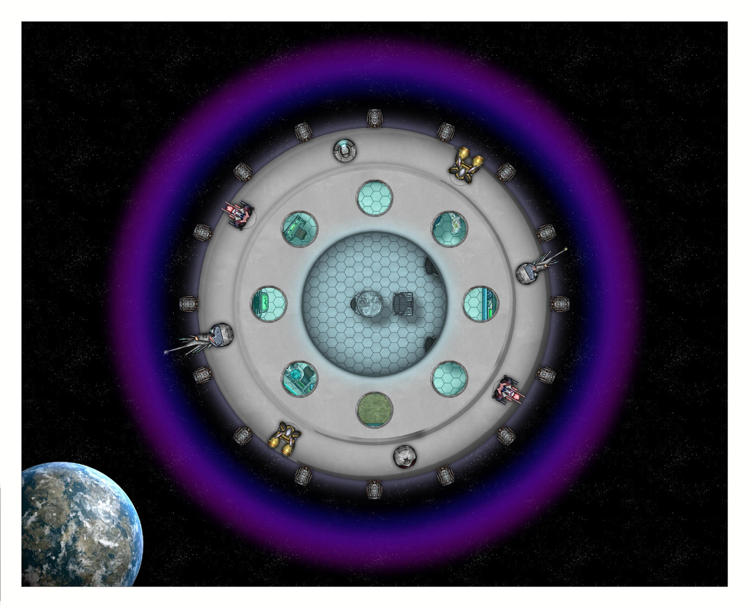
Here it is with retractable thrusters out:

Those gray discs are meant to be retractable hatches for weaponry and sensors. Here it is again with the four weapons (two lasers, two torpedo weapons) and four sensors out:
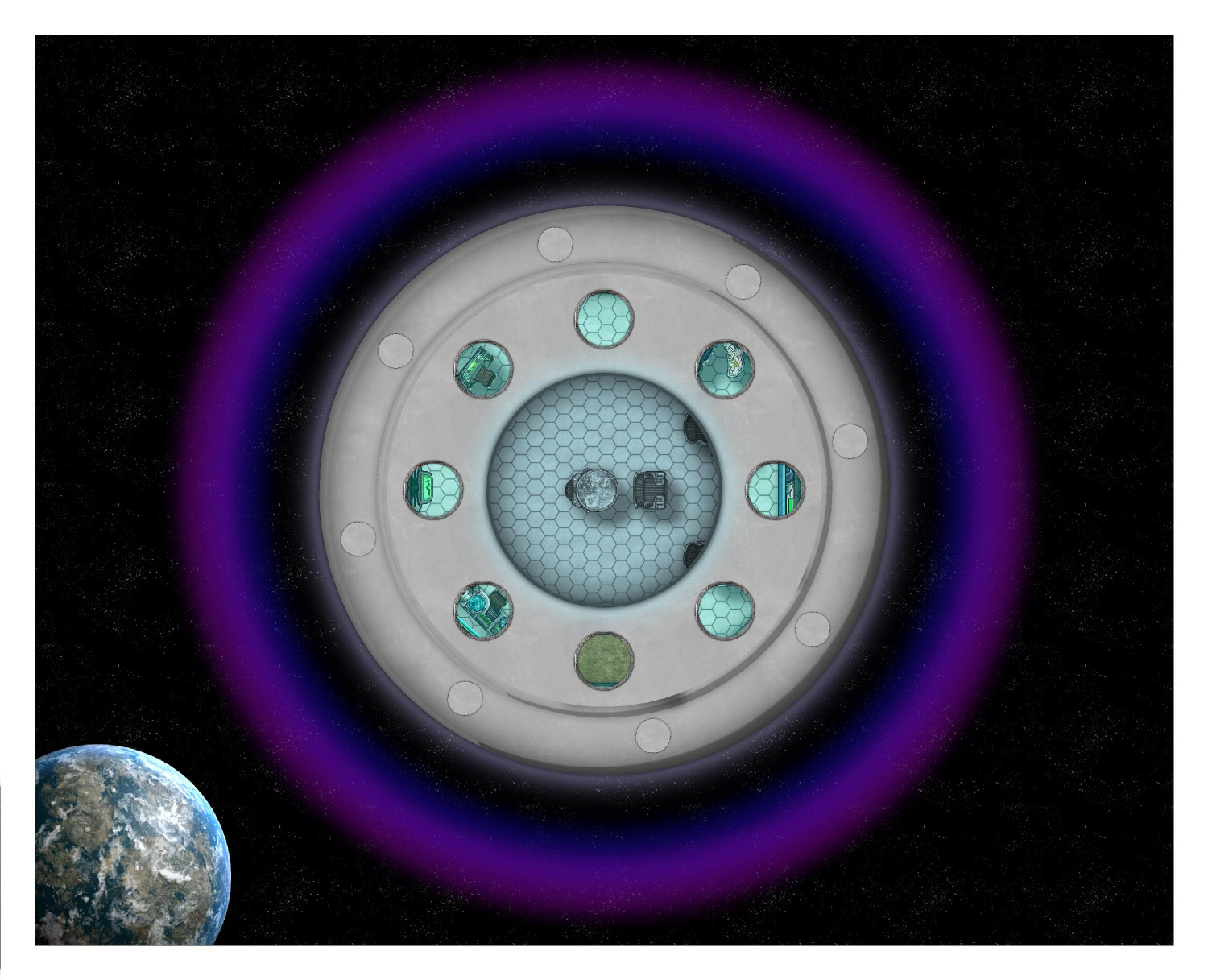
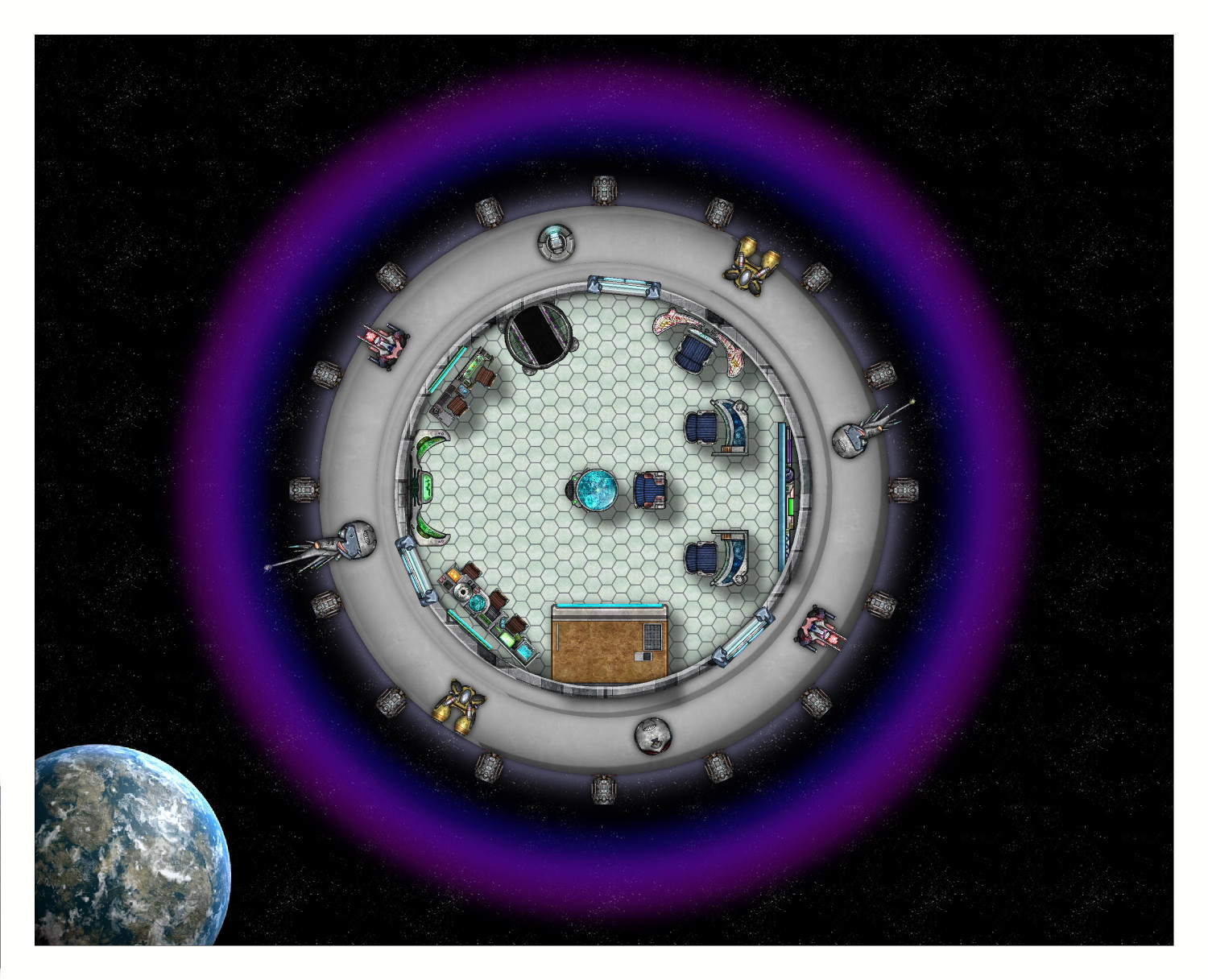
Top Deck: Command and Scientific Research
I was going to divide this floor into separate rooms, but it looked funny with the "skylight" windows. I suppose it makes sense for a research shuttle to allows the scientists and command crew to be together, since the scientists will really be directing the mission.
I played around with different stair options but didn't really care for them. I ended up settling for an elevator lift on the southern side, with an emergency ladder shaft on the northern side. Command/flight stations on the eastern side, scientific study stations elsewhere. Labels to come.
That's it for now. The other two floors and the bottom view still to come.


-
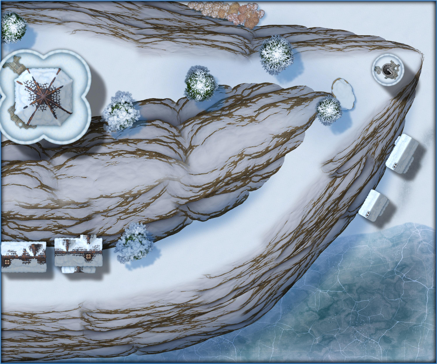
Wish List: City/Dungeon Top-Down Mountain Peaks, Ridges & Crags
And not that we had any reason to think Winter Trail/Winter Village would be different, but just for fun, here's a sliver of an alpine village.