


Royal Scribe
Royal Scribe
About
- Username
- Royal Scribe
- Joined
- Visits
- 9,533
- Last Active
- Roles
- Member
- Points
- 3,353
- Birthday
- February 5, 1968
- Location
- San Francisco, California
- Website
- https://legacy.drivethrurpg.com/browse/pub/31814/Royal-Scribe-Imaginarium
- Real Name
- Kevin
- Rank
- Mapmaker
- Badges
- 16
Latest Images


Reactions
-
[WIP] 1972 Travelogue (CA93 Modern Journeys)
Using two of Ralf's recent tutorials, Modern Journeys and Real-World Vector Data, I was finally able to create a condensed map of a 71-day vacation my parents took me and my twin on when we were 4 years old. (The images for the icon symbols are all public domain or CC-BY. Photo credits below.)
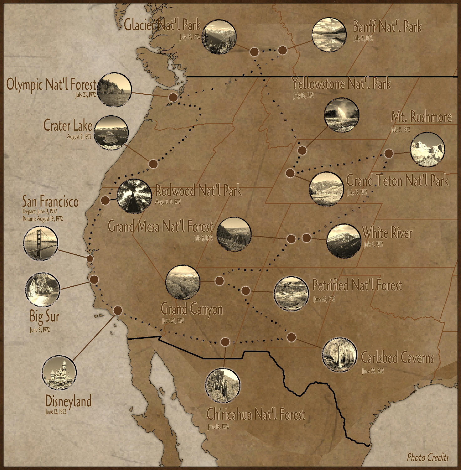
Like Ralf's Real-World Data tutorial, I had weird gaps in the middle of my map when I tried to convert the vector lines to land. Unlike Ralf, I didn't have the skills to be able to resolve it (despite watching the tutorial three times)...so I kludged a solution by drawing more land over the gaps. There was some other weirdness on the eastern side of the map that I didn't even have to worry about once I realized that I only had to show the part of the U.S. where we traveled.
Also, because I wasn't shading each state differently, I didn't have to trace the boundaries the way Ralf did. I simply moved the lines to a Border sheet and changed their properties to be the color and line thickness that I wanted.
I originally was going to source the photos from the U.S. National Park Service's website, where they have a database of images from their parks that are all in the public domain. (In the United States, all intellectual property published by the government is automatically in the public domain.) I was struggling to find images I liked, so instead I resorted to Wikimedia Commons. I made a point of only using photos that were either in the public domain or were published by a Creative Commons CC-BY license. Those licenses allow for commercial use, unlike the CC-BY-NC licenses (even though this isn't for commercial purposes), and allow for derivatives (unlike the CC-NY-ND "no derivatives" licenses). That allowed me to edit the images to be in sepia and cropped into circles. Instead of following Ralf's approach of making them sepia in the map, I used GIMP to desaturate them to sepia and then crop them to a circle which was then exported to a PNG (with the portions outside of the circle being transparent).
I added the photo credits to a Map Note and added a hotspot in the lower right corner to open up the note. Here are the photo credits (including some I wasn't able to use because of space considerations):
San Francisco, California - Dasturias, CC BY-SA 4.0, via Wikimedia Commons
Big Sur, California - Brian Lopez, Public domain, via Wikimedia Commons
Los Padres National Forest - Damian Gadal, CC BY 2.0, via Wikimedia Commons
Disneyland - Tuxyso, CC BY-SA 3.0, via Wikimedia Commons
Chiricahua National Forest - Zereshk, CC BY-SA 3.0, via Wikimedia Commons
Carlsbed Caverns - Eric Guinther, User:Marshman, CC BY-SA 3.0, via Wikimedia Commons
White Sands National Park - uncredited NPS employee, Public domain, via Wikimedia Commons
Petrified National Forest - AndrewKPepper, CC BY-SA 4.0, via Wikimedia Commons
Grand Canyon - Tuxyso / Wikimedia Commons
Glen Canyon Dam @ Lake Powell - Christian Mehlführer, User:Chmehl, CC BY 2.5, via Wikimedia Commons
Grand Mesa National Forest - National Archives and Records Administration, Public domain, via Wikimedia Commons
White River National Forest - JasonC photography, CC BY-SA 4.0, via Wikimedia Commons
Mt. Rushmore - Colin.faulkingham at English Wikipedia, Public domain, via Wikimedia Commons
Teton National Forest - US Forest Service, Public domain, via Wikimedia Commons
Yellowstone National Forest - Brocken Inaglory, CC BY-SA 3.0, via Wikimedia Commons
Glacier National Park - TaikiMcTaikiface, CC BY-SA 4.0, via Wikimedia Commons
Banff National Park - Sergey Pesterev / Wikimedia Commons
Mt. Baker National Forest - Joe Mabel, CC BY-SA 3.0, via Wikimedia Commons
Falls View, Olympic National Forest - Forest Service of the United States Department of Agriculture. Public domain, via Wikimedia Commons
Crater Lake, Oregon - DSparrow14, CC BY-SA 4.0, via Wikimedia Commons
Redwood National Park - m01229 from USA, CC BY-SA 2.0, via Wikimedia Commons


-
[WIP] Community Atlas - Rhaghiant (western Doriant)
That makes sense about making sure the major things are captured on the map, while being able to add smaller ones on the local area maps. And naming the features as well. I will have to come up with some names that aren't subconsciously lifting from literature. (Can't tell you how many times over the years I've thought, "Oh, Imladris is a good name for my elven kingdom -- no, wait!") I keep a running list on my phone of potential NPC character names. Some of those names may be suitable for place names instead (especially since so many place names are named after people.)
Here's the map as it stands with more hills in the "midwest" area, more rivers and settlements, roads and a few major bridges. (My thought is that except if I name where a road crossing a river something like "Blah Blah Blah Ford," there's a bridge there, but I added a few bridges that are meant to be unusually grand ones.)
Let me know if you spot anything weird or geographically improbable, or if there's anything missing. I also need to double check the Atlas maps to the north of the area I claimed to make sure there aren't features like hills or rivers that extend past the southern edges of those maps.


-
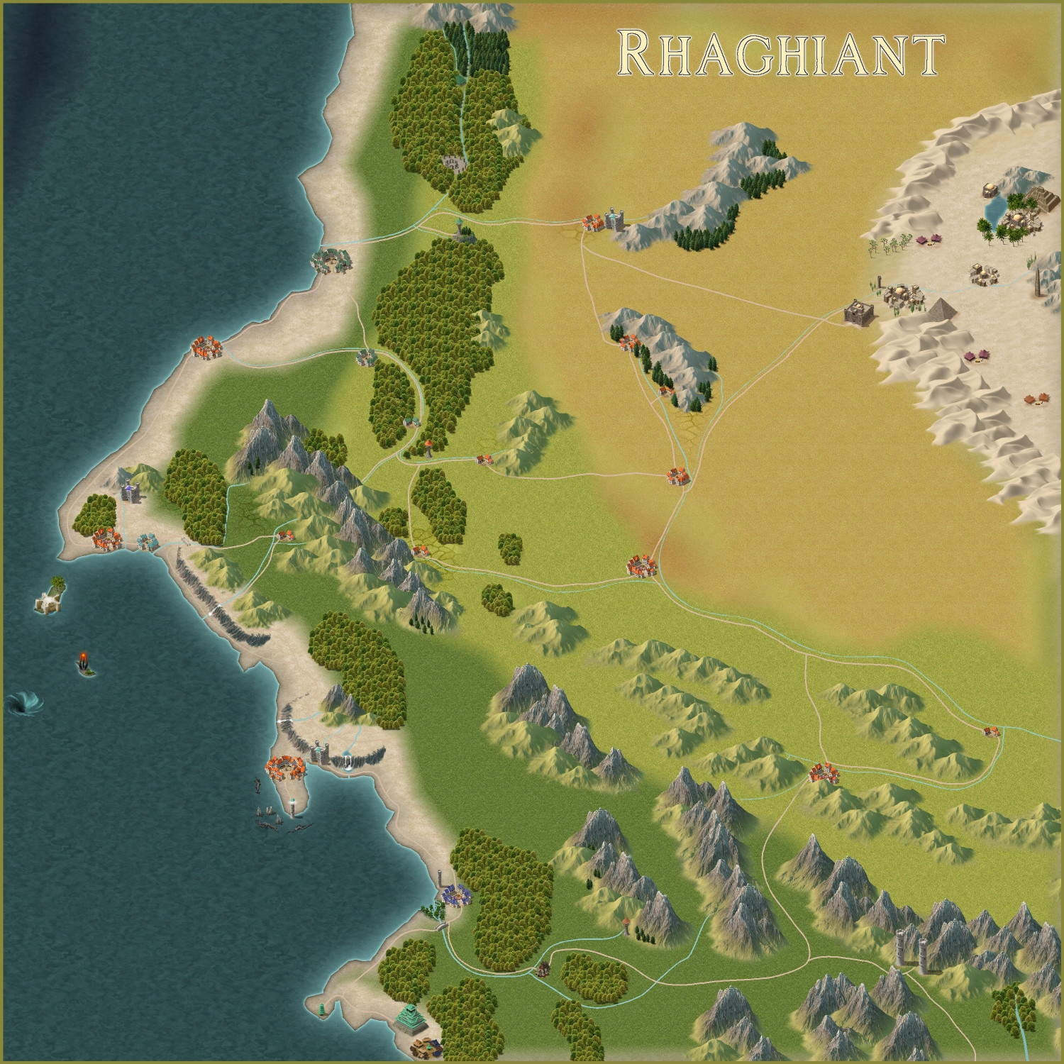
[WIP] Community Atlas - Rhaghiant (western Doriant)
I tried at 50% of the original size (which is double the size I used). Does this work, or are the symbols still too small?
Am I correct in understanding that if I later want to work on a local map of this, say a 200 x 200 mile section, I can add smaller towns and streams to that? For example, I have a small town I did before that I'd like to find a home for, but it's only about a quarter of a mile wide, so I'm thinking it's too small to register on this scale.
Also, I should come up with names now for settlements shown here, and other major geographical features, rather than waiting to name them in more detailed local maps?

-
[WIP] Community Atlas - Rhaghiant (western Doriant)
You're right, the symbols are better. I scaled the settlements down to 0.25 scale because at full size, they felt cartoonishly overlarge, even though they're meant to be a symbolic representation and not to scale. For example, I put a full scale city off to the side (in the ocean) for comparison. It takes up 75 miles!
Here's the full map, though admittedly the settlement symbols are harder to see scaled down here. Do you think scaling them to half size instead of quarter size would be better?

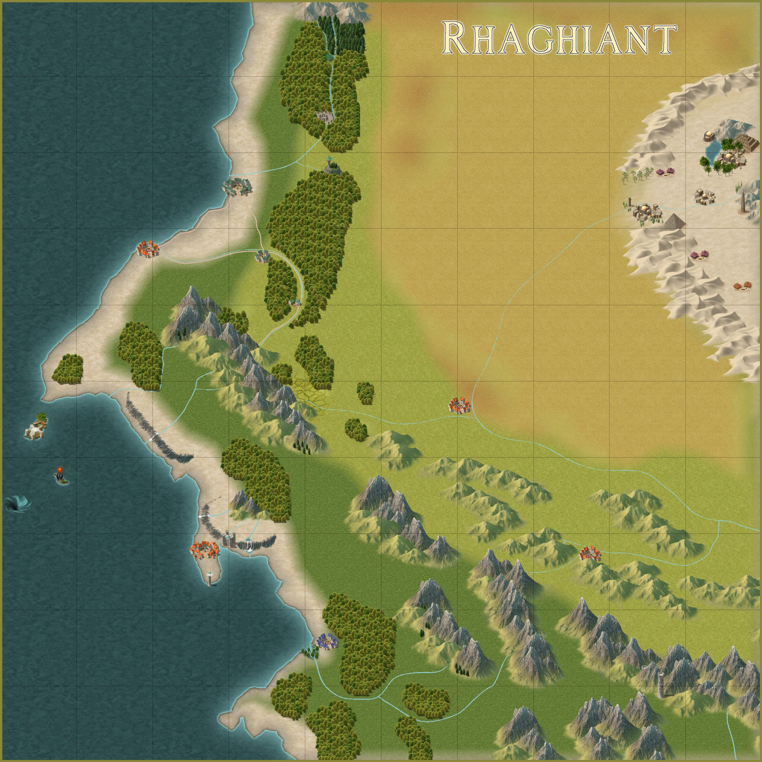
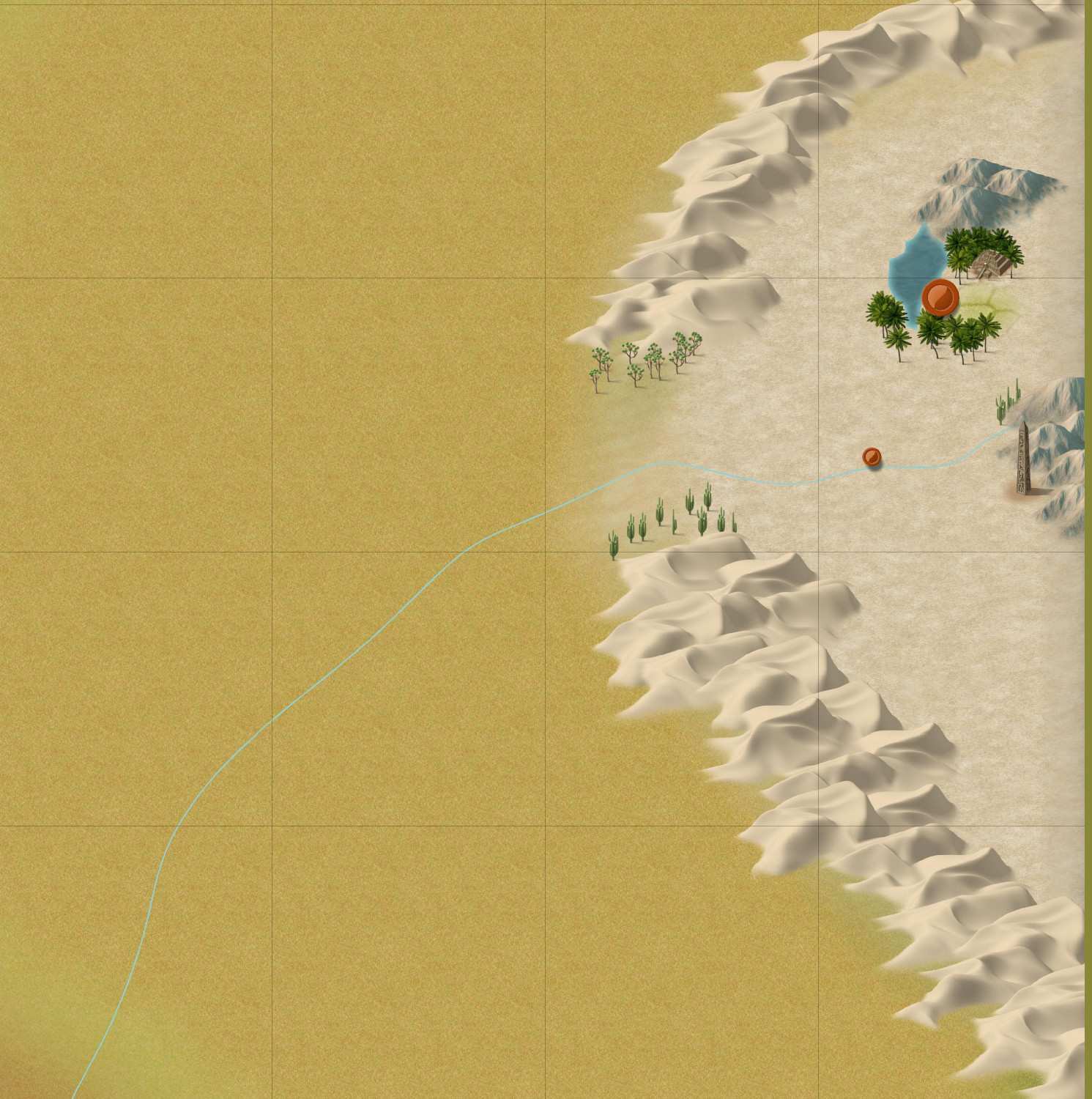
I won't show zooms of every area until it's ready for final inspection, but I did want to show off the desert.
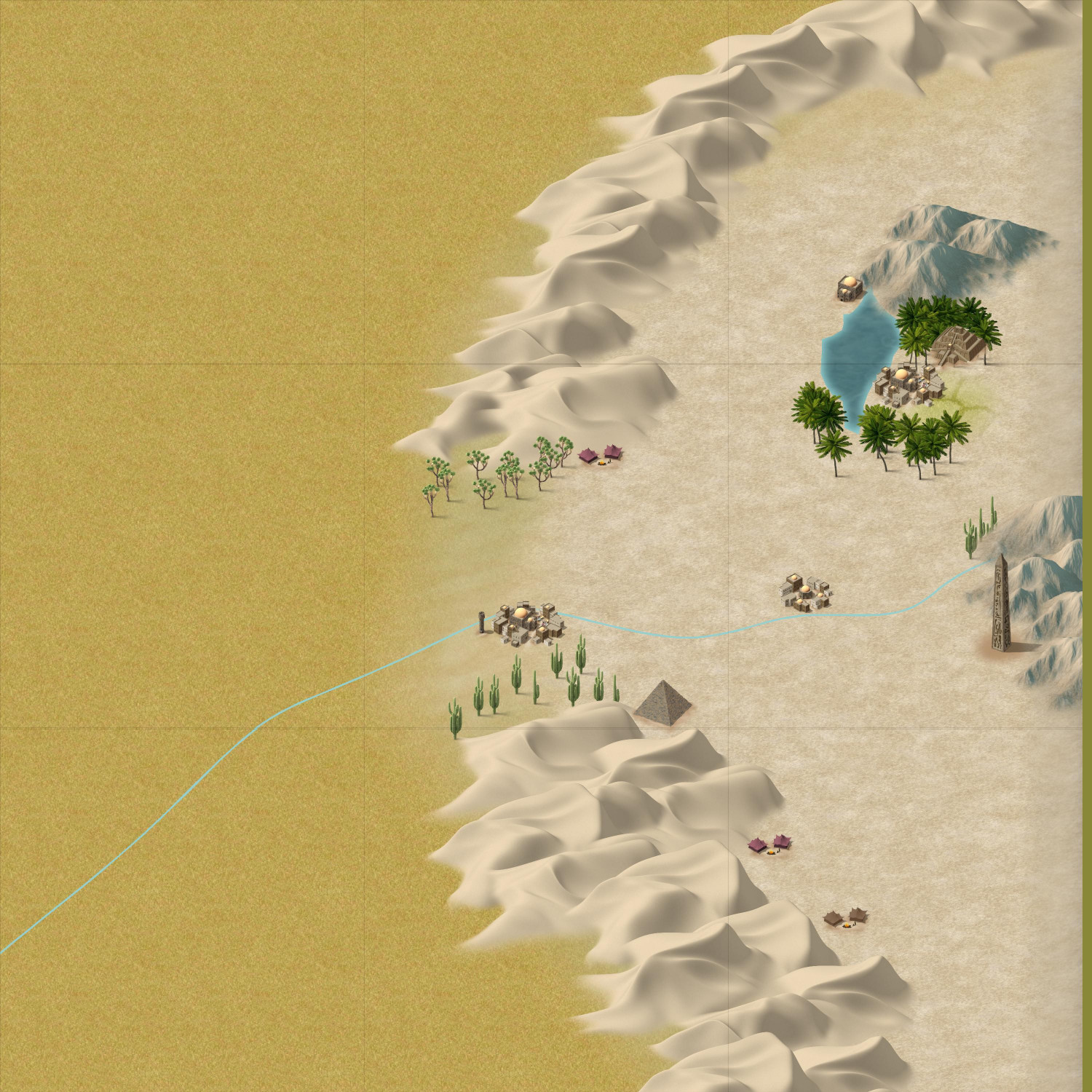
The symbols here have inspired me to expand on the maps I was planning to do. The oasis city will be where my ziggurat will go, and the town midway down the river will be for the Ancient Cities map I did (which I will expand to cover the whole town and not just the northern edge). I decided to add another city at the western edge of the desert so that I have an excuse to design something with the Desert Oasis style from the 2023 annual.
-
[WIP] Community Atlas - Rhaghiant (western Doriant)
Here's how it's progressed so far today. (Still not wed to the name.) Still need to do more in the middle area that I am mentally calling the Midwest, even if it's just adding some hills with tiny rivers coming out of them. Trying to figure out where to place my existing maps and the future ones I'm planning.

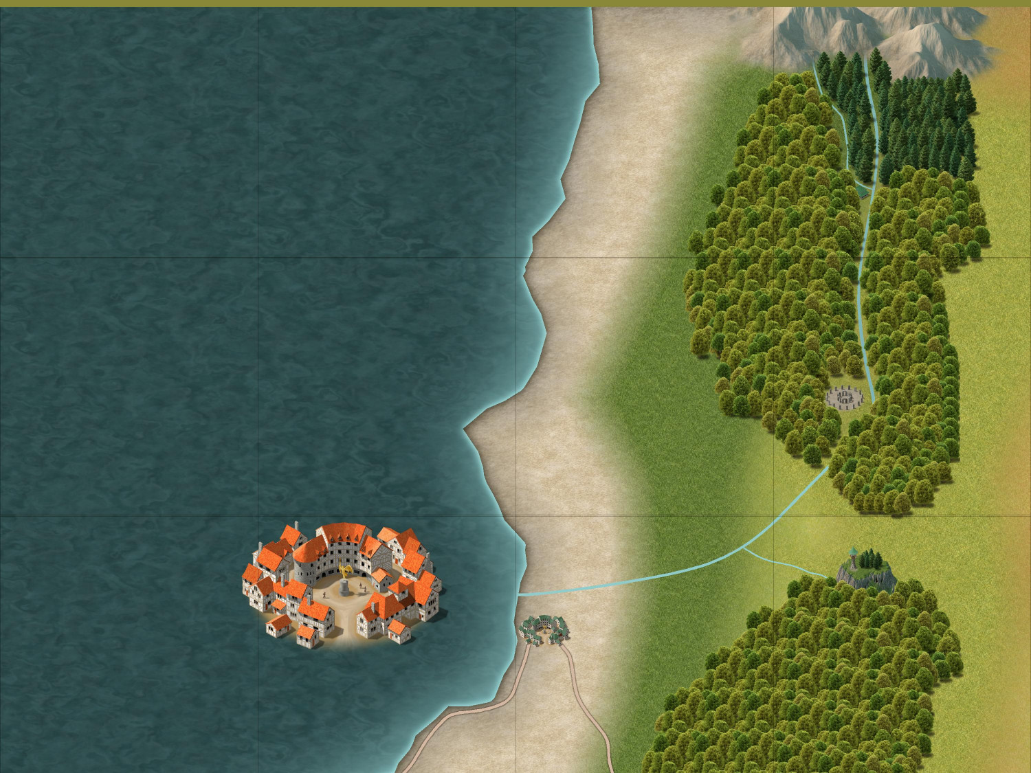
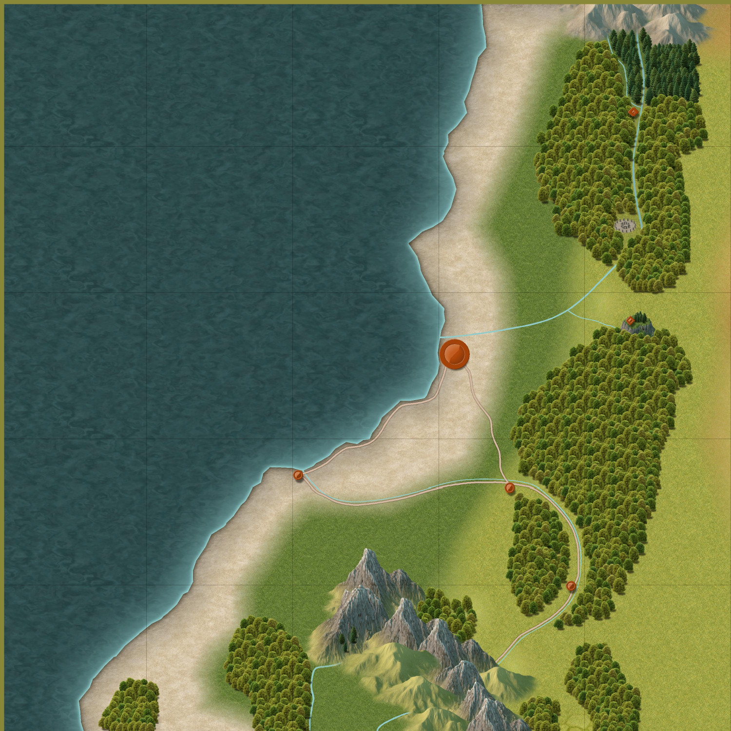
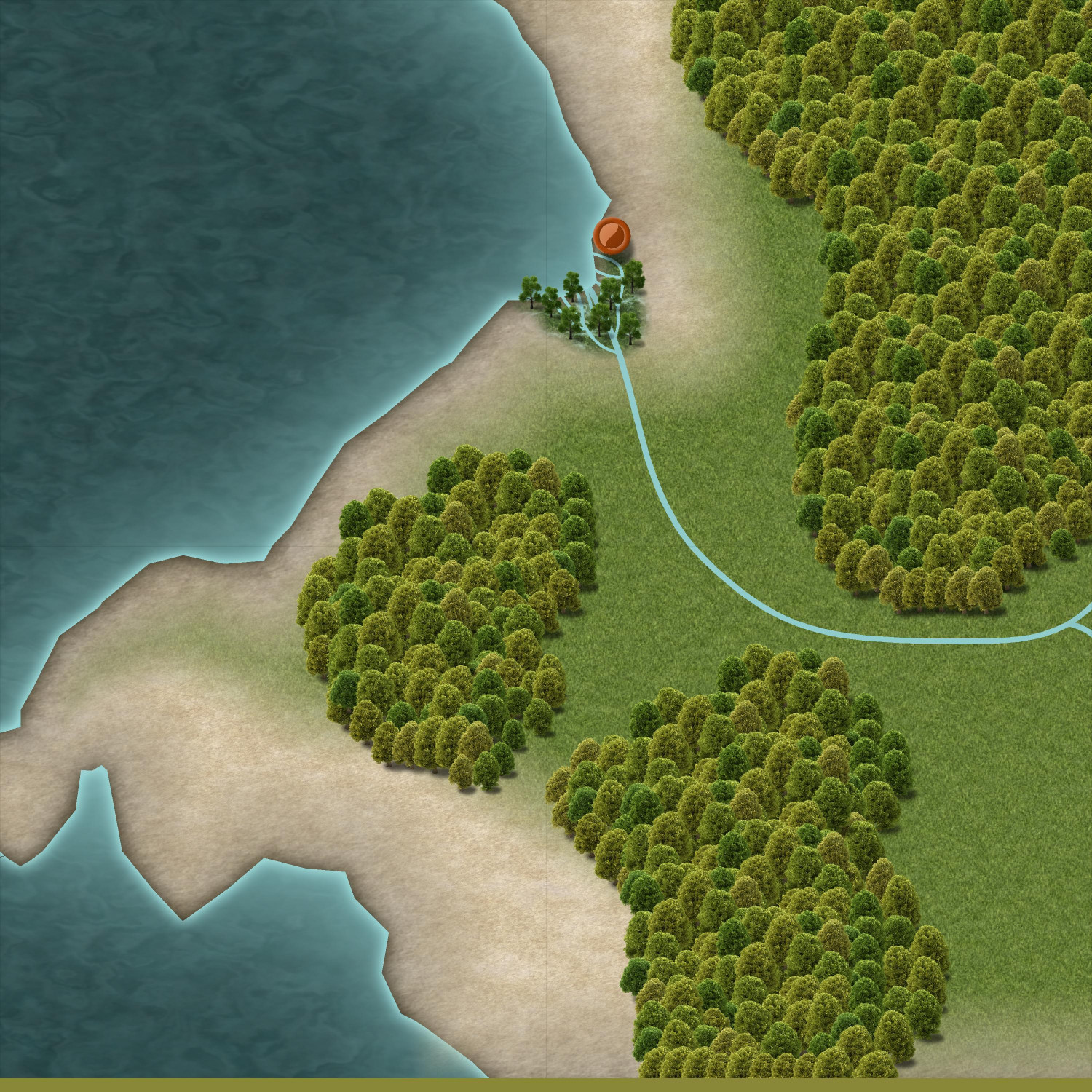
I redid the two northern forests to add rivers, a road, and a few smaller settlements...and a henge of stones. That northernmost forest will be an elven community that is outside of the kingdom. (This style doesn't have a political borders tool, does it? I may have to create one, or just rely on labeling.) There's a tepui at the northern edge of the second forest. I haven't decided what will go on top of it. Maybe a castle? Maybe a temple with an oracle, like the Oracle of Delphi?
Here's a closer look at the desert. You can see where I plan to place my ziggurat. The obelisk to the south is apparently all that remains of an ancient temple that was long-ago swallowed up by the sands.
Added some cliffs near the coast. The whirlpool on the western side is about where my Octopus' Garden will go. The upper island, as I said before, will be a playground for the rich and famous, like a Monte Carlo.
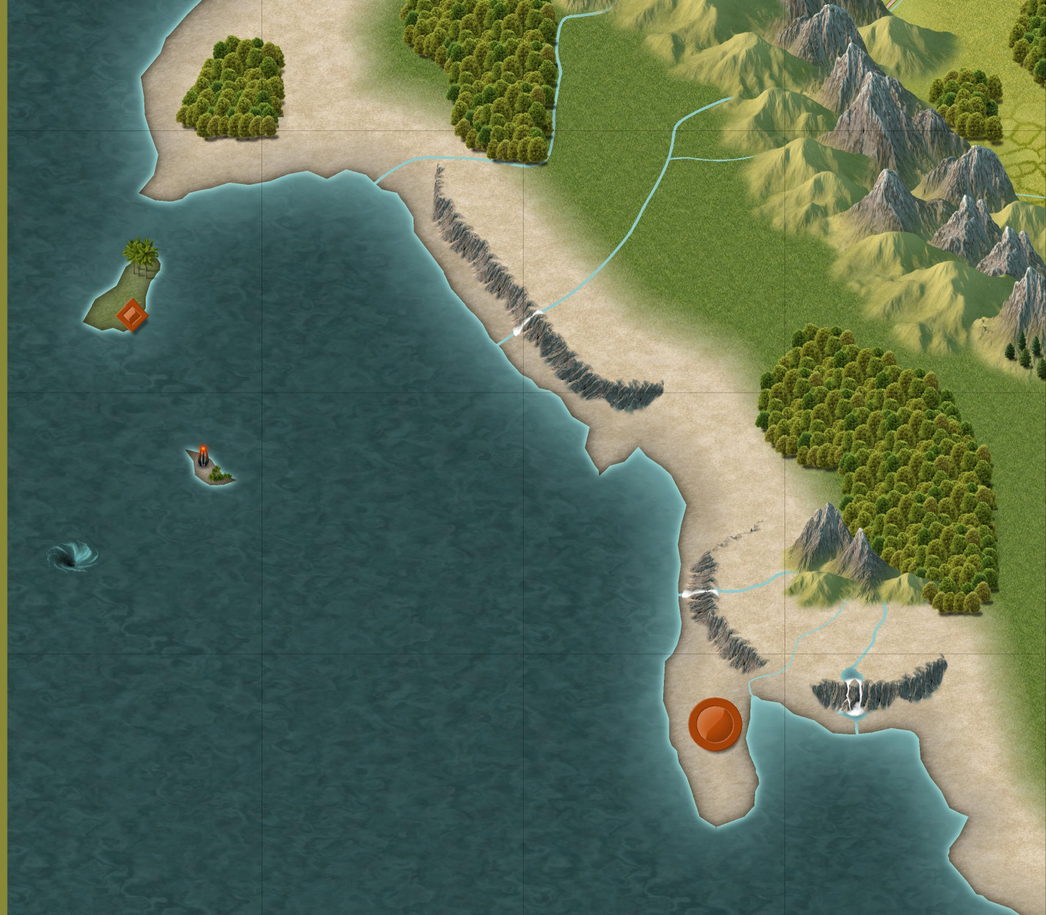
And I made a little swampy river delta with a settlement akin to New Orleans that I envision being rife with smugglers and ne'er-do-wells.
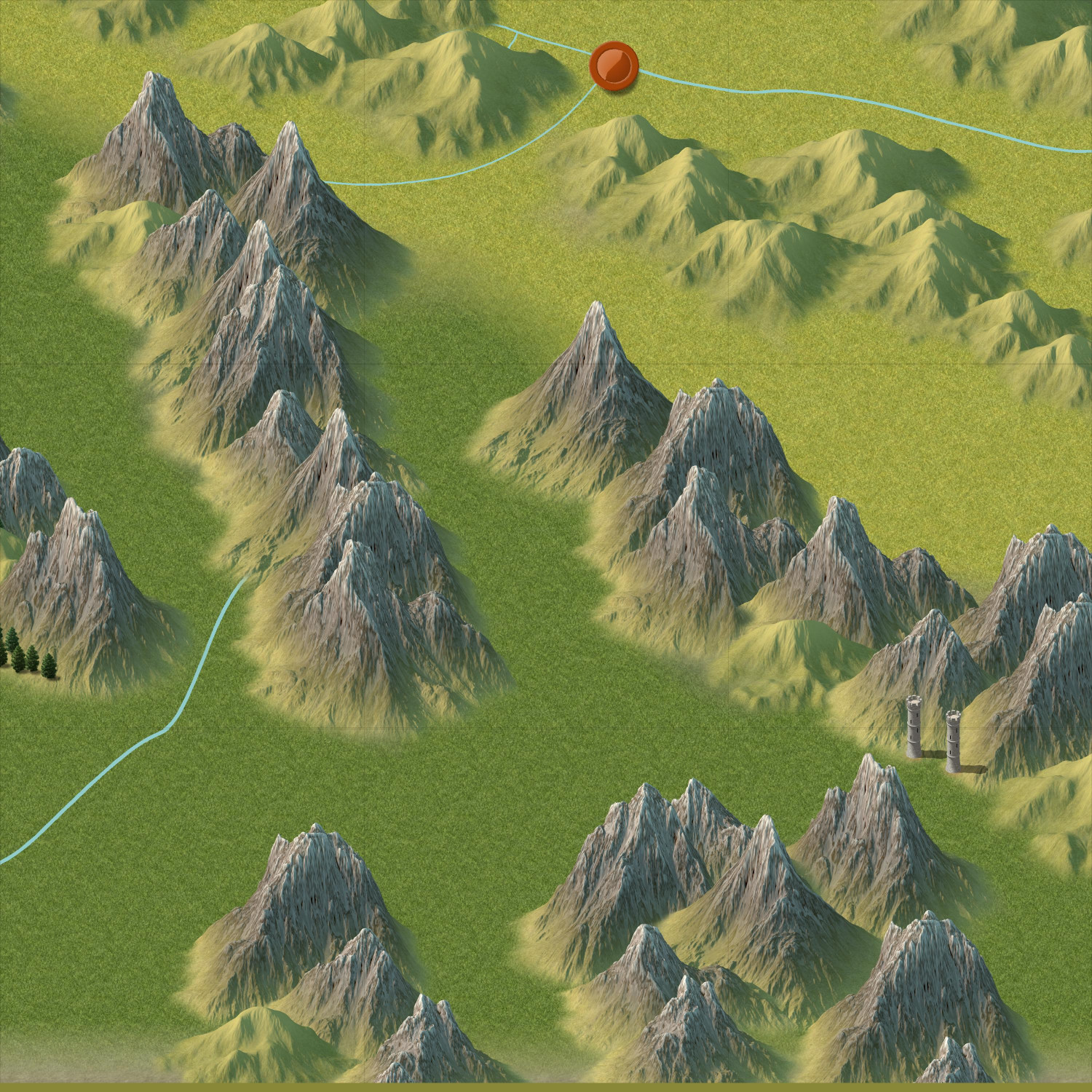
In the southern mountains, which is outside of the kingdom's borders, there's a dwarven fortress. You can't see it, but you can see the pair of towers (towards the southeast corner of the map) that guard the mountain pass leading up to the fortress.
Let me know if you have thoughts, feedback, or ideas for more adventure hooks to add.


