


Royal Scribe
Royal Scribe
About
- Username
- Royal Scribe
- Joined
- Visits
- 9,534
- Last Active
- Roles
- Member
- Points
- 3,353
- Birthday
- February 5, 1968
- Location
- San Francisco, California
- Website
- https://legacy.drivethrurpg.com/browse/pub/31814/Royal-Scribe-Imaginarium
- Real Name
- Kevin
- Rank
- Mapmaker
- Badges
- 16
Latest Images


Reactions
-
[WIP] Community Atlas - Gold Coast, Doriant
Remy said two things about the 1000th map contest that I have taken to heart:
- We can submit more than one map, but will only be able to win one prize; and
- We can make our own local map anywhere in the world to create a place for a village we want to design (but only the village map is eligible for the contest).
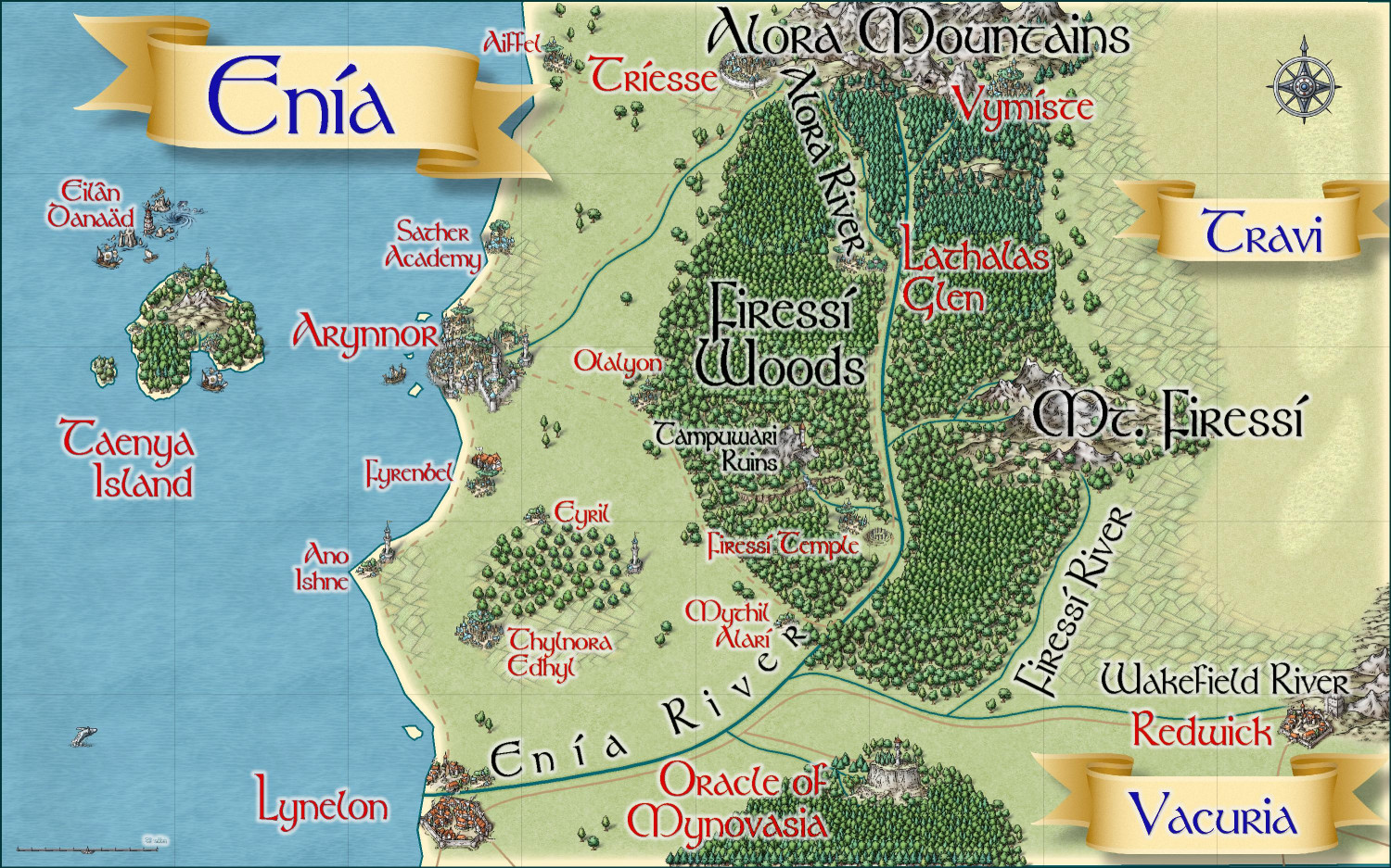
With that in mind, I have been working on this Gold Coast map as well as an area map for the Kingdom of Enia, an elvish kingdom on the northern side of the coast. I have two villages in Enia that I will submit. If this works best for you, @Monsen, I will create a thread for all of the non-contest Atlas submissions once they're finalized, and then the actual villages for the competition will be posted in the competition thread when they're ready to submit.
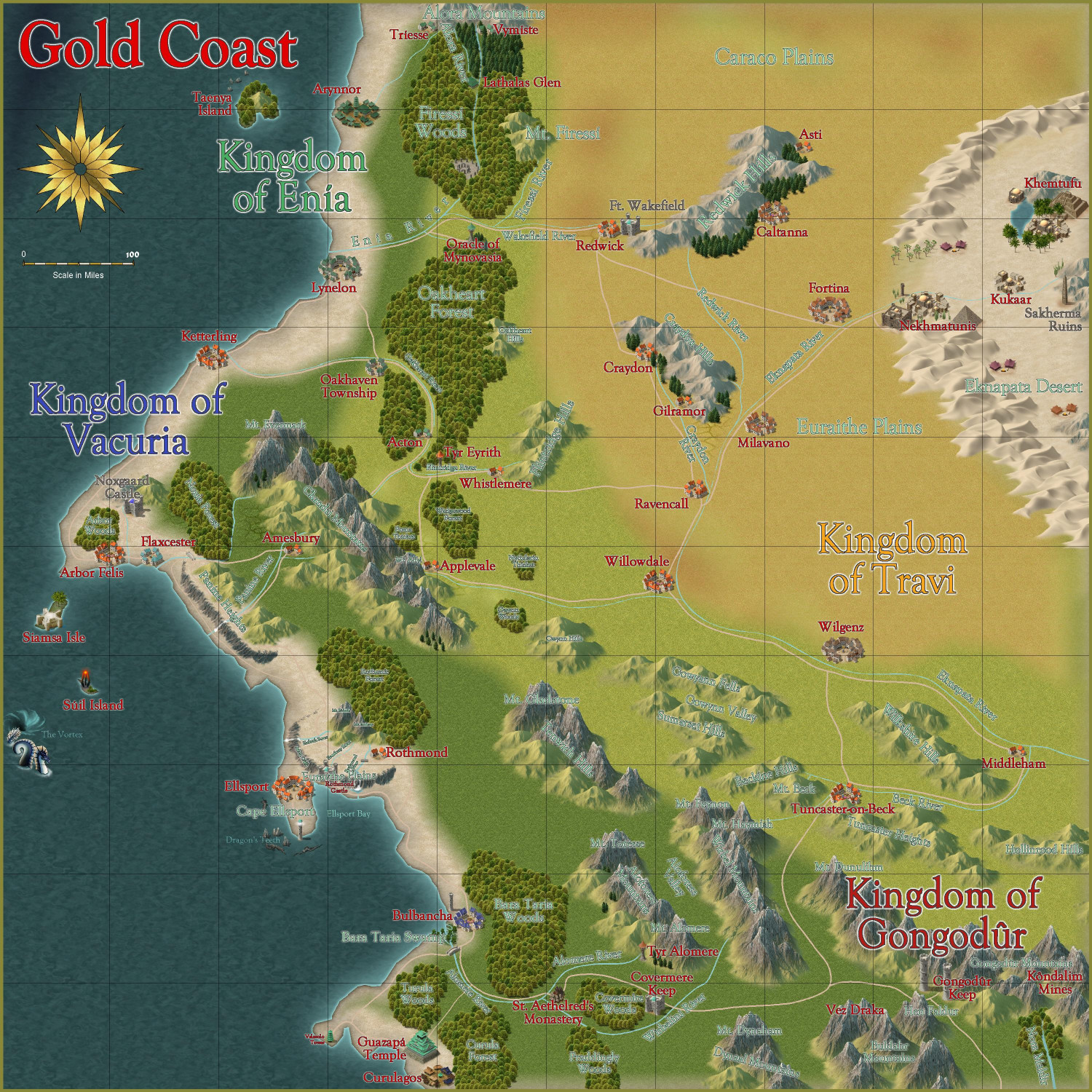
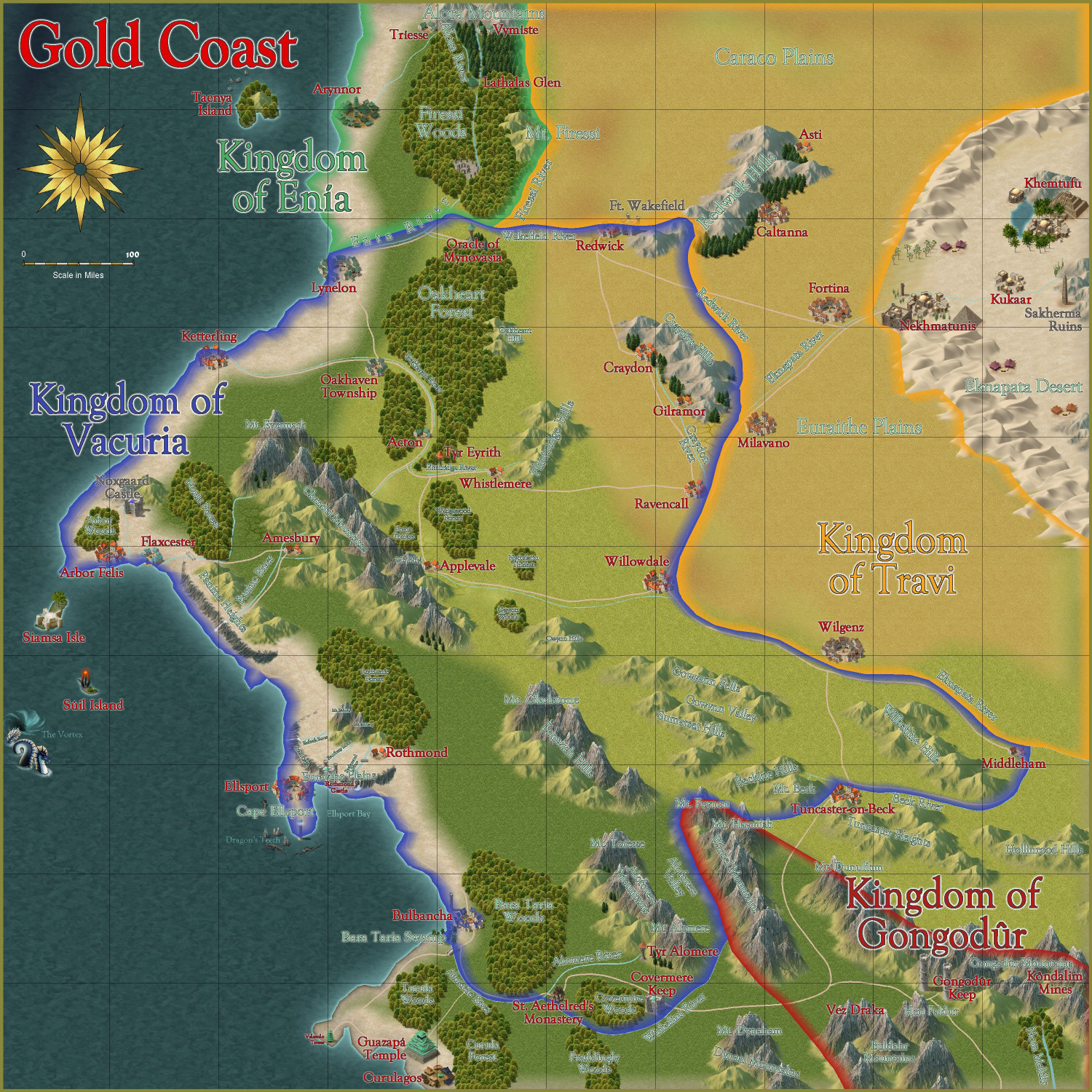
Gold Coast
Here is the Gold Coast region, first without and then with political borders (which can be toggled). I am writing up the description now.
Without Political Borders
With Political Borders
Thoughts?
And then here's a map of the Kingdom of Enia, with more smaller hamlets and other small details added, this time in the Mike Schley style:


-
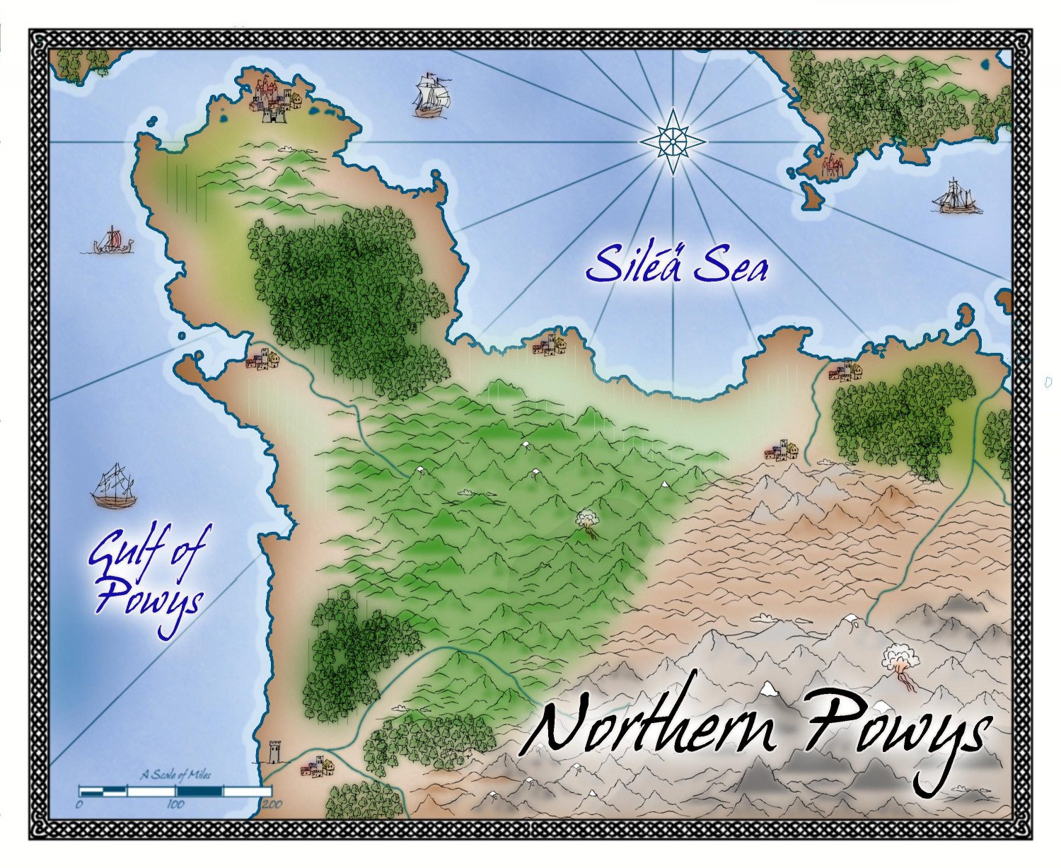
[WIP] Northern Powys (Sarah Wroot Revisited)
Playing around with the newest Sarah Wroot Revisited annual. This is the northern part of the Kingdom of Powys from my campaign world. The coastline was brought in from a Fractal Terrains export, but then the rest was done by eye/memory rather than trying to get the contours exactly right. It's like an impressionist painter's rough representation of the kingdom.


-
[WIP] Community Atlas Competition - Artemisia - Verinress Arl - Fon'Anar
I just noticed that although I posted my completed map in the competition thread, I didn't post an image of it here. Doing that now, just so this thread shows the full process.
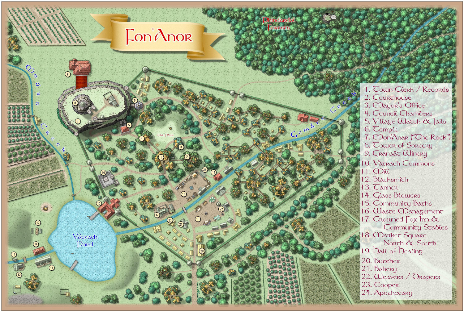
I have wanted to use Mike Schley's elven treehouse symbols ever since I started mapping with CC3+, so I am delighted to finally have had the opportunity. (My friend keeps calling this map -- especially because of the elevated pathways -- my Ewok Village.)

-
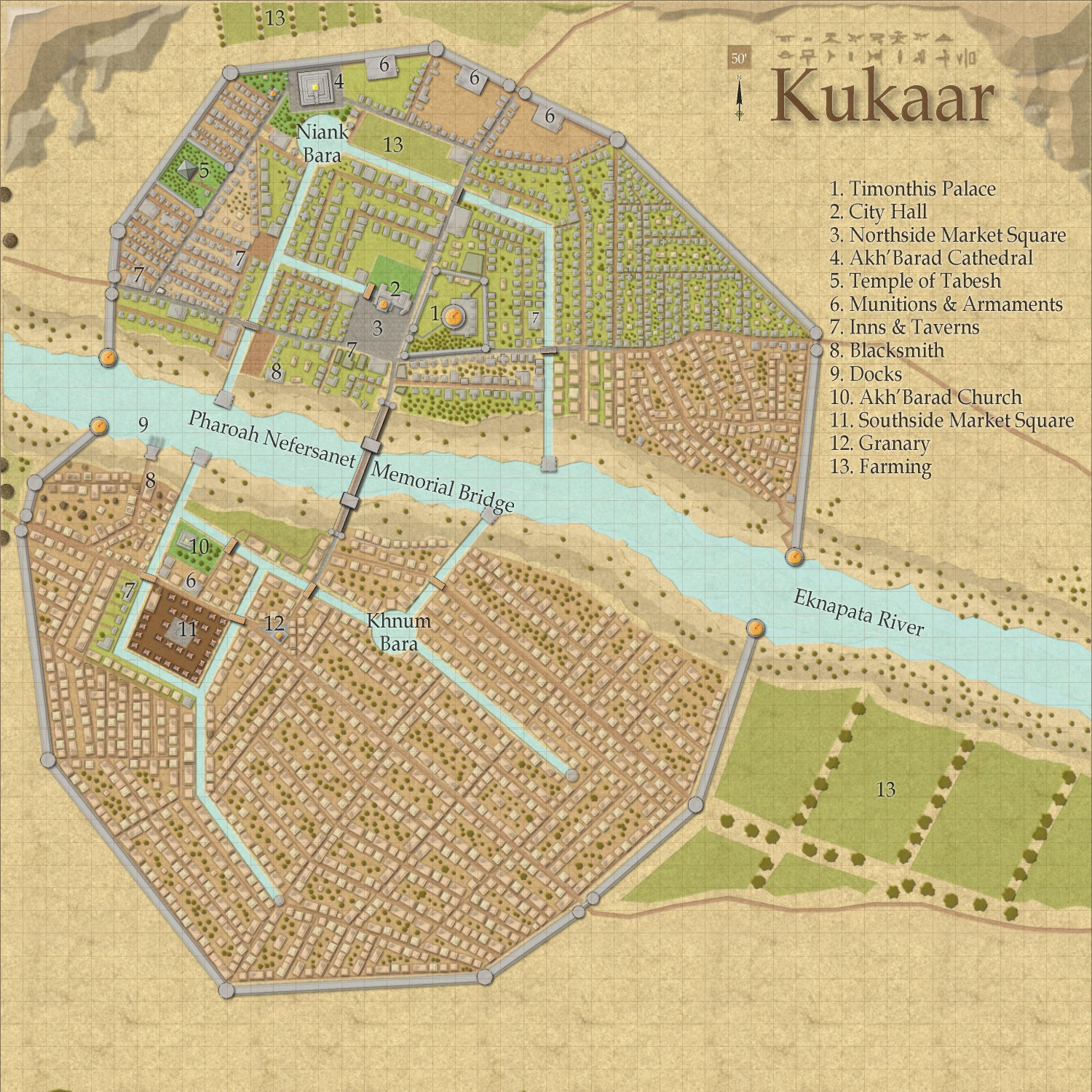
[WIP] Town of Kukaar (Ancient Cities Annual)
Finally had a chance today to add some names and some trees.
-
Community Atlas - Drachen Temple Battlemap
The shoes! Love that detail.
