


Royal Scribe
Royal Scribe
About
- Username
- Royal Scribe
- Joined
- Visits
- 9,529
- Last Active
- Roles
- Member
- Points
- 3,353
- Birthday
- February 5, 1968
- Location
- San Francisco, California
- Website
- https://legacy.drivethrurpg.com/browse/pub/31814/Royal-Scribe-Imaginarium
- Real Name
- Kevin
- Rank
- Mapmaker
- Badges
- 16
Latest Images


Reactions
-
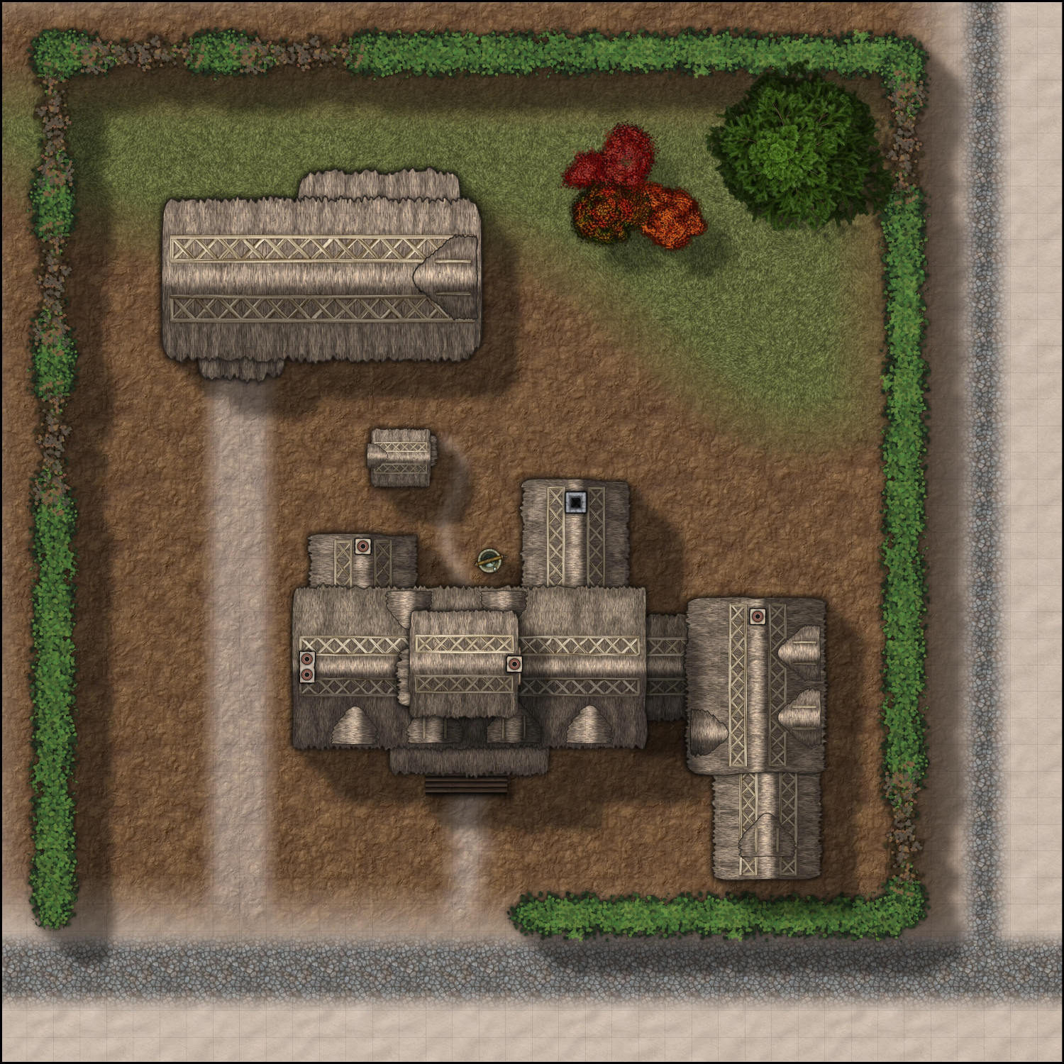
[WIP] The Candle & Kettle Inn in the village of Mapleford
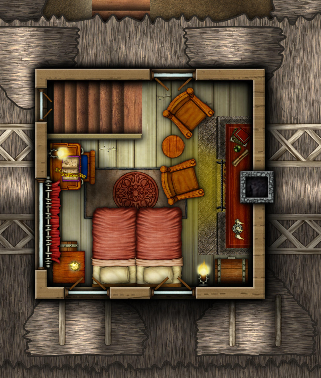
Here's the attic, crowded but cozy. Could be a VIP guest room, or maybe the innkeepers live up here so that the entire second floor is available to guests. But I like to think of it as the home of the innkeeper's eccentric uncle or spinster aunt whom the entire village thinks is a bit mad...until the adventurers seek them out for advice, revealing that the relative is one of the world's foremost authorities about the Abyssal Planes.
Cellar still to come...


-
[WIP] The Candle & Kettle Inn in the village of Mapleford
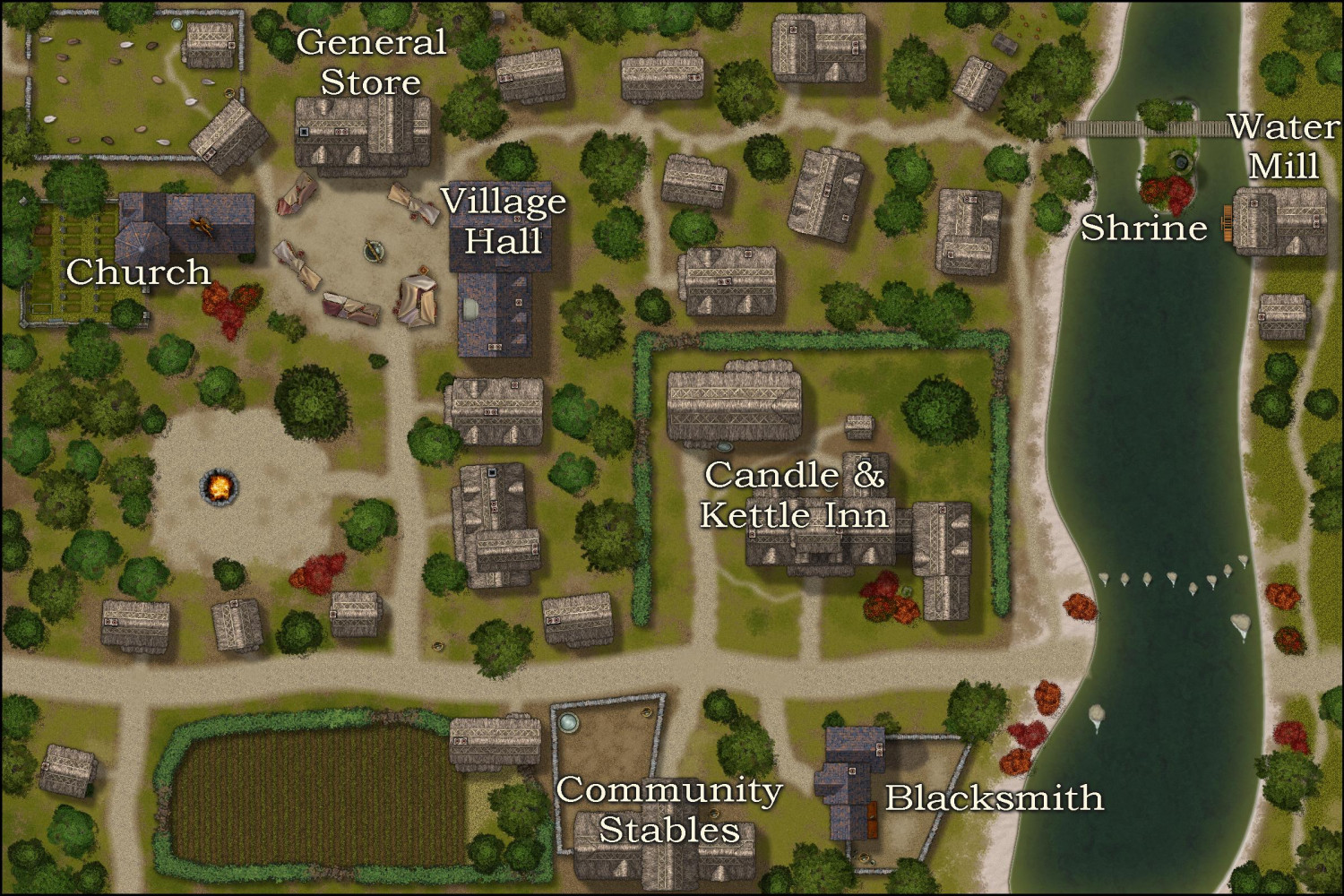
Oh, and I just noticed that I hadn't shared the rest of the village yet. Here it is. South of the inn is the blacksmith and the community stables. The main "square," where there are market tents, has the village hall on the east side, the general store on the northern side, and the village's only church (with a graveyard) on the western side. In the river, there's a little island with a shrine. (Not sure to whom, but the statue is of a fox from Creepy Crypts.) Made a bonfire -- maybe they're celebrating Beltane or the Summer Solstice? You can't really tell, but a few of the northern houses have chicken coops, with DD3 chickens running about.
I put the deciduous and pine trees on separate sheets to make it easy to replace when it comes time to do the winter version. I know I can globally replace in the Symbols Manager, but things don't always quite end up exactly where they should be.
Oh, and in addition to contributing Japanese Maples, the CA129 Asian Town annual (2018) also provided the water wheel for the mill.


-
[WIP] The Candle & Kettle Inn in the village of Mapleford
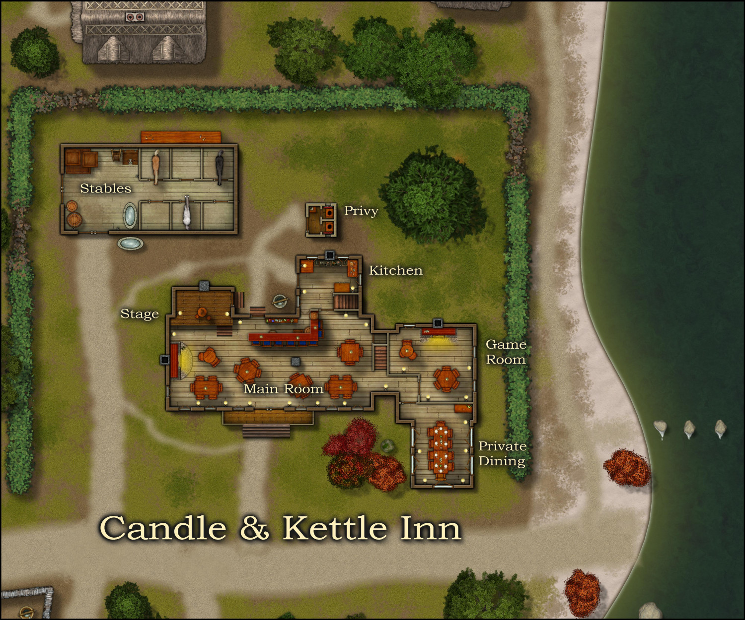
Here are the interior first two floors of the inn. (Also, I moved the maple trees to the front yard.) This is mostly in DD3, building off of the exteriors designed in Darklands City. But there are a few things from other annuals. There's a harp from Character Artist. The smaller second story fireplaces are from CA49 Dungeon Symbols (2011). The DD3 stairs have arrows, which I don't care for, so I used wooden stairs from Dundjinni Archives. And I tried to draw in bales of hay using a straw fill from Darklands City, but I wasn't happy with how they looked, so I resorted to hay symbols from Dundjinni Archives.
First (Ground) Floor
The stables has six horse stalls (I know they are a wee smaller than what Google tells me is proper, but quelle dommage!) There's a ladder by the northern stalls leading up to a hayloft. Behind the barn on the north side is a workbench that is covered by an awning in the Darklands City building symbol I used.
The privy has two stalls with painted glass windows to let in light but not peeping eyes -- and there are also curtains if that's not enough privacy.
In the inn, the ground floor is all common space. Big fireplace in the main room, courtesy of Shessar. Plenty of tables as well as a curved bar. Decent stage for traveling bars and troubadours. Kitchen with easy access to the well, and stairs down to the cellar. A separate game room for playing cards, dice, or darts. And a private dining room where an adventuring party, for example, might get a private briefing about their quest.
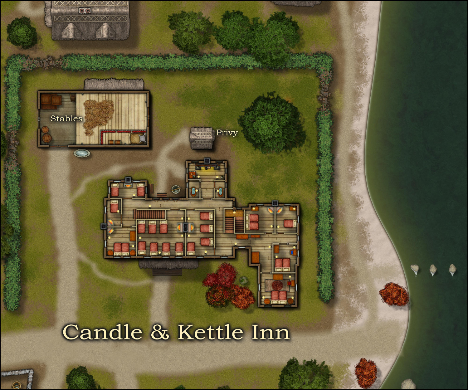
Second Floor
Over in the barn, we can now see the hayloft (with hay symbols from Dundjinni Archives). The stablehand has a curtained-off sleeping area here. No second story to the privy, of course.
The second floor of the inn is sleeping space for guests and potentially the innkeepers and their family. Several rooms, including both single and double occupancy rooms as well as larger, dormitory-style rooms (perfect for adventuring parties of four or seven). The "washing up" area is over the kitchen. Not shown: a person down below could attach buckets of well water to a hoist system to be pulled up through the window into the washroom. And another flight of stairs heading up to the cozy attic room, still to come.
-
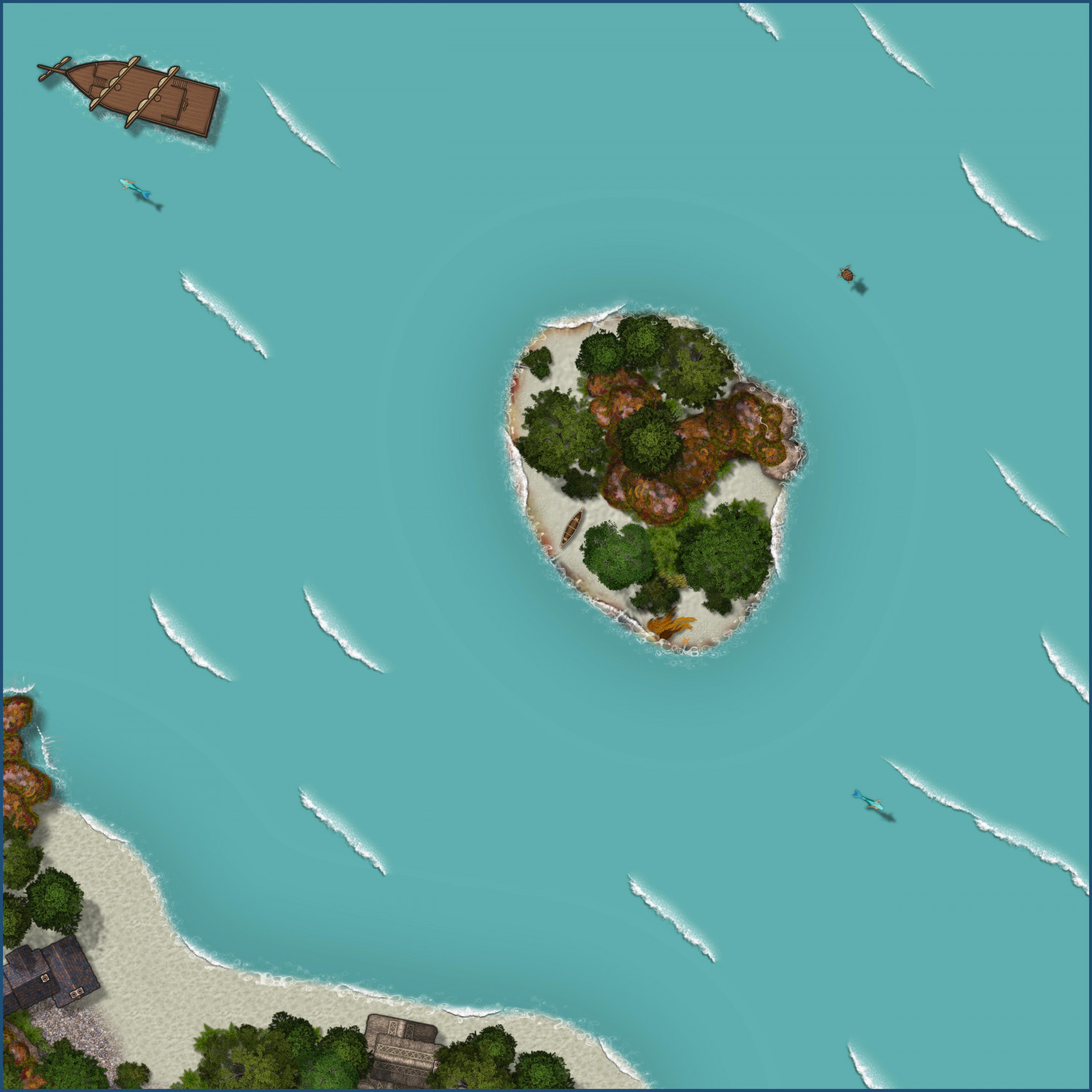
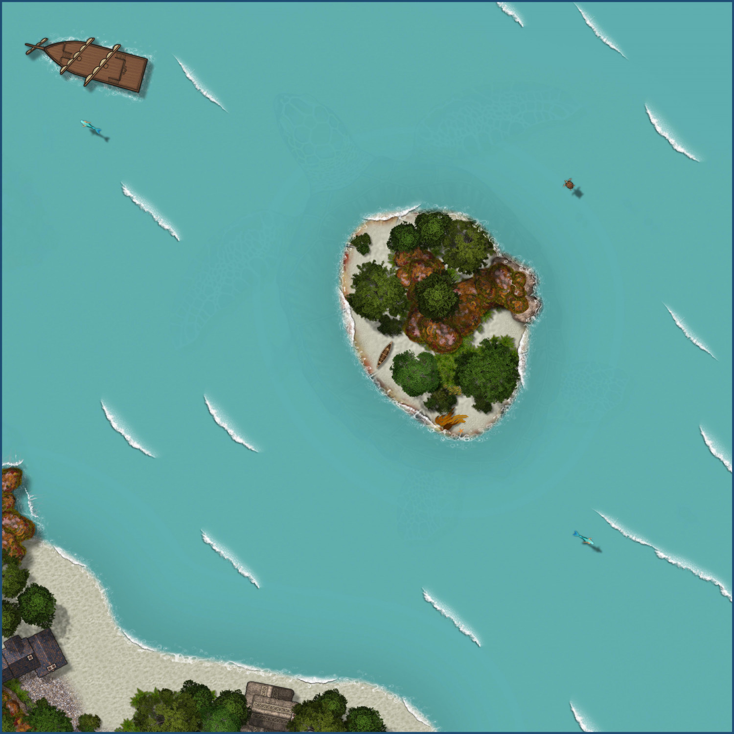
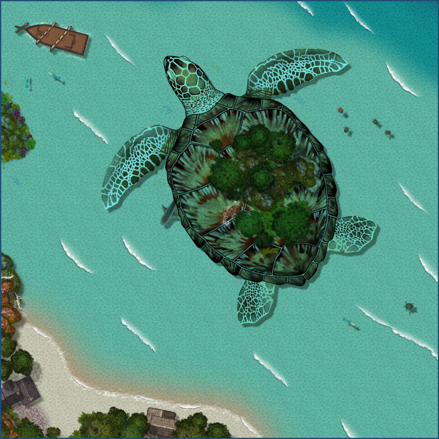
Aspidochelone
A year ago, I posted this map of an Aspidochelone. I wanted to revisit it to explore creating alternate versions.
Player Version
This tweaks the water to make it opaque by turning off the Blend mode sheet effect. I then added a colorize effect to make the water more turquoise.
Player Version...with a Hint
This version adds a slight Transparency effect to the water so there's a subtle hint of the creature below.
Submerged
If the PCs disturb the Aspidochelone (by lighting a campfire, for example), here's a version where it has dived below the water, imperiling the party. The canoe floats, fortunately, so I left it above water and added ripples around it.


-
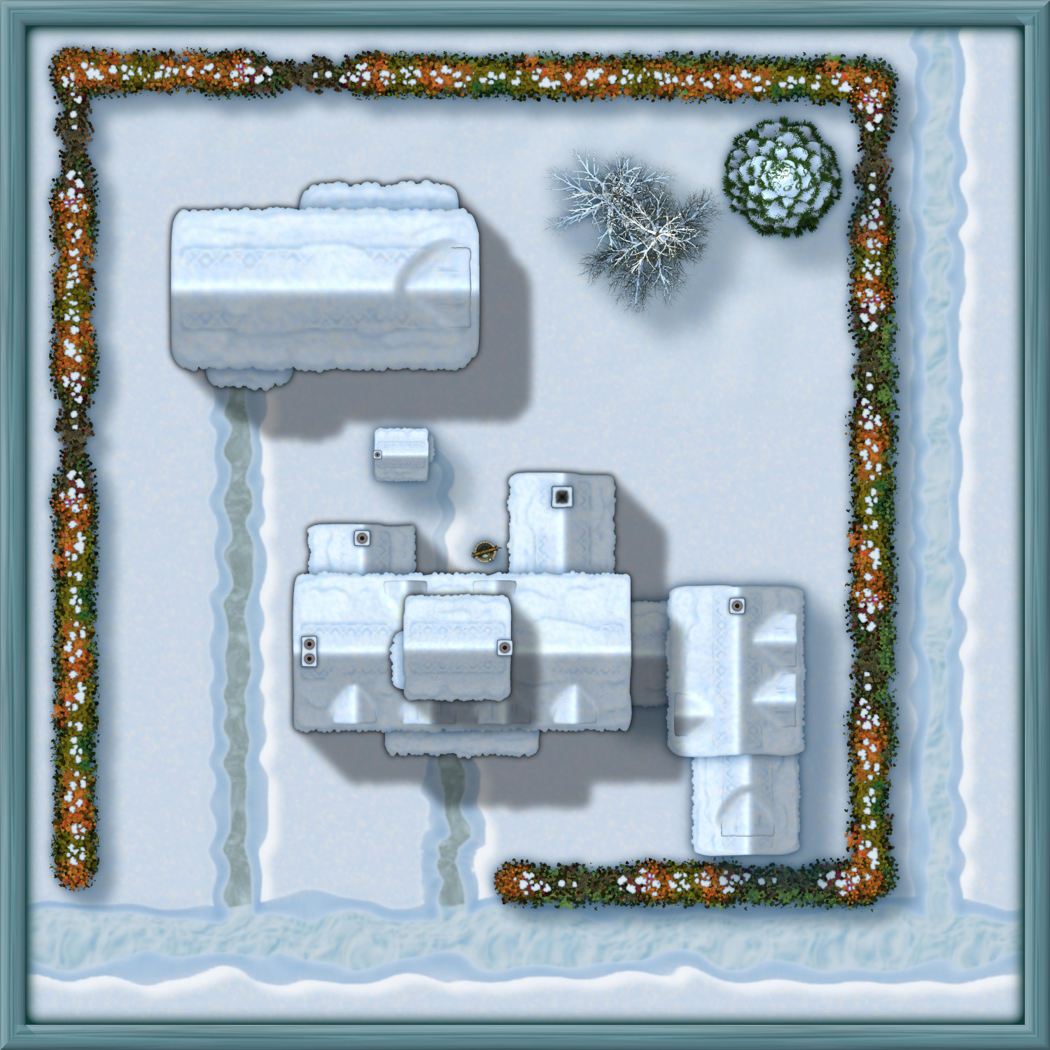
[WIP] The Candle & Kettle Inn in the village of Mapleford
I'm working on a little village called Mapleford (so named to give me an excuse to sprinkle in a few of the Japanese Maple trees from the Asian Town annual). Before I tackle the rest of the village, I wanted to focus on the Candle & Kettle Inn, which provides welcome accommodations for traveling adventurers and doubles as the village's only tavern for locals.
Here's the exterior of the inn and its stables (and outhouse). Lots of chimneys, but I covered a few with dormers. Fortunately, lots of fireplaces means lots of excuses to use Shessar's lovely fireplace symbols.
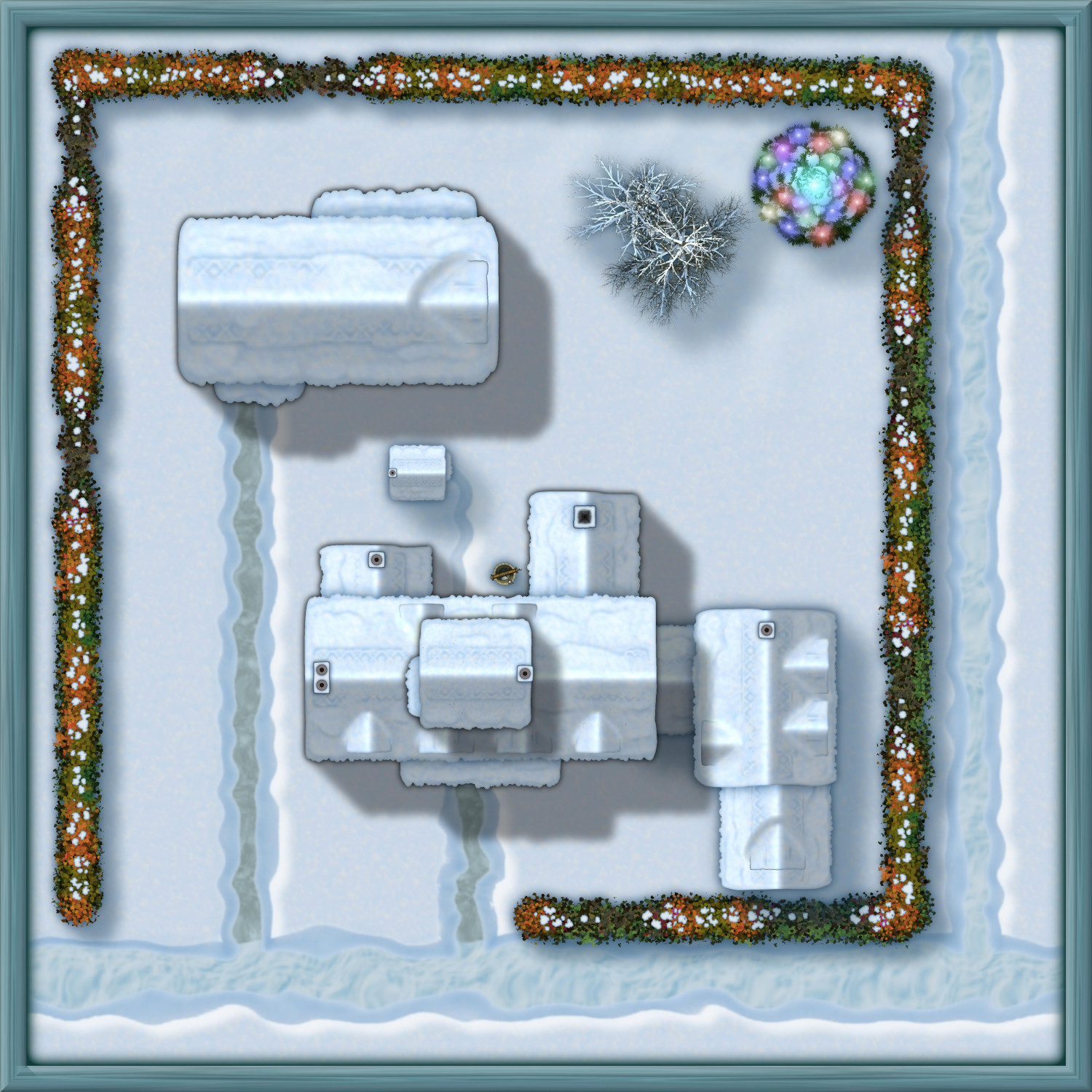
And here it is in the winter:
Just for fun, here's a Winter Solstice celebration with the fir tree decorated with lights (probably luminescent crystals, though it could be candles specially treated to glow with different colors).
Although I've mentally plotted out the interior layout, I want to work on the rest of the village before getting to interiors.

 and 1 other.
