Quenten
Quenten
About
- Username
- Quenten
- Joined
- Visits
- 8,067
- Last Active
- Roles
- Member
- Points
- 3,090
- Birthday
- November 29, 1950
- Location
- Australia
- Real Name
- Quenten Walker
- Rank
- Mapmaker
- Badges
- 16
Latest Images


Reactions
-
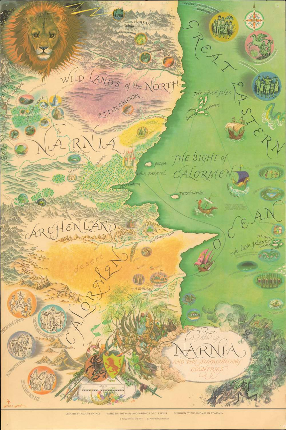
Map of Narnia
Have you got this map by Pauline Baynes?
-
Watabou City REVISED (annual 157)
I have now converted all the IMPORT into the appropriate sheets using the Change Like Draw Tool Command only.
Remember to set the correct Sheet and Layer for each Change like Draw Tool command.
eg Rivers and Seas (Lakes): Sheet WATER/RIVERS, Layer Water/Rivers
Roads and Squares: Sheet ROADS or ROADS PAVED, Layer Roads. Note that Square Paved cannot be used in Change Like Draw Tools since it has a macro attached. I may change this later if I can find a paving that doesn't need alignment.
Parks: Sheet PARKS, Layer Vegetation.
Docks: Sheet DOCKS, Layer Docks
Walls: Sheet WALLS, Layer Walls (Note: I have done away with the City Wall Layer). I am still not happy with the crens for the walls - now they hardly show. I will fix that.
Towers: Sheet TOWERS, Layer Walls. No longer need to draw these without the Change Like Draw Tools command. And it means no guessing as to the size required.
Bridges: Sheet BRIDGES, Layer Bridges
Fields: Sheet FIELDS, Layer Vegetation. The furrows align to how the generator drew the fields. So often, not a very intuitive direction. However, if you want to use the tool directly to draw fields, the tool does align the furrows (which are Hatch symbols) correctly. In the picture below, I have done this with the bottom right hand field.
Buildings: Sheet SYMBOLS BUILDINGS, Layer Buildings, or any of the Building layers you wish to use, eg Bldng (House 1)
I generally advise doing the Buildings last, as you can then Hide all sheets except Import and Symbols Buildings (with the latter being the selected one). This will then show only the buildings you need to convert.

I have also added buildings on top of the Palace, and smaller towers on the towers around the Palace.
Comments and suggestions really welcome.


-
Watabou City REVISED (annual 157)
The first most important thing is to just export as a SVG the actual elements you want and cut out all the pretty stuff. It is, after all, the street and building layout that we really want.
So ... in the generator, first check colour - make this either B&W, or Ink in the Presets.
Next, click on Style in the generator, and make sure you check or uncheck the following. Whatever I don't mention, you can choose as you wish.
- GRAPHICS: Check thin lines, leave the rest unchecked.
- ELEMENTS: Districts Hidden. Check scalebar only (if you want it, leave the rest unchecked
- BUILDINGS: Roofs plain, leave Raised unchecked. Otherwise, choose what you want.
- OUTLINE: Check buildings, and UNCHECK water and roads. They will seem to disappear, but will be present in the SVG and thus DXF
- MISC: Check Solids; Uncheck Show alleys and Show trees.
- FARMS: Choose plain. Though you can exclude farms if you like and use drawing tools provided to put them where you want. However, the drawing tools will work on the farms if exported as Plain.
- For those interested, you can get the number of buildings and suggested population if you click on SETTLEMENTS. However, I think the population does not take into account density of population, nor multistorey buildings, so the population levels for larger cities can easily be double the suggested number in the generator.
As you can see from the example map, I have done all that.
Now export as SVG (and Png if you want).
-
What I've been working on
I personally would lighten it - use adjust hue effect. That way you can lighten it by degrees till you have what YOU like.
-
Watabou City REVISED (annual 157)
Some more drawtools. All work with the change drawtools command as well, on appropriate lines or polygons.
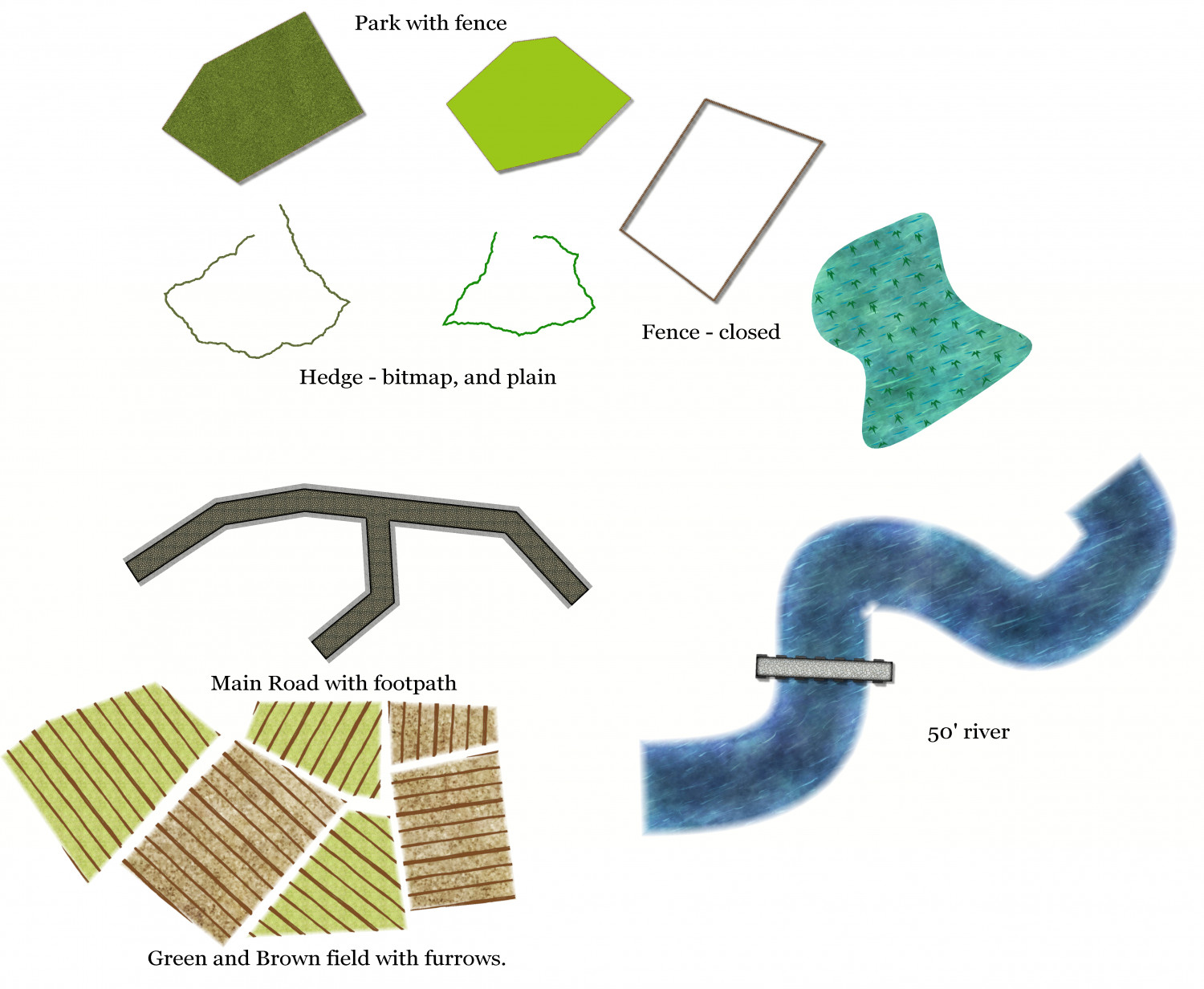
Not sure why the fence didn't show so well on the jpg, when it did on the fcw. It may need work