


Quenten
Quenten
About
- Username
- Quenten
- Joined
- Visits
- 8,067
- Last Active
- Roles
- Member
- Points
- 3,090
- Birthday
- November 29, 1950
- Location
- Australia
- Real Name
- Quenten Walker
- Rank
- Mapmaker
- Badges
- 16
Latest Images


Reactions
-
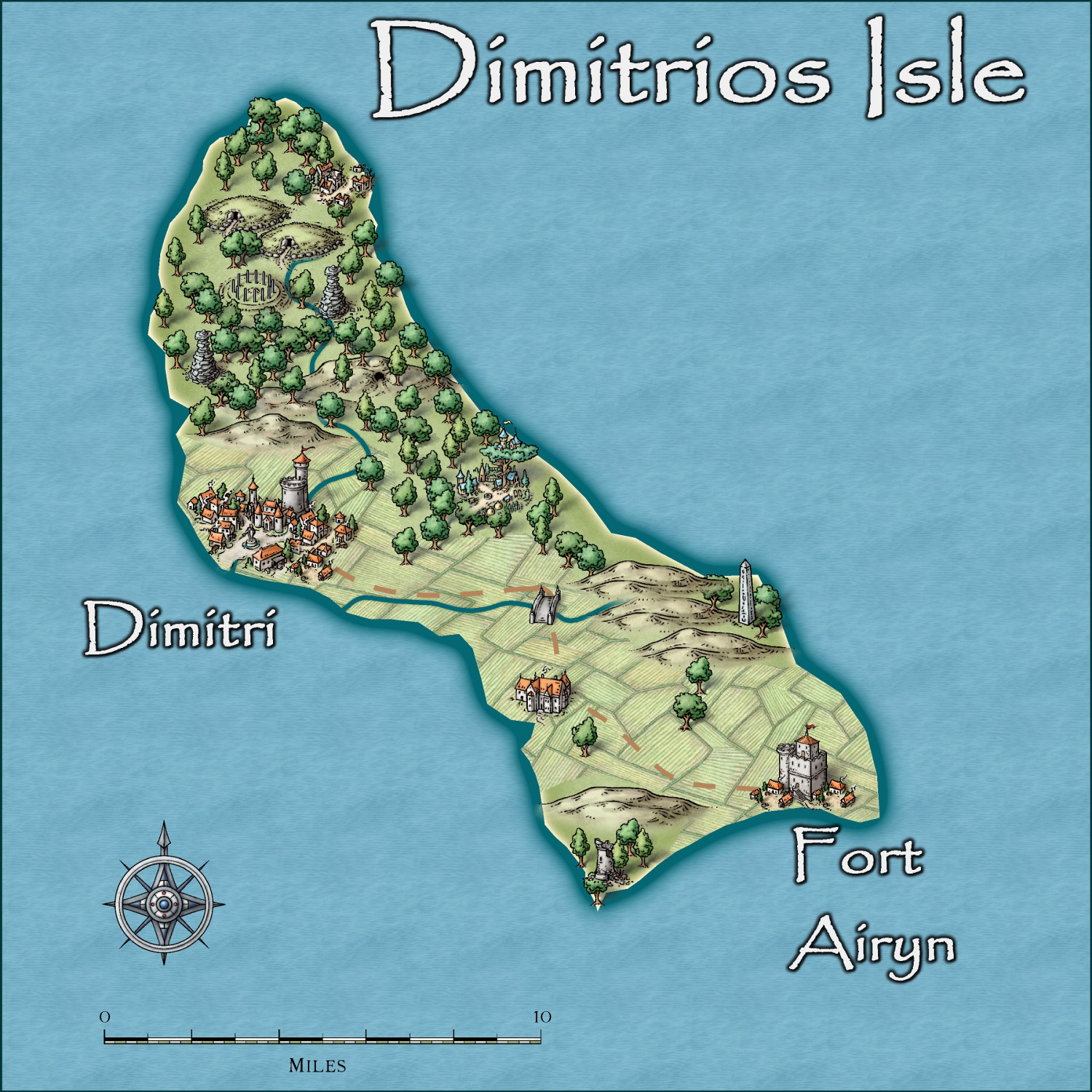
Community Atlas - Irisian City States - Dimitrios island
Here is my next Island. Not complete yet, and wanting suggestions etc.


-
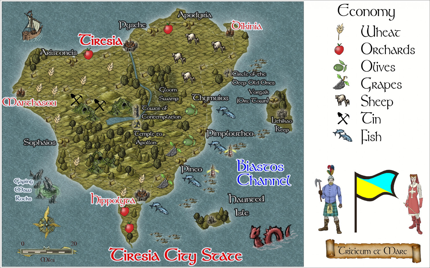
Community Atlas - Irisian City States - Tiresia City State
I think this is finished. I will write a map note, detailing mainly the potential adventure spots.
Please feel free to criticize and make suggestions.


-
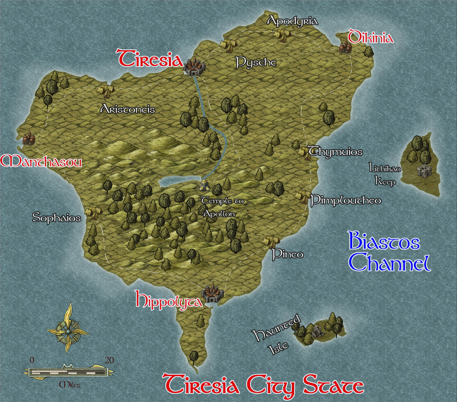
Community Atlas - Irisian City States - Tiresia City State
I have decided to map all the islands in the irisian City map style while I am waiting to get my new computer back from the repairers under warranty. Since I have to send it to the manufacturers - overseas - it will only take 6 weeks - outrageous!!
Anyway, here is the first - the biggest of the remaining islands, Tiresia City State, which has hegemony over the whole island. It is mainly agricultural and fishing, and is the least wealthy of the City States. It is also the closest to the hostile Kingdom of Helmonte.
I am using the same style as I did for Helmonte - Herwin Wielink, not my favourite style by a long shot.
This is the beginning of the map - interesting features to be added later.


-
Hardin Region (Myirandios) - Isle of Kalihirin, and Isle of adventure for low level characters.
Update on the village.
-
Hardin Region (Myirandios) - Isle of Kalihirin, and Isle of adventure for low level characters.
Here is a setting for a series of low level adventures to get a beginner D&D party on its way to fame and glory ... or grisly death.
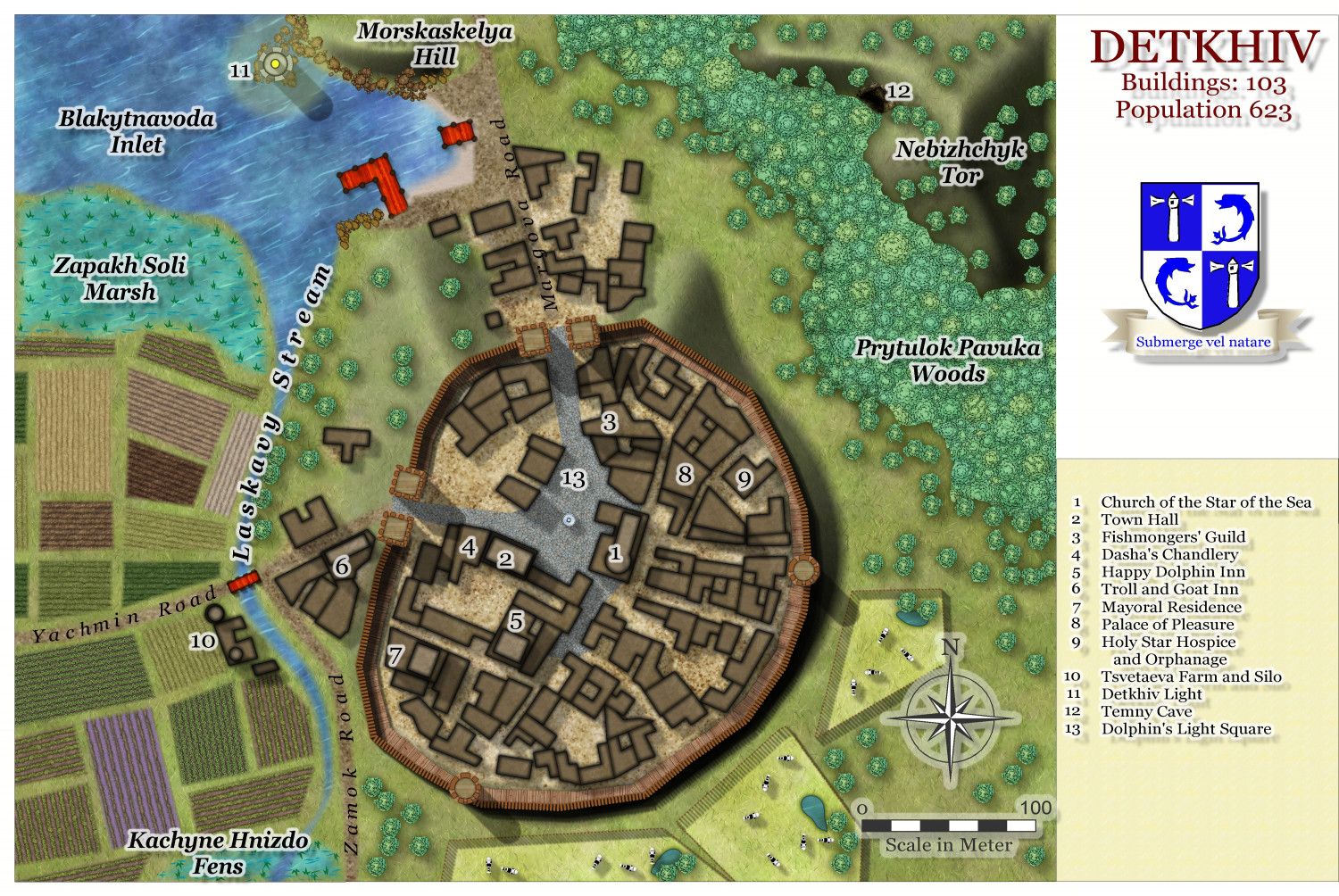
Kalihirin Island (nowhere near complete, of course). Of course, adventure sites etc are yet to be added.
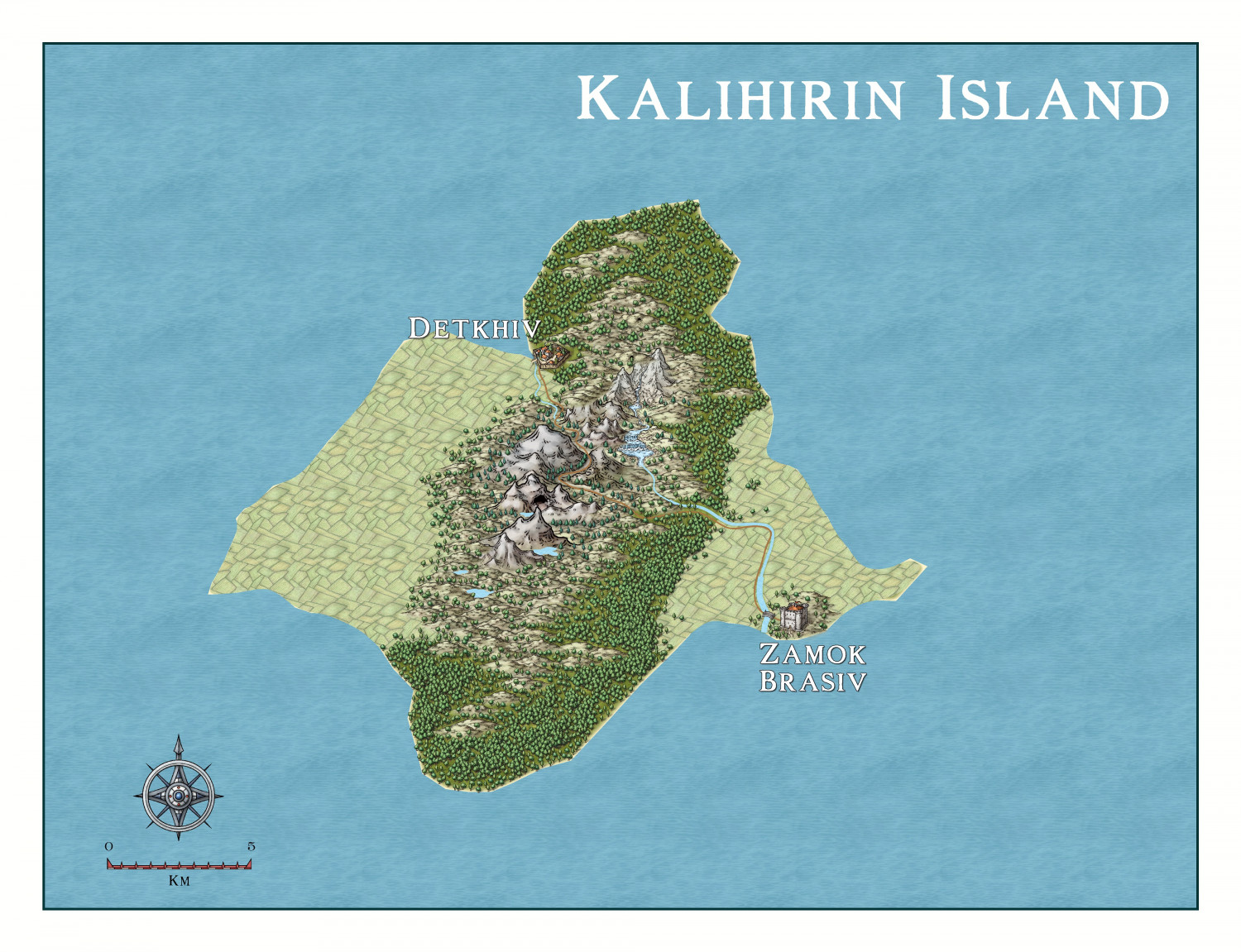
Detkhiv, the main settlement with a population of over 600.

I have made use of the draft version of the Watabou revised city annual to come later this year.

