Quenten
Quenten
About
- Username
- Quenten
- Joined
- Visits
- 8,069
- Last Active
- Roles
- Member
- Points
- 3,091
- Birthday
- November 29, 1950
- Location
- Australia
- Real Name
- Quenten Walker
- Rank
- Mapmaker
- Badges
- 16
Latest Images


Reactions
-
Community Atlas - Irisian City States - Tiresia City State
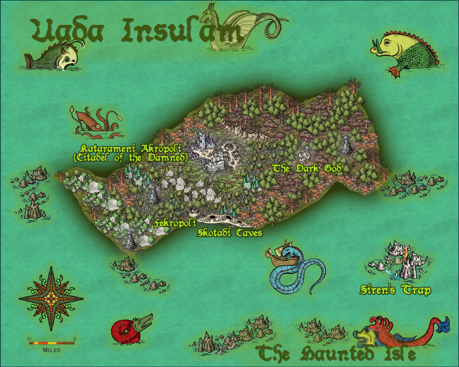
The final map for Haunted Island.


-
WIP - Senan
Blur is the worst.

-
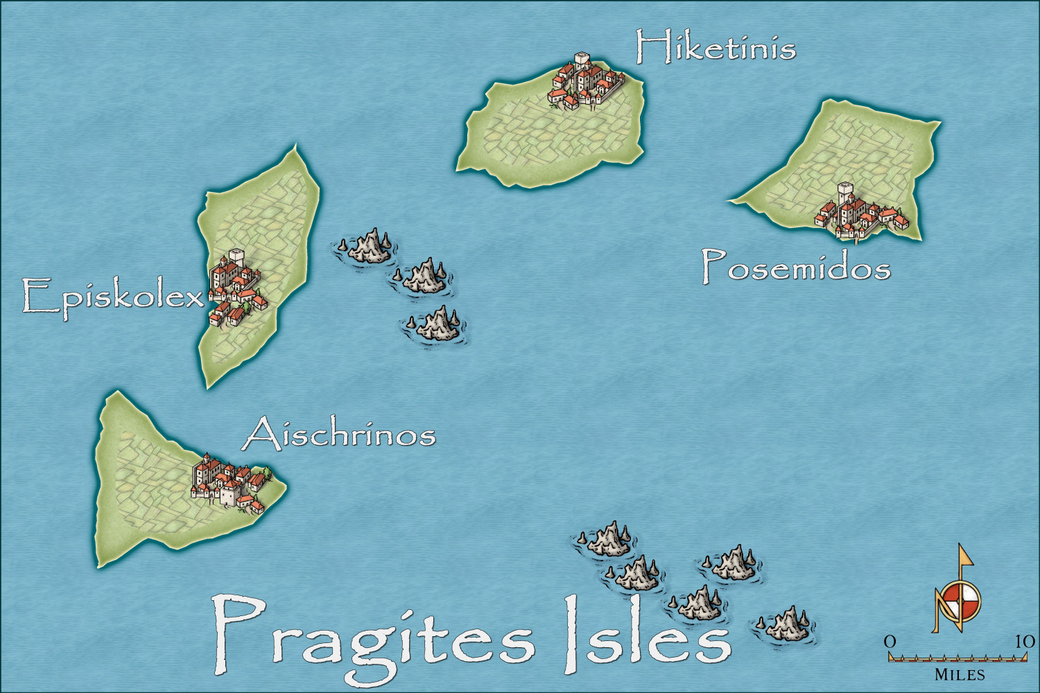
Community Atlas - Irisian City States - Pragites Isles
Halfway there. Thanks to Sue for the Marine Dungeon - for mermaid grotto and sunken city regions in the map.
Here is a region torn between the merchants of the Irisian City States, and the military Leonder Imperium. Hence the warships and fortifications on each island.


-
WIP - Senan
I love the Australian feel to your city - no houses all joined together in rows like most European cities, especially those with a lot of medieval areas. Houses with backyards, space between each free standing house - what a dream.
seriously though, too many fantasy cities suffer from the layout of houses too far apart - for richer areas, yes, for ordinary folk, I think not. So while I absolutely love your city, it certainly isn't a medieval one. Much more like USA and Australian suburbia. In fact, in our not very old cities in Australia, the inner suburbs are still all houses cheek to cheek.
-
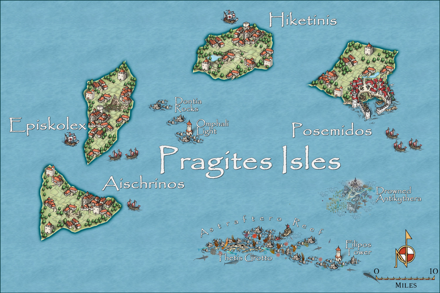
Community Atlas - Irisian City States - Pragites Isles
Here is the last Island map - contested territory between the Irisian City States, and the Leoner Imperium (who have control of it at present). A casus belli, for sure!
Obviously, just the beginning.