


Quenten
Quenten
About
- Username
- Quenten
- Joined
- Visits
- 8,066
- Last Active
- Roles
- Member
- Points
- 3,090
- Birthday
- November 29, 1950
- Location
- Australia
- Real Name
- Quenten Walker
- Rank
- Mapmaker
- Badges
- 16
Latest Images


Reactions
-
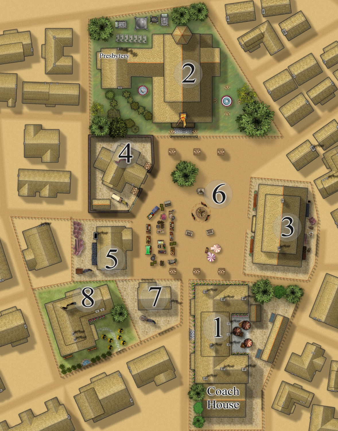
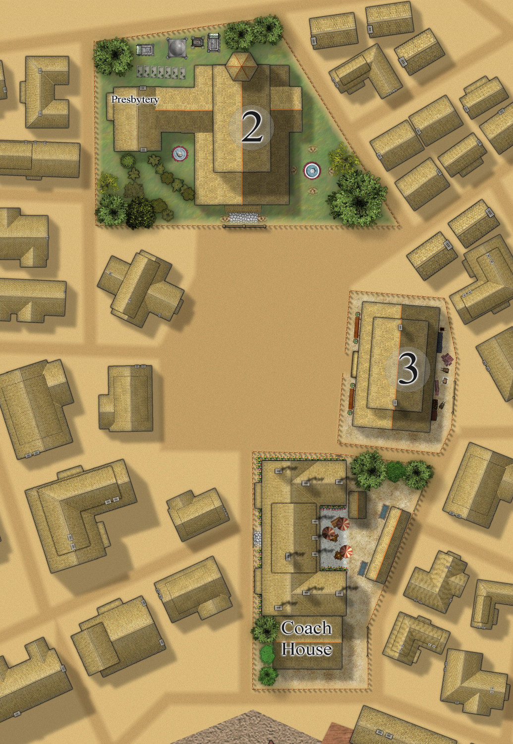
[WIP] Community Atlas Competition - Artemisia - Spiros Isle - Aretizo village
Village to date.
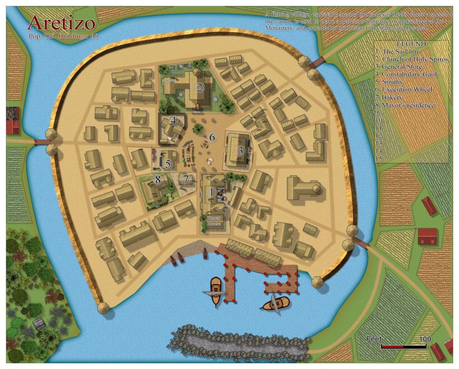
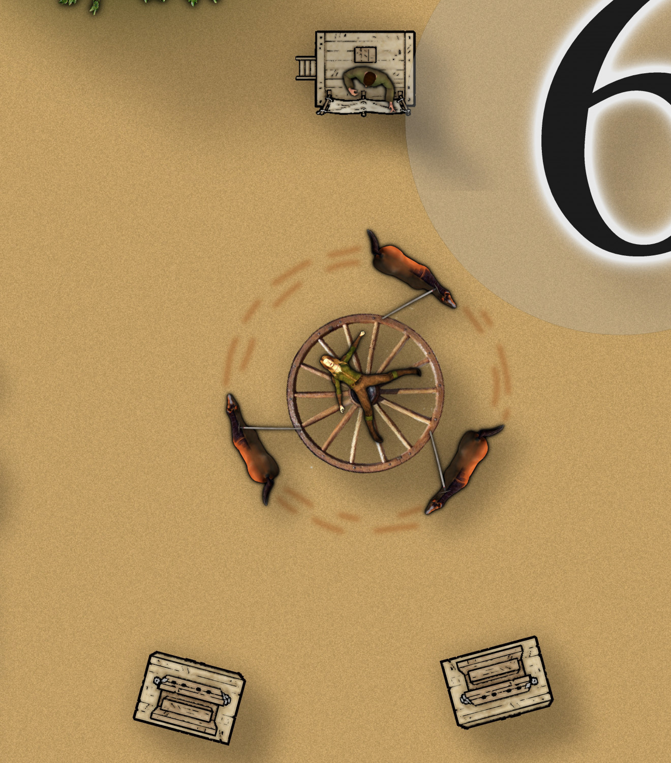
The central square - completed
And a close up of the execution wheel. The criminal/victim is tied to the wheel which is then revolved by a team of 3 horses till the victim dies from centrifugal force. The favourite method of execution by the 'compassionate and merciful' Monks of Holy Spiros, who has this town in its deadly grip.


-
[WIP] Community Atlas Competition - Artemisia - Spiros Isle - Aretizo village
Some progress on the three main buildings in the village = Church, Inn and Store. No town hall, though - all such community gathering places have been forbidden by the monks of Holy Spiros.
-
[WIP] Town of Kukaar (Ancient Cities Annual)
Actually, the grid street was common in the ancient world - the crazed street layout as more medieval.
-
Myirandios - Hardin Region - Athlordon Archipelago
Here is my latest addition to the region of Hardin, my personal project. I am hoping to complete all the land regional maps in the next 6 weeks!
You may recognize Spirova Island as Spiros Island of Atlas origin. I have taken this to include in the map, and turned it into a three Island 'nation' led by a rather tyrannical theocracy. (any resemblance to a future nation on earth is totally coincidental - honest).
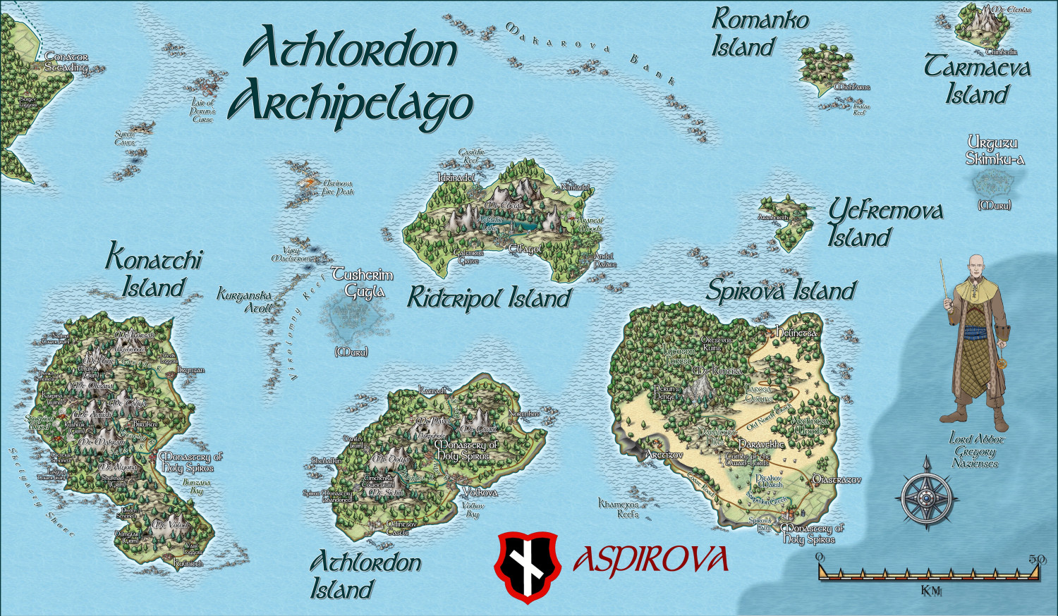
Next map is a more 'Ukrainian' based culture or the Cossack times.
A zoomable version is in the Gallery.
-
Myirandios - Hardin Region - Yamatji
Here is another island group in the Hardin region - inhabited by the Walloori, whose language and naming details I have taken from the indigenous language of the peoples of this area where I live in Geraldton, WA - the Yamaji or Wajarri people. However, the people themselves although dark skinned, look more like, and dress like medieval Indian people.
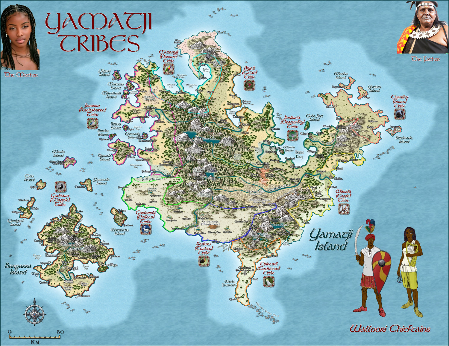
The larger zoomable version is in my gallery: Image Gallery: Hardin — ProFantasy Community Forum


