Quenten
Quenten
About
- Username
- Quenten
- Joined
- Visits
- 8,066
- Last Active
- Roles
- Member
- Points
- 3,090
- Birthday
- November 29, 1950
- Location
- Australia
- Real Name
- Quenten Walker
- Rank
- Mapmaker
- Badges
- 16
Latest Images


Reactions
-
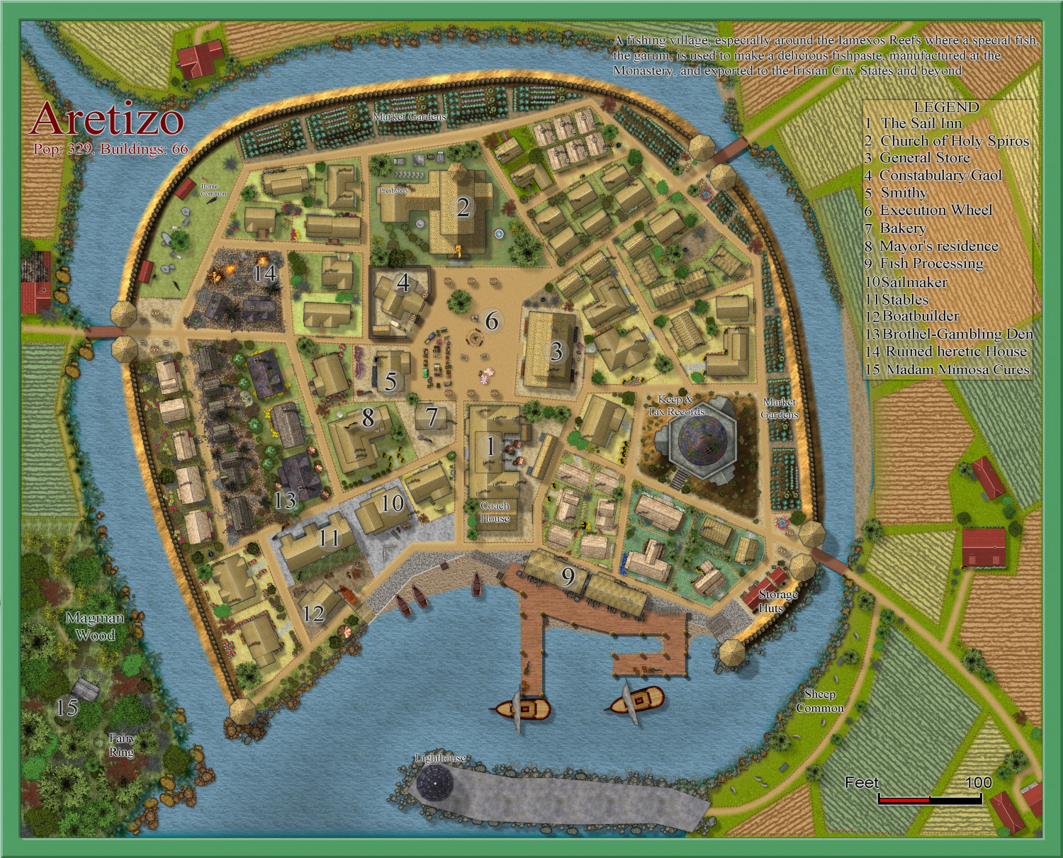
Community Atlas 1000th map Competition - with Prizes [August/September]
My competition entrant now finished.
REVISED 7th September. Added a small black dog in the central square and his name as the beach to the right. It is of course, my beloved Schipperke dog, Ahab. Plus a few minor changes. Larger version in the Gallery
Image Gallery: Hardin — ProFantasy Community Forum


-
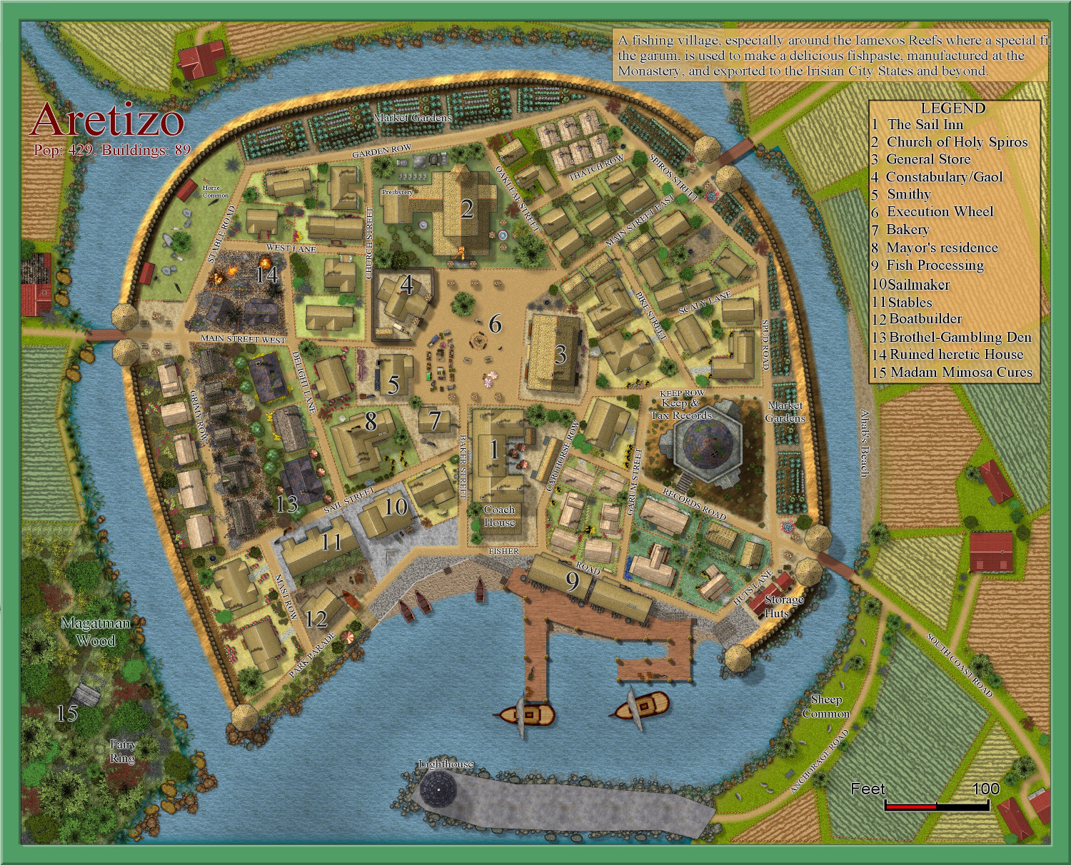
[WIP] Community Atlas Competition - Artemisia - Spiros Isle - Aretizo village
OK, here it is complete.
@Monsen Can you check the fcw to make sure all the fills and symbols comply with Atlas rules? Please.
A larger version is in the Gallery: Image Gallery: Hardin — ProFantasy Community Forum

-
New Watabou and Change Like DT
I have rescaled the drawing, so it is in metres. Also, the effects were set as imperial, not metric - I have also fixed that. Not sure why it didn't work properly if you did choose metric rather than imperial at the beginning. The bitmap resolutions may need to be altered though.
-
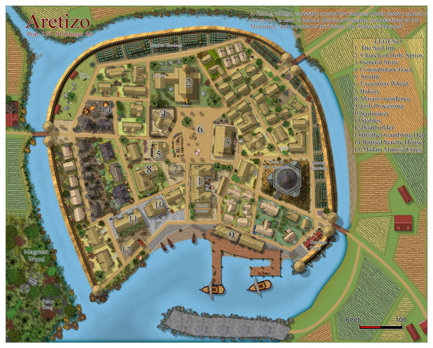
[WIP] Community Atlas Competition - Artemisia - Spiros Isle - Aretizo village
The finished map - unless I make changes later on - haha. But comments and suggestions welcome. Map notes to follow.
-
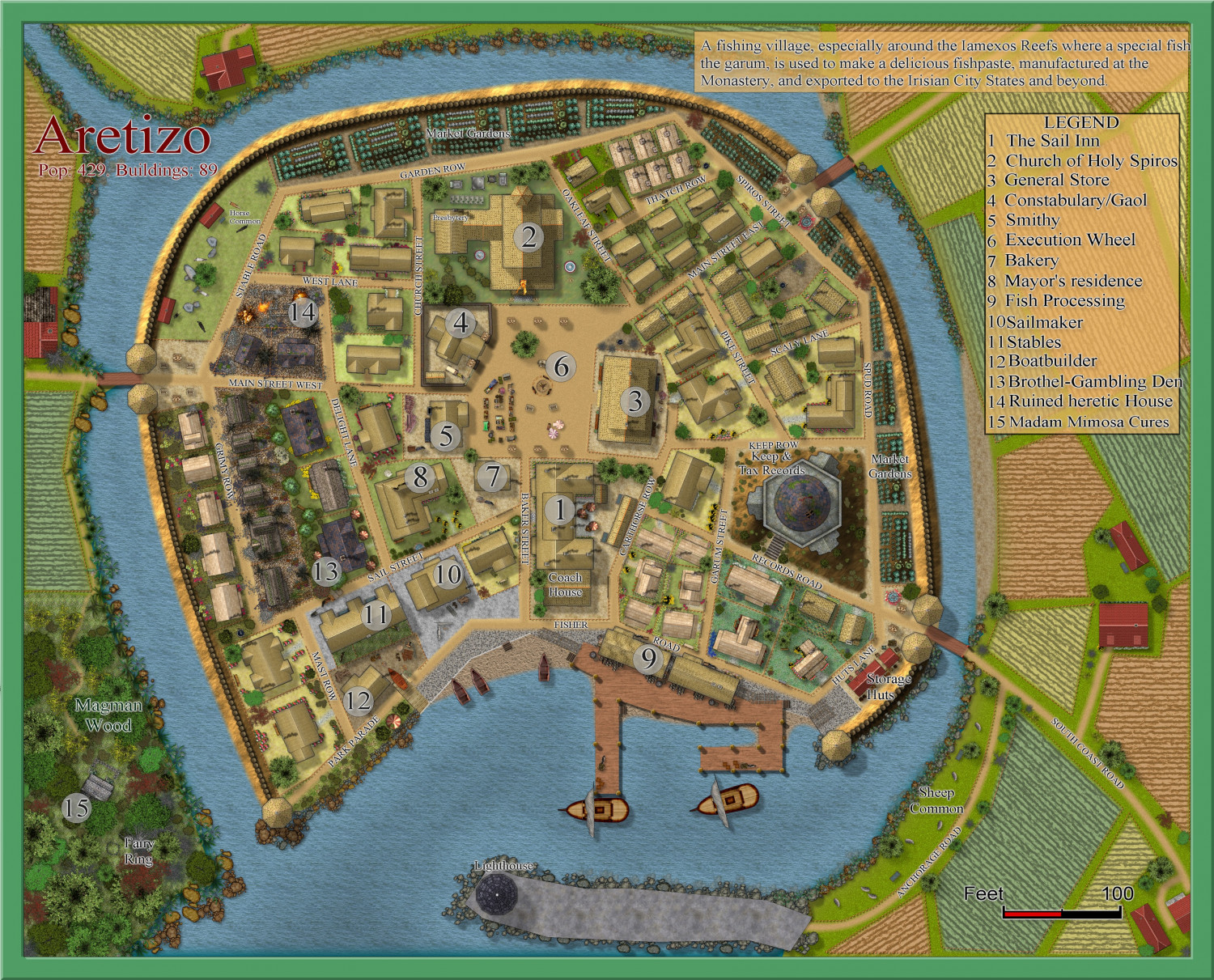
[WIP] Community Atlas Competition - Artemisia - Spiros Isle - Aretizo village
I have made a lot of progress - the village itself is finished. I have the periphery to complete, and the write-up. And a few names.