


Quenten
Quenten
About
- Username
- Quenten
- Joined
- Visits
- 8,064
- Last Active
- Roles
- Member
- Points
- 3,090
- Birthday
- November 29, 1950
- Location
- Australia
- Real Name
- Quenten Walker
- Rank
- Mapmaker
- Badges
- 16
Latest Images


Reactions
-
Pantheon of Gods, based on CA41 - Abstract Graphics
I have revised the pantheon. I have brought it into line with the 18 universal gods of my world, and transmogrified their names into Slavic sounding ones.
I have also done AI images of all the 18 deities, and used them in this revision, rather than someone else's artwork. (though I know AI often uses other people's artwork to create the images - at least the app I use does get artwork from public and free sourrces before altering it)
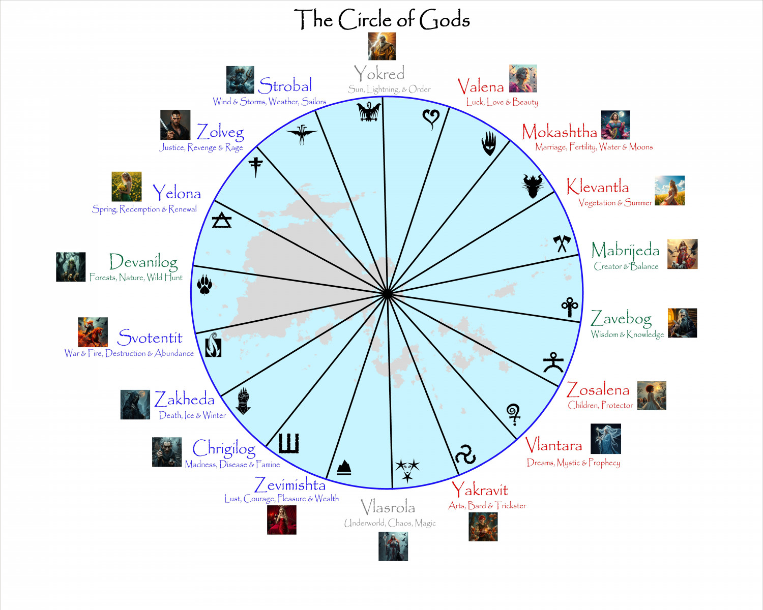
Here is the link to the larger version, where you can see the artwork better.

-
Hardin region of Myirandios
And here is the whole map now completed. Phew!
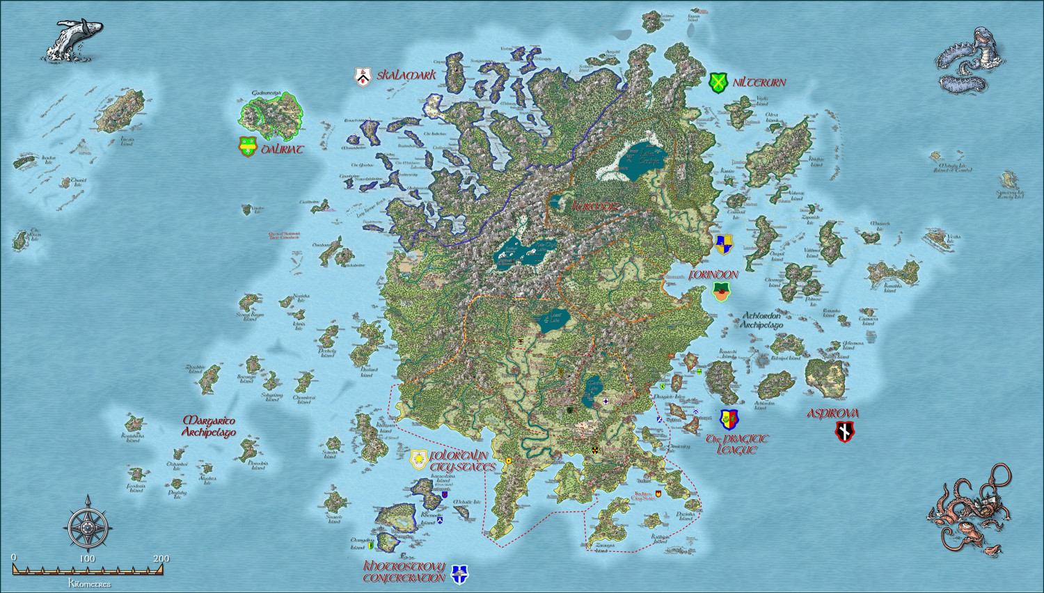
A larger version is in the gallery. Image Gallery: Hardin — ProFantasy Community Forum
And here is the fcw if anyone wants a closer look.


-
Hardin region of Myirandios
Here is the final part of the map - the Kingdom of Nilterurn - a Slavic ship kingdom, and instigator of many raids on other lands for loot and slaves.
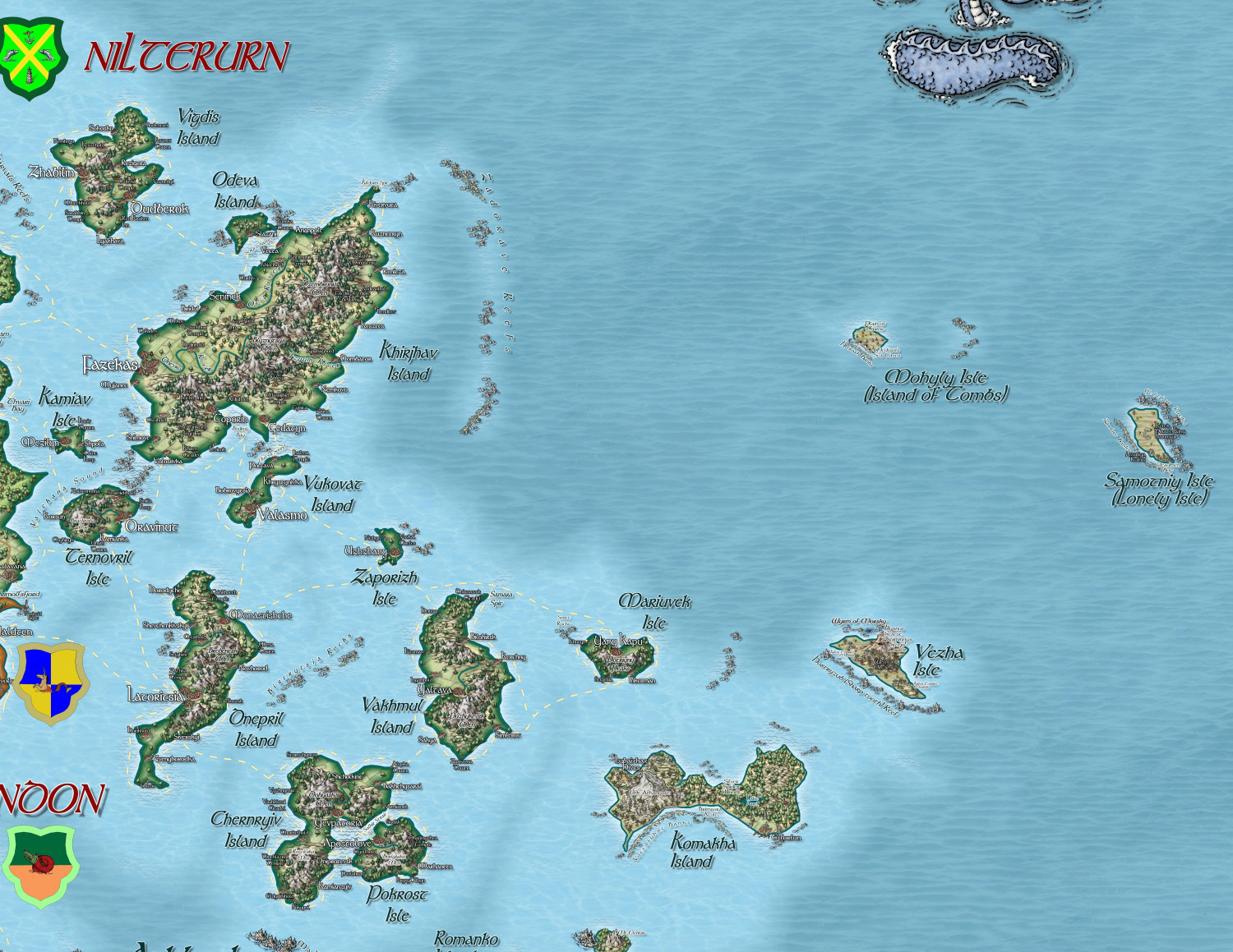
A larger version in the Gallery: Image Gallery: Hardin — ProFantasy Community Forum
-
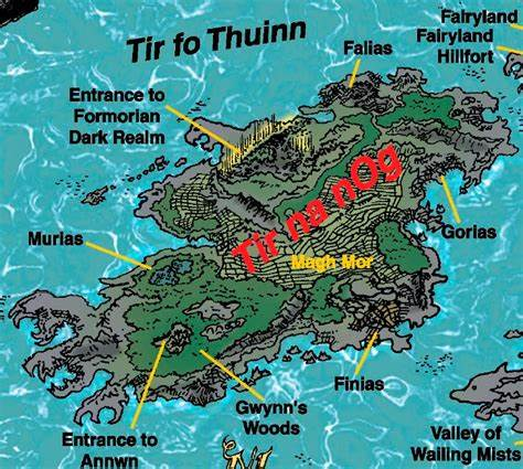
Tir Na Nog Map Slaine
Tír na nÓg is a mythical realm from Irish folklore, often translated as "Land of the Young" or "Land of Eternal Youth." Unlike the mortal world, Tír na nÓg exists outside the constraints of time and aging, offering an existence free from the sorrows and struggles of life. Legends often describe it as a lush, vibrant land, filled with stunning landscapes and an ethereal quality that sets it apart from ordinary reality.
One of the most famous tales involving Tír na nÓg centers around the hero Oisín, a renowned poet and warrior from the Fenian Cycle of Irish myths. According to the legend, Oisín is swept away to Tír na nÓg by Niamh, a beautiful fairy queen who falls in love with him. Read the legendary story of Oisín & Niamh.
Where is Tír na nÓg?
It's a mythical realm that does not exist in any physical location on Earth. In Irish mythology, it is depicted as a magical, otherworldly place, often thought to lie across a mystical body of water or hidden within the landscape of the Otherworld.
Various legends suggest different ways to reach Tír na nÓg. Some stories describe it as being accessible by crossing the sea or traveling through enchanted portals located at the base of fairy trees. Others suggest that it might be located in the westernmost part of the world, reflecting ancient Irish beliefs that the west was a direction associated with the afterlife and other mystical realms. It exists outside the bounds of ordinary reality, embodying an idealized place of eternal youth and beauty rather than a concrete geographical location. This makes Tír na nÓg a powerful symbol of a utopian existence rather than a place that can be found on a map.
I have looked for maps of it online, and here is the best IMO. It shows the 4 legendary cities of Muria, Finias, Falias and Gorlas

-
ColorKey doesn't cut through terrains
I wonder if the Color Key effect could be modified (or a new one created) that would let you indicate which Sheet it had to cut down to, allowing it to cut through multiple sheets at a time - it would be great to use for rivers in overland maps cutting through terrain and land sheets to the ocean below. Something like the various Lights effects.

