Quenten
Quenten
About
- Username
- Quenten
- Joined
- Visits
- 8,062
- Last Active
- Roles
- Member
- Points
- 3,090
- Birthday
- November 29, 1950
- Location
- Australia
- Real Name
- Quenten Walker
- Rank
- Mapmaker
- Badges
- 16
Latest Images


Reactions
-
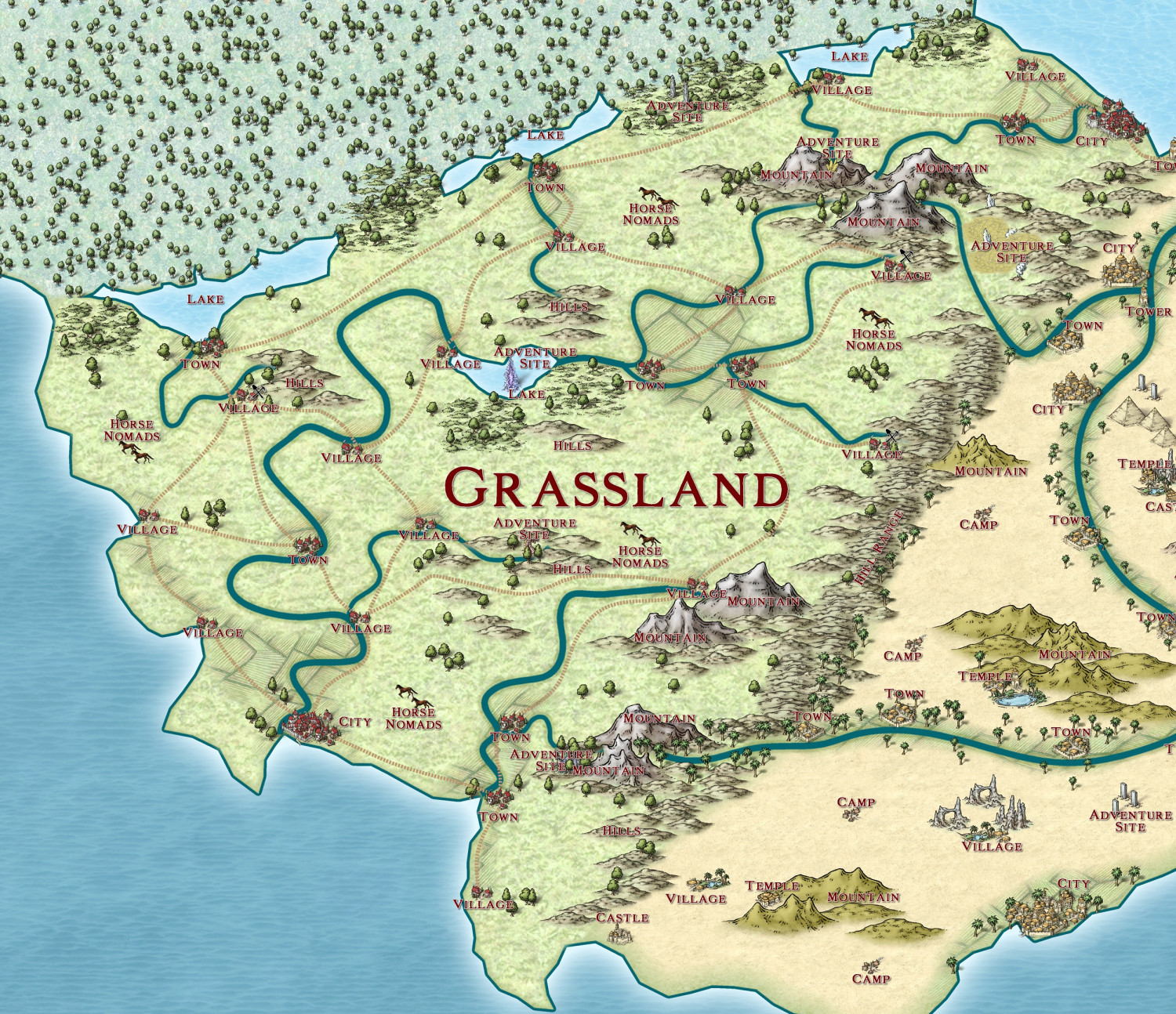
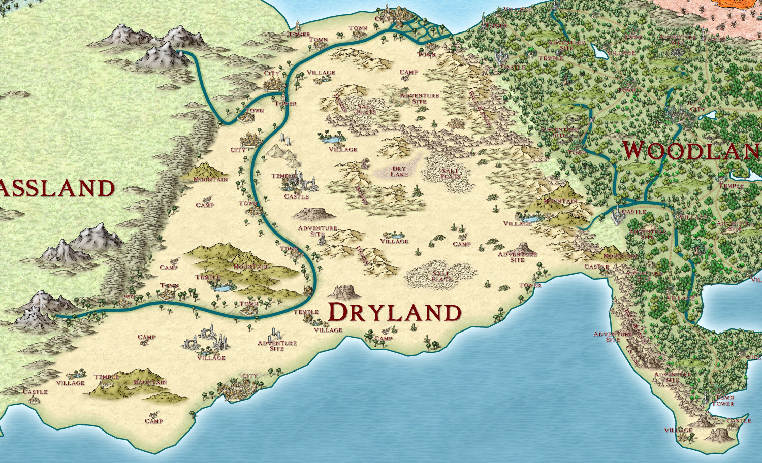
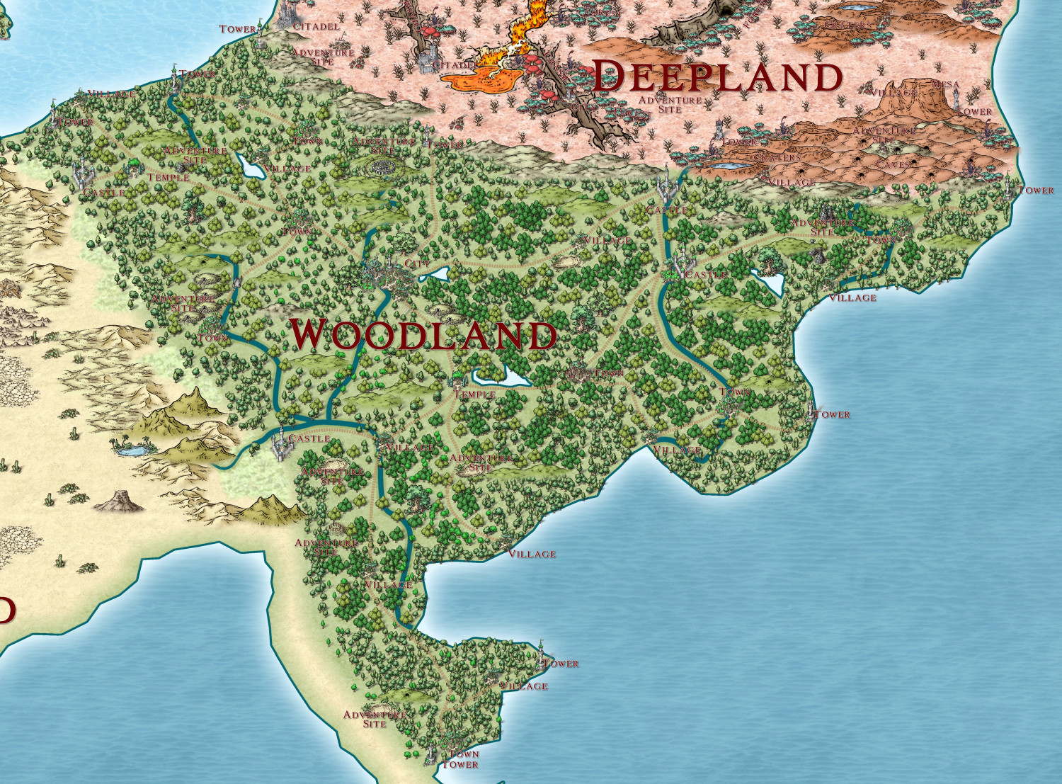
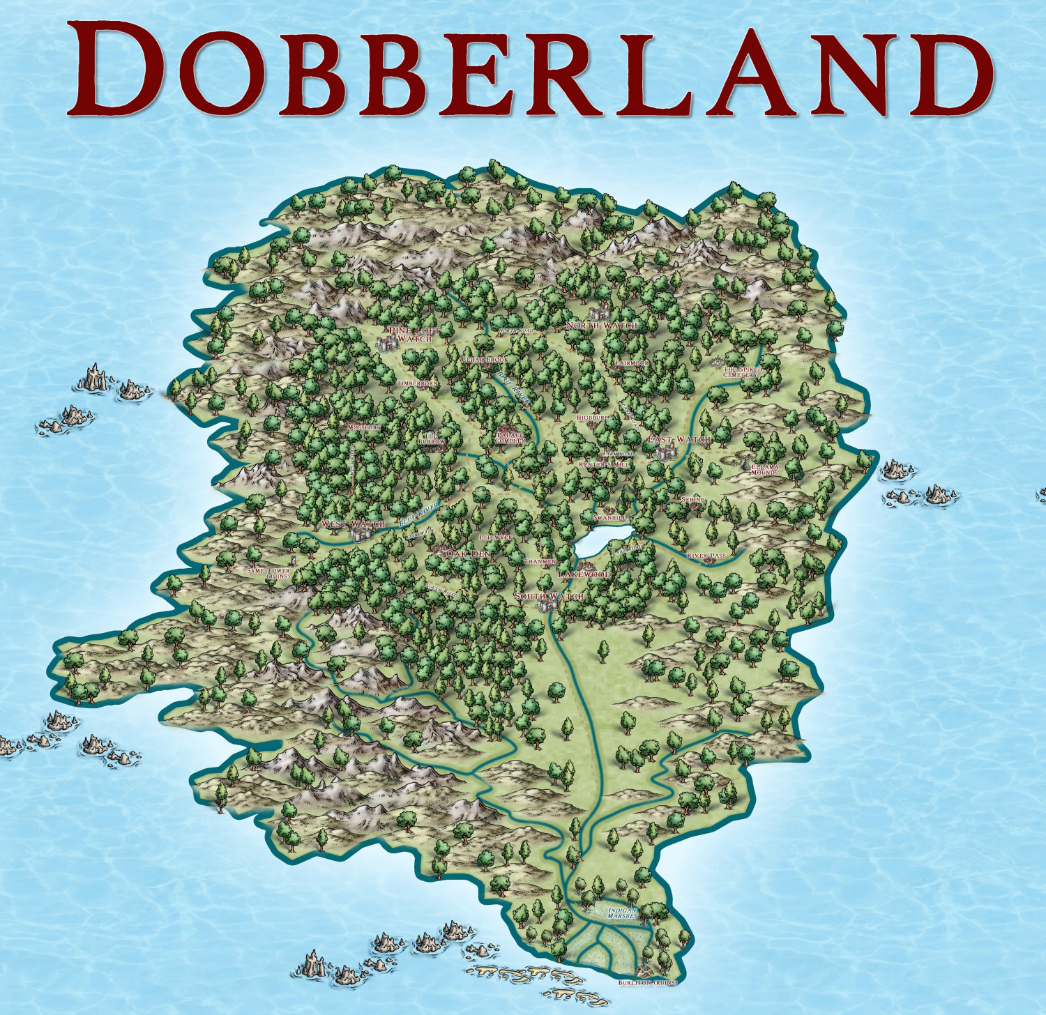
The Ten Kingdoms
Here are the six Kingdoms I have done so far, with generic names only.
Grassland:
Dryland
Woodland
Deepland
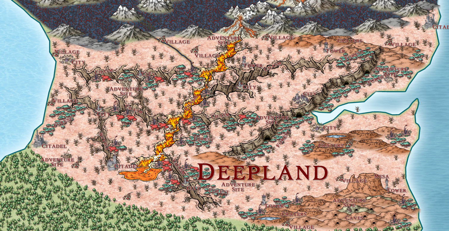
Fireland
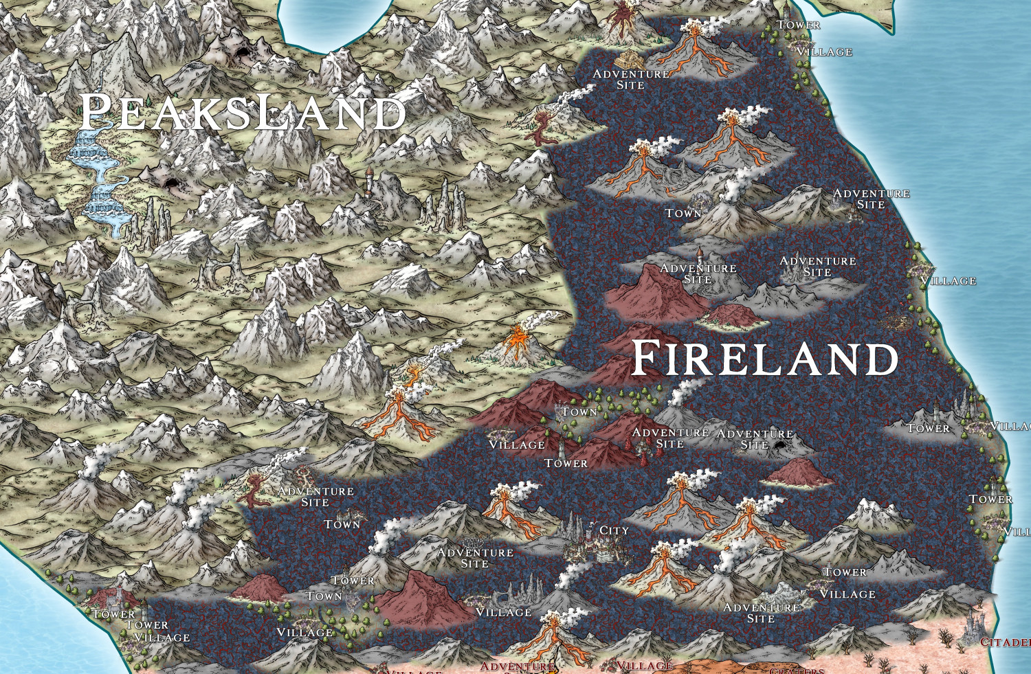
ANd Dobberland - this one is complete.


-
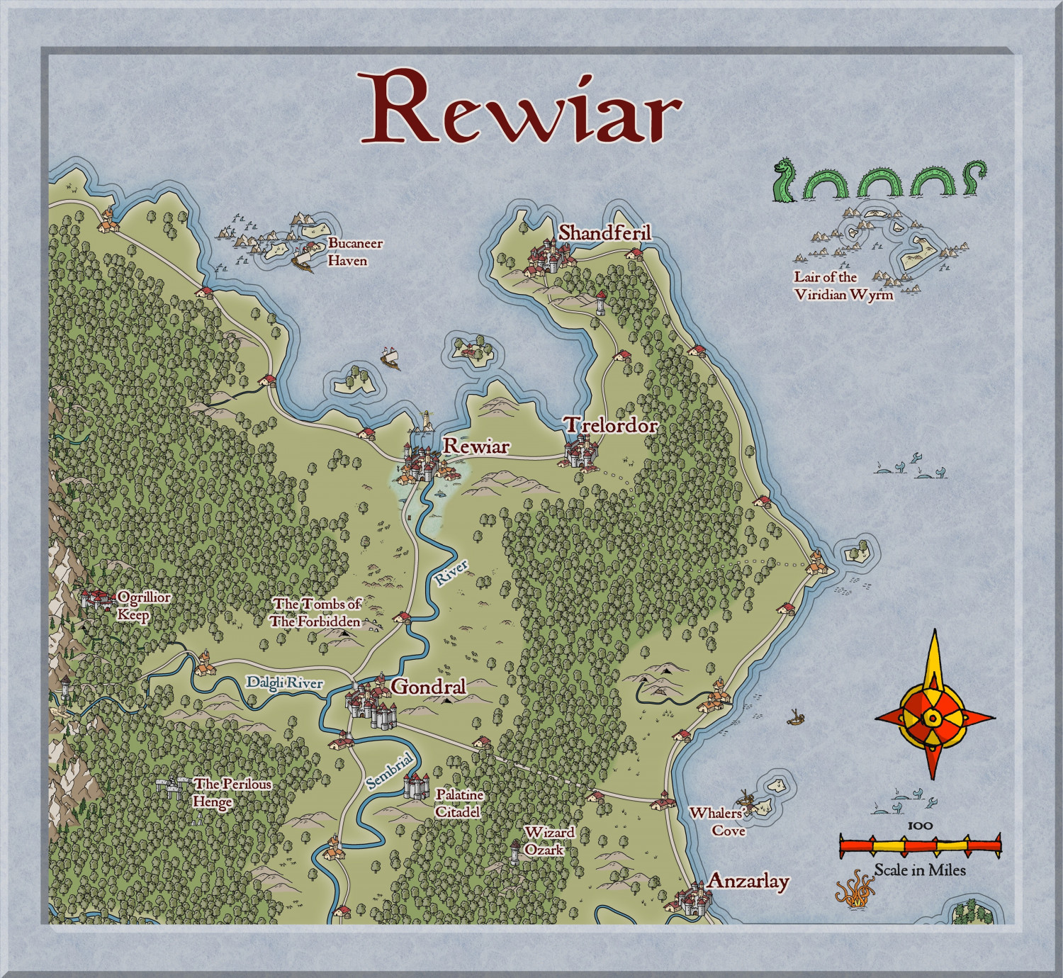
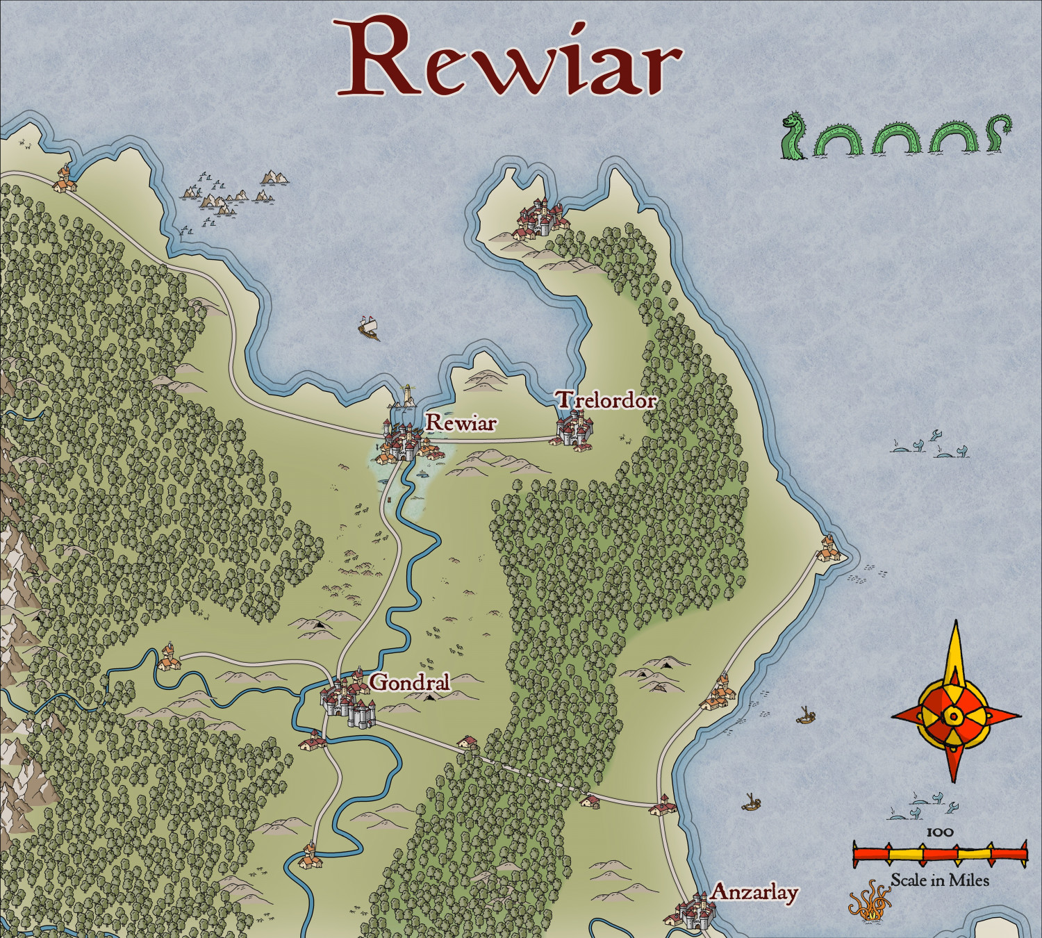
Community Atlas - Berenur - Rewiar
I think I have finished this, and will submit it to the Atlas.
@Ralf please continue to make more symbols and bitmaps for this excellent style.

-
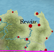
Community Atlas - Berenur - Rewiar
Here is the beginning of the region of Rewiar on the Berenur Continent, using the new style, which I think looks so gorgeous. @Ralf - more structure and marine symbols, PLEASE.
This is the region on the continent map:
This is the map so far:


-
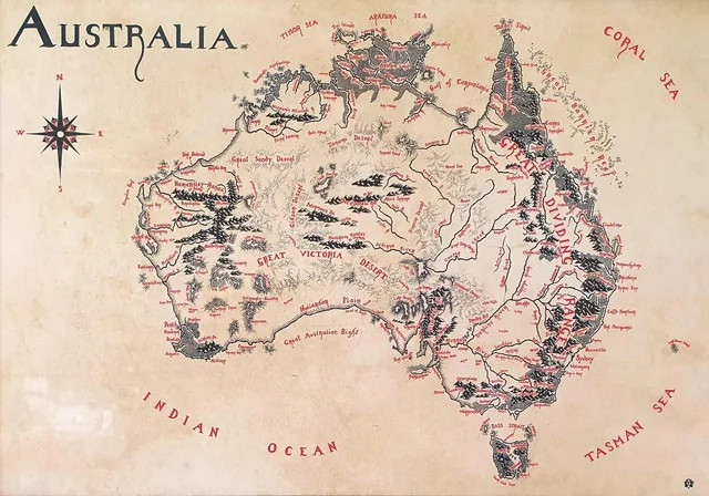
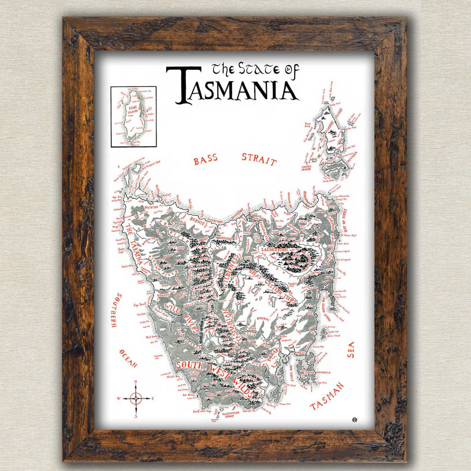
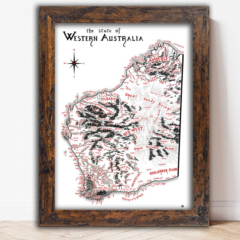
Show us your map collection!
Here are three maps I have - of Australia, Western Australia where I live now, and Tasmania where I used to live, all done in Tolkien style.


-
Massive overlands?
I also don't use any particular style, but use plain colours for both contours on an Altitude map and the same for biomes (Climate) map. Also the same about names as Calibre has outlined, with the addition of very important landmarks eg Desert of Pithin.
This is my world of Myirandios, both in Hemisphere AE version, and Equirectangular version.
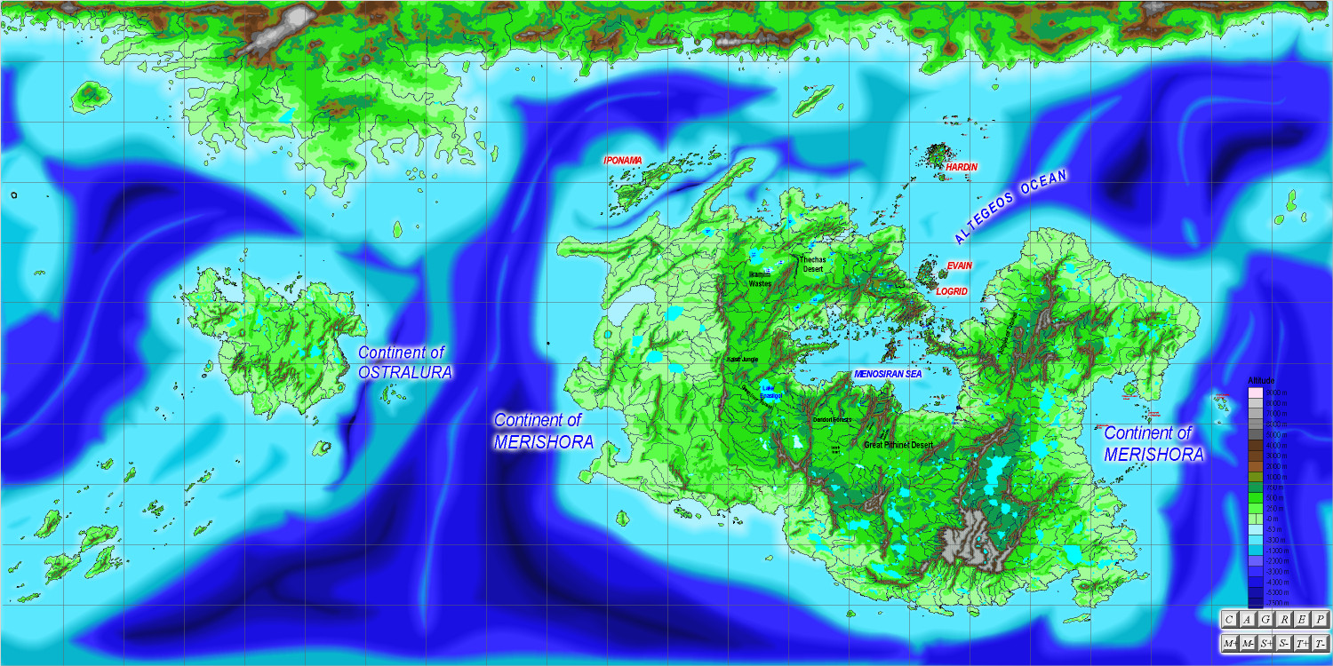
Equirectangular, Altitude
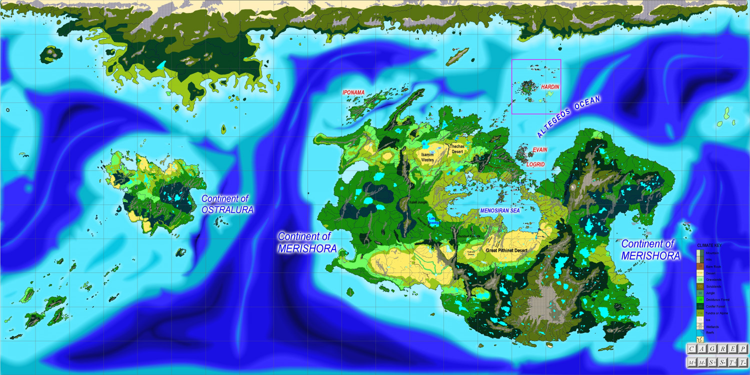
Equirectangular, Climate
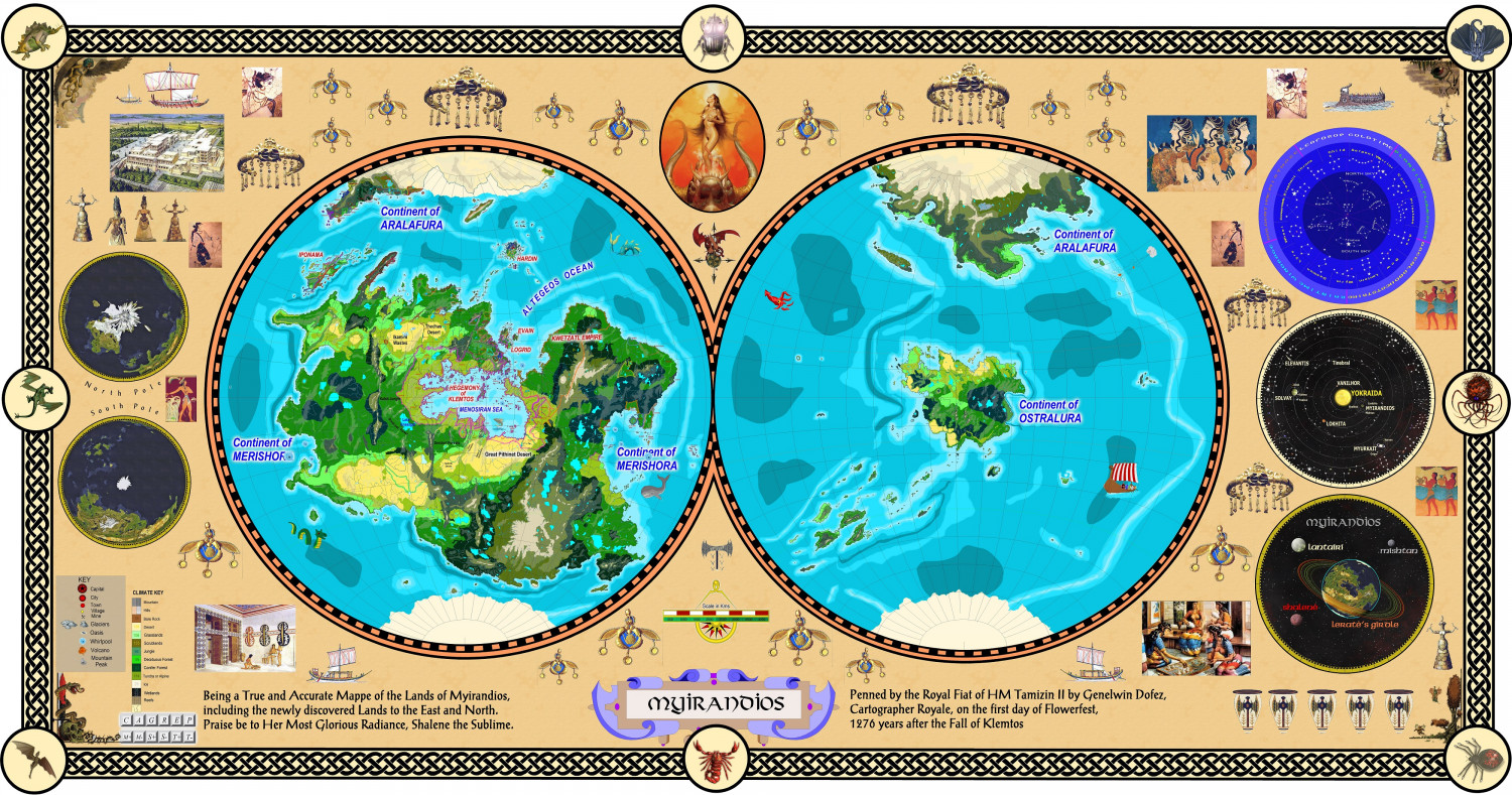
Hemisphere AE, Climate. I have used a simple brush pattern to depict hills and mountains.