Quenten
Quenten
About
- Username
- Quenten
- Joined
- Visits
- 8,061
- Last Active
- Roles
- Member
- Points
- 3,088
- Birthday
- November 29, 1950
- Location
- Australia
- Real Name
- Quenten Walker
- Rank
- Mapmaker
- Badges
- 16
Latest Images


Reactions
-
Dungeon Level Symbols - Celtic Revival Room by Room
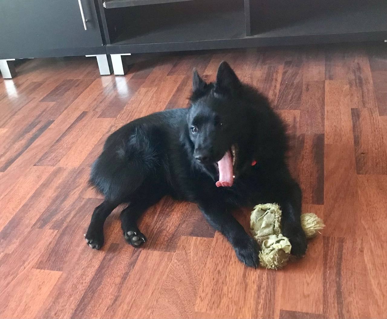
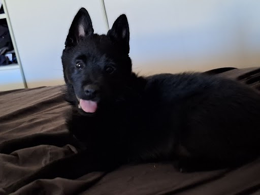
But for reference, here is Ahab, my beloved Schipperke (Belgian barge dog - all black with no tail).


-
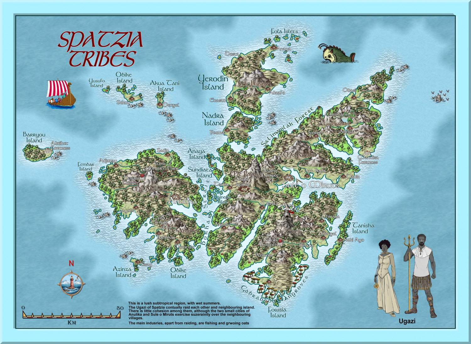
Hardin region of Myirandios
The final map for the Hardin region. An archipelago with Wallori (Australian Aboriginal-type) tribes (the Wombat Tribe) in the north; the centre is occupied by a warlike collection of city-states of the Kwetzatl (Aztec-Maya type) people; and the southern island is occupied by the equally ferocious Ming (Chinese-like) who are at war with themselves and the Kwetzatl to the north - the sound separating them has many sunken warships and trade vessels.
And of course, it is a mixed up version of the Falkland Islands aka Islas Malvinas
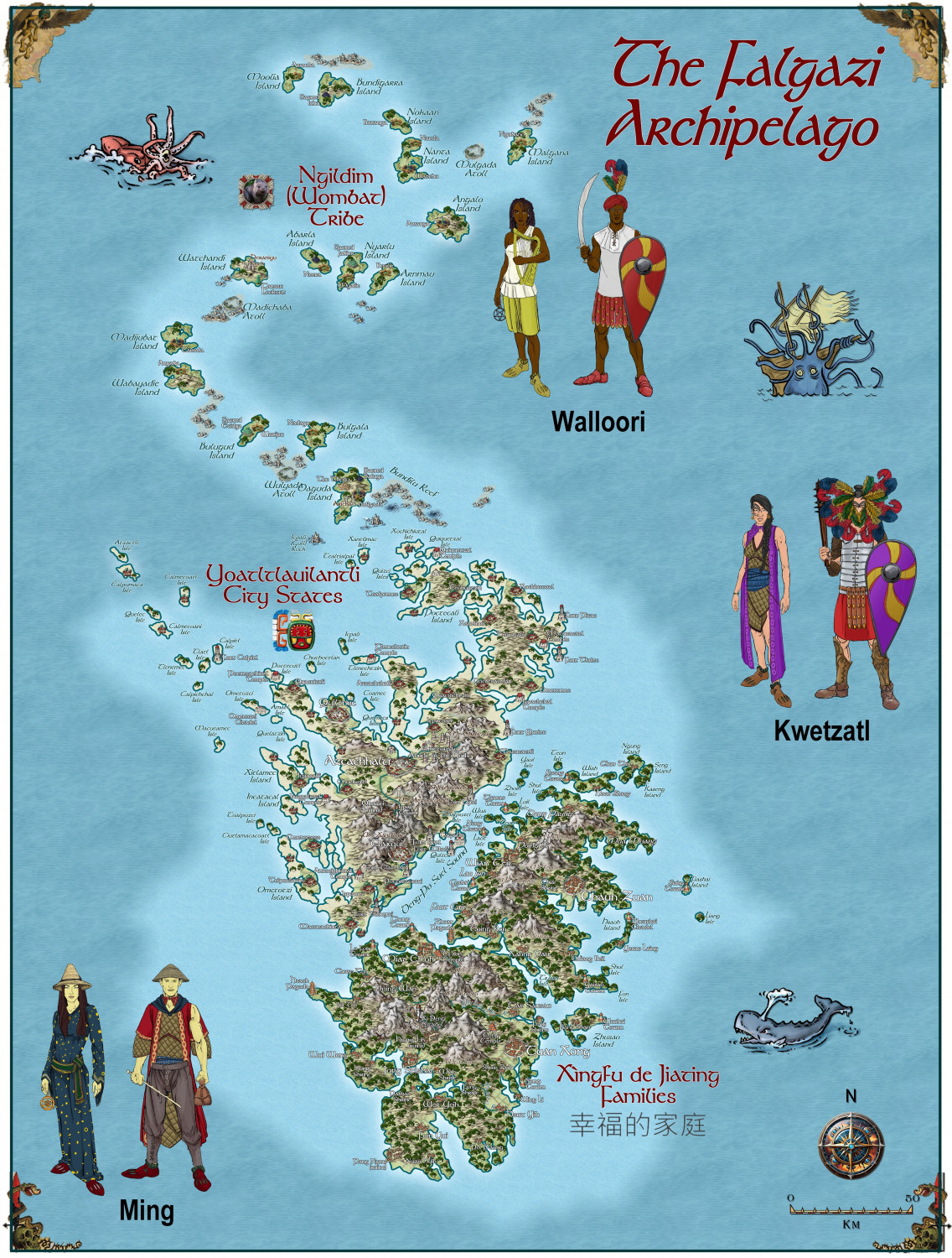
A larger version is in the Gallery:


-
Hardin region of Myirandios
Second last map in the region to be completed - the Lavini (Italian-like) nations of Finedesa and Dromidonla. Needless to say, the outlying islands are run by the 'benign' La Familia (aka the Mafia).
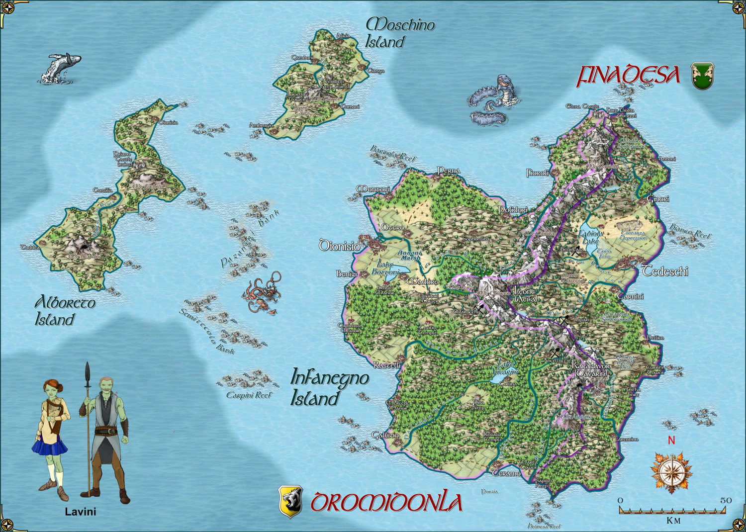
Larger version in the gallery.
-
Hardin region of Myirandios
Another region completed - barbaric black-skinned raiders (of each other as well as other island groups), with a religion that practices human sacrifice to some degree - a mixture of full-on Viking and watered-down Aztecs, set in a subtropical archipelago. Which is based on somewhere on earth that most Europeans will recognize as being anything but subtropical - LOL.
Large version in the gallery:
Image Gallery: Hardin — ProFantasy Community Forum
-
Using Mike Schley symbols
Open the FSC file you wish the new pngs to go to - usually in a folder in the Symbols folder on your CC3+Data folder.
Click on Symbols menu, then Symbol manager. You will get a screen like this:
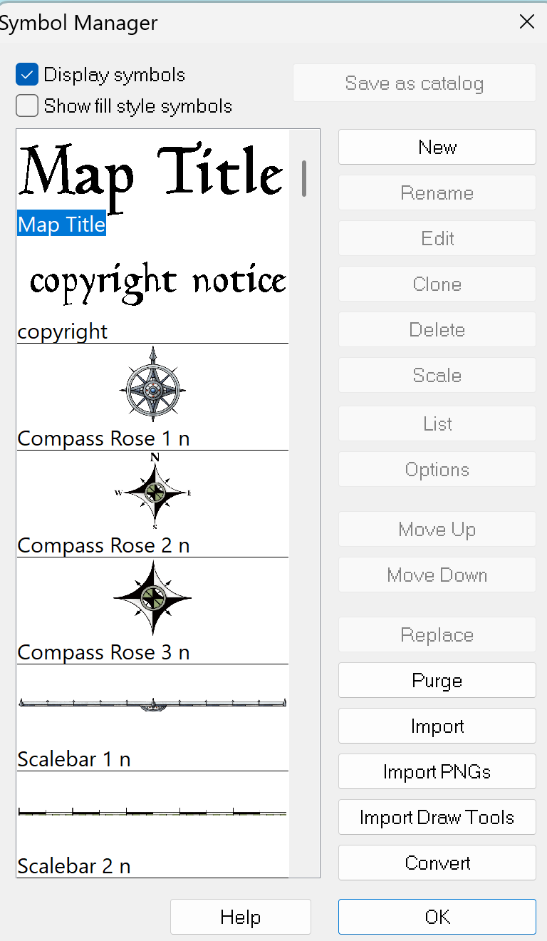
Click on Import PNGs and you will get a screen like this:
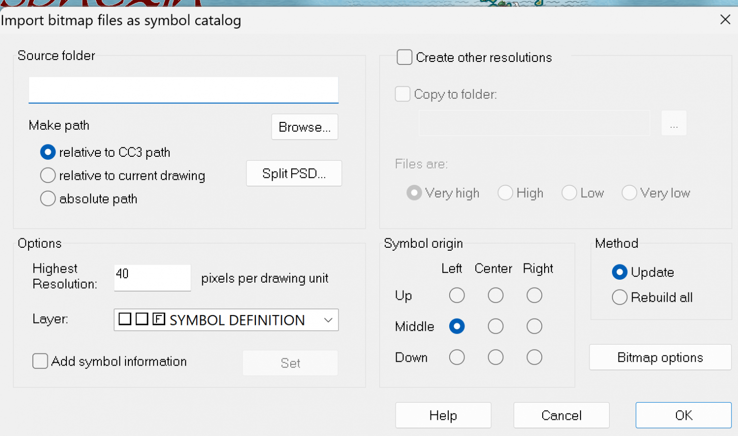
Click on Browse, and go to the folder which contains the PNGs you want. Open the folder and click on any of the pngs.
If the pngs already are in the 4 resolutions (Hi, Lo, VH or VL) then DO NOT CLICK 'Create other resolutions. If the png you want is NOT in the 4 resolutions, then do click on that. Then click OK.
When it is finished it will tell you how many symbols in the catalog and how many were updated or new ones created.
Then Open the Symbol manager again, and go through the symbols - the ones you added will be at the end of the list. You may have added pngs you don't want - just select them and press the delete button on the symbol manager menu (see above).
You can also reorder the symbols as they appear in the catalog.
Finally, click on the first symbol on the list, then select all the rest by using the Shift key on your computer and clicking on the last symbol. Then click Save as Catalog. Then click Save on the main menu, and you will have the new png along with all the other symbols that were in the catalog.
If you make changes to an existing official catalog, it is often better to give it a new name, otherwise it may be overwritten when there are updates, or if you have to reinstall everything.
Hope this is a little clearer than mud. Good luck.