Quenten
Quenten
About
- Username
- Quenten
- Joined
- Visits
- 8,062
- Last Active
- Roles
- Member
- Points
- 3,090
- Birthday
- November 29, 1950
- Location
- Australia
- Real Name
- Quenten Walker
- Rank
- Mapmaker
- Badges
- 16
Latest Images


Reactions
-
Ukadarlia
Finally, the main focus of the project:
The country of Zelenahavan (means Verdant Haven, or Greenharbour).
Two major ethnic groups: the Vynlings and the Kratirim, with all the tensions that this will imply.
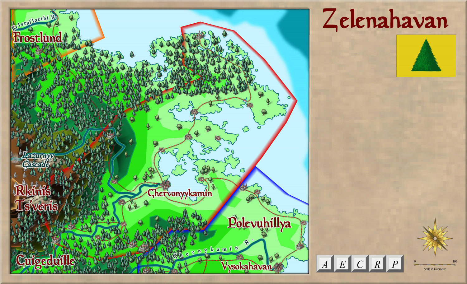
More detail on this will come of course.


-
Ukadarlia
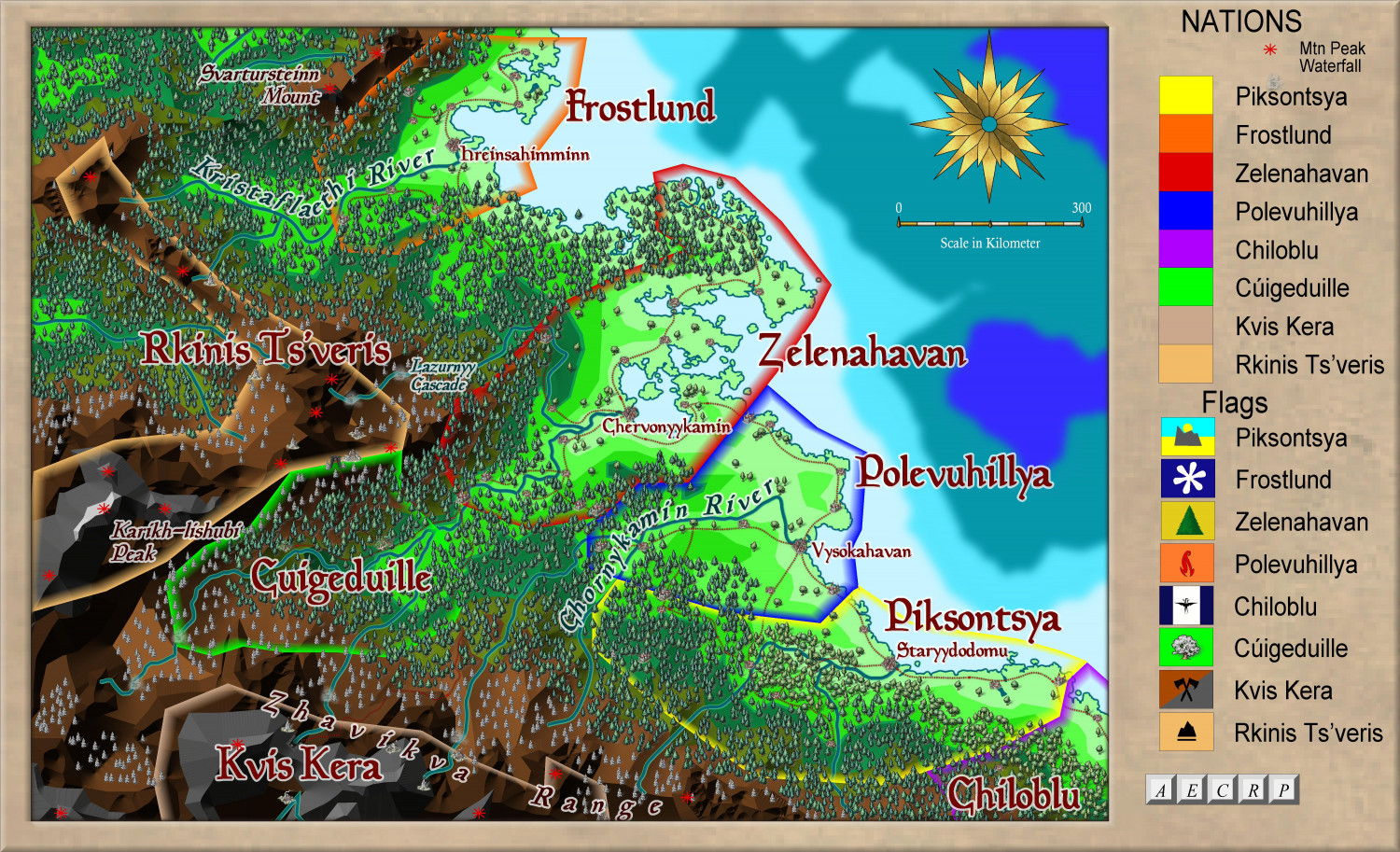
Here is the NE area, with a zoomed in version as well.
Zoomed in further:
-
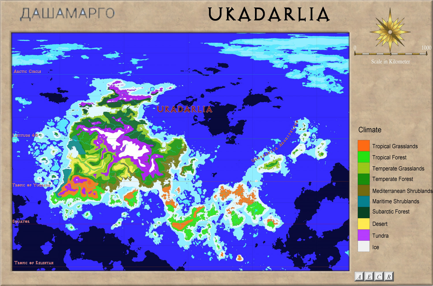
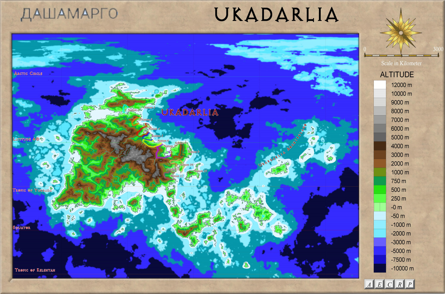
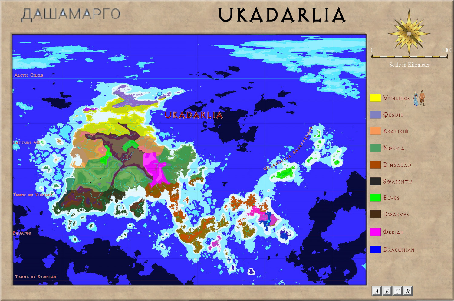
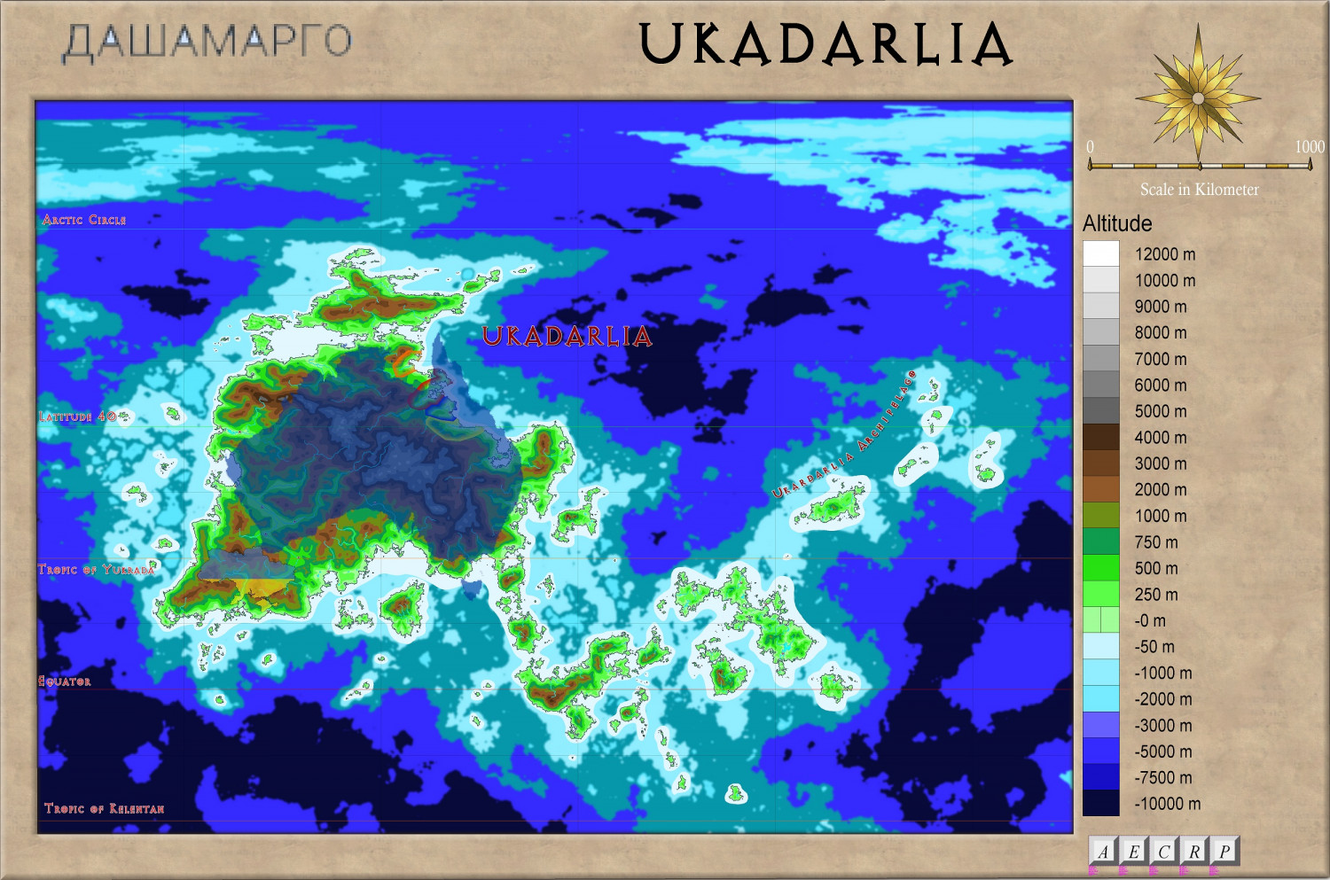
Ukadarlia
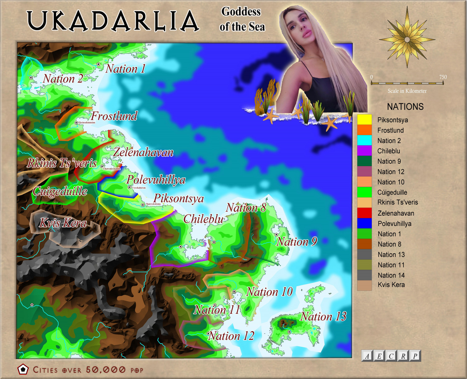
Here is the continent of Ukadarlia, stretching for subarctic to tropical zones. Also, for comparison, the size of Australia, and Ukraine.
Climate:
Altitude:
Ethnic:
And with Australia overlaid so you get an idea of the size:

-
Ukadarlia
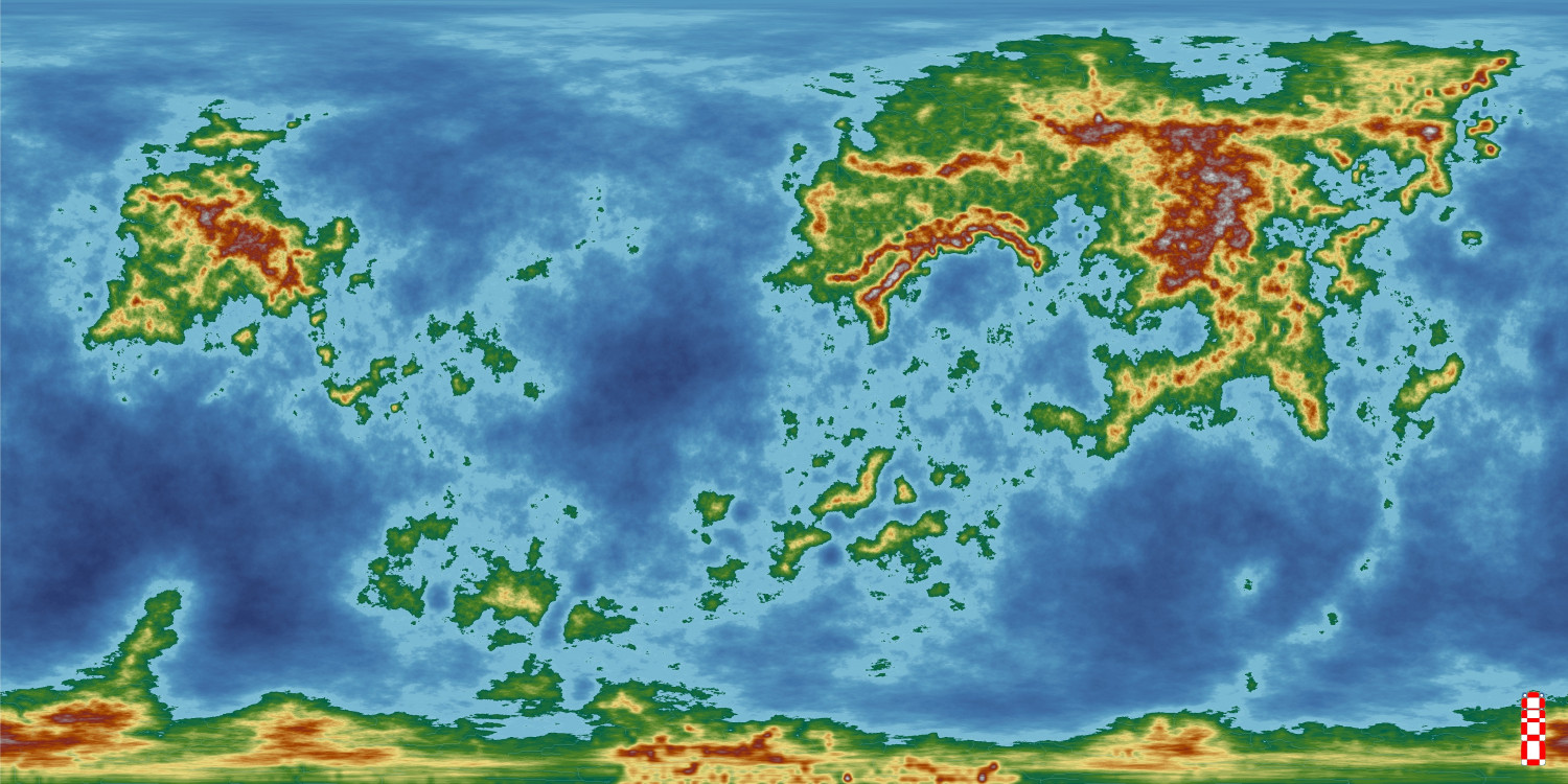
I have started on a project which I hope will get published next year. It is set on the continent of Ukadarlia on the world of Dashamargo, with the initial focus being on the NE of the continent, and the nation of Kelenahavan in particular.
These are the maps so far. In addition there will be geographical, historical, political and cultural notes, as well as notes on the various races, ethnicities, fauna and flora and unique 'monsters'. As well, I hope there will be at least 2o adventures, with a common thread to make a full campaign, as well as many other adventure hooks, and character profiles.
Anyway, here is a map of the world, as created in FT3.


-
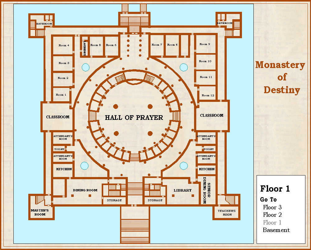
Community Atlas - Silver Springs - Monastery of Destiny
Further progress. Not sure if I should put texture for the floors or not - I will have to for the next 2 floors.