


Quenten
Quenten
About
- Username
- Quenten
- Joined
- Visits
- 8,062
- Last Active
- Roles
- Member
- Points
- 3,090
- Birthday
- November 29, 1950
- Location
- Australia
- Real Name
- Quenten Walker
- Rank
- Mapmaker
- Badges
- 16
Latest Images


Reactions
-
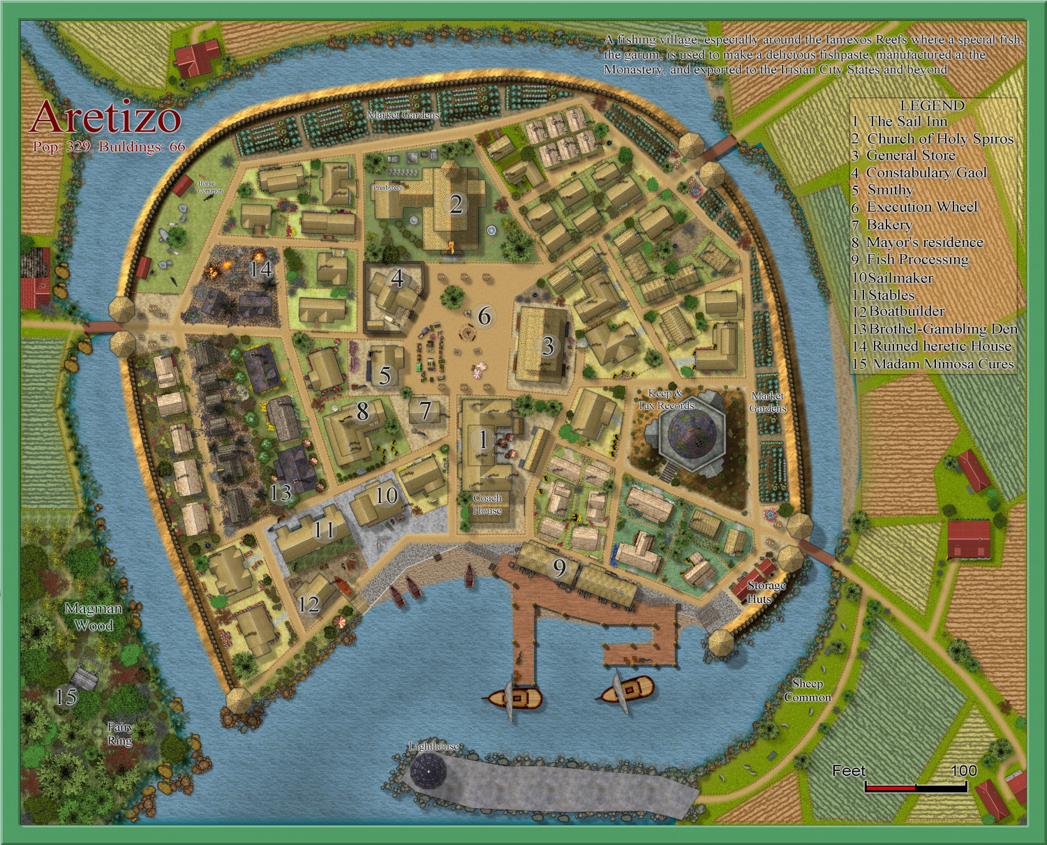
[WIP] Community Atlas Competition - Artemisia - Spiros Isle - Aretizo village
The finished map - unless I make changes later on - haha. But comments and suggestions welcome. Map notes to follow.


-
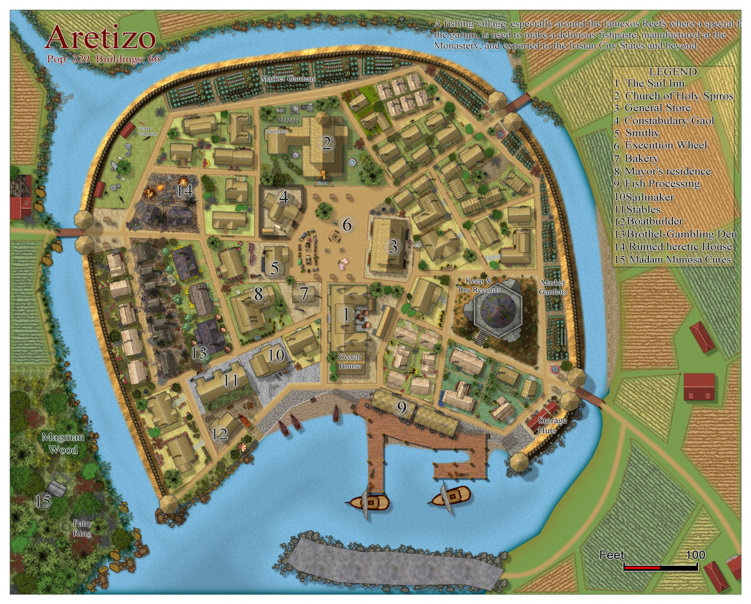
[WIP] Community Atlas Competition - Artemisia - Spiros Isle - Aretizo village
I have made a lot of progress - the village itself is finished. I have the periphery to complete, and the write-up. And a few names.


-
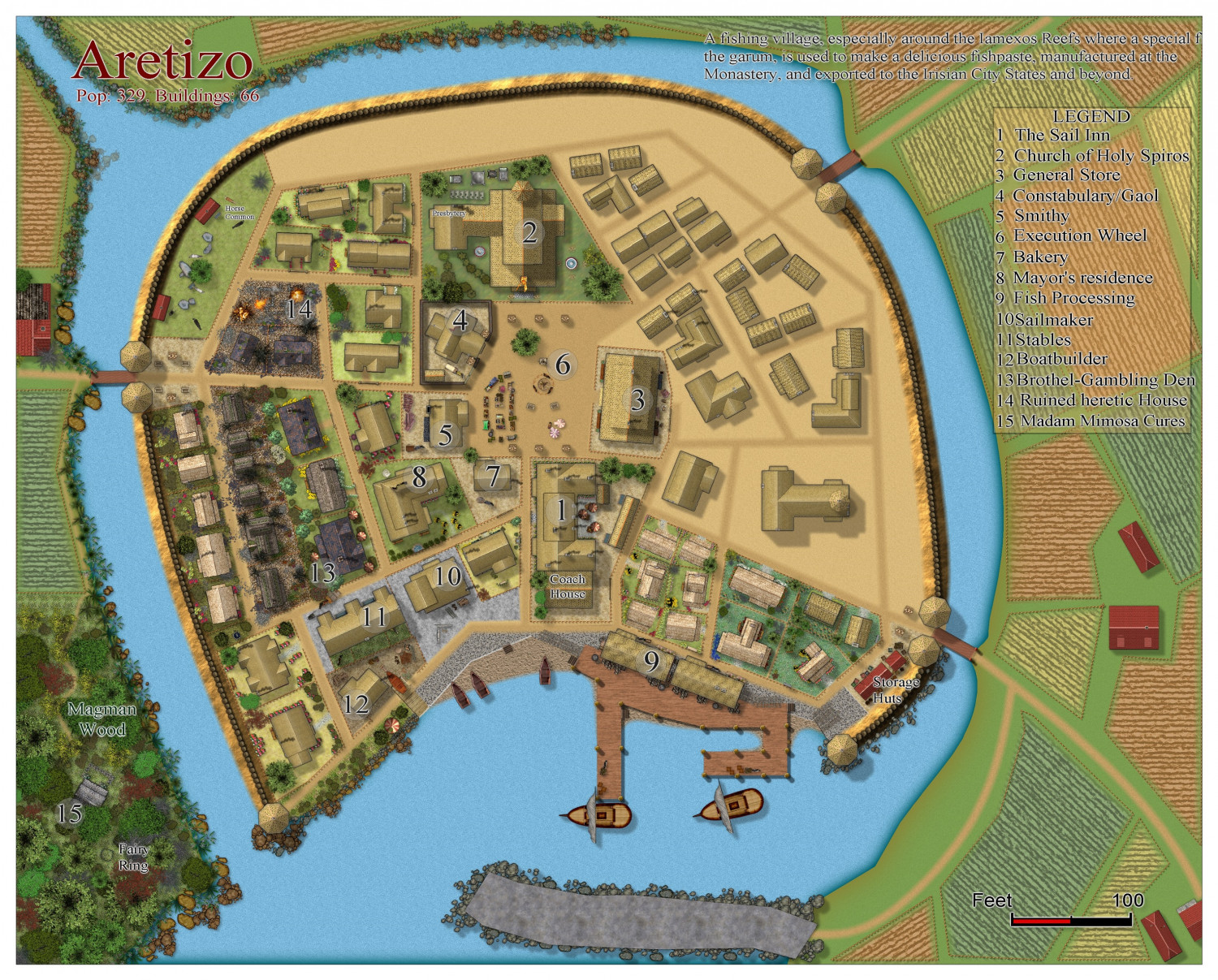
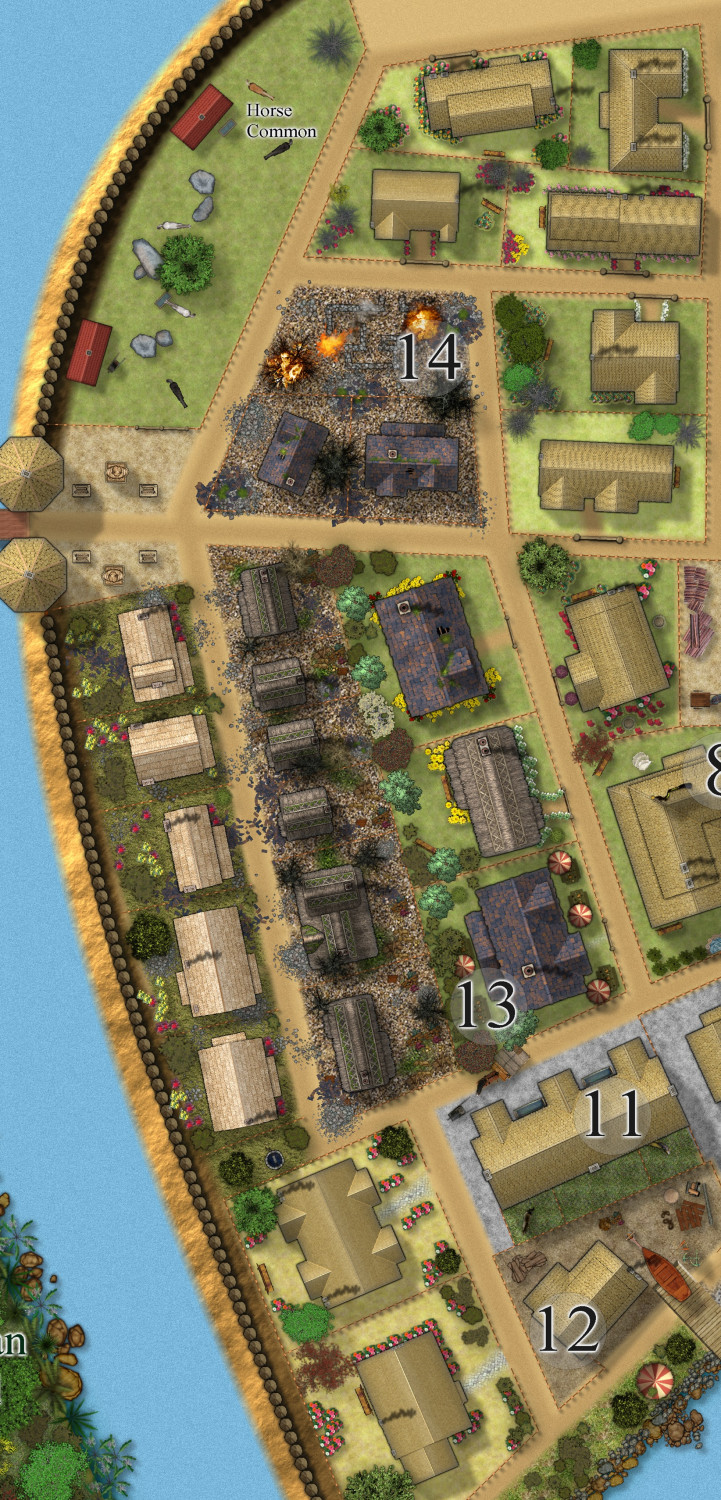
[WIP] Community Atlas Competition - Artemisia - Spiros Isle - Aretizo village
Slow progress. Here is the village as a whole to date, and the west quarter - Grimy Street, with the heretic (who is on the execution wheel) house which has been burned to the ground by orders of the kind gentle merciful Monks of Holy Spiros. (so glad nothing like this happens here in real earth).

-
[WIP] Community Atlas Competition - Artemisia - Spiros Isle - Aretizo village
Thanks Ricko - praise from you is much appreciated.
-
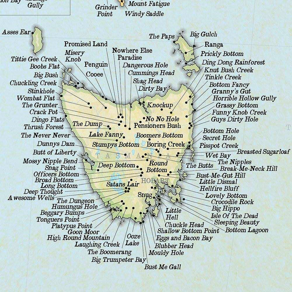
Place names for Fantasy maps
It often gets a wee bit difficult to find 'sensible', 'realistic' names for fantasy world maps. Perhaps these Tasmanian real world names will help.
Lol. Just has to share.


