Avatar

Quenten

Quenten

About

Username
Quenten
Joined
Visits
4,357
Last Active
Roles
Member
Points
2,198
Birthday
November 29, 1950
Location
Australia
Real Name
Quenten Walker
Rank
Mapmaker
Badges
15

Latest Images

  • Watabou City REVISED (annual 157)

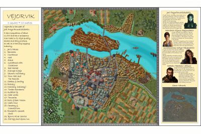
    Here is what it looks like with all the bells and whistles from the Watabou generator now. You can even add you own text for various buildings of importance.


    Royal ScribeScottARicko HascheJuanpi
  • Watabou City REVISED (annual 157)

    Then open Watabou city annual style. Pick the dimensions you want - get this from the scale in the generator.

    Then inset the dxf file.Scale it as non visual by factor of 2.5 (not 400 - it no longer appears as a dot!). Use 0,0 as the point to scale from.

    Next step - convert all from lines to paths (right click the Explode button). DO NOT FORGET THIS

    Now we need to move all elements apart from the buildings to their relevant sheets and layers. I do it in this order, but it doesn't really matter which so long as you remove all elements apart from the buildings to their relevant sheets/layers.

    1. Water: Turn Seas into closed polygon, move to sheet WATER/RIVERS, layer Water/Rivers. Use whatever fill you like. Turn River into a path of fixed width, fill whatever you like (or a actual smooth polygon, giving difereing widths along the course of the river, making it perhaps more natural, and perhaps allowing for some river islands). I do not use Change like Draw Tools for this - I got weird results (someone might like to check this out).
    2. Roads: Again, I turn the roads into a path of fixed width, fill pattern what I like. Again, I got weird results using the Change like Draw tools. This isn't too problematic, since there are only ever 2-6 roads. Put them on the sheet ROADS layer Roads. I actually add a ROADS PAVED sheet, with no Edge Fade effect because sometimes i want a stone road to be 'neat' at the edges.
    3. Walls: I do use Change Like Draw Tools for this - it works well. Make sure you select Sheet WALLS, and layer City Walls before doing this, though.
    4. Towers: I do these each separately (I actually hide all but the IMPORT, WALLS and TOWER and TOWER TOP sheets, just to make it easier). I do use the Draw Tools, (NOT Change like Draw Tools), but it is sometimes a bit trial and error to get the right dimensions. First, work on the Round towers: Once I have 1 tower right, I then copy that to all the other round towers, to keep the dimensions consistent (unless I deliberately want to make some bigger and even taller). Nest the square towers- usually the gate. I draw 2 towers with the distance apart from them being the width of the road, then add a WALL between them, narrower than the City Walls, to act as both a gate AND a maker to align them correctly to the walls. Again, I use the copy command to keep things consistent.
    5. Bridges. I make these either as a separate entity on a new BRIDGE sheet (in the map below I have used a BRIDGE sheet with a shadow effect, and a BRIDGE TOP sheet for railings, with an outer glow effect).
    6. Docks: I add a DOCKS Sheet, with Shadow effect, and outer glow (or just a black outline as in the map below).
    7. Greens: I add a sheet called PARKS, and transfer all greens to that sheet, Layer vegetation. Fill as desired.
    8. Fields: I transfer all furrows to the FIELDS FURROWS sheet, unless I decide to use a field fill that has furrows you can align as you wish. otherwise, follow the procedure as per the annual 157.
    9. Buildings: Hide all Sheets except IMPORT. Choose layer Buildings. Right click Explode button and change everything from Paths to Polys. Now change the fill to the desired fill - Watabou annual uses the Brown stone dark fill. Next add an outline to all the buildings, the press P for previous and move all the outlines to CITY BLOCK OUTLINE Sheet. I actually rename City Block to BUILDINGS, and City Block Outlines to BUILDINGS OUTLINES, and add a sheet BUILDINGS HIGH (which I transfer the large buildings to - remember to hide the outlines before you do this though!). The renaming isn't necessary, but since I like to have a different sheet for different size buildings, I prefer the name Buildings - my OCD showing! Of course, I add a Wall direction shadow to the BUILDINGS HIGH Sheet, with higher value than for the hoi polloi buildings. I find doing it this way, and NOT using the Change Like Draw Tool tool actually produces a cleaner result. But I am interested in what you people think.
    10. I actually change the sheet effects for the CITY BLOCK and CITY BLOCK OUTLINE as follows: The CITY BLOCK (or BUILDINGS) sheet had only the Wall shadow directional effect - delete the Glow effects, but copy the Outside Glow effect to the CITY BLOCK OUTLINE (or BUILDING OUTLINE) sheet instead.

    Now I have got the following - easy to add all the other bits to the map now.

    To the template for this revised annual, I would add the following sheets: PARKS, BRIDGE, BRIDGE TOP, DOCKS, BUILDINGS HIGH; and the following Layer: Cartouches. I would also change the sheet effects for the CITY BLOCK and CITY BLOCK OUTLINES as indicated above (and change the names to BUILDINGS AND BUILDINGS OUTLINE)

    I will finish this map off later.

    I really want comments and suggestions on this please. I would love to be able for us all to use the Watabou stuff easily again.

    MonsenLoopysueRoyal ScribeGlitchJuanpi
  • Deithardt-Kolsven Region

    This is the thread where all discussion on this region will now be held.

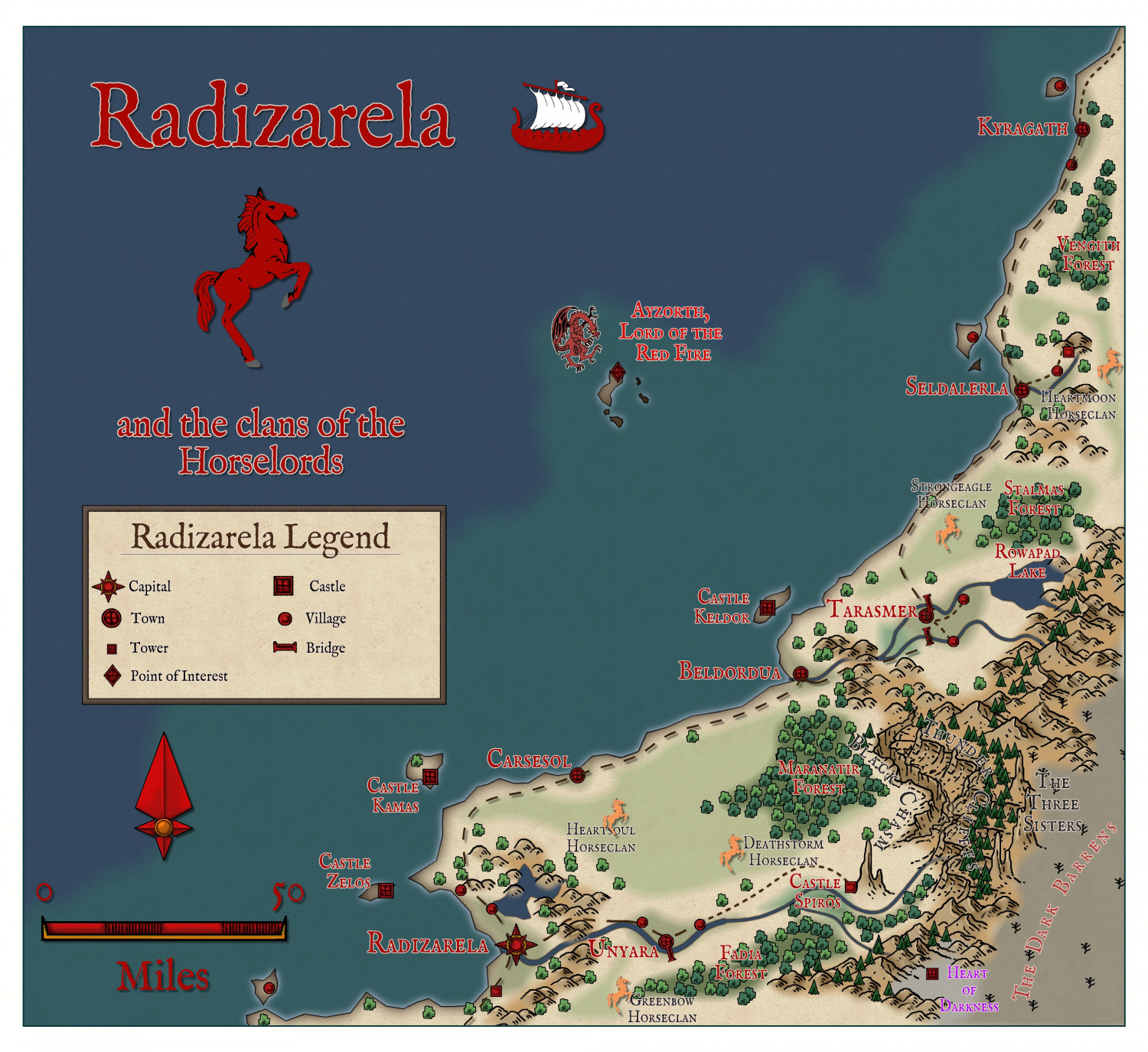
    Here are three regions fairly completely mapped - the last being the least complete.

    First, the 'Viking' kingdom of Kolsven

    Next, the once great empire of Deithardt

    With a close up of the remnants of Deithardt itself

    Two nations to the north of Deithardt - Varnavna - not so complete


    And Vuksatem

    Finally, the least complete (what I am working on at present, East Bolasov (I had to divide Bolasov into two, as otherwise the overall map became too large - and perhaps that will make for a regional and perhaps ethnic difference - eg like East and West Ukraine).


    MonsenRicko HascheGlitchJimPJuanpi
  • Weldarmon-Gyaflaggio region

    This stream will be dedicated to this region only.

    I am still undecided whether to use Schley Symbols for the structures, or more generic ones, as shown here. Opinions very welcome, and in fact necessary. In places I have used both, with one or other to be removed once you all help me make my decision.

    Here are a few areas already mapped out fairly completely, with the last the least complete to date.

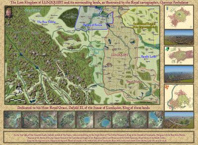
    This is THE core area, with many adventure sites already mapped and keyed in with both map and text links.

    This is the whole of Gyaflaggio - not complete in the western area of the map.

    These are small nations to the north of Gyaflaggio


    This is Western Bolasov - the least complete so far, and no use of Schley structure symbols. Comments on that please.


    MonsenRicko HascheJimP
  • Myirandios Regions mapped in detail.

    I have decided to not continue with my other worlds, but go back to my original Myirandios world, which has so much lore already. This is what I hope to publish as an RPG supplement next year.

    There will initially be three main regions - two are outlined in red, the other is Logrid and Evain to the south.

    I will be using some of the ideas and maps and races I designed for the other worlds, so as not to waste stuff, and also because they are all designed with Myirandios at the back of my mind anyway.

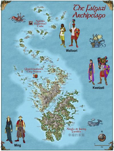
    So here are the two Regional maps. The bigger one on the lower left is cut into two. Each grid is 1600 km x 1600 km (approx 1000 x 1000 miles).

    I have supplied the altitude and climate maps.

    These are the two regions, at their very beginning.

    The Hardin region first, inspired by Harnworld.

    This is the larger region, divided into two halves.

    As you can see, I have already done a lot of work on these already.

    The Weldarmon-Gyaflaggio region, which contains the core playing area:

    As you can see, it uses primarily symbols from Mike Schley.

    I will work on this under a different discussion thread.

    The second area - Deithardt-Kolsven region - to the east of this, uses both symbols and also bevel-lighted contours for the mountains, instead of Mountain symbols. I would be interested in your thoughts on this. I will eventually decide on one style for all the maps, of course. But input will be very helpful.

    Here is an inset showing the bevel way of doing the mountains, combined with symbols for other things.

    I do need to finesse this more, I do realize.

    Still not sure which way is best.

    whit2468JimPCalibre