


Quenten
Quenten
About
- Username
- Quenten
- Joined
- Visits
- 8,062
- Last Active
- Roles
- Member
- Points
- 3,090
- Birthday
- November 29, 1950
- Location
- Australia
- Real Name
- Quenten Walker
- Rank
- Mapmaker
- Badges
- 16
Latest Images


Reactions
-
Hardin region of Myirandios - Forindon and Kurmdiz
Here is continuation of mapping in full detail the large Island of Hardin - two Nordic Kingdoms, but with a predominant Slavic population. (think the early days of Kyivan Rus)

Image also in Gallery - Image Gallery: Hardin — ProFantasy Community Forum


-
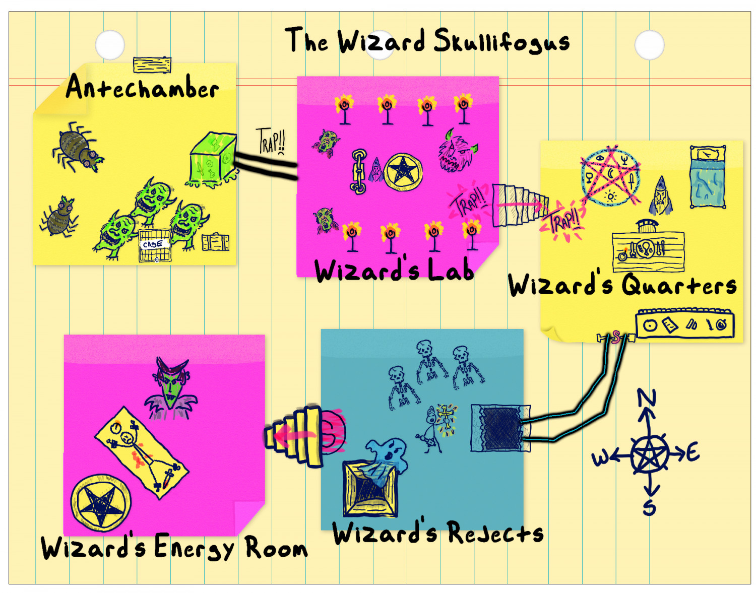
Sticky Note Dungeon - the evil Wizard Skullifogus
Thanks for this - it is likely to help me design better dungeons.
Here is my first foray - an evil necromancing wizard trying to create the ultimate undead monster- has created Vampelstein, a mutant vampiric-type critter
.


-
Pantheon of Gods, based on CA41 - Abstract Graphics
Here is my Pantheon of Gods, based loosely on Slavic Gods. I used the example in CA41 as a guide. The pics came from a few YouTube videos on Slavic Deities.
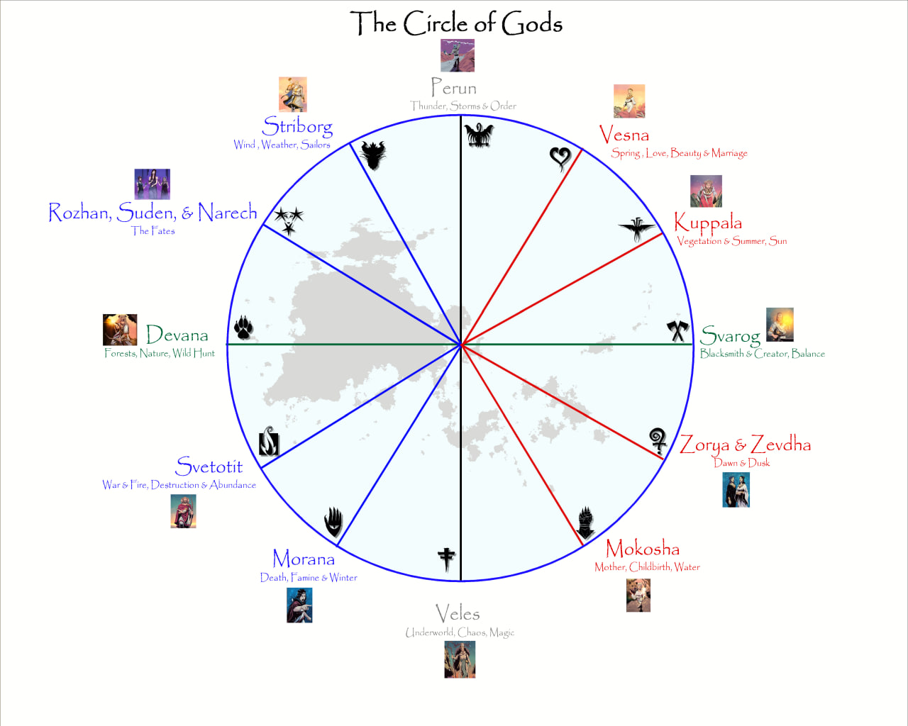
The landmass is the region I am using for a RPG Gaming aid.
-
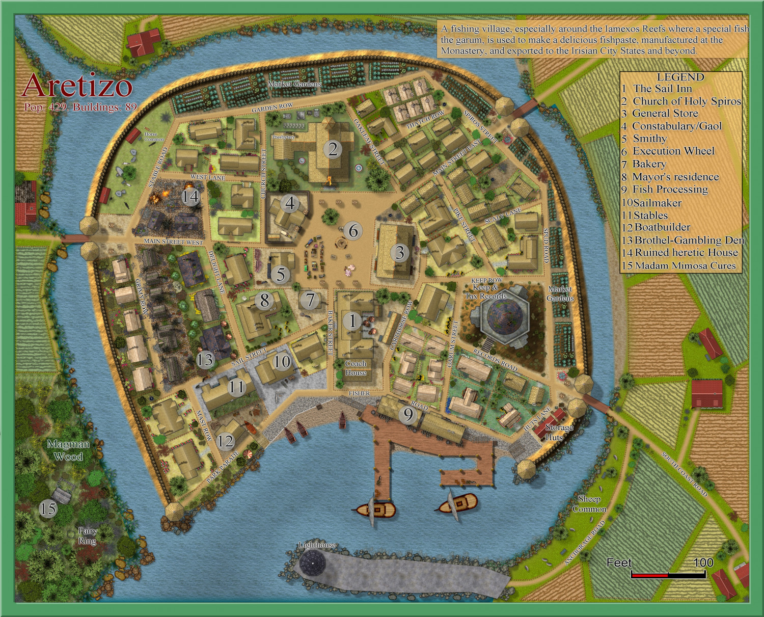
Community Atlas 1000th map Competition - with Prizes [August/September]
My competition entrant now finished.
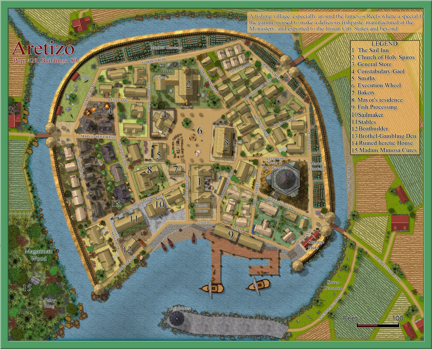
REVISED 7th September. Added a small black dog in the central square and his name as the beach to the right. It is of course, my beloved Schipperke dog, Ahab. Plus a few minor changes. Larger version in the Gallery
Image Gallery: Hardin — ProFantasy Community Forum


-
[WIP] Community Atlas Competition - Artemisia - Spiros Isle - Aretizo village
OK, here it is complete.
@Monsen Can you check the fcw to make sure all the fills and symbols comply with Atlas rules? Please.
A larger version is in the Gallery: Image Gallery: Hardin — ProFantasy Community Forum

