


Loopysue
Loopysue
About
- Username
- Loopysue
- Joined
- Visits
- 9,978
- Last Active
- Roles
- Member, ProFantasy
- Points
- 9,861
- Birthday
- June 29, 1966
- Location
- Dorset, England, UK
- Real Name
- Sue Daniel (aka 'Mouse')
- Rank
- Cartographer
- Badges
- 27
Latest Images


-
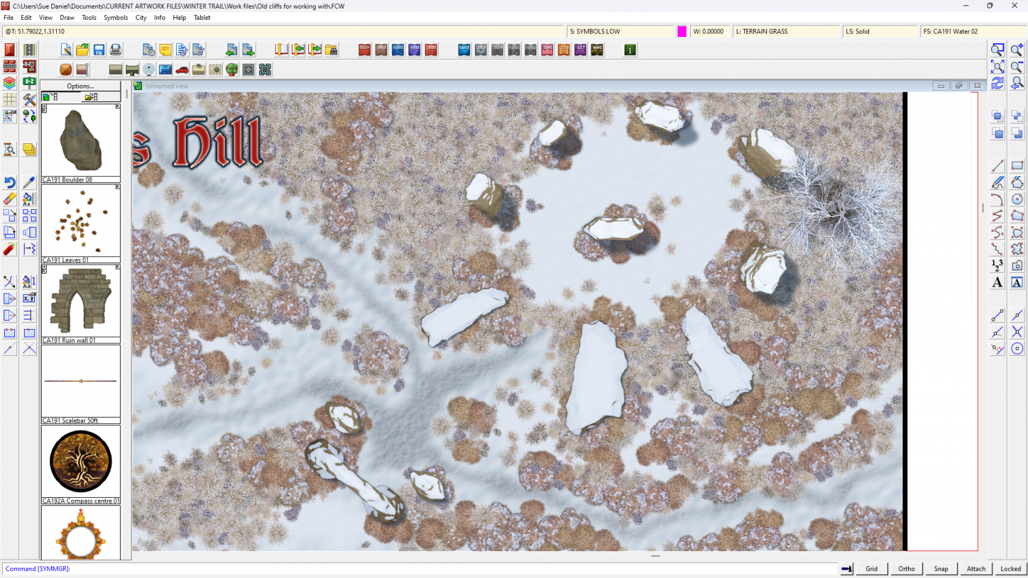
Winter Trail Project
Got the stones sorted out as well now. Quite a good day, really :)
![[Deleted User]](https://secure.gravatar.com/avatar/c75d9a245b74d9c59be0999ea81ca541/?default=https%3A%2F%2Fvanillicon.com%2F92add7f8c954488718110edc4896ad39_200.png&rating=g&size=200)

-
Dhakos, The City of Spires - Watabou Cities Annual
If you are working on top view maps it's a question of shadows.
A spire would be either a circular roof or some regular polygon shape, so they can be drawn using the House tool with a roof texture of your choice, on a sheet above all the other building sheets in the map so the long shadows they cast will fall over everything else. Or you could pick from the City Domes annual issue https://www.profantasy.com/annual/2018/bonus18.html which contains all kinds of small regularly shaped rooftops that could top a tall tower.
A spire might have a tall pinnacle above that roof, so you might need another sheet above that one to draw simple very thin pointy shadows to suggest that the little 'bobble on top' of a roof is actually the pointy bit of the spire.

-
Live Mapping: Secret Info and Interactive Maps
Hi Everyone! :D
In tomorrow's live mapping session Ralf will be digging into how to add various information overlays and interactivity to a CC3 map.
You can watch it here if you like:
Or come join in the conversation on YouTube here:

-
Post-processing Map to Age It
There are lots of different things you can do, but possibly the easiest if you happen to have an image of an old piece of parchment is to import that image onto a sheet that has a Blend Mode sheet effect on it set to multiply right at the bottom of the list of sheets (on top of everything else in the map).
I expect lots of others will come along and recommend more ways of doing it that are equally good, but that is one way of doing it within CC3.


-
Post-processing Map to Age It
I'm not sure I know for sure what you want, but I did write a blog a while back about achieving various map effects here:
There is a bit about increasing the contrast (number 3), and if that's not what you meant there are several other effects that might be the one.
-
can't view all of my map
Hi Helen :)
At this stage, where none of us know what extent or position everything should be in the map it might be easier to make a new HW map of the correct extent and then copy the details you want from the old map across to the new empty map. You can position everything as you paste it then. Be careful to only have the things you want to keep still visible as you copy. Hide things like the map border, screen and background before you copy from the old map.

-
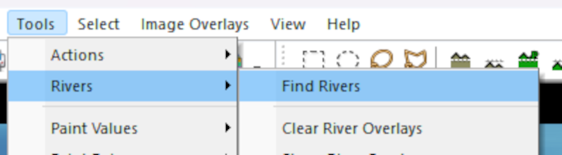
Rivers
After you have filled the basins:
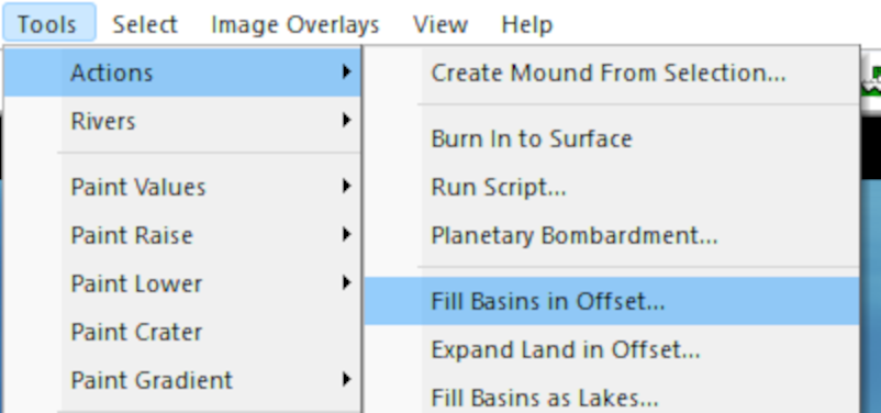
Pick the option to Find Rivers:
That is when you will be given the dialog where you can set up your rivers:
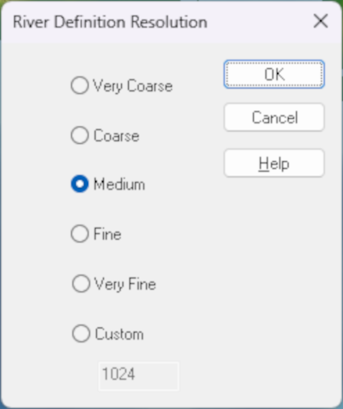
When you click OK in the first box, the second one is where you can set the river length and pick the colour of your rivers:
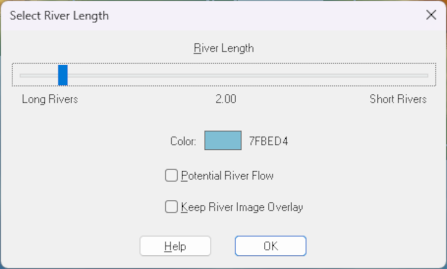
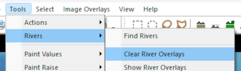
I don't think you can change the colour once they have been created, but I may be wrong. If I'm right about that it is relatively easy to delete those rivers and repeat the process with a different colour. To delete existing rivers pick Clear River Overlays:

-
March 2023 humble bundle
The bundle is an encore or repeat of the Maps Bonanza humble bundle from 2021.
-
Ss6 not working
Just to make sure we are all talking about the same thing here, this is a screen shot illustration of the process Ralf described.
Click the new map button...
That brings up this dialog:
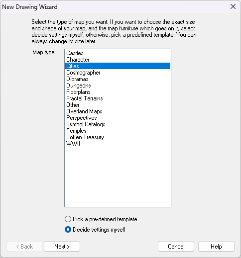
Then you select the Cities option and click Next, which brings up this dialog:
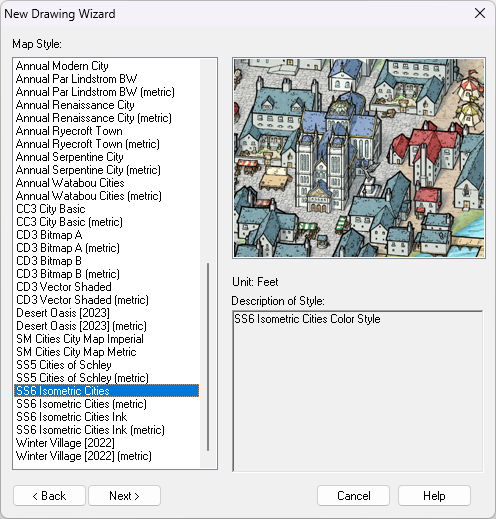
If SS6 is installed you should find the highlighted option near the bottom of the list - shown in the above screen shot.
Then you click Next again and go through the process of creating a new map in the SS6 style.
The question then is: which part of this isn't working?

-
Any Feedback to my first CC3+ Map?
A sky island...
When you turn the sheet effects on you could try dding a Drop shadow sheet effect to the LAND sheet, to make it look more like it is flying.


