


Loopysue
Loopysue
About
- Username
- Loopysue
- Joined
- Visits
- 9,971
- Last Active
- Roles
- Member, ProFantasy
- Points
- 9,853
- Birthday
- June 29, 1966
- Location
- Dorset, England, UK
- Real Name
- Sue Daniel (aka 'Mouse')
- Rank
- Cartographer
- Badges
- 27
Latest Images


-
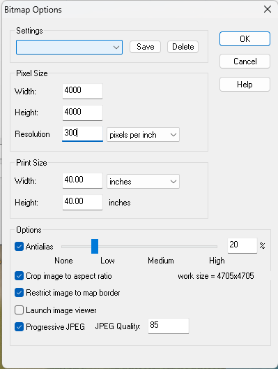
Cosmographer resolution problems
The size of the map in CC won't affect the size of your export.
Hit the Options button once you have selected your bitmap export type, and use any of the controls in the dialog that opens to increase the size, resolution and other output options.
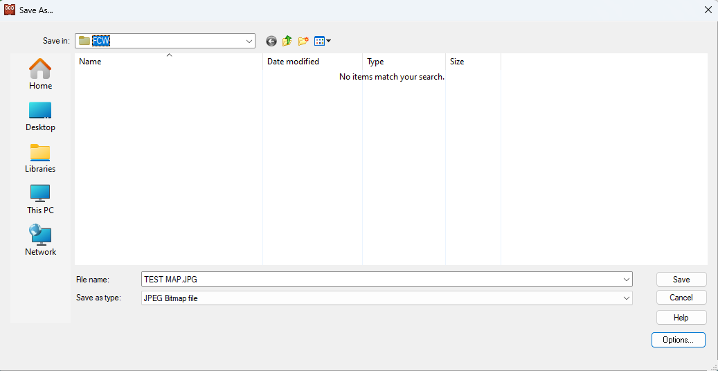

You can use any parameters you like, as long as the "Work size" (bottom right of the dialog) doesn't go much further than 10,000 x 10,000.


-
Birdseye Continental - style development thread
There wasn't much of a highlight on the lit side. I've tweaked them to show more light there now. Do they still look like holes?


-
Questions about converting into a png file
@Quenten You're welcome :)
It does relate to the thread more than you think, because it explains why AA shouldn't be used to export an image when you intend to remove the background in GIMP or PS. Using the colour picker to pick the background is complicated by the many different shades of variation around the edges as Remy pointed out above.
There is a way around it in GIMP, but it is a crude method and doesn't always work very well. I pick the background white with the selection colour picker, invert the selection, sharpen it, shrink it by 1 or maybe even 2 pixels, invert the selection again and then delete the background along with the fuzzy edge. It is much easier if the fuzzy edge created by AA doesn't exist in the first place.
![[Deleted User]](https://secure.gravatar.com/avatar/c75d9a245b74d9c59be0999ea81ca541/?default=https%3A%2F%2Fvanillicon.com%2F92add7f8c954488718110edc4896ad39_200.png&rating=g&size=200)


-
Birdseye Continental - style development thread
I'm messing with the colours. I made all the tree textures darker and adjusted the rest of the textures to fit.
An improvement?
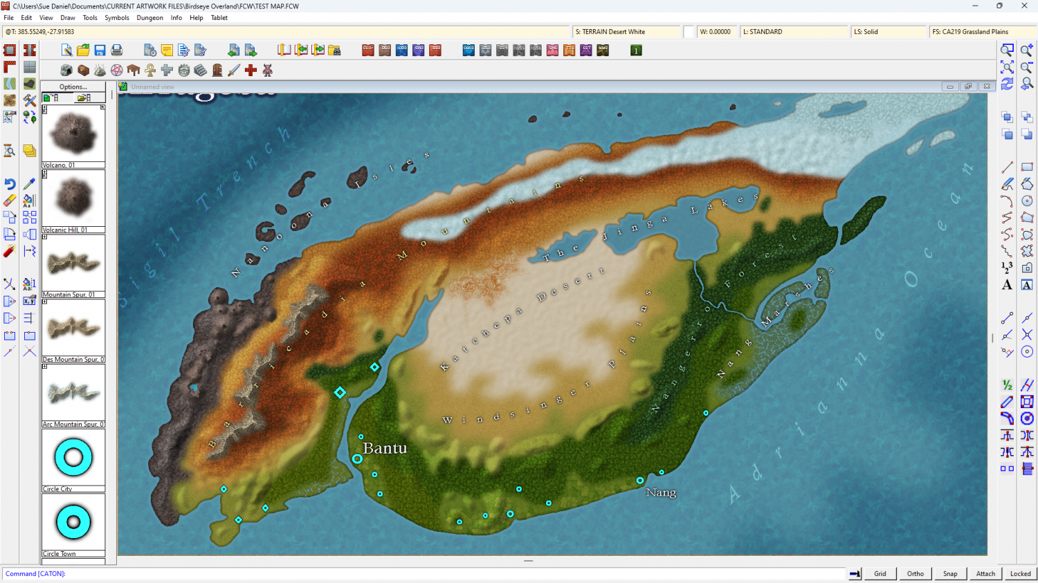
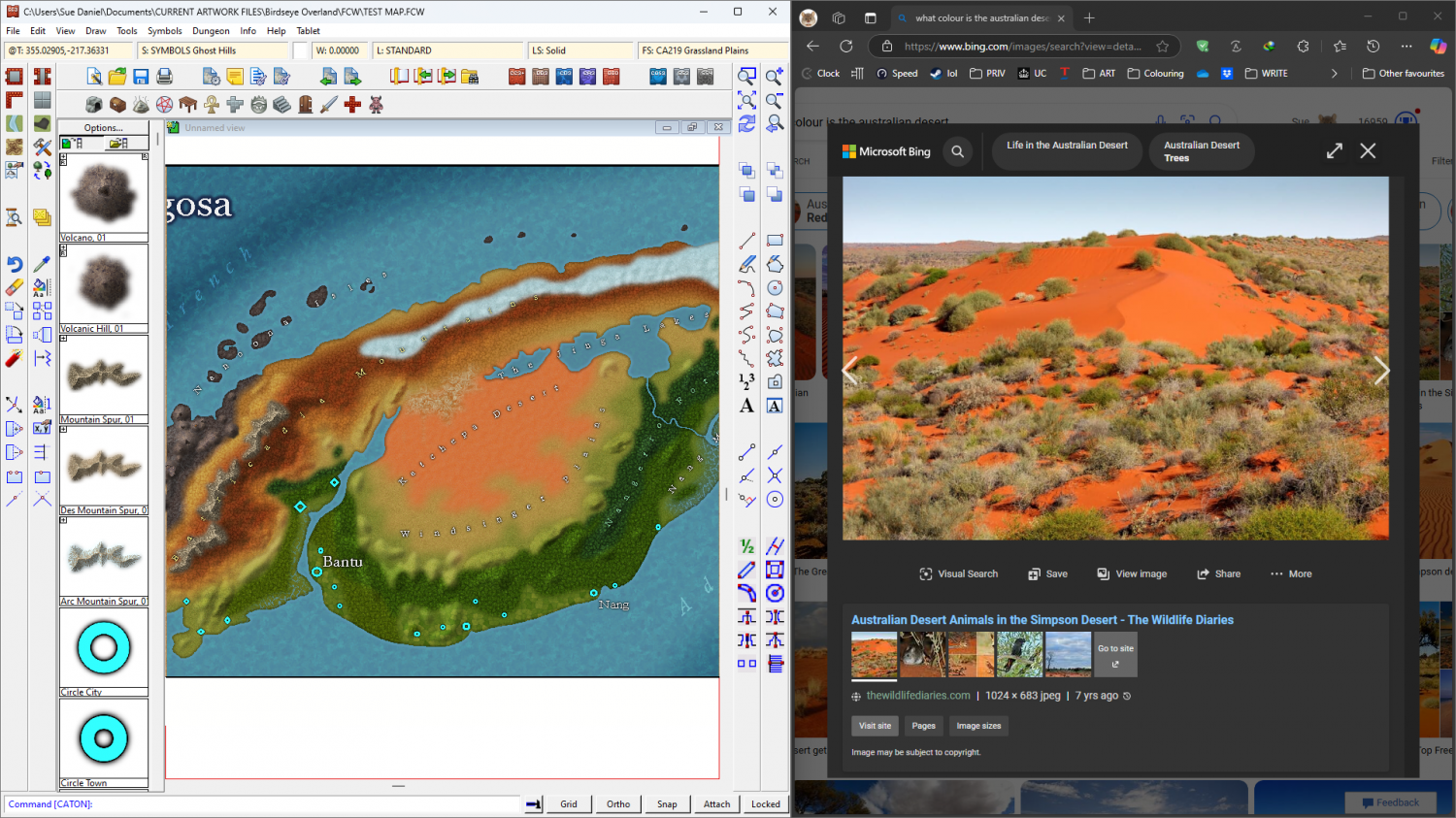
Personally, I'm not very keen on the red desert alternative, but it's a real thing. What do you think?

-
Community Atlas competition: Kristol Caverns
And now I am wondering if a longer bevel would be better.
I'm also thinking about adding something to that southern end. It looks a bit bland.
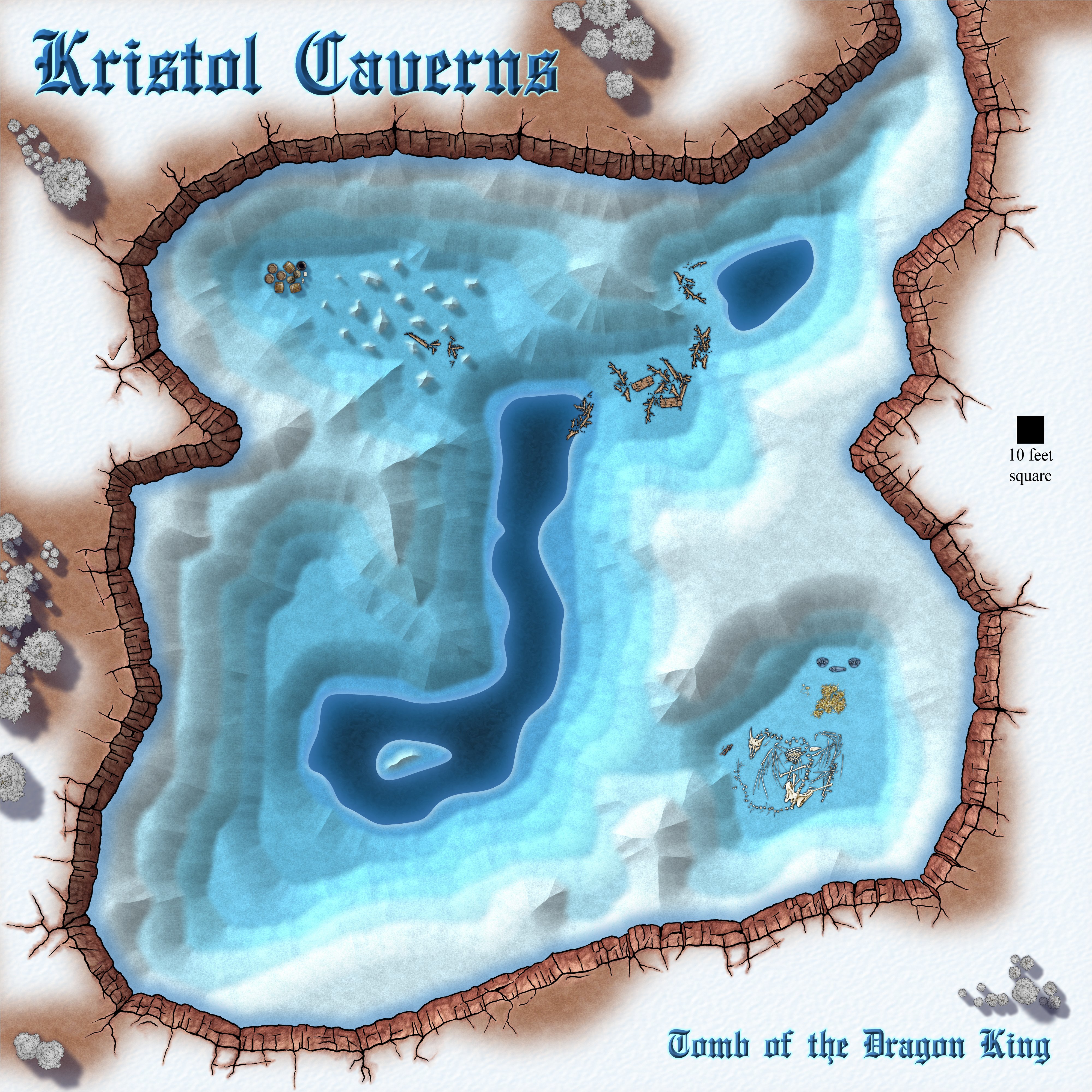
Long bevel, or short bevel - what do you think?


-
Community Atlas 500th Map Voting Thread - Please vote
Sorry! I give you a thumbs up for thanking Remy, but when I reconsidered I realised it might have looked like I was agreeing that your work was rubbish. It's NOT rubbish. So I took back my thumbs up.


-
Marine Dungeon - further developments
Thank you both for your ideas :)
I have to start Darklands City soon, but I think I might have to find a few more hours to do some more on this.

-
Map with x signs
Have you moved or renamed any of the folders or files in the C:\ProgramData\Profantasy\CC3Plus\Symbols folder?
You may find this blog article by Remy useful: https://rpgmaps.profantasy.com/why-do-i-see-a-red-x/


-
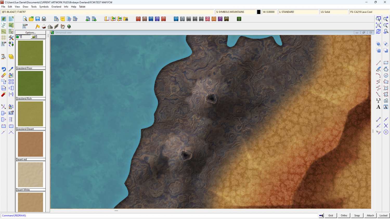
Birdseye Continental - style development thread
First stage of refinement for the now-named "Mountain Spine 01" symbol.
I've been staring and staring at Google Earth images of the Himalayas for ages and decided the easiest way to do this in a CC3 map from above is to make a spine and stick side ridges on it here and there.
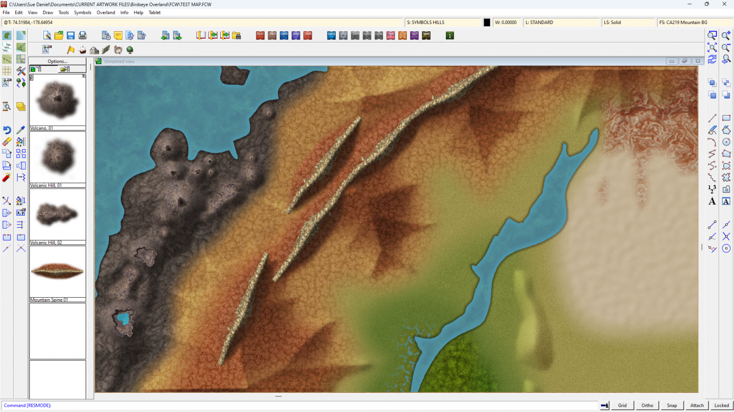
The old bevel mountains are still visible at the moment. I'm using them as a reference for the colour and shade required.
Once I've worked out how to do the ends, and whether this is possibly a connecting symbol or better placed by hand, I can do variations in wiggly-ness, curve and length.

-
Frozen arctic lands
Maybe if you thin them out as they get closer to the snow line so you end up with a sort of edge fade, but done in tree symbols?


