


Loopysue
Loopysue
About
- Username
- Loopysue
- Joined
- Visits
- 9,968
- Last Active
- Roles
- Member, ProFantasy
- Points
- 9,852
- Birthday
- June 29, 1966
- Location
- Dorset, England, UK
- Real Name
- Sue Daniel (aka 'Mouse')
- Rank
- Cartographer
- Badges
- 27
Latest Images


-
Lighning Rendering problem
That is most usually caused by the lights not being present in the current render pass, and not accounted for in the total light falling in the current render pass. At a guess that image took 2 passes to render.
Type EXPORTSETMPPP and hit enter.
The number showing in your command line will most likely be 4000000 (4 million)
Type 40000000 (40 million) and hit enter.
That will expand the size of each pass over the map as it is rendered, and hopefully prevent the artefact by completing the whole map in a single pass.


-
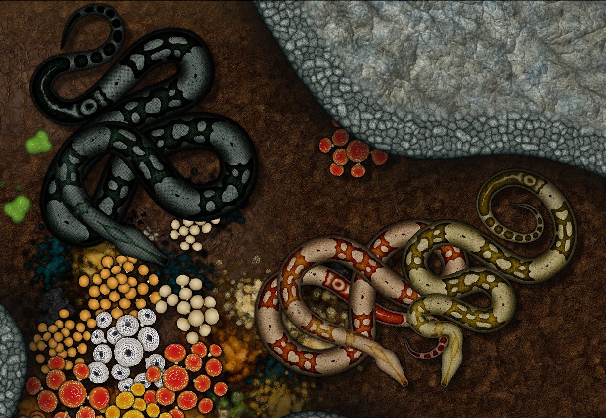
The Creepy Crypt project
I think this is all of them so far. I say 'so far', but I can only add more snakes if I get to the end of the wish list and still have some time left.


![[Deleted User]](https://secure.gravatar.com/avatar/c75d9a245b74d9c59be0999ea81ca541/?default=https%3A%2F%2Fvanillicon.com%2F92add7f8c954488718110edc4896ad39_200.png&rating=g&size=200)
-
Birdseye Continental - style development thread
Maybe this is slightly better?
Or even more discontinuous?


-
ProFantasy is looking for a web developer and graphic artists
Profantasy is a most excellent employer - the best I've ever had in all my 57 years :)


-
Birdseye Continental - style development thread
Thanks Quenten :)
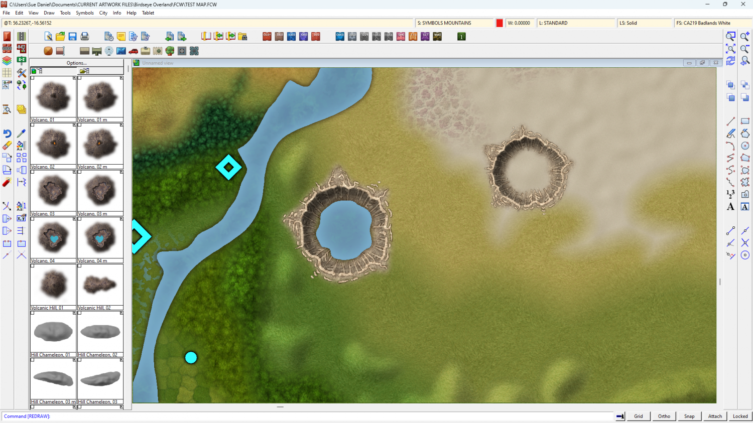
A crater sample.
The water in this style is drawn over the top of everything else, like in city styles, so it's easy to add a lake.
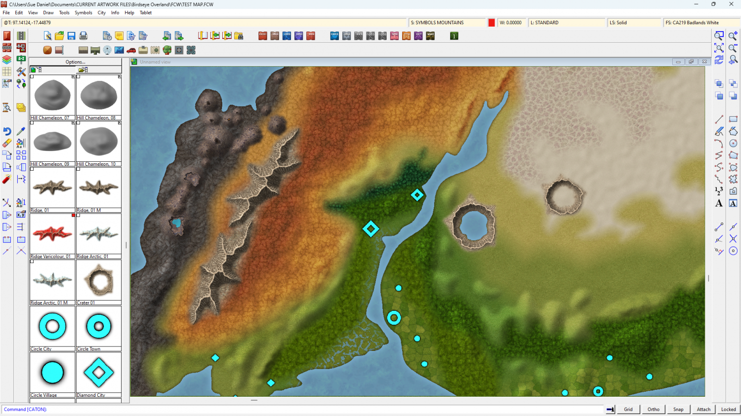
I am thinking that the structure markers might be a little too large at this continental scale. What do you think?
For reference, the larger crater is 90 miles (144 km) across.


-
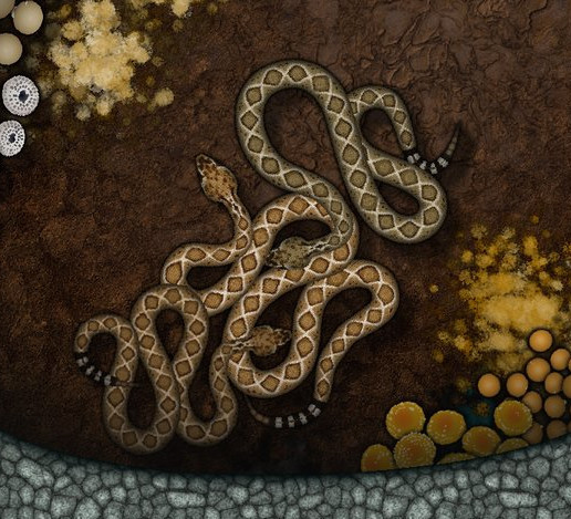
Grimdark Fantasy (renamed "Darklands") - development thread
@Wyvern - Thank you :) I did two volcanoes the end, and three versions of each one so you could have an active volcano setting without half the map being covered in ash clouds. Since this isn't going to be a huge set I think I might have overdone it at that.
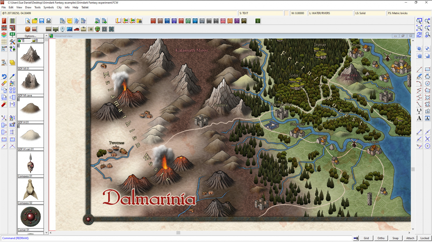
@Quenten and @thehawk - Thank you :)
Ok, I admit I have been fascinated by Etna just recently, and I've also been a long-term fan of Kilauea's current Helama'uma'u crater eruption at the summit. I check the webcams every evening when dawn breaks in Hawai'i and the lava glows red for real in the low light. Though recordings of the Fissure 8 eruption in 2018 (recently given it's official new name of "Ahu‘aila‘au") are more impressive than the current eruption.
@Autumn Getty - I come from a place where there are large tracts of lowland heath not far to the east (since we don't have any mountains in Dorset), so purple is very natural for me, but you can probably do different colours by leaving that fill out and adjusting the background colours to suit :) Colour theory is fascinating, but not entirely necessary for mapping ;) And never be afraid to say what you think, even if you didn't find a thread until late on. A conversation isn't complete if there is anyone who wants to speak but doesn't, and anyway... I find your contributions interesting. Having them gives the thread a more balanced feel - all views are welcome :)

-
Community Atlas competition: Kristol Caverns
Version 1, after a lot of messing around and false starts. I'm starting at the very bottom and working up to the top, level by level. Haven't quite decided if there will be anything desirable or dangerous in the water.


-
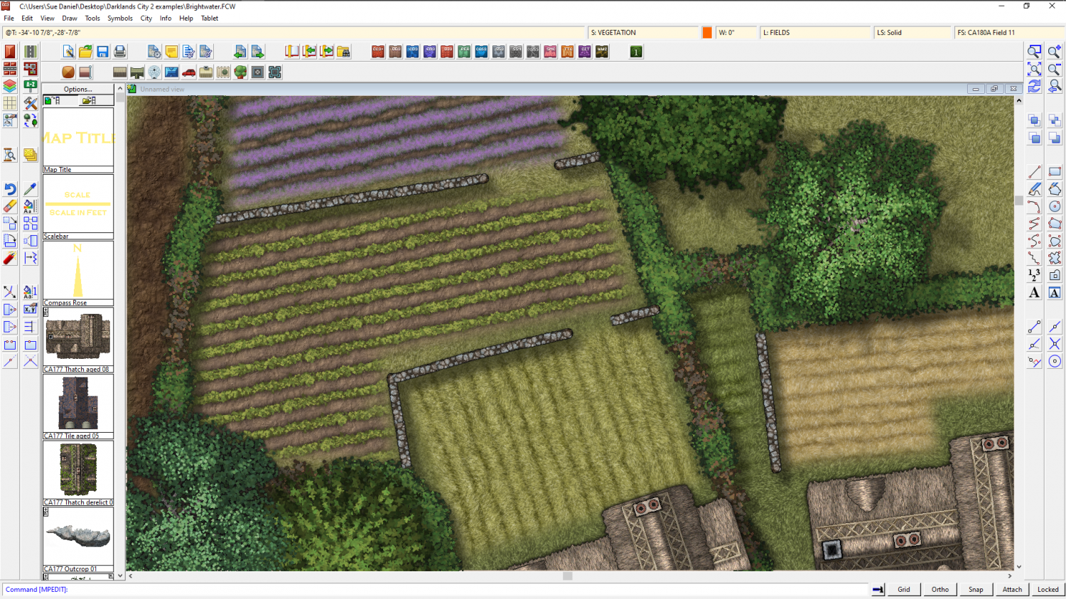
Watabou City REVISED (annual 157)
Ok. I think it's coming along pretty well. The main thing I would adjust if I was using it myself for a map is the hills. I would use effects and settings similar to those found in SS5, though I adjust those to make the bevel lighter again than it is in the template.
The HILL sheet uses polygons of "Solid 20", and my personal settings for the Bevel, Lighted sheet effect give the hill a highlight as well as a shadow. It's personal taste, of course, but I find the template setup makes the hills a little too dark for my liking.

These settings also use a lot more smoothing than you have in your template. It gets rid of the knife edge ridge which feels a bit unnatural for a relatively small hill - unless they are meant to be mountains.
Having sufficient edge fade on the hill after the bevel also helps to make the hill look like it's a rise in the ground, rather than something stuck down on top of it - a curve into the slope rather than a sharp line, or a line that hasn't been faded enough with a wide enough EFI. I increase mine from 10ft to 15ft, though it could be wider.


-
CA style development - "Darklands City" (issues for September and December 2021)
Ah.
Gates...
Well, I guess for now you might have to walk along and find a hole till I work out how to fit one into the hedge.
Or maybe just leave a gap?
At least, that's what I've done with the walls I just made.
-
Making a Mountain
Height in a CC3 map is always an illusion. We don't currently have any heightmap features in CC3. Automatic roof shading is achieved by a specialised normal map applied to each building the moment it is placed in the map.
CC3 normal maps are linked with the symbol file in the symbol graphics folder, and only contain information about how steep the roof is, and which direction it is facing relative to the sun as blue and red components.
The connecting cliff symbols have normal maps that function in the same way, which is why they look darker on the face away from the global sun once they are pasted into the map. However, connecting symbols don't scale - as you have already discovered.
If you want to make the connecting cliff symbols bigger you have to draw the line of cliffs at the default scale, and then scale the whole thing up as one long snake of cliff symbols, which is easier to do if you group them first. That can still be tricky, though, because it requires that you can draw a miniature version of the cliff line by eye, perhaps to one side of the map.
Alternative methods that you haven't already tried out are a bit more complicated. You could make your own relief shading sheet like this one I did for a city on a very steep island city, lit from the south east.
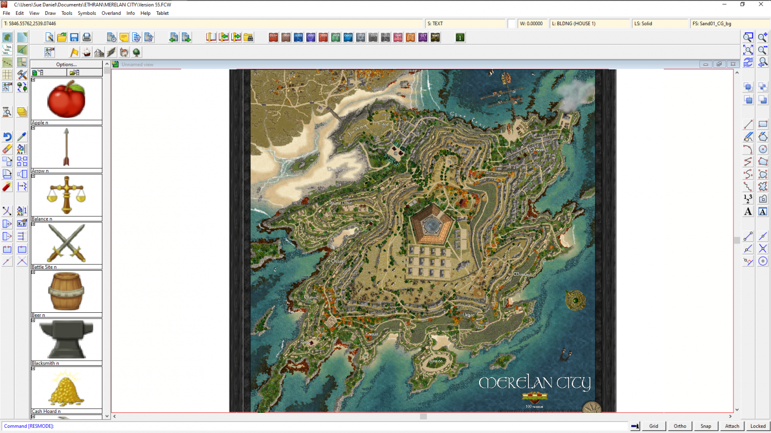
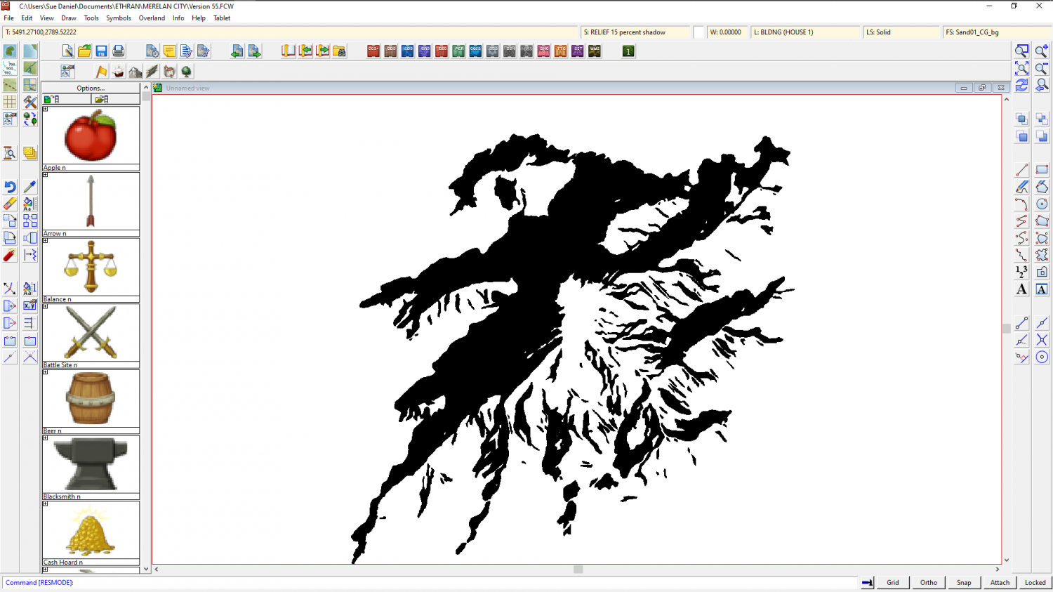
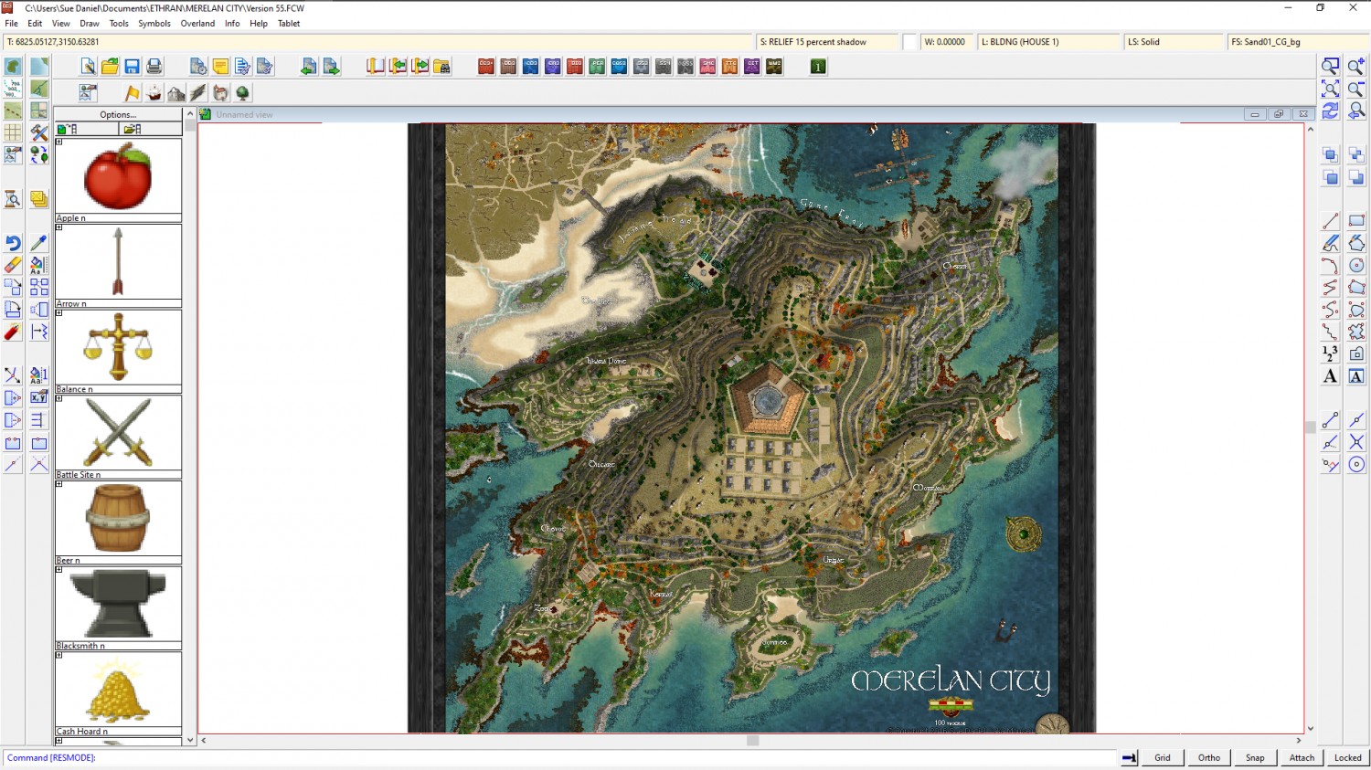
But that requires that you have an eye to see where the shadow needs to be in the first place. All good if you do, but if you can't see it in your imagination first I don't recommend it.
Another hand drawn method I've tried is explained in this blog article here: https://rpgmaps.profantasy.com/orde-on-the-rock-map-analysis/. It's a bit easier than Merelan City, but it will take a bit of time and care to set up. If I were trying to convert this map (image below) into a hollow mountain I would sink the entire city into a dungeon-style depression into the top of the plateau to give the illusion of a cave with the top of the mountain sliced off.

The FCW file for this map is contained in that blog article if you want to use it as a base for your own map.
These are not the only ways of generating the impression of height differences in a map. There are plenty more, like Shessar's tutorial here: https://forum.profantasy.com/discussion/9155/dd3-battlemap-tutorial-part-3-adding-contours


