Loopysue
Loopysue
About
- Username
- Loopysue
- Joined
- Visits
- 9,987
- Last Active
- Roles
- Member, ProFantasy
- Points
- 9,864
- Birthday
- June 29, 1966
- Location
- Dorset, England, UK
- Real Name
- Sue Daniel (aka 'Mouse')
- Rank
- Cartographer
- Badges
- 27
Latest Images


-
The Creepy Crypt project
@JulianDracos - Oh dear! I came back to this after a couple of hours and realised a friend who whispered in my ear that I had rather put a downer on the idea of mausoleums was right. I have, haven't I.
Sorry - my bad!
The tombs I will make for the set should double as above ground mausoleums, and should also be reasonably compatible with existing DD3 stuff, if that helps?

-
Land Editing not Affecting Coastline in M.S. Ink
There's a loop in the line at that point. If you look at it as if it was a road you were driving down starting from the left, when you get to that point you are heading to the northernmost point first, and then the southern point second. Jim is right - you just need to decide which of those points is the one you want and delete the other one using the delete node tool |CC2DELNODE|.
If you are having trouble hitting the point it's not at the very tip of the line because the line has a width. The nodes are in the centre of the line width, so it will be a short distance in from the tip of the point.
-
How to draw an arrow???
Hi davehetfield :)
If you right click the Line tool on the left toolbar you will get a menu that offers "Line with Arrow".
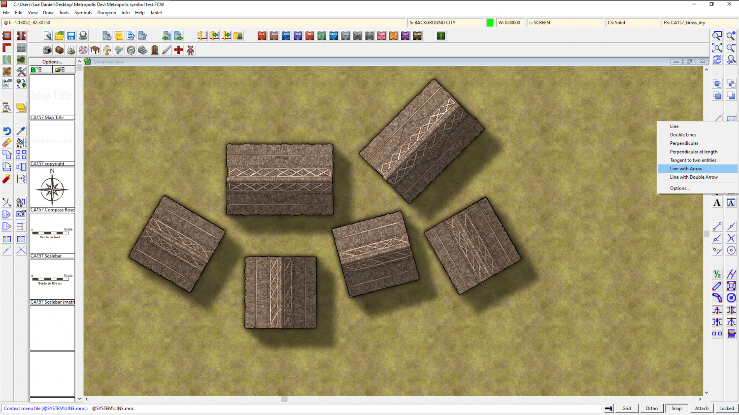
However, there can be limitations with the automatic arrowheads if you want to have a thick arrow, so what I quite often do is draw one myself using ordinary lines and the snap grid, and then copy/clone it to other places on the map where I need them.

-
cutting up a continent
Are you saying it was too slow on the larger map? That can make things seem uncertain. Other than that things should behave the same way if you do them the same way between maps.
If things are slow now before you ever add anything but the land, then it could be that you have too many nodes for comfort. The problem only multiplies as you add terrain and trace along the existing coastline for the edge. If this is ringing true to what you are seeing, I recommend using the SIMPLIFY keyboard command to reduce the total number of nodes. You would be surprised just how many of the nodes in a coastline don't actually do anything because they are too close together to be noticeable.
-
Running from USB External Device
Hey that's great news Shessar! I really miss your maps :)
-
WIP: The Rocks, Sydney 1930's Street Annual
If this is a real place, the scale can be found from a conventional map of the area. If not, then your guess is as good as mine.

-
cutting up a continent
You're welcome :)
I learned everything I know on this forum, or from the many video tutorials and live mapping sessions, and from the Tome, but most of it was by asking questions right here - so I'm just passing things on in the traditional way ;)

-
How to draw an arrow???
If the lines are already drawn you can use Change Properties to give the lines a line width if they have none, or to make the line width thicker. Rather than guessing how thick the line is to start with, you can use List from the Info menu to find out how thick the line is before you start.
-
How to draw an arrow???
That's why I generally draw my own arrowheads and copy and paste them on the ends of all the arrow sticks.
-
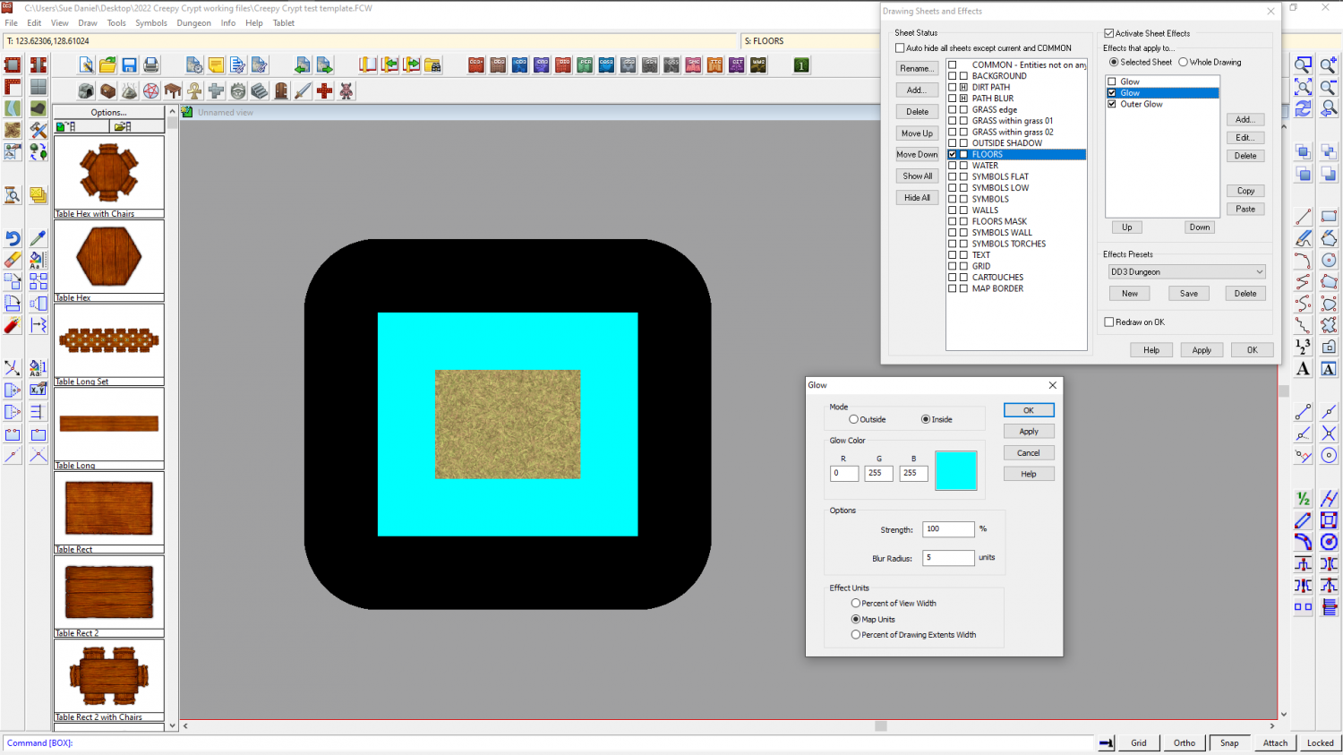
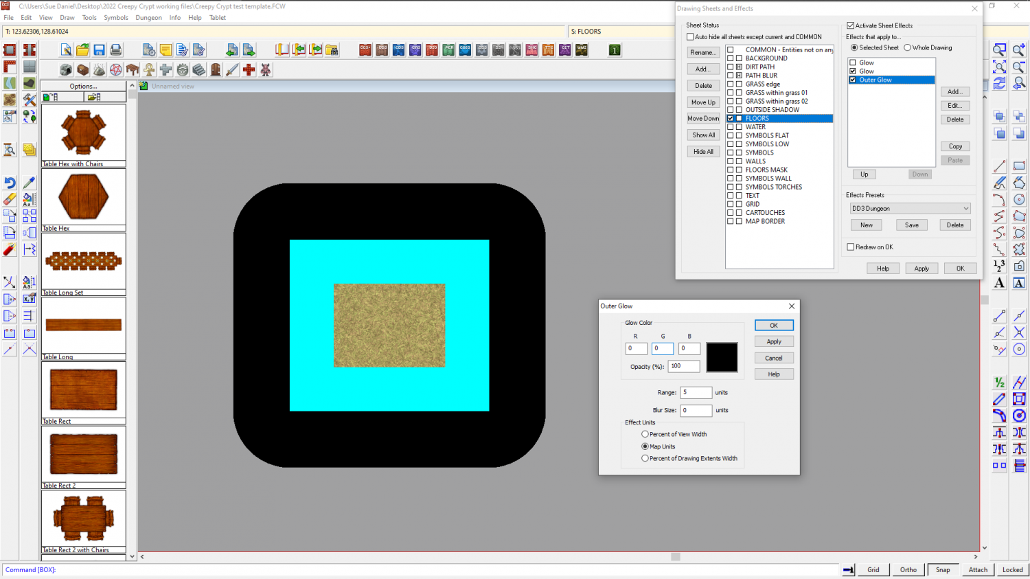
Tracing an edge
Lines can be prone to this, and so can offsets, so there's no point in me suggesting that you use offsets instead.
In this situation, where the borders don't have an edge of something to follow (like the land itself), I would probably add a temporary sheet effect or two to the land sheet to use as a guide to hand draw the border. This is a square of grass texture on the FLOORS sheet of this dungeon map I'm working on. I've added two temporary sheet effects to mark a 5 map unit distance outside and inside the perimeter of the grass square. The outer corners are rounded, but if you were measuring exactly that amount from the corner they would be rounded.
This is not the normal use for glows, so I have shown you both effects so you can see how to set them up to use them like an automatic guide.
I would delete them both when I was finished.