


Loopysue
Loopysue
About
- Username
- Loopysue
- Joined
- Visits
- 9,993
- Last Active
- Roles
- Member, ProFantasy
- Points
- 9,868
- Birthday
- June 29, 1966
- Location
- Dorset, England, UK
- Real Name
- Sue Daniel (aka 'Mouse')
- Rank
- Cartographer
- Badges
- 27
Latest Images


-
Pencil Sketch Overland
If you don't mind having to learn a new app, there's a free bitmap editor called Krita that can help with the seamless tiles. I once used it to draw all the seamless tiles in the Ferraris Style, but I've forgotten a lot of how to use it these days.
Basically, you open or create your square tile and press SHIFT+W for the tiled view, and then you can draw on it right across the tiled view disregarding the edges.
I wish more bitmap editors provided seamless tools.
-
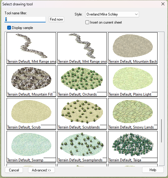
fill style locations
You should be able to import the one you want by creating a new and temporary Mike Schley overland map, and then importing that dummy map into your own map - pressing the ESC key just before you actually paste it.
That will cause any missing Mike Schley fills to be imported, even though you never actually pasted the dummy map.
Doing it that way will also automatically scale the fill correctly for you.
Once you have imported the fills you can switch to the "Overland Mike Schley" drawing tools in the dropbox at the top of the drawing tool dialog and grab the correct drawing tool for the farmland.
EDIT: although looking at the names in my drawing tool list there seems to be a bit of a mix up on my system at the moment. I'm sure yours will be fine.
-
Pencil Sketch Overland
Krita is better quality, but if you are happy with the GIMP version that's fine.
-
Cavern Symbols - Stalactites/Waterfalls
If you search for stalagmite in the C:\ProgramData\Profantasy\CC3Plus\Symbols folder, you might come up with a few. That will give you the location, and therefore the style. There aren't that many, but there are a few.
Same for waterfalls.
It really depends on which parts of the full set you haven't got.

-
Pencil Sketch Overland
That was the drawback. Krita works well and gives good results, but it takes a couple of days to get used to it.
This video covers the basics in Krita, though you have to use your imagination to see how it can be applied to the kind of tiles we make.
I recommend using tiles that are 1-2000 pixels square, rather than the smaller size demonstrated in the video. Use larger tiles when the pattern is something large, like rocks (when the repeat becomes rather more obvious on smaller tiles), and smaller tiles where the pattern is something fine grained, like sand or grass.
-
WIP Thyra
Yes, the original Color Key matches the canals you drew - in that blue colour.
If you switch off the sheet effects you see them light blue, instead of the ocean. They are cutting (at least on my machine they are), but adding a magenta patch as you did in your screen shot above won't work until you add the second Color Key as Joe indicated.
No sheet effects.
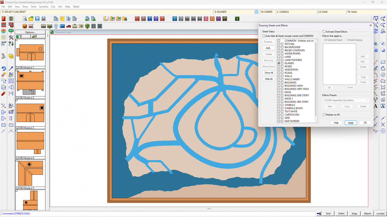
Sheet effects.
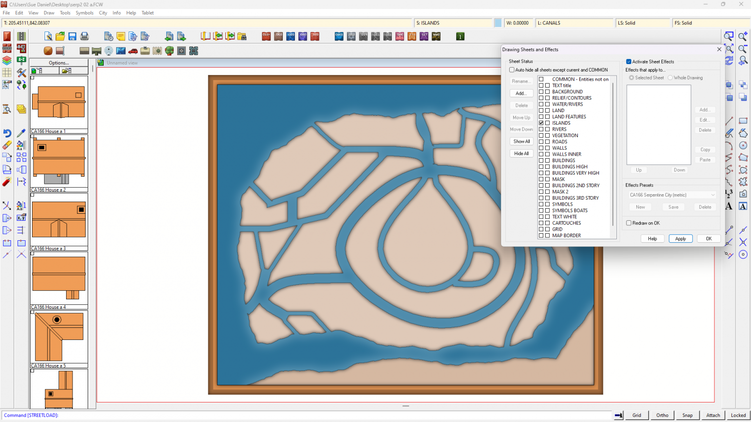
Don't delete or alter that first Color Key, or these blue shapes will no longer work. Just add the new default one.
-
Live Mapping: Naomis Floorplans. 28 Nov
Hi Everyone! :D
Next week, Ralf will be creating a tavern layout with the Naomis Floorplans style, which is included in the Humble Bundle offering: Maps Extravaganza 2024.
Come watch it live and join in the chat here on Youtube: https://www.youtube.com/watch?v=Ondg6forUKM
Or if you prefer you can watch it here on the forum (no live chat on the forum)

-
How do I fix the lines on my map?
Hi Otaku :)
The blue lines are eminating from the objects on the CONTOURS (LAND) sheet because the line width there is greater than zero.
There are duplicate entities on the LAND sheet, and the COASTLINE entities aren't behaving properly at all, I recommend working with just the CONTOURS (LAND) sheet entities and deleting the entities on the LAND and COASTLINE sheets. I've written a more detailed suggestion below.
Please work on a copy of your original map in case anything goes wrong, or in case I've completely forgotten to tell you about something.
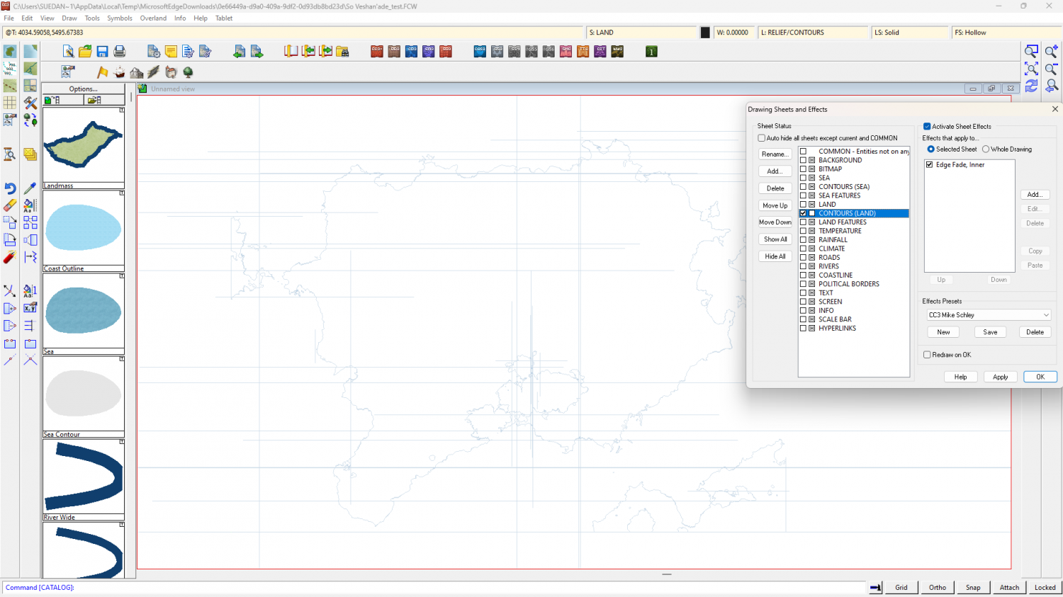
Step 1 - The first thing to do is isolate and delete all the duplicated entities on the LAND and COASTLINE sheets by hiding all the other sheets. Then reshow just the CONTOURS (LAND) sheet.
Step 2 - Switch off the sheet effects (uncheck the Activate Sheet Effects checkbox at the top right of the dialog). Make sure that only the CONTOURS (LAND) sheet is visible. Ok the Sheets and Effects dialog and use the Change Properties tool |CC2MCHANGE|to set the line width to zero for all the visible entities. This should get rid of those grid lines. At this stage you can then use SIMPLIFY on the visible entities if you wish. I found that the shapes were already quite simple and didn't look any more simple until I used a distance factor over 1 (I used 2).
Step 3 - Whether or not you use SIMPLIFY, the polygons on this sheet have artefacts you probably don't want to keep, such as these single lines - 2 node polygon islands and peninsulars. You can use the delete node tool |CC2DELNODE|to get rid of them.

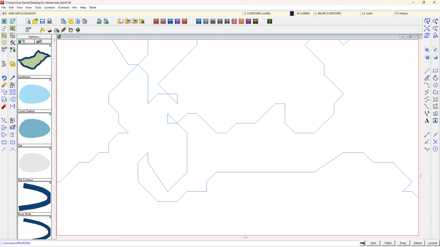
Step 4 - Once you have tidied up all the undesirable bits use the Change Properties tool again |CC2MCHANGE| to set the Fill style (choose the land fill), and the Sheet (LAND), and hit OK.
Step 5 - show all the sheets again and turn the sheet effects back on.
Notes...
There are other ways of doing the same thing, but this one worked best for me in this situation.
The reason I haven't recommended recreating the COASTLINE polygons (the blue line around the edge) is because the staggered nature of the coast does not lend itself well to that method of delineating the land. Any increase in line width, which is what the coastline is - a line with a width, will most likely cause the grid to reappear. If you want to have a blue line around the land as if there is still a coastline present, you can use sheet effects on the LAND sheet to simulate one without that grid problem. If you are unsure of how to do that shout again. Either I or another member will help you.
-
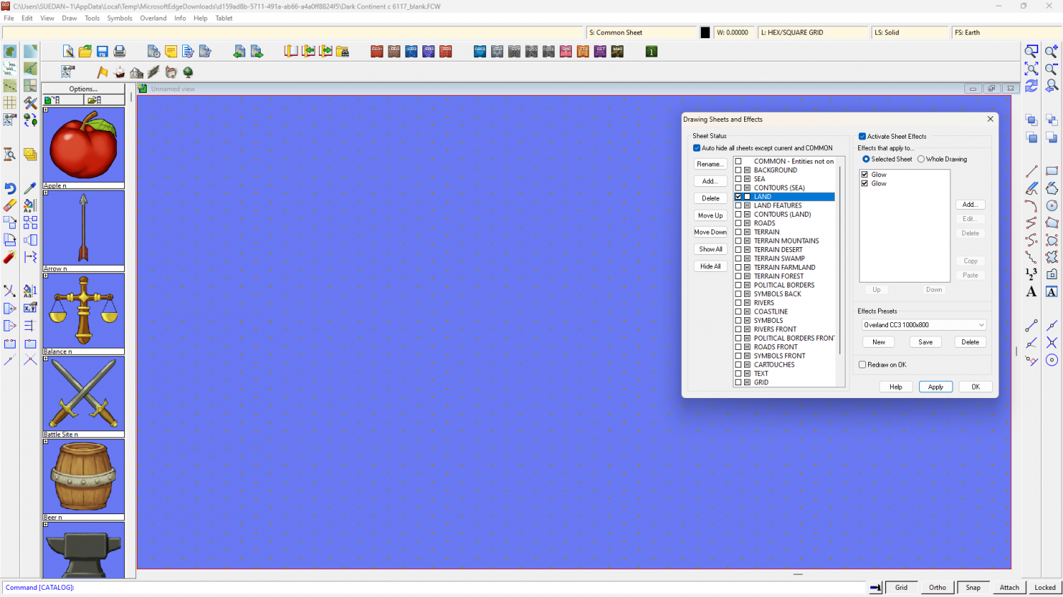
Almost all Entities have disappeared
There are a few things that aren't on the right sheet, but I'm not sure which sheet these things should really be on.
For instance, you have what appears to be the landmass on the POLITICAL BORDERS FRONT sheet, which is on top of most of the other stuff - hence everything vanishing.
This is what's on the LAND sheet.
And this is what's on the POLITICAL BORDERS FRONT sheet
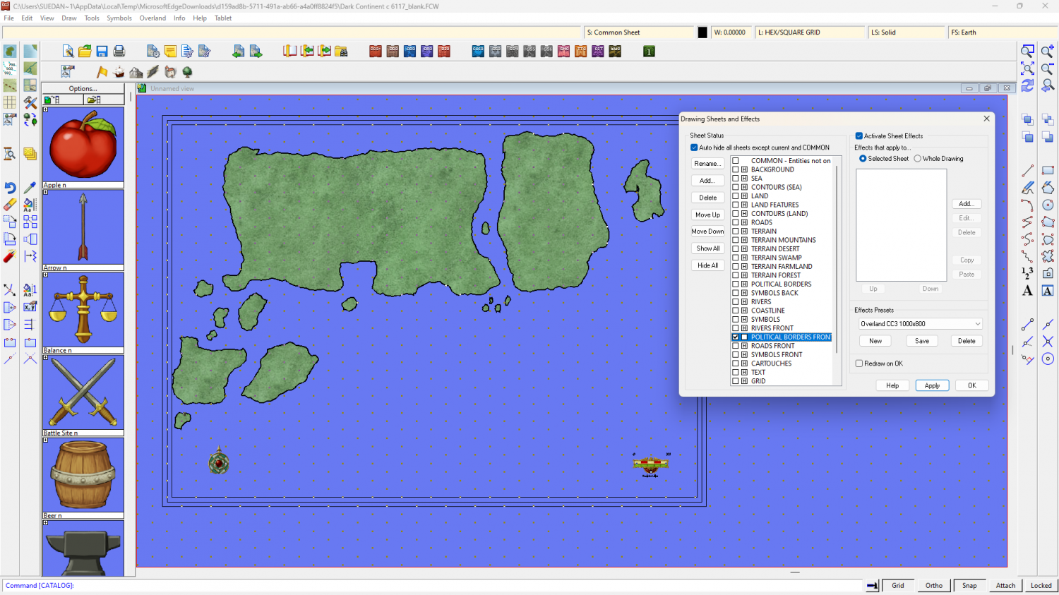
If I start moving stuff around between sheets for you that will leave you in an even bigger mess, so I have turned the background to the sea texture and left everything else as it was.
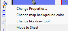
If you want to move things between sheets, like moving the land to the LAND sheet from the POLITICAL BORDERS FRONT sheet, first isolate the POLITICAL BORDERS FRONT sheet by hiding all the rest (that's what is shown in my second screen shot). Then right click the Change Properties button on the left and pick Move to sheet...
Select all the land polygons and hit D for do it, then pick the LAND sheet as the destination.
I've noticed that you appear to have the land polys and a set of identical black outlined polys on the same sheet and layer, so you may have to select by colour or fill to separate them. Select options can be accessed by right clicking when you are asked to make your selection.

-
Birdseye Continental - style development thread
It's only the structures I was thinking of doing fish-eye, and not very much at that. Just enough to show what kind of buildings are under those rooftops.
I promise I will do more structures this time around ;)
Would you like it to be similar in colour scheme to Darklands City?


