


Loopysue
Loopysue
About
- Username
- Loopysue
- Joined
- Visits
- 9,992
- Last Active
- Roles
- Member, ProFantasy
- Points
- 9,868
- Birthday
- June 29, 1966
- Location
- Dorset, England, UK
- Real Name
- Sue Daniel (aka 'Mouse')
- Rank
- Cartographer
- Badges
- 27
Latest Images


-
[WIP] - King's Shire - critique sought.
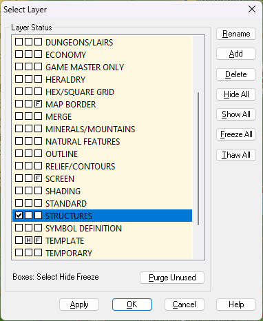
I showed all the sheets and hid all layers except the MAP BORDER on the Area Map and discovered there were 6 entities there. One was a screen. That's the white thing that goes around the outside of the map, and it belongs on the SCREEN layer, not the MAP BORDER.
I put it on the SCREEN layer, but that still left 5 entities on the MAP BORDER layer. However, these were all either lines or polygons with exactly the same extent, so I deleted all of them and replaced them with a single black hollow rectangle of exactly the same extent using the snap grid. It's possible that you may have accidentally copied pieces of the original MAP BORDER while you were working on the map. To prevent this happening I have frozen both those layers with everything in the right place.
Try exporting this version:
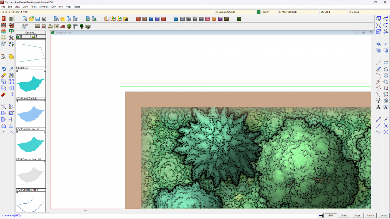
On the Winholme map I found the green lines demarking the MAP BORDER on the MAP BORDER layer were outside the extent for some reason. Not sure how that might have happened, but I have moved them back into place using the node edit tool with ATTACH turned on to snap them to the actual corners.
Try exporting this one:
-
[WIP] Trying to design a barrel roof
Maybe one day, but there are the other 99 things on my list of jobs to do first.

-
MY MUNDI IS READY!
If they are on a separate sheet you could hide everything else and then pretend to delete or move them, and select all of them. That will give you a count in the command line.

-
Live Mapping: Modern Journeys (with Custom Symbols)
Hi everyone!
This week Ralf is back to Live Mapping - trying to relieve his German "Fernweh" by drawing a Modern Journeys map, while also showing how to use some trickery with custom symbols.
Come watch it on Youtube here:
https://www.youtube.com/watch?v=gSJwUzMQsTU
Or you can watch it here on the forum:
If you join the Live Chat we will be asking for requests for future live mapping sessions near the end of the stream.


-
Live Mapping: Modern Journeys (with Custom Symbols)
Thanks for taking the time to make a list. I've copied it all into my new suggestions doc.
-
Shallow waters for an Inner Sea?
Thanks.
Ok, this is really quite easy to set up because you've only just started the map and there's nothing else on it but sea, land and this massive lake.
The first thing I did was hide the COASTLINE sheet.
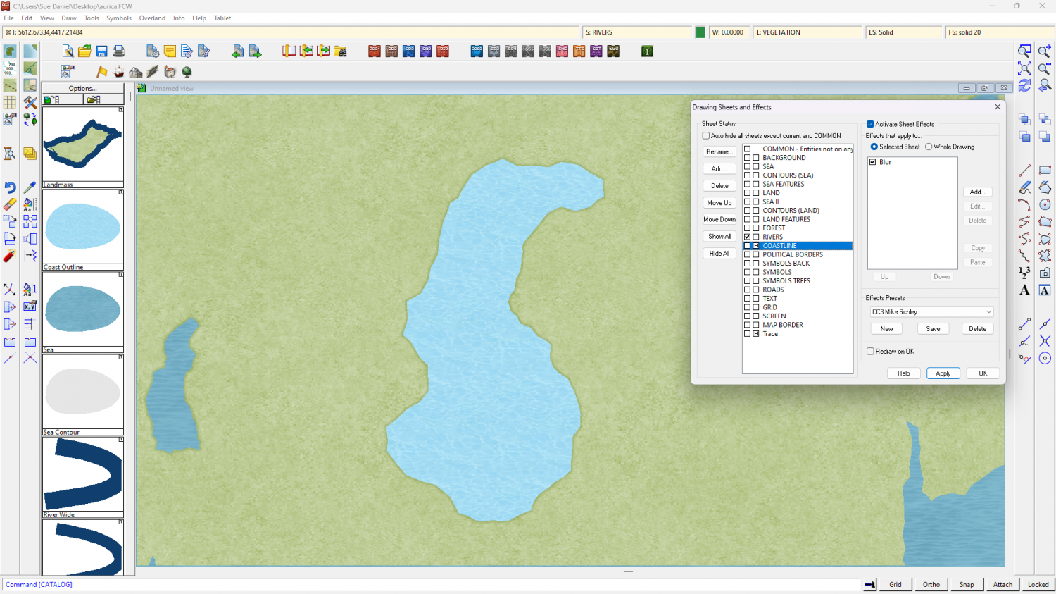
Then I used the change properties tool to move the lake polygon to the LAND sheet, and convert it to a solid fill of the colour 6, which is magenta. I also added a Color Key sheet effect to the LAND sheet, using the same default colour number 6 as the knock out color.
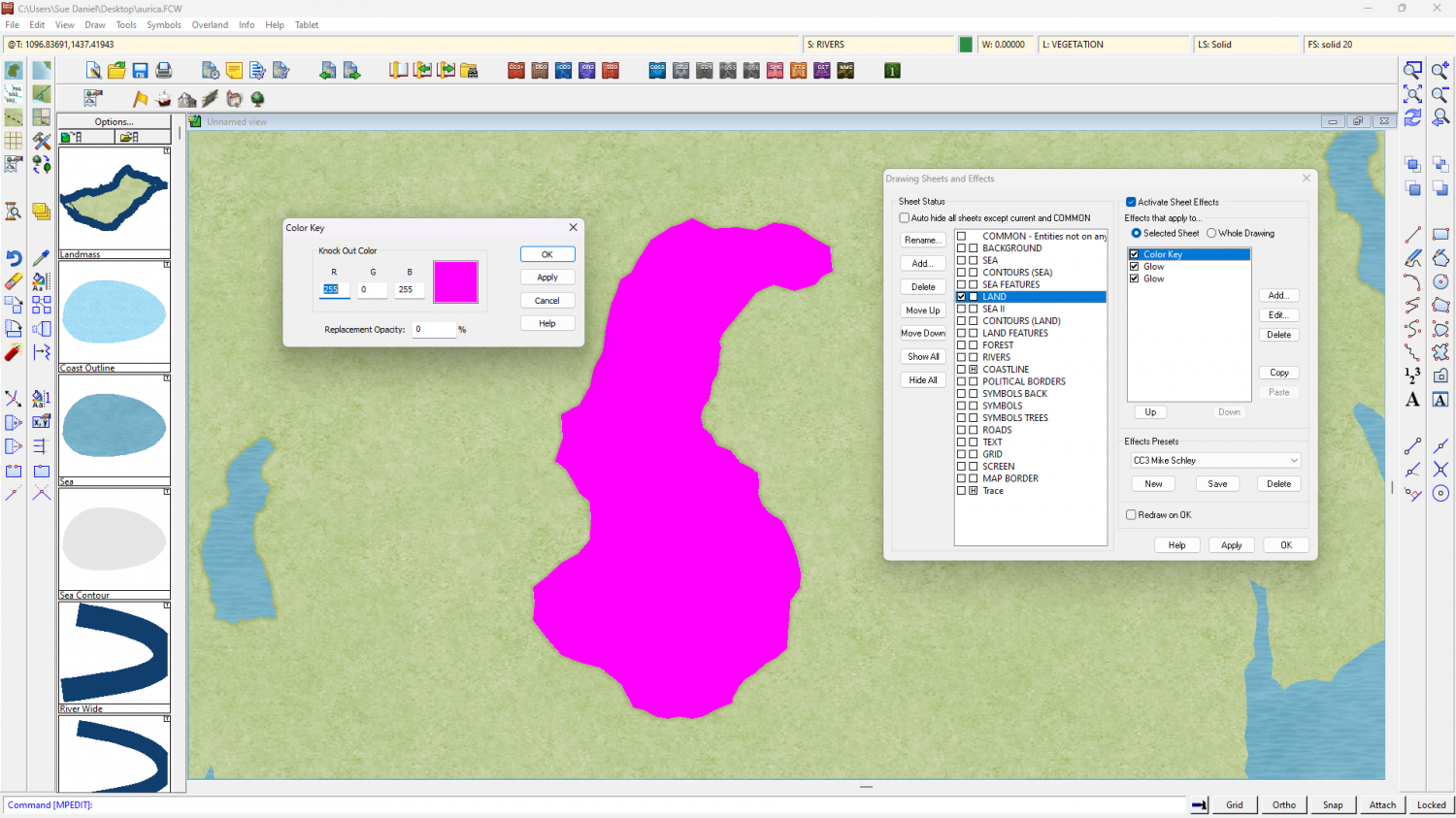
Then I reshowed the COASTLINE sheet and hit apply.
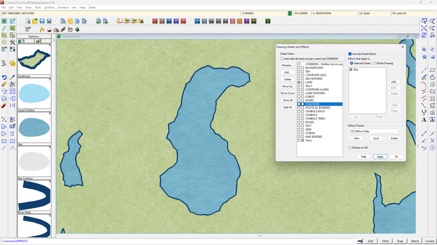
If this is what you want (above), here is the modified FCW.
-
Accessing the Trace Command
Unfortunately, no.

-
Live Mapping: Real-World Vector Data
Hi everyone! :D
In response to the Live Mapping requests we recieved from our mappers, this week Ralf will be taking a look at using vector data from real-world maps in CC3+.
Come and join in the live chat on Youtube live here:
https://www.youtube.com/watch?v=25wnZscqnm8
Or watch it here on the forum, though there is no live chat here.
-
Live Mapping: SciFi Bases
Hi everyone :D
In Ralf's words: It's been a while since we've done anything science fiction related, so let's take a look at the SciFi Bases style in tomorrow's live mapping session.
Come along and join in the live chat on Youtube here:
https://www.youtube.com/watch?v=4_4XkB0jdOw
Or you can watch it here if you prefer, though there is no live chat on the forum.
We look forward to seeing you there :D

-
Colorize Whole vs Sheet
I don't think symbols that have map files to control the roof shading are redrawn. So they are affected by the sheet effects. You can also use Color Key and other sheet effects on them. Color Key can be quite useful to make ruins by cutting holes in the roofs.


