


Loopysue
Loopysue
About
- Username
- Loopysue
- Joined
- Visits
- 9,991
- Last Active
- Roles
- Member, ProFantasy
- Points
- 9,866
- Birthday
- June 29, 1966
- Location
- Dorset, England, UK
- Real Name
- Sue Daniel (aka 'Mouse')
- Rank
- Cartographer
- Badges
- 27
Latest Images


-
Merging polys -- how?
Ooooo! Booleans!
:D


-
Festive Winter Card Challenge - Ended - Please vote for your favorite
Thank you very much to all who voted for me :D
I was kind of hoping for a draw with Shessar towards the end, but well...
That was fun. Maybe we could do it again next year if you aren't too busy?
Congratulations to all! :D

-
WIP: Dominion of Ostia
I forgot to say - Another way you can affect a smooth gradation but a sharp edge at the ocean is by placing the ocean on top of the land and its terrains, so that the terrain shapes vanish under the sea and only show a faded edge on the land.
Darklands WATER sheet already had the Color Key sheet effect. All you need to do is cut a hole in the ocean to expose the underlying paper - the land, once you add the terrain colours. You can convert a map to be water over land if you wish. It just takes a bit of thinking and careful reordering of the layers. You don't have to redraw your land shape because it can be turned into the magenta shape that cuts the whole in the ocean. Here the green is faded on the land, but has a sharp edge where it vanishes under the ocean.
-
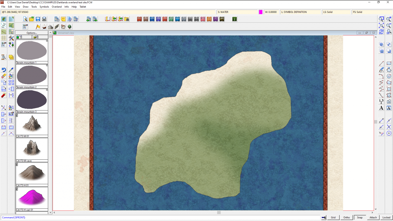
WIP: Orchish Hoard (First Overland Map)
That's a pretty cool map :)
The only suggestion I have is to activate the Blend Mode on the FOREST SHADOWS sheet, and set it up a bit like this. That should prevent the shadow patch under the woodlands dominating the woodland areas so much. Here is a before and after jungle woodland.
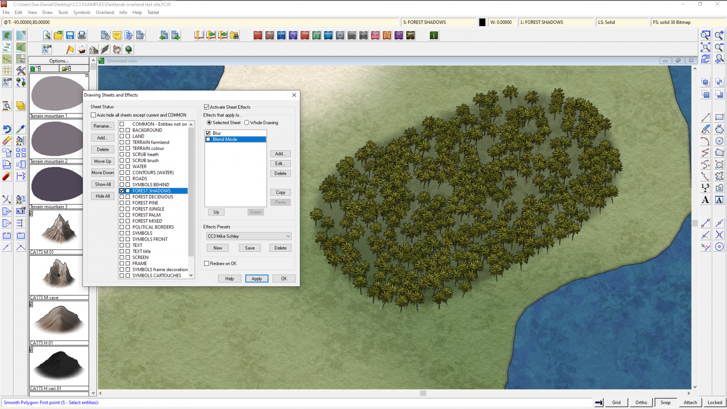
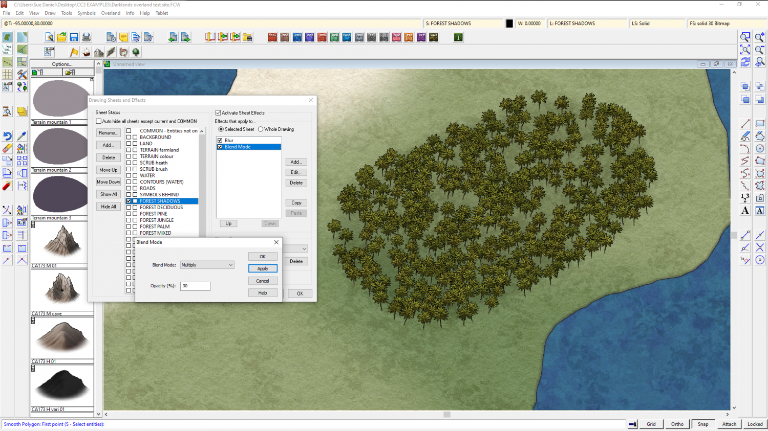
I also doubled the blur from 10 to 20 between those two shots.
There is still a shadow, but it doesn't stand out quite so much.

-
Is there a way to make something like a fill style with a group of tileable textures?
Here is a suggestion that might help achieve the look that you want.
how about making the sky fill a solid blue, and adding the cloudy bits as fuzzy edged symbols? If the cloud symbols are mostly transparent you can build up thicker layers of cloud by overlapping or placing them on top of one another.

-
Sheets button not showing
This is a bit different to entire toolbars vanishing, so it might be worth re-contacting Tech Support before you reinstall if it comes to that.
-
The Creepy Crypt project
They're in the set, Calibre :)

-
City Designer Lag
That has little to no effect.
What usually causes the problem is if you have loads of House entities rather than symbols, because they are built from filled polygons and dramatically increase the node count.
You can work on a district at a time and then move a completed district to a layer of it's own and hide it until you need it later to check on how things look overall, or for rendering.

-
Path control points showing up in render
Try pressing CTRL+F, which toggles the control point visibility. What's visible in the map (that isn't a snap grid) will be visible in the render.

-
sw eriador
From Google:
In south and western England, a hundred was the division of a shire for military and judicial purposes under the common law, which could have varying extent of common feudal ownership, from complete suzerainty to minor royal or ecclesiastical prerogatives and rights of ownership.
From me:
I live in Uggscombe Hundred, though I'm more likely to call it the Parish of Chickerell and Chesil, which is the modern unitary authority (similar, but not identical in shape and extent). As I understand it the ancient hundreds were presumably resposible for providing at least a hundred men at arms in response to the local lord's call for arms.
![[Deleted User]](https://secure.gravatar.com/avatar/c75d9a245b74d9c59be0999ea81ca541/?default=https%3A%2F%2Fvanillicon.com%2F92add7f8c954488718110edc4896ad39_200.png&rating=g&size=200)
