HelenAA
HelenAA
About
- Username
- HelenAA
- Joined
- Visits
- 986
- Last Active
- Roles
- Member
- Points
- 393
- Rank
- Surveyor
- Badges
- 6
Latest Images
Reactions
-
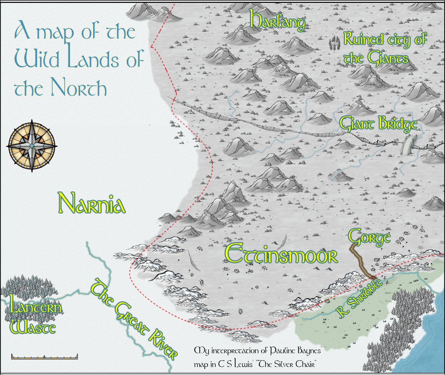
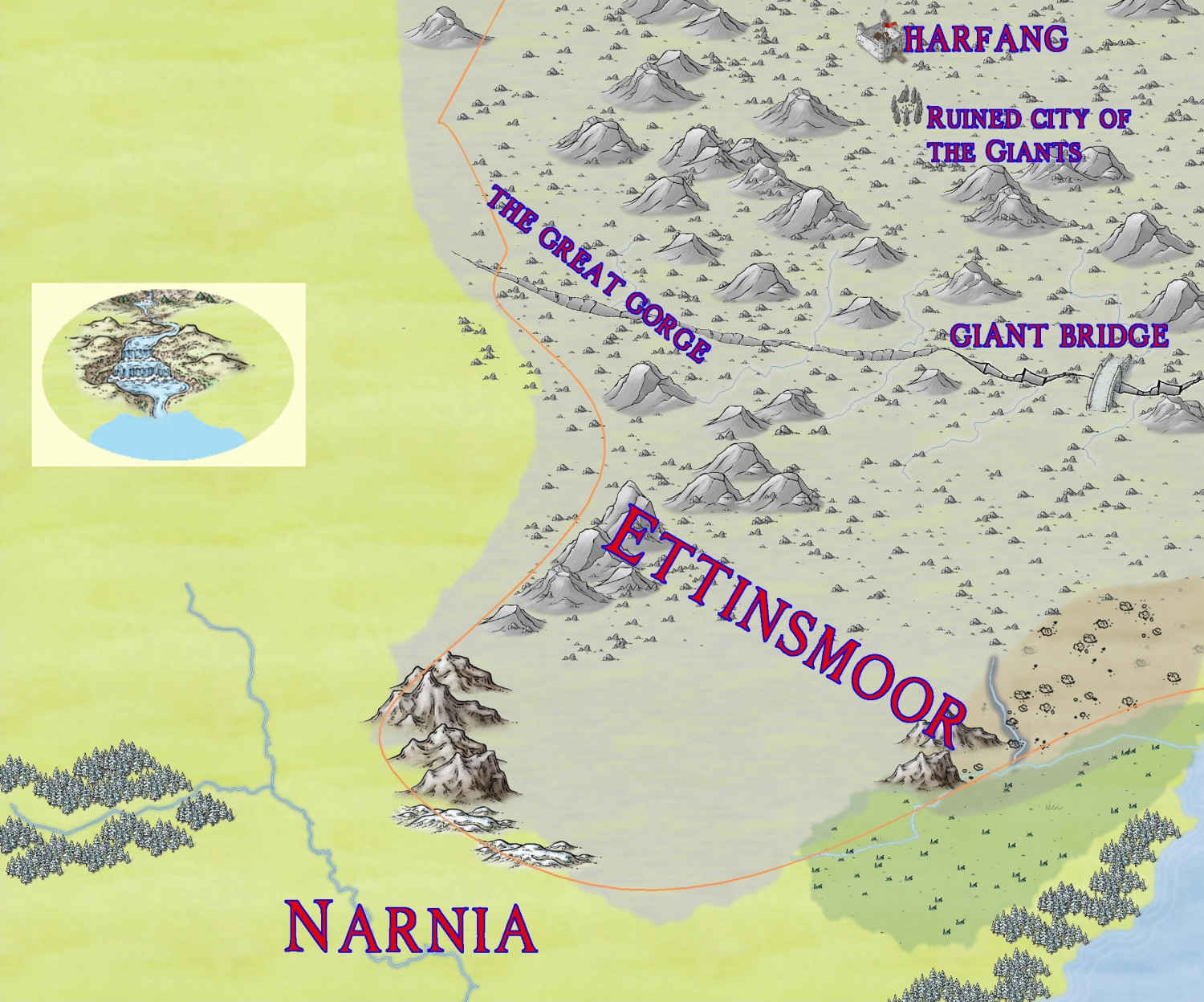
WIP Ettinsmoor and northern Narnia
Here is the final map! Loads of things kept on vanishing just as I thought I'd done, mainly the Narnian rivers and the pine trees so the rivers became the part that I dreaded looking at, and yes I had saved them between sessions!
I chickened out of doing my 'cameo' idea as it proved to be way more trouble than it was worth. Besides which the original map title ended in taking at least double the space that the Baynes one had.


-
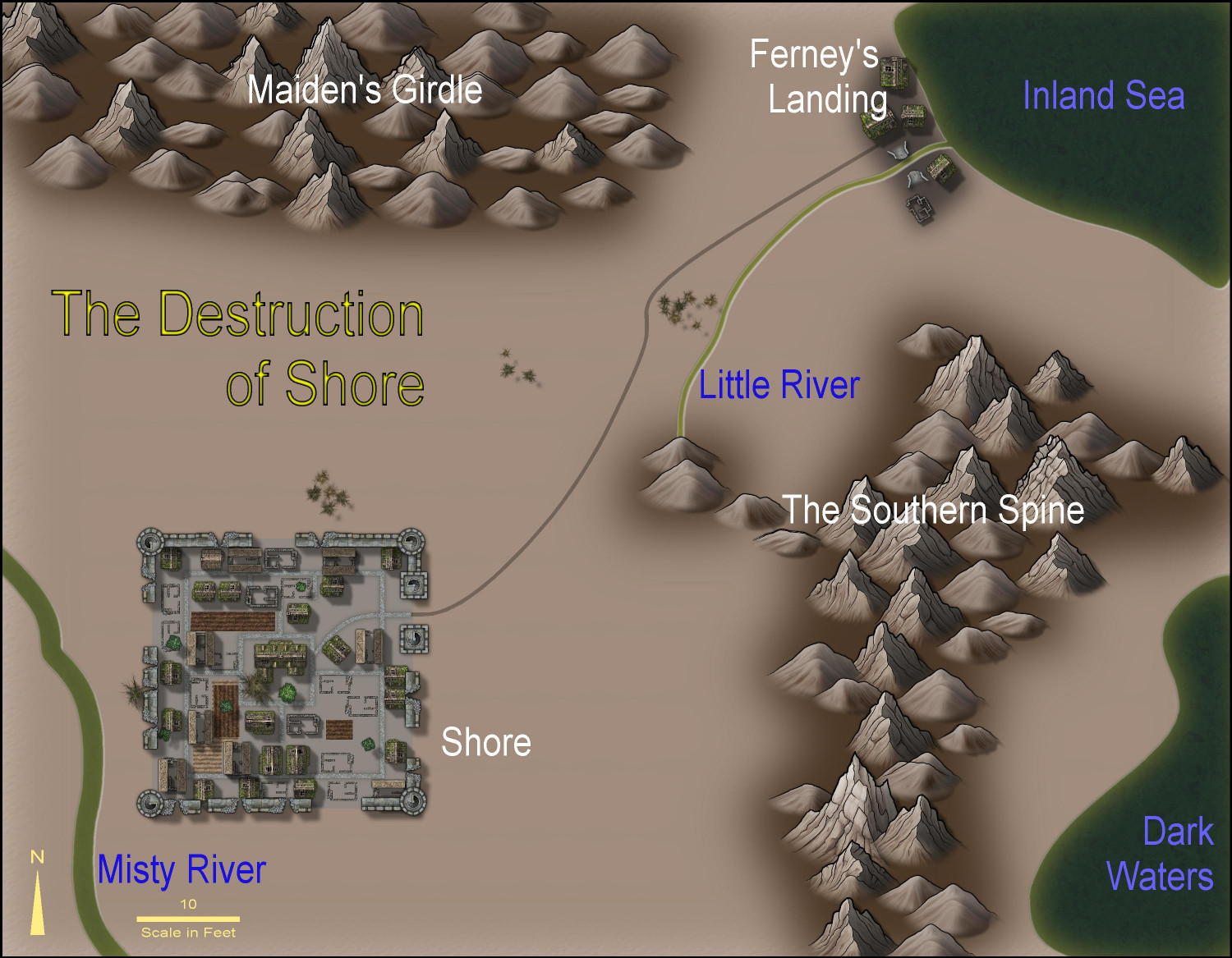
The Destruction of Shore
Just a fun, quick (for me) overland-cum-city map using only Sue's two Darklands templates. The map is a reimaging of a part of a map I did in 2015.


-
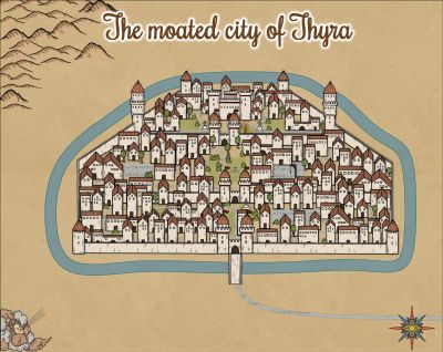
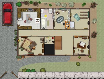
WIP Thyra
I've switched template now and I have a question for you. Have I crowded the buildings too much? I'm unconvinced on either Yes or No.
I'm deliberately doing the roads last, by the way.

-
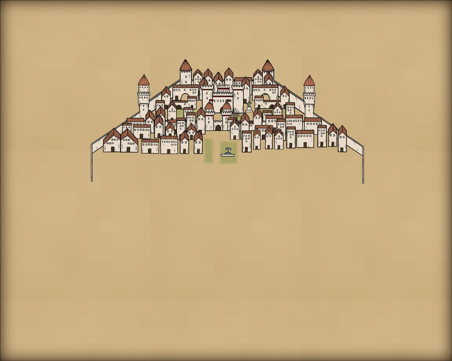
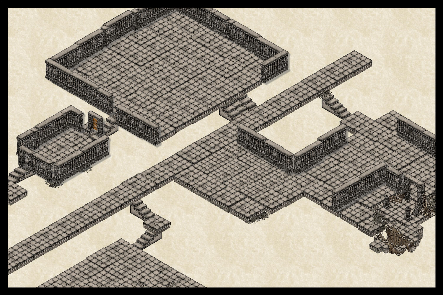
WIP Ruins of Charn
my most recent layout. I'm not going to put walls everywhere - otherwise I'd obscure some bits.

-
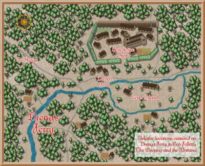
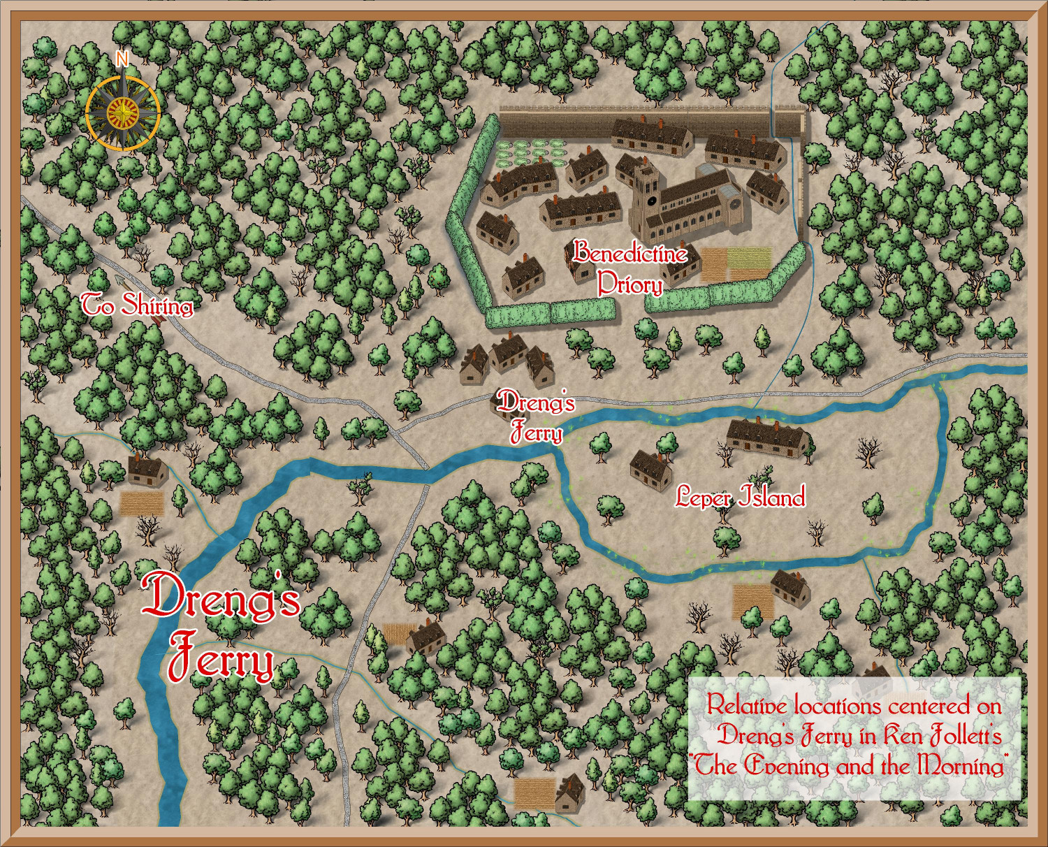
Dreng's Ferry
after at least 2.5 months of fighting with various templates to create this map I eventually settled on Isomeric Town for the buildings and Mike Schley's Overland maps for pretty much all vegetation apart from the fields (Fantasy Town tends to be my 'Go To').
-
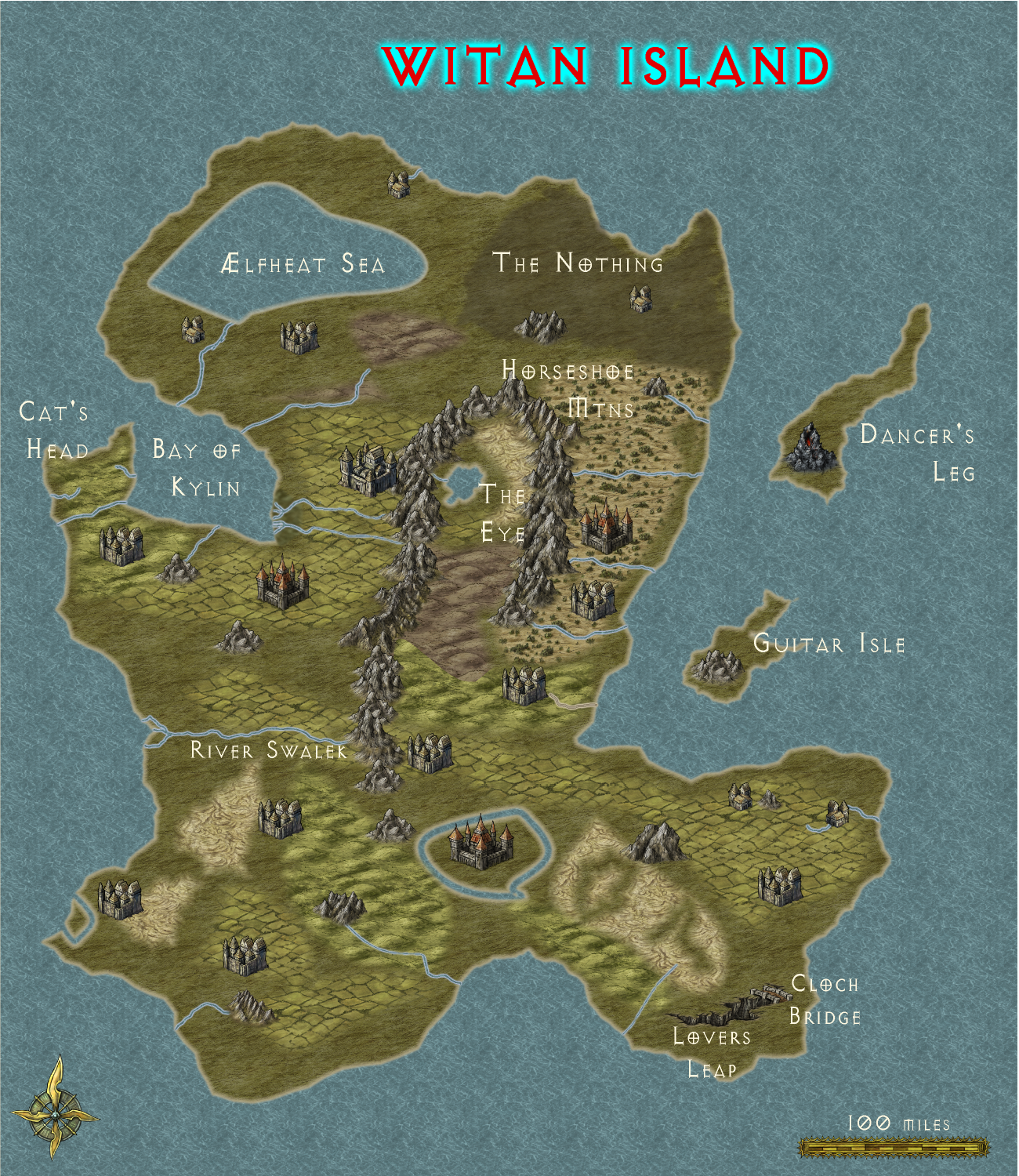
Farveld - now Witan Island
This is a much more complex map than Farveld was. However I've got place names that make the map too busy and the labels nearly overlap. I can't decide whether to have a key to every location or to shrink the text. I don't like maps with everything listed in a key but I also don't like too tiny labels.


-
WIP Ettinsmoor and northern Narnia
Here is the latest version for comment. I had to export the cameo as a .jpg and paste it onto the map's .jpg form. I just could not import/insert the cameo into the main map. I'm probably going to change the contents of the cameo though. is it too small though? The scene comes from the first chapter of the final book, "The Last Battle".
EDIT: Having looked properly at the map, I'm pretty sure the cameo is way too small.
-
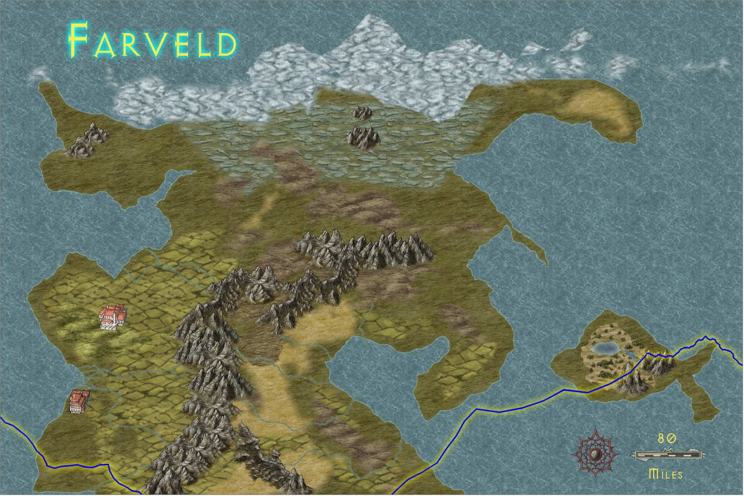
Farveld - I'm having problems with which structures work best
This version has got a couple of SS6 symbols but I don't know if I like them. Please help.

-
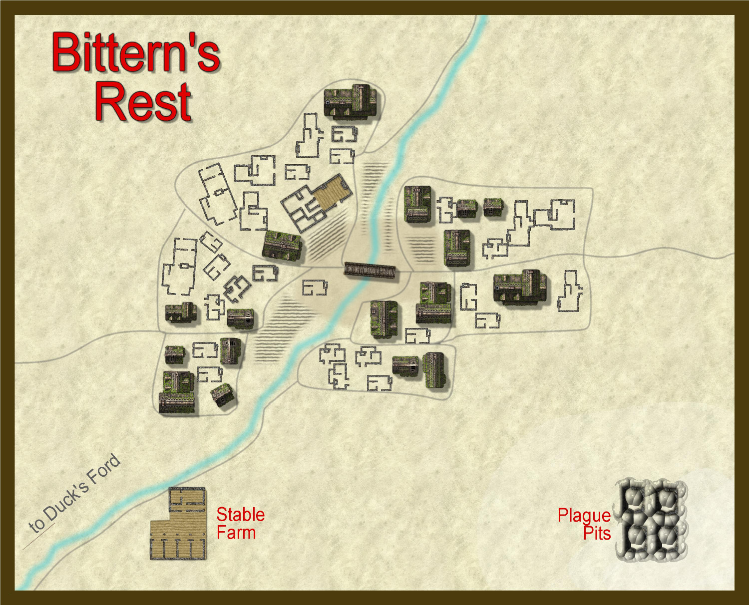
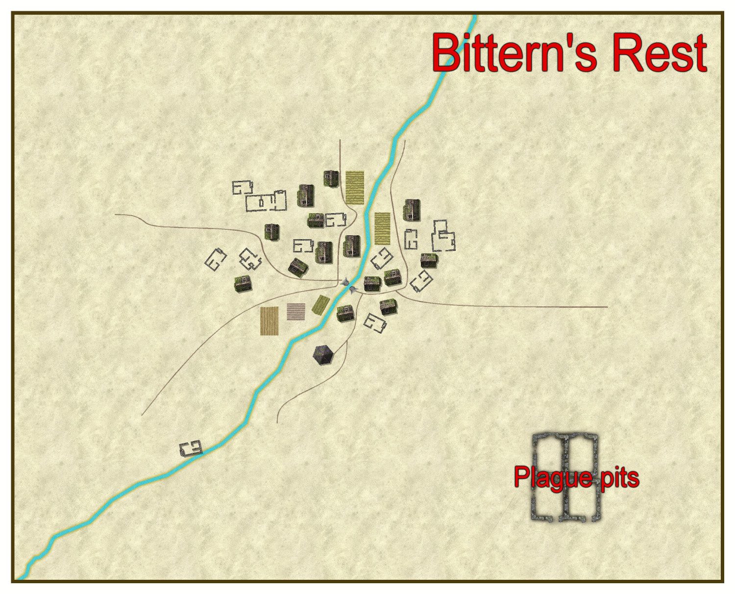
WIP 1000th map competition - Bittern's Rest
Bittern's Rest had been a town North East of Duck's Ford in Kentoria before plague struck about 80 years ago. Now a large village of 14 homes its inhabitants live in dread of the plague pit complex placed well away from the settlement.
Note. I know there's not much physical geography on the map right now but that's sometimes how I build maps!
-
WIP 1000th map competition - Bittern's Rest
Here's the latest manifestation of the land around Bittern's Rest. I've got a few trees on the map as well now, but as the original map by Wyvern looked as though it was a very dry area I've kept that in mind when placing vegetation. The stream floods massively and provides the only fertile land. I'm going to try to do an underground map focussing on the Plague Pits but as it will be a first for me I don't know if I'll link the two files in time.