Avatar

Wyvern

Wyvern

About

Username
Wyvern
Joined
Visits
2,970
Last Active
Roles
Member
Points
5,159
Rank
Cartographer
Badges
24

Latest Images

  • CA style development - "Darklands City" (issues for September and December 2021)

    @Loopysue asked: Does this look like how you would imagine a chimney fire from directly above?

    Possibly, though it's quite common to have a heavy plume of smoke above the fire, so you can't see the central flame so well. Chimney fires have a tendency to produce copious amounts of dark smoke, sometimes with embedded sparks, which tends to be more what you'd see, particularly given the chimney itself is relatively tiny compared with the smoke plume. As house chimneys often kink inside, you might not be able to see the blazing soot unless it's near the top of the chimney anyway. From memory, the flames tend to be redder as well, though this is from the perspective of viewing from the side, rather than top-down.

    roflo1LoopysueRaiko
  • What B&W Styles are Suitable for Large Maps?

    Don't forget there's also the standard CC3+ B&W overland style, CC3 Vector BW, and if you have SS1, there's the Fantasy - Monochrome and Handrawn - Hollow (varicolor, so choose a suitable black for the lines) options. It's easy to forget these amongst all the many Annual options, I know!

    Some of the varicolor sets can also be changed to actual, or more-or-less, B&W too, with a bit of experimentation.

    Plus, depending on what sort of area you're intending, it may be possible to enlarge the symbols to keep them clear enough when resized (although this can lead to pixellation).

    Depending on what style you're using, you may also be able to add a Whole Drawing Greyscale effect using the RGB Matrix to shift everything to look black-and-white.

    LoopysueRoyal ScribeRyan ThomasJulianDracos
  • Town Map for a Cthulhu Game

    Not sure why you had to use Photoshop for any of this, as from the looks, the whole could have been achieved in CC3+ too. Appreciate that if you're more familiar with Photoshop, that could have been the reason though!

    Regardless, nice-looking map. Not keen on the newcomer to town though...

    roflo1[Deleted User]Mythal82
  • [WIP] Community Atlas: Snakeden Swamp, Lizard Isle, Alarius - Dedicated to JimP

    The surface map for Snakeden Hollow presented an unusual challenge, as there is no equivalent to the old CC2 style for city-type maps available with CC3+. Source Maps Cities - City Map is perhaps the closest we get, although the symbol options for that alone are rather limited, and don't have options to easily show, or create, ruins, which I'd need for what this map's to illustrate. Instead, I opted for the CD3 Vector Shaded style, using the Vector Classic symbols. These provide a very large range of options in a clean, simple, drawn look; in fact if anything, it's difficult to hold in mind exactly what's where among the series of extensive symbol catalogues in this style. There are five different sets of options just for trees, for example, each in a separate catalogue (there is a sixth, but I think that's a duplicate). As this wasn't a style I've done anything with before, I spent some time - the equivalent of a full mapping session - simply exploring the range of symbols available, and also the drawing tools, to get a better feel for what was available.

    In the meantime, I'd also sketched out a general layout for the ruined settlement. The Inkwell dice design was to form one tiny segment of that whole, as I was influenced by the symbol from the Lizard Isle map that showed there to be a substantial ruin here. You can get an impression of the Inkwell design's appearance and original size from the Seer's Hall Village map in Ezrute (as this is the intact version of the Snakeden ruin die-face), discussed on the Forum here earlier. However, during the planning process for this map, I decided it might be better to double its size in this case, partly to stop it from being lost here, partly to make the surviving buildings a bit larger and more imposing. The Inkwell dice designs aren't specifically scaled, although there is a basic assumption that the subterranean ones will be scaled to around 100 feet per side.

    That settlement sketch-plan was determined initially using the standard Shadowdark RPG's system for randomly generating settlements, as far as its layout and some additional major structures were concerned, with more additions from the old Judges Guild ruins system, presented almost 50 years ago now (groan...) in their first "Wilderlands" products, all tweaked appropriately. This led to the sketch-map becoming so cluttered and confused that even I'm not sure what all the scribbles mean now, thus I've avoided showing it on any of the following WIP images! I have though left the little Ruins dice sketch design on the first two screenshots, to help give a degree of orientation and scaling.

    As with the area map, on creating the new CC3+ file, I found there were several sheets with effects already on them, so again this was going to be a more relatively sophisticated map than I'd earlier anticipated. The shots that follow are also of a reduced size, as previously, as they're really little more than impressions of progress at this stage. This one's with the base terrain colours and main streams sketched-in:

    For a bit better clarity, I've turned off the transparency effect on the bitmap sheet with the dice-design sketch. The yellow-green towards the edges is the general swamp terrain, the darker green where the jungle-woods are going, and the "other" green is the basic background.

    Next came the road-lines:

    Again, these are simply to indicate the general layout at this point, and their relative widths. These were soon to be altered, as the widths were simplified here to get the lines drawn quickly.

    Next, some contours were added to help suggest the "Hollow" aspect from the place-name - hence why those swampy patches were drawn as they were too - and the first elements from the Inkwell dice-face were added as well:

    There are no suitable escarpment symbols available to fit what was needed here for the cliff-face, so I simply dropped one into the map at an appropriate scale size nearby, and drew a set of suitably-spaced and sized lines for the cliff-face as sketched, and then discarded the symbol.

    Moving on, the rest of that small square segment was completed, a process that included finding and testing various of the rubble, ruins and similar options spread among several symbol catalogues. The perceptive may notice too an experiment in adding a second height contour to some of the hills. Ultimately, that was dropped as showing nothing useful, once more symbols and elements were filled-in elsewhere. It does feature on the next couple of images before that decision was made though.

    There is a reason too why the ruins are chiefly on the southern side of that little square area, which will only be revealed later!

    Various fresh symbol elements were added at this stage, including where the main Lizardfolk groups are situated across the settlement (hut clusters), a few more ruins and still-standing buildings, some of which were from the main new features randomly added during preparation, and the start of the vegetation symbols.

    Of course, at this point, nothing is too firmly-fixed, but I was liking how the trees worked with the whole. Wasn't so sure about leaving the base vegetation colouring behind the trees at this point, although this was the stage I realised the higher contour colours just weren't working with the tree cover.

    So this is where I'm up to currently, with all the trees set-up across the woody areas (there will be more elsewhere in time, though less densely), the higher contours gone, and decisions to be made next as to how best to show the swamp vegetation. More to follow...

    LoopysueDon Anderson Jr.seycyrusMapjunkieRicko
  • What are you using your maps for?

    Seeing the replies to Monsen's original query, I seem to be something of an aberration, as while I do make maps for RPG use, and tabletop wargames sometimes, the primary reason I invested in Campaign Cartographer initially was to make historical and semi-historical real-world maps, particularly regarding military history, and its mythical counterpart, from what wargamers class as the "Ancient" period. This covers pretty much everything prior to the widespread use of gunpowder weapons during European medieval times.

    One of the first maps I did with CC3 was for use with the Erin wargame rules produced by Scottish company Alternative Armies. This concerns the mythological island of Ireland, its waves of invaders, and the battles they fought in the mythical past. Alternative Armies make a unique range of cast metal 28mm miniatures to go with these rules, interpreting some of the mythic inhabitants of Ireland in interestingly unusual ways (to me, anyway). The background information in the rules included some details on a few places already, along with providing a sketch map based on a 15th century CE drawing from details given by Claudius Ptolemy (circa 90-168 CE). However, I wanted to go further than this, and embarked on a lengthy journey into the mists of Irish mythic history, and how that has been influenced by physical topography and prehistoric sites across the land.

    Ultimately, in 2012-2013, I constructed three maps of this mythical place. The first was based on modern topography, with selected Curious and Ancient places of interest added using various red-labelled symbols or markers. The purpose was to provide a range of sites scattered across the whole of Ireland, without cluttering the map too greatly, to help stimulate ideas for Erin game scenarios, drawing upon real-world and mythical Ireland, where the latter elements were mostly taken from the different redactions of the 11th century Lebor Gabala Erenn (The Book of Invasions).

    [Image_14980]

    Since this was intended as a poster-sized map, the labels on this image are mostly illegible, so to give a better idea of what was going on, this is a closer view of the central-eastern part of the island - still a little fuzzy to keep within the Forum's image parameters.

    [Image_14981]

    Blue labels are for watery elements - so coastal features, rivers, lakes and so forth - brown place-names for physical features such as mountains and hills.

    Next, I drew-up a revised version of that 15th century Ptolemy's map of Ireland with all of Ptolemy's place-names added using blue and brown labels, and red-labelled items taken from the Erin game background positioned in relation to the amended geography, as far as possible, along with green name-labels for the five peoples involved in the Erin setting.

    [Image_14982]

    While compiling notes for this project, I came upon a paper by Robert Darcy & William Flynn, "Ptolemy's map of Ireland: a modern decoding" that had been published in 2008 in the periodical Irish Geography (Vol. 41, No. 1, pp. 46-69, if anyone wishes to hunt it up). Their research suggested a rather different form for Ireland as understood by Ptolemy, and on the principle one can never have too many maps, I decided to draw a third version showing this, again adding features as for the "other" Ptolemy map, but this time making the named watercourses more closely follow patterns like their plausibly-identified modern ones, variant coastline permitting.

    [Image_14983]

    Further afield, one of my particular historical-archaeological interests has long been the ancient Near East, notably from the 4th to 1st millennia BCE. Published maps often use only established modern geography when discussing parts of this region and period, whereas both coastline and river courses are known to have changed considerably in places. This can become confusing, especially where ancient coastal trading settlements seem to be nowhere near the modern coast, along with those places no longer served by watercourses or wells of any kind. Plus of course, even maps with the earlier coasts and watercourses shown (so far as such things can be established now) frequently failed to contain other details of greatest interest to me - isn't that though always the way?!

    A couple of CC3 examples. This was one of the first maps of its kind I devised, back in 2013-14, for the 3rd millennium BCE, to illustrate the relative locations for a selected number of key ancient settlements around the Fertile Crescent region, notably in southern Mesopotamia (modern Iraq).

    [Image_14984]

    Those familiar with the area will appreciate the head of the Gulf lies significantly north of where it does now, and there are more channels - mostly human-built canals - on the lower Euphrates river.

    The second example, from the same epoch, was to illustrate the places east of southern Mesopotamia known to have had trade links with the near-Gulf city-states.

    [Image_14985]

    Here, there have been additional changes to the Pakistan-India coast and the lower River Indus, for instance.

    Sadly, the FCW files for both these maps were lost in separate hard-disk and memory-stick failures, before the originals could be copied elsewhere, so all that survives are a couple of JPEGs.

    Returning to more mythological themes, something else which has held a long fascination for me is the voyage of the Argo, firstly thanks to the Harryhausen "Jason and the Argonauts" movie, but in later times through the various ancient Greek and Latin versions of the tale. In 2015, I finally got round to doing some CC3 mapping for that too, regarding the outward voyage of the Argo from Greece to Colchis, at the eastern end of the Black Sea (modernly Georgia). The overview map:

    [Image_14986]

    However, as this was designed as an A0 poster, I'd be amazed if anyone can properly read any but the largest labels on this reduced-size version. So this is just the mainland Greece part:

    [Image_14987]

    Even that's not as clear as it might be, but the eagle-eyed may spot an unexpected inland lake where there now isn't one north of Pagasae, restored to its probable 1st millennium BCE appearance. And if you think some of the names look a little faded, you're quite right; that was entirely deliberate, because settlement names were often widely understood for the period, but regional names could be rather more fluid.

    I did a whole series of maps for some of the places sailed-by or stopped-at in one or other version of the Argo's journey, using a similar "contoured" style to this Black Sea one for the more historical settings and places. However, I switched tack for those more mythological places, such as Colchis:

    [Image_14988]

    You'll notice a lack of scale on this image. That's because even the relative location of the places shown isn't firmly-fixed in the tales, let alone how far apart they were from one another. Real-world geography is no help at all, as even the possible location of the city of Aea isn't as established as you might hope.

    Along the way to Colchis, I devised a series of tabletop wargame scenarios, including mythical battles described in the tales as well as some "what if" ideas that didn't feature so, drawing on the "Hordes of the Things" (HotT) fantasy wargame rules. These allow small-scale actions to be fought on a handily square area - often no more than three-feet on a side. So I sketched the tabletop layouts for those too with CC3, like this one for the escape of the Argonauts from Colchis with the Golden Fleece:

    [Image_14989]

    Can the Argonauts get to their ship and escape before the pursuing Colchians catch them?!

    Working on all this, in conjunction with the HotT rules, which allow for longer wars to be fought too, I came up with a couple of on-land campaigns between the various peoples along the southern Black Sea coasts and further inland that the Argonauts had met, knew about, or had sometimes fought with, many of whom also featured in the more historical ancient texts. So another mapping style could be explored as well, if of a more abstract nature suited to the standard HotT campaign procedures:

    [Image_14990]

    It may not be obvious that Dorylaeum and Ankyra are intended as independent, unaligned cities, separate from the named powers illustrated here. For orientation, Cius and Amycus represent places near the eastern-southern Propontis/Sea of Marmara coasts, while the line from Calpe via Mariandyni City (modernly Eregli) to Sinope is effectively the southern Black Sea coast east as far as the modern Sinop headland of Turkey.
    [Deleted User]Loopysueaulyre
  • Community Atlas: Embra - Travelling Places

    Moving on swiftly from the dubious delights of Toll Cross brings us to the cheerier Travelling Places segment of the Twilight Market, Market Row:

    A colourful scatter of tents, wagons and stalls spills along and beyond the road here, and there's even a group of buildings, since for once, there is a more fixed settlement alongside the Market (or perhaps it grew up because the Market was here). Though the footprint of several buildings is large, particularly when contrasted against the much smaller market stalls, I opted to make them all merely single-storey structures, so the Market didn't get lost among the houses. Only the buildings have been provided with internal floorplans, which also helps clarify which they are, of course:

    The individual darker trees are to match with the featured text notes, and I think something of the strangeness of Toll Cross lingered with me, as I decided not to name the open land between the two "Mirror" properties and the foot of Longing Hill, which the Market also seems to avoid, and simply kept it as an empty place the locals become evasive about if anyone asks. Quite why I've left for GMs to determine, however...

    LoopysueJimP[Deleted User]
  • Community Atlas 1000th map Competition - with Prizes [August/September]

    Having already reserved the orange-highlighted area below in Haddmark, Peredur to place the next small dungeon map in my ongoing mapping project this year, I'd already completed the map for it before the contest was announced.

    While it's not been submitted for the Atlas yet (it will be later), this is the map I've prepared, called The Whispering Wastes:

    I've explored why it is as it is elsewhere on the Forum, including how I'd had the crazy notion at one point to prepare maps for all 41 features in the labelled hexes. I'd even worked-up details for most, including the ten small settlements. I'll not be doing all that. However, I have decided to try mapping the ten little settlements, although whether I'll finish them all by the end of September is another matter!

    The list of settlements, and the theoretical order in which I'm hoping to map them, is as follows:

    • Ljungby Village (Hex 005)
    • Bruga's Hold (Logging Hamlet, Hex 403)
    • Ivan's Keep (Defended Village, Hex 505)
    • The Village of Toresk (Hex 805)
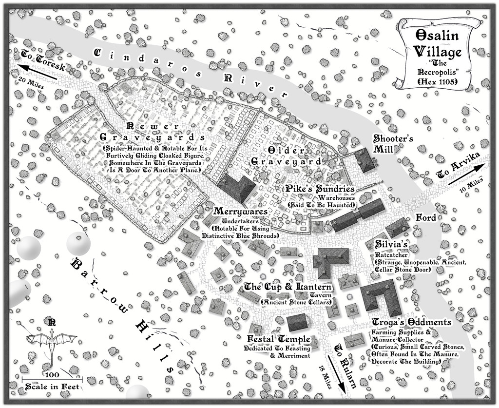
    • Osalin (Necropolis Village, Hex 1105)
    • Arvika (Bridge Hamlet, Hex 1304)
    • Rularn (Isolated Hamlet, Hex 1307)
    • Brightlawn (Watery Hamlet, Hex 1604)
    • Fairbridge (Torne Crossing Village, Hex 1702)
    • Skara (Farming & Logging Hamlet, Hex 1611)
    Royal ScribeLoopysueRickoMathieu GansMonsen
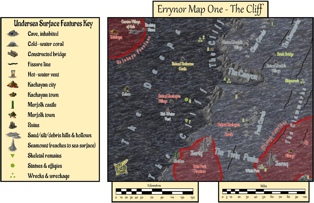
  • Community Atlas: Errynor Map 01 - The Cliff

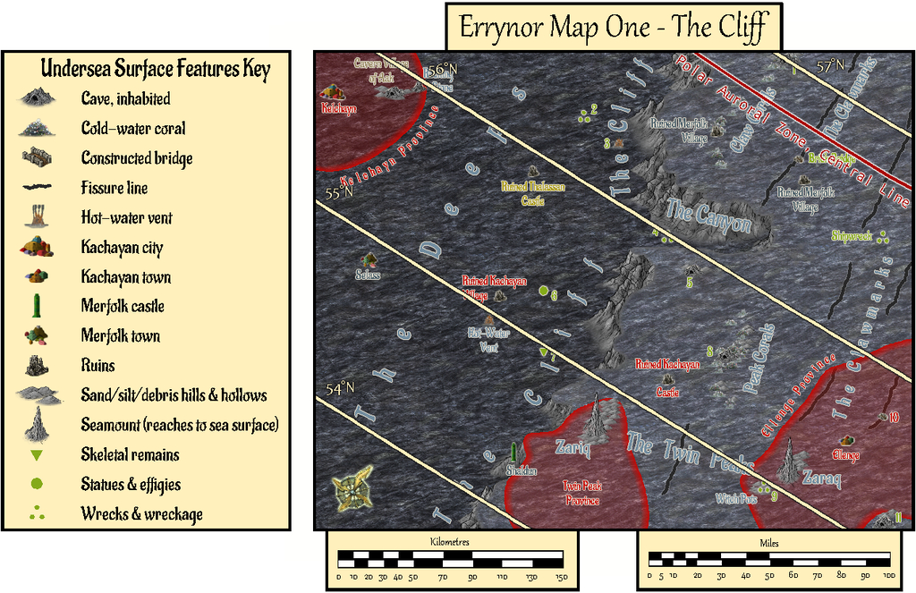
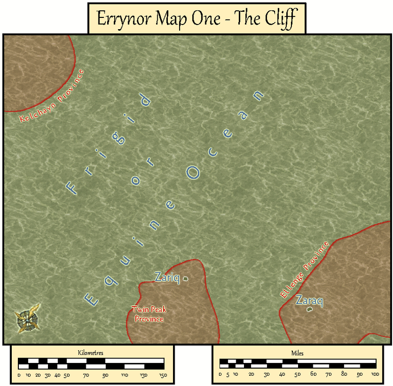
    With the new undersea symbols ready, finally I could begin constructing the first map. Logically, this was to be my original Map 1, at the top left corner of the Errynor map:

    Clearly, the seabed was going to be the primary aspect here, with just two tiny islands above sea level, so that's where I began:

    The tremendous cliff at the continental shelf edge is so dominant here, that had to become the map's name, while the relative sparsity of other undersea surface features had been a deliberate choice from the initial planning of the main Errynor map. What items are shown, are thus those more easily found by new travellers to the area, or those whose presence is more influential for whatever reason. This also reflects the apparent nature, as far as can be established, of Earth's own ocean floors. The shallowest seabed mapped here, towards the lower right corner, lies below some 300 m (nearly 1,000 ft) of seawater, for instance. It further fits with the idea of the relative smallness of the undersea intelligent populations in the region, compared with the vastness of Nibirum's oceans, as I'd envisaged them. There is the further advantage that plenty of space is available for GMs to add extra points of interest, should they wish.

    The red-limned regions are Kachaya/Sea Devil provinces, incidentally.

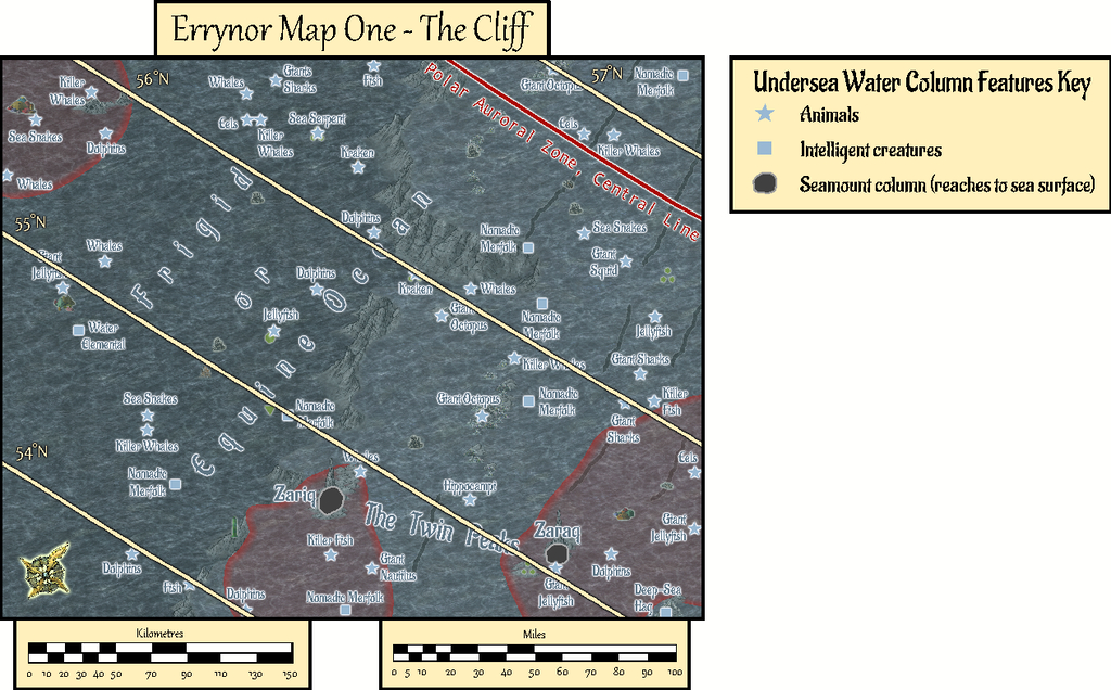
    I added a SOLAR/GEOMAGNETICS Layer overlay to show lines of latitude for each 1°, and the midline for Nibirum's polar auroral zone. This option should be available by a toggle for the Atlas version.

    These 250 x 200 mile maps are small enough for the north direction to be fairly consistent across most of the area covered, so I'd been able to add a compass rose as well, which hadn't been possible for the main Errynor map.

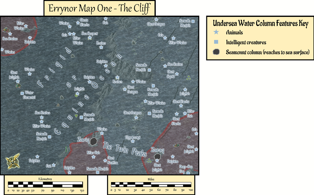
    When designing the hand-drawn paper maps at the start of this project, a selection of larger/more interesting/more dangerous creatures (and things, for the solid surface) that could be encountered had been randomly included. Many of the undersea types were free-swimming. For RPG use, it's naturally important to know where these are not merely for the sea and undersea land surfaces, but in the water column between too. Hence another map toggle, activating the UNDERSEA WATER COLUMN Layer, is intended to shift the view to that water column (it's best to turn off the TEXT, SURFACE UNDERSEA Sheet for clarity first):

    This view isn't at a fixed depth below the sea surface, simply to illustrate in general what can be found somewhere in the water column. Thus although the great seamount rock columns of Zariq and Zaraq have been given physical dimensions here, those are representative only. An 11-page PDF of the map's accompanying text-file notes explains this, together with detailing various of the other more noteworthy features shown.

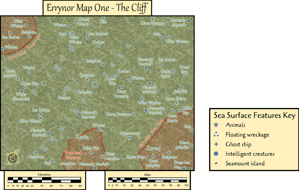
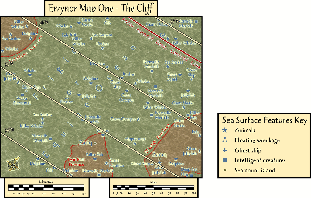
    A third toggled view, turning on the COAST/SEA Layer, shifts us to the sea's surface, where the seamounts have become small islands, and the midwater denizens have been joined by several ghost ships and an area where floating wreckage collects from time to time:

    By turning off the SYMBOLS, SEA SURFACE Sheet, the paucity of sea surface features is very clearly seen!

    GMs here may be unsurprised to learn I became distracted by some of possibilities of this map while drawing it into CC3+, as I've hinted in some of my more recent Forum posts here. Consequently, instead of progressing immediately to the next Errynor sub-map, I embarked on a group of feature maps from this one first. Plus, it also seemed unhelpful to not provide some guidance regarding the nature of the undersea features, especially the sea-bed settlements, for future mapping, as this is something scarcely touched-upon by published RPG settings and adventures. Thus this one map has become merely the first in a package of around twenty from this one area, which explains much of the delay in getting them ready for the Atlas, given I felt the whole group needed to be finished before any were submitted, in case changes were needed to those prepared earlier in the sequence - and that has happened along the way.

    In fact the maps were prepared relatively quickly in each instance with CC3+. The most time-consuming aspect has been preparing and checking the detailed write-ups for them, as these are what has particularly allowed me to explore and expand upon ideas regarding fantasy undersea environments that I've been mulling over in part for decades.

    Rather than drop the entire set on Monsen at once, my intention is for a gradual "release programme" with a new map or map-group only every few weeks. Maybe this will give me time too to complete more of the "Errynor 40" maps along the way, hopefully not taking quite so long each...

    LoopysueTheschabiDaltonSpence
  • Community Atlas: Embra - Watery Places

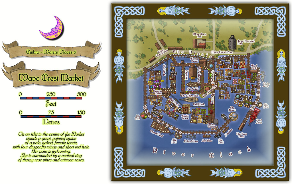
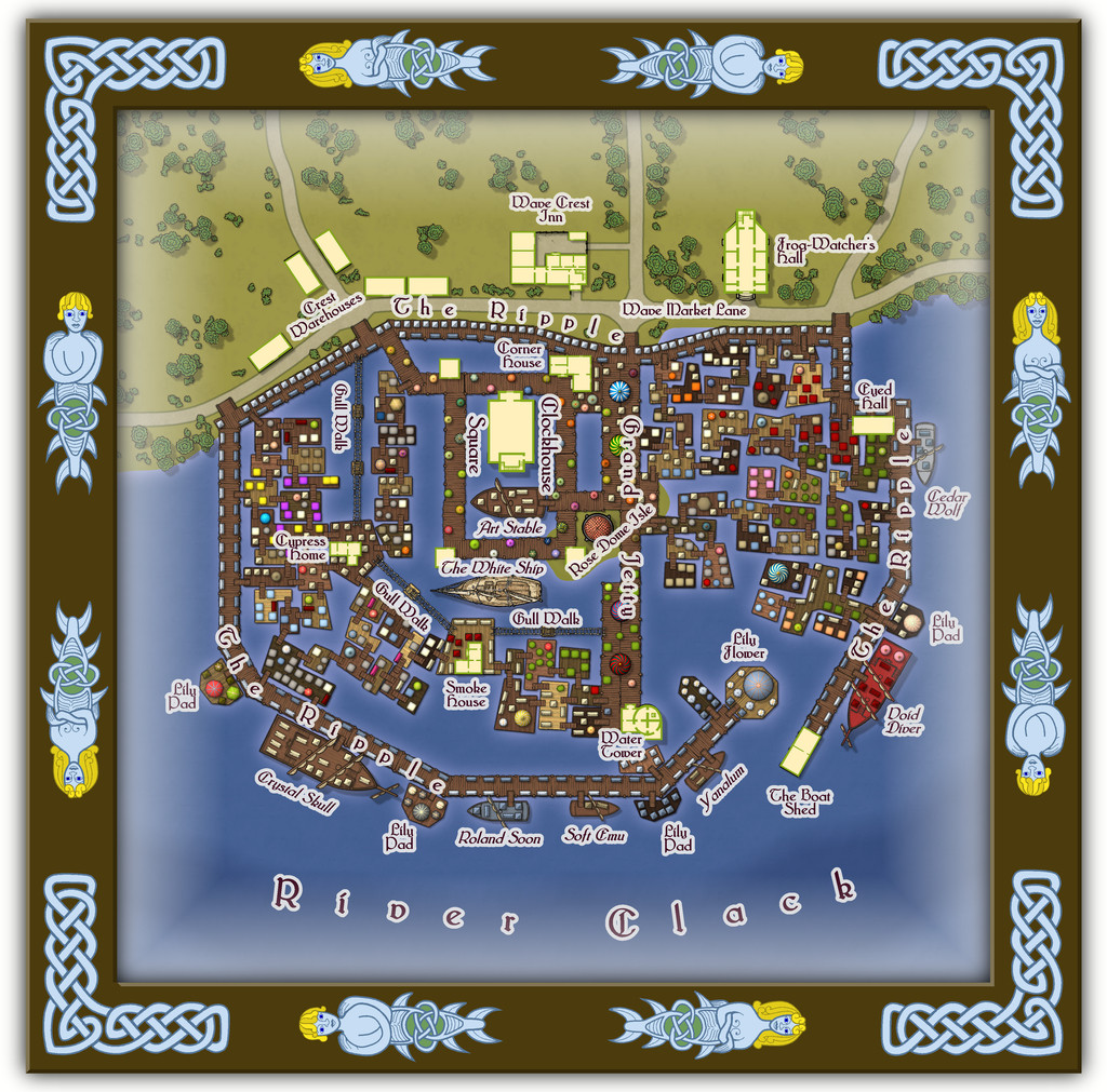
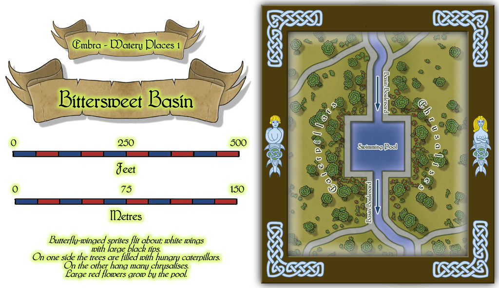
    The first two Watery Places were drawn as smaller maps than usual, based on the reduced-size template designed for the Lawn Market map. This was because, as with Lawn Market, both base maps were generated from randomly-selected maps in the old Judges Guild "Temples Book I". As noted previously, this book used a much smaller scaling than the other old JG works I was drawing on for inspiration in creating the Embra maps. The first of the Watery Places then is the Bittersweet Basin Swimming Pool:

    This is a remarkably simple area by comparison with many of the previous Embra Places maps, though of course variety is important in constructing an array of maps of this kind, to prevent things becoming too predictable. The featured text notes were used to add to the details shown here, without taking away any of their oddness. It's perhaps worth noting that as a mapper, it's equally important to have a few maps that are easier to produce like this, again helping avoid things becoming too stale and "samey". Especially as not all the Watery Places maps were going to be so "quick and easy"...

    LoopysueJimP[Deleted User]pablo gonzalez
  • 1930's Overland Mountain Mapping

    It really depends how close a match you want to that original Northern Italy map you linked to.

    Looking closely at the book's image, it seems they used mainly one set of hatching lines to represent the general appearance of the landscape, with denser, longer hatching for what I imagine would be higher peaks and ridges, less dense, shorter hatching for lower hills. Occasionally, there is more than one such set of lines (Mt. Viso, a little below the 45° line on the map's left edge, has some complex examples, for instance), but this seems fairly rare, often used only for some of the higher, or possibly larger, more complexly-formed, mountains.

    In places there does seem to be a "contour line" drawn for some - but by no means all - of the unhatched higher areas and hilltops, though that seems to be sometimes only on one side of the top, or only around part of it. In some cases, this seems to be an illusion due to the density of the landscape hatching lines. In others, it looks as if it has been drawn to show ridge or scarp features partway up a hillside too.

    Similarly, the line density and direction can be variable in different places around the same peak or along the same ridge, probably to show ridges and spurs, or other smaller features, that can't be shown just using the "hatch and bare hilltop" style because of their sizes.

    Unfortunately, because the map looks to have been drawn to try to replicate much of the overall patterns shown by the actual landforms, I'm not sure creating drawing tools will allow a very precise mimicking of the style, and might need to be done almost entirely by-hand, like the original. As I said though, this really depends how close a match you need your version of the style to be.

    As Sue suggested, what you have now is a perfectly reasonable facsimile overall, though I would probably make less use of the dashed "contour lines". Maybe think of adding some of those blue speckled areas for the icy, glaciated highest peaks as well?

    JulianDracosLoopysueMapjunkie