Monsen
Monsen
About
- Username
- Monsen
- Joined
- Visits
- 660
- Last Active
- Roles
- Administrator
- Points
- 8,858
- Birthday
- May 14, 1976
- Location
- Bergen, Norway
- Website
- https://atlas.monsen.cc
- Real Name
- Remy Monsen
- Rank
- Cartographer
- Badges
- 27
Latest Images


-
Importing Symbols from Other Mapping Programs
Well, guess it was more or less what I expected. A lot of companies likes to lock down their artwork.
That is actually one of the advantages to buying CC3+ and add-ons, as you are free to use the art with whatever program you choice. You can't redistribute the actual art files, but no matter if you make the map in CC3+ or in Photoshop using our art, you can still use the map commercially.


-
Should I buy now or wait?
Am I right in thinking that the standard licence allows the use of any and all art assets provided to be used in a map that is made for commercial purposes? (Obviously, it's even better to make your own art assets, but if the program is commercially viable 'out of the box', that helps.)
Since those above didn't answer this, yes, this is how it works. You can make commercial maps out of the box with the standard license. and those maps can be utilizing any of the assets distributed with the program. Note that this is limited to publishing the maps you make with said assets commercially, you're not allowed to distribute the assets themselves. But please use the contact details provided by Sue above if you need official clarification, as most people here can only give you an unofficial answer.


-
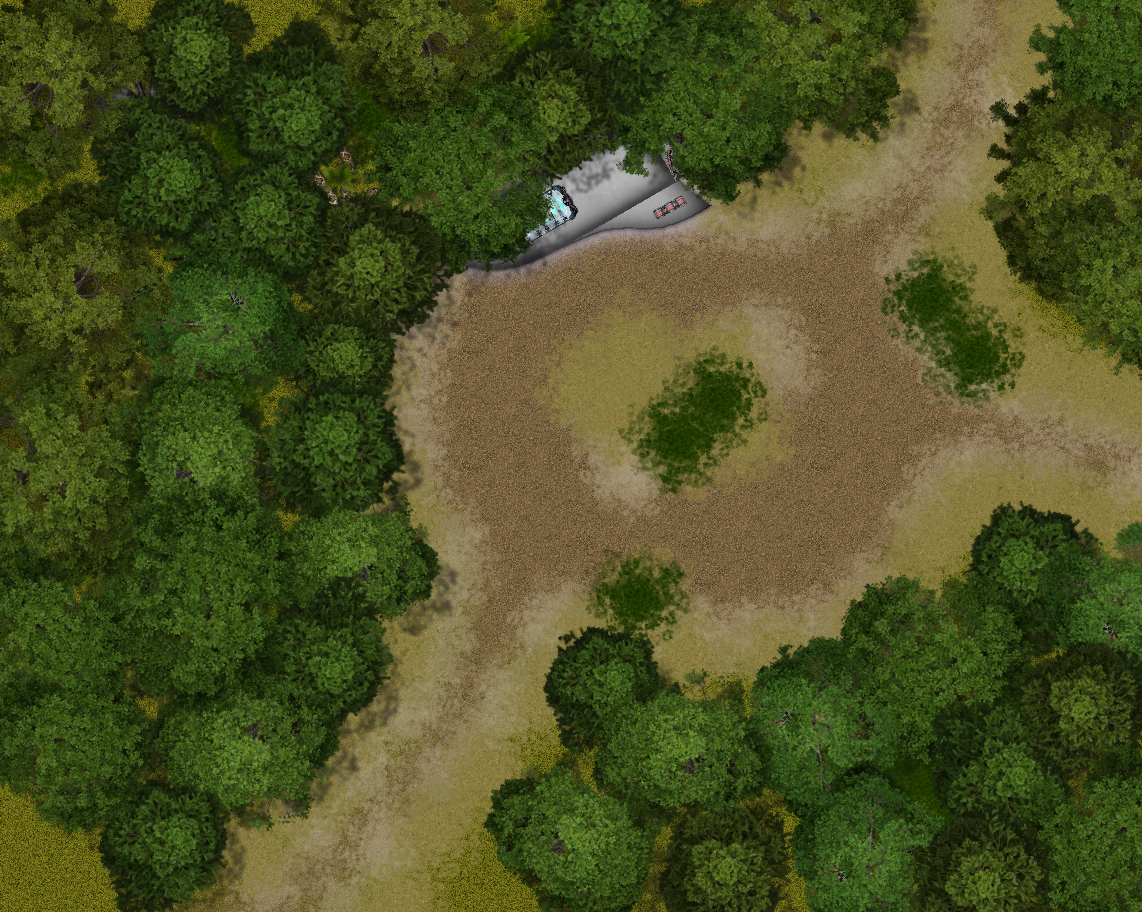
Live Mapping - Hiding in the forest.


-
Floor Tiles
@Wyvern stated:
Dread's the one that uses a Jenga tower to resolve actions instead of dice, so it isn't for everyone (if you have real-life dexterity issues, say)
I have a real-life cat. Those are also not 100% compatible with jenga towers.


-
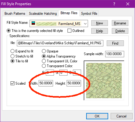
Community Atlas - Irisian City States - Dimitrios island
@Ricko Hasche wrote:
how i can do this master @Monsen ?
Reducing the scale of a single fill is just a matter of opening up the fill style dialog, selecting the appropriate fill, and reduce the width/height values.

-
Support Resources
Support Resources
Please be aware that this is a community support forum. While ProFantasy employees do read these discussions and may answer, official tech support is done through the Profantasy website. Please check out the FAQ and the Tech Support database for an answer to your problem before you post here.
Please search the forum before asking for help. A lot of the common issues have already been answered, and it is quicker to search for an answer rather than wait for someone to come along to answer your post.
Having said that, the user community does an excellent job at quick and efficient support. It is probably the quickest way to get help for normal issues. Many thanks to all our helpful users!
Suggested Material
This is a suggested list of material you can or should use to increase your familiarity with Campaign Cartographer 3+ and its accompanying software.
Standard tutorials and help
- Do the Quick Start Guide available from the Help menu in CC3+.
- Read and follow the Essentials Guide to CC3+ (or the appropriate add-on). The Essentials Guide is available as a pdf in the Documentation directory.
- Read and follow CC3+ User Manual. You can open the pdf from the Help menu.
- For individual command reference, check out the Windows help files available from within CC3+ (Help menu).
- Watch the ProFantasy Livestreams on YouTube.
- Check out the FAQ on the ProFantasy site and in the forum.
Purchasable material
- Get the Tome of Ultimate Mapping.
- Get a copy of the Cartographer's Annual subscription. Most months contain a pdf mapping guide showing you how to create a certain style of map.
Third-party help
- Check out the user-submitted tutorials available on the website.
- Check out the written and video tutorials available in this forum.
- Download and examine user-submited maps from the community atlas to see how other people have created maps.
- Ask people on the community forum or the facebook group for how they have created things.
- For support for the unofficial add-ons published by the Vintyri group, check this post
- Check out the community Facebook group
General tips on creating artistic maps
- Check out the Cartographer's Guild forum, for all things mapping-related.
- Follow the ProFantasy blog
![[Deleted User]](https://secure.gravatar.com/avatar/c75d9a245b74d9c59be0999ea81ca541/?default=https%3A%2F%2Fvanillicon.com%2F92add7f8c954488718110edc4896ad39_200.png&rating=g&size=200)


-
Community Atlas - A huge metropolis somewhere
Actually, the mapping units CC3+ itself uses are just "map units", completely independent of any of the two.
The real problem isn't if the map is in metric or imperial, CC3+ doesn't actually give a damn about that, it is the scaling that is the issue.
If you just use an imperial template and pretend it is meters, everything gets gigantic. For example, if you place down a car in SS3, that car is designed to be about 15 map units long. On an imperial map, that results in a car 15' long, or about 5 meters, but if you treat feet as meters, you have a gigantic 15 meter long car. So, the solution is simply to scale that car by 0.3048 to get it correctly sized, and that is exactly what the metric template do for you, but unfortunately, there are some issues with some of the tools when it comes to handling things that are scaled (connecting symbols for example).
The house drawing tools always place the frill symbols at scale 1, which is why there exist a separate metric scaled chimney symbol, and metric variants of the tools which are use that symbol instead of the imperial sized one.
If the only goal of the map is to produce an image, you can kind of ignore this and just map using the imperial template, and simply change the values on the scale bar in the end. But fudging it this way means that none of the values in CC3+ makes any sense. All measurements will be off, effects sizes doesn't read correctly, and so on. So while it may be fine if you just need the image, it is not fine for future use of the .fcw (Which is why I require all atlas maps to be scaled correctly)
-
The Plague of Red X Symbols and Symbol Catalogs Not Importing
As Joe also said, don't rename your user profile. Windows will not like that at all. Instead, it is better to make a new profile using that name and just switch to that. But the desktop is really no good place keeping these files, so doing that is more a band-aid than anything really. As Joe suggested, it is better to fix the problem.
The command Joe mentions is documented in the Blog article, under the heading "Four B – Fixing the Map", under the subheading "Everything at Once" (But I recommend reading the whole thing, don't just that section)
As for symbol catalogs, you don't normally import those into your drawing. You open the symbol catalog in the symbol catalog window using the :ICON_CATALOG: button, and simply use the symbols from there. Symbols will then be imported into the map one by one as you use them from the symbol catalog (But do note that symbols are indexed by their name, so if you have a symbol with a certain name already in your map, it will use that, even if the one in the catalog is different but with the same name)

-
Do you know if you can mirror a Line in CC3+
You can create a mirrored copy, just pick Mirrored copies from the right click menu of the :CC2COPY: button.
You may want to have snaps or ortho on when defining the mirror axis to ensure it is perfectly straight.
-
Unexpected results from Multipoly
An additional thing to look for when things doesn't seem to go right is the number of selected items during the command. The command line will show the number of entities selected when you do the multipoly, and if you expected to multipoly 2 entities, but the selection tells you 3 selected, then that is a good indication that you have an extra entity in there somewhere, possibly a doubled-up one like here.