Ricko
Ricko
About
- Username
- Ricko
- Joined
- Visits
- 6,740
- Last Active
- Roles
- Member
- Points
- 10,565
- Birthday
- February 7, 1977
- Location
- merlo san luis argentina
- Rank
- Mapmaker
- Badges
- 22
Latest Images
Reactions
-
Ideas and Wishes for Monthly Dungeon Symbols
I think buildings are still a bit lacking in the cities. Specific oriental, Greco-Roman, African and Meso-American buildings would be a great addition to the collection.
As for the floorplan, battlemap, dungeon:
Library, Church (more variety of statues and idols).
Loose items: Weapons and armor, robes, staffs, bows, etc.
More decorative elements for gardens and squares, flowers
Casino and gambling items
Ruins and rubble
Graves, tombstones, ruined temples, shrines
Image patches with different ground textures like Sue did in forest trail
Roots and vines
Rope bridge
Tents and huts
Ruined stairs
More floor symbols, whether sacred or cursed (circular, triangular, loose runes, etc.).
Craters
Sleeping bag
Luxury furniture


-
Community Atlas: South East FONLORN ARCHIPELAGO - FISHER ISLAND
-
First Time Mapper, First Time Poster, Long Time Struggling Learner
Hello brother welcome!
I suggest you start with Joe's videos, they cover the first steps in the program very well.
https://www.youtube.com/watch?v=QLaTKOJC6og&t=157s
Apart from that, profantasy has tutorial videos of the most varied styles available on the same page.
https://www.youtube.com/@ProfantasySoftware
If you have any other questions, just search to see if any topic has already been created on the subject or just ask.
Cheers

-
What got you into cartography?
Maps have always fascinated me — long before RPGs crossed my path.
I remember well when the world was not yet made of screens. We lived surrounded by paper, pencils and imagination, and even without knowing exactly why, I was already attracted to those mysterious lines that indicated paths, places and possibilities.
There was, for example, a map of acupuncture points that my aunt kept very carefully. It fascinated me. It was this first contact that led me to study acupuncture for more than twenty years. It was as if each point on that drawn body was a crossroads between science and mystery. I also fondly remember geography classes. With silent maps we had to fill in roads, railways, capitals, rivers... That, far from being just a school task, was almost a sacred activity for me. I lost myself in that process with a joy that few would understand.
And then came RPGs. My first adventure was as a master — due to a lack of volunteers, it's true, but perhaps destiny was already giving me a push. I didn't follow the game's official script. I created my own story inspired by the short stories of the masters Roy Thomas and John Buscema and drew, as best I could, a small, crude map. It was 1987. And from there, it was all uphill.
Also, there was a time when maps were not only used to dream of distant worlds, but to emerge unharmed from a real world. In those days a well-placed line could be the difference between returning... or not.
Years later, around 2010 or 2011, the internet finally became accessible in the small town where I was living at the time. That's when I thought, half-laughing to myself: "It's already 2011... where are the flying cars?" If they hadn't arrived, at least, I imagined, maybe there was a computer program to make it easier to create maps — since those made by hand required time that I no longer had. It was in this search that I found Campaign Cartographer. I installed it, started fiddling around, and soon after my life turned upside down. I moved to Argentina, in an unexpected turn of events, and only really resumed this passion in 2021.


-
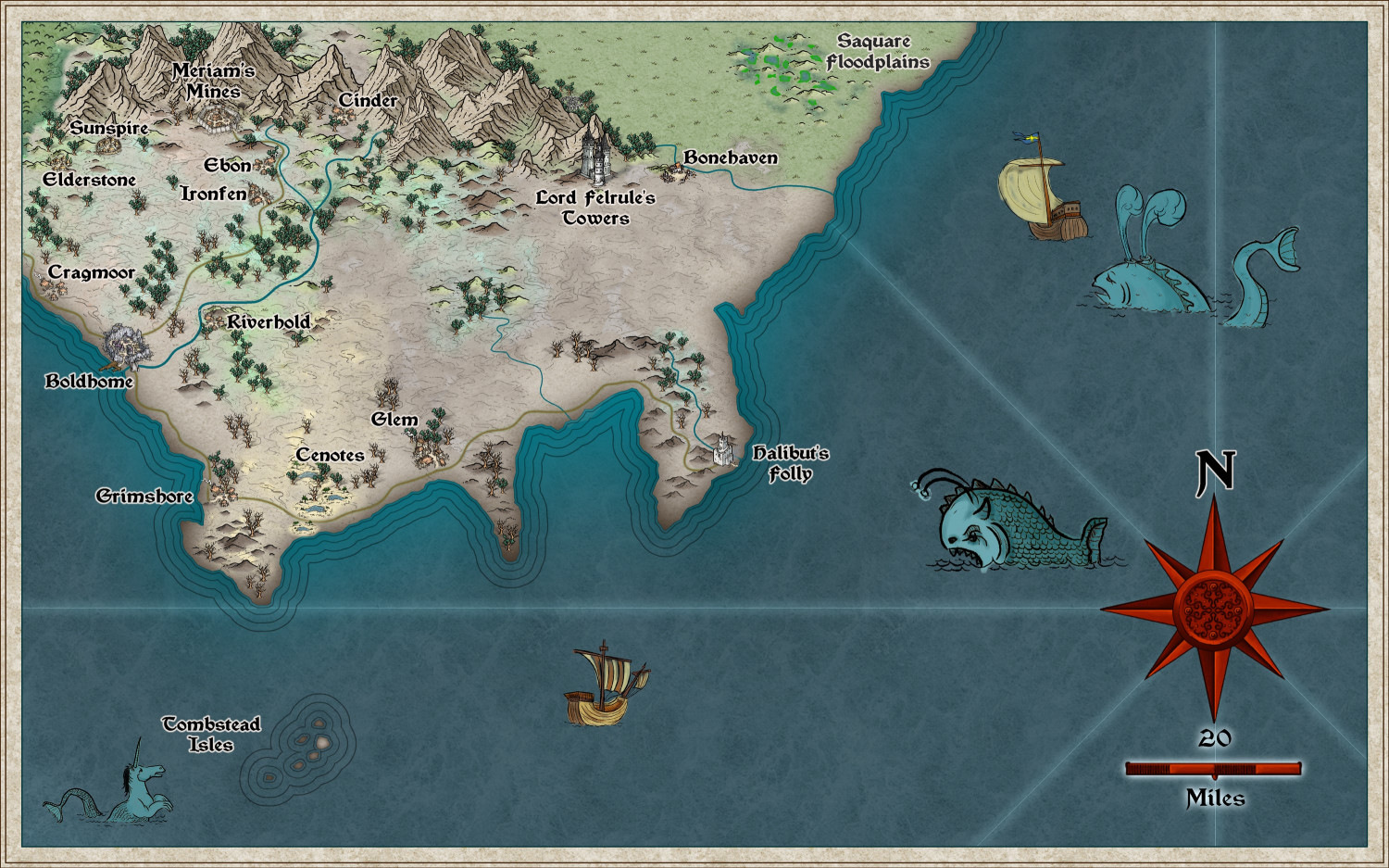
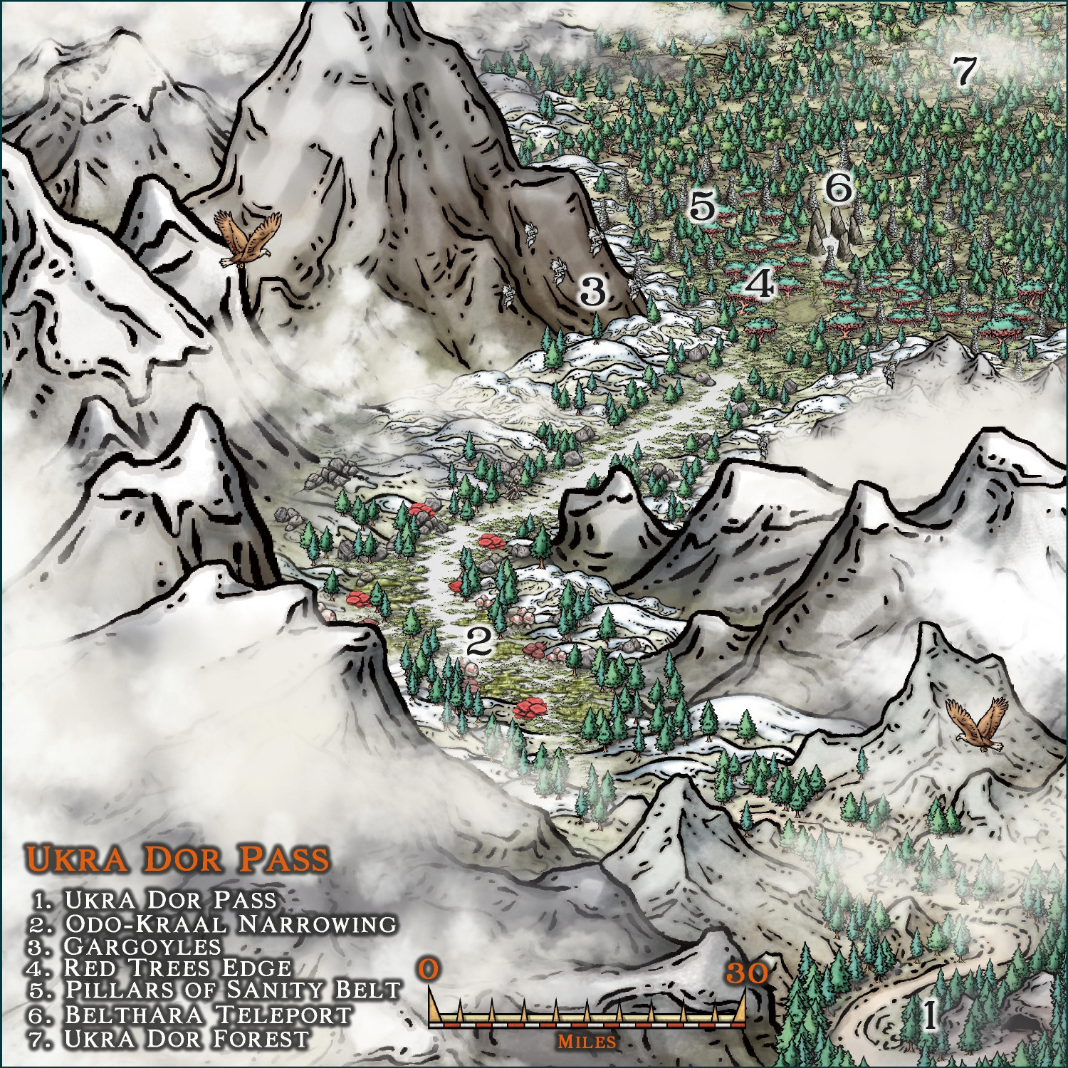
Community Atlas - Ezrute - Ukra Dor Pass
-
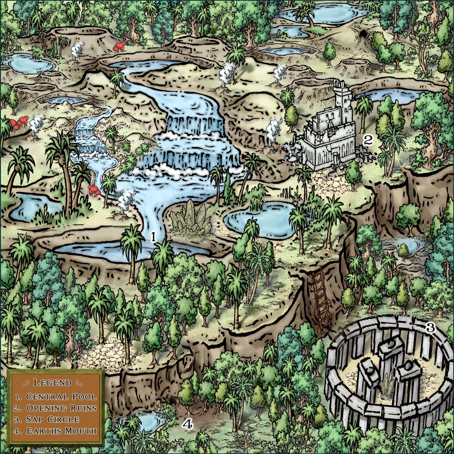
Community Atlas - Ezrute - Fertile Valley
-
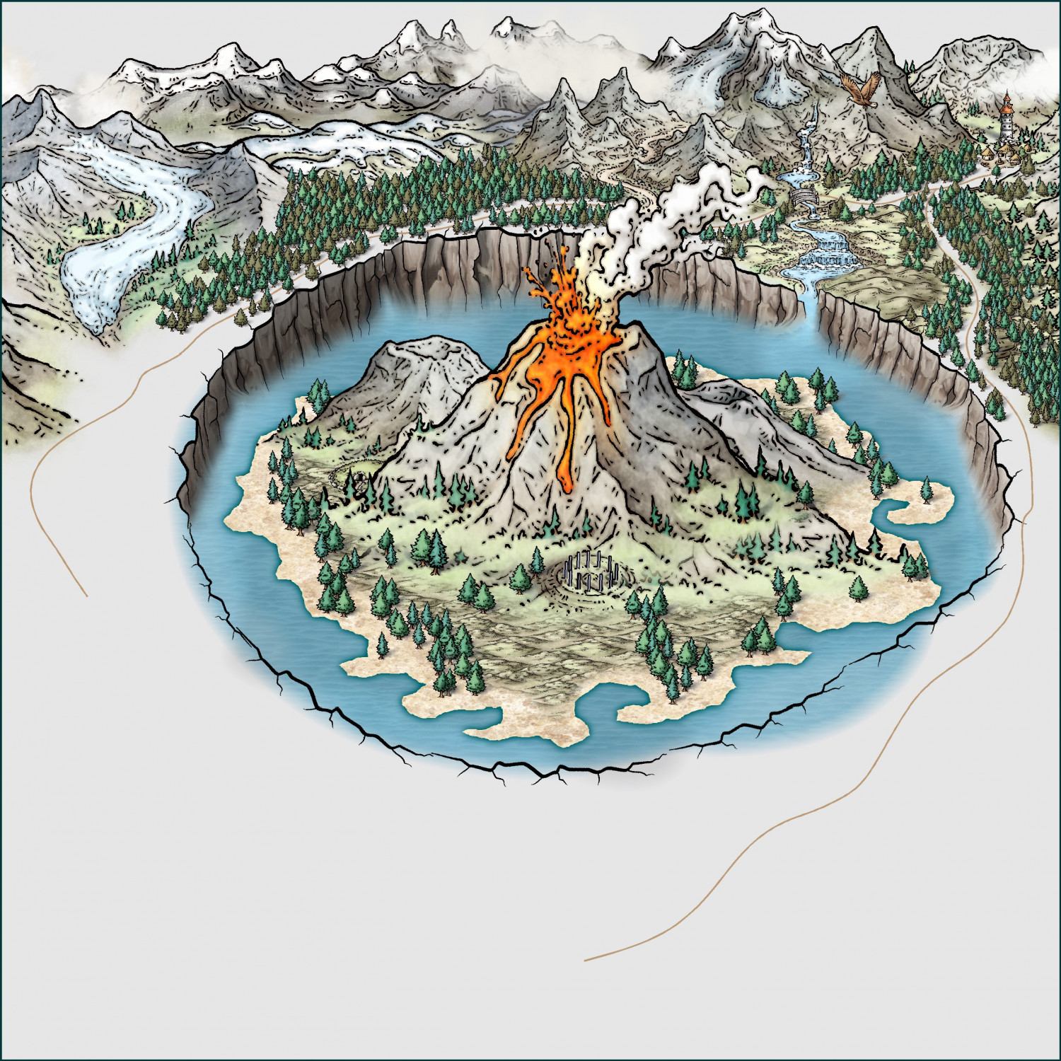
Volcanoes
As expected, this time it's a MS-style volcano. I have an idea of the center of the painting, but not yet the entire design. We'll see what the final image turns out to be in this freehand.
-
Volcanoes
-
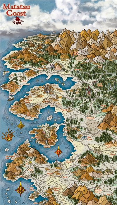
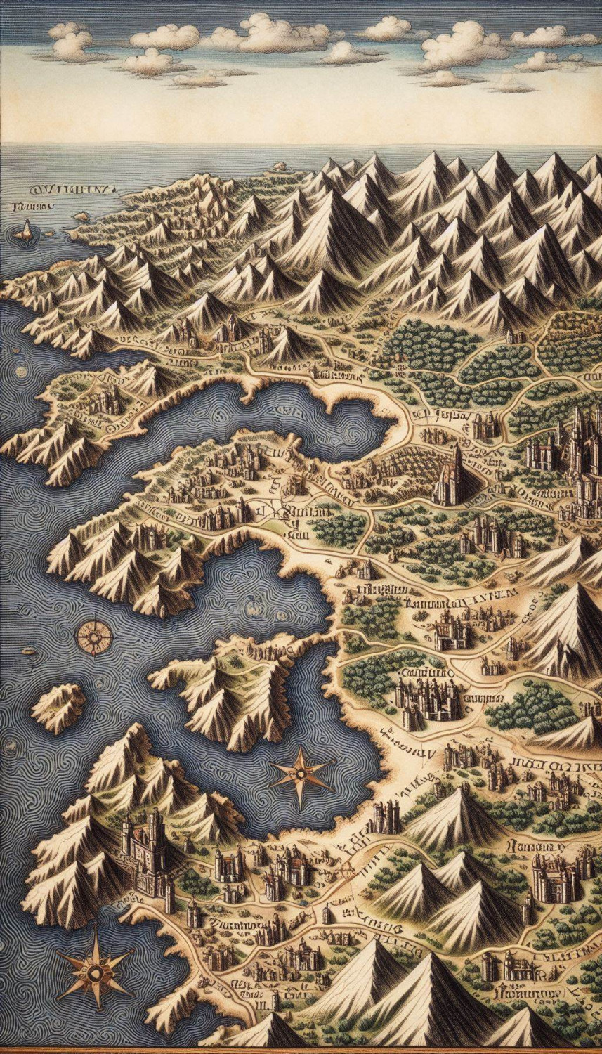
Matatau Coast - Trace from IA map
I created a generic map from the IA in a 4:7 ratio to use as a base for a trace.
Here is the image that I used Handdraw Fantasy for in a size of 400x700 (I don't remember if it's metric or imperial), for the purpose that I used the map, it doesn't matter either.

-
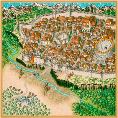
New city for a friend
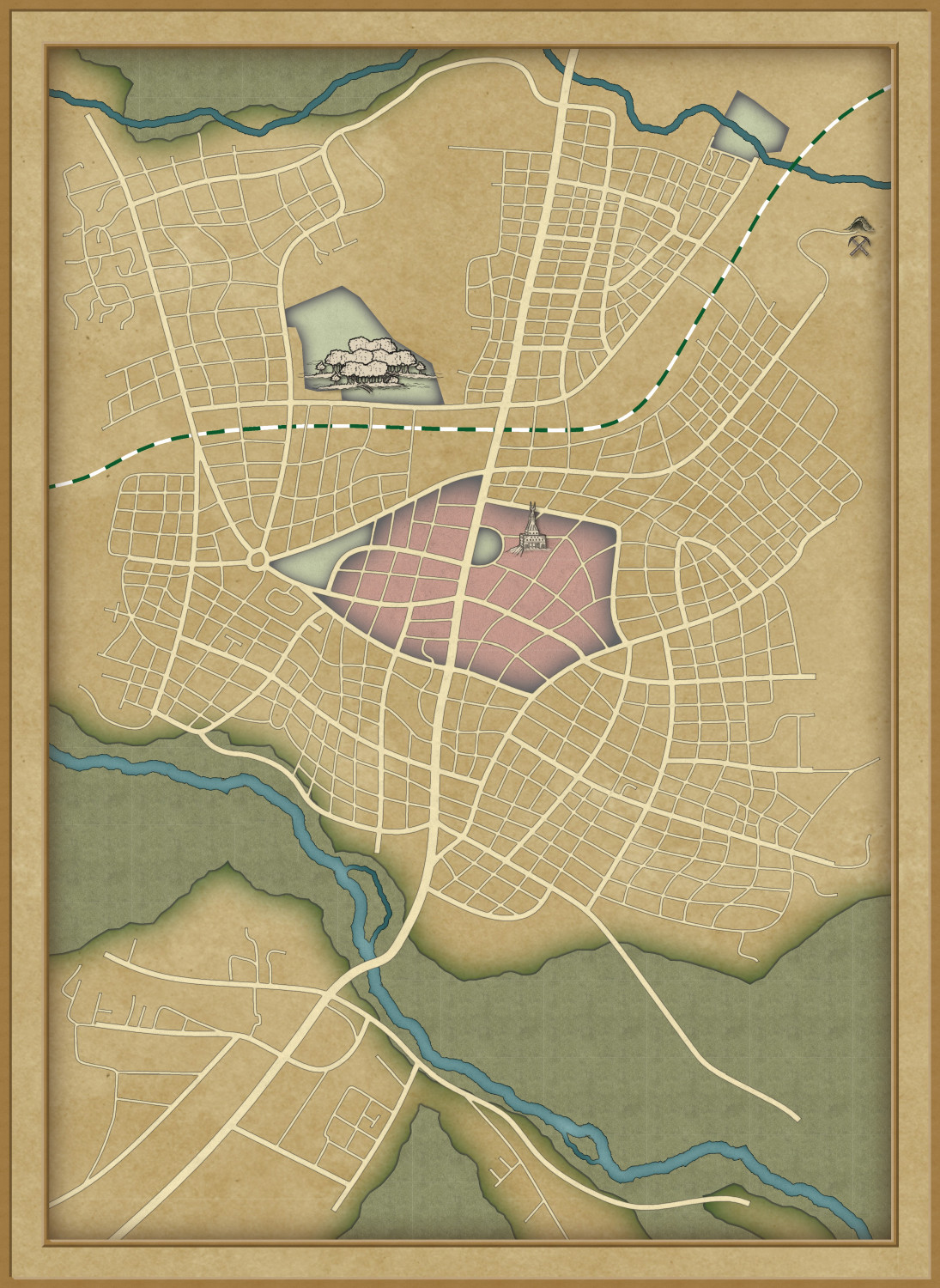
Using Cthulhu City again to create a city frozen in time and slightly cursed.
I used the small town of Stratford-upon-Avon, where William was born, as a reference.