


Royal Scribe
Royal Scribe
About
- Username
- Royal Scribe
- Joined
- Visits
- 9,529
- Last Active
- Roles
- Member
- Points
- 3,353
- Birthday
- February 5, 1968
- Location
- San Francisco, California
- Website
- https://legacy.drivethrurpg.com/browse/pub/31814/Royal-Scribe-Imaginarium
- Real Name
- Kevin
- Rank
- Mapmaker
- Badges
- 16
Latest Images


Reactions
-
[WIP] Viking Adventures
I was looking for a peaceful, zen mapping project and was inspired by the expansion of Viking symbols released today. It also gave me an excuse to using some of the glacier and icy Overland symbols that I've never used.
I didn't want to lift from Norse mythology and decided to go with Icelandic names, which I stole freely from lists on Wikipedia.
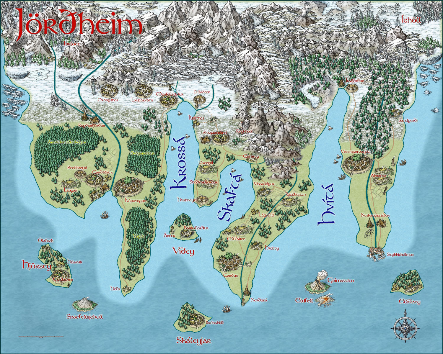
I will also post this in my galleries if anyone wants to zoom in closer.


-
[WIP] Wizard's Tower - Interior
Yes, absolutely! I kinda forgot about that once I found a place in the Atlas for them. But as that may take me some time to submit, and then Remy some time to process, here they are in the meantime:
One thing to note: I found my computer getting kinda sluggish with some of these until I hid all of the outside stuff while working on the rest. (That cleared up when I rebooted.) To deal with that, I created an "OUTSIDE" layer for each of these and put almost everything that wasn't inside the tower on that layer. If you're customizing and find it slow, hide the OUTSIDE layer while you're working and that may speed things up.


-
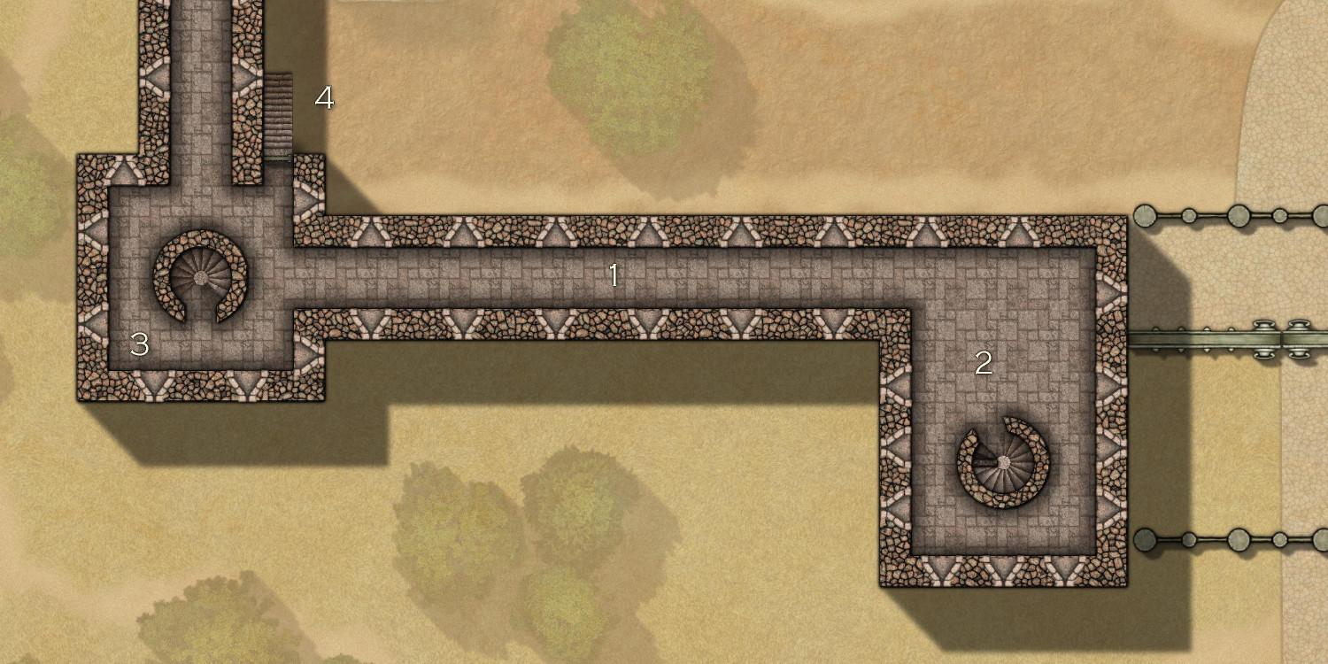
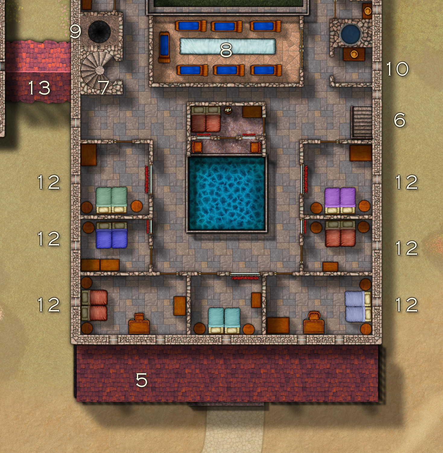
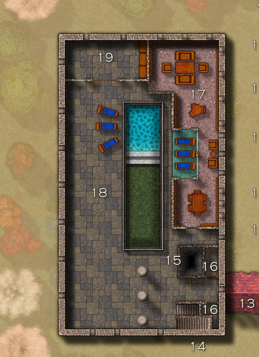
[WIP] Villa Citri (Roman-style villa)
Okay, the second floor is mapped and furnished!
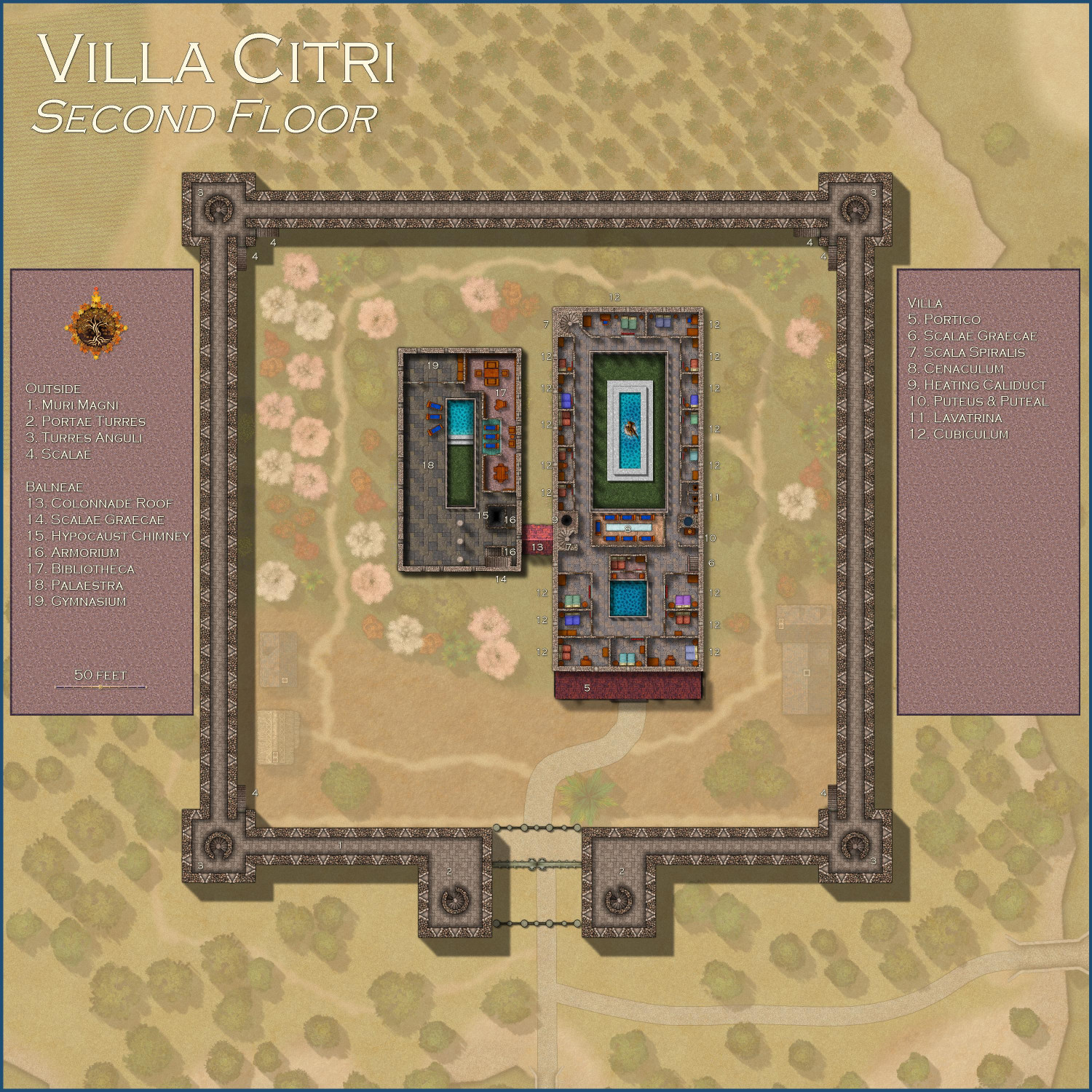
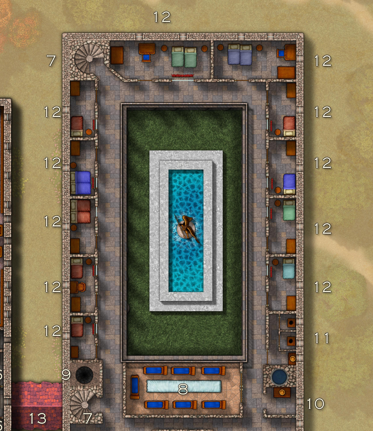
Outside
- Muri Magni: Inside the second floor of the outer wall in a 10-foot-wide passageway with arrow slits at regular intervals.
- Portae Turres: The gatehouse towers
- Turres Anguli: The corner towers
- Scalae: Exterior staircases open on one side that lead to the second-floor entrances of the corner towers
Villa
5. Portico Roof: The roof of the covered porch
6. Scalae Graecae: Staircase from the first floor
7. Scala Spiralis: Spiral stairs leading to the third floor
8. Cenaculum: The dining room on an upper floor of Roman houses
9. Heating Caliduct: Hot air from the hypocaust in the basement of the balneae flows through this shaft to heat the floors
10. Puteus & Puteal: An interior well with unheated water
11. Lavatrina: Lavatories
12. Cubiculum: Bedroom
Balneae
13. Colonnade Roof: The roof of the colonnade that connects the main villa to the bathhouse
14. Scalae Graecae: Staircase from the first floor and up to the third floor
15. Hypocaust Chimney: Exhaust vent for the vast amounts of smoke generated by the hypocaust in the basement
16. Armorium: Closets
17. Bibliotheca: The library, including a reading area overlooking the tepidarium pool
18. Palaestra: An exercise area and prominade
19. Gymnasium: Exercise equipment

-
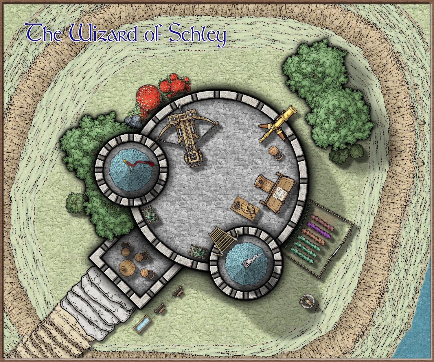
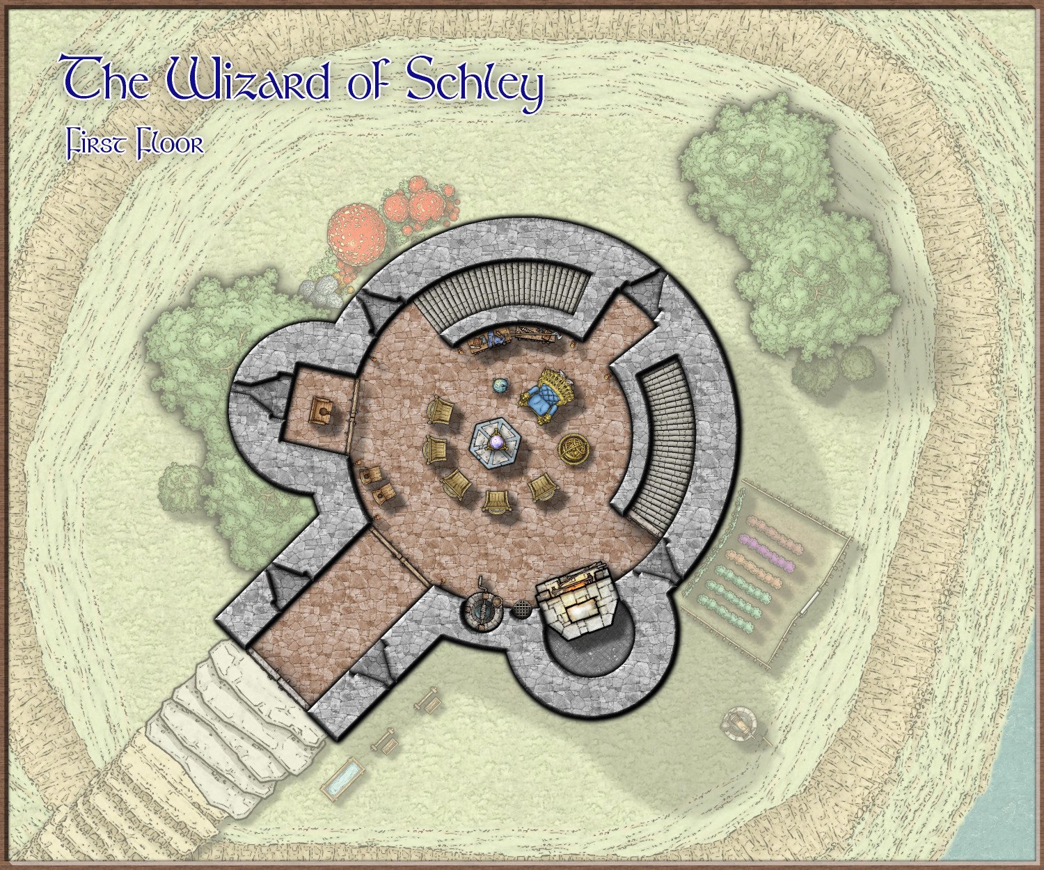
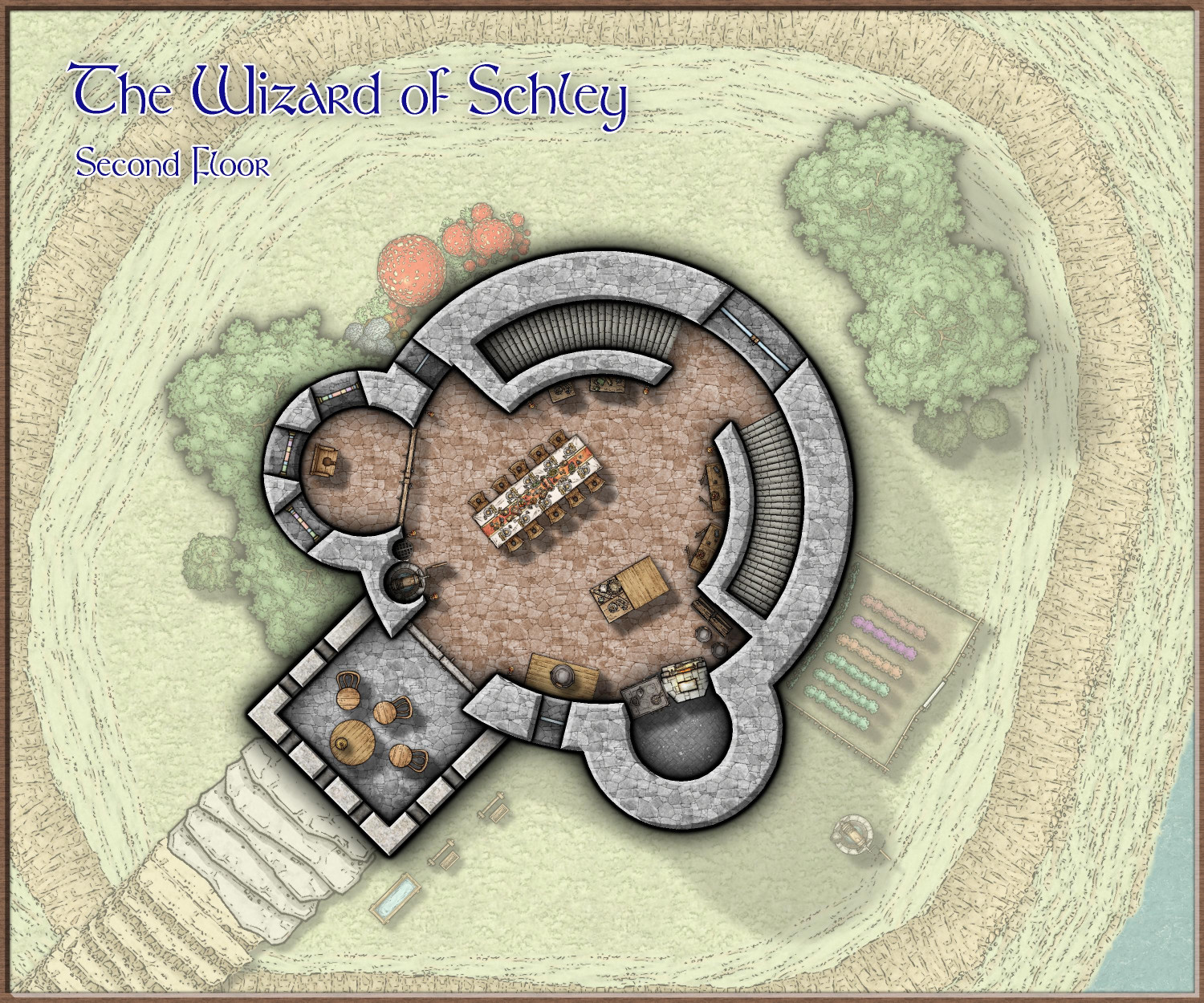
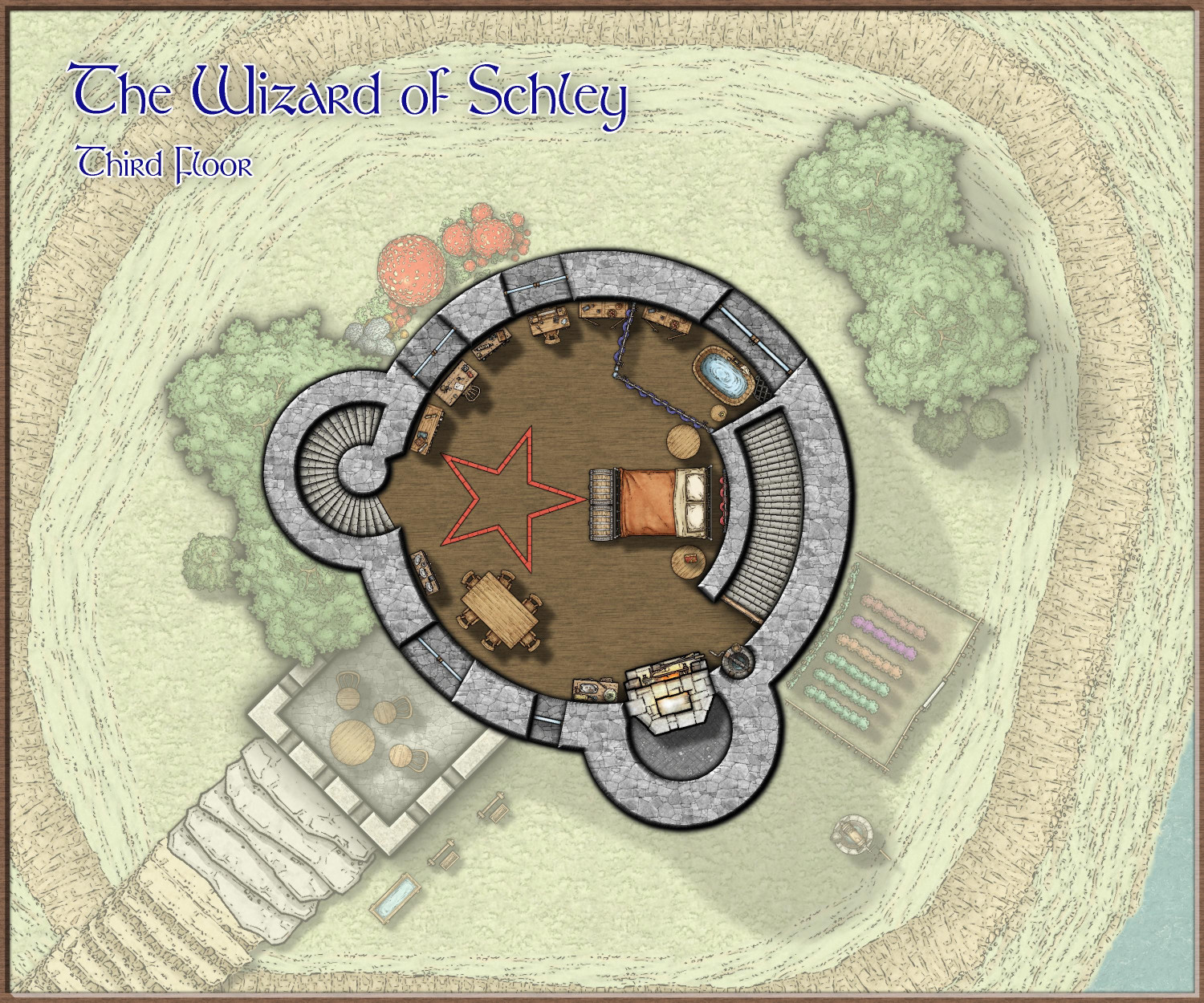
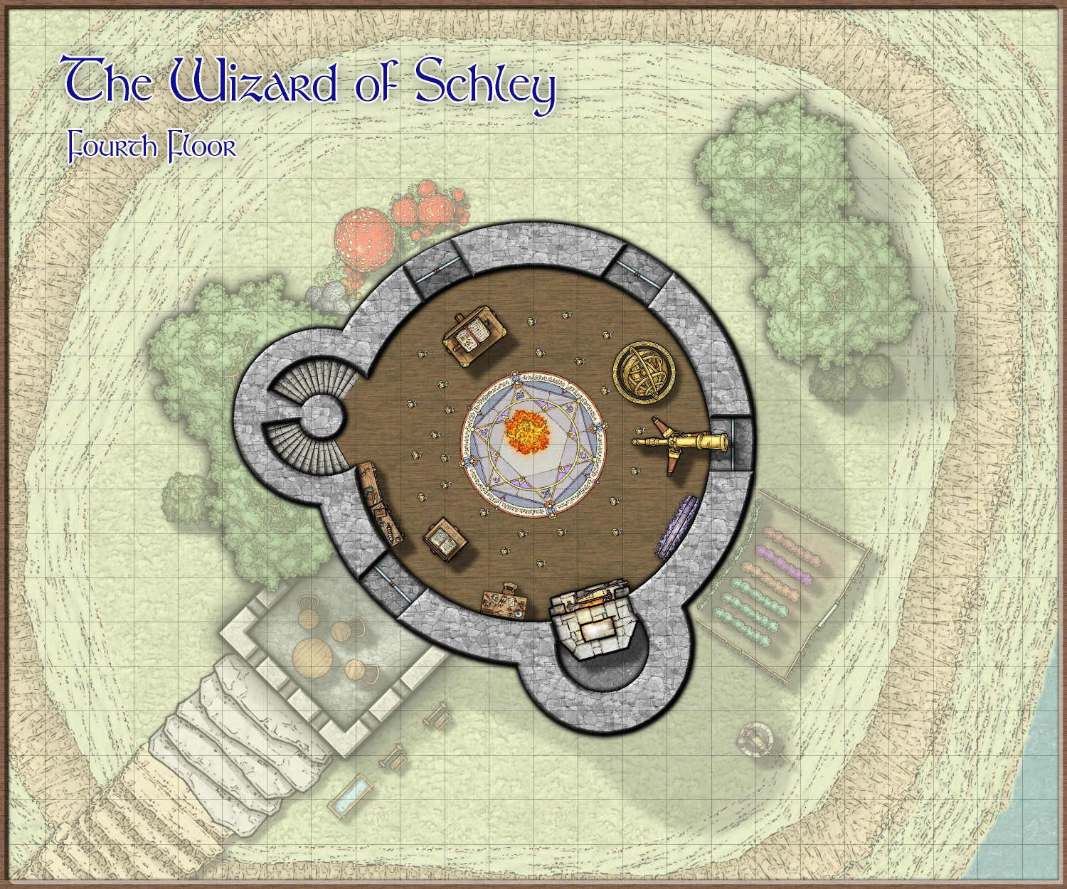
[WIP] The Wizard of Schley
I've been using DD3 symbols for interior furnishings lately because they are a better fit as a supplement to dungeon styles like Creepy Crypts. But I just had to play with Mike Schley's latest symbols (especially the astrolabe!), including some like the cliff symbols as well as the Stairs and Steps from last year's annual. I'm calling it this tower the Wizard of Schley...
(However, I just realized that although I have interior stairs going down, I haven't designed the basement yet. I will do that tomorrow.)
From Above
On the roof of his tower, the wizard paint the landscape by day and study the stars at night. He's also planted a little herb garden up here. The stairs to reach the roof are in the western tower; the southeastern tower is a chimney.
First Floor
This floor is principally used to receive guests, especially adventurers seeking to buy potions and scrolls, or to have curses removed, magical items identified, prophesies interpreted, or their destination scried upon to scope it out. He has set it up to impress and intimate guests, with an ornate throne for himself. Most of the magical devices that he might need for the typical visitors are available here.
Second Floor
The second floor is the wizard's main living space, with a kitchen and spacious dining area. The roof of the gatehouse can be accessed from here, and the wizard has set up a table and chairs here for outdoor dining on nice afternoons and evenings.
Third Floor
This is the wizard's bedchamber, bath, and private office. The main interior stairs end here, but a spiral staircase in the western tower continues up.
Fourth Floor
This is the wizard's workshop and summoning chamber. The tower stairs continue from here to the roof.


-
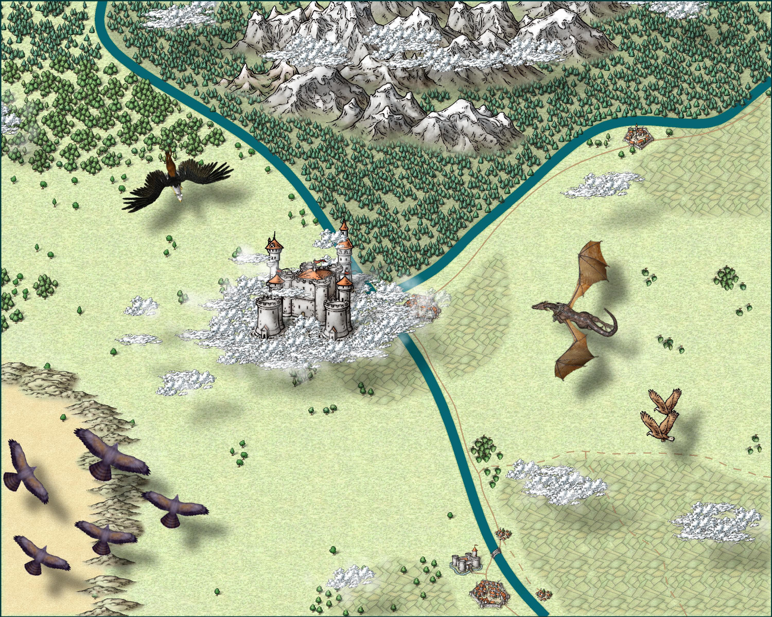
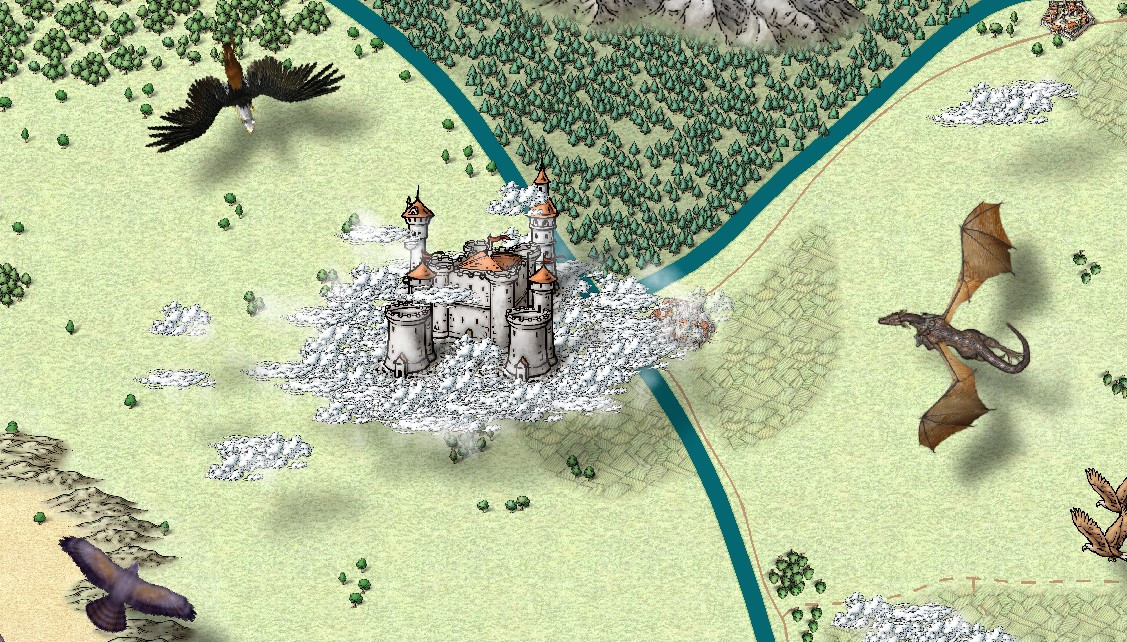
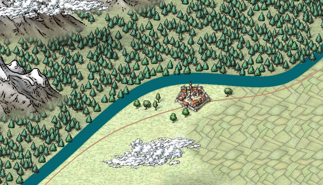
Castle in a Cloud
I made a few tweaks per Jim's suggestion. I added some misty cloud coverage above the castle, and also added some cloud wisps above the mountains and on the right side. I also added a few more smaller birds meant to look like they were flying lower.
I also discovered that Mike Schley's Overland style already has cloud symbols, but I wasn't sure how they'd work semi-transparent. I added them as a base to the castle but most of the clouds are still from Forest Trails.
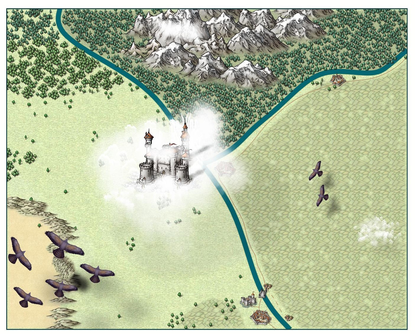
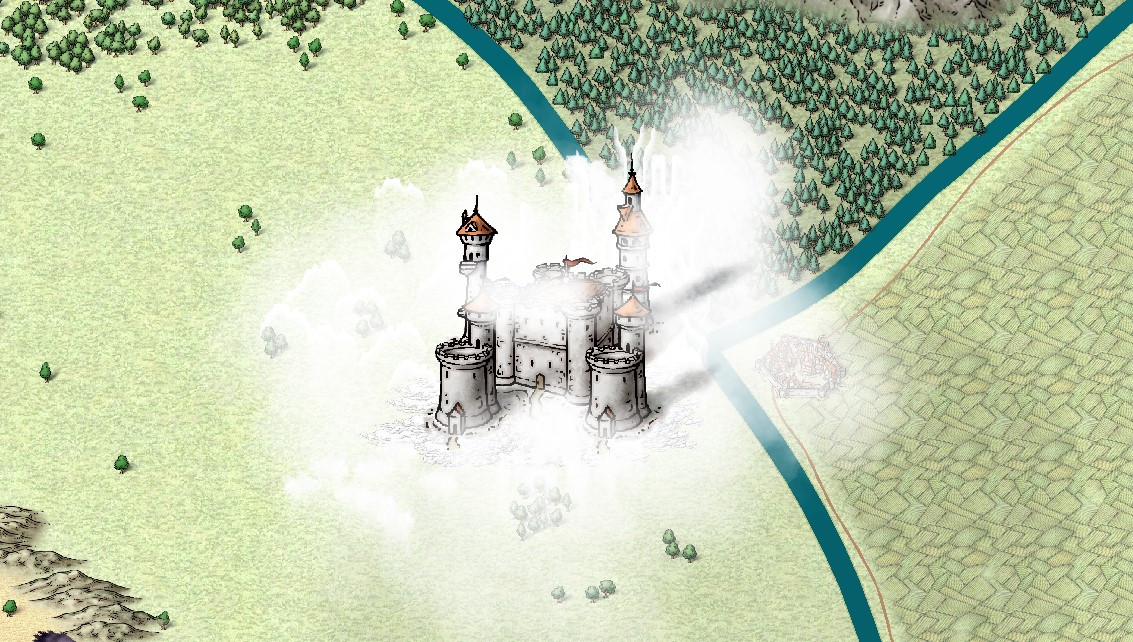
Also made a few other tweaks, like adding hills to separate the grasslands from the default terrain, and a few more trees below the castle peeking through the clouds.
I looked through my symbols to see if there were any other flying creatures, but couldn't find anything. Mike Schley's lovely dragons were sleeping, not flying. I even checked WikiMedia Commons to see if there was a flying pegasus or dragon in public domain that would be suitable, but didn't find anything. If anyone has any other recommendations for other flying symbols, please let me know.


-
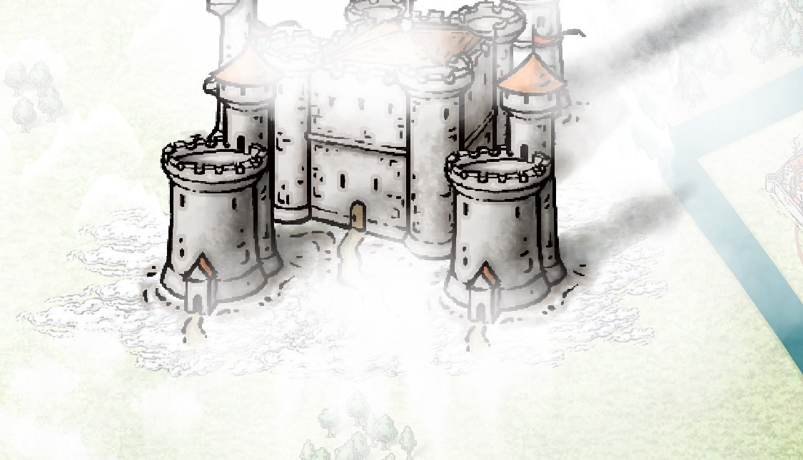
[WIP] Wizard's Tower - Interior
Turret is done, and with it the entire above-ground portion of the tower. There are several basement areas (cold storage and wine cellar, sewers, dungeon!) that still need to be mapped. My hope is to finish it all off before the end of the month.
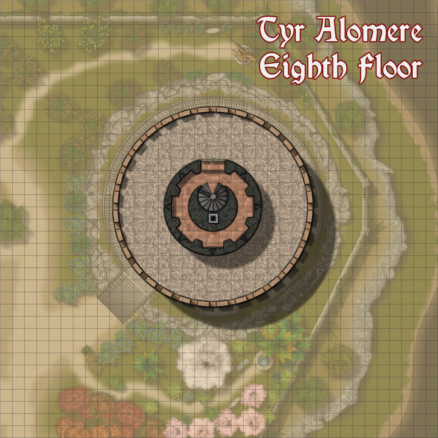
Eighth Floor
The 8th Floor of the tower is the first floor of the turret, plus the roof area (protected by crenellations) of the main tower. The turret has arrow slits that can be closed off inside with metal shutters. (In looking at the arrow slits, I see they are not quite like the ones on lower floors, so I may adjust them.) The spiral staircase extends up one more level.
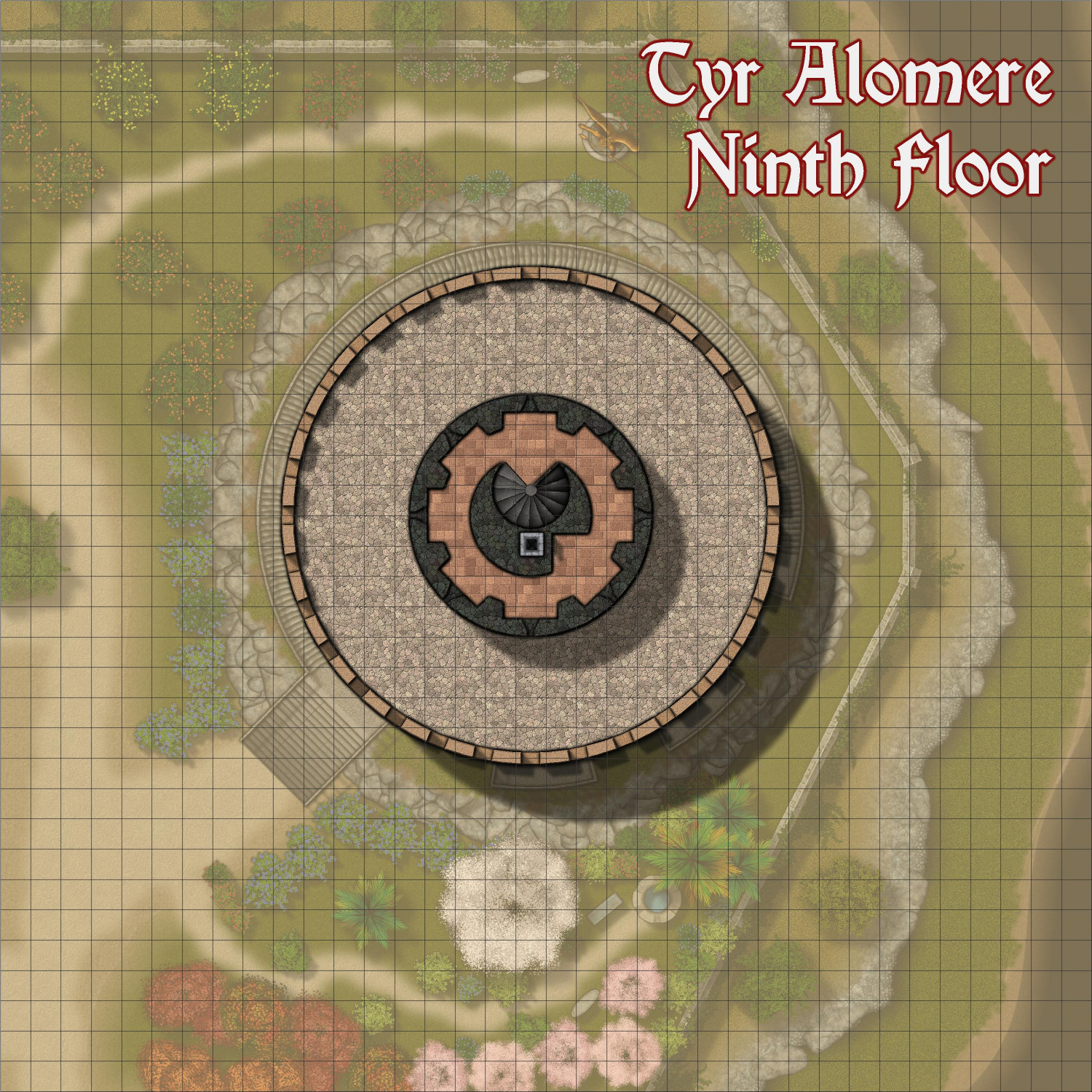
Ninth Floor
This floor provides arrow slits elevated above the roof of the main tower. The spiral staircase ends here, but rungs mounted on the wall allow for ascending to the "bell tower" above.
Tenth Floor
It's more of a light house than a bell tower. Luminescent crystals radiate light that can easily be seen for miles around. On holidays and special occasions, the wizard can use simple illusions to change the color of the light to match the holiday's traditional décor.
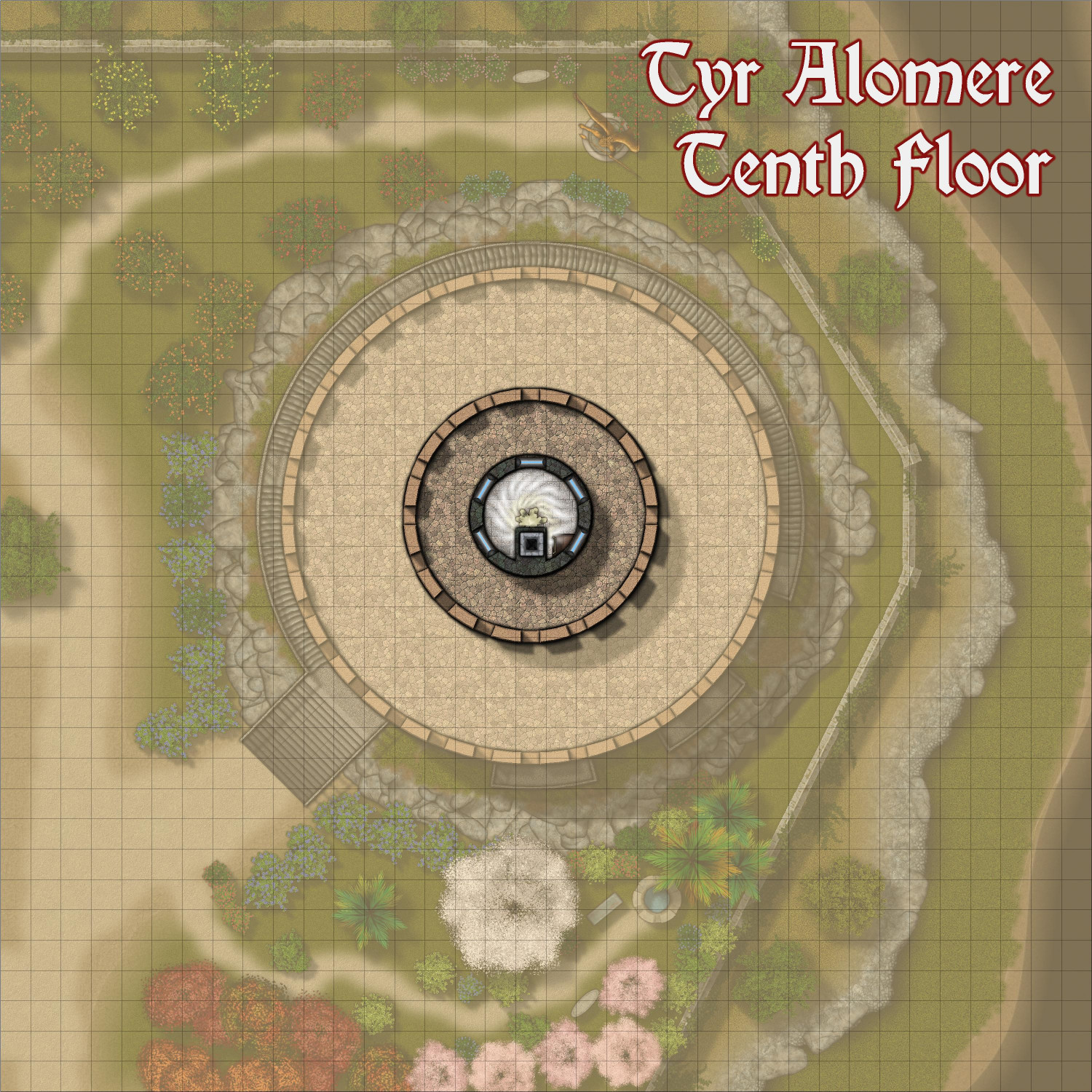
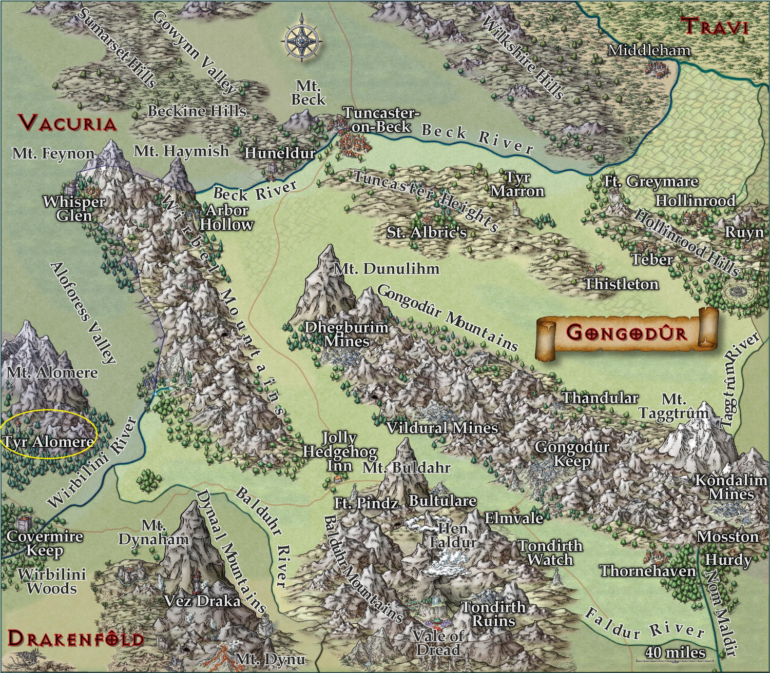
You may have noticed that these images now use the title "Tyr Alomere" instead of "Wizard's Tower." I have decided where I'd like to home it in the Atlas, a wizard's tower that I had placed in the Gold Coast area of Doriant that I mapped for the Atlas (circled in yellow in the two images below).
I will need to design the small village the tower is in first. Do you think I need to do a more regional map, or will the village with the tower suffice?
Here it is on the Gold Coast:
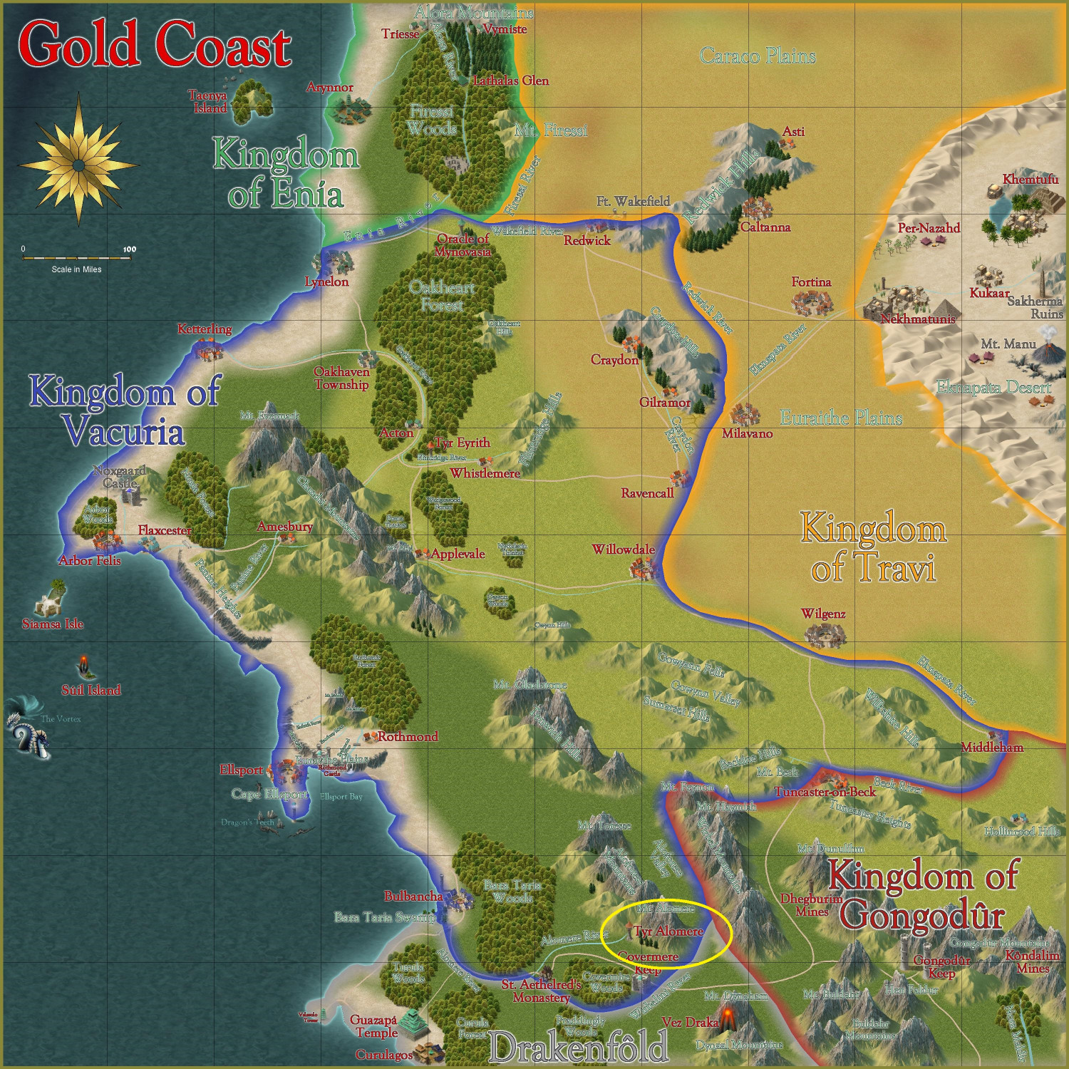
It also makes an appearance on the edges of the regional map of Gongodûr -- it's in the Kingdom of Vacuria, but on the edges of Gongodûr:
-
[WIP] Town of Kukaar (Ancient Cities Annual)
Hi everyone,
Thank you for the feedback, it was very helpful. I put the legend back to the original size and location, and it actually looks pretty good. There's room for some lines to wrap if I make it slightly larger, but it seems legible enough as is. Also, I made the roads stand out a little more by changing the transparency effect from 50% opaque to 75% opaque.
Also, are the numbers on the map okay? Should I make them bigger? (I just noticed that some seem to be different sizes, so I will at least have to standardize that.) Are there effects that would make them pop more, like a stronger white glow? Is there anything else unlabeled that should be labeled? I just provided a few sample businesses (inns, blacksmiths, etc.) figuring that a DM could make up something on the fly if players were looking for a specific type of business, but I can add others that folks think are necessary.
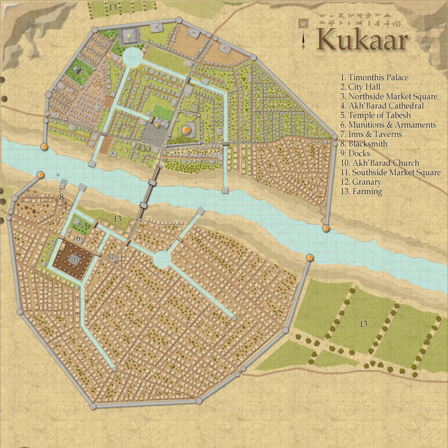
Neighborhood maps are a good idea if anyone wants to do a full campaign here (rather than an adventure limited to an inn or a temple, where the rest of the map just provides a general context). I have a whole laundry list of maps I want to do first, but once this is published in the Atlas (after the contest is done), I would welcome anyone to take a neighborhood and expand on it.


-
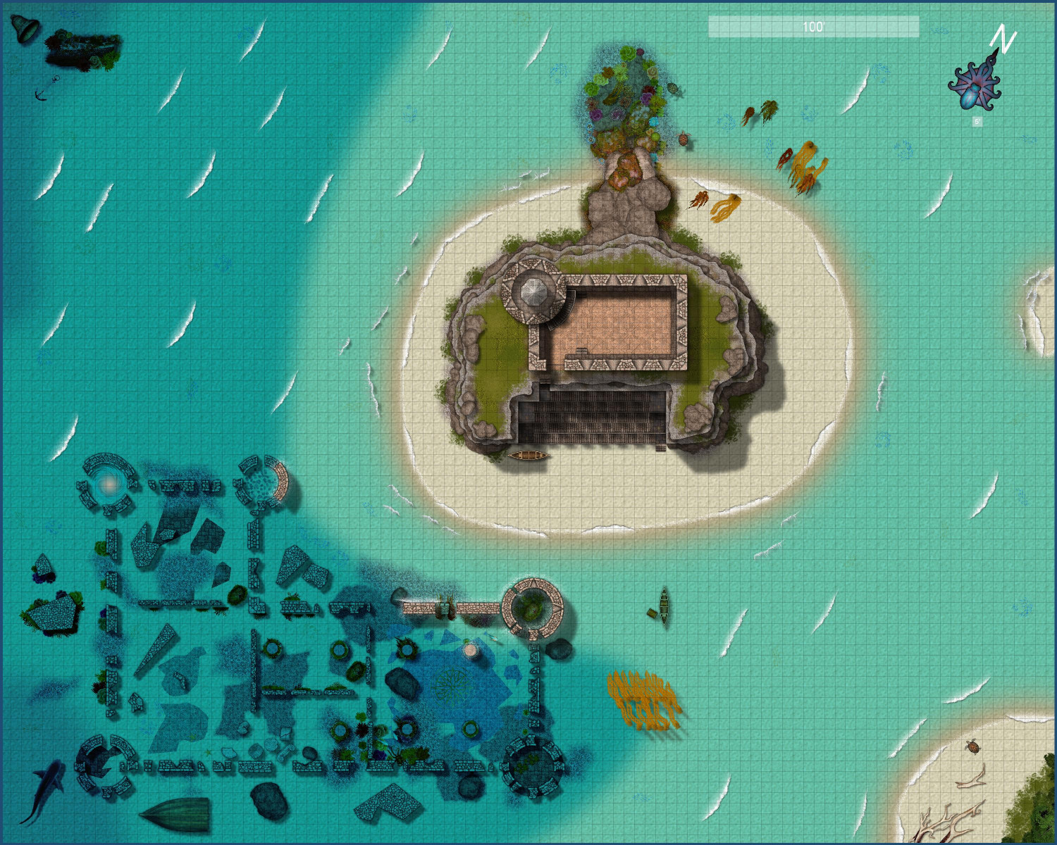
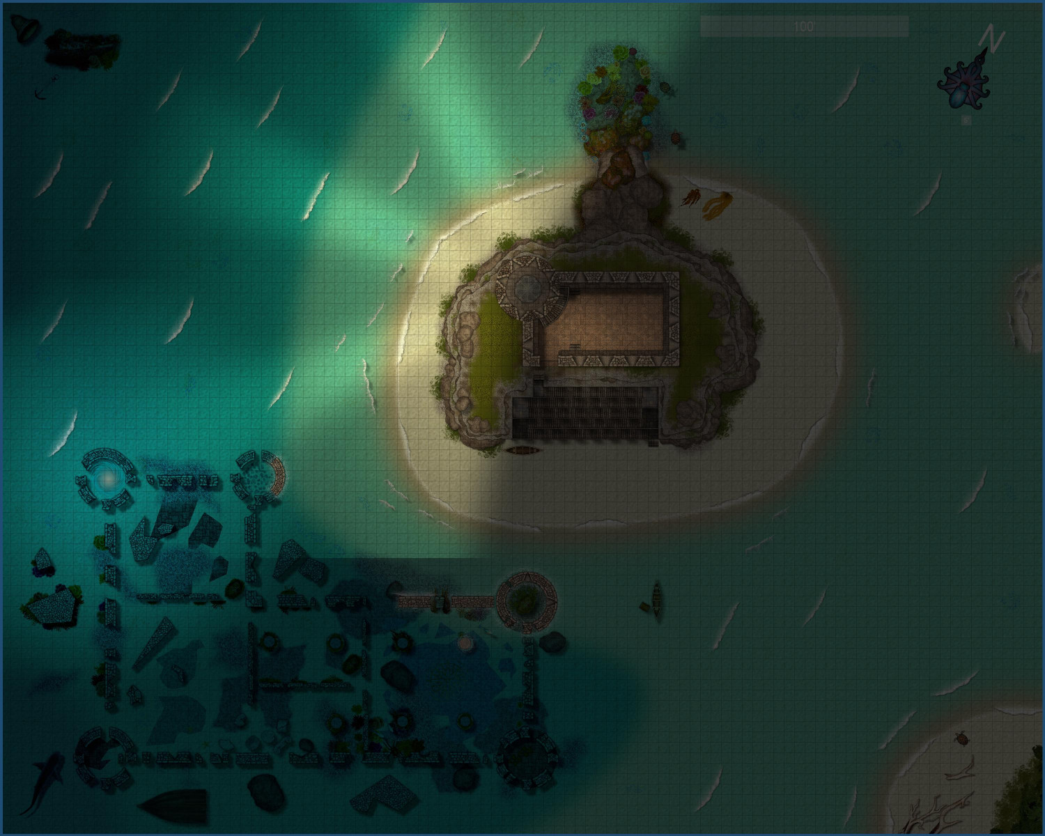
[WIP] Marine Dungeons Lighthouse (more May Annual Stairs & Steps)
Added a few final touches (a friend was confused about the seaweed washed up on the beach, so I added a little more floating in the sea, and a few other minor tweaks here and there. Not really sure what that line cutting off the light in the nighttime version is from.
Here's the "final" (is anything ever really final?) version of the daytime and nighttime full maps. More details maps in my galleries.

-
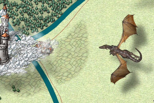
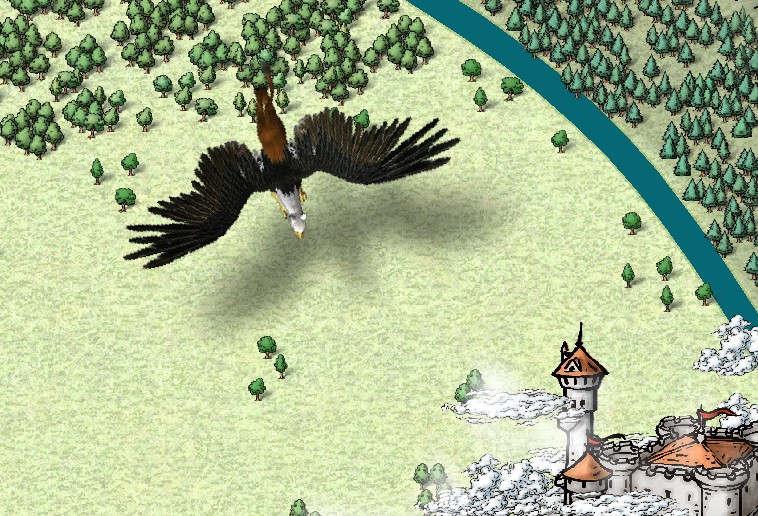
Castle in a Cloud
Thank you, everyone, for your help.
After a bit of wrestling (and an evening of downloading massive files), I was able to install the Dundjinni symbols that Wyvern recommended. I added a griffon and a dragon with a rider. I also swapped out the giant hawks in the lower right side for a pair of eagles from the Mike Schley Overland that I missed. My flying creatures are a bit oversized compared to the castle, but I figure it's a bit of forced perspective, with the flying creatures coming in from above and closer to the viewer.
(I also trimmed back some of the farmland on the right side so that it's now mostly around the towns and cities.)
I belatedly discovered that Mike Schley's clouds also have a vericolor version, so I could add in some light gray ones to add a little texture, but I haven't done that. I will get the 2014 Annual with the Alyssa Faden clouds in a few weeks and try them on a whole new map from scratch.
Ricko, I am enjoying your tutorials. Thank you.
-
[WIP] Swamp Witch
The third version uses Marine Dungeons as the basis, with stumps (and snakes) coming in from Creepy Crypts and trees coming in from Forest Trail. This has the best waves and ripples, naturally. I tried to darken the water a bit by using patches of the Water Deep and Water Deepest drawing tools, and then applying some effects to that sheet (specifically, using the RGB Matrix to make the deeper waters sepia toned, and then the Adjust Hue/Saturation effect to change the lightness by -15%. I should probably add more algae floating on top.
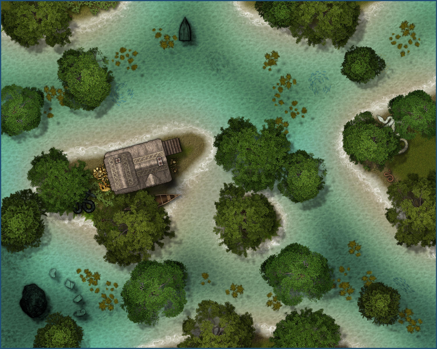
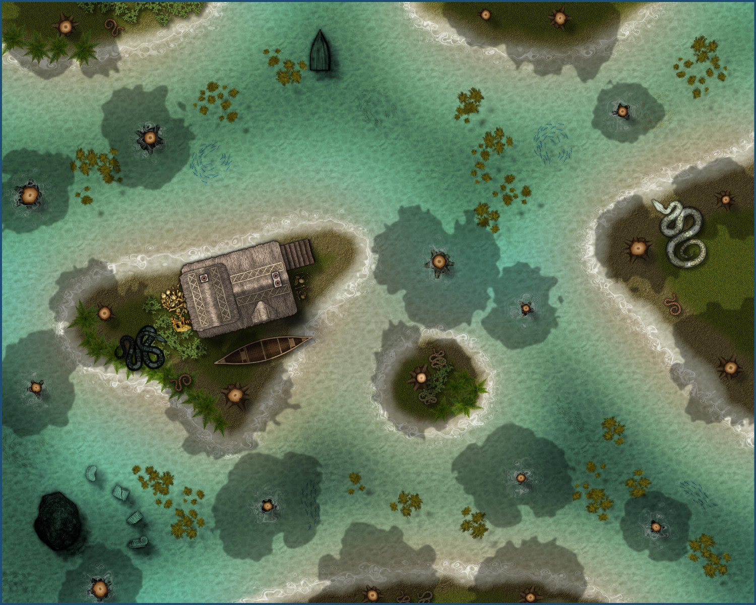
Anyway, these more mostly just for fun. I don't currently have a specific plan for them, but I wanted to see if I could create a swamp with current assets/techniques. Still hoping for a Jungle/Swamp annual some day. 😉


