Royal Scribe
Royal Scribe
About
- Username
- Royal Scribe
- Joined
- Visits
- 9,529
- Last Active
- Roles
- Member
- Points
- 3,353
- Birthday
- February 5, 1968
- Location
- San Francisco, California
- Website
- https://legacy.drivethrurpg.com/browse/pub/31814/Royal-Scribe-Imaginarium
- Real Name
- Kevin
- Rank
- Mapmaker
- Badges
- 16
Latest Images


Reactions
-
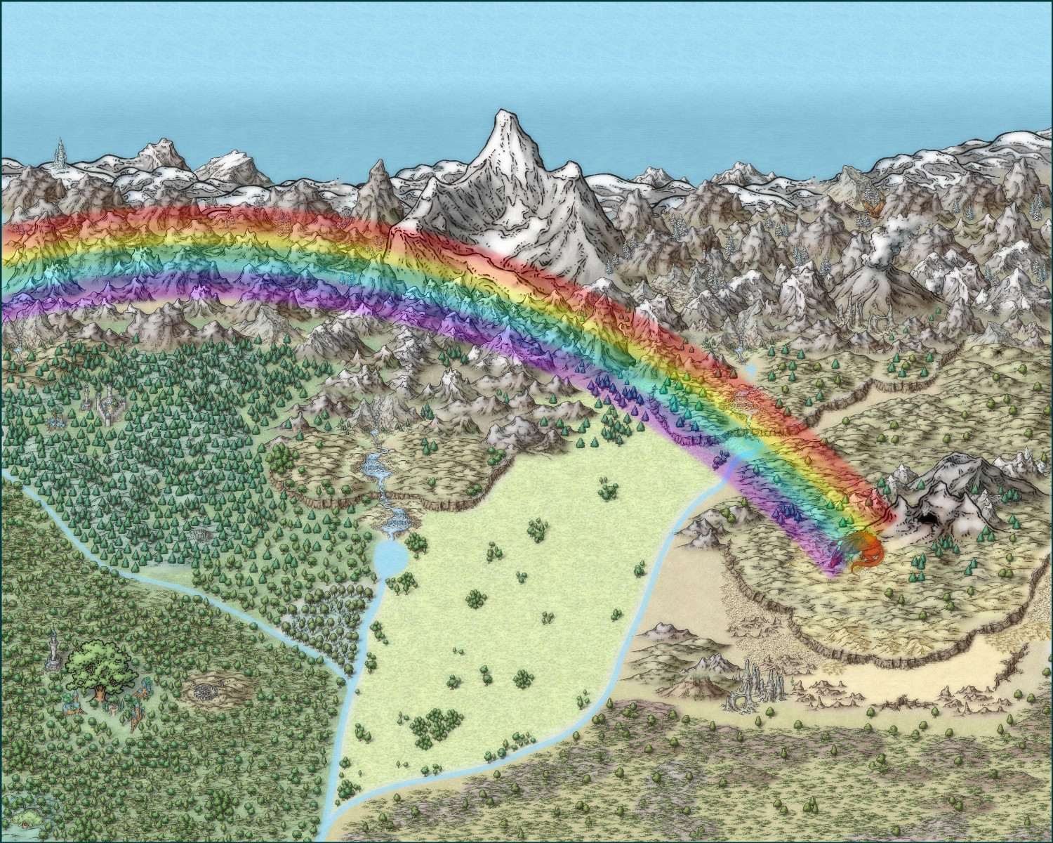
On leprechauns and rainbows and pots of gold
When I was ready to revisit the idea with the Mike Schley style, I took inspiration from Ricko Hasche's gorgeous maps that combine Mike Schley's Overland style with elements from the Cities of Schley Isometric style. I kept thinking about gold and leprechauns. Who else covets gold? Dragons, of course! So this rather large overland map has the rainbow ending on a dragon's nest with her golden egg. (Originally it was going to be a gold dragon, but the red one popped on the screen better.)
I will post some zoomed-in versions in my galleries.
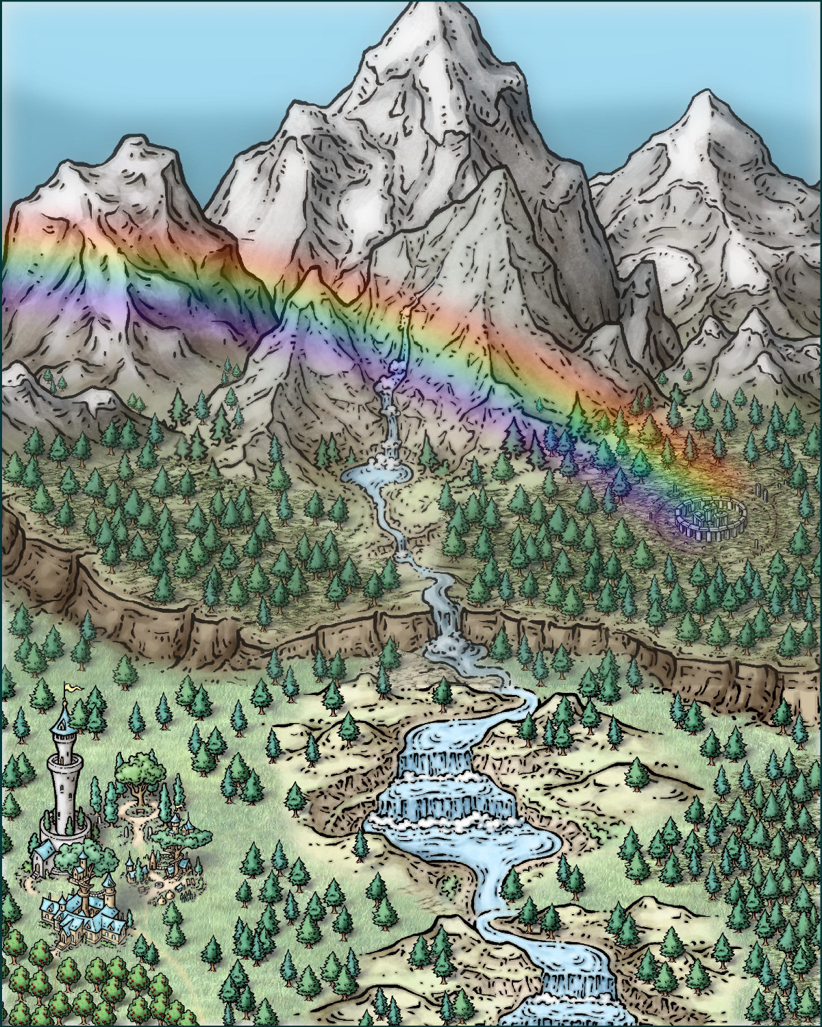
Although I was pleased overall, it doesn't have the impact that Ricko Hasche's gorgeous maps do. I decided to make another attempt, this time with a much smaller area and going vertical. I'm much happier with this next attempt, although I need a ton more practice to get mine looking a fraction as nice as Ricko's.


-
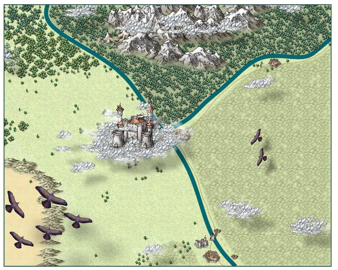
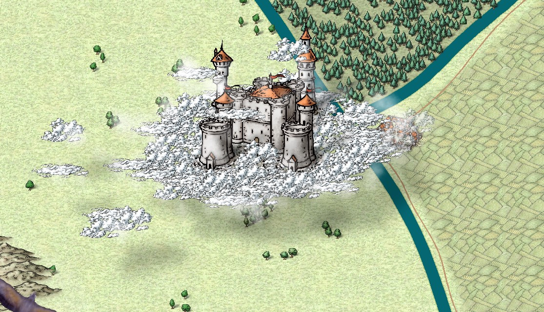
Castle in a Cloud
I am going to try to install the Dundjinni symbols that Wyvern recommended.
In the meantime, I switched the clouds from the Forest Trails rapids to the Mike Schley clouds, as they are consistent in style with the rest of the map. I may try the Alyssa Faden clouds later but I don't have that Annual yet. I put the clouds on a sheet above and below the "Symbols on Cloud" sheet to give them a 3D effect (and also cover up the walkways/roads to the castle that are part of the symbol). I also added some of the "waterfall clouds" from the Forest Trail to the periphery of the Mike Schley clouds -- they aren't very noticeable but give a nice misty semi-obscurity to the trees and other symbols below. I tried having another cloud sheet for the edges that would allow me to use the Mike Schley clouds with a transparency effect added, but I didn't like how it looked.
I had the same problem that Julian did, in that the castle didn't always look like it was floating. I hope the drop shadows with the Mike Schley clouds rectify that.


-
[WIP] The Candle & Kettle Inn in the village of Mapleford
Here's a first pass at winterizing Mapleford (with the summer version as a comparison):
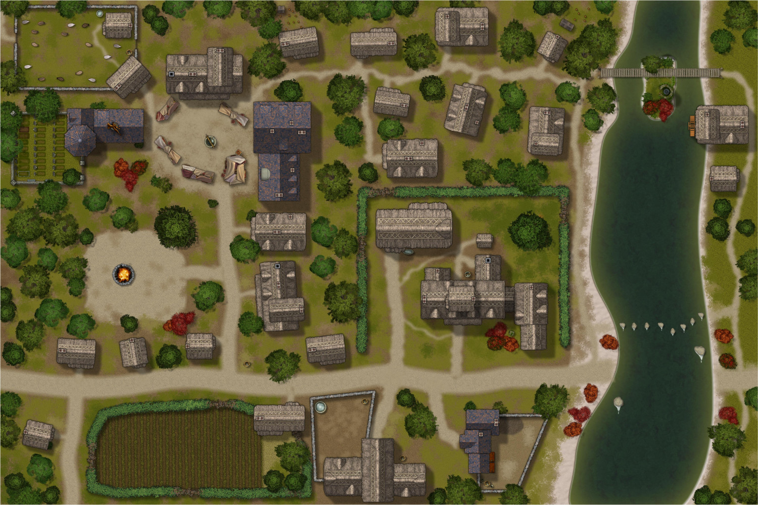
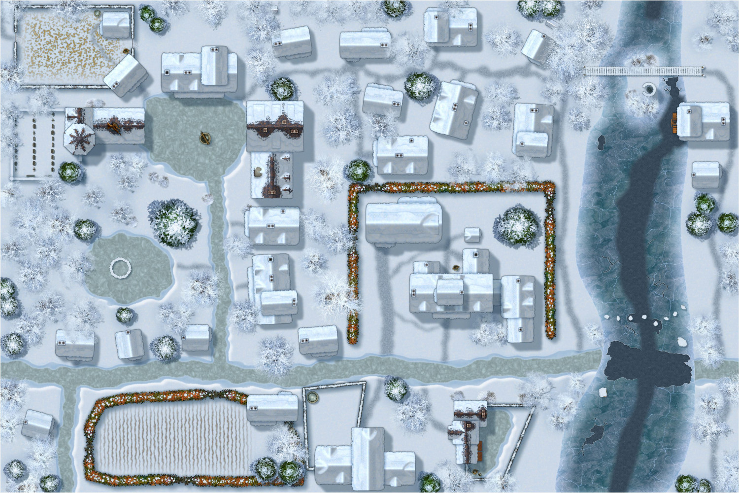
I am in awe of Sue's artistry in designing these annuals -- and what a tremendous gift to RPG gamers to have winter styles that match Forest Trails and Darklands City.


-
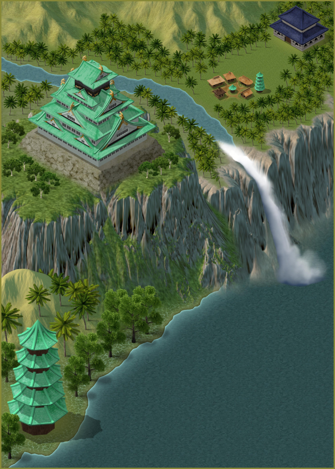
[WIP] Jungle Temple
Using Spectrum Overland, a temple in a tropical jungle...


-
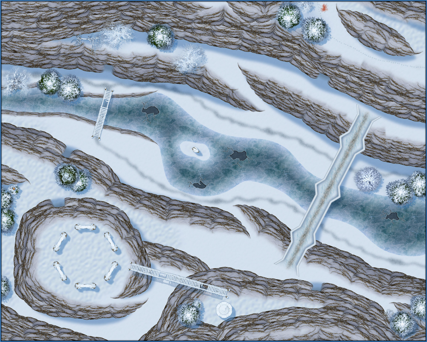
[WIP] Rise of the Crone-Mother
Here's the above-ground areas of the Frostmaidens' Cradle, lair of the alpine hags. The underground areas will make use of the Ice Caverns annual.
-
[WIP] Applevale
This is my first pass work-in-progress attempt to create a city map using an overland style (in this case, Handdrawn Fantasy) that Ricko does so magnificently.
It's meant to be a community of halflings and elves living together harmoniously, albeit mostly on opposite sides of a river.
Not sure if something like this would work for the Atlas because the scaling is tricky (and if it's not suitable, that's okay -- I had fun doing it). The map is set at 5x7 miles but then I had to enlarge a lot of the symbols.


-
[WIP] Community Atlas: Kumarikandam - SE Tiantang Region
Oh, apologies! Can you use this FCW instead? There's one more toggle:
TOGGLE: "SHADOWS" layer to reveal/hide cliff shadows.


-
[WIP] - An audience with the King
I love, love, love Mike Schley's new throne symbols! Had to design a little throne room to show them off.
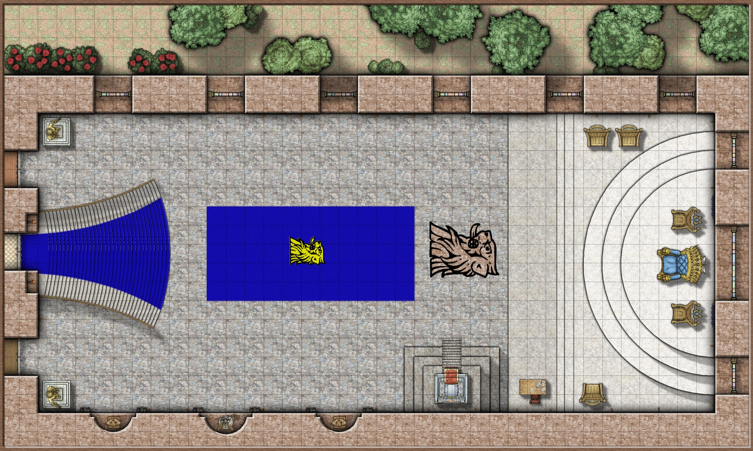
Most of my time was spent on the grand staircase on the western side. There were several possible approaches to getting it to flare out, and also have a carpet runner. Not sure if the approach I took (with heavy use of the Color Key cutout effect) was the best, but it works.
When the King is receiving petitioners, the room is mostly empty of furniture, as courtiers and petitioners are expected to stand. The king is flanked by two smaller thrones for his Queen and Heir Apparent. The Lord Chamberlain and Minister of Protocol are seated on the northern side of the dais, with the Lord Chancellor on the south side near a desk for the Royal Scribe to transcribe proceedings and draft writs and edicts as needed.
Another throne on a small dais is on the south side. This is called the Sedd Peryglus or Siege Perilous. In Arthurian legends, the Siege Perilous was a seat at King Arthur's Round Table that was left vacant for the knight destined to recover the Holy Grail. Here, it is enchanted with a permanent Zone of Truth spell that prevents anyone seated on it from knowingly lying. It is rarely used, for to be asked to sit there is tantamount to being declared a dishonorable oath breaker: swearing an oath to tell the truth should be sufficient for anyone of honor.
In the evening, tables will be brought in for a great feast. But alas! A great calamity is about to befell the kingdom.
A few quick sequel maps to come...

-
[WIP] Villa Citri (Roman-style villa)
Here's a first pass at the first floor of the main villa. There's more work to be done (like windows, and maybe furniture), but in the meantime, I wanted to solicit feedback on what types of rooms I'm missing. As this is a fantasy world, I'm absolutely fine blurring the lines on what would be strictly Roman, and mixing in things that would be more medieval or fantasy.
Also, bear in mind that this is just the ground floor. The basement will include a larder, wine cellar, and access to the sewers. The upper floors will have bedroom suites overlooking the courtyard. I plan to have a library on the upper floor of the baths next door.
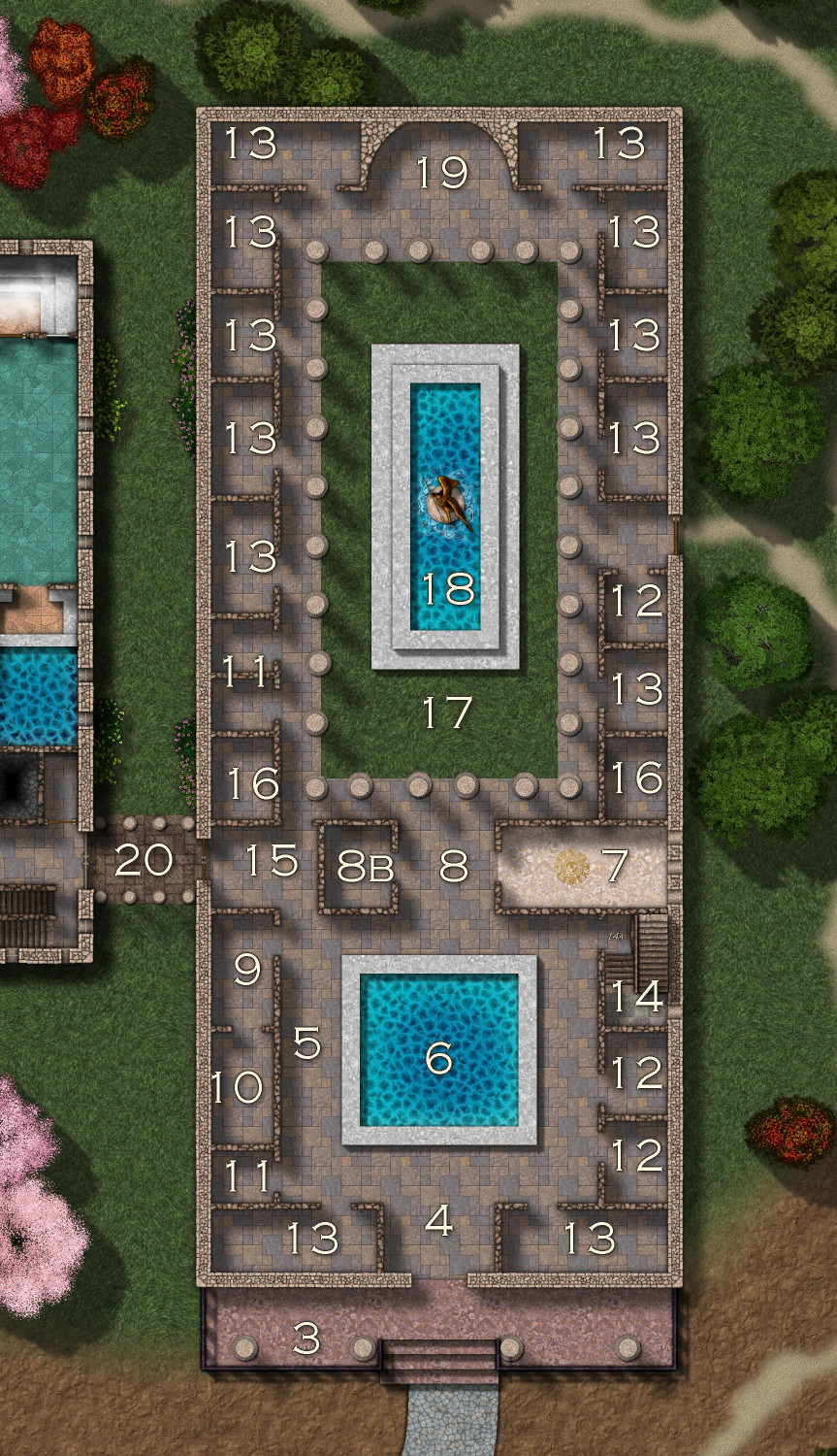
Here's the description for the numbered labels:
- Fortification Walls (not shown here)
- Gatehouse (not shown here)
- Portico - Covered porch
- Vestibulum - entry to Atrium
- Atrium - The central hall, where guests were greeted and the family's household gods were honored. It has an open roof (compluvium) and a rainwater pool (impluvium)
- Impluvium - Shallow pool that collects rainwater which is then carried by pipes to the kitchen
- Triclinium - The dining room where guests reclined on couches to eat
- Tablinum - The office or study of the head of the household, often located between the atrium and peristyle. The floorplans I've seen always show it without doors, so the head of the household can keep an eye on things, but I have chosen to add an enclosed office next to it.
- Culina - The kitchen
- Cellarium - The pantry.
- Lavatrina - Lavatories
- Horreum - Storage rooms
- Cubiculum - Bedrooms. I have a lot on this floor, but since the upper floors are intended to be mostly bedrooms, I am very much open to converting some to other uses if you can think of things I should add.
- Scalae Graecae - Staircases going to second floor. (The term "scalae" referred to a staircase that was open on one side; "scalae graecae" referred staircases with walls on both sides.) You may not be able to see it, but an archway under the stairs going up is meant to lead to stairs going down to the basement.
- Andron - In ancient Greece, this room was a room for men only, with couches arranged in a U-shape. By Roman times, it could also mean a room that was a passway between sections of the villa. (Open to changing this name if my sources are bogus.) In this villa, it provides access between the atrium, the peristylium, and the colonnade so that folks don't have to pass through the tablinum when it's in use.
- Alae - My sources about what this is are all over the place. As far as I can tell, they were once used as chambers with windows to allow daylight to the rest of the villa, but this became less important once the compluvium was added to allow light from the sky. They later became used as storage rooms, or as rooms to honor the ancestors. I've decided to go with the "honor the gods and ancestors" meaning.
- Peristylium - An open-air courtyard, often a garden, located at the back of the house.
- Piscina - Originally a fishing pond, the term later evolved to also refer to man-made pools and fountains.
- Exhedra - Semicircular or semi-open space or room, often found in ancient Greek and Roman architecture, used for conversation and seating. I am going to put in a semicircular bench here, and maybe a cozy brazier. Nice place to sit and chat overlooking the courtyard on those warm summer evenings.
- Colonnade - Unwalled, covered walkway lined with columns that leads to the bathhouse.
- Posticum - I forgot to label this one, but it's the read/side exit.
What am I missing? What would you want to see in the main floor of a wealthy noble's country estate?


-
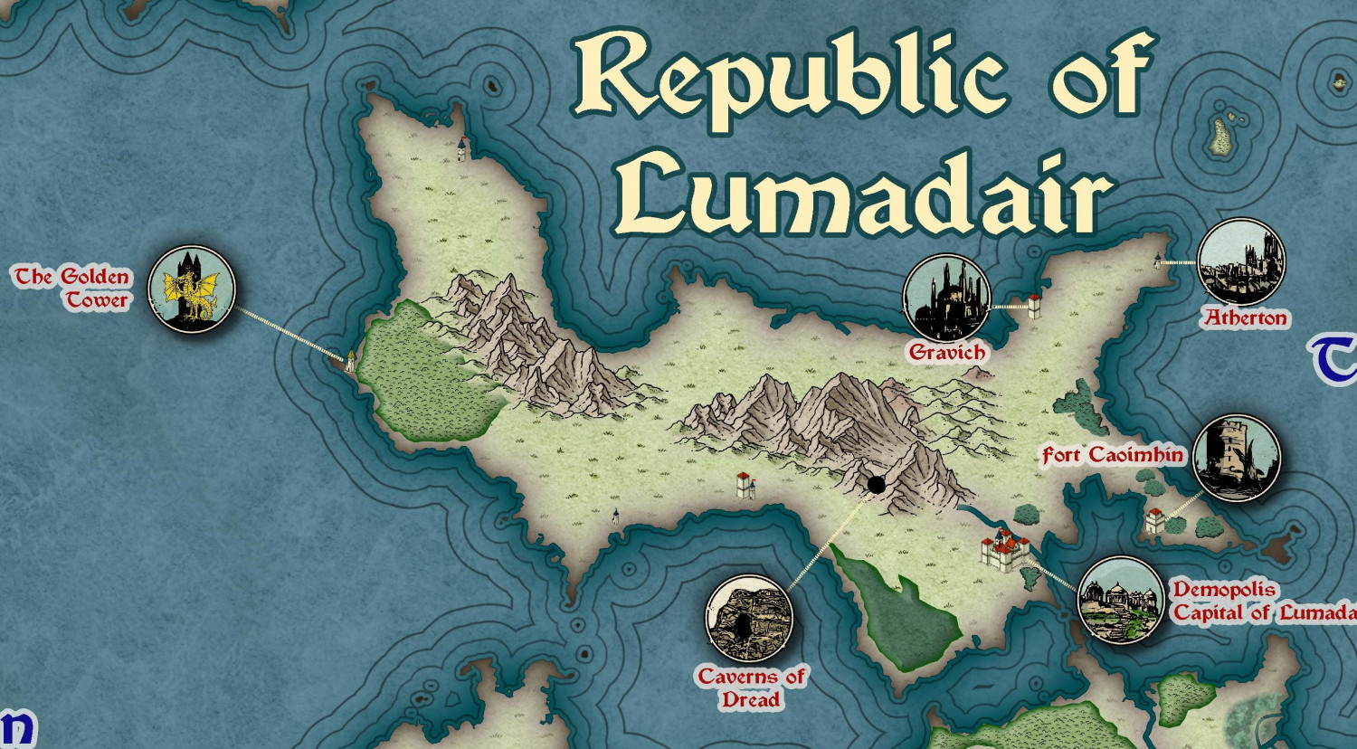
[WIP] Republic of Lumadair (Ancient Realms Revisited)
Okay, I think this may be done. Added a few more icons and place names.
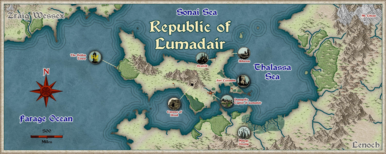
Here's a zoom of the Republic itself, without the portions from the continents of Zraig Wessex or Lenoch.
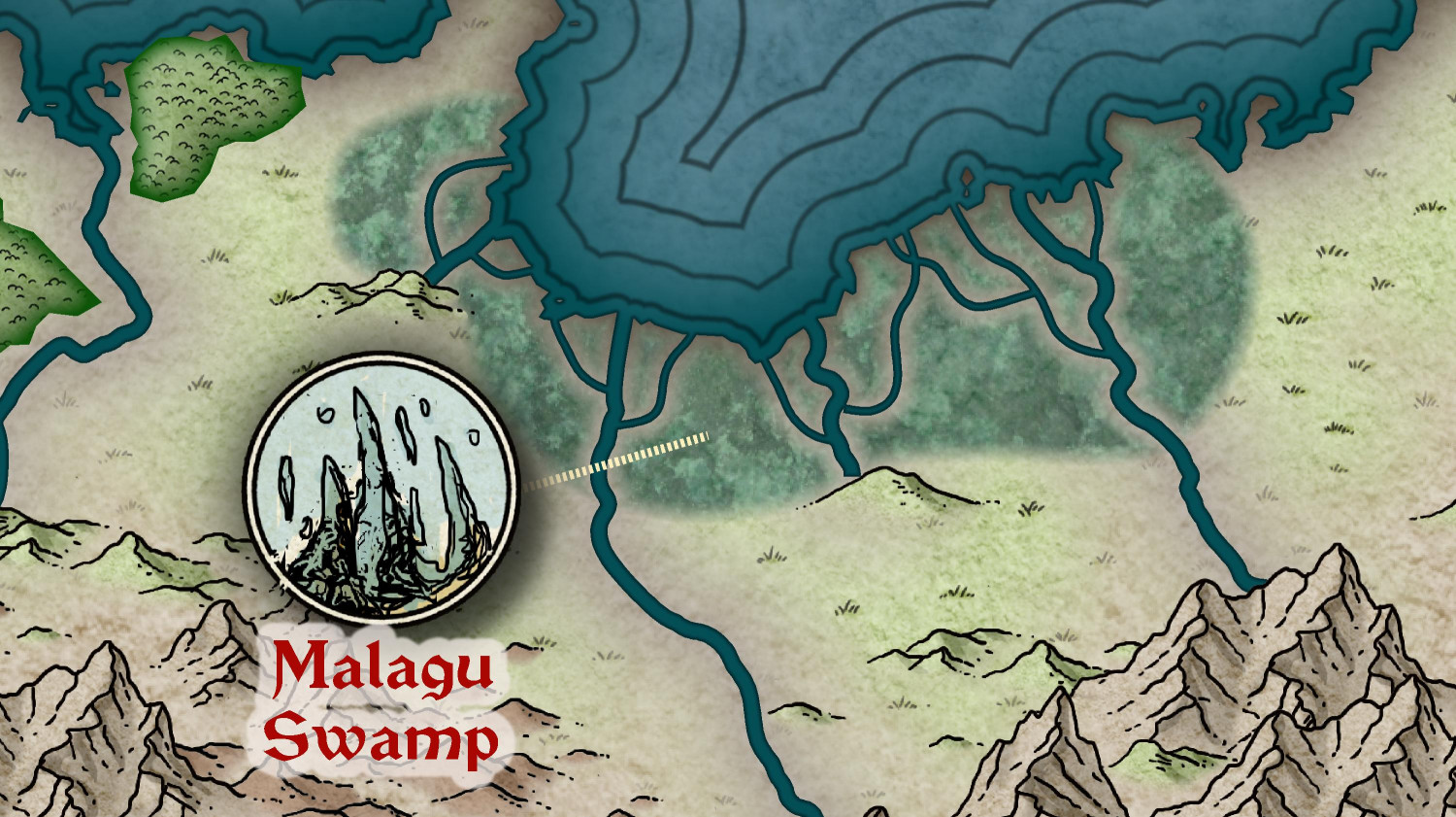
And here's a zoom of my swamp: