Royal Scribe
Royal Scribe
About
- Username
- Royal Scribe
- Joined
- Visits
- 9,529
- Last Active
- Roles
- Member
- Points
- 3,353
- Birthday
- February 5, 1968
- Location
- San Francisco, California
- Website
- https://legacy.drivethrurpg.com/browse/pub/31814/Royal-Scribe-Imaginarium
- Real Name
- Kevin
- Rank
- Mapmaker
- Badges
- 16
Latest Images


Reactions
-
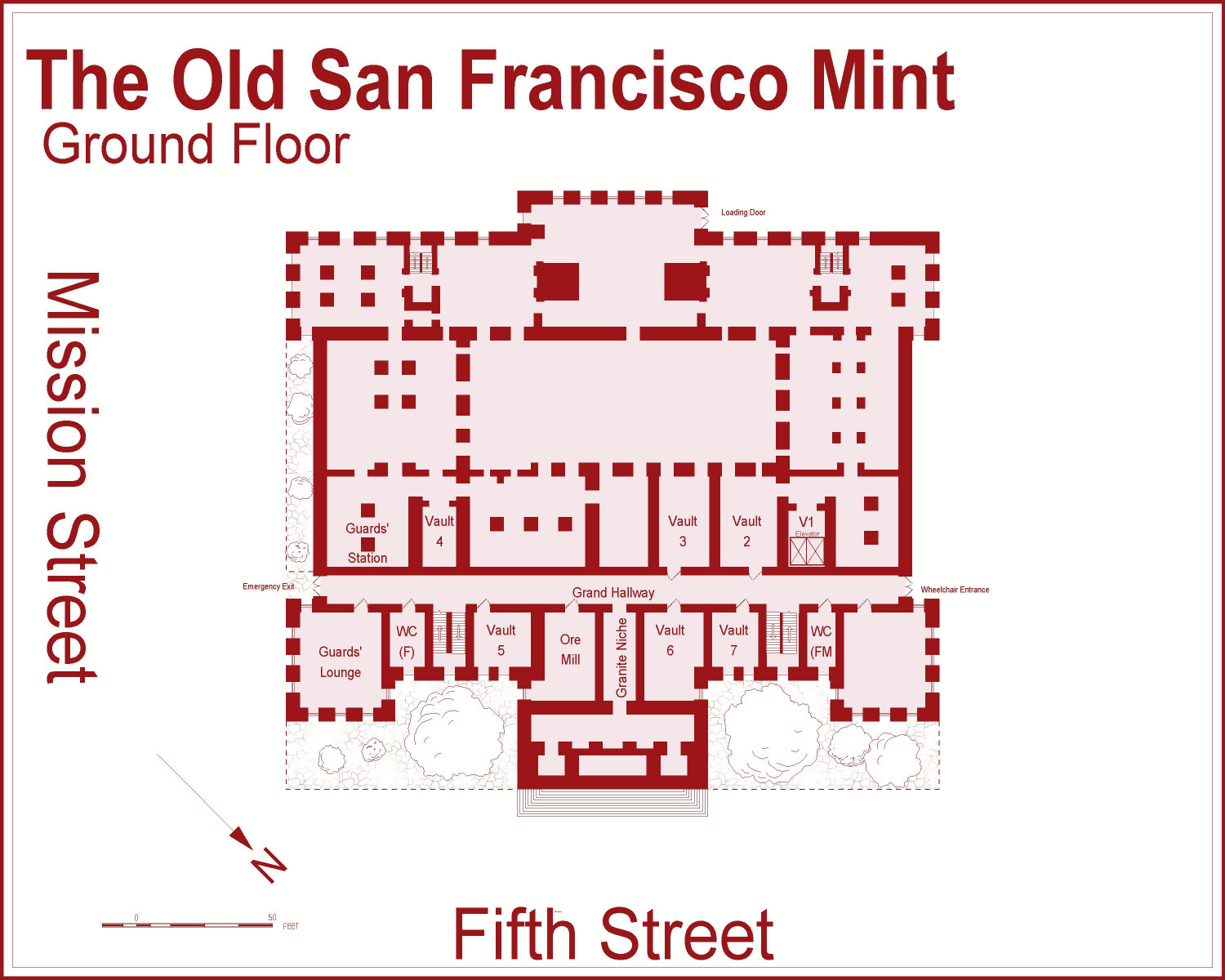
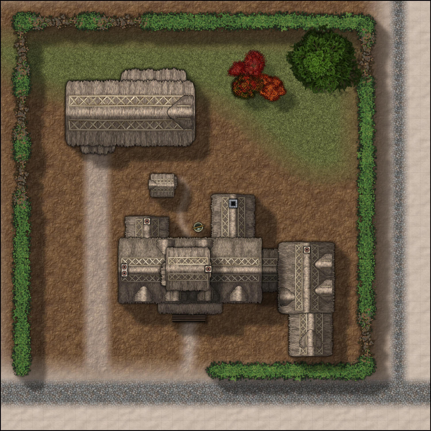
[WIP] The Old San Francisco Mint (Dracula Dossier)
I was inspired by Christina's most recent All the Annuals post and decided to use that as motivation to try out the Dracula Dossier annual from 2015.
My initial thought was to design the old San Francisco Public Library Main Branch, which is now the Asian Art Museum. I had a thought about how adventurers might have to go there to find an ancient tome hidden while it was still a library to use to banish an ancient eldritch evil. I couldn't find good floor plans of it,* though, so I poked around to find floorplans of other old SF buildings and settled on The Old San Francisco Mint.
I was able to find lots of floor plans because the first two floors are now used as an event venue -- weddings, corporate events, and an incredible adults-only haunted mansion in October called Terror Vault. Some things may be different -- I have a feeling, for example, that the original mint didn't have quite so many ballrooms. And what was once the first vault is now the base of an elevator shaft.
The Mint was built in 1874, replacing one that had been built in 1854. It survived the Great Earthquake and Fires of 1906, which is good because at the time, it was home to a third of the U.S. Government's gold deposits. It was decommissioned in 1937 after a new mint was built across town (which we still call The "New" Mint even though it's over 85 years old).
The main entrance is on the second floor, but there is a wheelchair entrance, freight entrance, and emergency exit on the first (ground) floor, so I will start with that. I have gridded pix as well that could be used for an RPG, but for now, here are the ungridded ones.
Ground Floor
Emergency exit on the Mission Street side, wheelchair entrance on the opposite side (Mint Plaza), and a loading entrance in the rear (Mint Street). It's primarily accessed from the second floor, though, through a freight elevator in what was Vault 1, or through one of four sets of internal stairs.
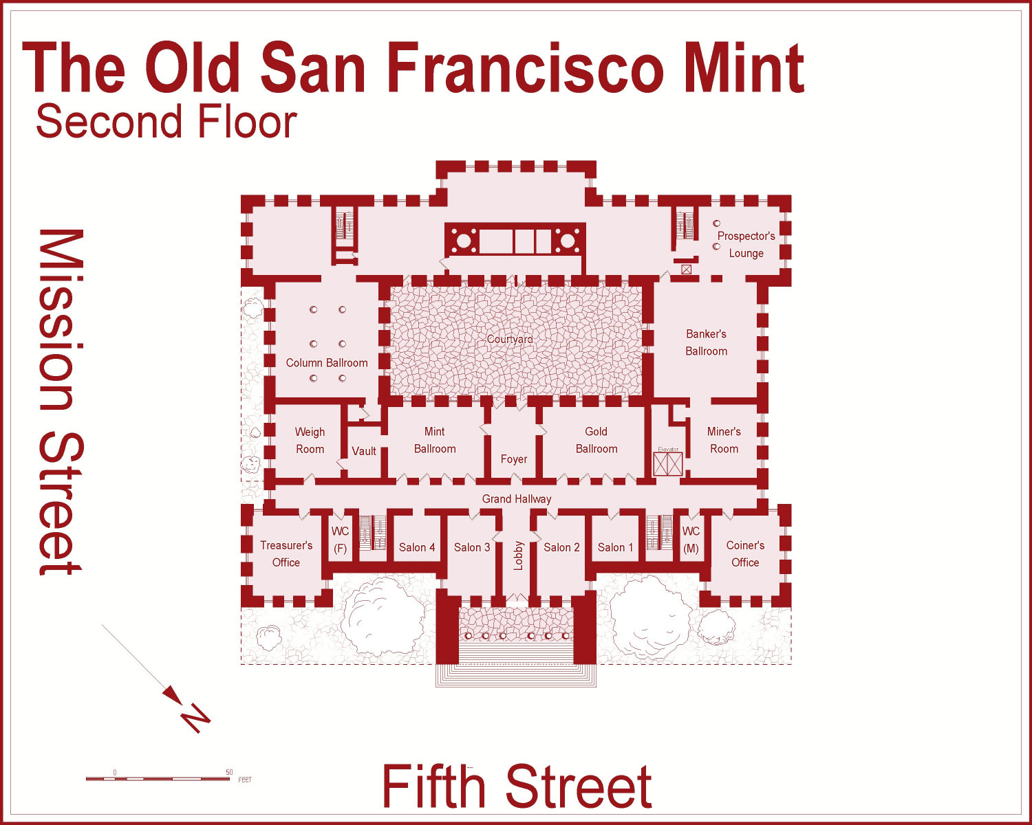
Second Floor
The main entrance from Fifth Street leads up exterior steps to this level. This level also has a courtyard covered by a glass roof.
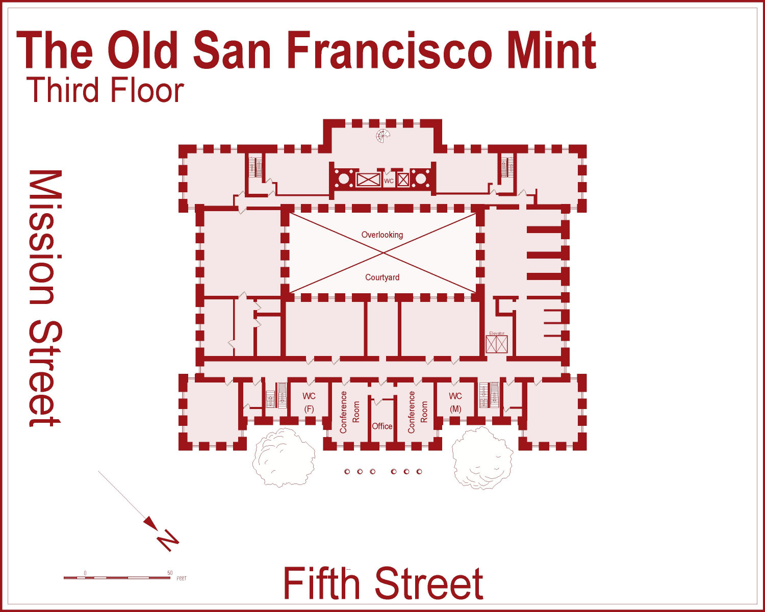
Third Floor
I eliminated the foliage outside except for the trees, which I thought might reach close to the third floor windows. The columns here do appear on the floorplans I found.
Fourth Floor
Note that the columns are now covered by the fourth floor, which serves as a roof for them. Looks like there's some office space on the Fifth Street side, and some utilitarian space on the opposite side, but mostly it's just roofing over the third floor.
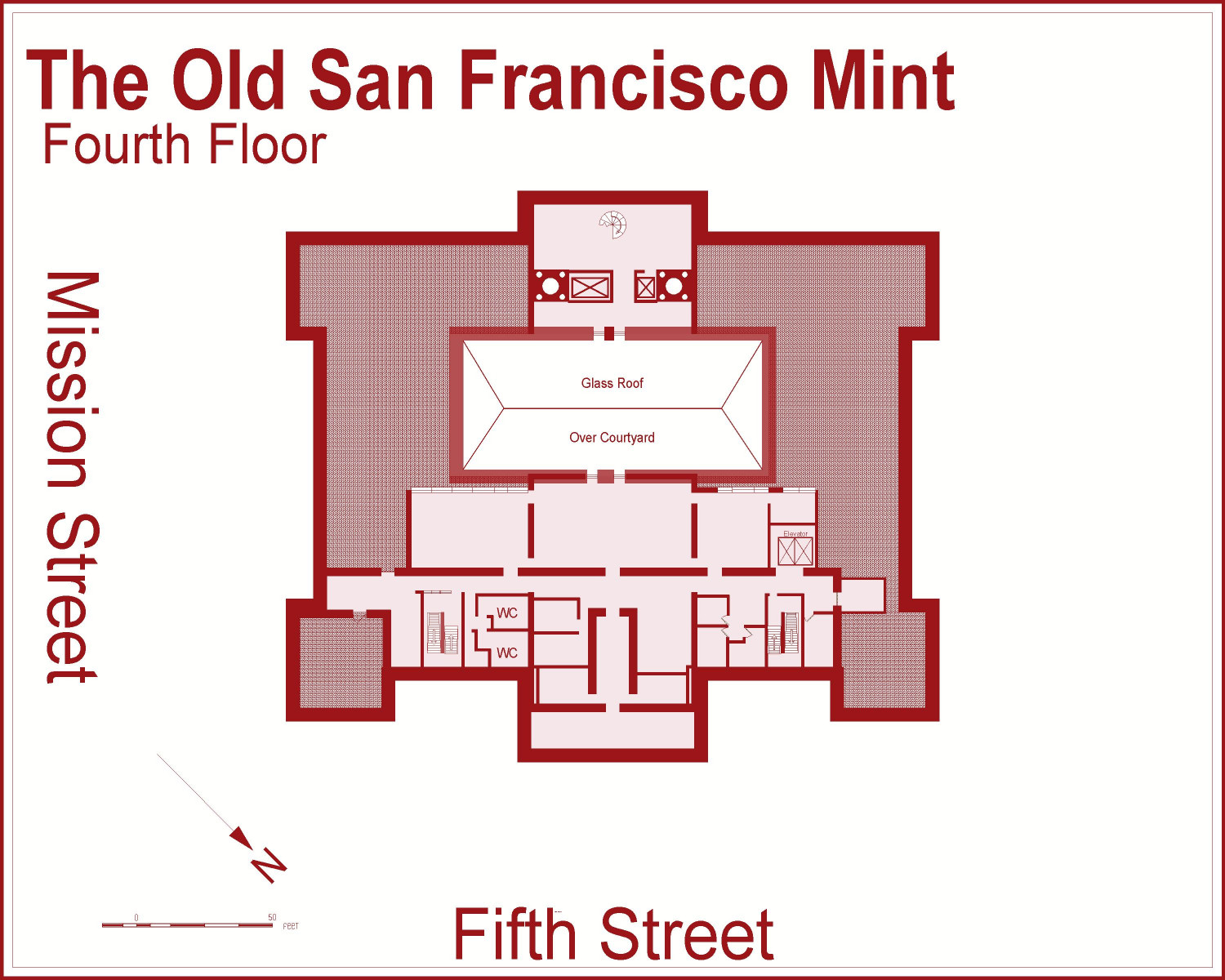
* I subsequently have found good floorplans for the Old Library! When I went downtown to take photos of the Old Mint, I decided to swing by the new Main Library's History Center, and they did have the floorplans. They will be coming in a future project, maybe with a different floorplan annual.


 and 2 others.
 -
[WIP] Varicolor Will-o-Wisps make great Christmas tree lights
Another one that I should wait for December 1st for, but I couldn't hold myself back. A country inn has decorated a nearby tree for Yuletide celebrations.
I was going to try to find little balls and add lighting effects, or maybe just use candles from one of the sets of dungeon symbols...but the varicolor Will-o-Wisps from Creepy Crypts are actually perfect.


 and 3 others.
 -
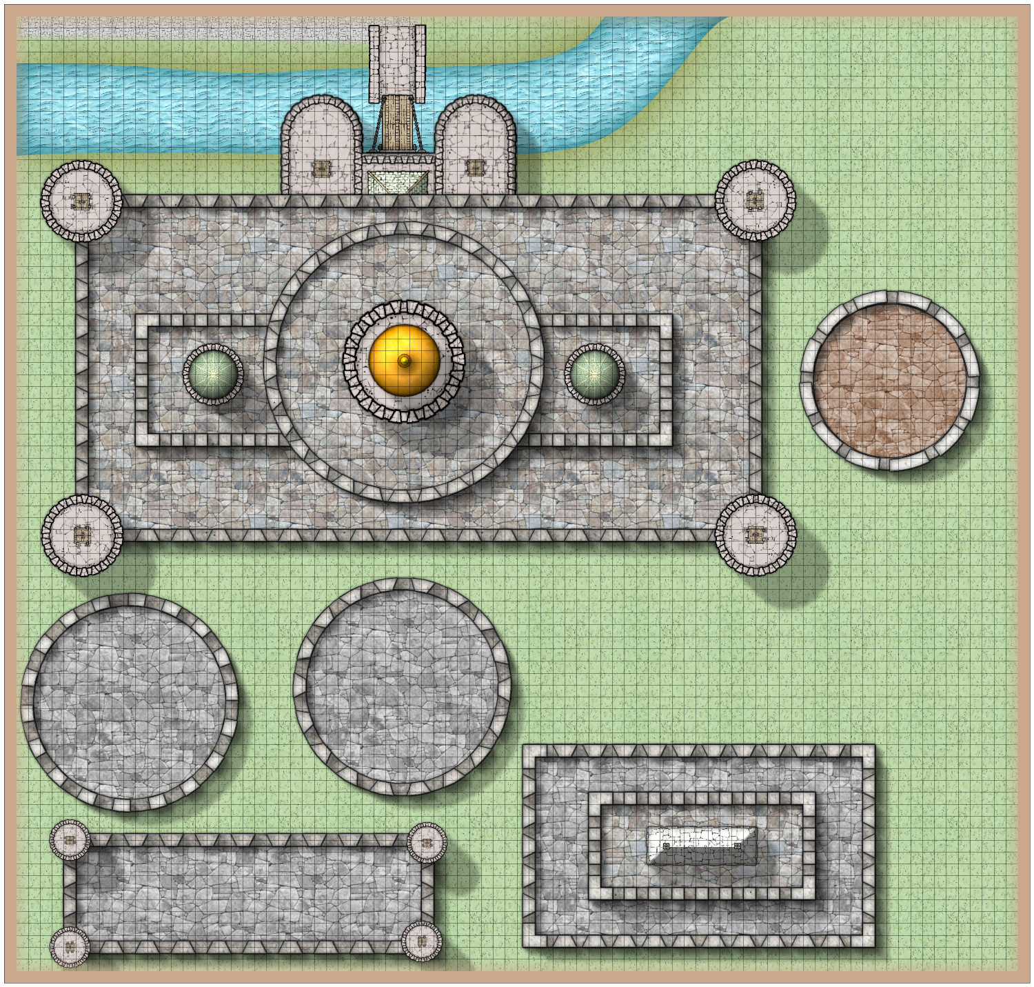
I designed crenellation symbols
In a recent thread, @Traveller mentioned that he is seeking to discover the best style of designing castles in order to map the many real castles of the U.K.
I have been on a similar quest, though my quest is so that I can design fantastical castles of folklore and fairy tales, like Camelot and Sleeping Beauty's Castle, or the castles in Errol Flynn movies. Castles with many levels of battlements, parapets, towers and turrets, gardens with hedge mazes, and imposing keeps.
One of the things that seems to come up regularly in these forums is crenellations. I was experimenting using Mike Schley's walls along the top edges of my fortresses, and that looked okay, but didn't allow for much flexibility since the symbols come in one length and the wall drawing tool doesn't show the embrasures and merlons.
Anyway, I designed some symbols. I have 5' x 5' square ones. I have trapezoidal ones that can be placed to have arrow slits. I have corner L-shaped pieces. And I have several different rounded ones for round towers, including a tapered one to create arrow slits.
They are all created using CC3+'s drawing tools, with fills from SS4 Dungeons of Schley. There are five different shades of every shape, using Mike Schley's Natural Stone 1 through Natural Stone 5. (This was designed in SS5 Cities of Schley, but I imported the Dungeons of Schley fills as well.) I think that approach allows them to be used in the Atlas. @Monsen, can you confirm?
(I used the Stone Paving Grey for the structures, but tried one tower with Stone Paving Brown to see how it would look. The intention was to try to create the look of
They are all designed for a five-foot wide crenellation -- basically, you'd draw a line or circle with a 5-foot width for the base of the crenellation and then place the merlons on top. I've tried it both placing them by hand and also using SYMBOLS ALONG, and both approaches work reasonably well.
I am not an artist, and I'm sure others here could do much better ones, but I think it gets the job done. I'm happy to share if anyone would like to use them.
Here is the FSC file and also an FCW example:
And here are some images so you can see how they look. (I put a Bevel effect on the merlons, which is showing some odd effects because the colors with the base are close, even though I used a darker shade of the Natural Stone for the base.)
Here's a close-up of the trapezoid merlons along the edge of a straight building.
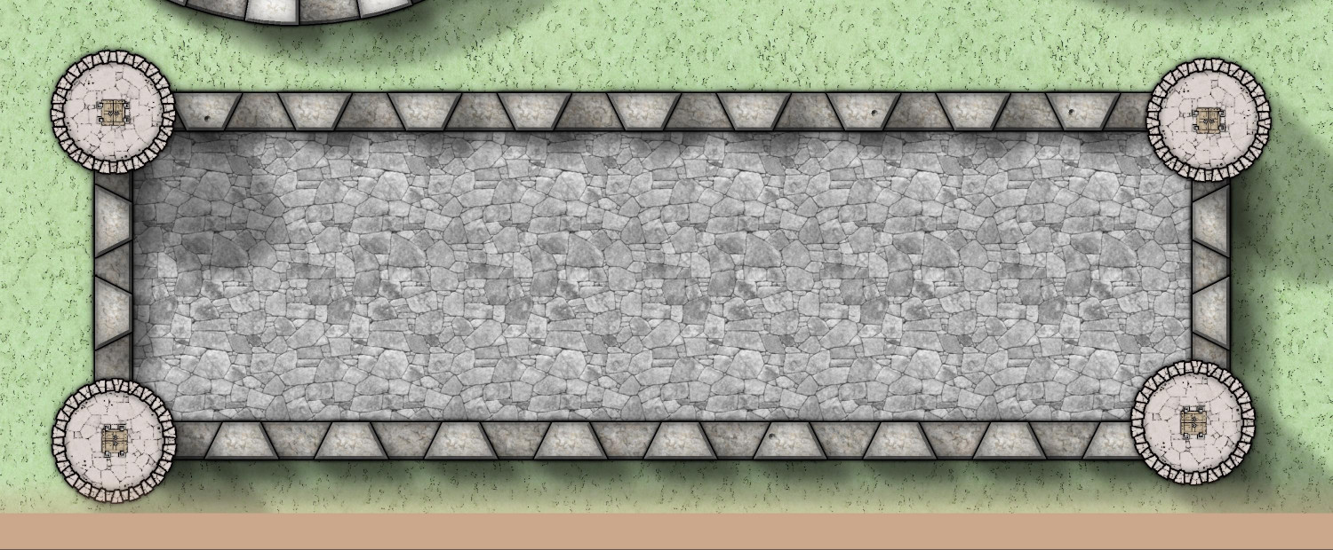
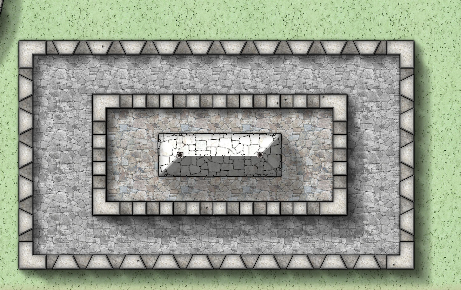
And here's one using the trapezoidal merlons for the lower level and then the square ones for the higher level. It also shows the corner pieces.
Here are two different round towers. The one on the left has normal merlons, and the one on the right has tapered ones for arrow slits. (I need to fix the Wall Shadow effects -- the base of the tower should not be casting a shadow farther out than the crenellation on top of the tower!)
Here's a quick "proof of concept" of a multi-level castle with different crenellation styles, plus some domes from City Domes for turrets.
And one last tower using the brown paving fill. This one uses a wider merlon using the SYMBOLS ALONG tool, but I don't think it's quite lining up correctly.
Feedback welcome, and feel free to use the FSC if you like them.


 and 1 other.
 -
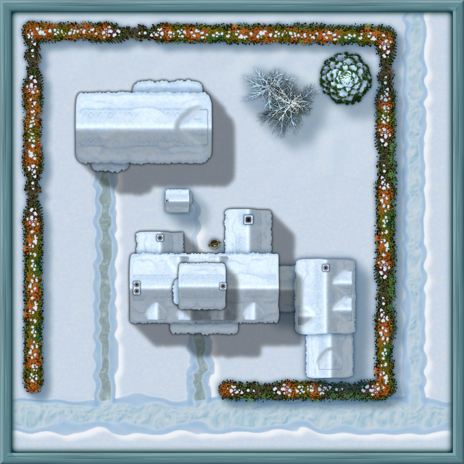
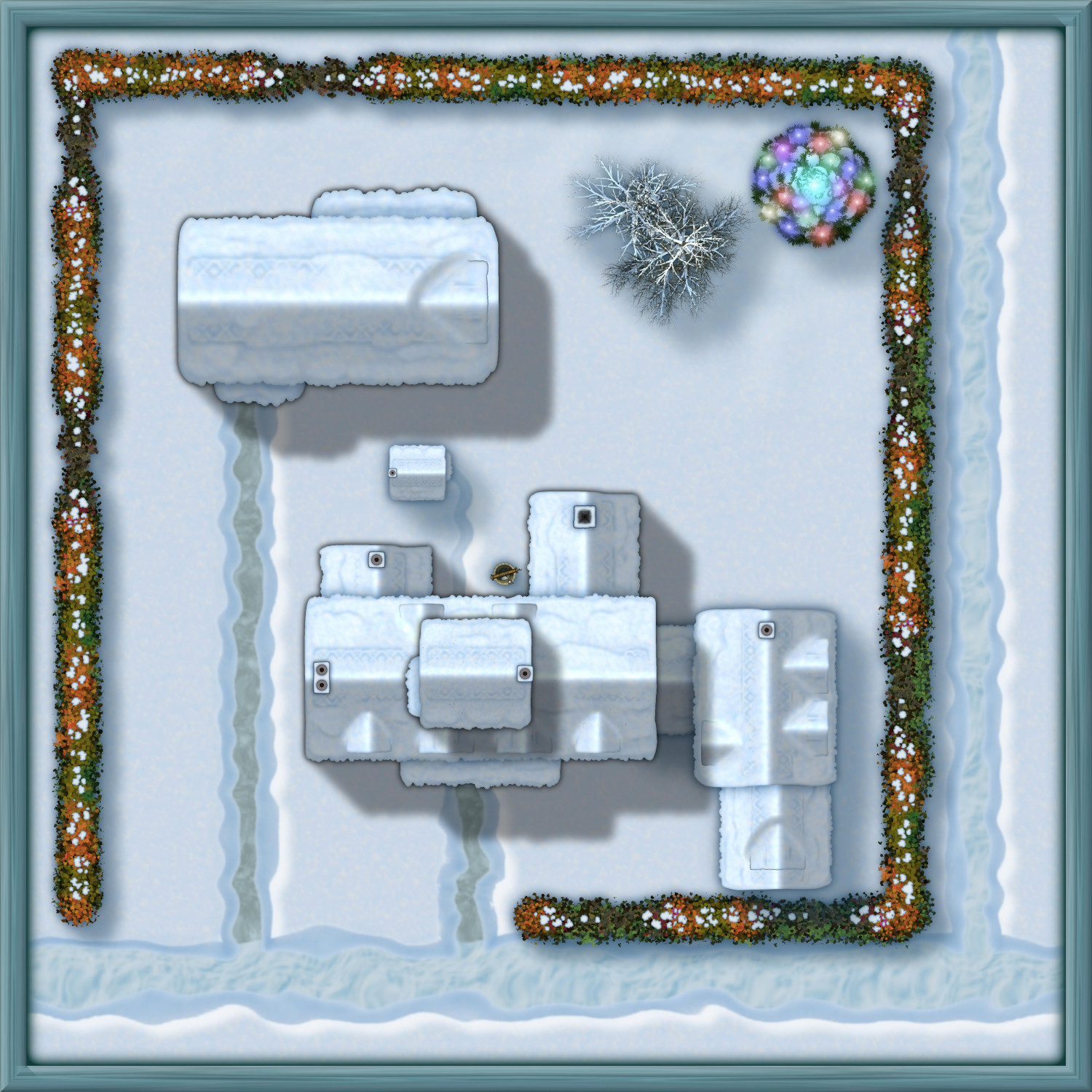
[WIP] The Candle & Kettle Inn in the village of Mapleford
I'm working on a little village called Mapleford (so named to give me an excuse to sprinkle in a few of the Japanese Maple trees from the Asian Town annual). Before I tackle the rest of the village, I wanted to focus on the Candle & Kettle Inn, which provides welcome accommodations for traveling adventurers and doubles as the village's only tavern for locals.
Here's the exterior of the inn and its stables (and outhouse). Lots of chimneys, but I covered a few with dormers. Fortunately, lots of fireplaces means lots of excuses to use Shessar's lovely fireplace symbols.
And here it is in the winter:
Just for fun, here's a Winter Solstice celebration with the fir tree decorated with lights (probably luminescent crystals, though it could be candles specially treated to glow with different colors).
Although I've mentally plotted out the interior layout, I want to work on the rest of the village before getting to interiors.


 and 1 other.
 -
[WIP] Wizard's Tower - Interior
Been working on the other floors, but I still have several more floors to do. (And this is the Wizard's Tower that I am calling the "small" tower, in contrast to the other one I started that is more like a Council of Wizards' fortress. This "small" tower will still be at least eight stories above ground (though some of them are smaller and one is really just a bell tower), and at least three underground (though one is just the sewers)).
From the main entrance on the third floor, you can go up or down through the spiral staircase in northern wall. Let's go down to the second floor.
Second Floor
This is primarily the main dining area for the wizard and his or her guests. In addition for seating for 15, the dining hall has two fireplaces, with the smaller one used to heat up kettles of tea and other food. This room also has a sink connected to the water system, a separate pipe that runs through the room (for more water in the floors above), several cabinets for dinnerware sets and table linens, and a statue of a female wizard -- a former owner, perhaps the tower's creator. Outside the room, a long table in the hall is used by the kitchen staff and footmen to assemble the food before bringing it in for guests. Unlike the third floor, where the arrow slits were off of a corridor and the rooms had no external windows, on the second floor the arrow slits also allow for daylight to enter the rooms.
Beside that room in the southwest corner of the tower is a cozy, wedge-shaped room with a balcony overlooking the great stairs a floor below. From here, the wizard's family can lean over a railing to greet guests on the landing. This floor also has a restroom, and a small, gated "back door" with a sign directing visitors to continue up another flight to the main entrance.

First Floor
The first floor is at the same level as the main landing with the extra wide stairs, but for added security, there is no doorway there, nor windows or even arrow slits. This floor has a spacious kitchen with a stove and a marble countertop, along with a dining nook for the tower's staff. There are also two rooms equipped with crystals that magically emit cold energy. The one on the south side is called the Cold Room and the one north of it is called the Ice Room, as it is cold enough to freeze water. (Basically, they're magical versions of a walk-in refrigerator and freezer.) The final room on this floor, other than the WC, is a furnace room with a massive furnace for heating water and a great tub of hot water for doing laundry. The room is hot enough that even on rainy days, wet laundry will dry on clotheslines strung up in this room.
(True story: my family did not have electricity for eight years of my childhood and one of my daily chores was to build a fire in an outdoor fireplace like this one to heat water than ran through it in pipes. We also had not one but two outhouses -- fancy!)

Haven't started on the basement yet, so for now, let's go back upstairs.
Fourth Floor
Reversing direction, we can climb up to the fourth floor, the lowest level to have proper windows instead of arrow slits. This floor has the main lounge for entertaining overnight guests, where folks can socialize, play cards and other games, or enjoy a performance from a traveling bard or a minstrel from the nearby village. This room even has a wet bar! I should put in some chairs and couches, though.
This floor also has a chapel (looks like I forgot to put in pews). It also has a WC with a window to the outside, a room for bathing, and two oddly-shaped guest bedrooms.

Working on the fifth floor now, which will include use of one of the two balconies you can see poking out on the south side.
Here are the FCW files if anyone wants to customize them for their own gameplay, using the same licensing terms as the Atlas (where this will someday find a home).


-
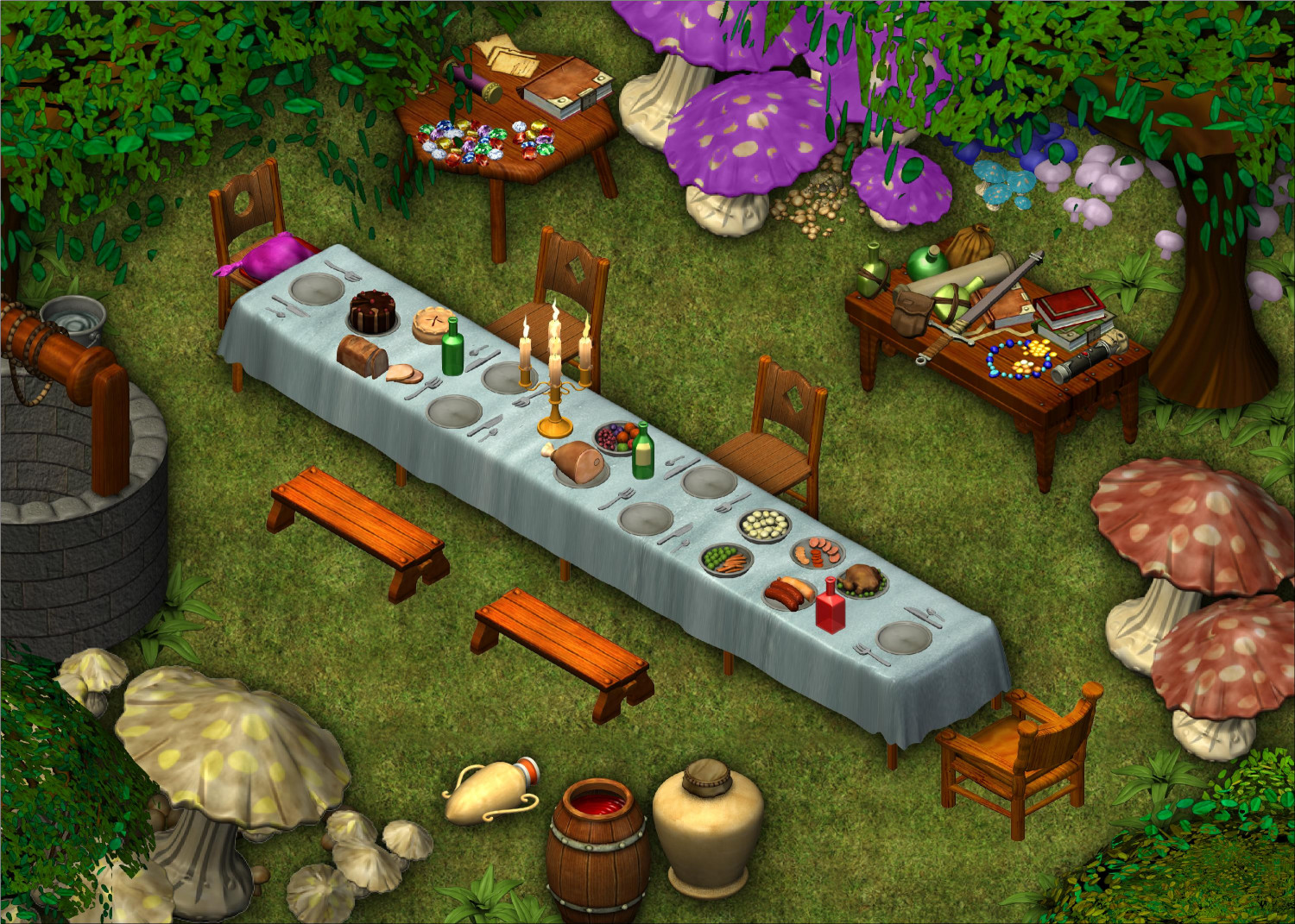
[WIP] The Mad Tea Party
I haven't done much with isometric symbols or Perspectives, but I decided to create an outdoor party scene inspired by the Mad Hatter's Tea Party from Alice in Wonderland. Still getting the hang of Perspectives and how to maneuver everything into the right spot. (Spent a lot of time trying to get the chairs in the right positions!)
I was going to make the toadstools as large as trees, but I thought they looked better sized like large bushes.
It's meant to be a birthday party, with tables of (unwrapped) presents off to the side.
Although Perspectives comes with great symbols for all sorts of food and all the silverware, I was surprised that I couldn't find glasses, goblets, mugs, (or tea cups and a tea pot), or other drinking vessels. Unless I missed them, I guess the guests will have to drink straight out of the bottle.
 and 2 others.
 -
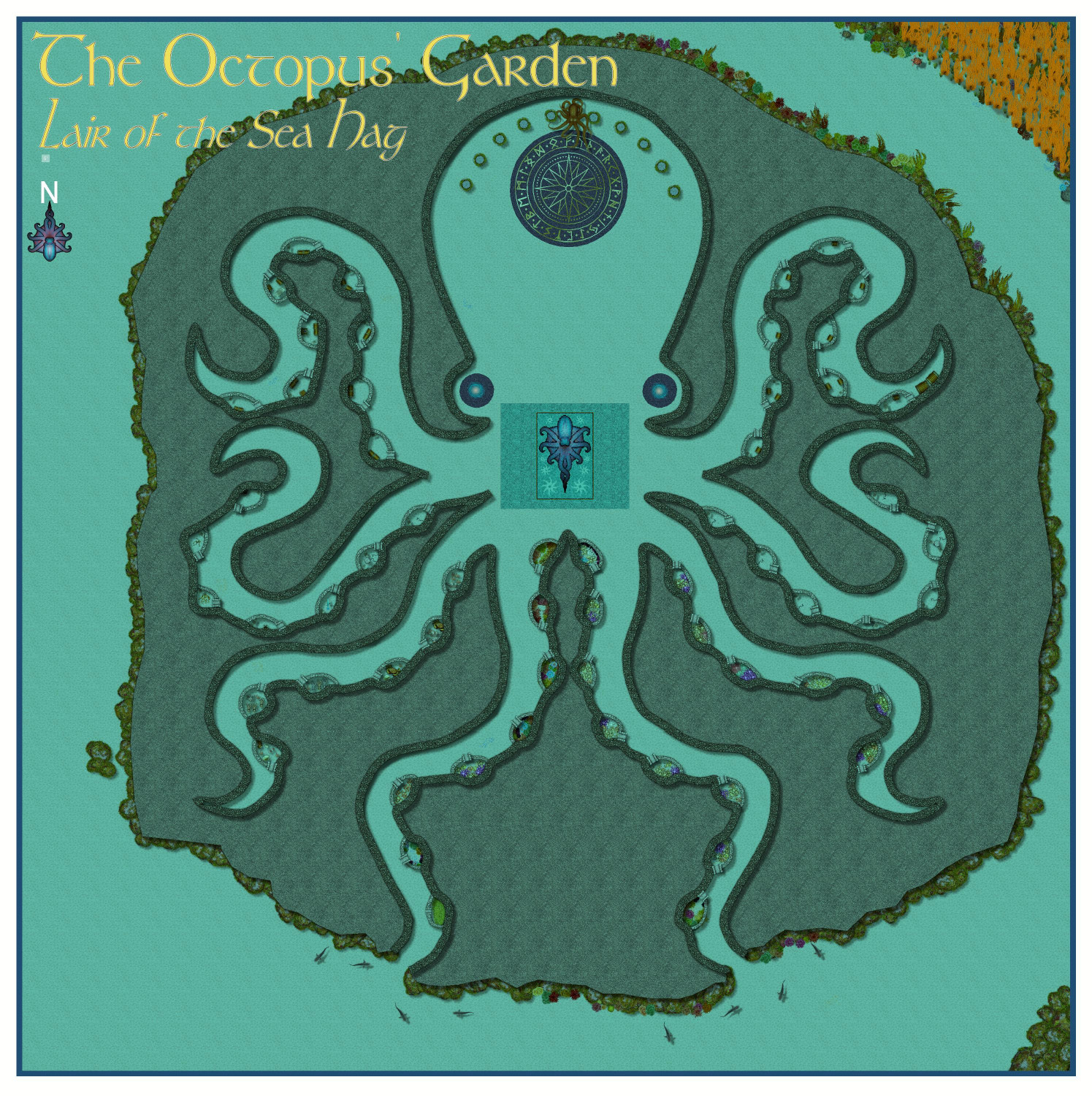
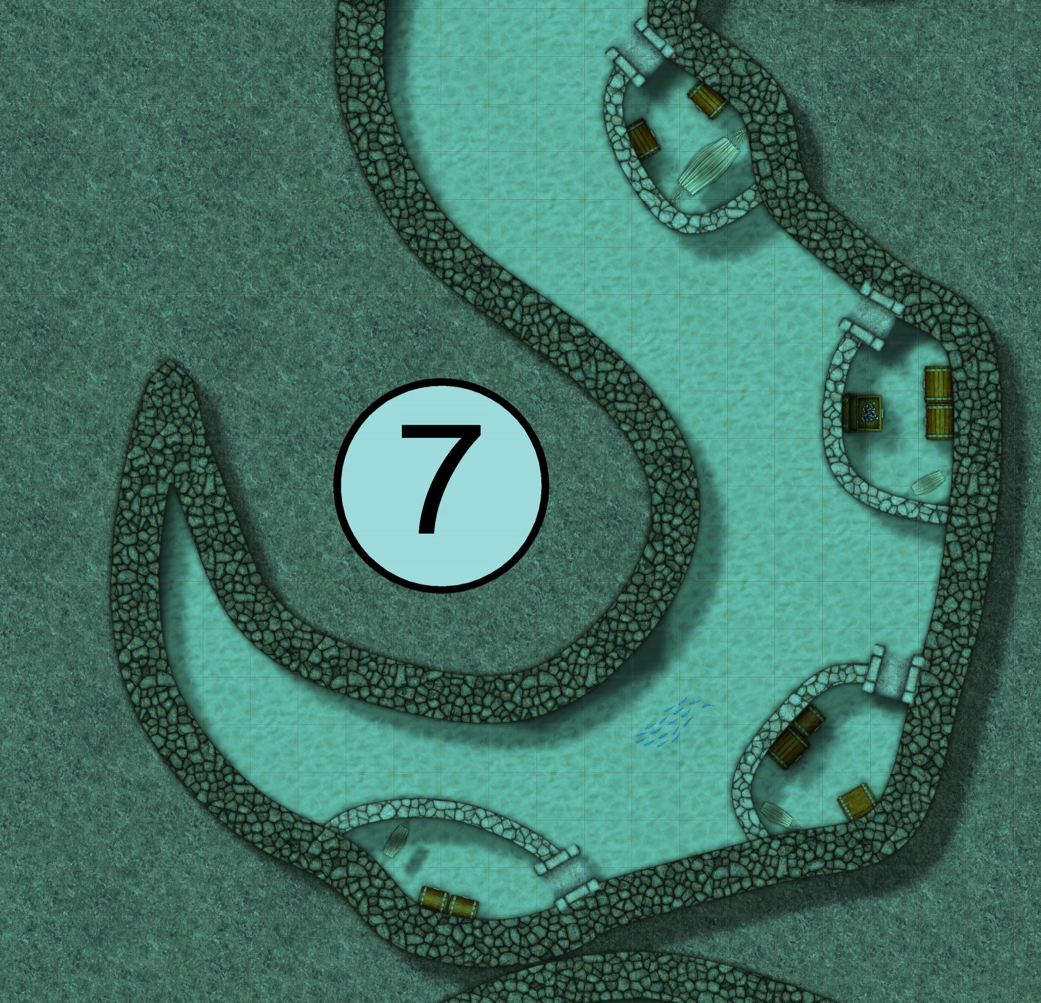
[WIP] The Octopus' Garden
I'd like to be
Under the sea...
Here is the second of the three Marine Dungeons I've planned. The first was the Sea Elves Outpost, and the third will be a full-scale, multi-story underwater fortress (though it may take me a bit to get to it, as I'm letting myself get sidetracked).
My goal with this one was to go for speed. I wanted to see if I could create a nice dungeon in a reasonably quick amount of time. Like, imagine it's a Friday evening and I have to whip something together for my players who will be coming over Saturday morning.
I have a collection of public domain images produced by the Society for Creative Anachronism for use as heraldry symbols, and I used one of an octopus to use as a tracing guide. All told, it took me about four hours, I think, to do the first draft. I then went back to rip out the gardens that require sunlight (per the conversation in the Sea Elves Outpost thread) and replace with things that wouldn't require sunlight.
This one is called The Octopus' Garden. It's unknown who first excavated this realm beneath a marine mountain, carving it out in the shape of an octopus, but it has now become the lair of a Sea Hag.
Here it is unlabeled:
Here it is with labels:
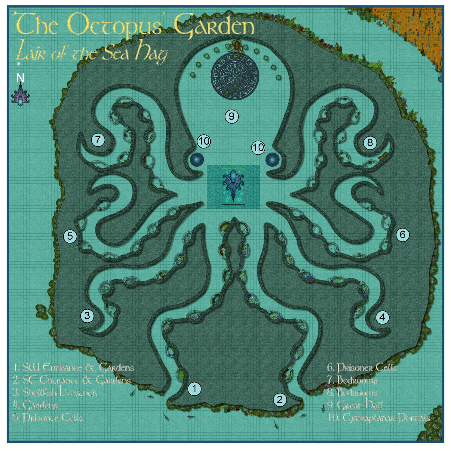
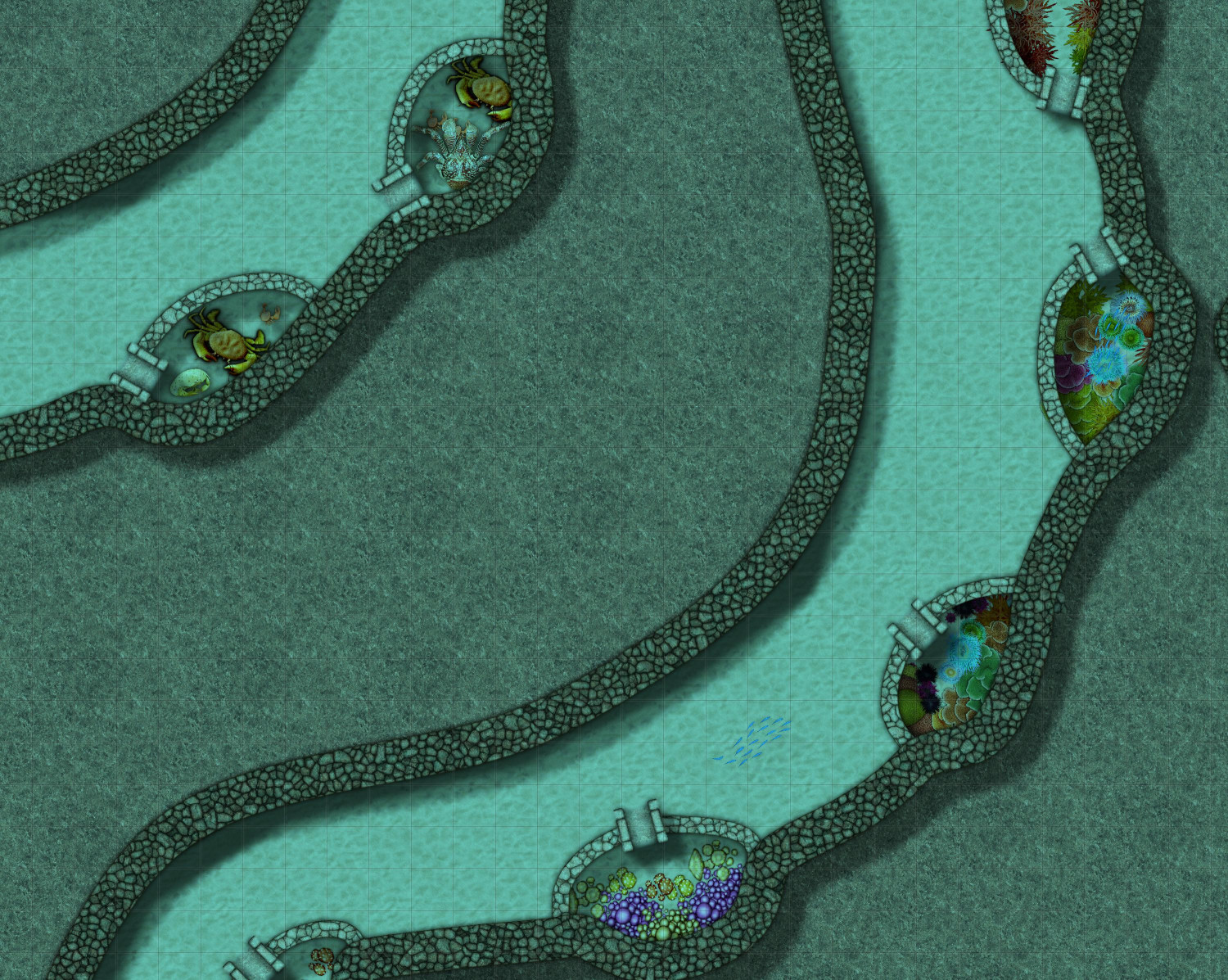
The octopus' eight arms serve as wings in the lair (or maybe we should say tentacles instead of wings), with the suckers becoming small rooms in the lair. The southernmost tentacles open to the sea, becoming entrances to the lair, while the other six are fully enclosed. The chambers in tentacles 1, 2, 3, and 4 are used to produce food for the lair's residents.
As you enter -- if you can get past the sharks that the Sea Hag has enchanted to guard her entrance -- you'll see that the chambers closest to the entrance get just enough sunlight (improbably) to grow vegetation. The other chambers grow things that don't need sunlight, particularly marine mushrooms. (True story: freshwater aquatic mushrooms were discovered about 15 years ago. They're only found in a single mile-long stretch of the Rogue River in Oregon, in a spot where my family has a cabin that has been in the family for generations. But in my fantasy realm, saltwater mushrooms are abundant.)
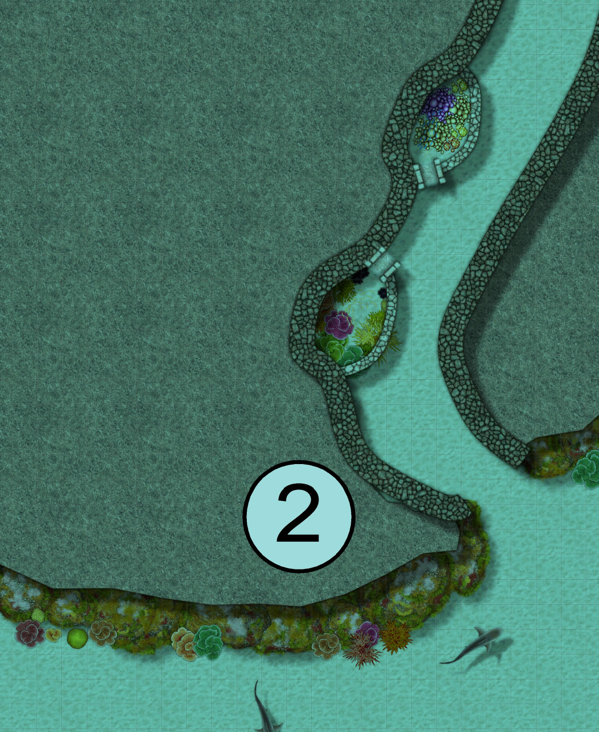
Other chambers are used to raise shellfish, sea urchins, and anemones, who are all fed with vegetation harvested from the kelp forest outside of the lair on the northeastern side.
The chambers in tentacles 5 and 6 are all prison cells. If you look closely, you'll see a double set of gates in the entrances to those chambers. They all have hammocks for the prisoners to sleep in, but they are also all equipped with shackles bolted to the lair's walls for situations where a prisoner may need extra restraints. If you look closely, you'll see that two of the cells have humanoid creatures (probably sea elves) shackled to the walls. Another has a humanoid skeleton, while a fourth has the skeletal remains of some other creature. A fifth has an imprisoned mermaid, and the others in this closeup are unoccupied.
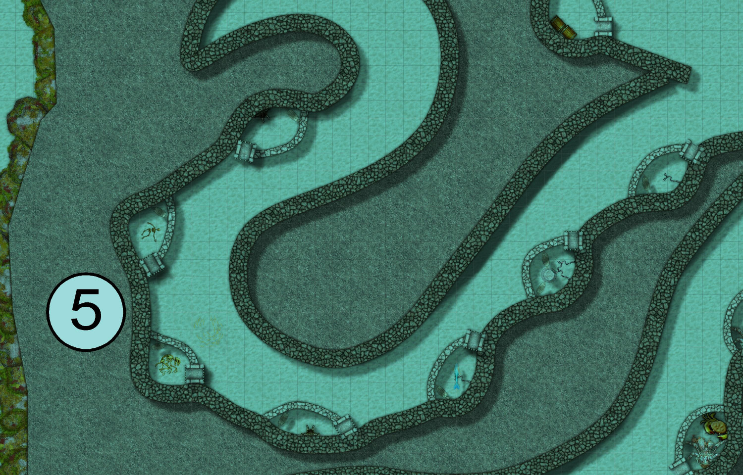
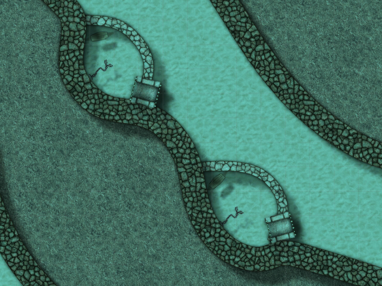
The chambers in tentacles 7 and 8 are are bedchambers, each equipped with a hammock and one or more chests so the resident's valuables don't go floating away.
The "head" of the octopus is a Great Hall, where the Sea Hag holds court. Today she has chosen to take the form of a giant octopus.
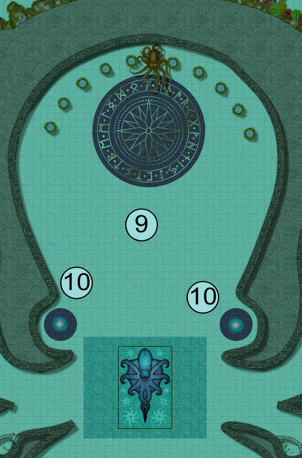
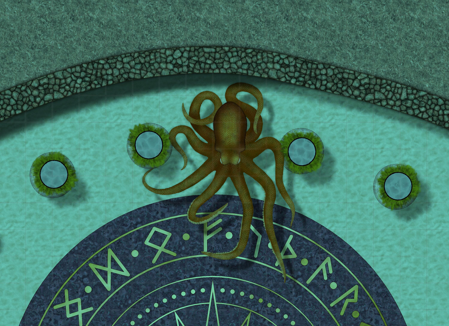
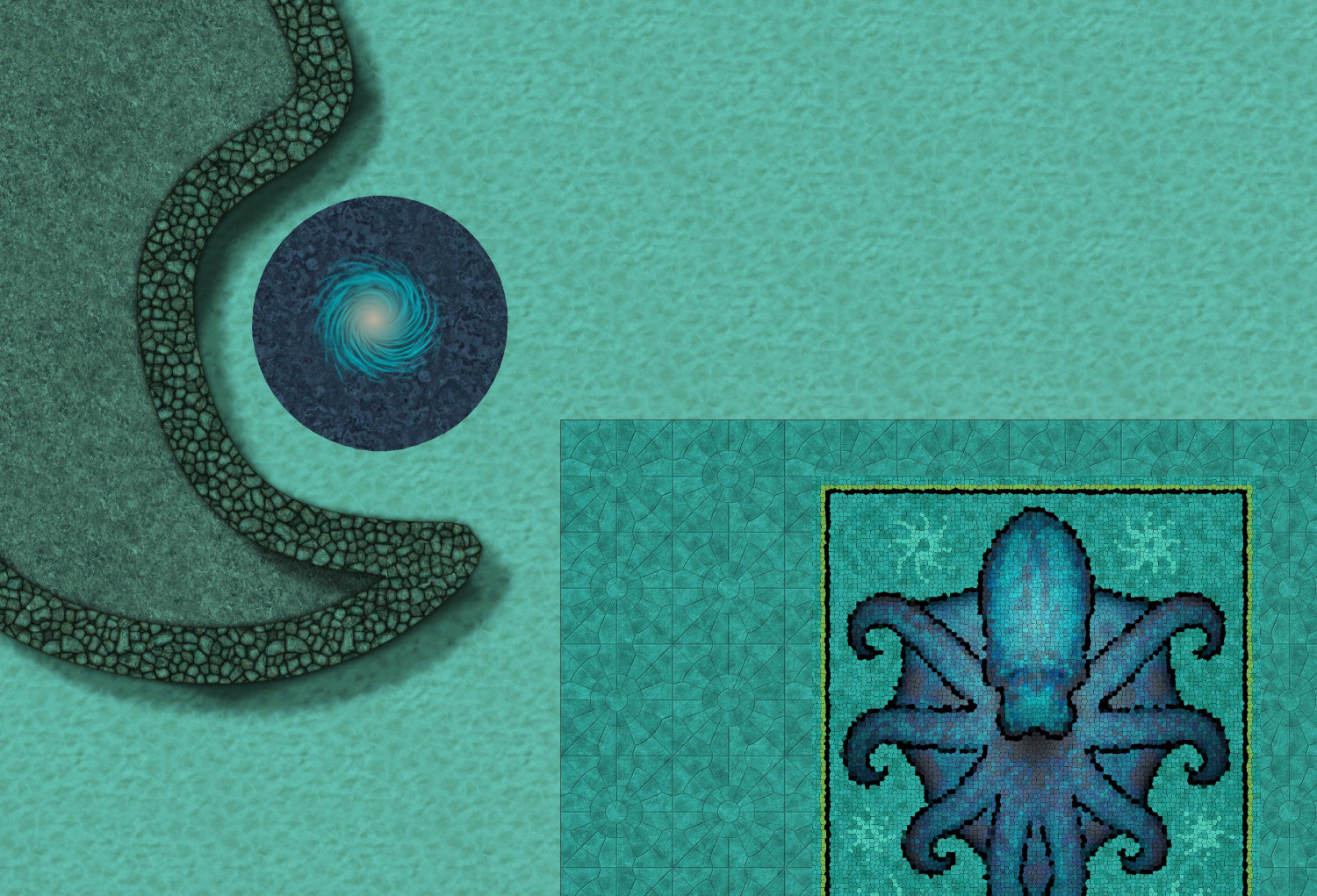
The two spots labeled #10, where the octopus' eyes would be, are extraplanar portals. Some say that one goes to a dangerous swamp in the Feywild while the other goes to an even more dangerous fen in the Shadowfell. Others say they go to the Elemental Plane of Water, or to soggy planes of the Abyss.
Why would our adventurers go there? Perhaps they are trying to rescue the mermaid, or the other NPCs. Perhaps they need to use the portals to get to the next stop of their missions. Perhaps they need to negotiate with the Sea Hag for help with something. (Maybe one wants to trade her voice for a love potion -- no, not that.) Maybe the Sea Hag has a magical artifact that they need to complete their quest....

-
[WIP] Lumadair - Hand-Drawn Fantasy (CA221)
Usually I wait until Ralf has had a chance to demo new annuals in the Live sessions, but since there was no Live today because of the May Day holiday, I decided to dive in anyway. Here's my tried-and-true, oft-mapped Republic of Lumadair in the new "Hand-Drawn Fantasy" style.
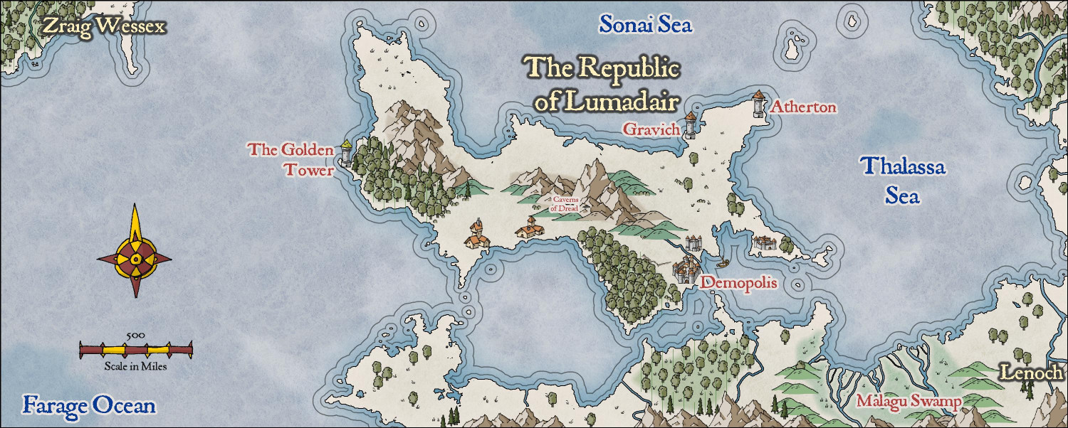
I used the cutout approach for the rivers. But rather than drawing the swamp terrain around the rivers, I added the Color Key effect to the Swamp Terrain sheet and then copied my magenta rivers to that sheet as well.
It's funny how much I've mapped Lumadair, given that it isn't even intended to be the main location for my campaign world. But it is a conveniently-sized area, and once I did one map of it, I found it useful to do other styles for the same location as a convenient way of comparing them.

-
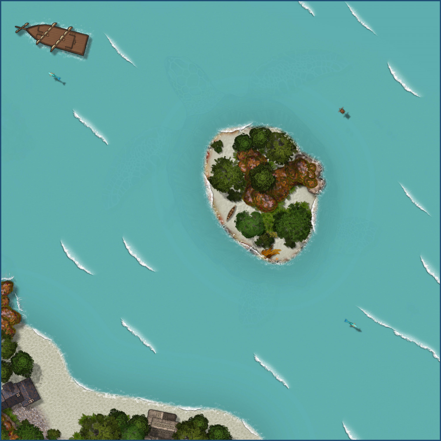
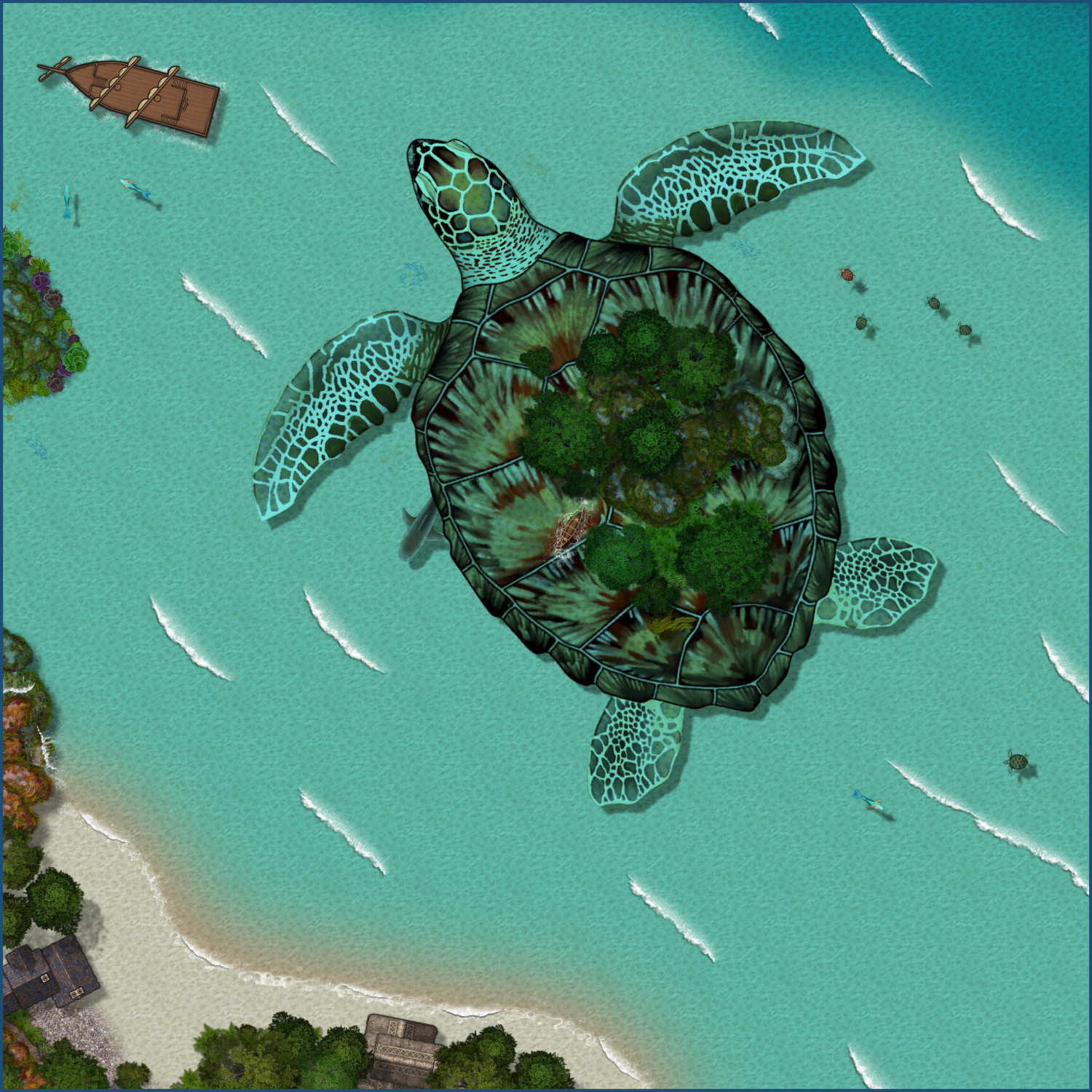
Aspidochelone
A year ago, I posted this map of an Aspidochelone. I wanted to revisit it to explore creating alternate versions.
Player Version
This tweaks the water to make it opaque by turning off the Blend mode sheet effect. I then added a colorize effect to make the water more turquoise.
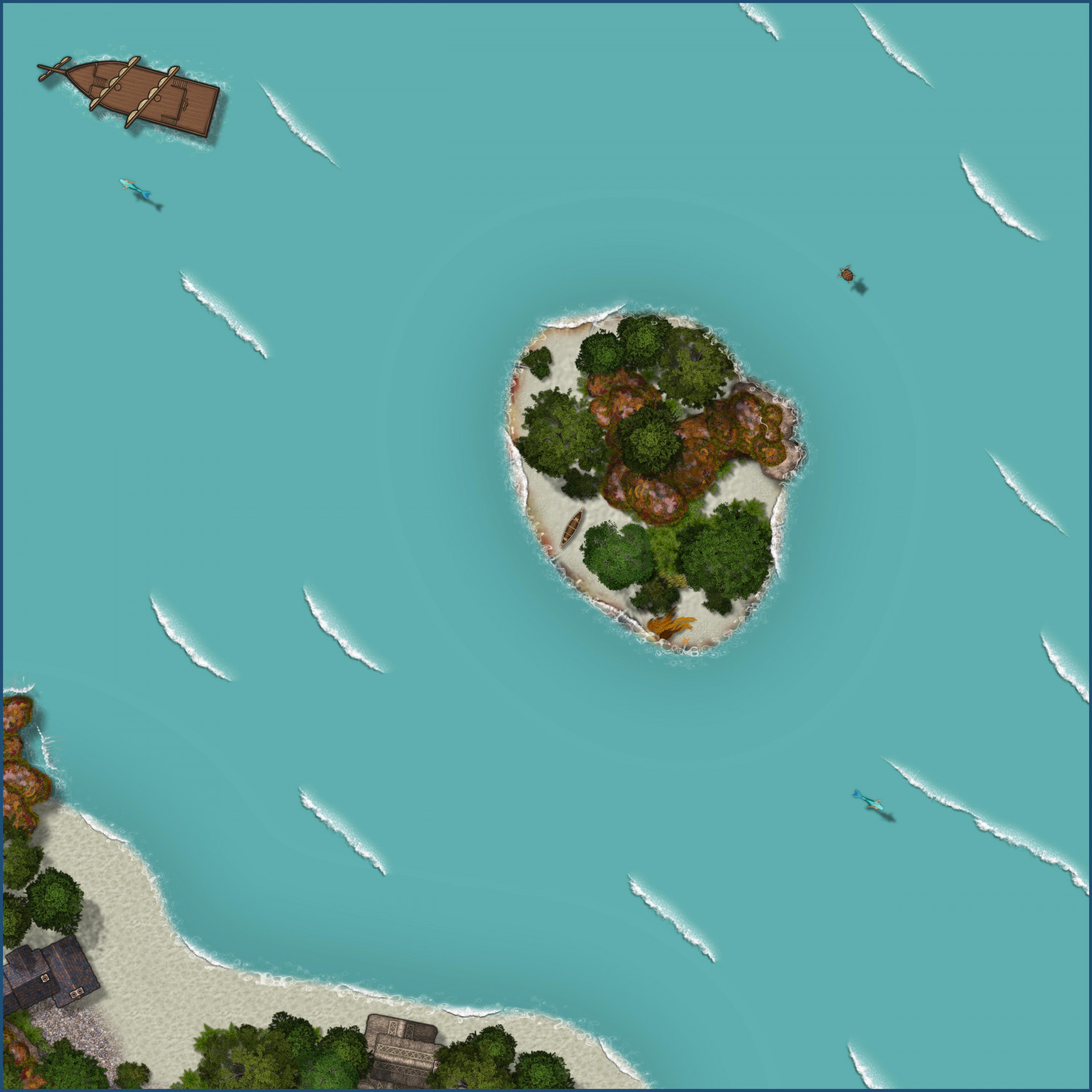
Player Version...with a Hint
This version adds a slight Transparency effect to the water so there's a subtle hint of the creature below.
Submerged
If the PCs disturb the Aspidochelone (by lighting a campfire, for example), here's a version where it has dived below the water, imperiling the party. The canoe floats, fortunately, so I left it above water and added ripples around it.
-
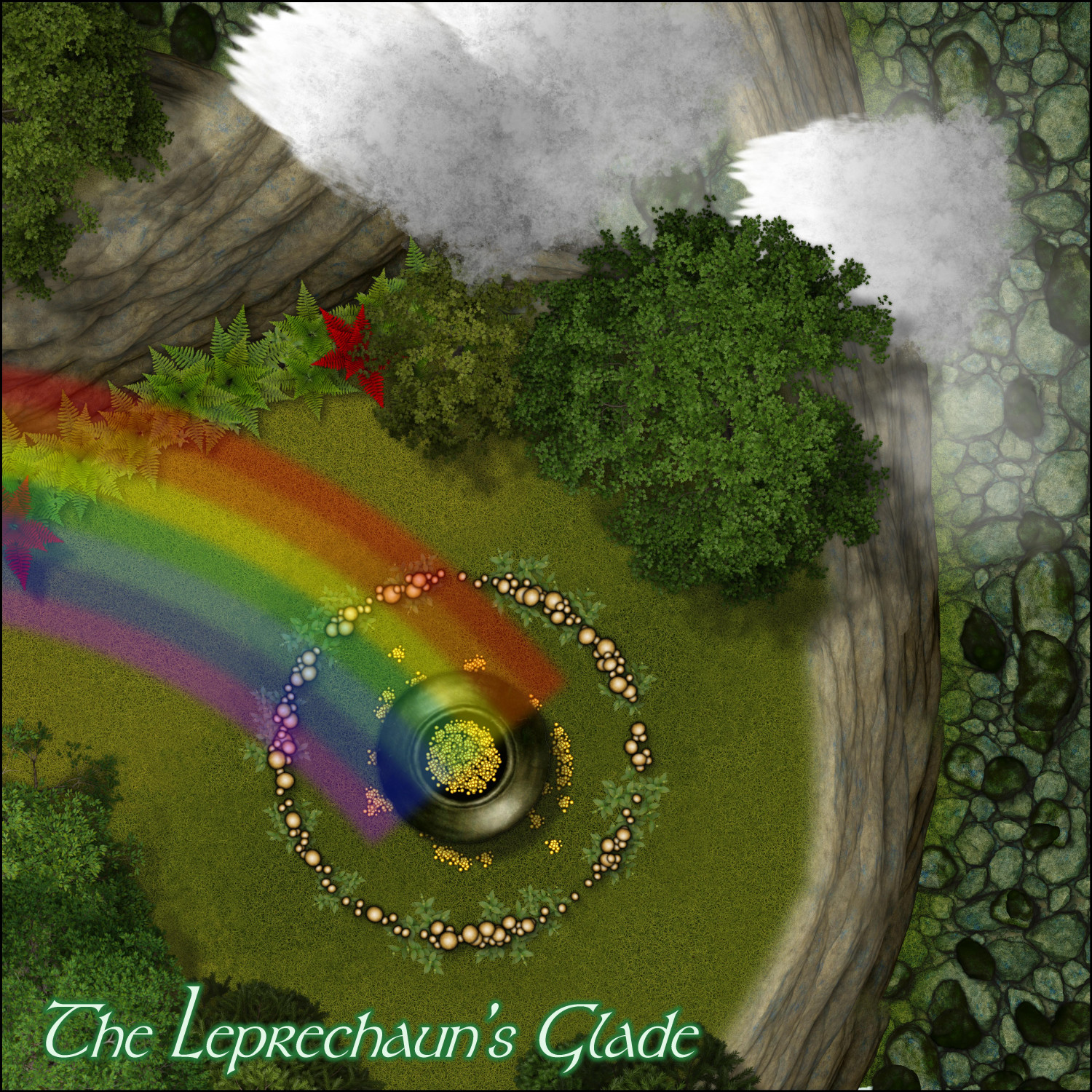
Lucky Leprechaun
We're coming up on St. Patrick's Day...and I found the leprechaun's pot of gold!