Royal Scribe
Royal Scribe
About
- Username
- Royal Scribe
- Joined
- Visits
- 9,533
- Last Active
- Roles
- Member
- Points
- 3,353
- Birthday
- February 5, 1968
- Location
- San Francisco, California
- Website
- https://legacy.drivethrurpg.com/browse/pub/31814/Royal-Scribe-Imaginarium
- Real Name
- Kevin
- Rank
- Mapmaker
- Badges
- 16
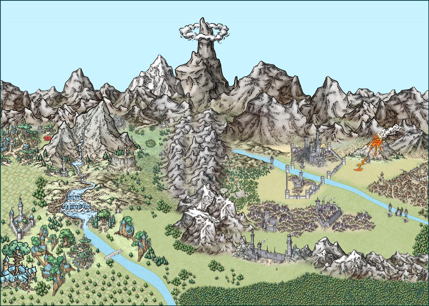
Latest Images


Reactions
-
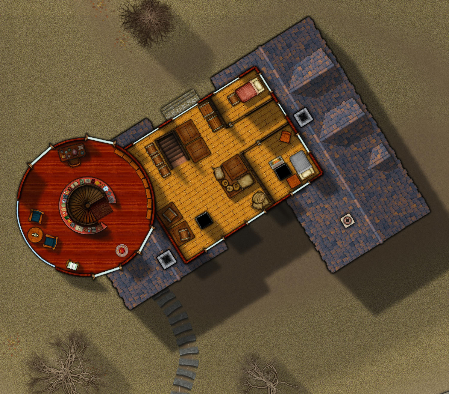
[WIP] Haunted Mansion
Here's level 4 of the mansion. There were only supposed to be three floors of the main mansion plus the tower, but when I was halfway through the third floor, I noticed that the main mansion has a central section that rises above the others. I decided to make that more of a rough attic storage space with a few rough servants' rooms. The tower doesn't connect here, but you can see it has been turned into a wizard's workshop. It extends up one more flight.
And I just noticed that I never posted the third floor.
Third Floor
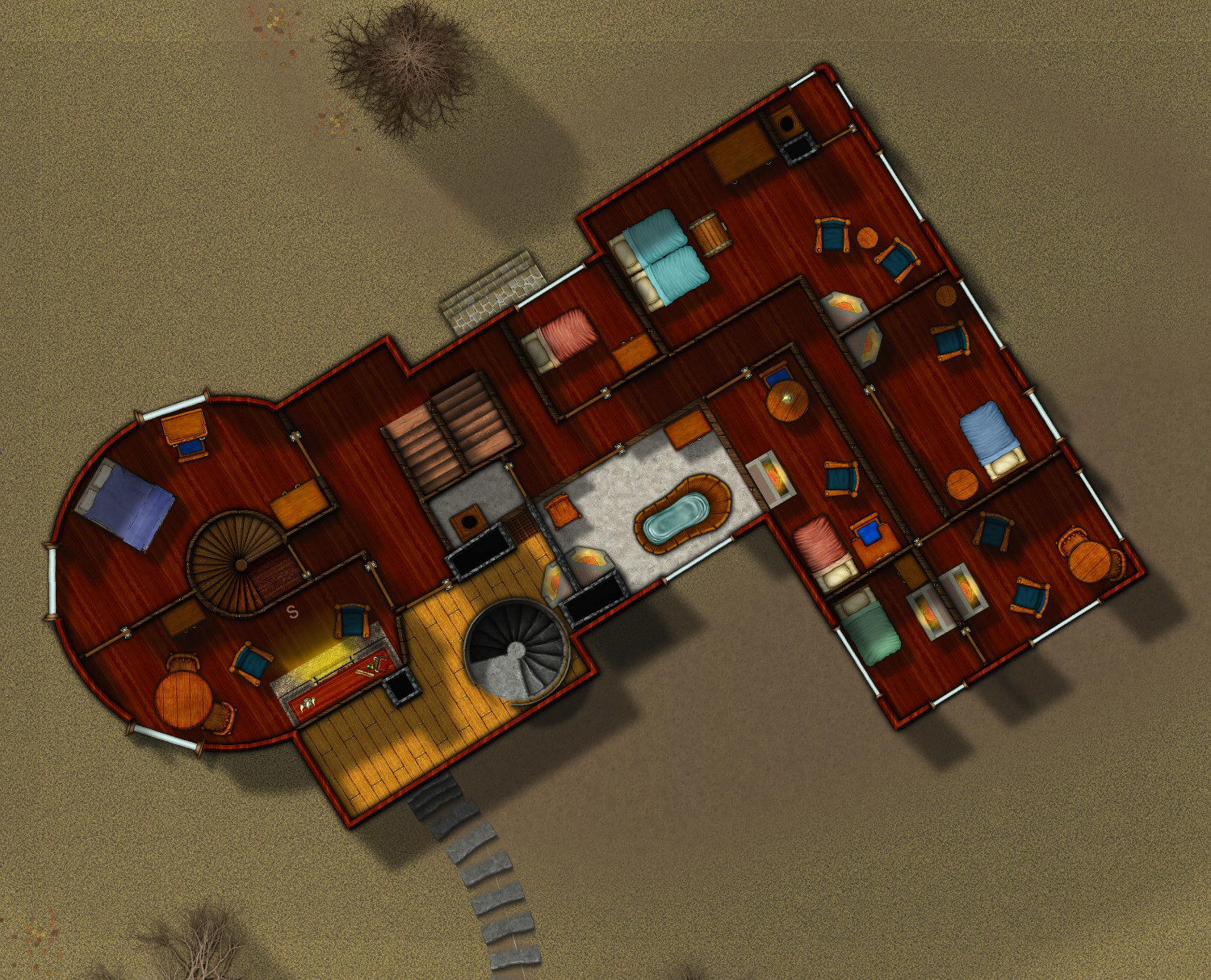
Fourth Floor


-
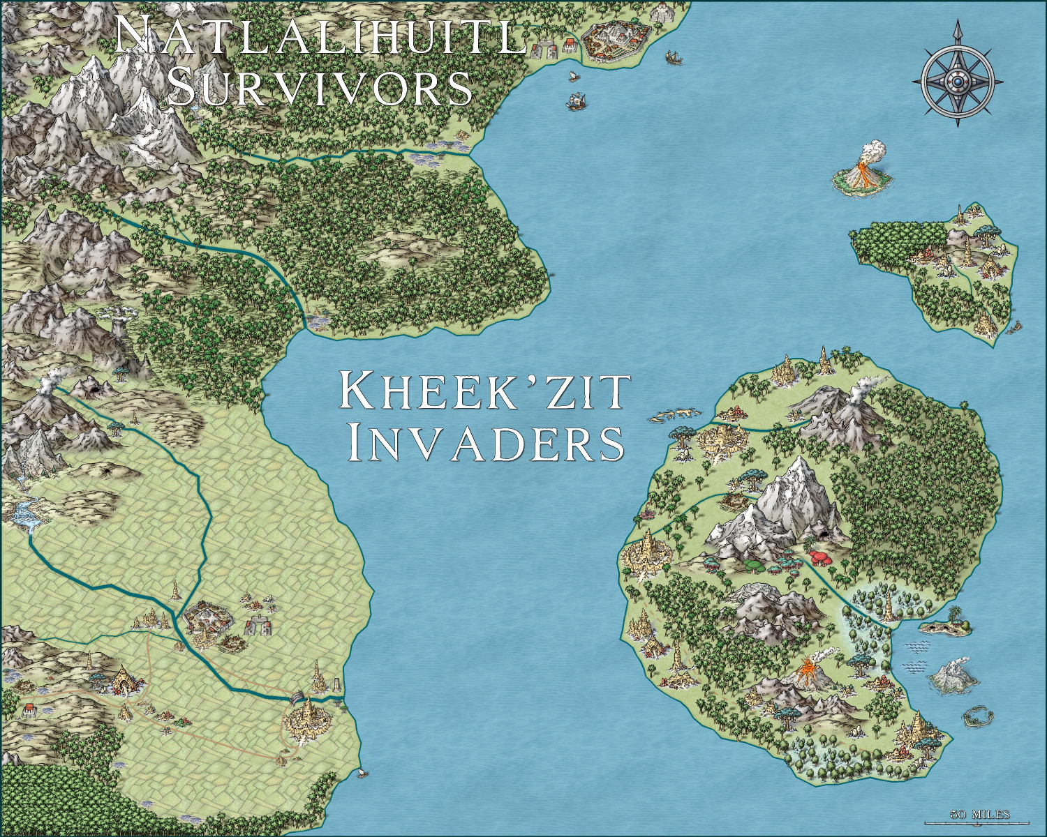
Invasion of the Pod People
Had a little fun with the second Hive monthly released today. The Kheek'zit invaders have made it to the mainland, infecting and destroying the Natlalihuitl Empire's southern cities as they continue to push their way north....

-
[WIP] Elves v. Dark Empire
Here's the other map. Much smaller southern forest. This map has 2,380 trees -- nine more than the map above.

-
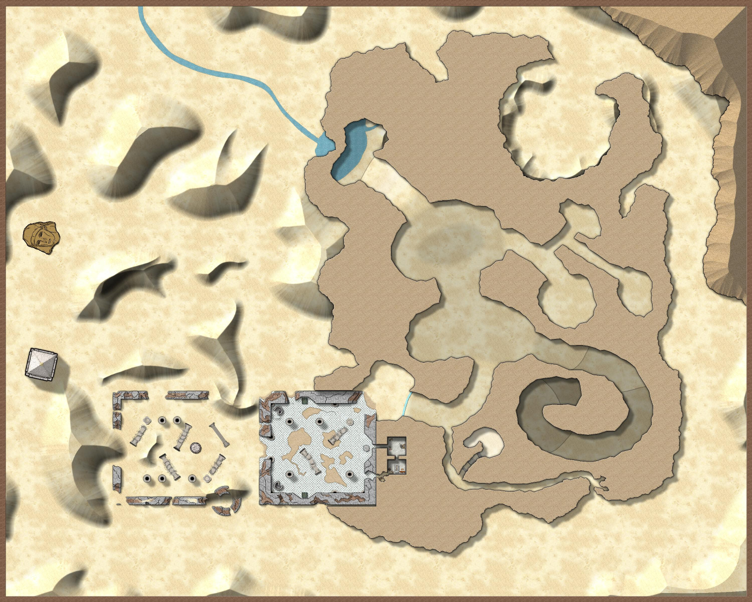
[WIP] - Sakherma Ruins
Reduced the Lightness Base from 75 to 58 for the HILL sheet and 62 for the HILL 2 sheet (but I'm not sure that a 4 point difference is visibly apparent to the human eye), and added some more dunes.


-
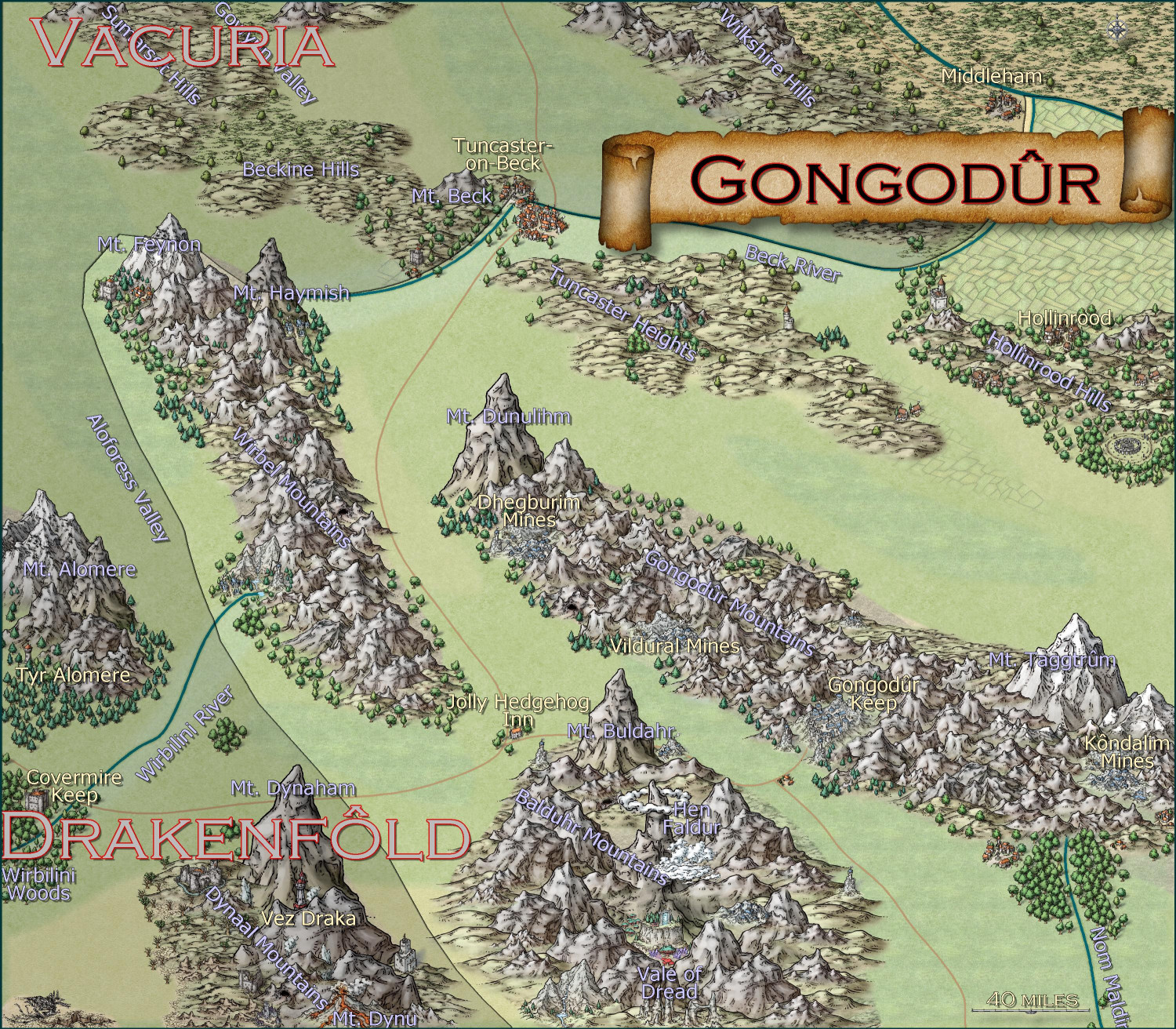
[WIP] Kingdom of Gongodûr
Here's a "work-in-progress" area map for the Kingdom of Gongodûr, a dwarven kingdom in the southeast corner of the Gold Coast area I've been working on (to provide a home for a dwarven mining village I'm working on). I used the Mike Schley Overland style because it has the best dwarven community symbols.
I shaded the countries outside of the borders of my dwarven kingdom, but not sure if that's the right approach. I could do proper borders for those neighboring kingdoms if that would be better.
I still need to name the places that are new to this local map but the names from the parent map have been added. I was going to do them all in Copperplate font since the font has a sort of "chiseled in stone" look, but it's such a wide font that it made place names challenging. Colors, sizes, and effects on labels remains one of my weaknesses.


-
Community Atlas submissions: the Gold Coast (Doriant) and areas within it
I am going to use this thread to officially submit my maps for the Gold Coast region of Doriant. I will have separate Work-in-Progress threads for feedback on maps as I am working on them, and then will use this thread for the official submissions so they are easy for Remy to find. I know Remy isn't processing new submissions until the contest ends, but this will queue up my future submissions for later this fall or winter, and it also provides a home for some of the villages I want to submit for the contest.
The first submission is ready! It's a 1000 x 1000 mile section on the western side of Doriant.
Here's a markup of the parent map to put it in context (the blue border represents the area I'm calling the Gold Coast.
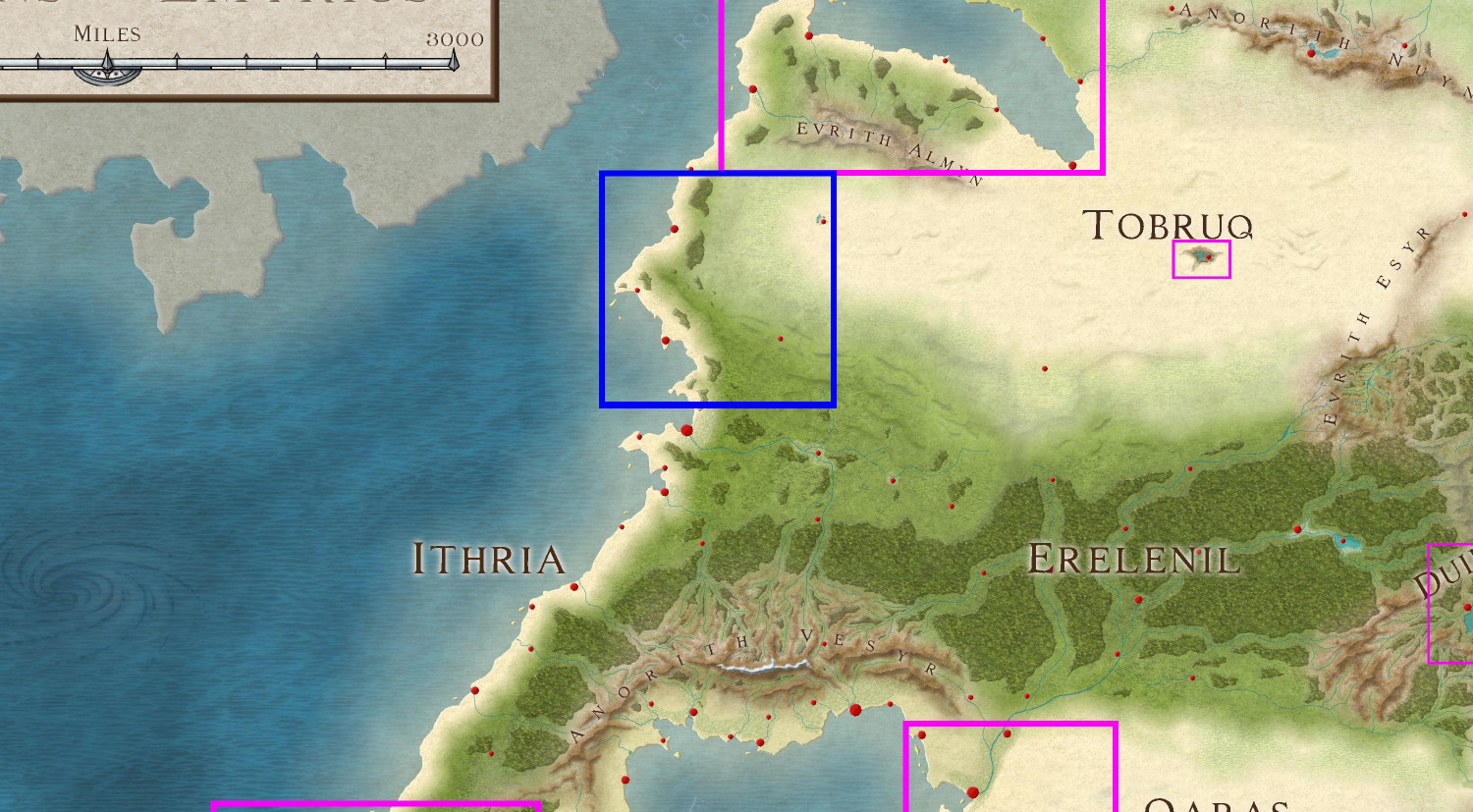
And here is the Gold Coast with all labels but without political borders shown:
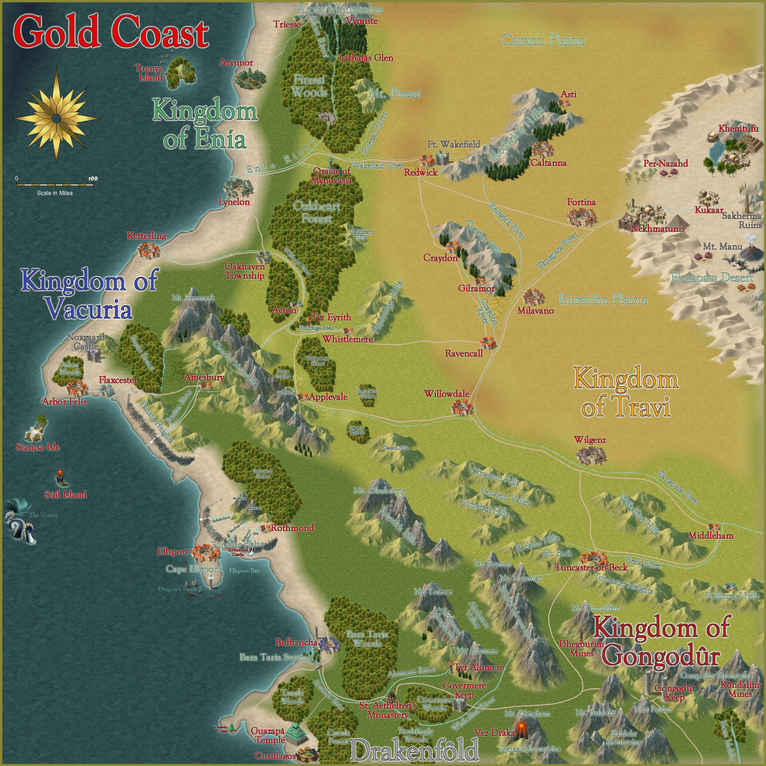
Here is the FCW file, along with a PDF description and a plain text description. (I stripped out accents and special characters in the plain text file.)
Primary Style: Annual Spectrum Overland
Toggles: "Borders (Political)" sheet to turn display or hide the political borders within the region.
@Monsen, please let me know if I've messed up and need to fix anything, or if you'd prefer submissions to be handled in any other way. I have lots of other local area maps within this region that will be ready to submit soon.


-
[WIP] Greenwood Falls (CA211 Watabou City Revisted)
I was a little intimidated to attempt this without seeing a Live demonstration first, but since I have the day off, I decided to dive in.
My first attempt was just a small village (152 buildings, population of 920), but I can see how a lot of the conversion goes quickly regardless whether you have a population of 500 or 5,000.
Here's what Watabou generated for me (converted from PNG to JPEG for size considerations):
And here's what I was able to create in a few hours:
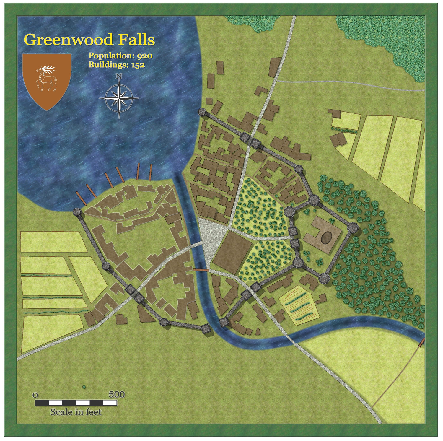
I didn't export the fields or the trees, just added them myself. Didn't do much in the way of adding furrows, etc., to spruce it up -- I can see why, even though it speeds up the process, I could still spend many hours adding lots of flourishes.
(One oddity from Watabou: The exported heraldic symbol that was exported ended up being different that what was shown, one deer instead of three, but no big deal.)
@Quenten and @Ralf, you did a magnificent job with this! What a tremendously helpful service you have done for Game Masters!


-
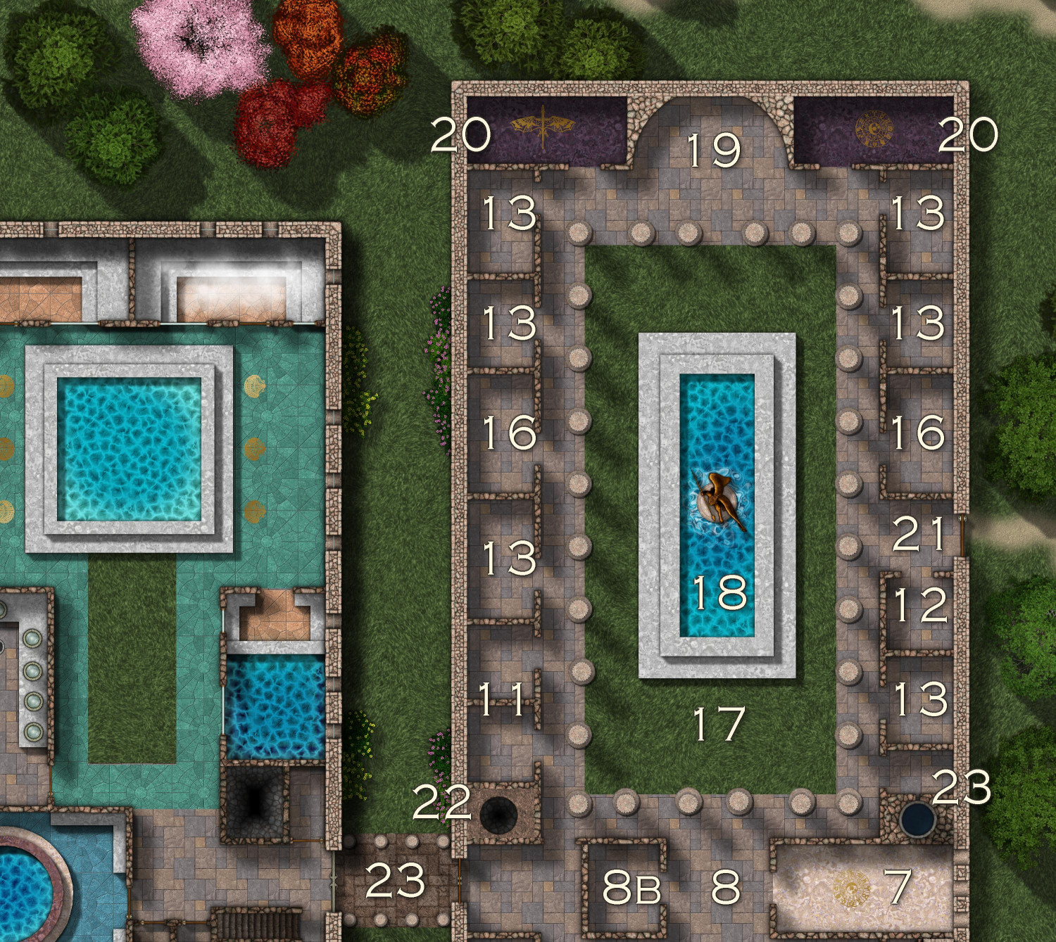
[WIP] Villa Citri (Roman-style villa)
Okay, I made some tweaks. The Alae (#16) have been moved up to be more central in the Peristylium courtyard. Now they are going to be strictly for honoring the household's ancestors, because next to the Exhedra (#19) I have added two shrines to honor the gods, the Lararia (#20, or singularly, Lararium). It's amazing what you can learn from Google if you just ask the right questions. I thought I can gotten down the rooms for Roman villas, but when I asked Google whether Roman villas had chapels, it told me about these shrines to gods. Plus, that gave me another excuse to use the brass inlays that I love so much. (Added some inlaid shells next to the pool in the bathhouse, too.)
Also added a shaft (#22) for hot air from the basement hypocaust to reach the top floor. Across the hall, there's a shaft (puteus) for water to be piped up into a little room with a tap for the water (puteal) -- that came from Googling "what did ancient Romans call a 'well'?"
Still have to add windows and doors, and furniture. Wish we had some Roman couch symbols!

-
[WIP] Satellite Streets
Playing around with the Satellite Streets annual this afternoon. I was going to do the little town I grew up in, but it had 3,000 people at the time (about 10,000 now) and was a bit too big to be a cozy little town. I ended up doing a town loosely inspired by a much smaller unincorporated town that that about 15 miles away.
Pretty pleased with how the highway onramps/offramps worked. I had an underpass at one point (by creating a "Roads Back" sheet) that worked pretty well, but couldn't really get it to fit with everything else without enlarging the size of map, so I abandoned that.
There are supposed to be hills on either side of the river, with the river in a deep canyon, but drawing the town on the hills wasn't quite to my taste.
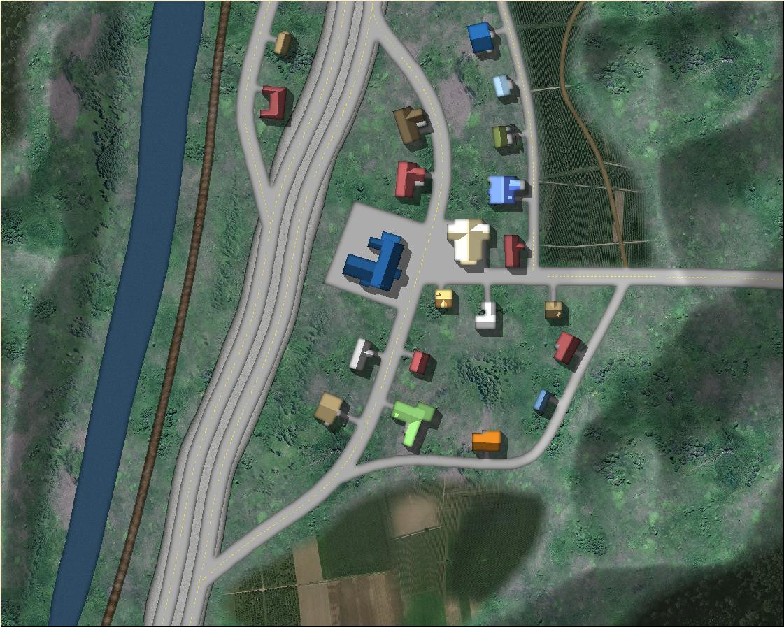
I did have a little weirdness with the railroad tracks. They looked funny when I first drew them, and I discovered that I didn't have the Earth background fill that it used, so I was getting red X's. I checked the Bitmaps folder for this annual and it did have the earth fill, so I reimported all of the fills for this annual and got it to work.
Also discovered that while it works to draw a forest or woods over the mountains, you lose some of the beveling detail. I ended up redrawing the forests and woods in little patches.

-
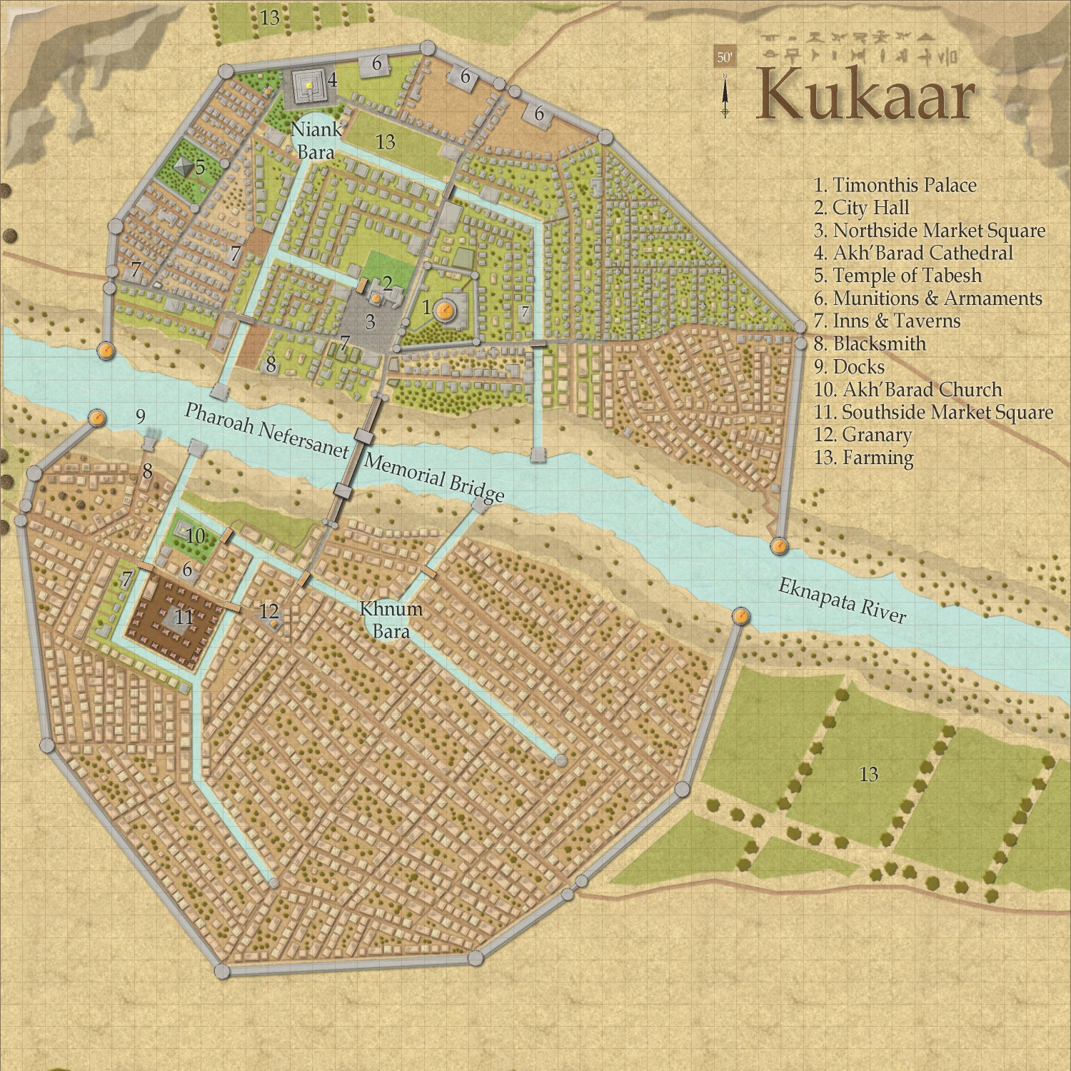
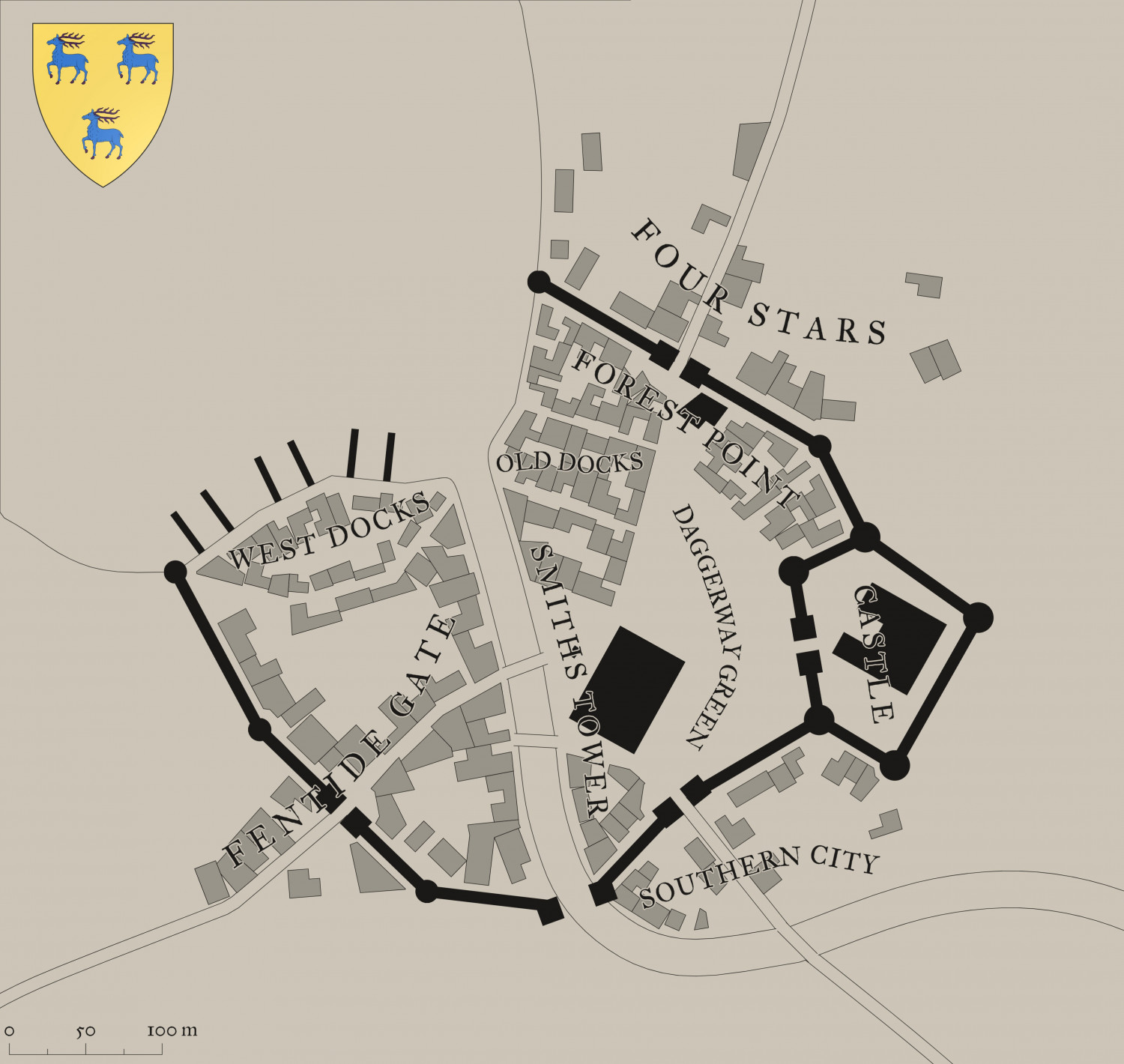
[WIP] Town of Kukaar (Ancient Cities Annual)
Finally had a chance today to add some names and some trees.