


Royal Scribe
Royal Scribe
About
- Username
- Royal Scribe
- Joined
- Visits
- 9,532
- Last Active
- Roles
- Member
- Points
- 3,353
- Birthday
- February 5, 1968
- Location
- San Francisco, California
- Website
- https://legacy.drivethrurpg.com/browse/pub/31814/Royal-Scribe-Imaginarium
- Real Name
- Kevin
- Rank
- Mapmaker
- Badges
- 16
Latest Images


Reactions
-
[WIP] The Wizard of Schley
Here are the dungeons -- er, basements.
Basement 1
Halfway down the spiral staircase, there's a secret door that leads to a secret passageway with stairs that descend into a hidden treasure chamber. This chamber also has a secret door that leads to a double-trapped secret tunnel that in turn leads into a secret cavern with more secret treasure.
The non-secret areas of this basement include a larder, laundry room with furnace, and stairs locked with a sturdy stone door* that descend to the sewers.
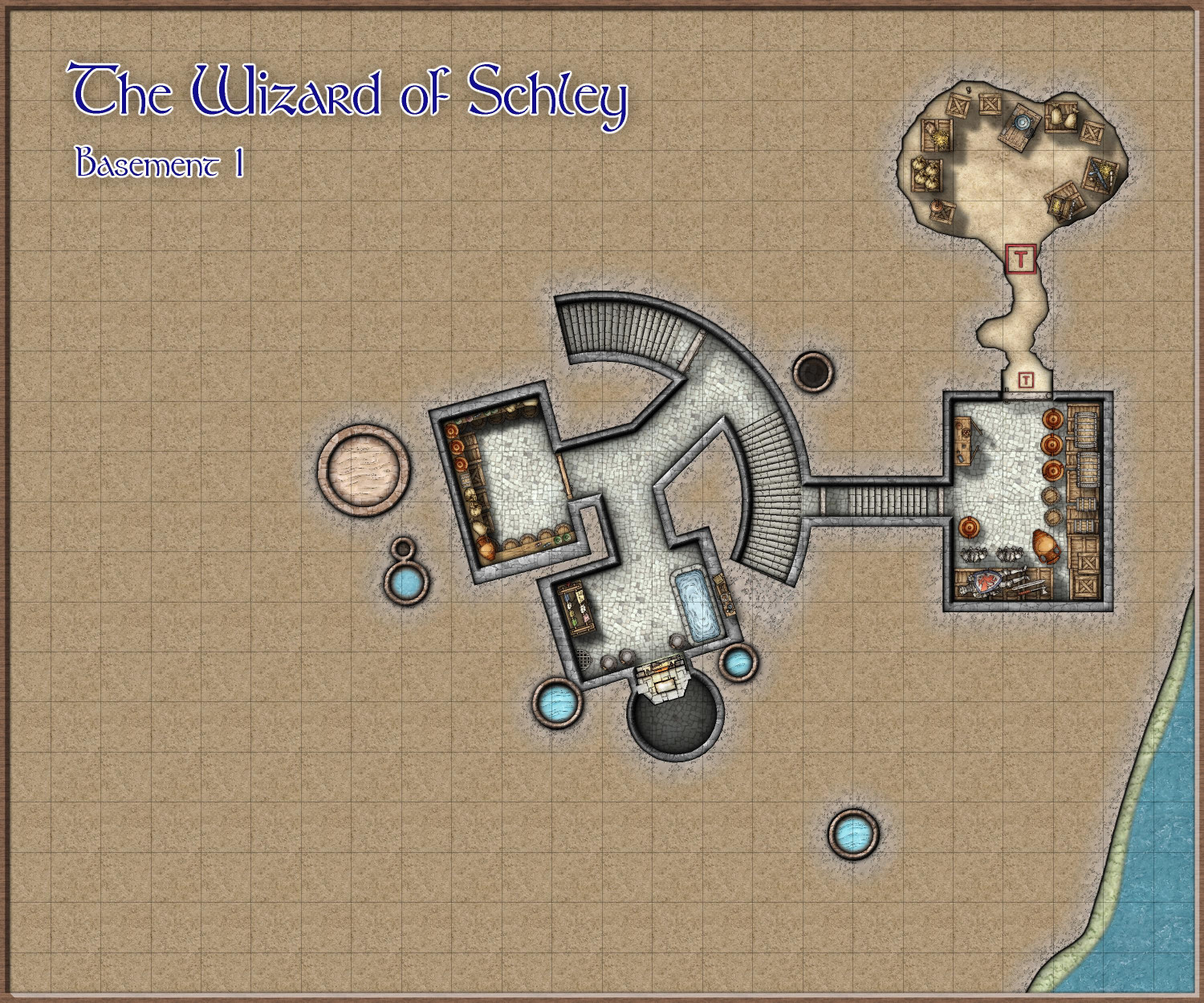
* I have discovered that Mike Schley's dungeons do not have metal doors.
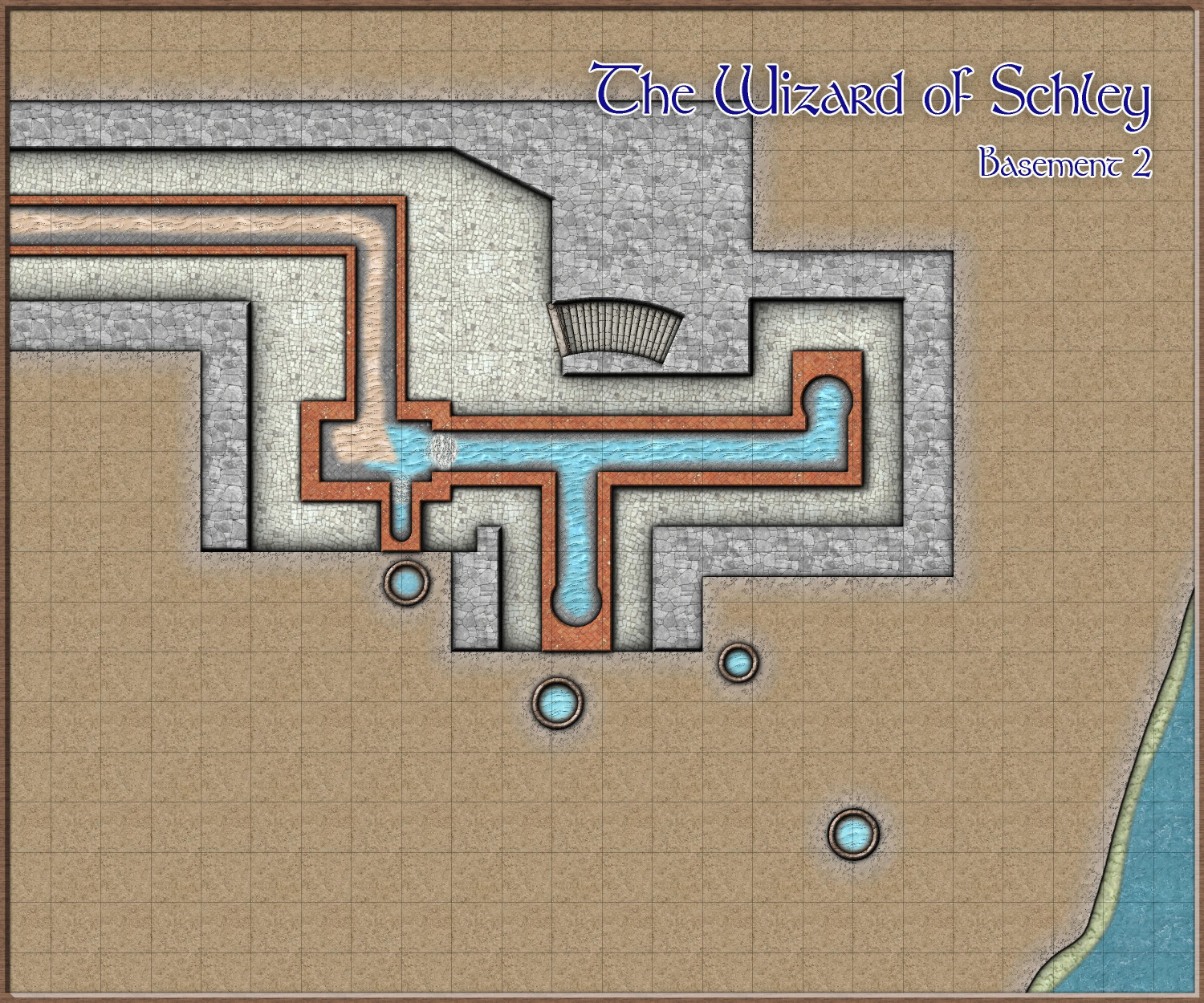
Basement 2
The second basement is really just access to the municipal sewers. I love the idea of adventurers using the sewers for heists, escapes, or other shenanigans.


-
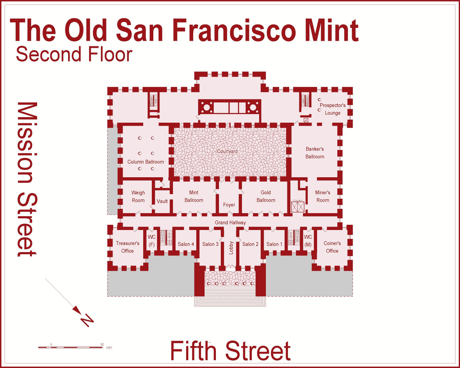
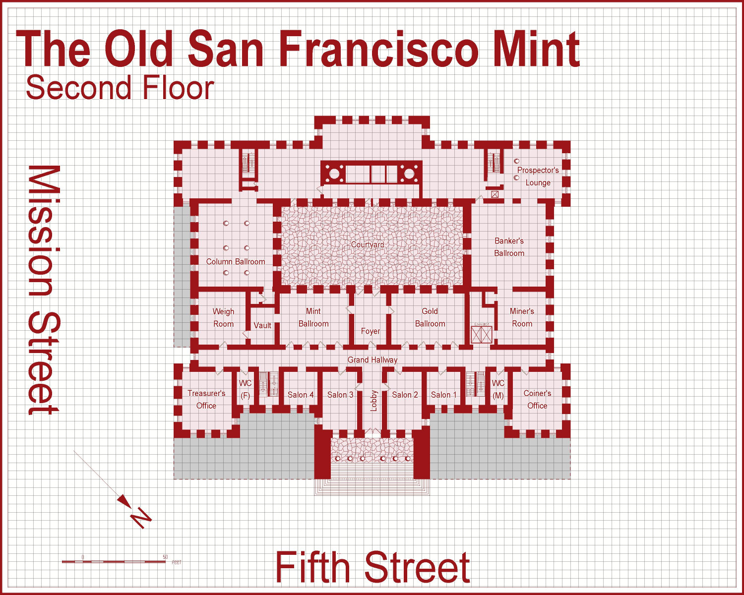
[WIP] The Old San Francisco Mint (Dracula Dossier)
Went in to change the outside landscaping in the second floor file and noticed that I forgot some of the windows, especially on the main entrance side. @Don Anderson Jr., does this achieve what you recommending with the landscaping for the higher floors: keep the fence but eliminate the foliage? I kept the fence and added a Solid 20 fill (which I could change to Solid 10 if it looks too strong).

-
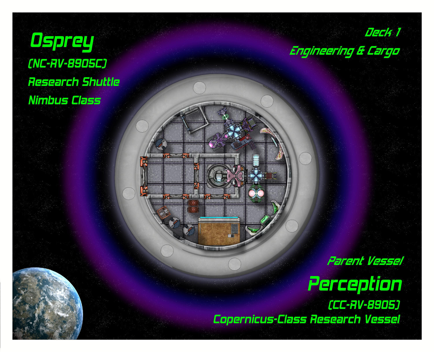
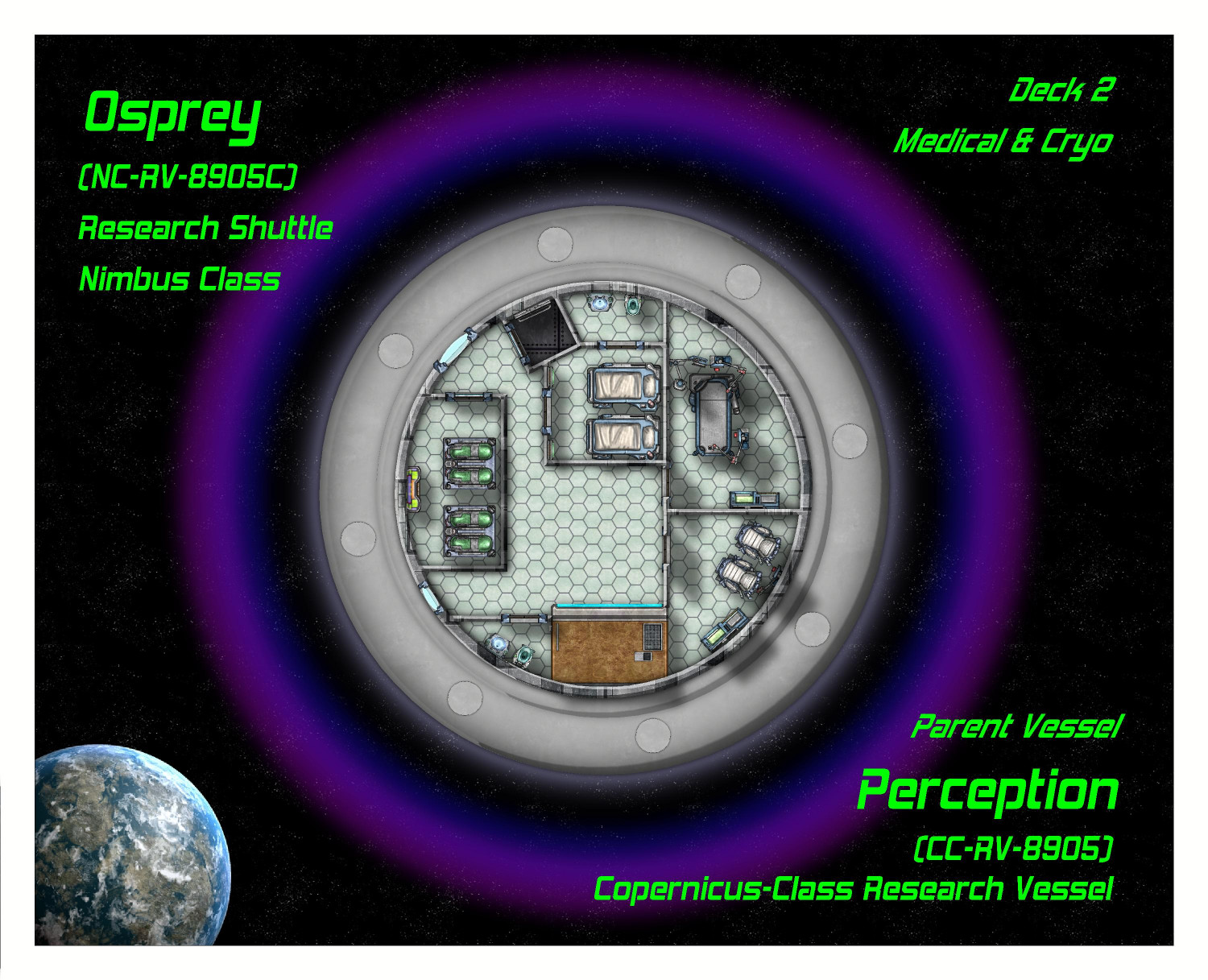
[WIP] Research Saucer Shuttle
I intended to have three decks, but ended up pushing it to four because it was hard to squeeze medical and living quarters into a single deck. And even then, I had to make compromises (like bunk beds, and deciding to have a standard crew of six rather than eight).
Deck 1: Engineering & Cargo
This is the lowest deck. On the left side is an airlock door with an (unseen) retractable ramp, for planet surface landings. The center has a ring hatch for connecting with other space craft. A tractor beam can also pull objects into the craft from here. The ship's main computers and engineering systems are here, including life support, artificial gravity generators, shield deflectors, the cloaking device, propulsion systems, sensors, weapons, communications, and more.
Cargo (mostly specimens collected from the planet) can also be stored here wherever there's a little spare space.
Deck 2: Medical & Cryo
This floor is dedicated to medical care and biological research (including a lab table where local fauna can be...examined). There are four cryogenic tanks here for emergencies -- not enough for the entire crew because this is not an interstellar space craft and the cryo tanks are for emergencies. Usually that means keeping an injured crew member on life support until the ship can return to the parent vessel or space station. Sometimes if a shuttle is stranded, it can keep the crew alive (in rotating shifts) until help can arrive.
Deck 3: Habitat
This is where the crew lives when they aren't on duty. As this ship is only intended for short missions of a day or so, sometimes a week, the living quarters can be more cramped than on their parent ship. The crew even has to sleep in bunk beds in a shared room. There are two bathrooms with showers.
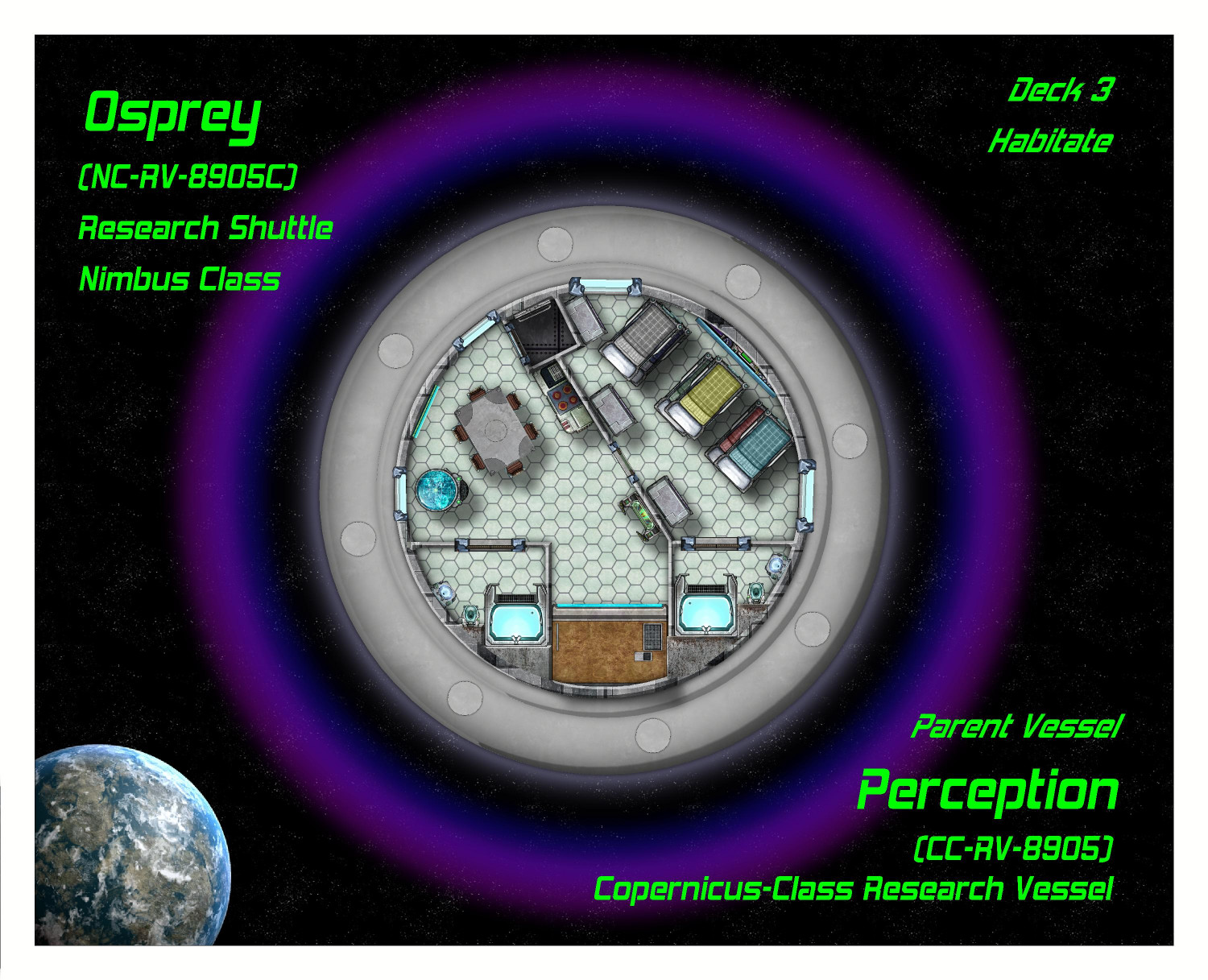
The other floors were already posted and haven't changed. I'll see if there's any feedback and then post the final set.


-
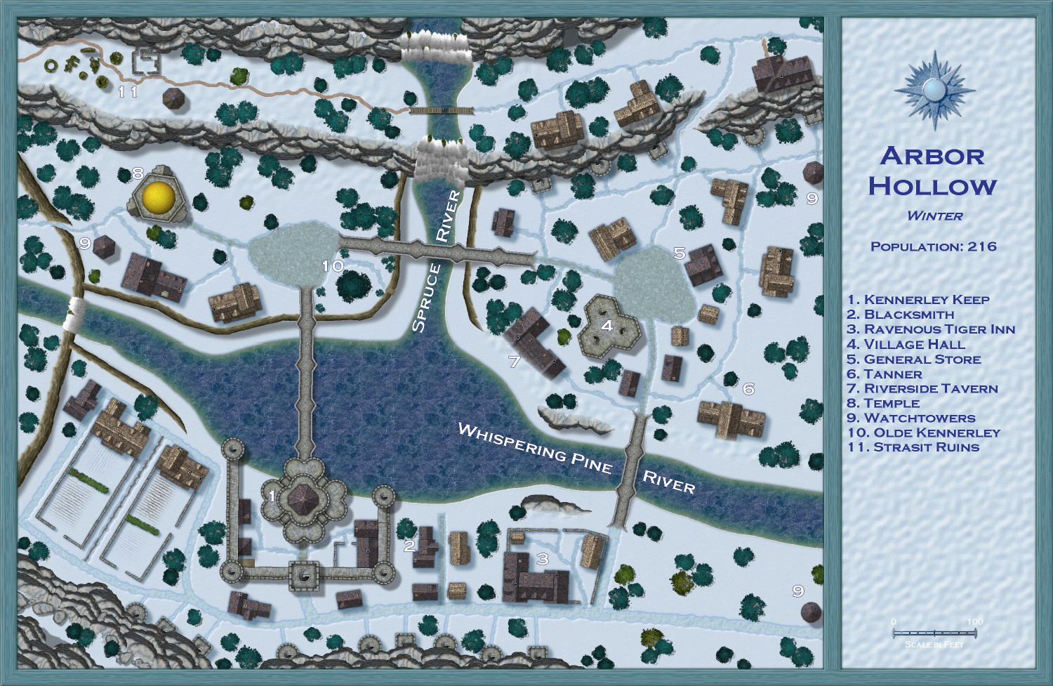
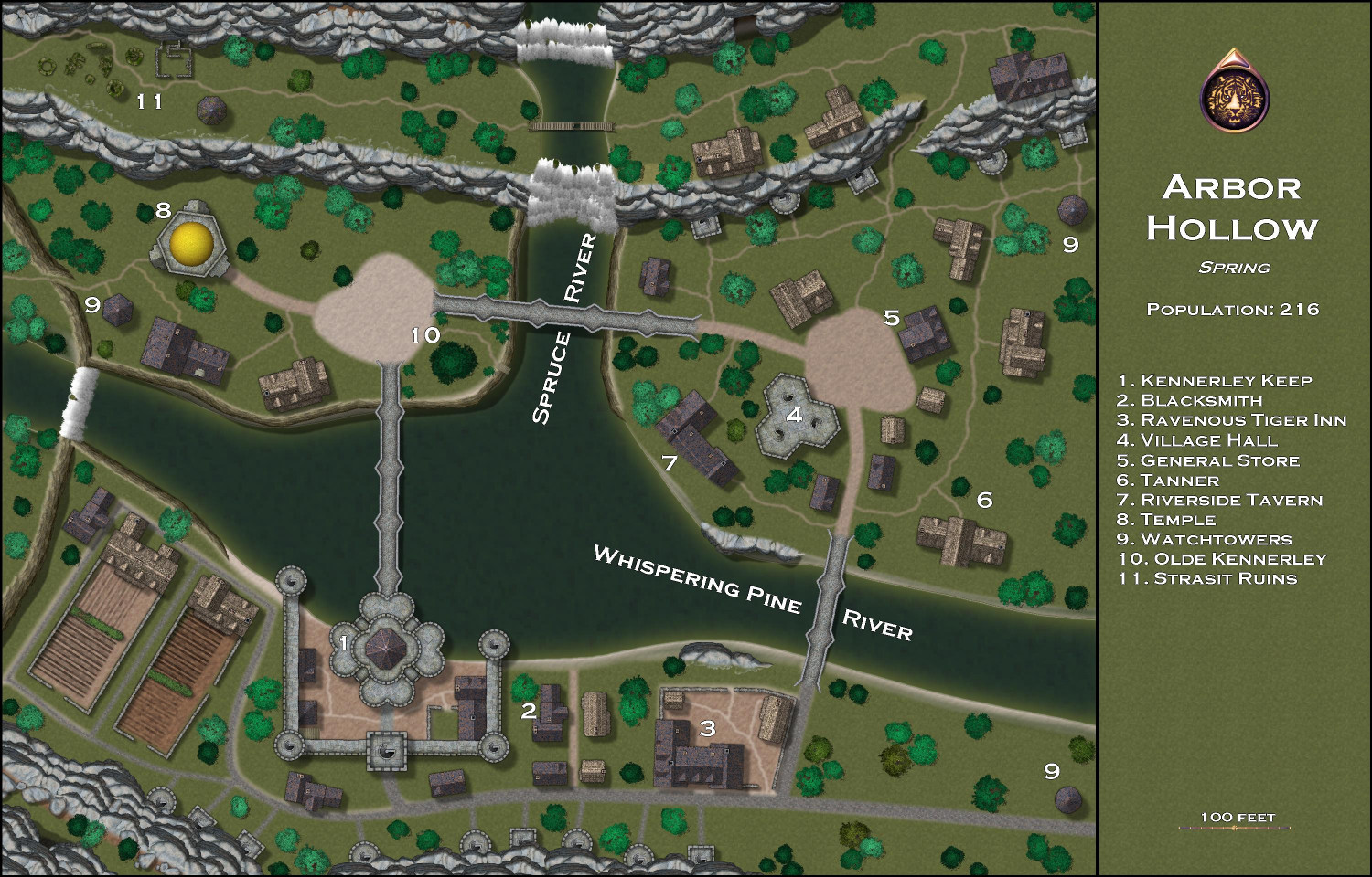
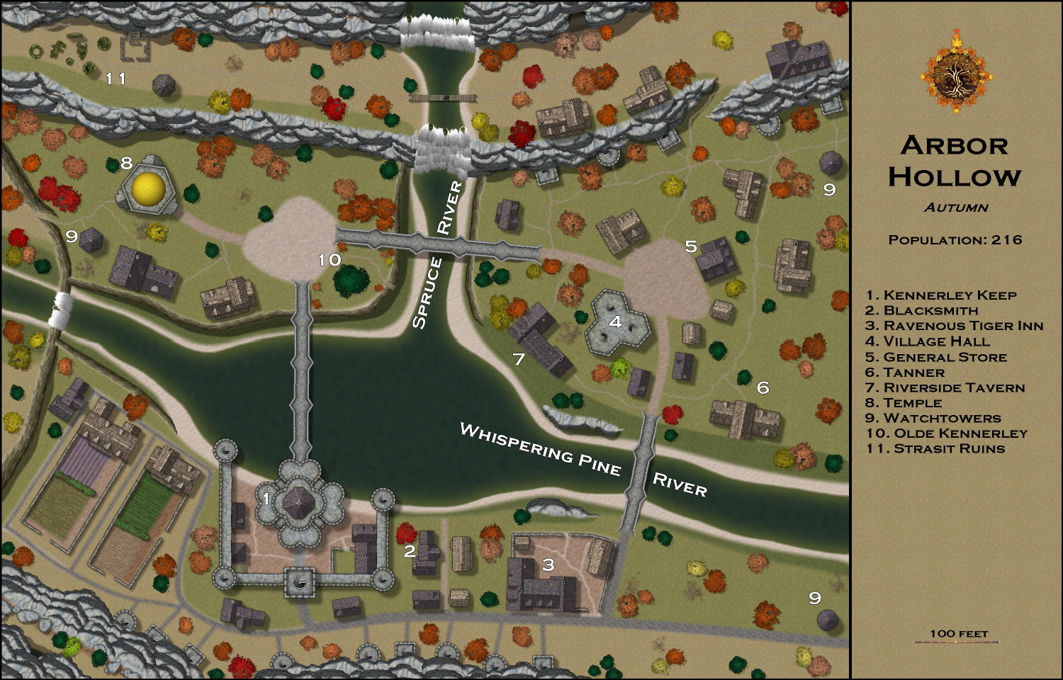
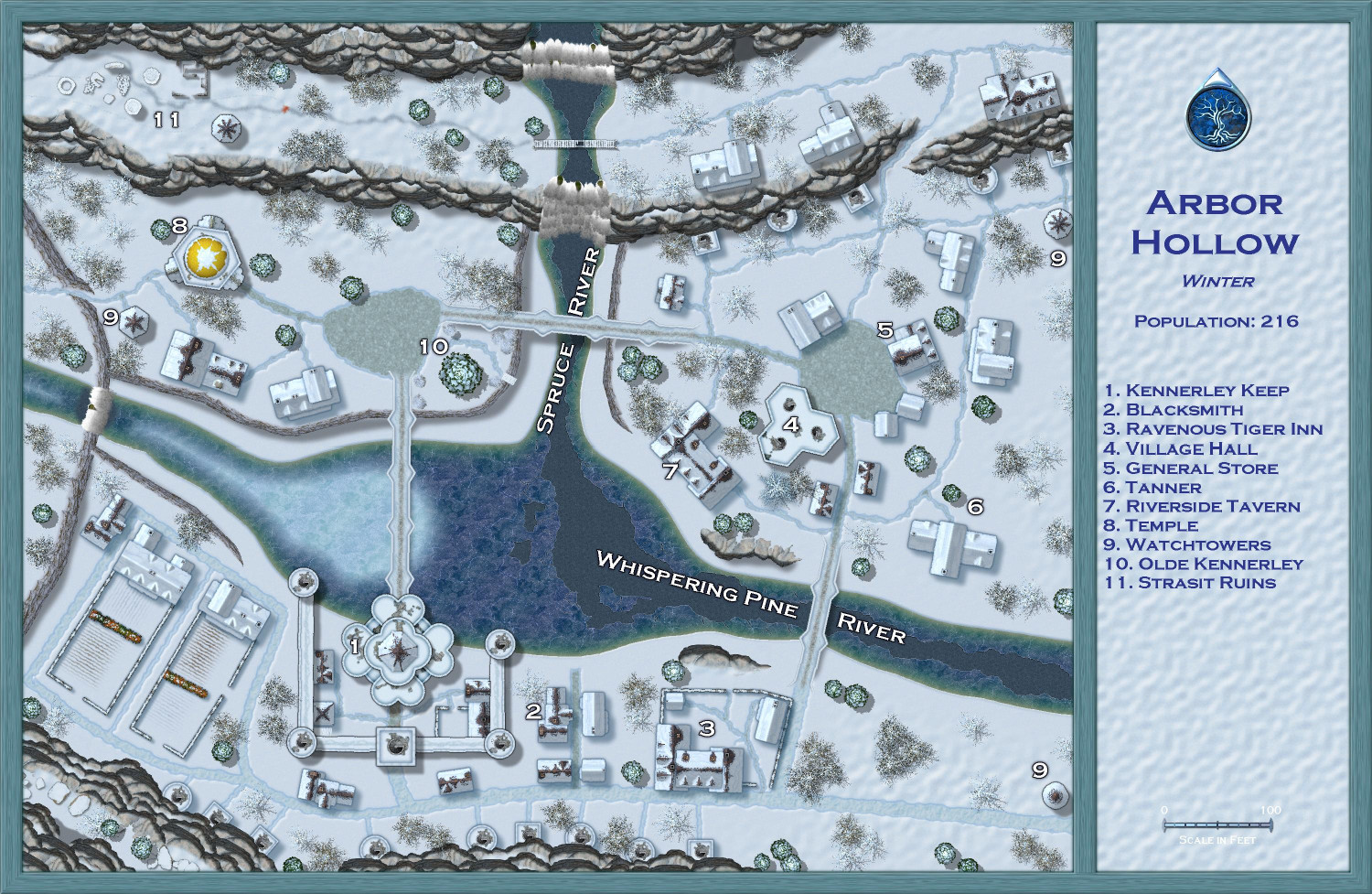
[WIP] Atlas Contest (potentially) - Arbor Hollow (summer, autumn, winter, spring)
Here is Winter so far. Still tons to do, but I've managed to get everything on their correct sheets, I think, and the imported sheets in the correct order. Converted the rivers to the iced-over versions. I will add breaks and cracks from Winter Trails later to the Spruce River and the lower part of Whispering Pines River, and then frost to the upper part of Whispering Pines River. Converted the paved roads to the default winter roads, and the dirt ones to the winter muddy roads. (You'll notice that one path at the ruins in #11 hasn't been converted yet. When I start to bring in style features from Winter Trails, I will make that into a path or maybe footsteps. Converted the crops to snow-covered counterparts. But the biggest changes are yet to come: swapping out the building, tree, and other symbols for their winter counterparts. I will have to look at the sample maps with the annual to get ideas for how to better display the label numbers.


-
[WIP] Swamp Witch
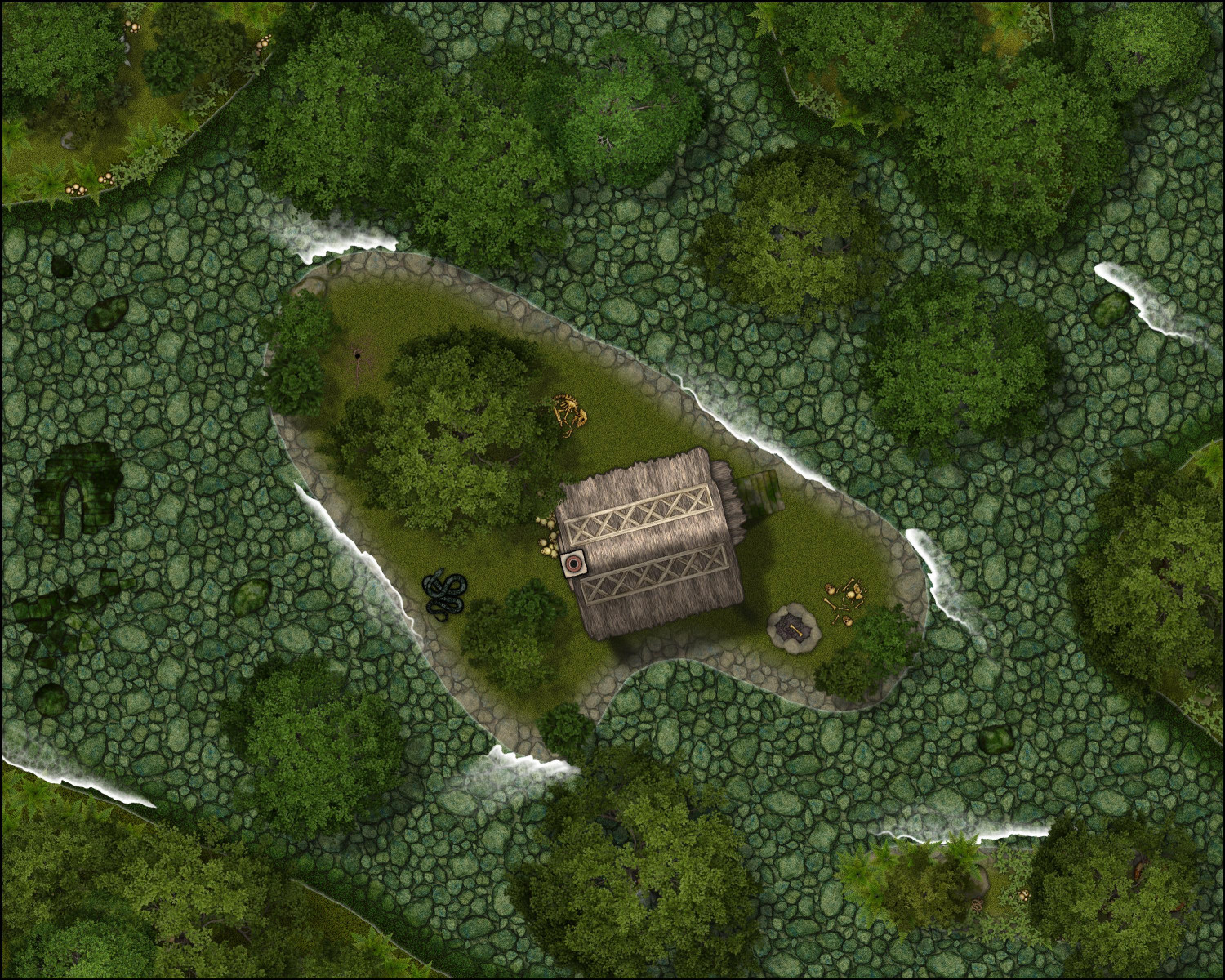
For Forest Trail, I had to bring in the cottage from Darklands City, and the bones/debris from DD3. I struggled with two things: the riverbed and the ripples around trees growing in the water. For the ripples, I used the rapids symbols that come with the annual. For the riverbed, I tried three different versions.
Here are all three together:
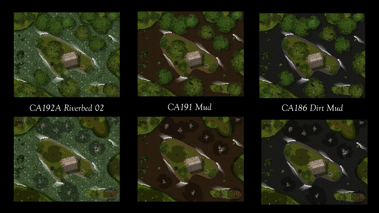
The first version uses the riverbed fill from the annual. It doesn't look particularly swampy to me, though.
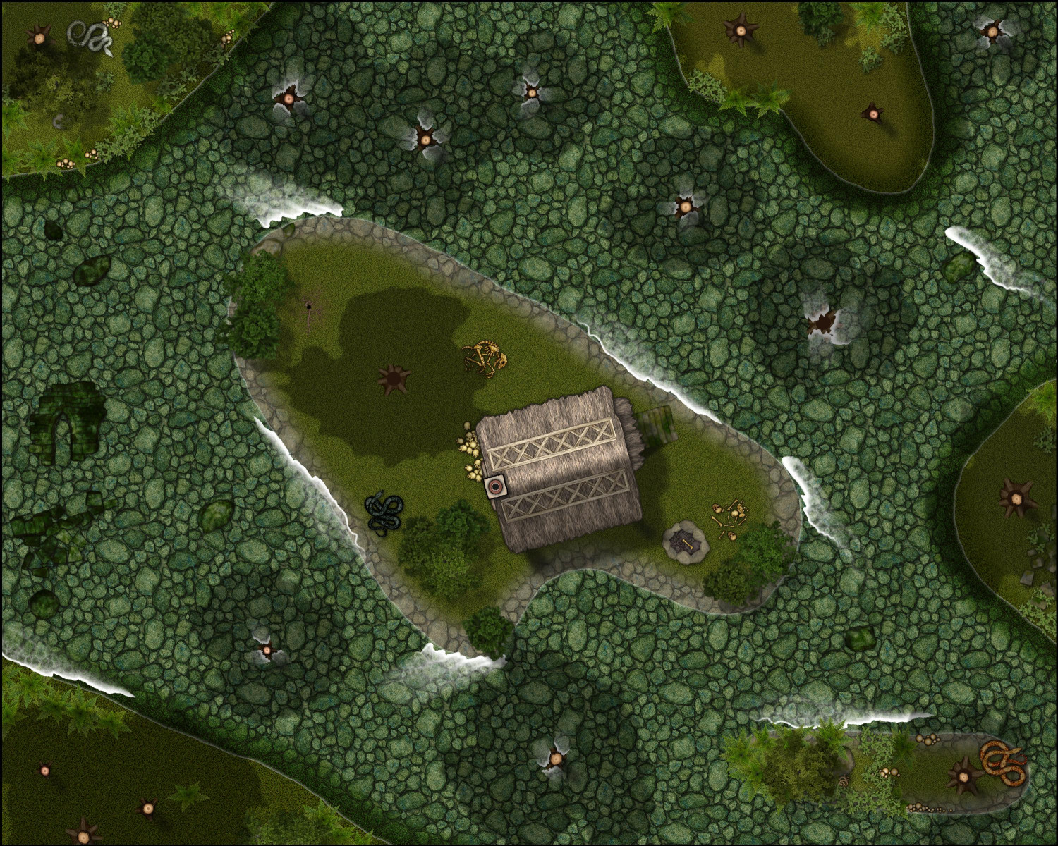
The second version uses a mud fill from the Forest Trail annual:
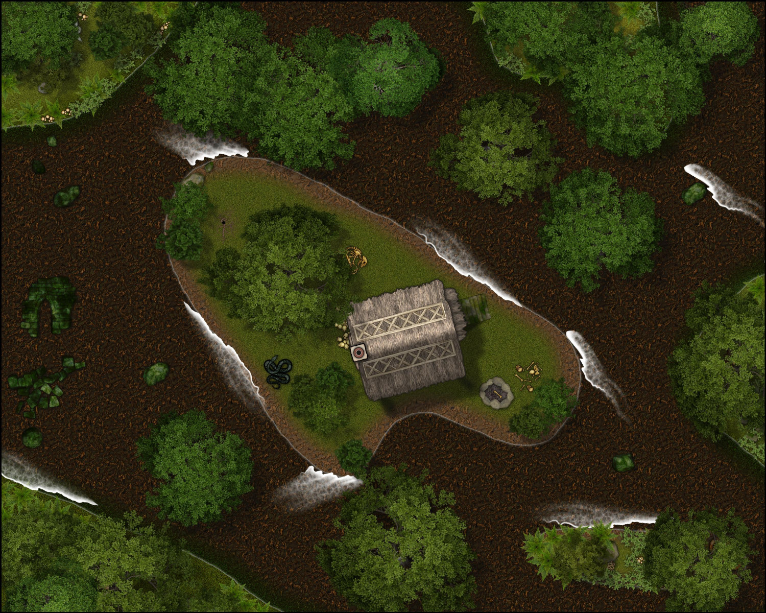
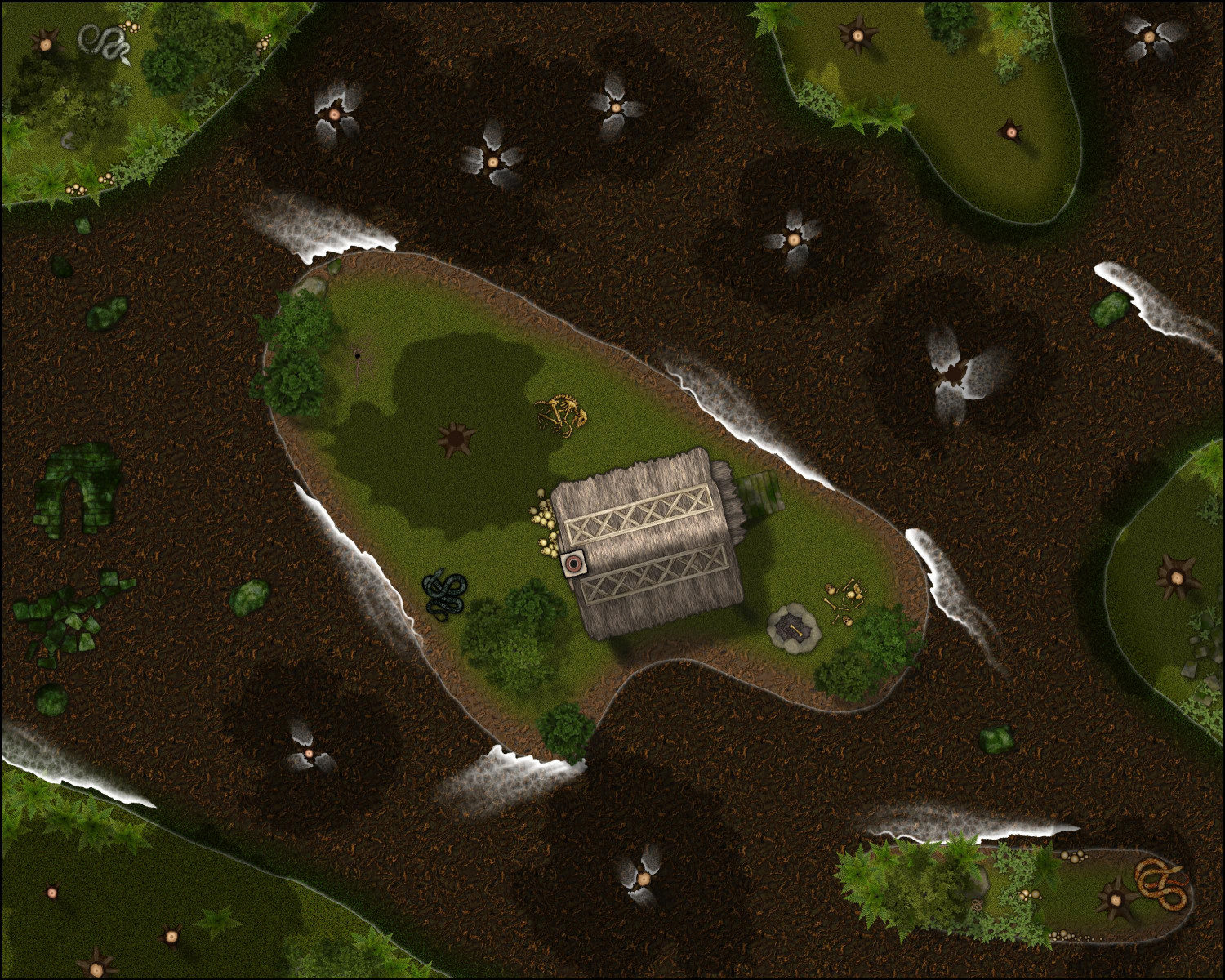
The third version uses a mud from Creepy Crypts:
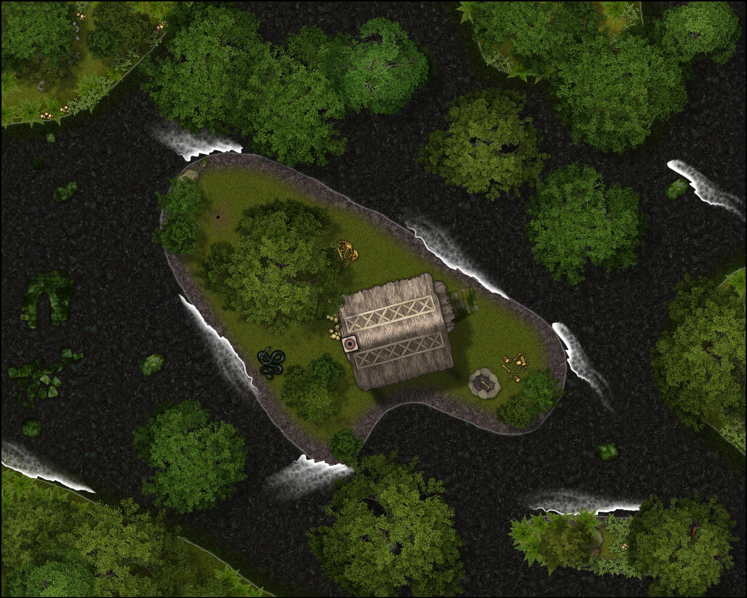
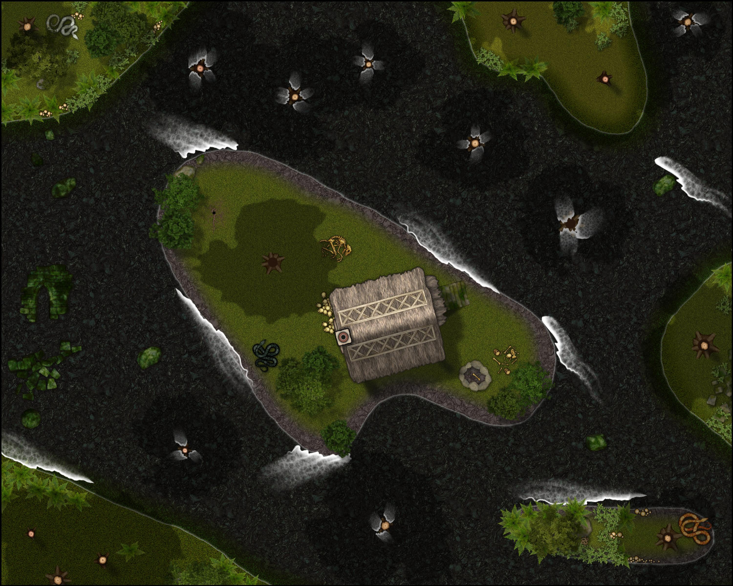
I like the mud from the second two, but I'm not sure it's clear that the trees are growing out of muddy water and not just mud. Maybe if I added more waves, or played with the water effects?

-
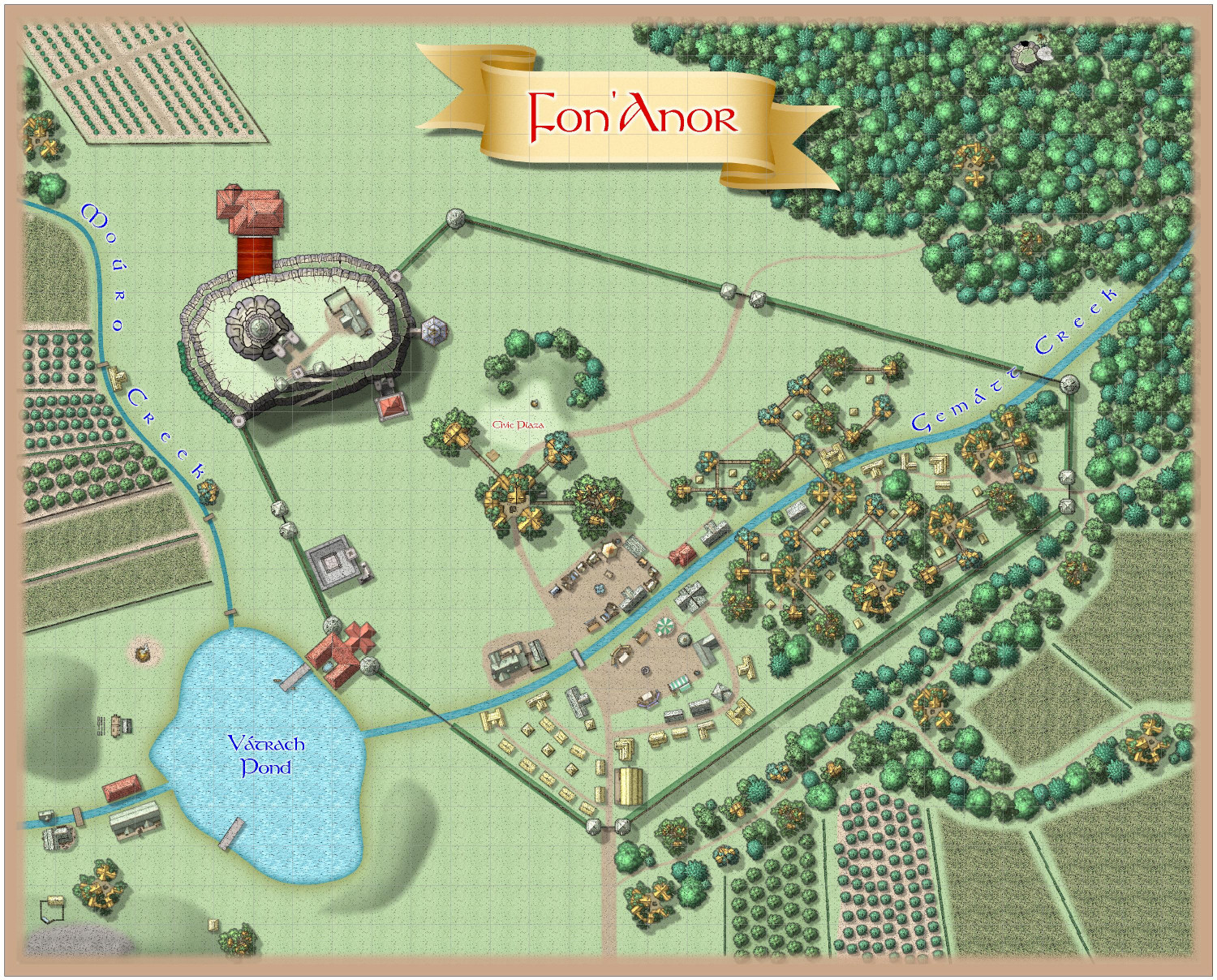
[WIP] Community Atlas Competition - Artemisia - Verinress Arl - Fon'Anar
Here's a bit more. More to come, especially fleshing out the empty spots within the village walls. Plus labeling, of course.


-
Community Atlas submissions: the Gold Coast (Doriant) and areas within it
Been out of commission with the flu the last few days, but on the mend now. I wanted to submit the Spring, Autumn, and Winter versions of my village of Arbor Hollow in case Remy finds it easier to process them at the same time as the Summer version, which was submitted as part of the Atlas contest.
Here are images, followed by the FCW files. The description is the same for each, but I will provide again here anyway.

-
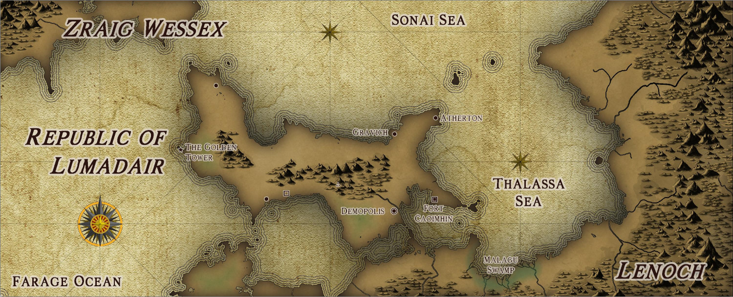
[WIP] Republic of Lumadair - CA218 Fractal Parchment Worlds
Before attempting to do my entire campaign world in the new Fractal Parchment Worlds style, I wanted to try it out with a familiar spot: the Republic of Lumadair.
For this one, I exported Lumadair from Fractal Terrains in the Fractal Parchment Worlds style that Ralf demonstrated in today's Live session. But I also exported a contour map of the same view, and then copied a few of the elevation contours over, then used the Draw Like tool to convert them to the proper contour appearance.


-
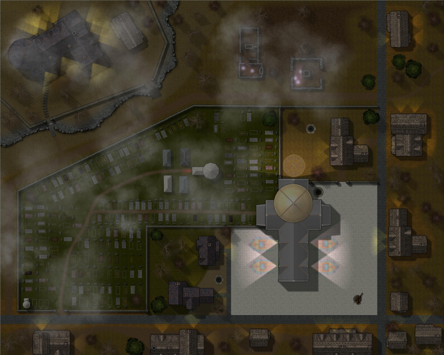
[WIP] Haunted Mansion
Here's a look at it at night, with lights added. I experimented with adding a moon like Jeff B did with his contest entry, but it was creating weird banding effects that I couldn't resolve. Instead, I played with the Shadow-Transparency in the Global Sun settings.
This is 35:
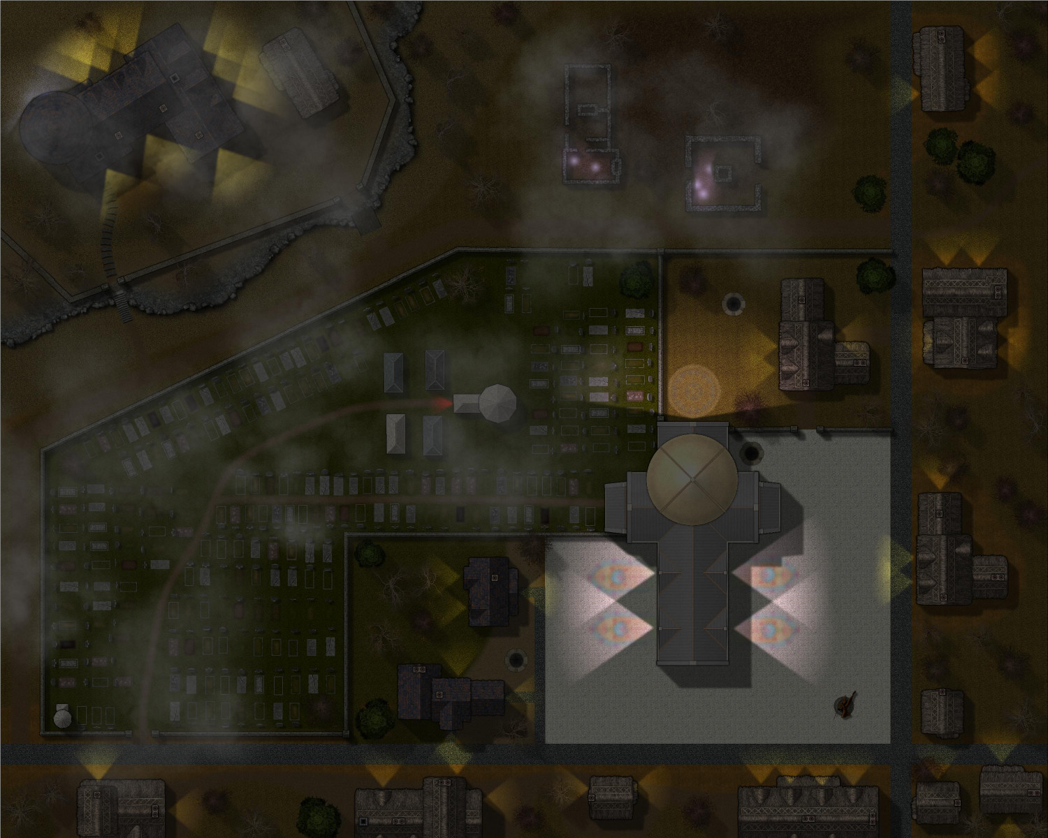
This is 50:
-
[WIP] Marine Dungeons Lighthouse (more May Annual Stairs & Steps)
I decided I didn't want to redo the entire tower, so I did some stairs ascending around it from the courtyard as a proof of concept. I do like the idea of stairs winding around a tower. Wonder if I can make it go around multiple times? I have some thoughts on how to do that, but I will save them for another map.
In the meantime, here's how it turned out:
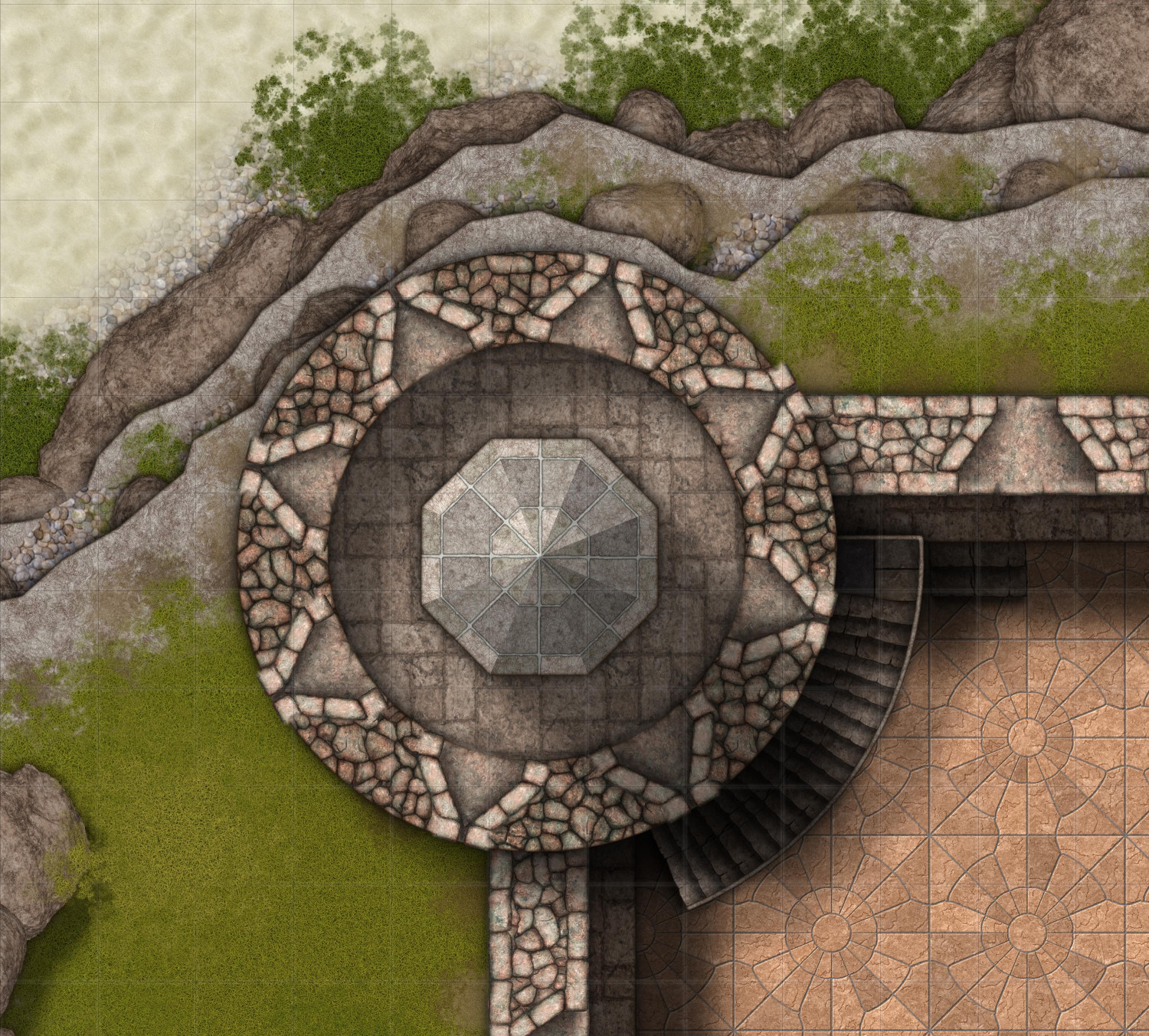
(It's subtle, but beneath the railing there are railing posts, which you can't really see but they cast a subtle shadow.)
Anyway, I'm rushing out the door, but I will make any tweaks when I return and then re-export the maps that show the tower.


