


Royal Scribe
Royal Scribe
About
- Username
- Royal Scribe
- Joined
- Visits
- 9,530
- Last Active
- Roles
- Member
- Points
- 3,353
- Birthday
- February 5, 1968
- Location
- San Francisco, California
- Website
- https://legacy.drivethrurpg.com/browse/pub/31814/Royal-Scribe-Imaginarium
- Real Name
- Kevin
- Rank
- Mapmaker
- Badges
- 16
Latest Images


Reactions
-
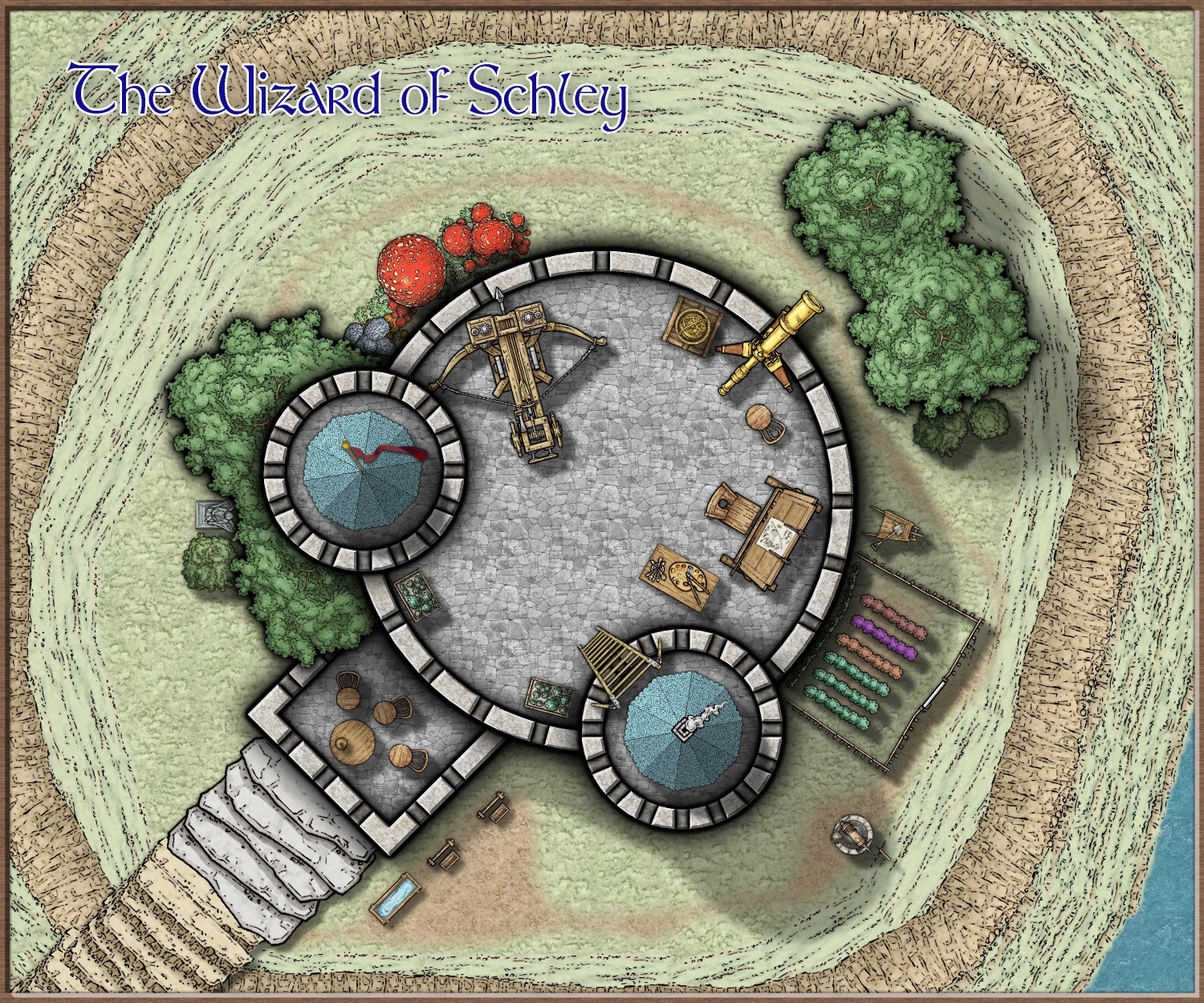
[WIP] The Wizard of Schley
Still haven't finished the basement (got sidetracked with Cosmographer), but revisiting this to add some of the newest monthly symbols. I experimented with adding tombstones #4 and #5 from Mike Schley's latest monthly as decorations on the top of the tower, like where gargoyles and grotesques would go, but I couldn't get them to look right. And creating a little graveyard outside of the tower looked weird on such a small hill. But I couldn't resist doing something with the new symbols, so I added tombstone #4 as a statue amidst the trees on the western side, and the wheelbarrow next to the vegetable garden.
I think I've managed to get something from each of the 2025 monthly dungeon-scale symbols into one or more of these Wizard of Schley maps.


-
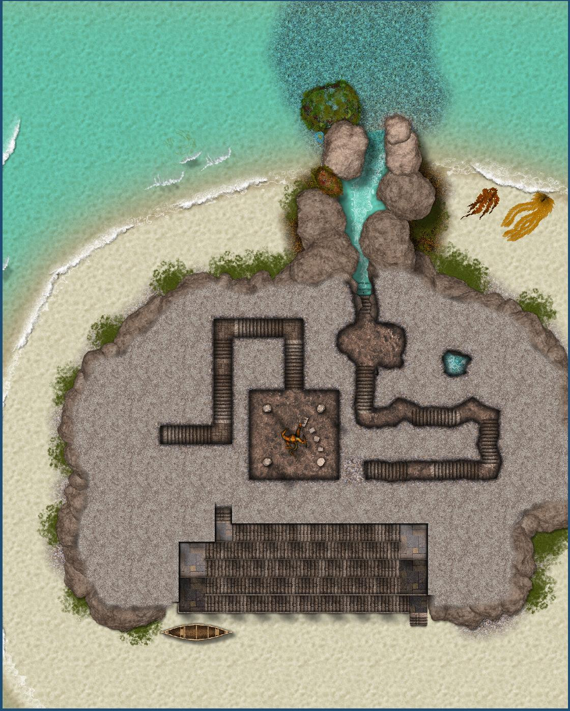
[WIP] Marine Dungeons Lighthouse - Inside
Tweaked the second basement level. The edge fade effects that I had added to the mountain for the interior rooms (similar the effects Sue created for Creepy Crypts) had a weird effect on the cliffside steps, so I added a "Mountain Mask" layer below it to have a sharper edge to the cliff steps area.


-
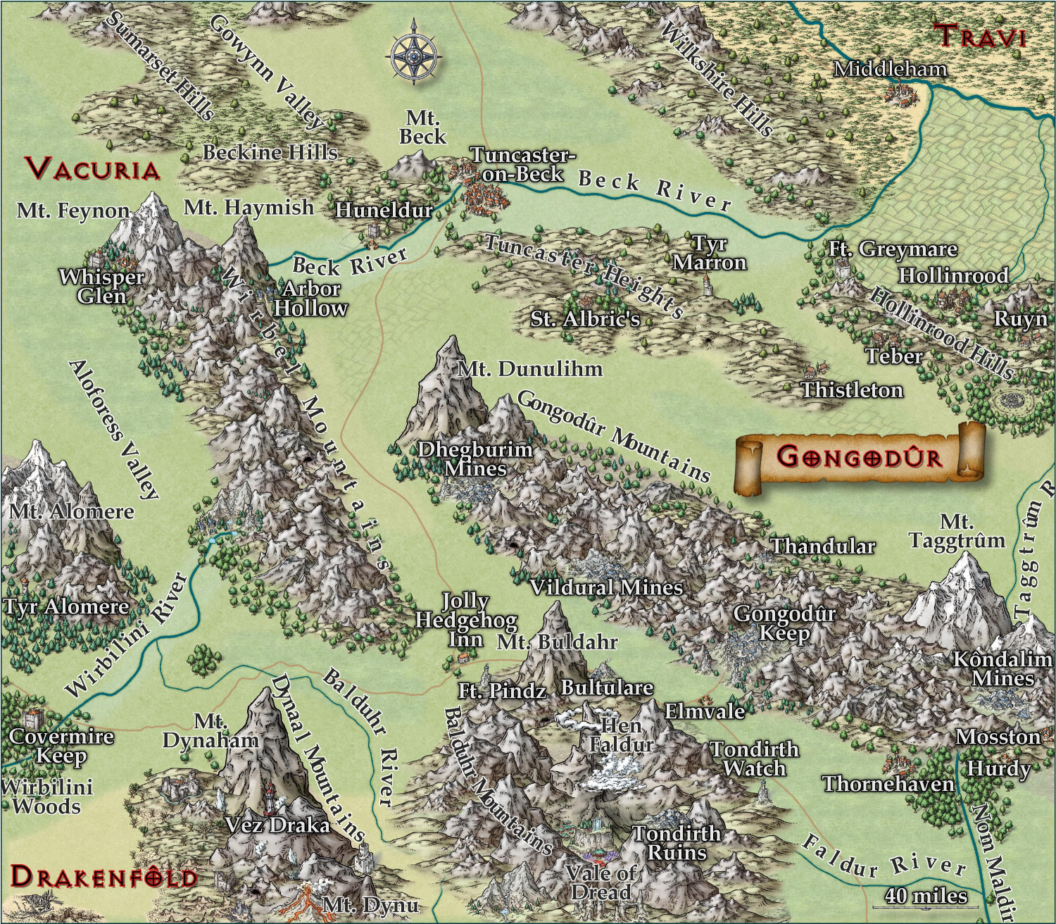
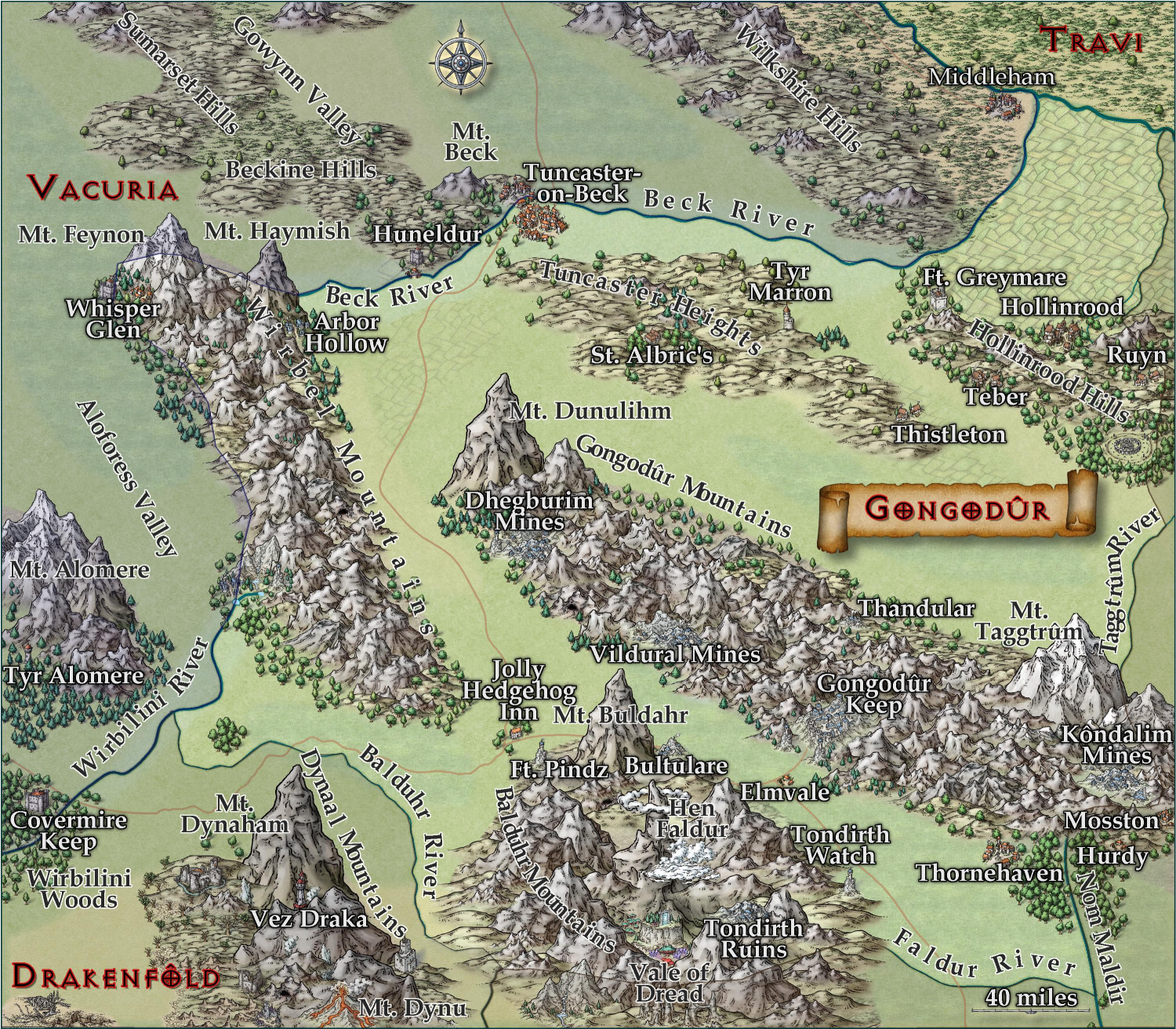
[WIP] Kingdom of Gongodûr
Okay, the first thing I did was back another backup of the FCW in case I didn't like the fractalization and couldn't undo it. ;-)
The fractal command isn't something I've used that much, and when I tried it on this map earlier, I wasn't sure of which settings to play with. While I think the smoother map works for a map of this scale, I rather like the Depth 2, Strength 40, smooth result on the rivers. Fractalized a few of the roads but not all -- there were some where it just made the road look overly-caffeinated.
With the place names: I added names for the settlements and rivers that were missing them (let me know if I missed anything important). I've played with the Glow settings a bit. I'll post the FCW, too, if anything has adjustments to recommend.
Here it is without the borders:
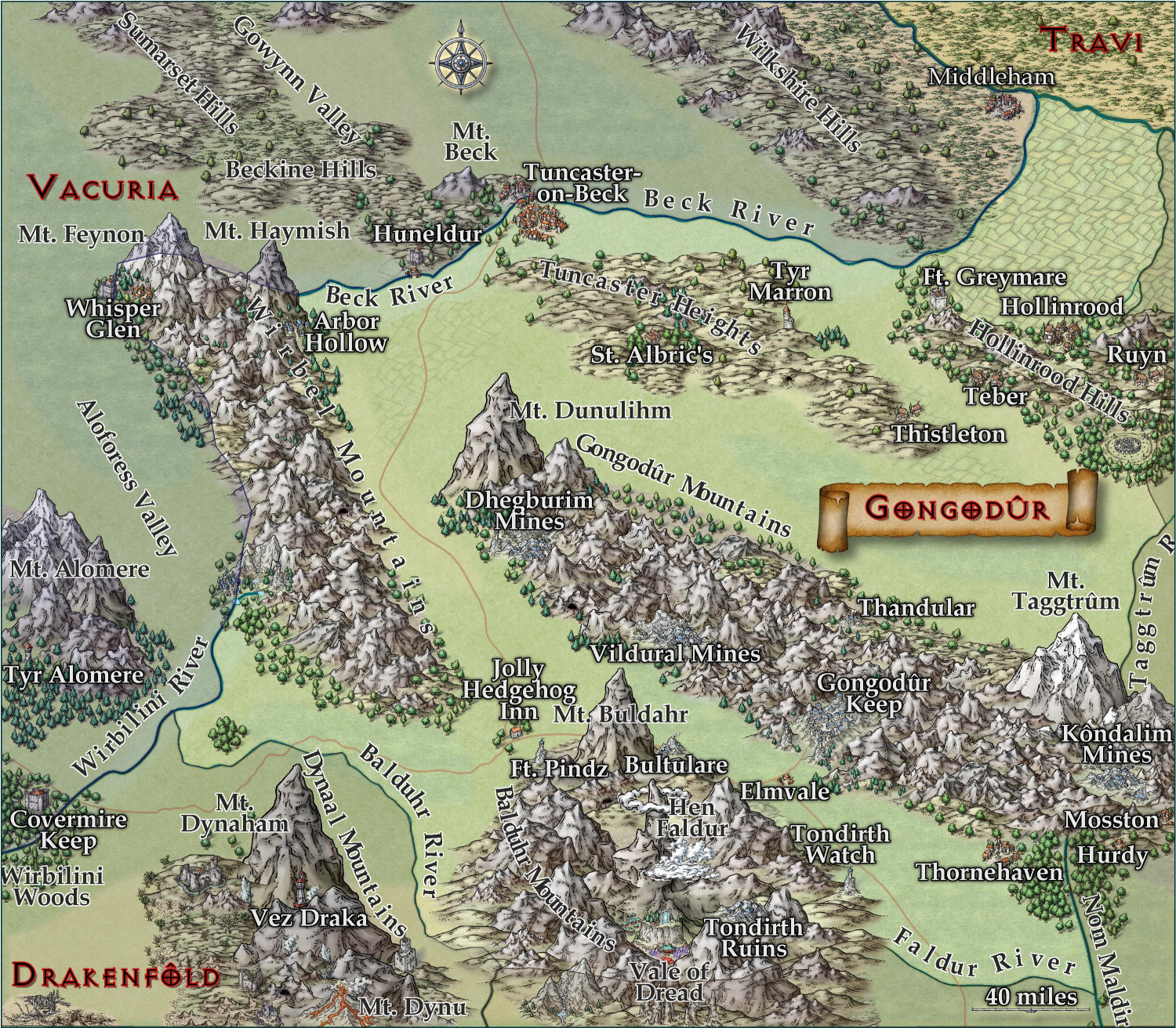
And again with the redrawn borders:


-
[WIP] Kingdom of Gongodûr
Tweaked the text for the ones I saw that were too close to the border. I will have the borders set to be on, but the political borders and names of the other countries are all on the same layer, so they can toggle on and off at the same time.
-
[WIP] Zhao Guang Si monastery
Trainees who survive the Trial of Fire and Ice are teleported to the Trial of the Elements. This is actually five separate, disconnected caverns that can only be accessed through teleportation portals.

Trainees appear on a teleportation portal on a dais in the center of an octagonal room. There are four daises on four of the walls, each with a teleportation portal. Before each is a circle inscribed with runes and a sigil marking their element: a cloud with a lightning bolt on the east for the Trial of Air; a symbol of flame on the south for the Trial of Fire; a drop of water on the west for the Trial of Water; and a gem on the north for the Trial of Earth.
There are four statues on the remaining corners: a cat, a winged person, a snake, and a demon's skull. When the room is entered, the skull statue will speak and tell trainees that they may embark on a psychic contest of wills with each statue to receive a benefit that will help their trials. For each, the Game Master will roll a d20+5. The trainee rolls a d20 and adds their Wisdom bonus. If the trainee's is higher, they win the contest and receive a magical benefit that lasts 24 hours. If they fail, there is no harm but they do not receive the bonus and cannot try again.
Success against the cat statue grants the magical ability of Spider Climb for 24 hours, while the winged statue grants Feather Fall, the snake grants immunity to poisons and venom, and the skull grants immunity to electrical/lightning damage. These benefits only last 24 hours.
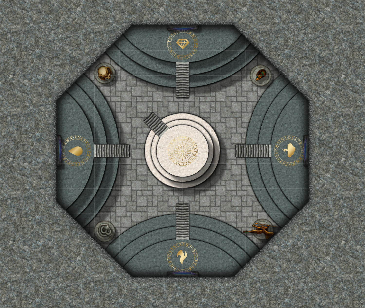
Trainees can tackle the trials in any order they choose, but cannot teleport out until they have survived all four.
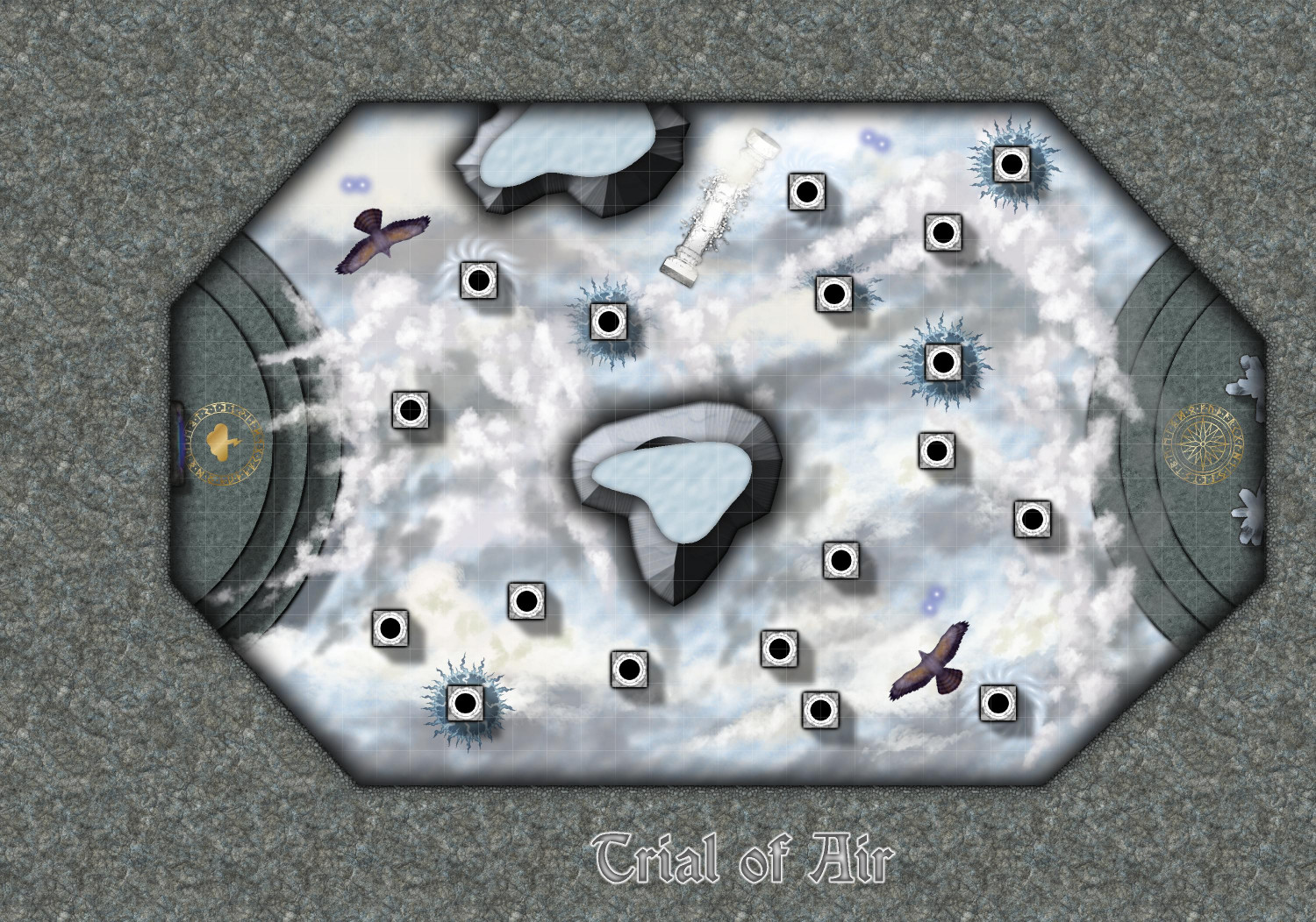
Trial of Air
Trainees must cross a cloudy room by leaping from pillar to pillar. If they slip, it's a 30 foot drop, and they will take damage unless they have Feather Fall. Some of the pillars delivery electrical damage unless they have immunity. And they may also be attacked by flying creatures (signified by hawks here, but Game Masters may choose to use harpies, elementals, or other flying creatures).
If they make it to the dais on the far wall, they can take a shard of crystal and be teleported back to the central room.
I'm not thrilled with how to tops of the outcrops look. Any recommendation on sheet effects settings is welcome.
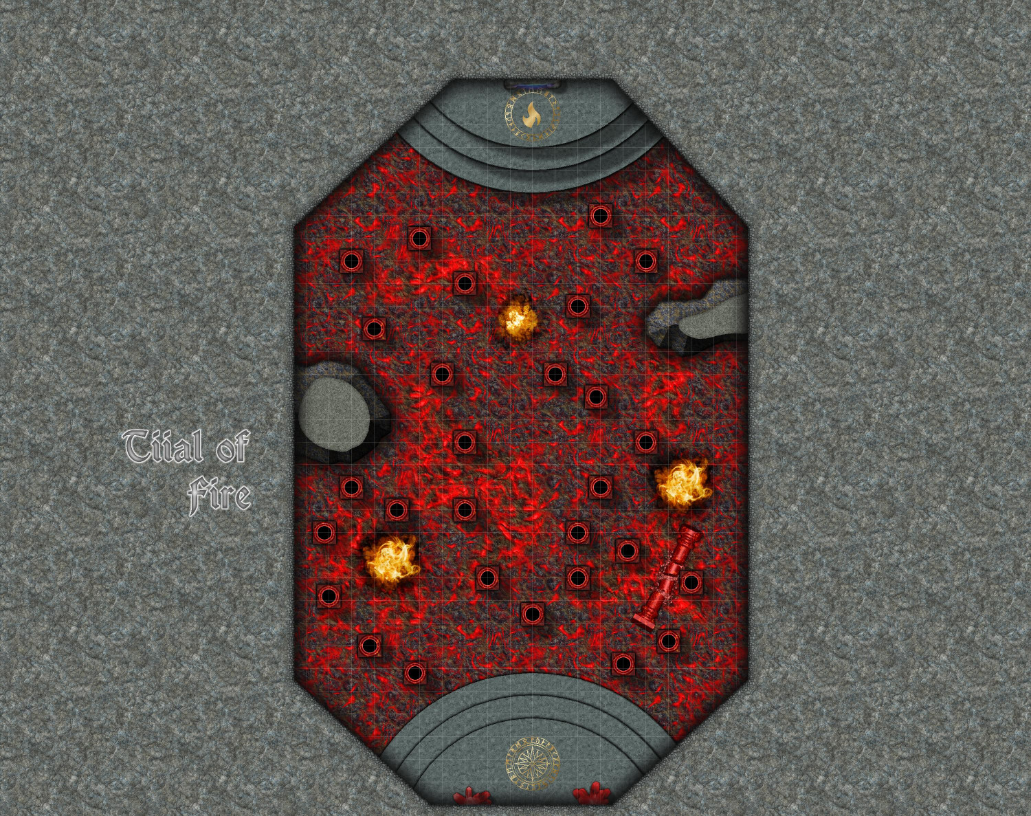
Trial of Fire
Here, trainees leap from pillar to pillar, trying to avoid falling into the lava. (If they acquired a red crystal from the Trial of Fire and Ice, that will come in handy here.) There are also Fire Elementals (I used bonfire symbols from Darklands City -- love Mike Schley's newest symbol but the style didn't really work here.)
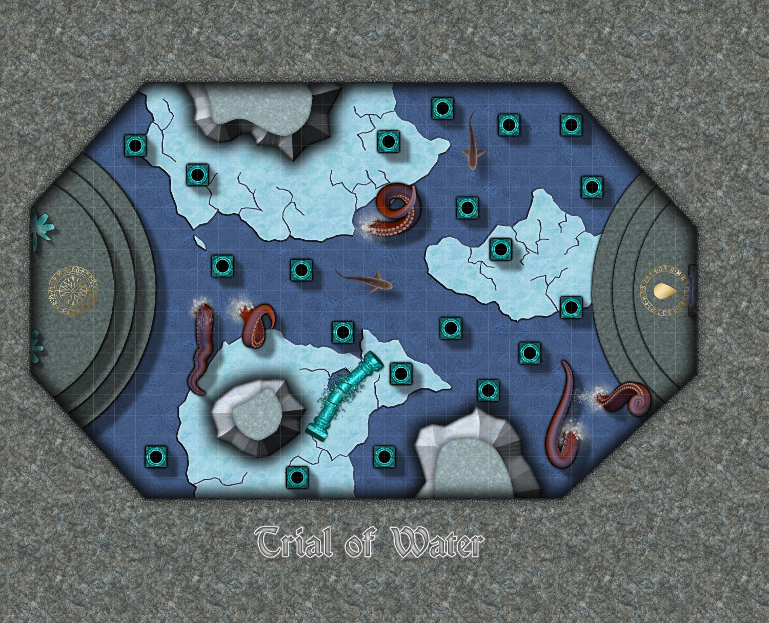
Trial of Water
The water is swimmable if trainees fall in, but it's icy cold and they will take damage unless they have a blue shard from the Trial of Fire and Ice. There are also sharks in the water as well as tentacle creatures.
Trial of Earth
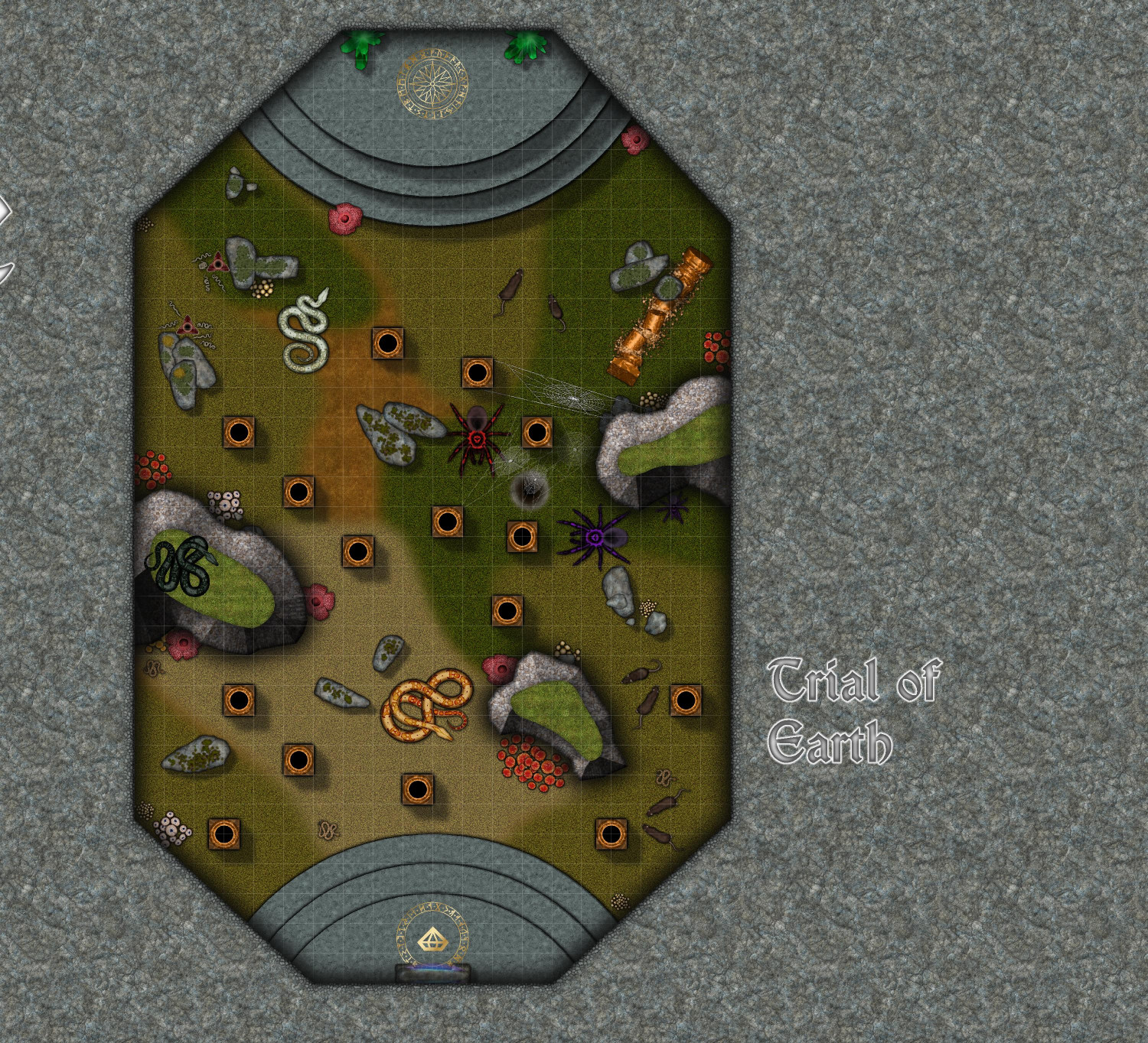
This room is filled with venomous snakes and giant spiders, and diseased giant rats, so immunity to poison would be helpful here. The mushrooms are also poisonous if anyone is foolish enough to eat them.
Trainees who collect a shard from each of the rooms can activate the teleportation portal in the main room, which will transport them to the Ritual Room in the temple's basement.
Any recommendations on sheet effects, especially for the tops of the outcrops, are welcome.
-
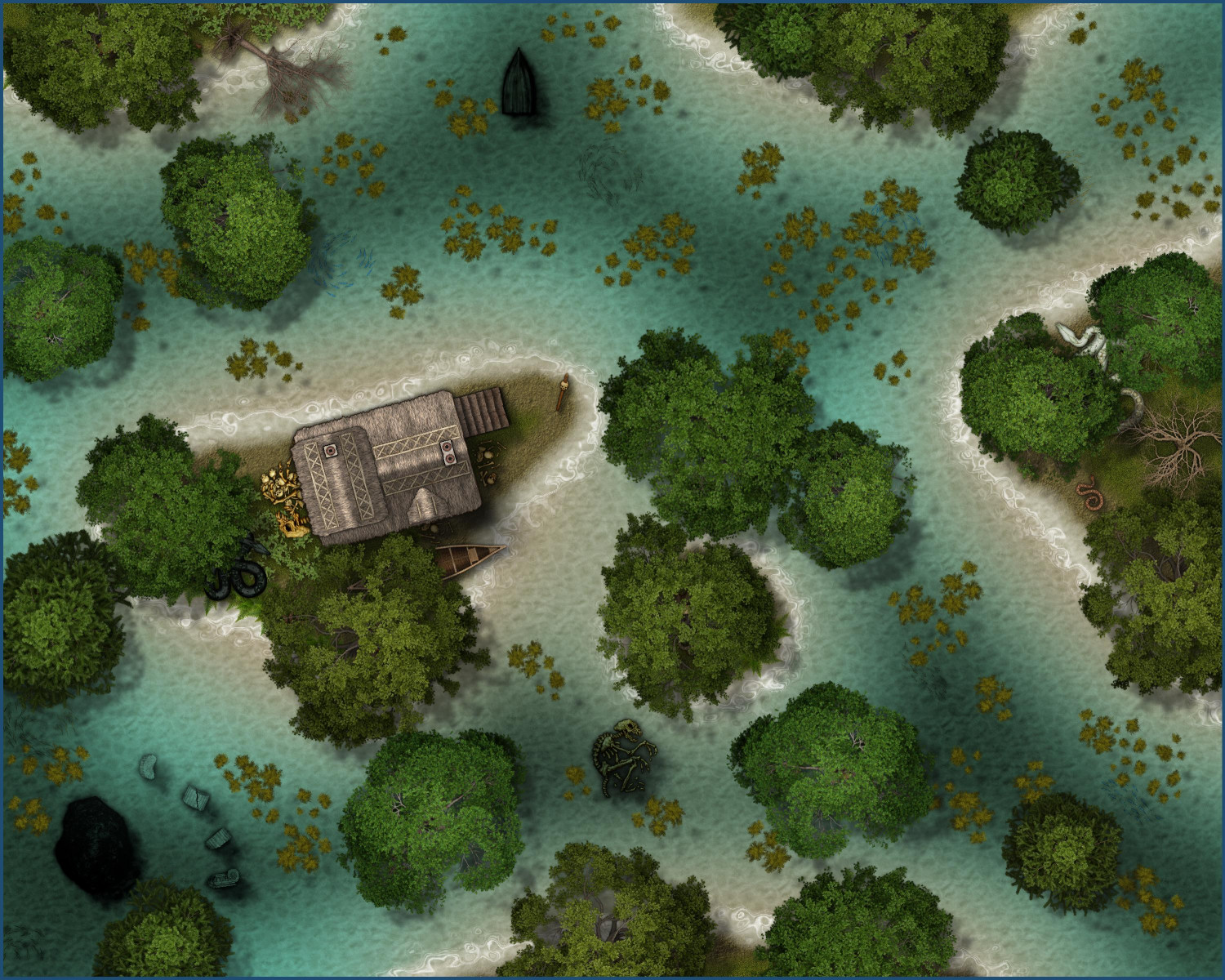
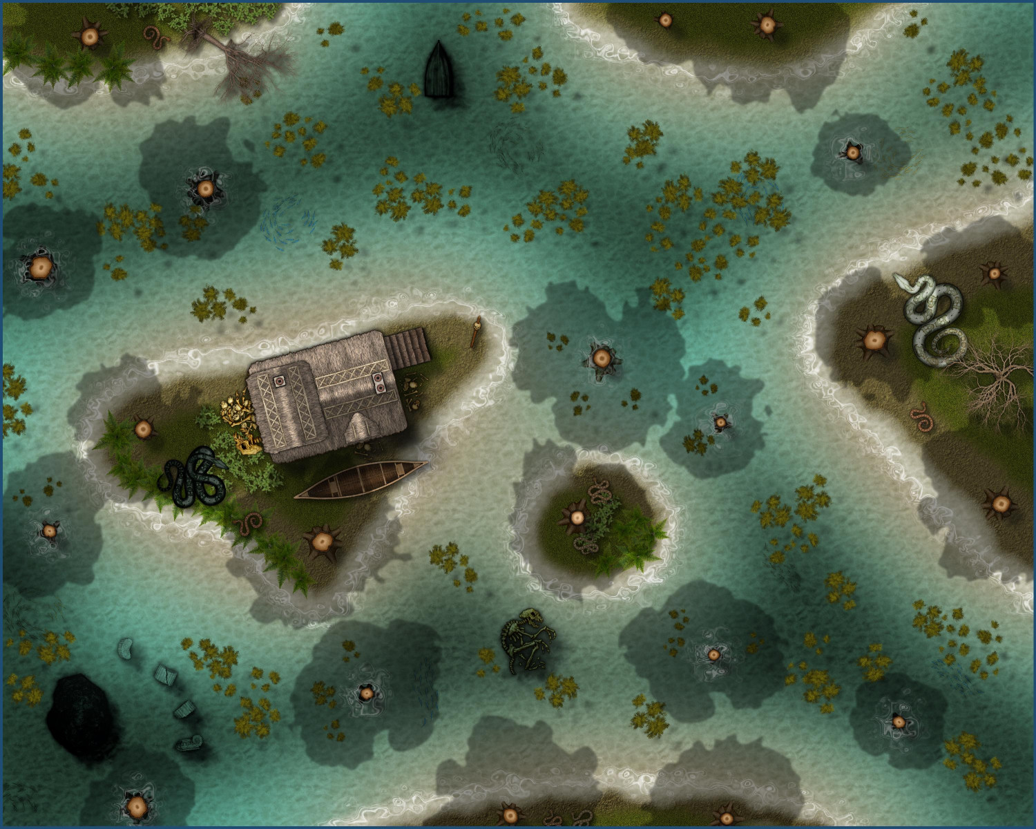
[WIP] Swamp Witch
Tweaked the Marine Dungeons version a bit: darkened the deeper water a little more, added a few dead trees, added more algae, and a few more bones.
-
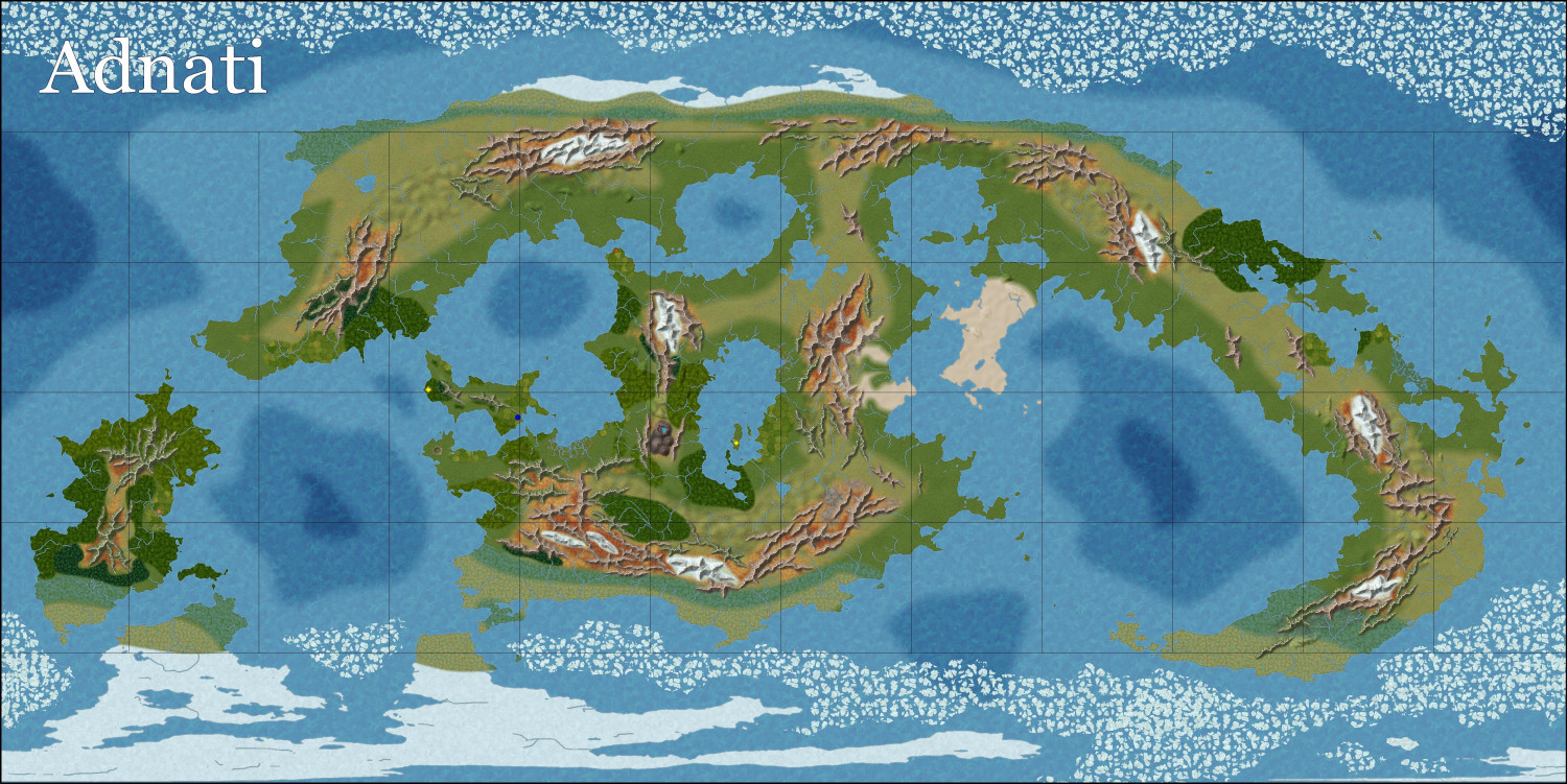
[WIP] Adnati - Birdseye Continental
Widened the edge fade on most of the terrains -- considerably wider on the grassy ones, less so on some of the others.
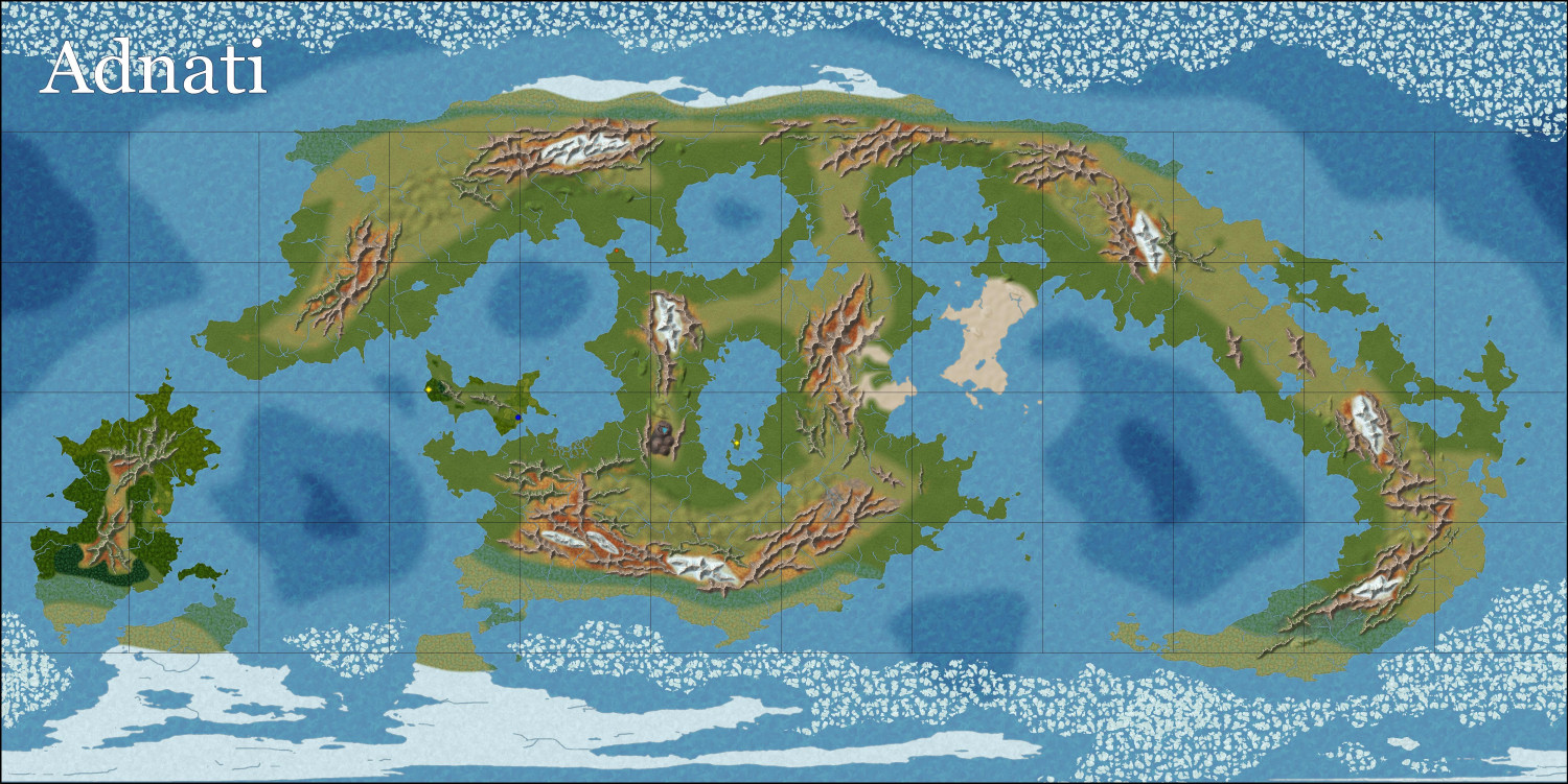
Starting to add more forests and farmland. Also need to add more natural features like volcanos and cliffs.

-
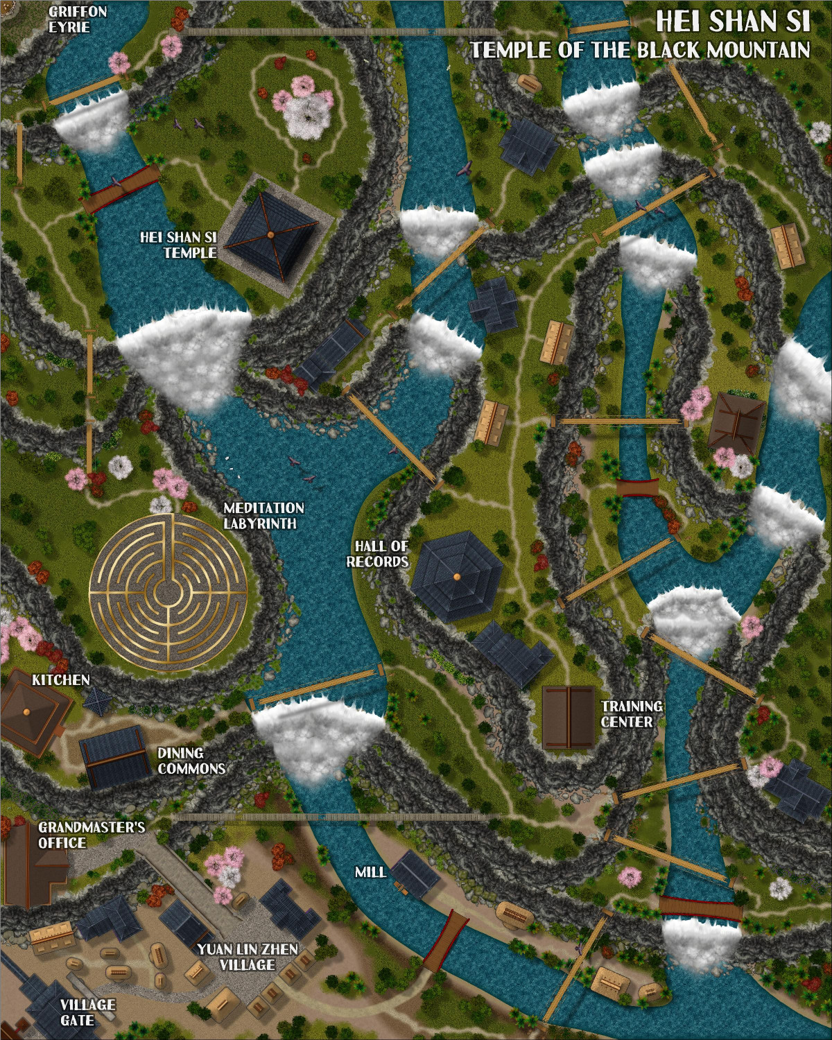
[WIP] Hei Shan Si monastery
This is the second of three monasteries that I am collaborating with Ricko on. The ideas and text description are Ricko's. The mapping is from me, with his advice, but he is currently traveling and hasn't had a chance to see a lot of the newest stuff. Since he won't be back for nearly a week, I figured I would solicit feedback here in the meantime.
(Also, I have not yet added the clouds that Ricko includes so beautifully in his maps. I will be experimenting with that next.)
There's a full description that will be included when it's submitted for the Atlas, but for now, here's a synopsis:
The Sacred Path of Hei Shan Si
In the heart of the Black Mountains and surrounded by the Ancient Forest, amidst peaks that touch the sky, stands the Hei Shan Si Monastery (Temple of the Black Mountain), a sanctuary of spiritual peace in contrast to the chaos of the surrounding region. Founded by an anonymous sage, the temple is said to have been built with the help of divine forces, its black walls harmonizing with the eternal shadows of the mountains.
The Challenging Path
The road to Hei Shan Si is a test in itself. It begins in the fertile valleys, and ends at the final stop in the village of Yuan Lin Zhen, passing through the living heart of the forest, steep cliffs and narrow trails that wind dangerously through the mountains. Incessant rain, dense fog and biting winds are constant companions of travelers. Worn rope bridges span unfathomable chasms, and legends tell of guardian spirits who punish those who disrespect them.
I didn't have a lot of birds to work with, but I did use the cartouche from Forest Trails and a few other birds from Dundjinni Archives. Like with the last monastery, Chuan Bei Si, the monks use a labyrinth path for meditation (similar to the Labyrinth at the Cathedral of Chartres). But while Chuan Bei Si's stone-and-tile labyrinth is poorly maintained, cracked and worn, the brass-and-tile labyrinth at Hei Shan Si is immaculately maintained.
Clouds are coming, but that will require some experimentation to get it right. They will be on a separate layer that can be toggled on and off.

-
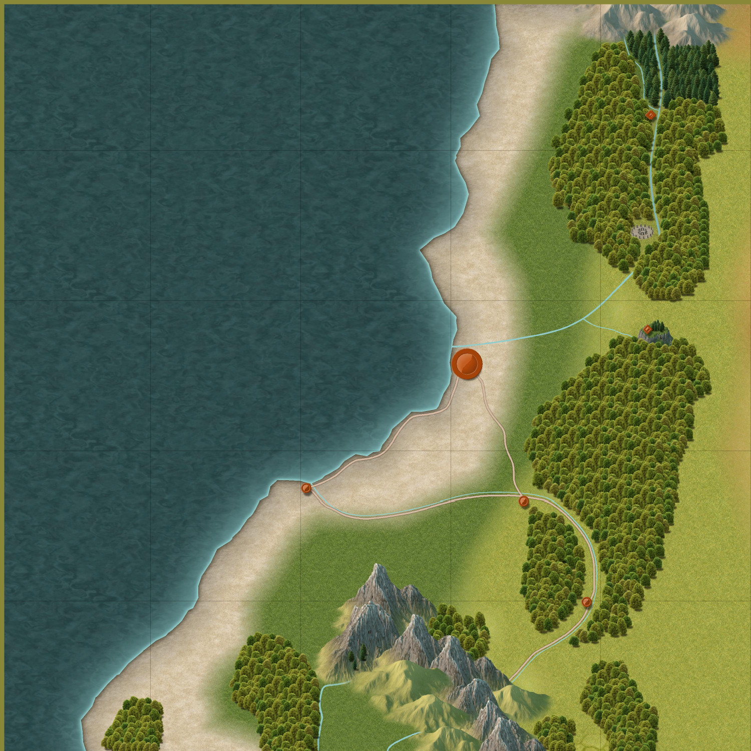
[WIP] Community Atlas - Rhaghiant (western Doriant)
Here's how it's progressed so far today. (Still not wed to the name.) Still need to do more in the middle area that I am mentally calling the Midwest, even if it's just adding some hills with tiny rivers coming out of them. Trying to figure out where to place my existing maps and the future ones I'm planning.
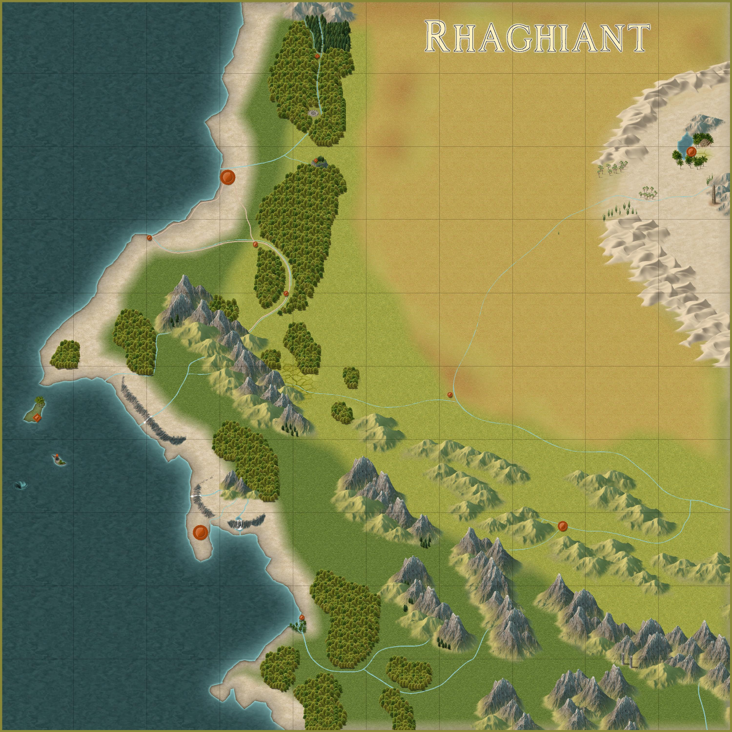
I redid the two northern forests to add rivers, a road, and a few smaller settlements...and a henge of stones. That northernmost forest will be an elven community that is outside of the kingdom. (This style doesn't have a political borders tool, does it? I may have to create one, or just rely on labeling.) There's a tepui at the northern edge of the second forest. I haven't decided what will go on top of it. Maybe a castle? Maybe a temple with an oracle, like the Oracle of Delphi?
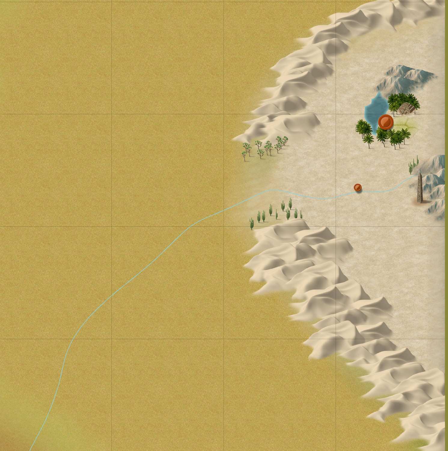
Here's a closer look at the desert. You can see where I plan to place my ziggurat. The obelisk to the south is apparently all that remains of an ancient temple that was long-ago swallowed up by the sands.
Added some cliffs near the coast. The whirlpool on the western side is about where my Octopus' Garden will go. The upper island, as I said before, will be a playground for the rich and famous, like a Monte Carlo.
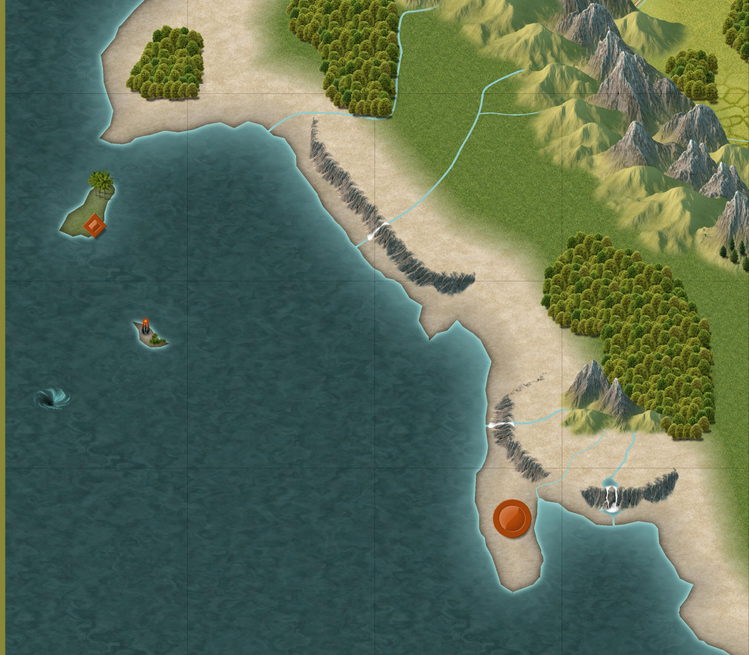
And I made a little swampy river delta with a settlement akin to New Orleans that I envision being rife with smugglers and ne'er-do-wells.
In the southern mountains, which is outside of the kingdom's borders, there's a dwarven fortress. You can't see it, but you can see the pair of towers (towards the southeast corner of the map) that guard the mountain pass leading up to the fortress.
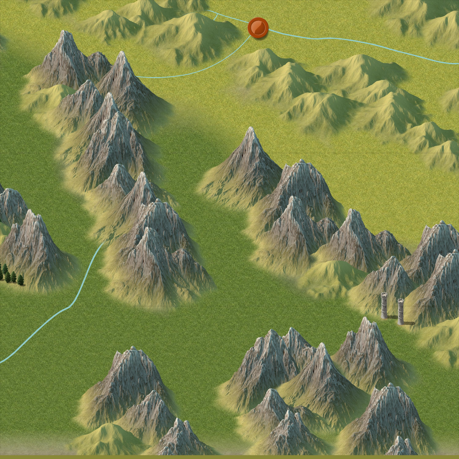
Let me know if you have thoughts, feedback, or ideas for more adventure hooks to add.

-
[WIP] Zhao Guang Si monastery
I wanted to share and get feedback on the third of three monasteries that @Ricko and I have been collaborating on. This is the only one where I have also mapped interior parts of the monastery.
For context, here is the description that Ricko wrote:
Situated in a hidden valley where the morning mist never quite dissipates, Zhao Guang Si (Temple of the Morning Glow) is a place where deceptive beauty hides a dark core. Despite its poetic name, the temple is synonymous with silent death and lethal precision. Here, under the first rays of dawn, apprentices learn the art of killing. The morning glow symbolizes the last moment many see before their silent and ordered death.
The Dark Environment
The temple, with its angular and austere architecture, is surrounded by twisted trees and a river of dark waters that flows silently like clotted blood. The black stone walls are decorated with murals depicting stories of betrayal, revenge and glory gained by force. The only constant sound is the echo of calculated footsteps in the cold corridors. Lanterns covered with red veils create a blood-red glow, making the environment even more somber and oppressive. Life and Training
Those who come to Zhao Guang Si are desperate, rejected, or ambitious, seeking a new identity. Under the watchful eye of their masters, known as the Shadows of Dawn, the apprentices undergo intense and cruel training.
• Physical Training: They climb cliffs without ropes, traverse fields filled with deadly traps, and duel to exhaustion, all to strengthen their bodies and reflexes.
• Mental Training: They are taught to hide emotions, manipulate the minds of their targets, and plan assassinations with surgical precision.
• Practice of Forbidden Magic: The temple houses ancient grimoires containing magics that grant temporary invisibility, silencing voices, and even cursing the senses. These spells demand sacrifices, often blood, making the price of power high.
The Bond with the Emperor
Although few would admit it, rumors persist that the temple has deep ties to the imperial throne. Men of the Emperor’s Personal Guard, known for their lethality and unquestioning loyalty, are said to have received secret training at Zhao Guang Si. Some claim that the emperor himself is the temple’s greatest patron, using its resources to eliminate rivals and consolidate power.
Legends and Intrigues
The temple is shrouded in dark tales:
• The Ritual of the Scarlet Mist: It is said that an assassin can sacrifice his soul to merge with the shadows, becoming invincible for a night. But few return from this ritual unharmed.
• The Echo of the Morning Glow: Legend has it that those who hear a whisper at dawn are marked for death by a blade that will emerge from the temple.
• The Faceless Master: A mysterious leader who never reveals his identity rules the temple. Some say he is an ancient spirit who has ruled the place for centuries.
A Haven of Questionable Morality
Zhao Guang Si is not just a temple; it is a training ground, a storehouse of forbidden knowledge, and a center for the trade of death. Those who enter rarely leave, but for those who survive the rigorous training, life outside the shadows becomes irrelevant.
In the dim light of dawn, under the treacherous glow of morning, Zhao Guang Si molds assassins, manipulates destinies, and remains a dark pillar in the region's balance of power.
And here is the exterior:
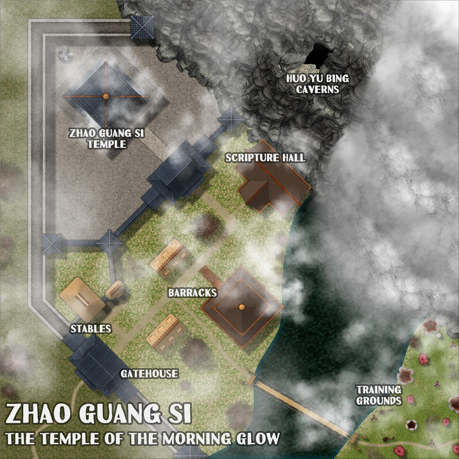
I will post the interior maps as follow-up comments in this thread.


