Royal Scribe
Royal Scribe
About
- Username
- Royal Scribe
- Joined
- Visits
- 9,530
- Last Active
- Roles
- Member
- Points
- 3,353
- Birthday
- February 5, 1968
- Location
- San Francisco, California
- Website
- https://legacy.drivethrurpg.com/browse/pub/31814/Royal-Scribe-Imaginarium
- Real Name
- Kevin
- Rank
- Mapmaker
- Badges
- 16
Latest Images


Reactions
-
Fractal Terrains to CC3+ - Three Approaches
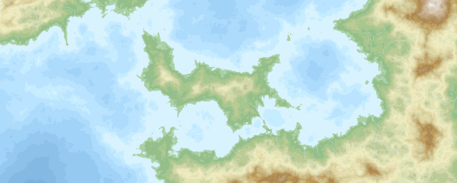
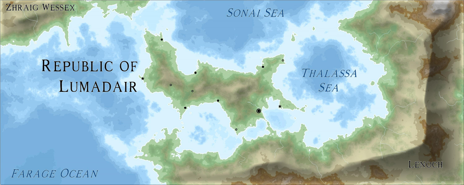
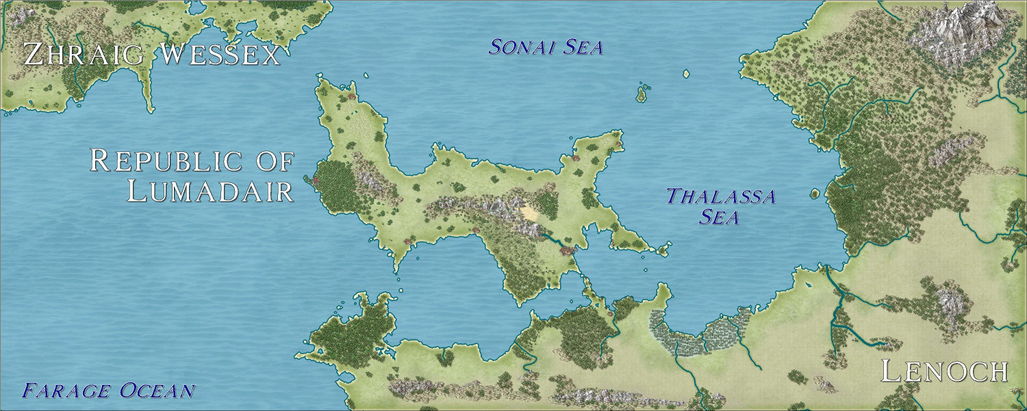
I have been experimenting with three different approaches of taking a portion of a world designed in Fractal Terrains and then expanded upon in CC3+. All three of these experiments export the same view in FT.
The portion of the world I practiced on is an equatorial island nation called the Republic of Lumadair. The coastline is 10,099 miles long, with a length of about 2,000 miles long, depending where you measure from. (For reference, Australia has a mainland coastline (excluding islands) of 22,258 miles.)
Here's what it looks like from Fractal Terrains:
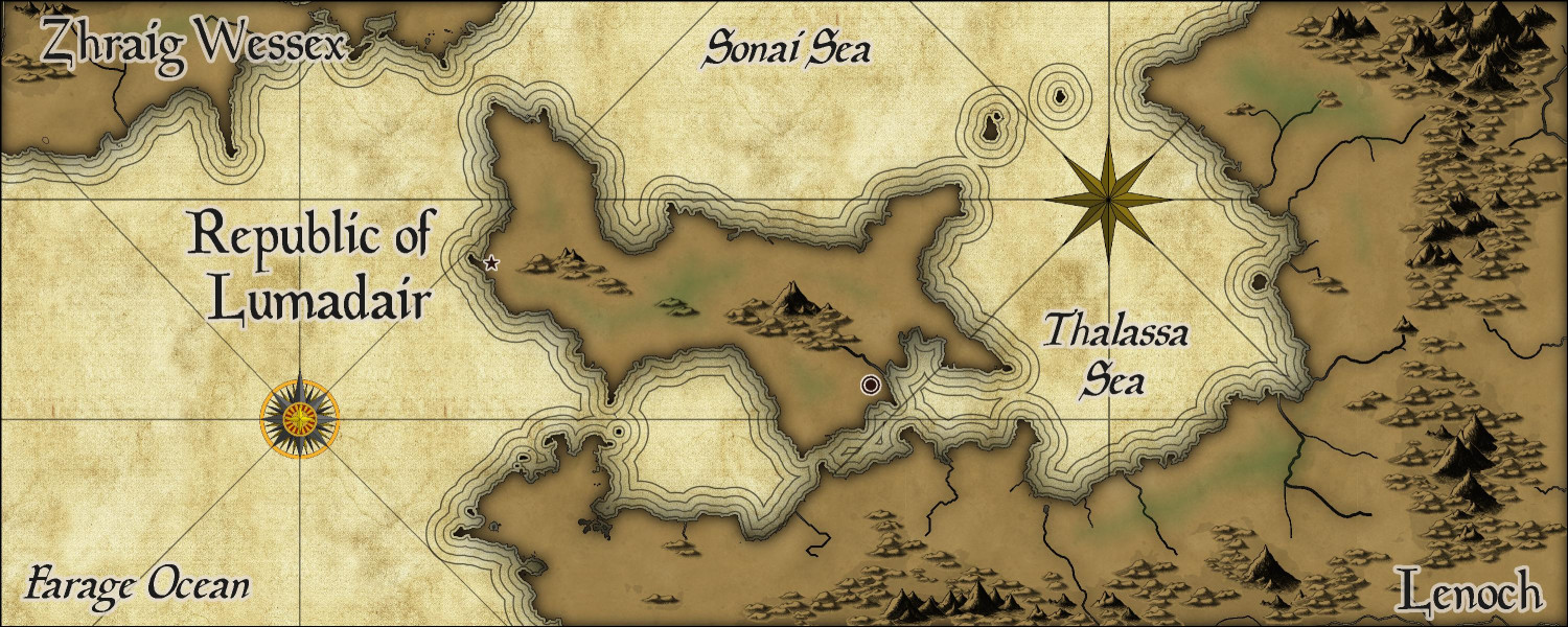
Approach 1: Parchment Maps
As previewed in a separate thread, this was my attempt to render it in the Parchment Maps style from the February annual using a technique that Ralf demonstrated in this video. It's scant on details -- the kind of map my players might find in old ruins somewhere giving them a clue where to continue their adventures.
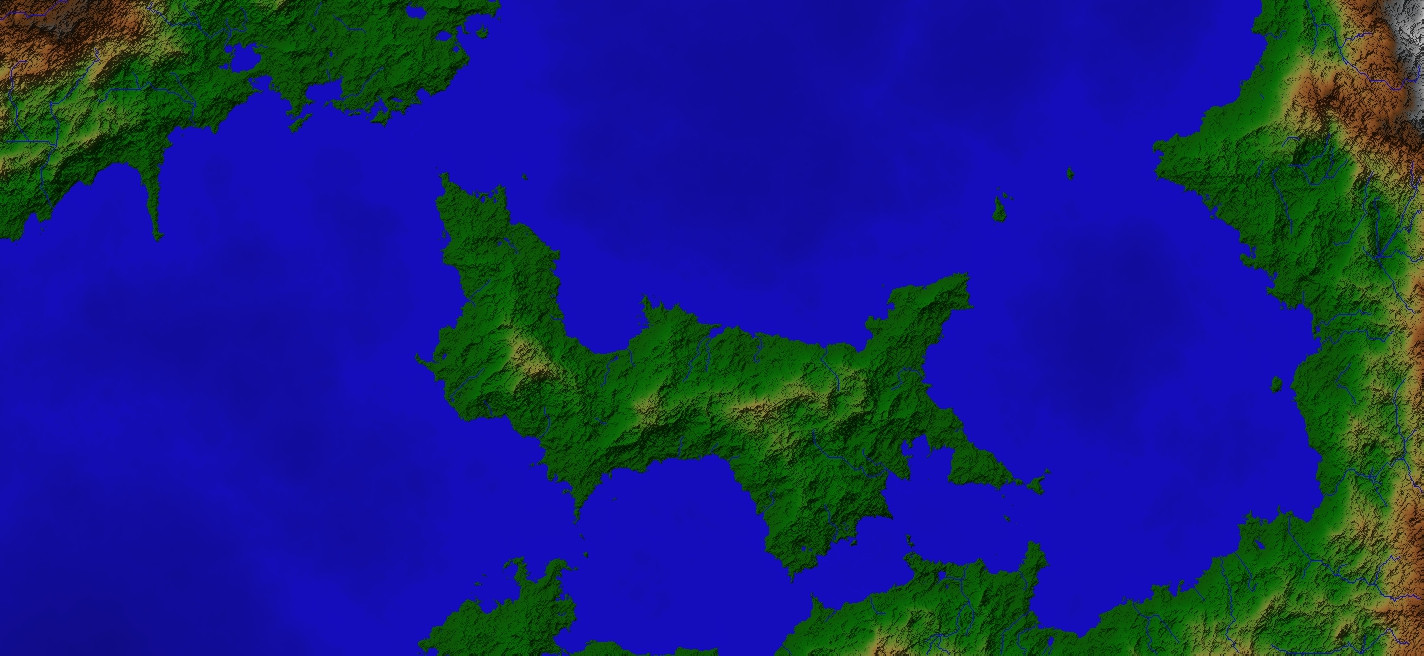
Approach 2: Jerion Shading
This approach, also previewed in another thread, using the technique in this demo from Ralf to take the Jerion style and add beveling effects to some of the contours to create shading effects. I added cities and major towns (and a few magical places) but only named the major bodies of water and the two close continents.
Approach 3: Mike Schley Style
This approach exports the same land mass into the Schley style (which I only recently discovered was an option in FT), then added some contours brought in from the Jerion style. This is the slowest-to-render map I've ever done due to some techniques (and lessons learned) that I will describe later in this thread.
I just love the versality here -- I can have identical coastlines for all three maps, but they all have different looks and vibes.


-
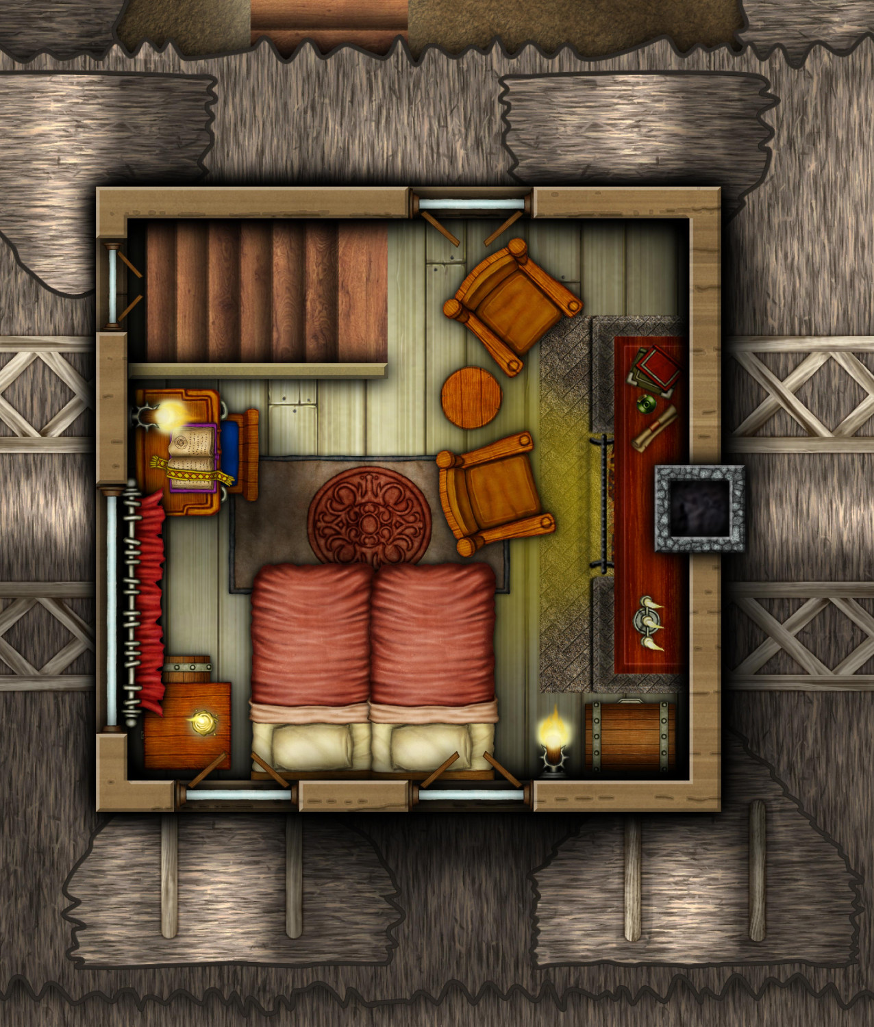
[WIP] The Candle & Kettle Inn in the village of Mapleford
Here's the attic, crowded but cozy. Could be a VIP guest room, or maybe the innkeepers live up here so that the entire second floor is available to guests. But I like to think of it as the home of the innkeeper's eccentric uncle or spinster aunt whom the entire village thinks is a bit mad...until the adventurers seek them out for advice, revealing that the relative is one of the world's foremost authorities about the Abyssal Planes.
Cellar still to come...


-
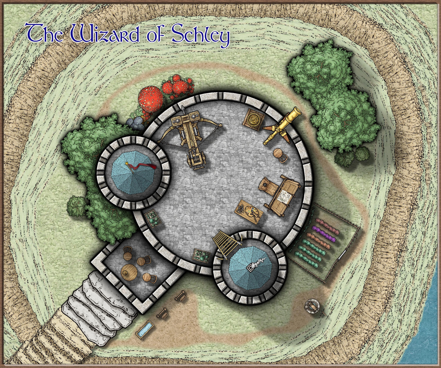
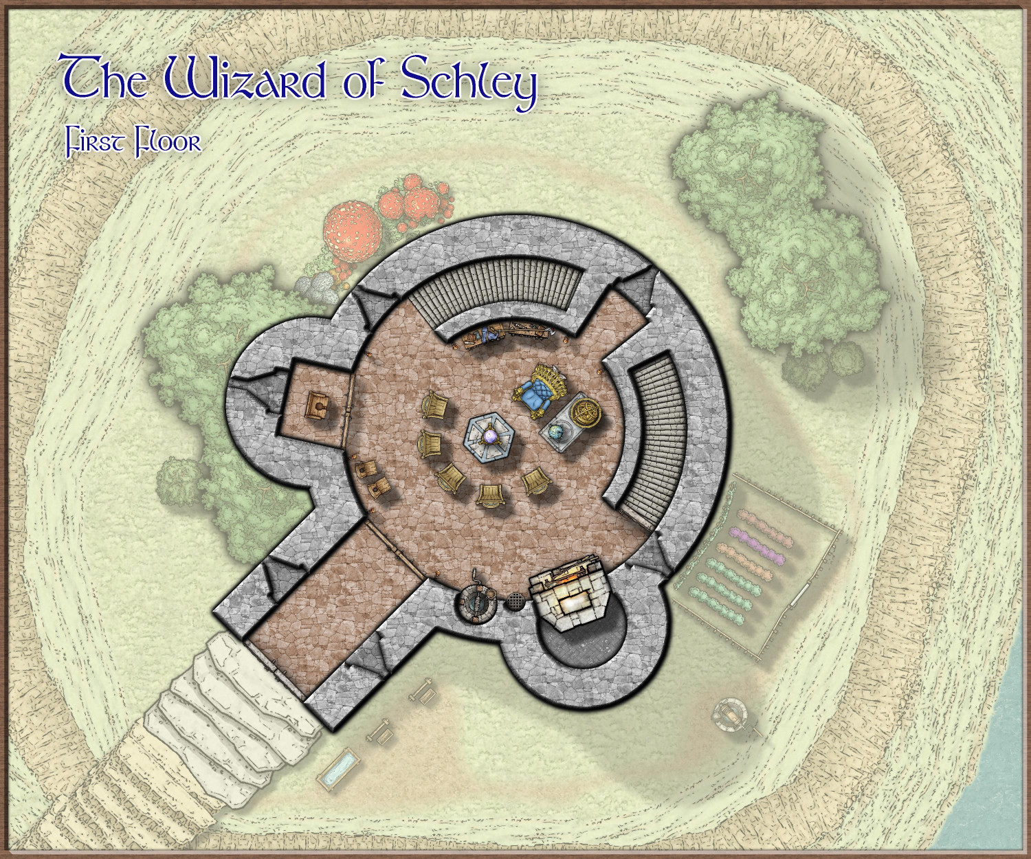
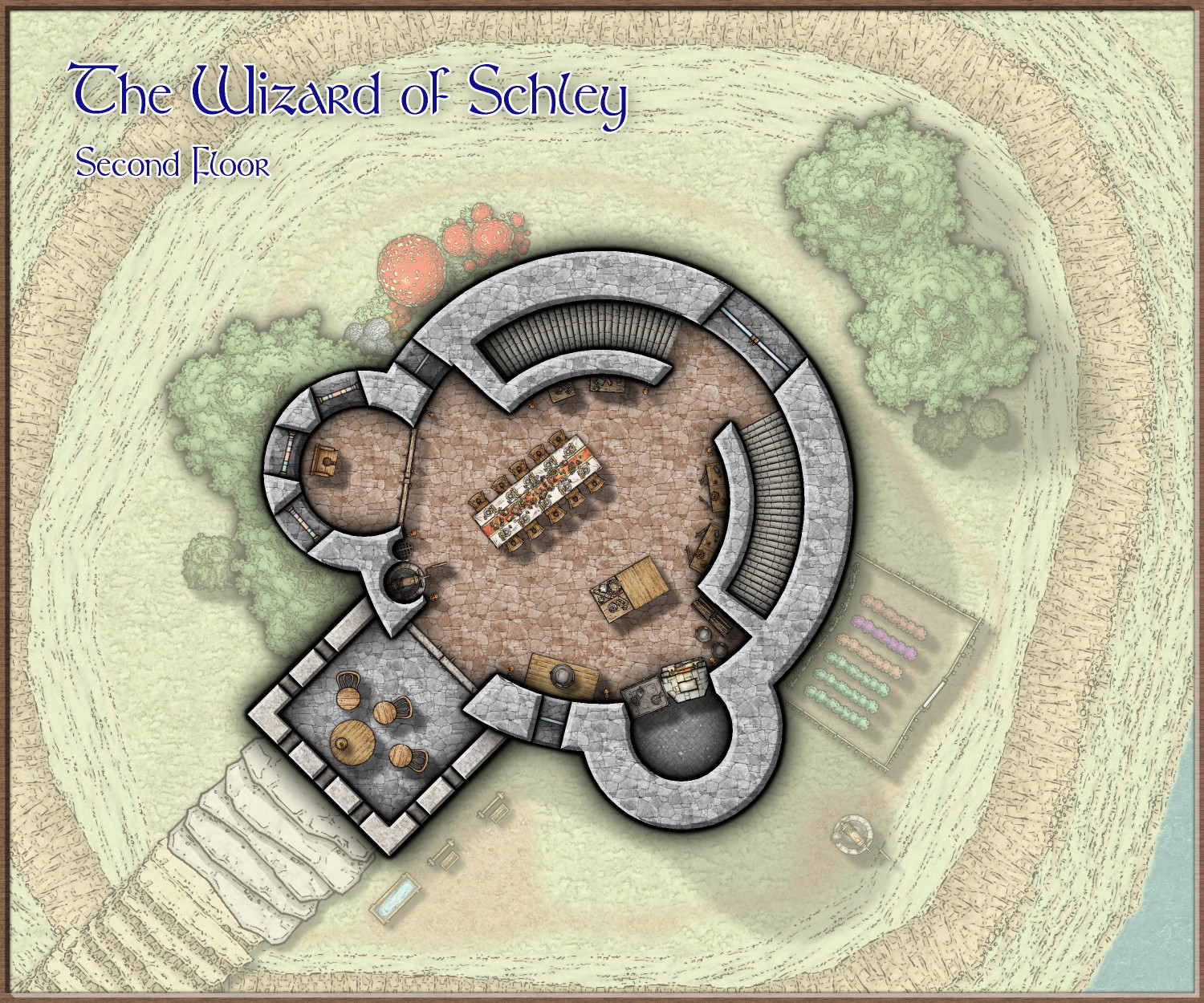
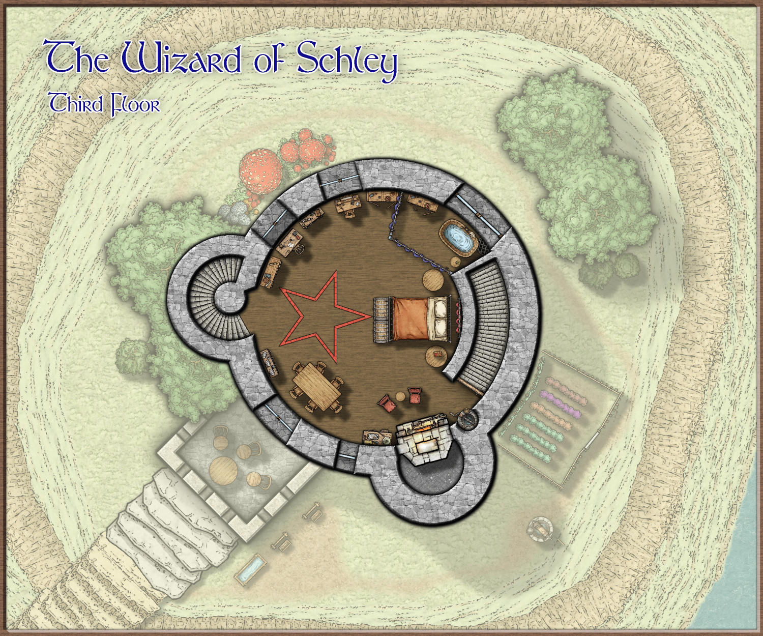
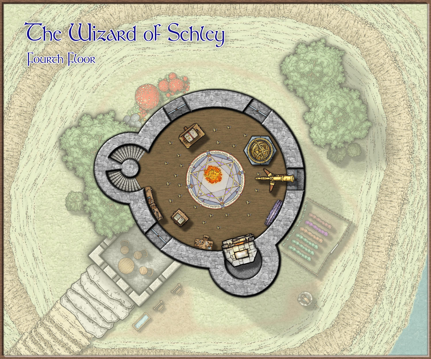
[WIP] The Wizard of Schley
Added the path to the well and the hitching posts (not stocks), and made some other adjustments. Working on the basement (but I have a recent urge to design a small research vessel in Cosmographer, which I've never really played with so I might get hijacked).
It's fun having a chance to use Mike Schley's latest symbols.

-
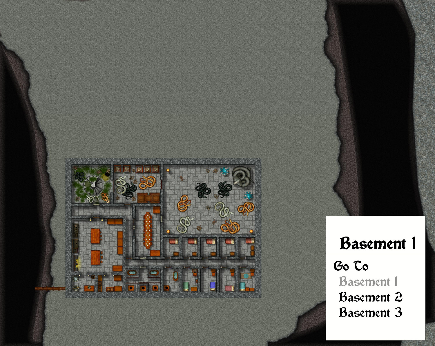
[WIP] Beneath the ruined temple
A few months ago, I posted a ruined temple that I designed in the Forest Trails annual. The folks who live in a nearby village often come during the day to picnic on the river banks to the south, southeast, and east of the ruins, but never on the ruins itself. There are rumors that the site is haunted (and plenty have claimed to have seen ghosts there at night). Plus, the place is overrun with snakes, some dangerously venomous.
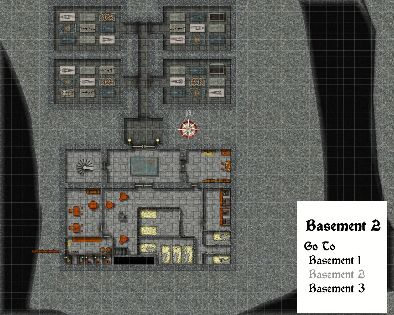
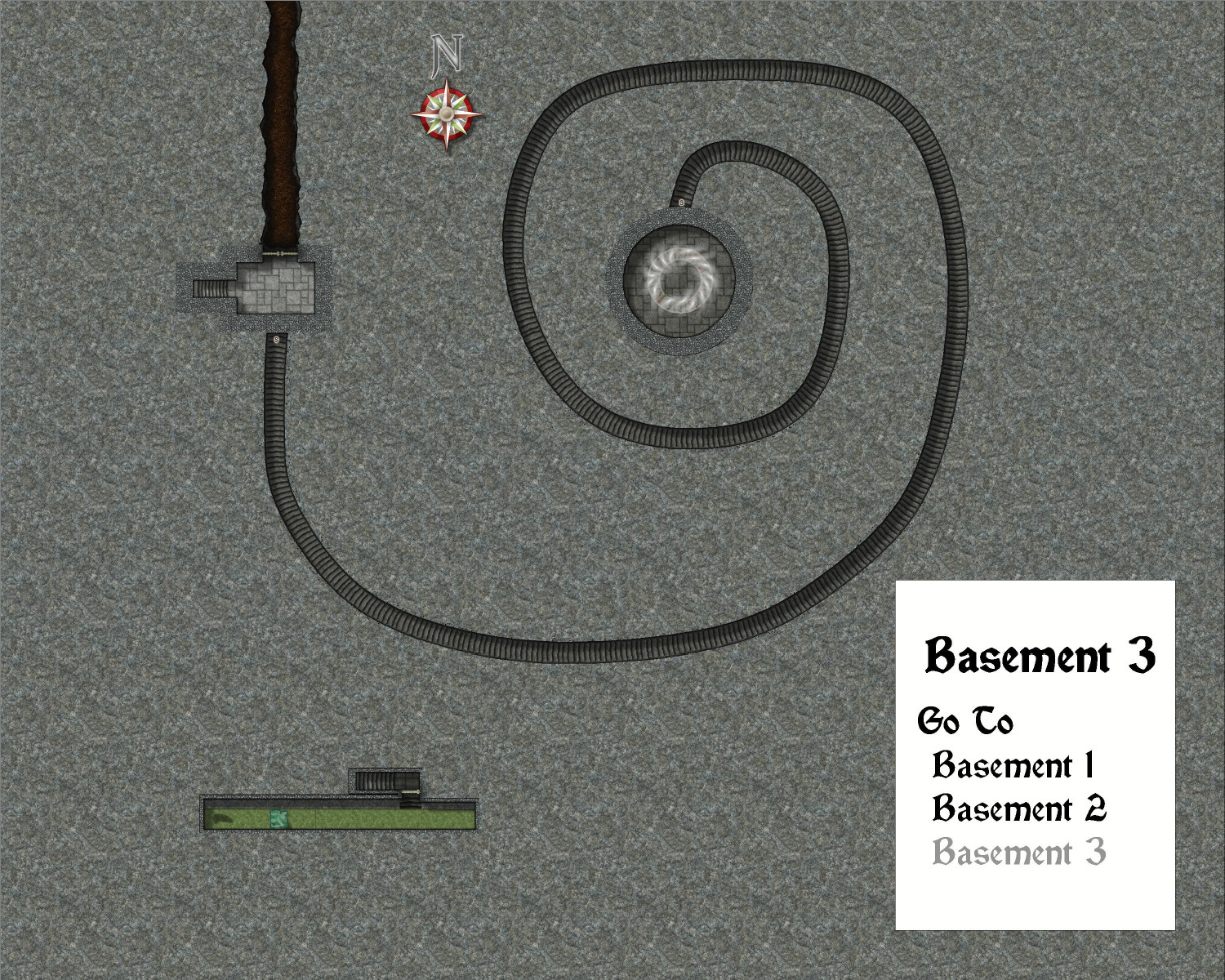
I have finally designed the levels below the temple's ruins. This is mostly designed with Creepy Crypts, with heavy assist from DD3 and a few elements from Dungeons of Schley. I will post more images of this in my galleries.
The basement areas of this ruined temple have been taken over by an unsavory religious cult known for developing poisons as part of their worship of a serpentine god, and using them in their kidnappings and assassinations for hire. (The "ghosts" the townsfolk swear they've seen is actually smoke coming up through the ruined steps.)
The cultists mostly live in the first level of the temple's subterranean levels. They don't actually use the mossy steps (they enter and exit through lower levels). The original priests' chapel has been replaced by an alter to their serpentine god, and several sections of this level are dedicated to raising the venomous creatures.
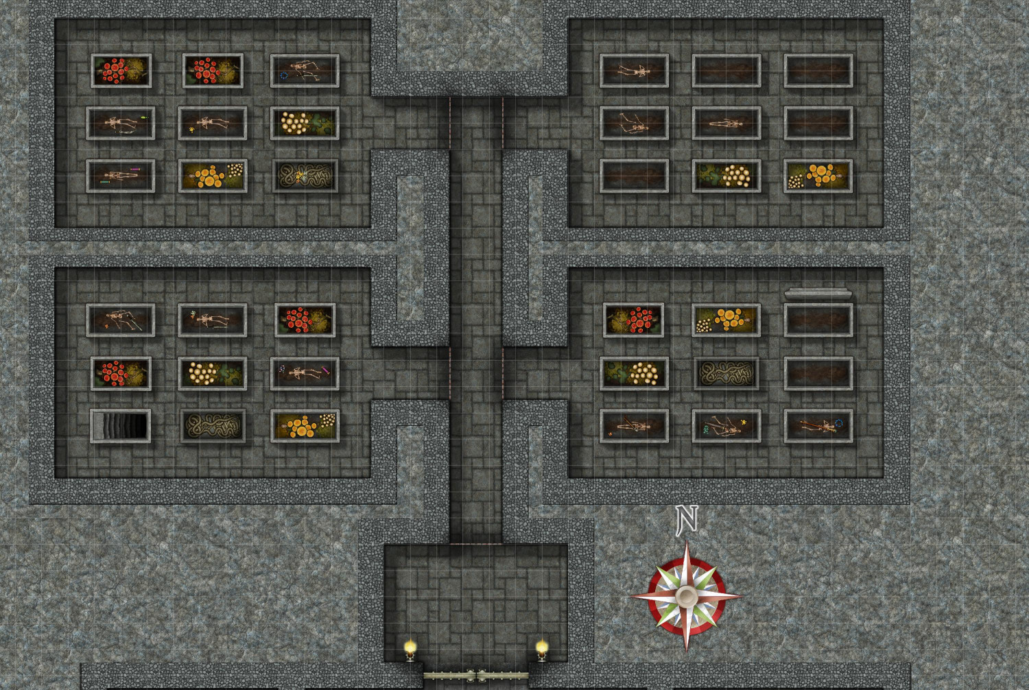
The stairs in the northwest corner room also descend to the second level of the basement, but that's where they end. Here there are prison cells used to hold the cultists' kidnapped victims. One room is dedicated to raising the rats used to feed the pet snakes. A room that was once used to prepare the deceased for entombment has now been converted into a laboratory for the production of poison. There are also catacombs with crypts of the original temple's religious leaders. It's unclear whether the new cult also buries anyone in the crypts [maybe I will put a pile of bones in one of the sarcophagi that have been picked clean by the gelatinous cube in level three], but they do use one of the tombs for its secret use: the secret stairs in the southeastern-most tomb that descend to the third level. (Oh, the sewer pipes from Sinister Sewers are used to bring in fresh water from the river.)
The third and final level is mostly the real entrance/exit used by the cultists (though one "waste management" area brings in a gelatinous cube to keep things hygienic). Here, the stairs from the crypts above lead to a room with a tunnel to the north where the true entrance is located far away from prying eyes. But a secret door also leads to a winding stair: 506 stairs that descend another 380 feet to a secret room where a teleportation portal is located.


-
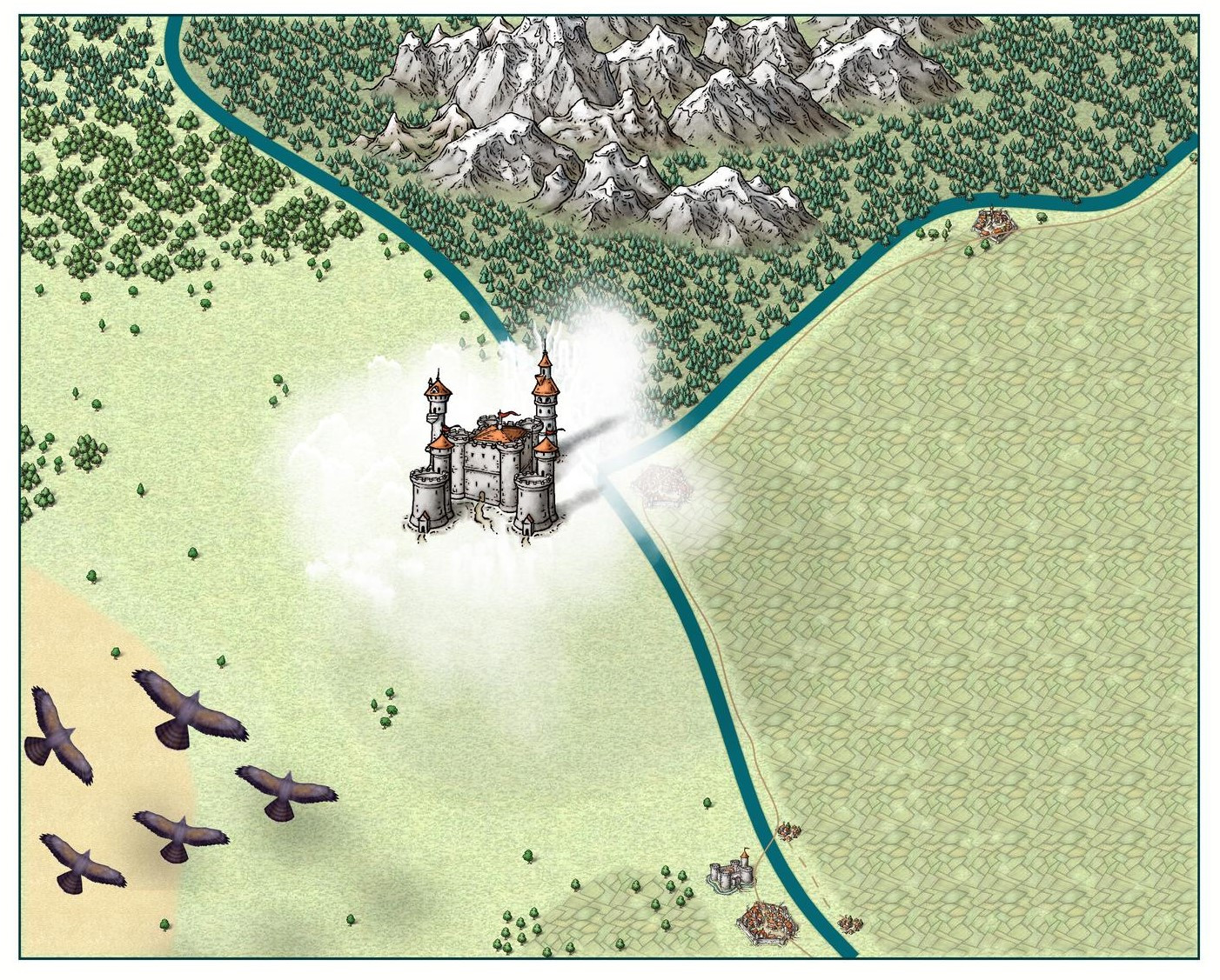
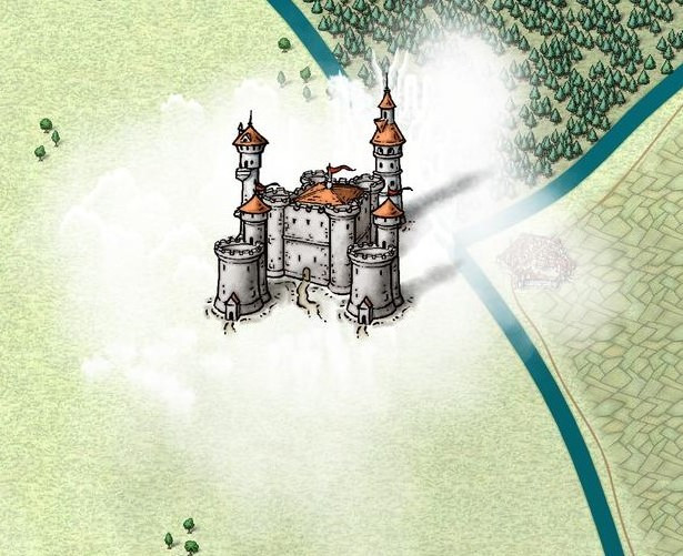
Castle in a Cloud
I'm still practicing and experimenting with different maps of all sorts. Just for fun, I thought I would take a stab at designing a castle on a cloud. (Maybe it's a cloud giant's castle? Undecided.)
I started with an overland map set at 250 x 200, I believe. (Maybe I will do a city map of it later for a closer look, or perhaps a dungeon map.) I decided to use Mike Schley's Overland style. To create the clouds, I used various foams, rapids, and waterfall mist from Sue's Forest Trail set. It's hard to see until you move in, but there's a little bit of texture to the cloud added by the foaming rapids. I put them on a new sheet that I called "Clouds," placing it below the Roads sheet, which was the lowest of all of the surface-level sheets. I tried to put a drop shadow on the Clouds sheet but couldn't get it to work (entirely possible that some or all of my cloud ended up on the wrong sheet). Instead, I drew inspiration from the manual cliffs shadows that Sue had in Forest Trails. I used the Sea Contours to draw a shadow, and then moved the "Contours (Sea)" sheet to render before the cloud.
The castle, with its extra towers, was added to a "Symbols on Cloud" sheet that I created. I also had a Flying Lowest and Flying Low sheet above the Cloud sheet, and Flying and Flying Highest sheets below it. I thought the four different flying sheets would allow me to show things at different altitudes with different drop shadows, but I ended up only using one of them for the birds (maybe Giant Eagles or Giant Hawks?), which from the cartouches from Forest Trails.
Anyway, there's my first pass at something I haven't see here before.


-
Ideas and Wishes for Monthly Dungeon Symbols
I am so glad you asked, because you know I've been keeping lists! You can check out some of my ideas in this thread, but here's a recap of some highlights:
Interior
- Thrones - Ornate metal and stone; "elven" (wooden with art nouveau flourishes); "evil" (skulls, spikes, etc.)
- Regalia - Crowns; scepters; orbs
- Couches - Both "regular" and Roman-style (I think SS4 only has chairs that I make extra wide for couches)
- Mage/Sage Furnishings - Globes, astrolabes
- Ornate Staircases - Maybe modular so you can construct your own (left, right, and center for bottom, middle, and top, in stone and wood, with and without varicolor carpeting)
- Musical Instruments - Upright and on their side (lutes, harps, harpsichords, drums)
- Ancient Tombs - Think Indiana Jones-style stuff, like idols
Exterior
- Gardens - Varicolor flowers, rose bushes, berry bushes, exotic/carnivorous plants
- Tiltyard - Quintain, pell, horse armor
- Topiary - Bushes trimmed to form the shape of animals and mythical creatures
- Statues - Riding and standing free. Royalty plus archetypical character types (sword fighters, archers, mages)
Building Construction
- Flagpoles - Upright and on their side, separate from flags for flexibility
- Flags - Varicolor top-down and on their side
- Gargoyles and Grotesques
- Clocktower - Clock hands on side of building; bells for belltower
- Spires
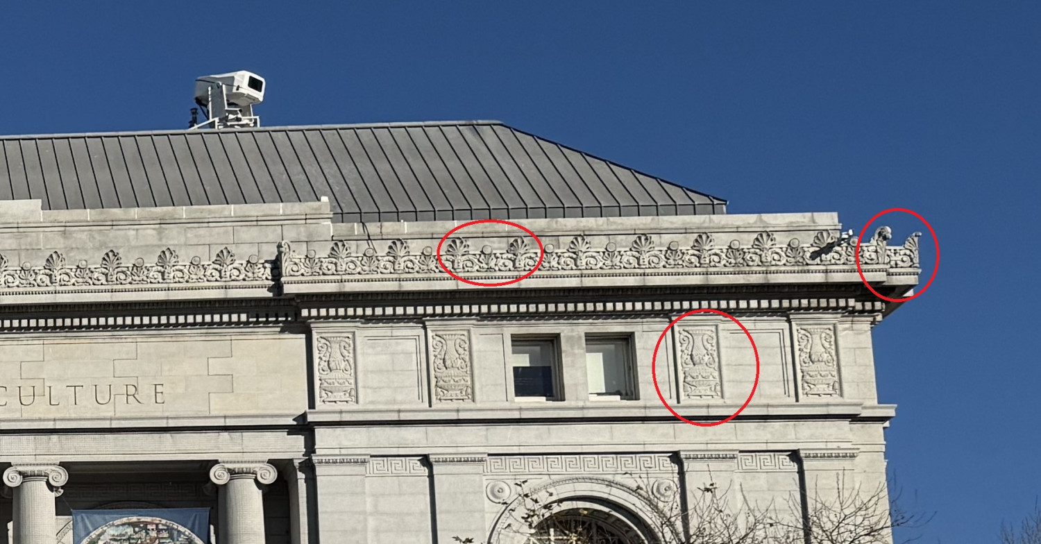
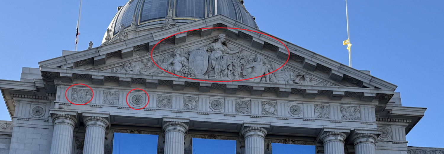
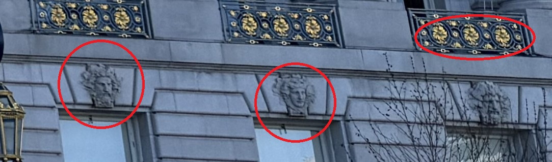
- Façade Ornamentation - I don't know the proper term, but here are some pics I took to illustrate


-
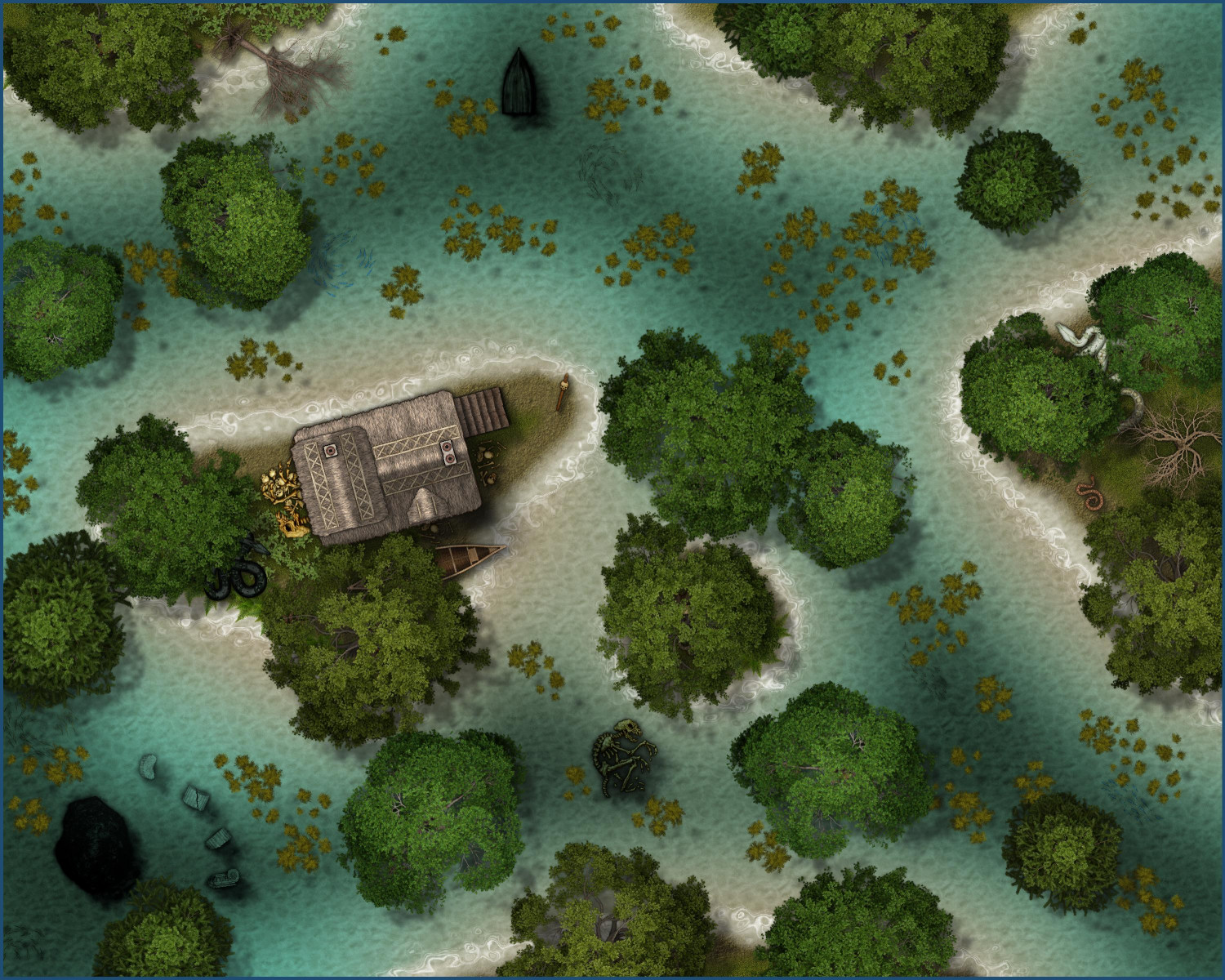
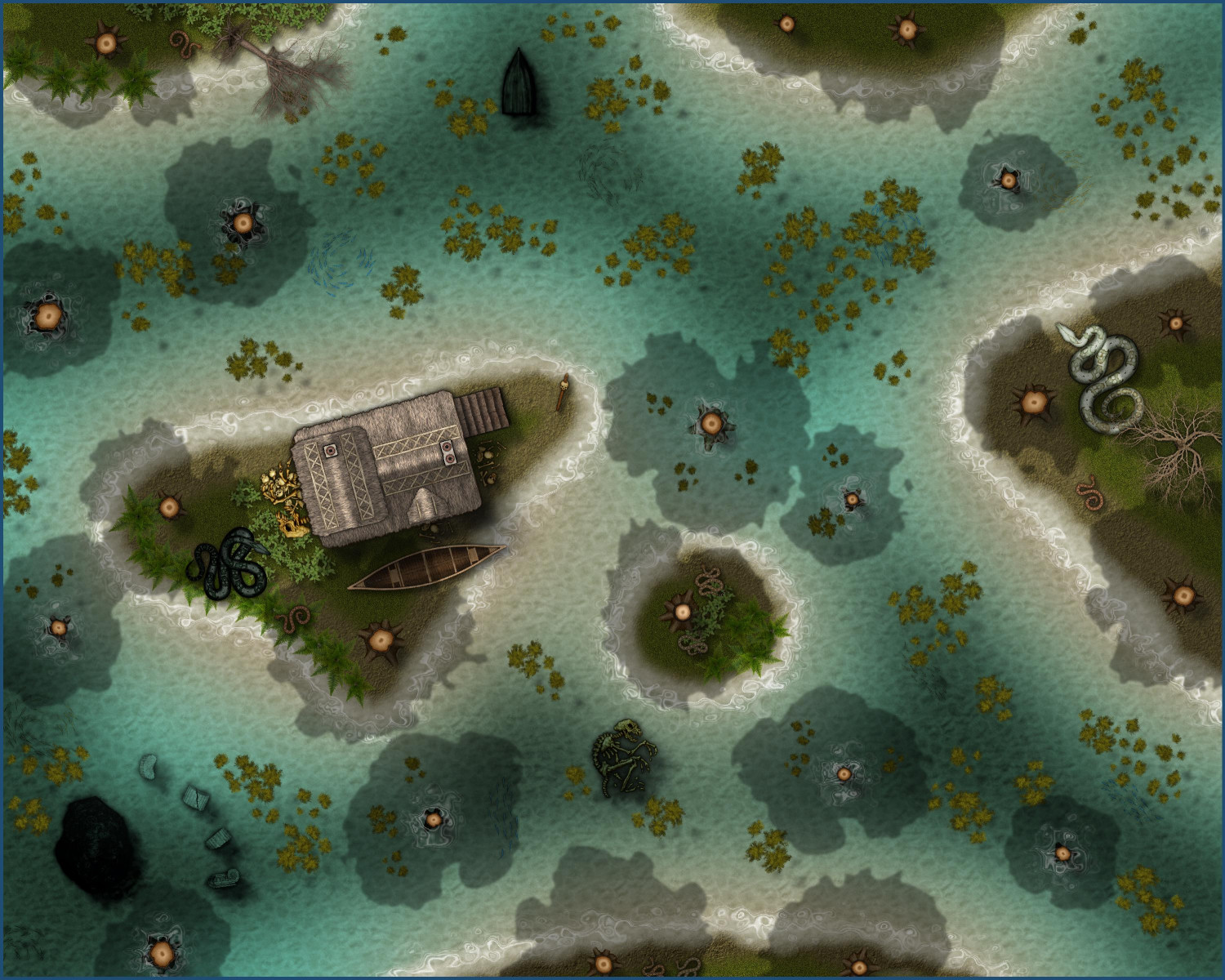
[WIP] Swamp Witch
Tweaked the Marine Dungeons version a bit: darkened the deeper water a little more, added a few dead trees, added more algae, and a few more bones.
-
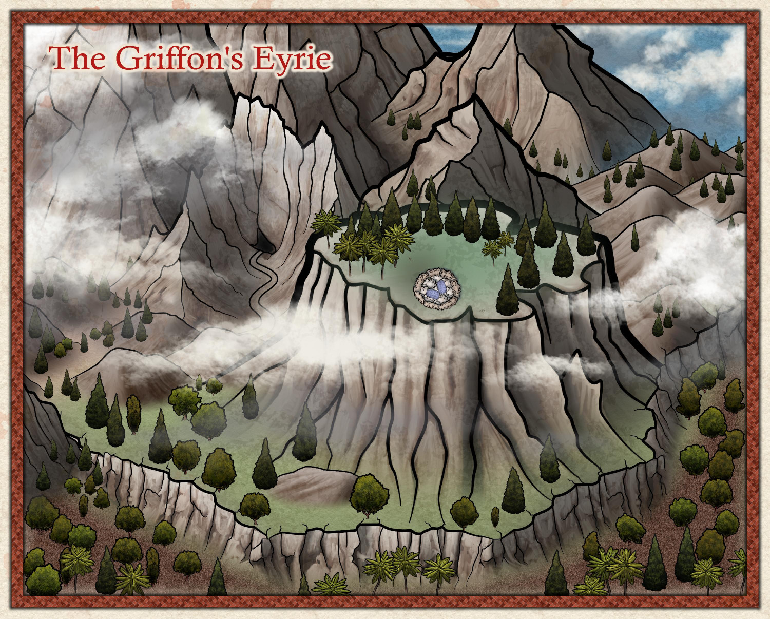
[WIP] - The Griffon's Eyrie
Some adjustments based on Ricko's recommendations...

-
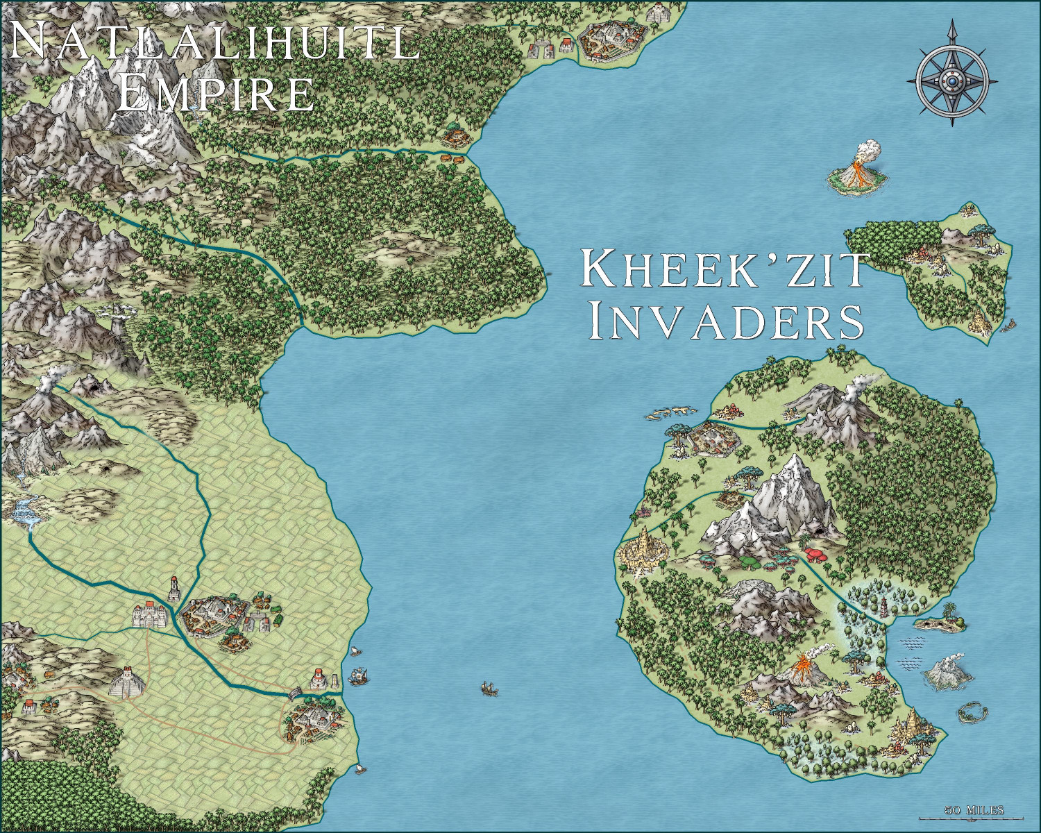
Invasion of the Pod People
Coincidentally, I happened to watch one of the remakes of Invasion of the Body Snatchers (the 2007 Nicole Kidman film Invasion) the night before Mike Schley's latest monthly symbols were released. Just for fun, I decided to do a quick-and-dirty map with the new Hive Civilization symbols. I hadn't gotten a chance to play with the Mesoamerican symbols (busy making villages when those symbols came out!), it gave me an excuse to try them out, too.
If there's a Hive expansion next month (they tend to come in pairs), maybe I will revise this same map to show the Kheek'zit invaders' expansion onto the mainland.

-
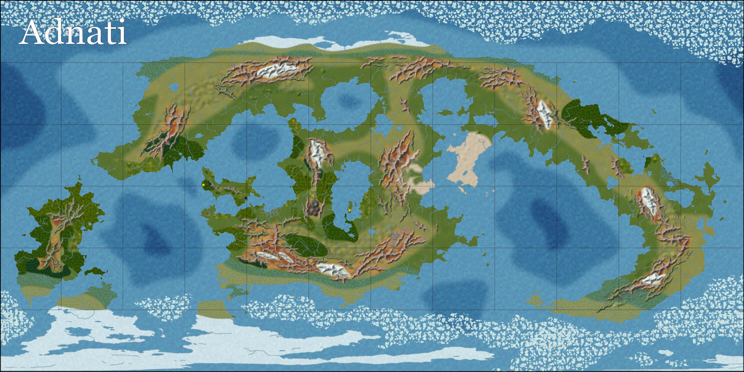
[WIP] Adnati - Birdseye Continental
Widened the edge fade on most of the terrains -- considerably wider on the grassy ones, less so on some of the others.
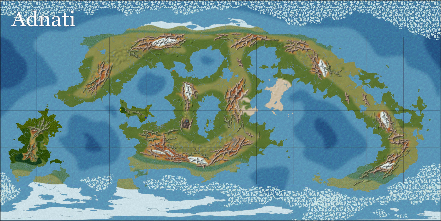
Starting to add more forests and farmland. Also need to add more natural features like volcanos and cliffs.