


Quenten
Quenten
About
- Username
- Quenten
- Joined
- Visits
- 8,061
- Last Active
- Roles
- Member
- Points
- 3,088
- Birthday
- November 29, 1950
- Location
- Australia
- Real Name
- Quenten Walker
- Rank
- Mapmaker
- Badges
- 16
Latest Images


Reactions
-
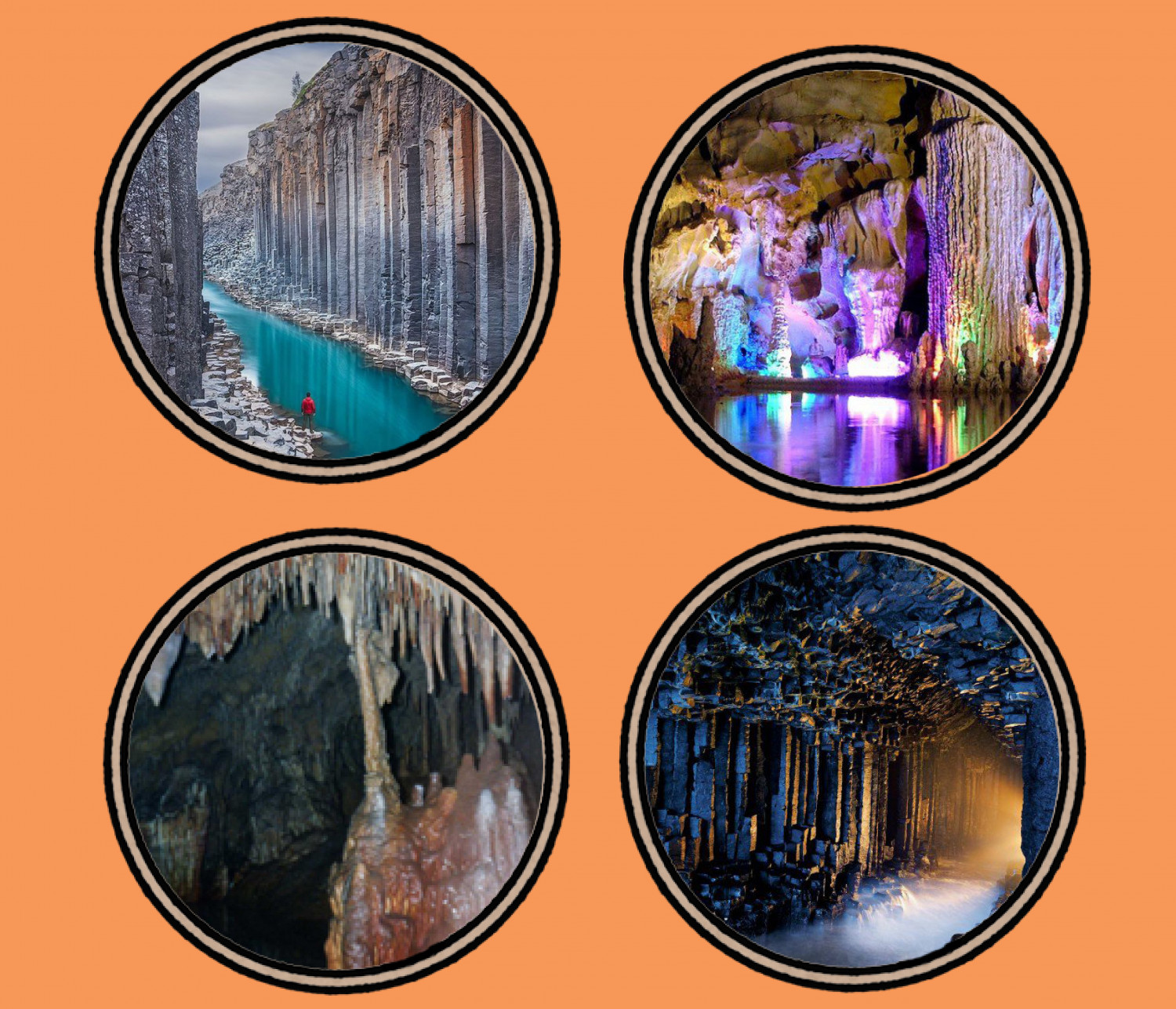
Ancient Realms revised - a test map with new icons
I have decided to revisit this style myself - it is a favourite of mine, especially with the use of icons. I was delighted that Ralf showed how to make new icons, so I have been making some for myself.
I have decided that even the major settlements will be represented by icons rather than usual symbols - just for fun.
Here is the beginning.
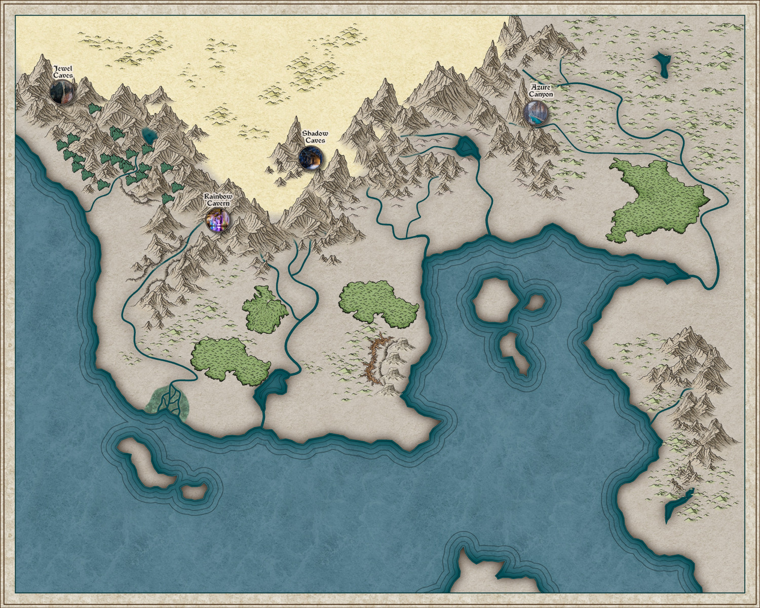
I am happy to share the icons if anyone wants them - all from free images on the internet.
Here are the 4 I have done so far:


-
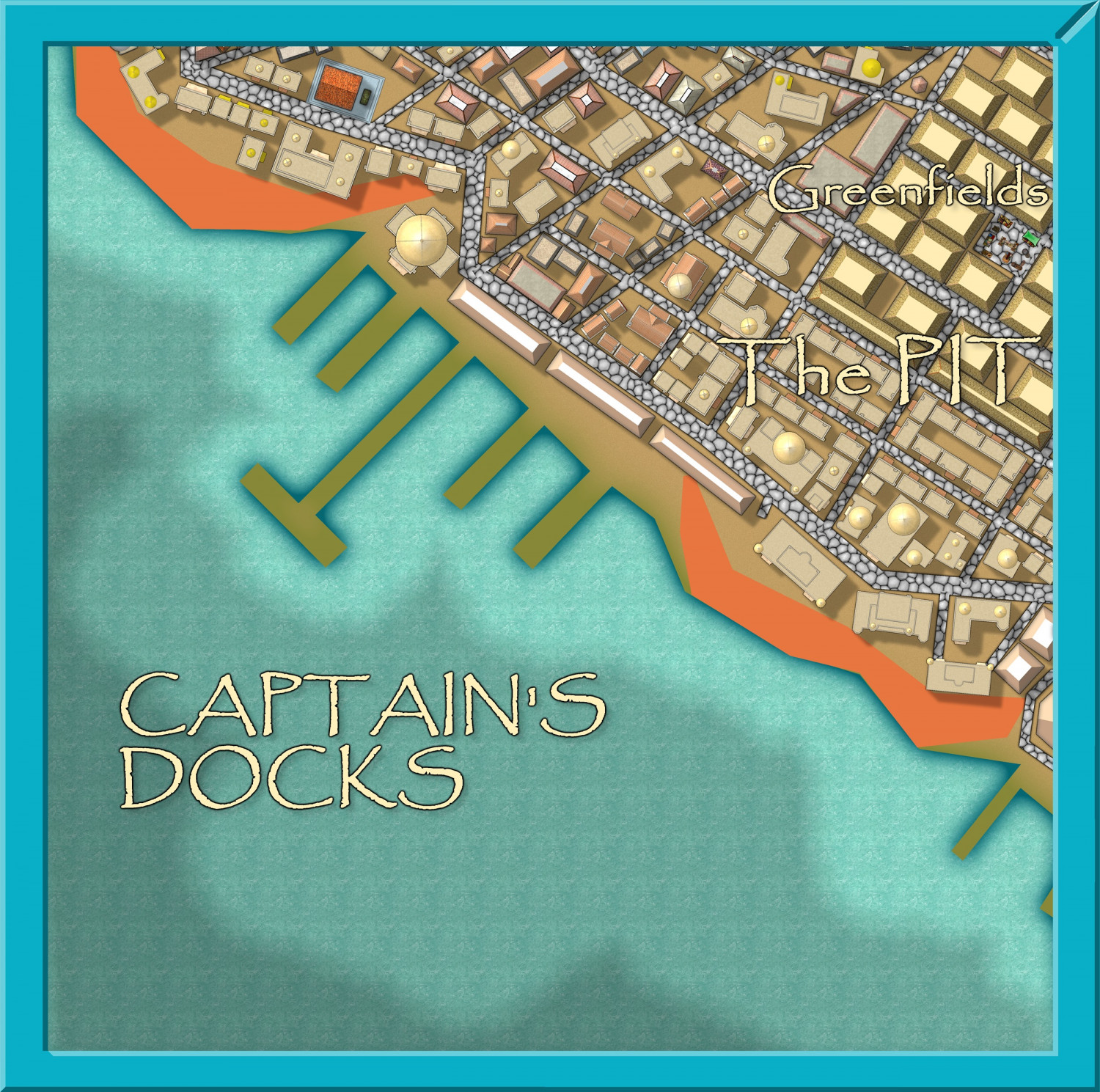
Community Atlas - Stromphe City - Captains Dock District
I am on my way to completing and submitting yet another district to the Stromphe City map. all the buildings are in, now just for the non-building features.


-
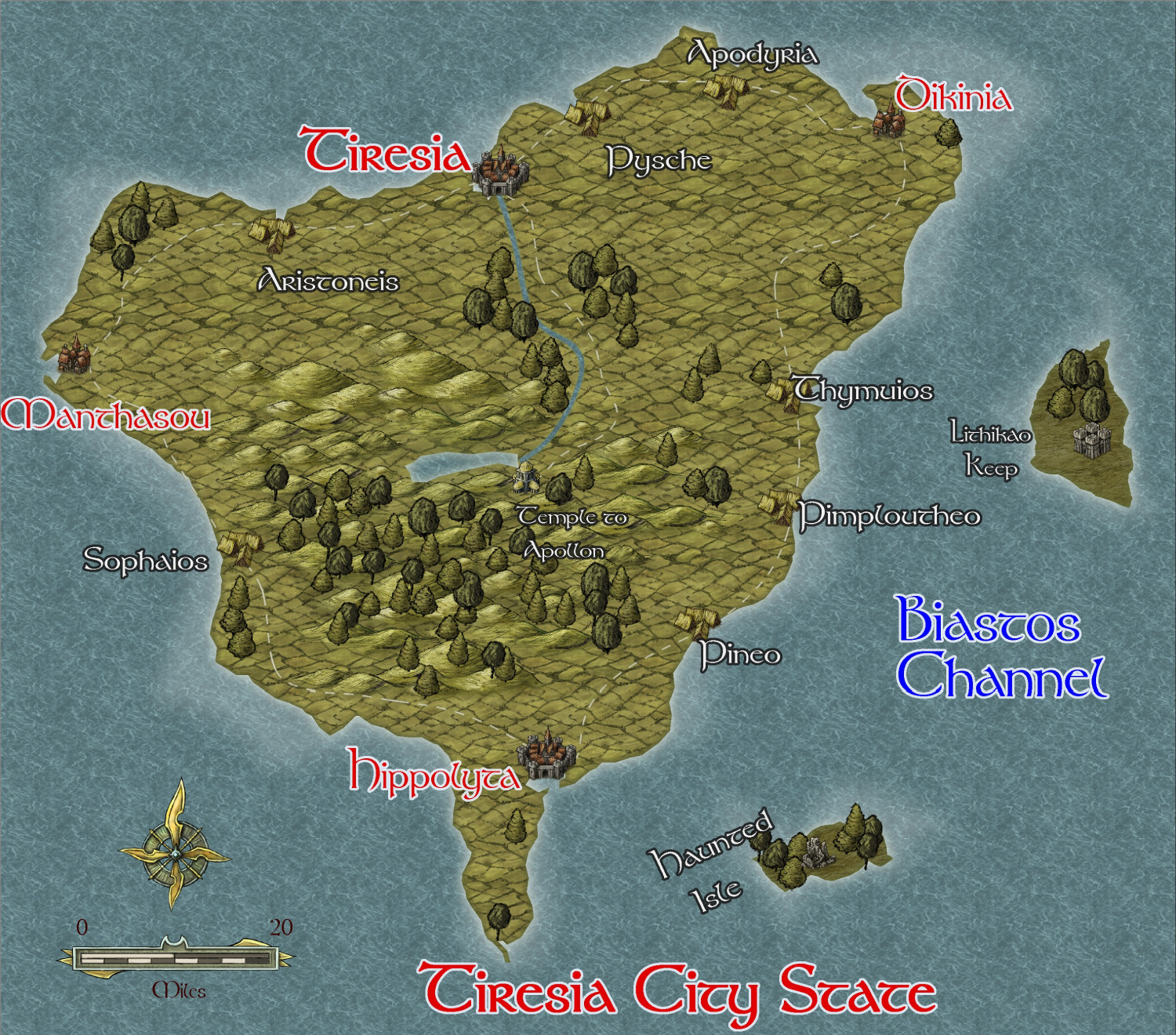
Community Atlas - Irisian City States - Tiresia City State
I have decided to map all the islands in the irisian City map style while I am waiting to get my new computer back from the repairers under warranty. Since I have to send it to the manufacturers - overseas - it will only take 6 weeks - outrageous!!
Anyway, here is the first - the biggest of the remaining islands, Tiresia City State, which has hegemony over the whole island. It is mainly agricultural and fishing, and is the least wealthy of the City States. It is also the closest to the hostile Kingdom of Helmonte.
I am using the same style as I did for Helmonte - Herwin Wielink, not my favourite style by a long shot.
This is the beginning of the map - interesting features to be added later.


-
Community Atlas - A huge metropolis somewhere
Here is progress on the Palace area. Next will be the other area.
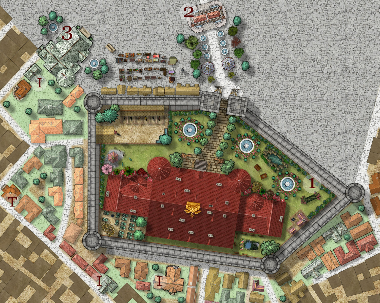
I = Inns and Taverns
T = Temples and Shrines
1 = Palace
2 = Triumphal arch
3 = City Hall

-
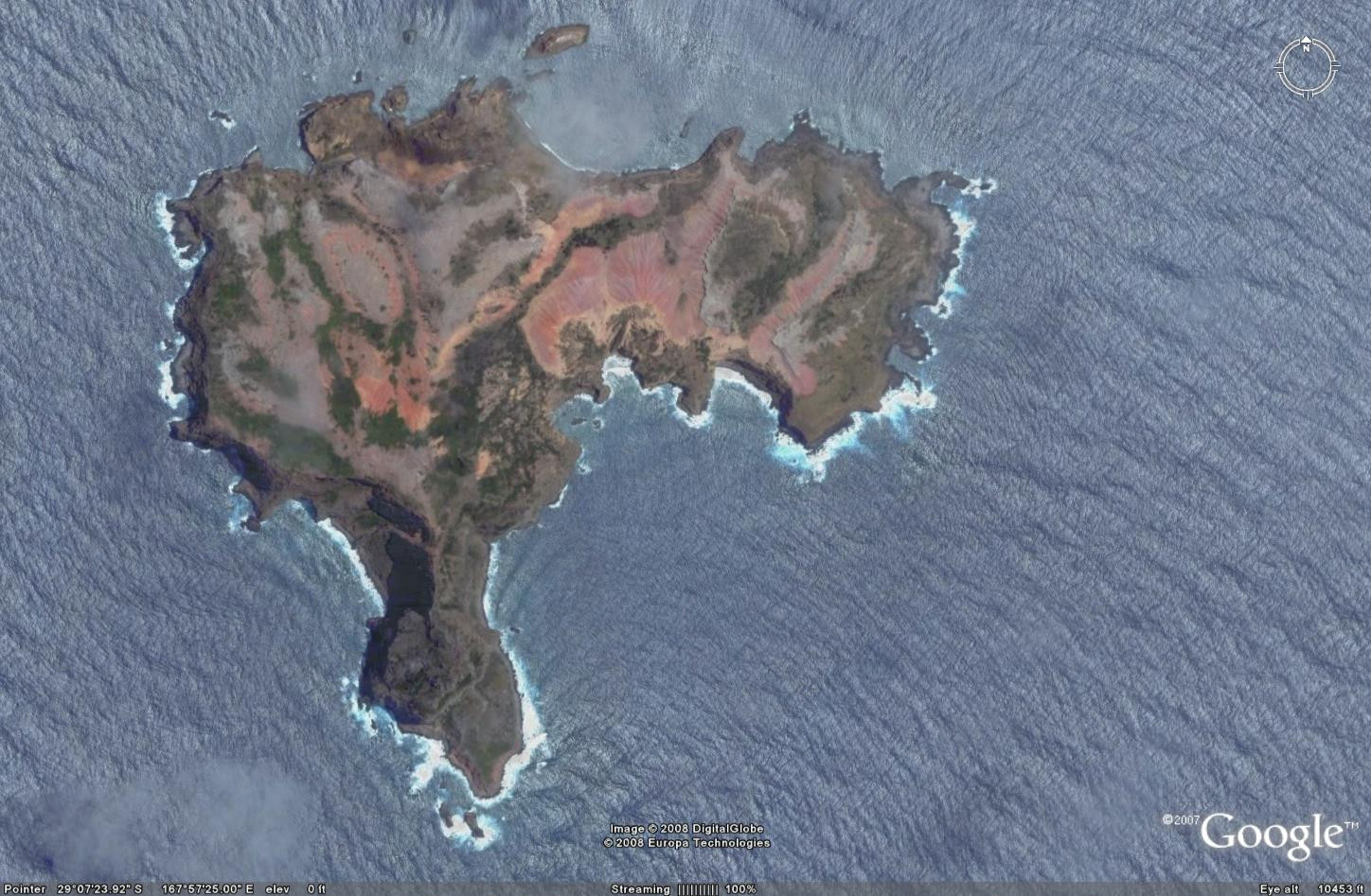
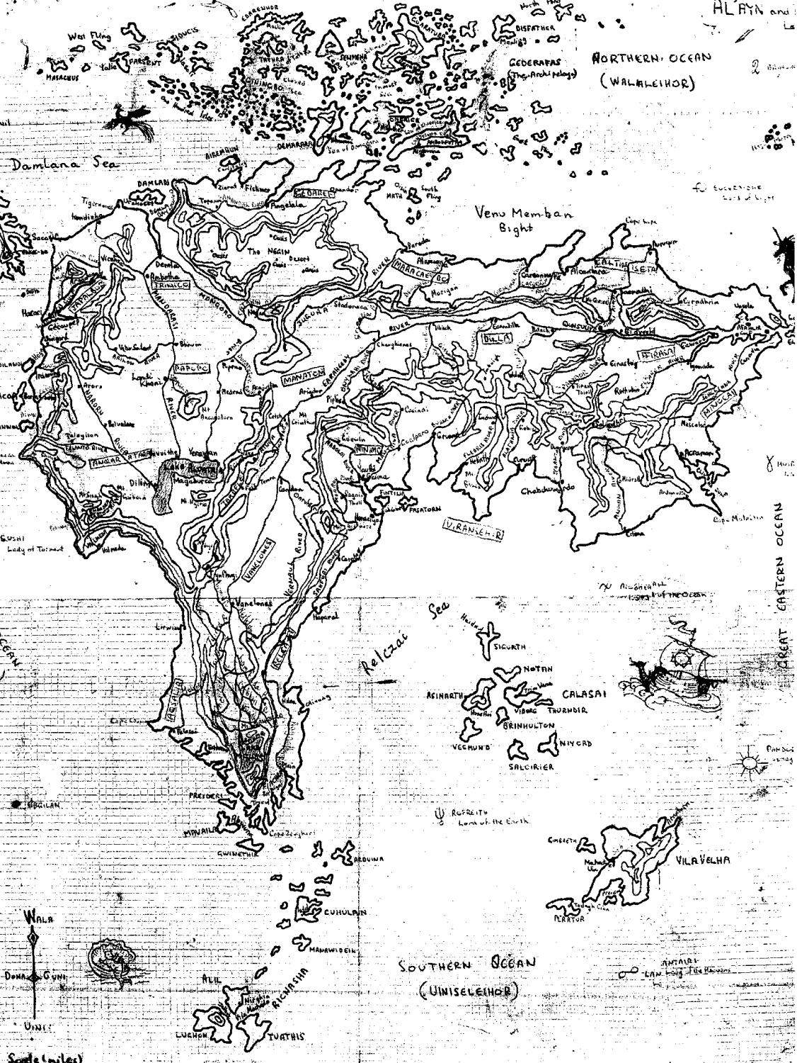
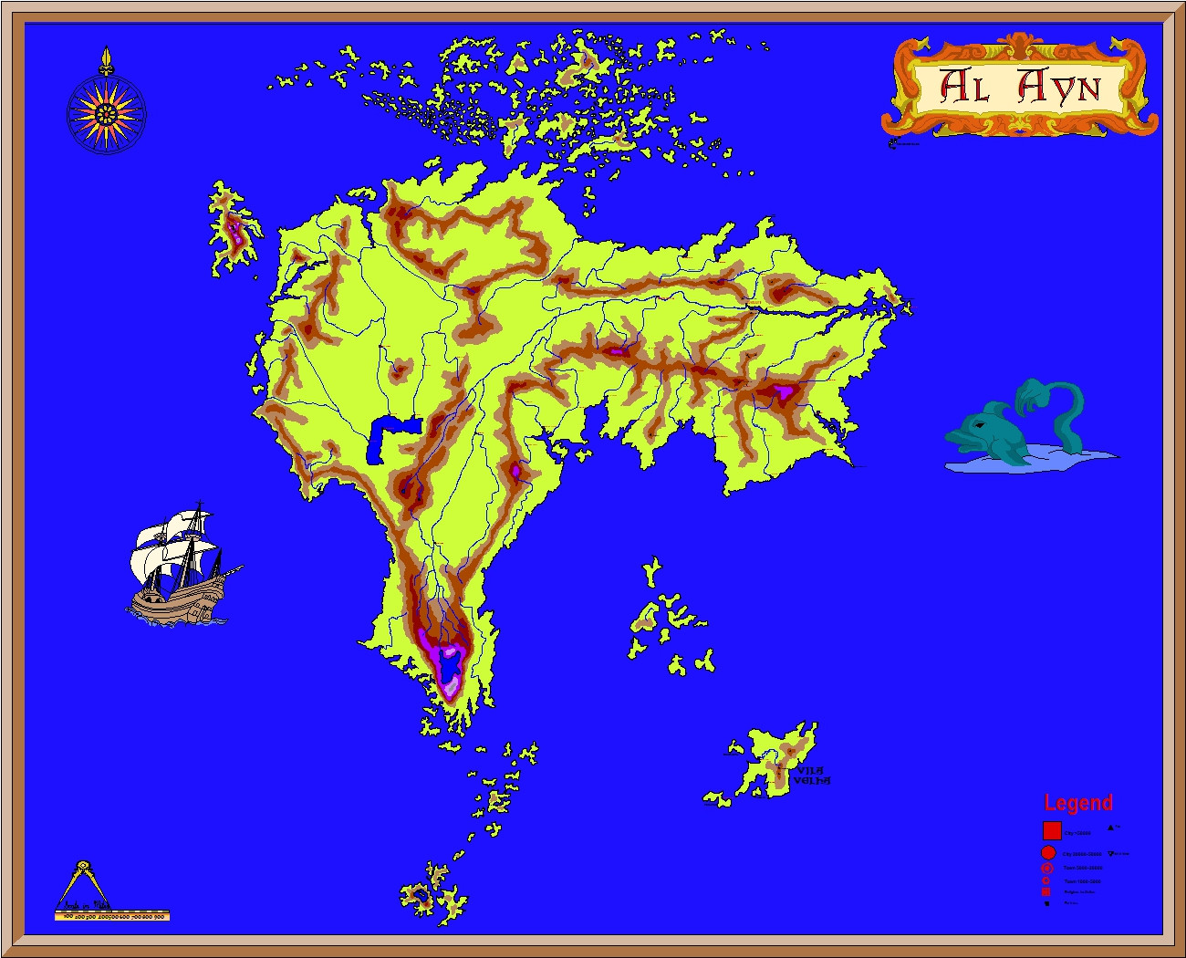
What got you into cartography?
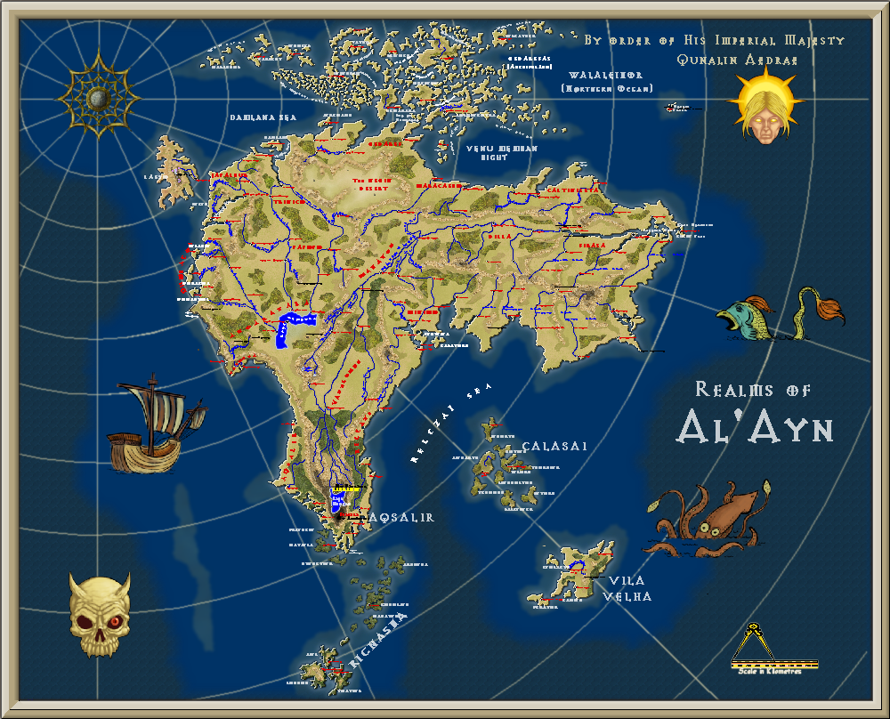
When I was 12, I was obsessed with Lord of the Rings, and wanted to create my own world. Then I went on a school expedition to Norfolk Island, and 'fell in love' with the map of Phillip Island, 5 km south of Norfolk island, and denuded of all vegetation by rabbits imported there by the prison officers for their 'hunting entertainment'. They have actually got rid of the rabbits and the island is being revegetated, but when I visited it in 1964, it was like a moonscape!
Anyway, this is the Google map of Phillip Island, and the first map I ever did (by hand) of the fantasy land of Al'Ayn - again for a book I will never write. And also, the third map is the newer version made when I got CC2, then the fourth when I got CC3+.
-
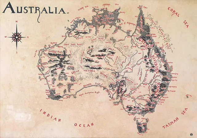
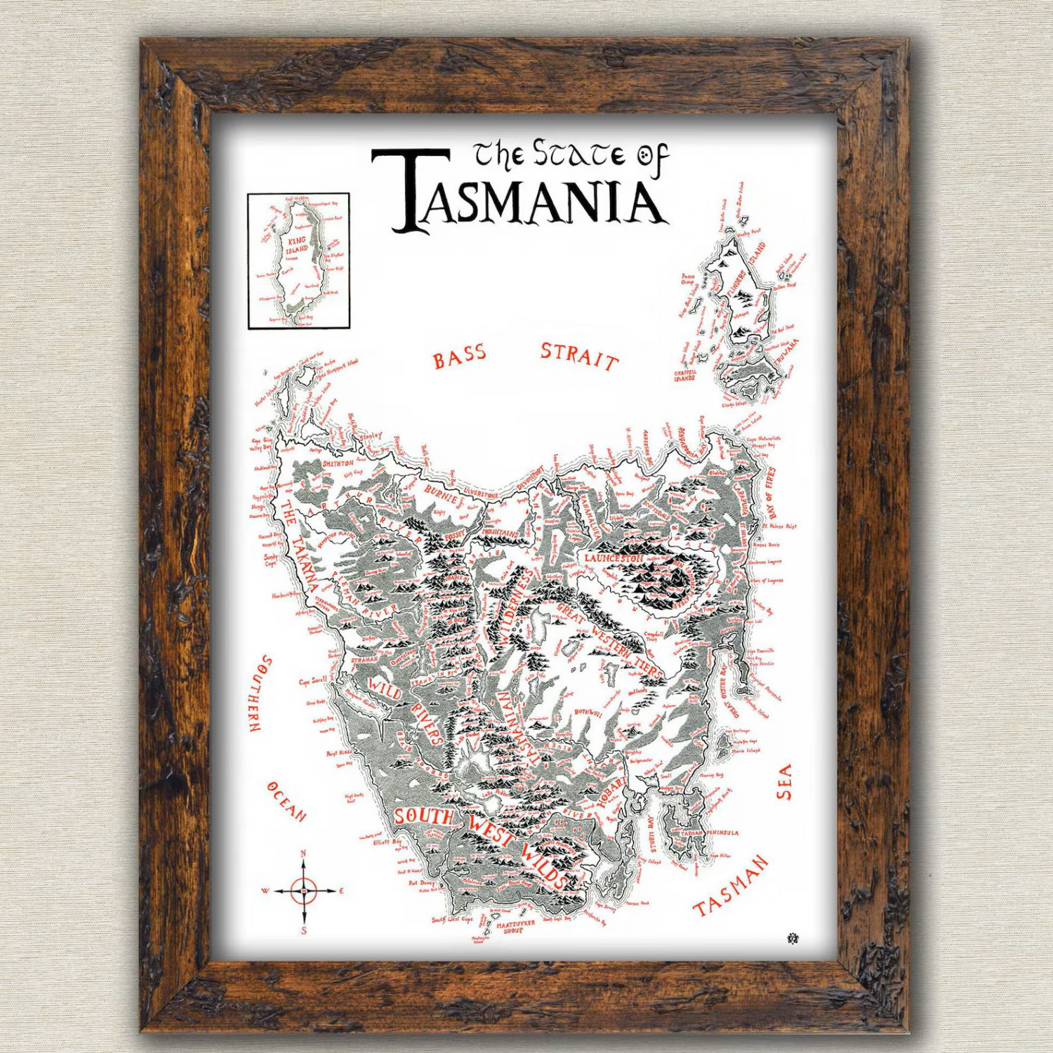
Show us your map collection!
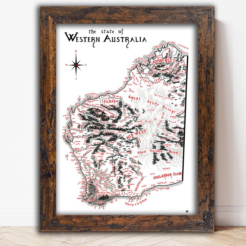
Here are three maps I have - of Australia, Western Australia where I live now, and Tasmania where I used to live, all done in Tolkien style.
-
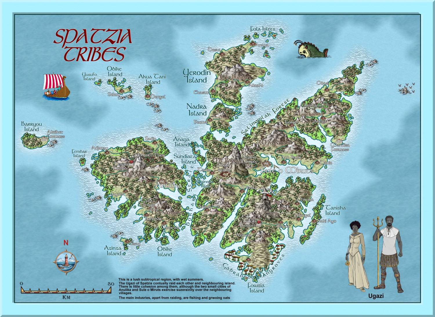
Hardin region of Myirandios
Another region completed - barbaric black-skinned raiders (of each other as well as other island groups), with a religion that practices human sacrifice to some degree - a mixture of full-on Viking and watered-down Aztecs, set in a subtropical archipelago. Which is based on somewhere on earth that most Europeans will recognize as being anything but subtropical - LOL.
Large version in the gallery:
Image Gallery: Hardin — ProFantasy Community Forum

-
Tatilana - Western Sergeevna
Update. The style is getting more to what I want. I have altered the mountain contours, and added ethnic groups, plus national borders, some forests and a marsh, and some more names.
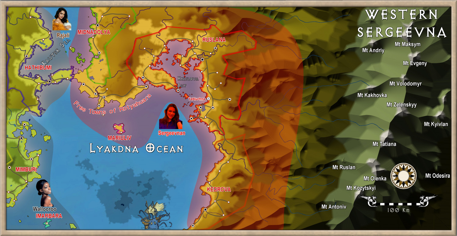
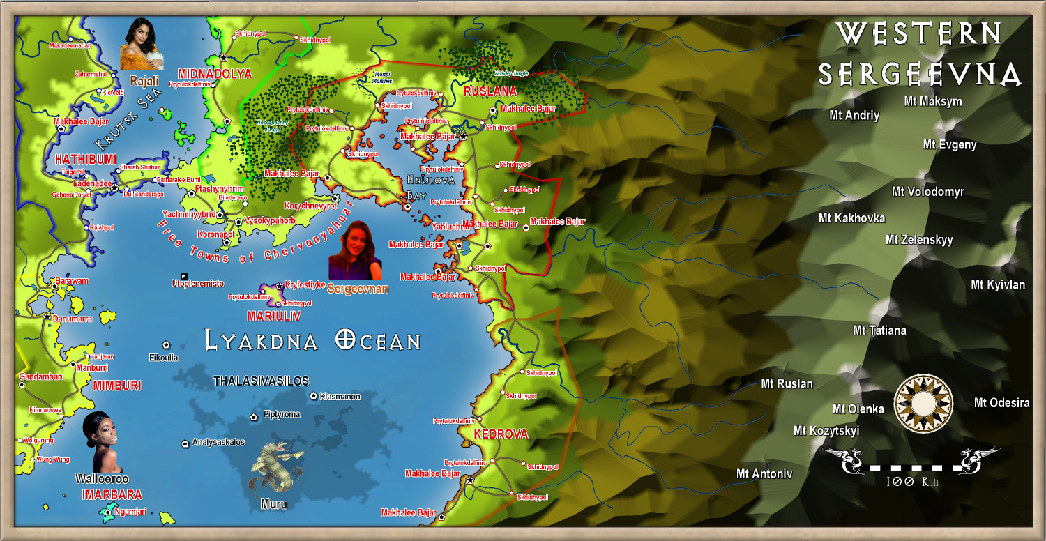
Sorry for the small text, but it is meant to be viewed at a larger canvas. When I have finished the text, I will put a 8Mb version in the gallery.


-
Watabou City REVISED (annual 157)
I will post my revision of the Templates and Drawing tools later on. Unless @Ralf thinks that would violate the ProFantasy agreement. They will be titled Annual Watabou City QW, to distinguish them from the official version, and they will also have their own Drawing Tools and bitmaps - again, drawn from existing CC3+ bitmaps - hence I will await to hear what Ralf says before posting.
But they will fix the problem with the present annual, given all the developments in the watabou city generator since that annual came out.
-
Ukadarlia
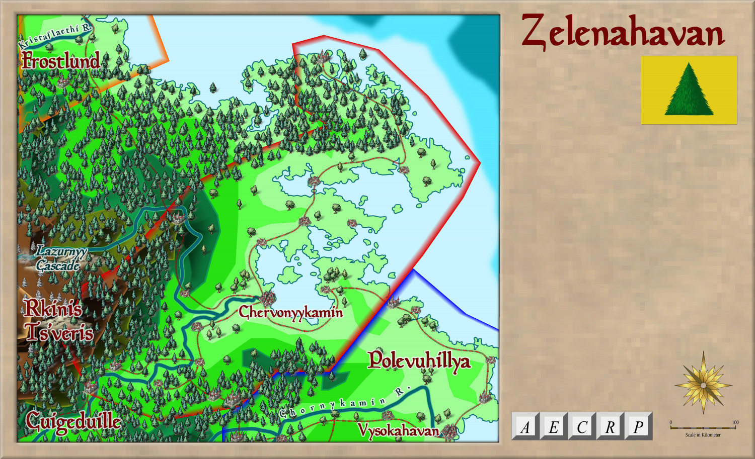
Finally, the main focus of the project:
The country of Zelenahavan (means Verdant Haven, or Greenharbour).
Two major ethnic groups: the Vynlings and the Kratirim, with all the tensions that this will imply.
More detail on this will come of course.


