


Quenten
Quenten
About
- Username
- Quenten
- Joined
- Visits
- 8,060
- Last Active
- Roles
- Member
- Points
- 3,087
- Birthday
- November 29, 1950
- Location
- Australia
- Real Name
- Quenten Walker
- Rank
- Mapmaker
- Badges
- 16
Latest Images


Reactions
-
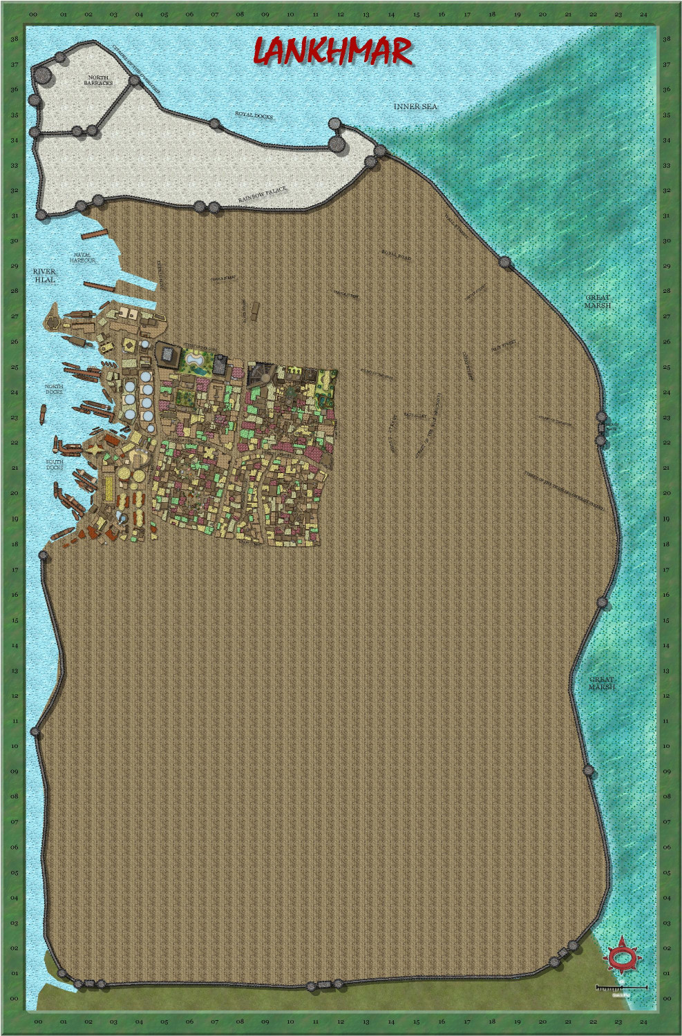
My version of Lankhmar
Today's work - added some of the docks.


-
How EXACTLY does "Fill with Symbols" work?
There is also an article by Remy Monsen as well.
Command of the Week - Fill with Symbols (Week 50) — ProFantasy Community Forum
I also make a lot of use of Symbols in area.
Command of the Week - Symbols in Area (Week 52) — ProFantasy Community Forum
This may also help in setting up your own catalogues for using Symbols in area.
And this explains how to use exclusion commands as well for Symbols in area, and Fill with symbols.
Exclusion Commands
Ever needed to fill a polygon with symbols, but exclude the area overlapping with another polygon? CC3+ now includes a couple of exclusion commands that lets you do just this; CONTOURSMX, FORESTX and SYMFILLX. These three commands all behave exactly as their normal counterpart, the only difference is that they will ask you to select entities two times. The first set of entities you select are the ones to be affected by the command, and the second set defines those entities that will be excluded from the command. Below is an example using the Fill with Symbols (FOREST) command. The first image shows three polygons (A forest area with two lakes) before filling anything. The second image shows what happens when using the regular Fill with Symbols on the forest polygon, while the third shows what happens if we use FORESTX instead and define the two lakes as excluded. Except for the fact that you are asked to select entities twice with FORESTX, it behaves the same as the regular Fill with Symbols command. (To change settings for FORESTX, go to Draw -> Fill With Symbols first to load whatever setting you wish to use, but click close instead of Run Now).


-
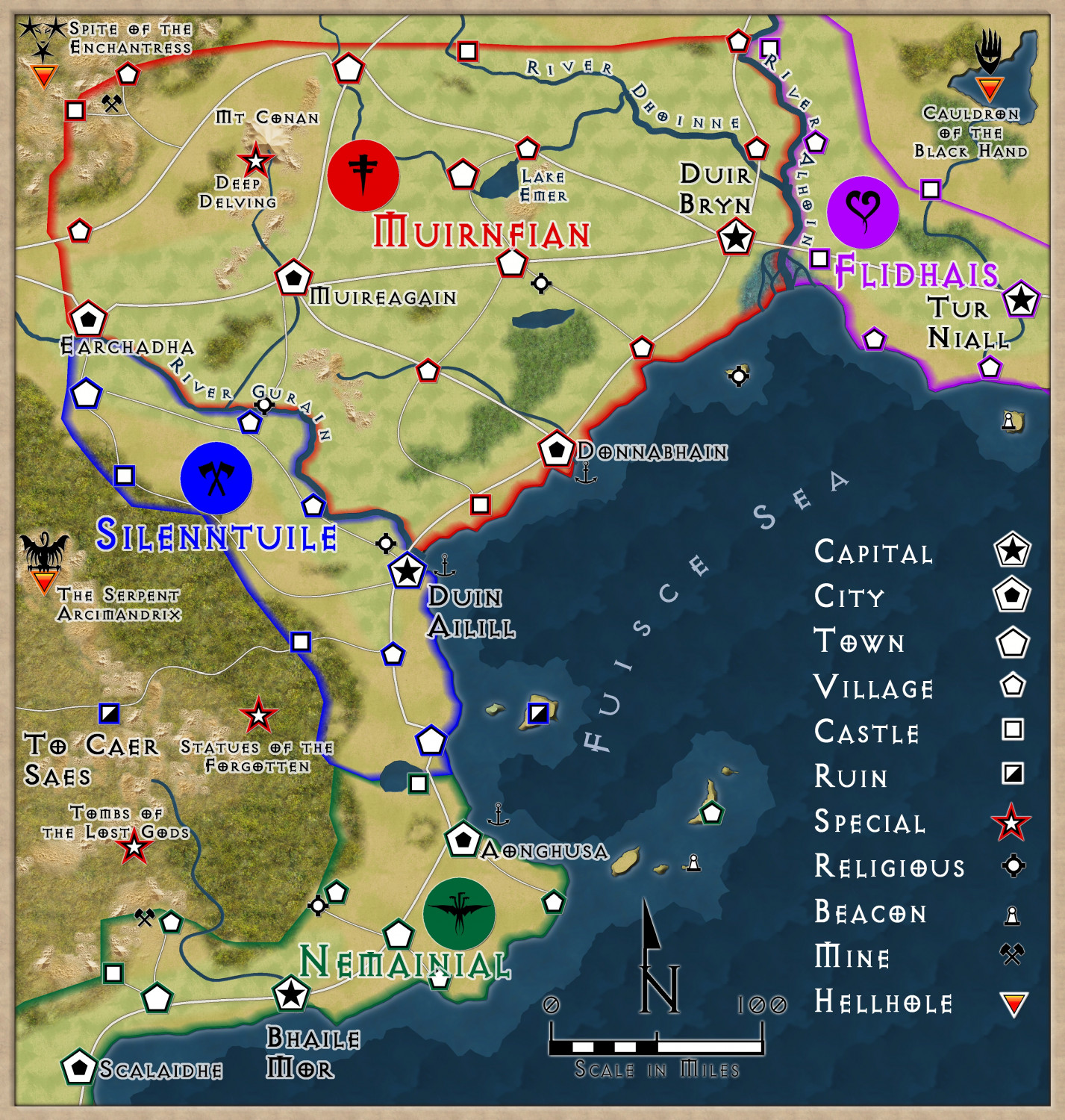
Community Atlas - Berenur - Duir Bryn Region
I think this is finished, depending on comments.


-
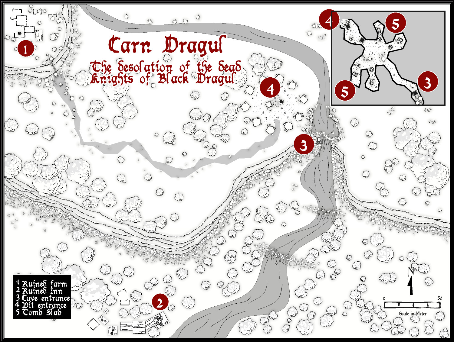
Carn Dum - using Inked Ruins annual
This is a slightly updated version, ready to go into the Atlas.


-
Sticky Note Dungeon - the evil Wizard Skullifogus
Thanks for this - it is likely to help me design better dungeons.
Here is my first foray - an evil necromancing wizard trying to create the ultimate undead monster- has created Vampelstein, a mutant vampiric-type critter
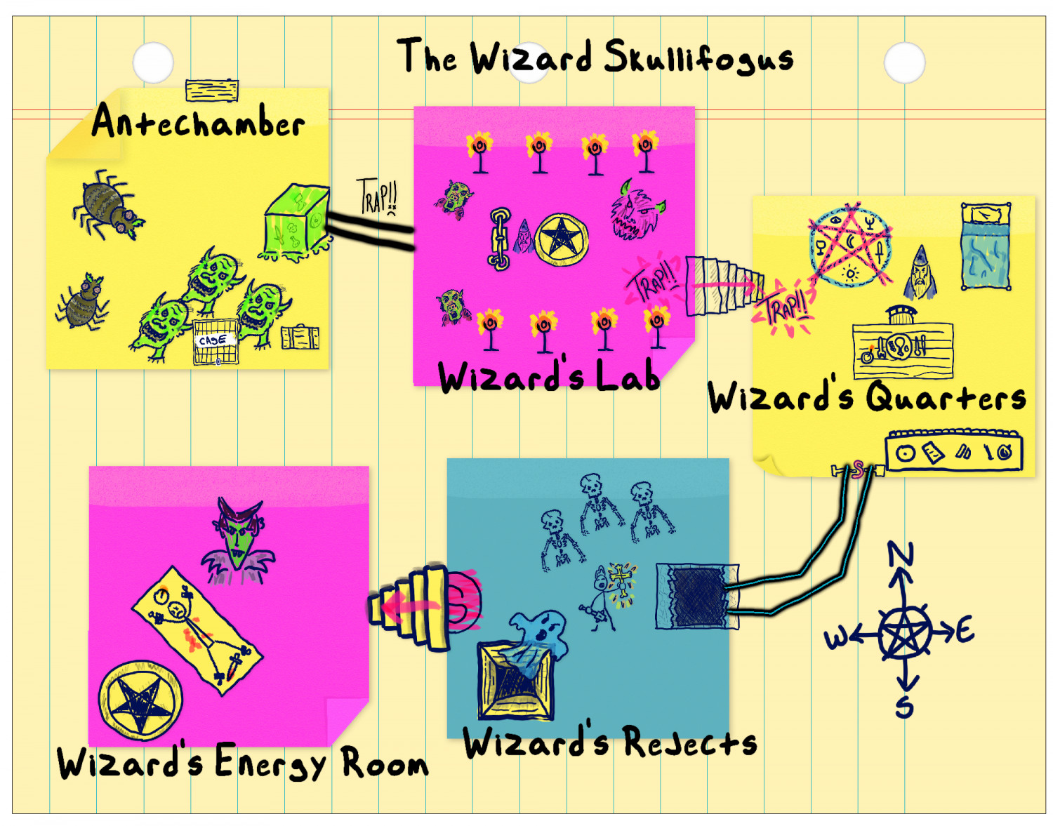
.
-
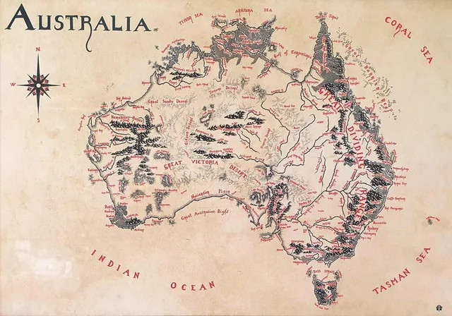
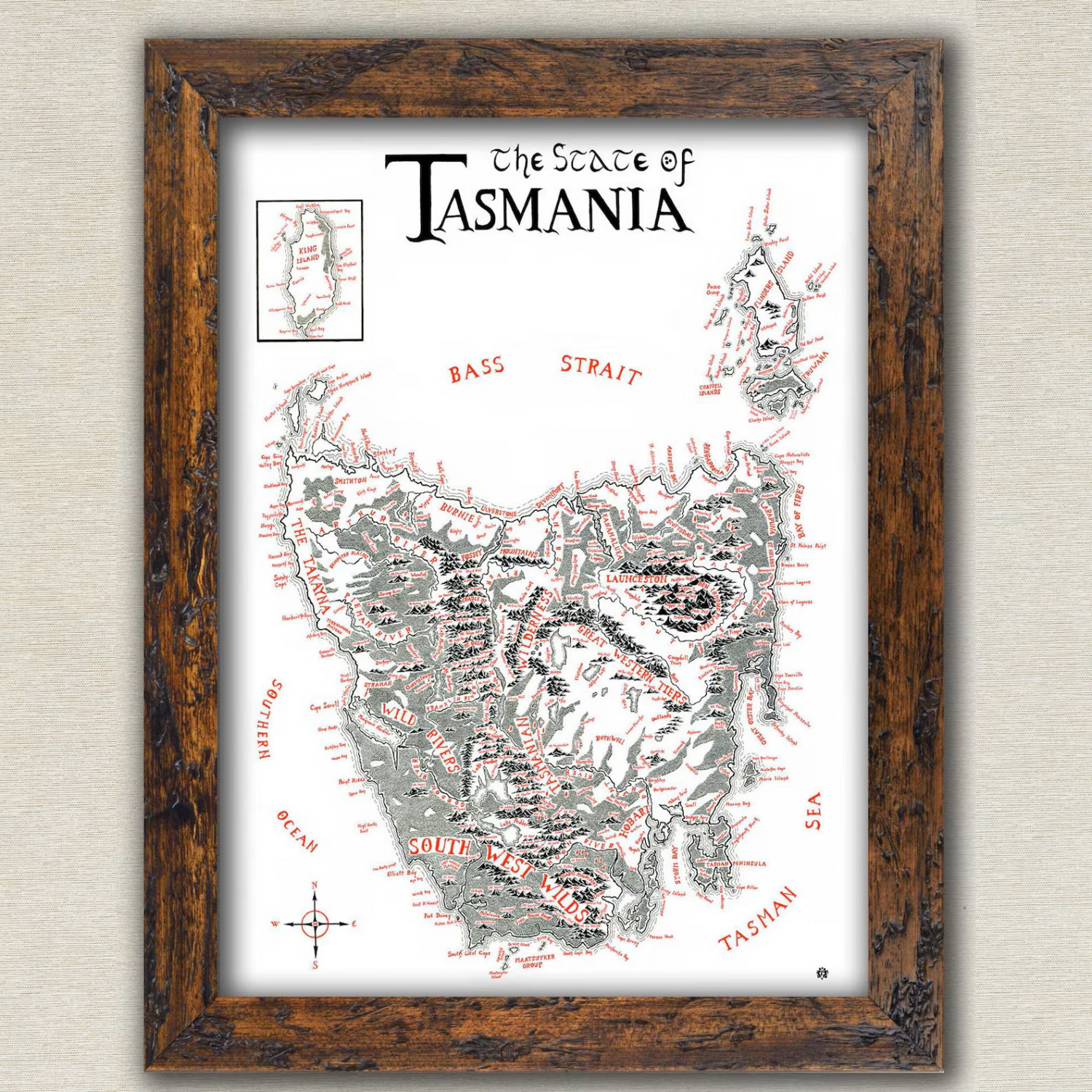
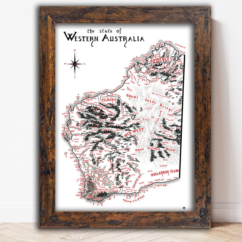
Show us your map collection!
Here are three maps I have - of Australia, Western Australia where I live now, and Tasmania where I used to live, all done in Tolkien style.


-
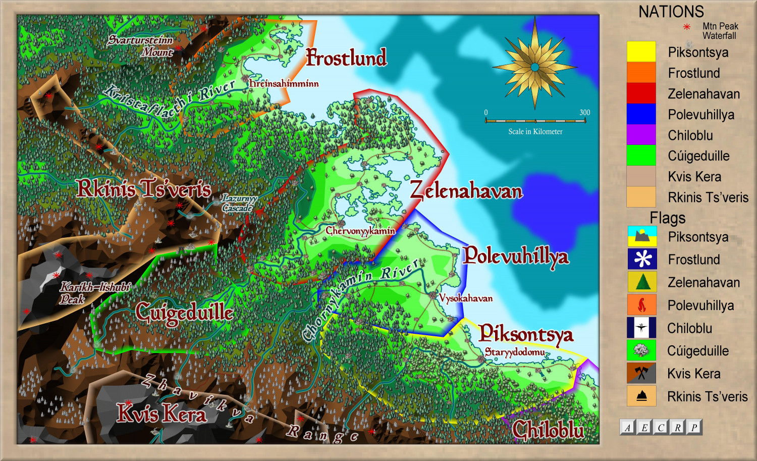
Ukadarlia
Here is the NE area, with a zoomed in version as well.
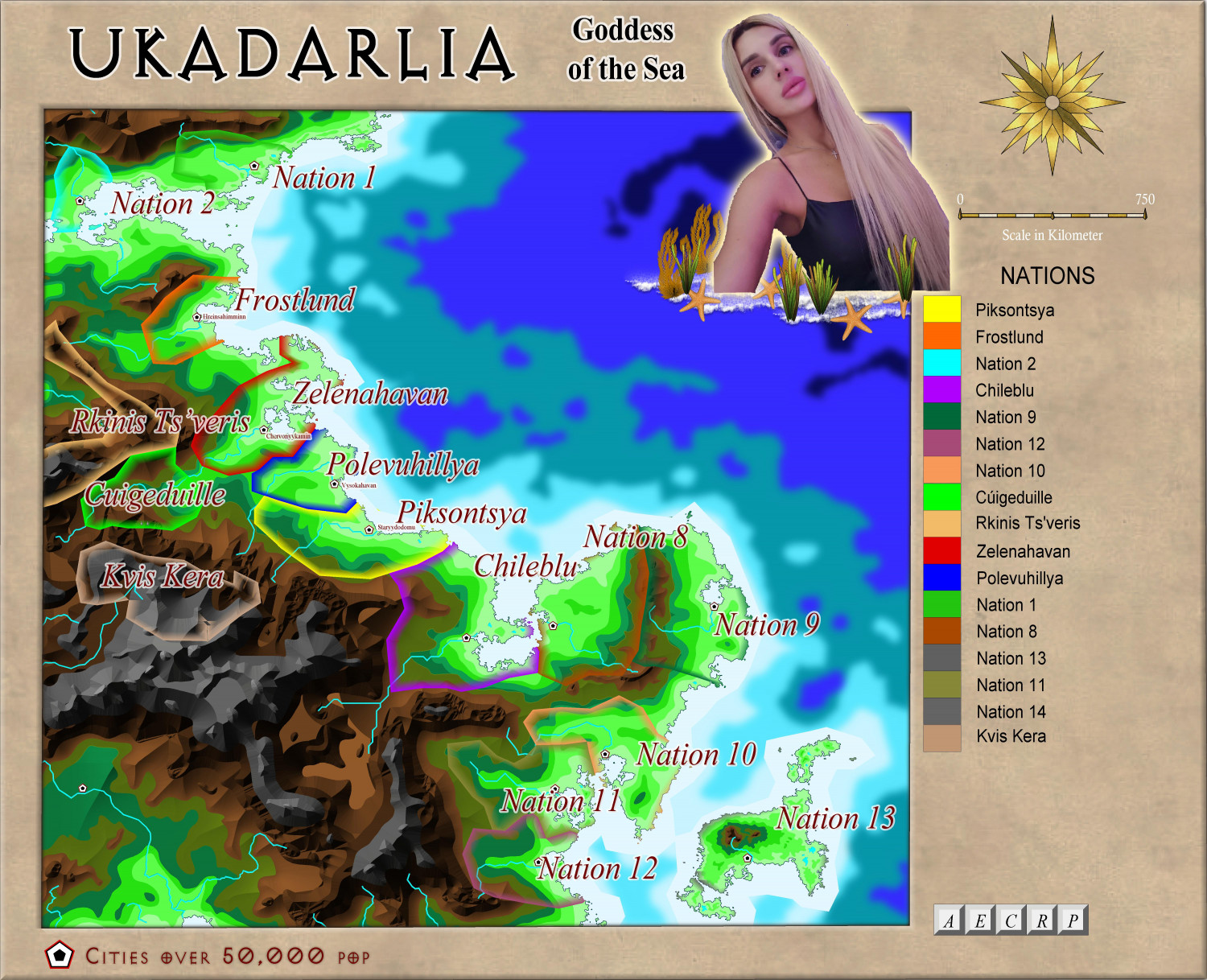
Zoomed in further:


-
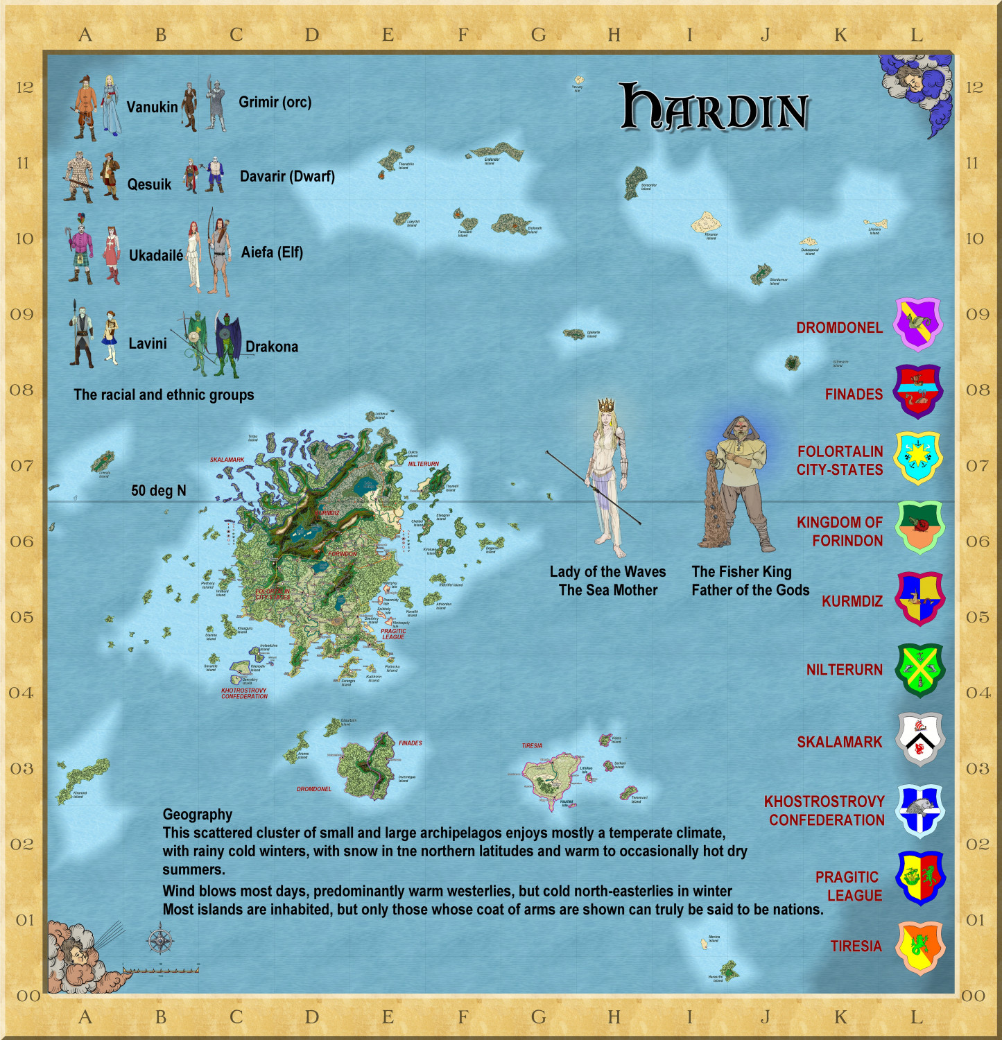
Hardin region of Myirandios
Here is the final map of this region - 2400 km w x 2500 km l. It will be the basis of my campaign Gazetteer which I hope to publish in about 12 months.
I am now working on mapping each subregion, starting with Fol0rtalin. I have included many of the maps I have done for the Atlas, a little revised.

-
Community Atlas - Irisian City States - Xenothon and Demydice Isles
I think this is finished, but await further suggestions. Map notes to come.
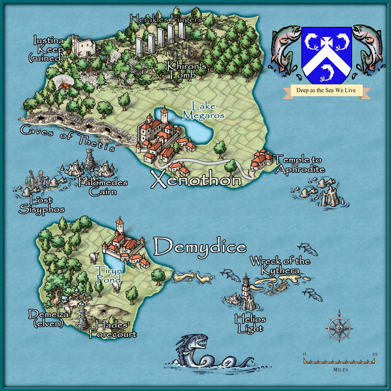
Three islands to go.

-
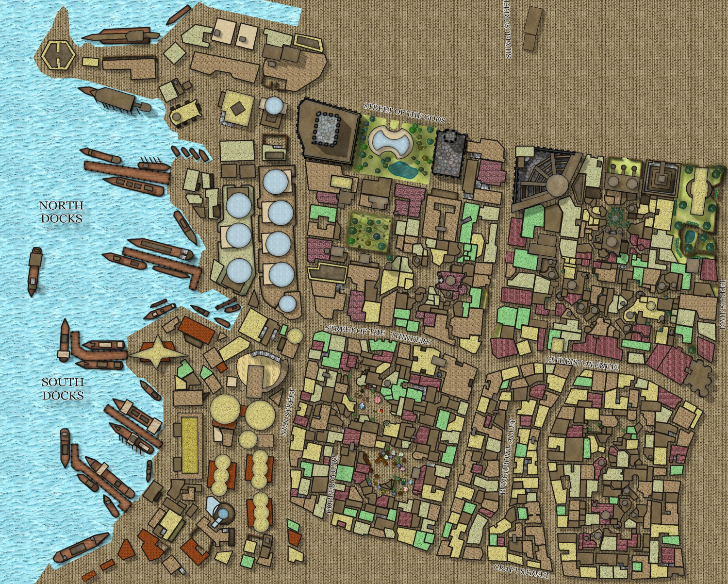
Community Atlas - A huge metropolis somewhere
Here is progress on the Palace area. Next will be the other area.
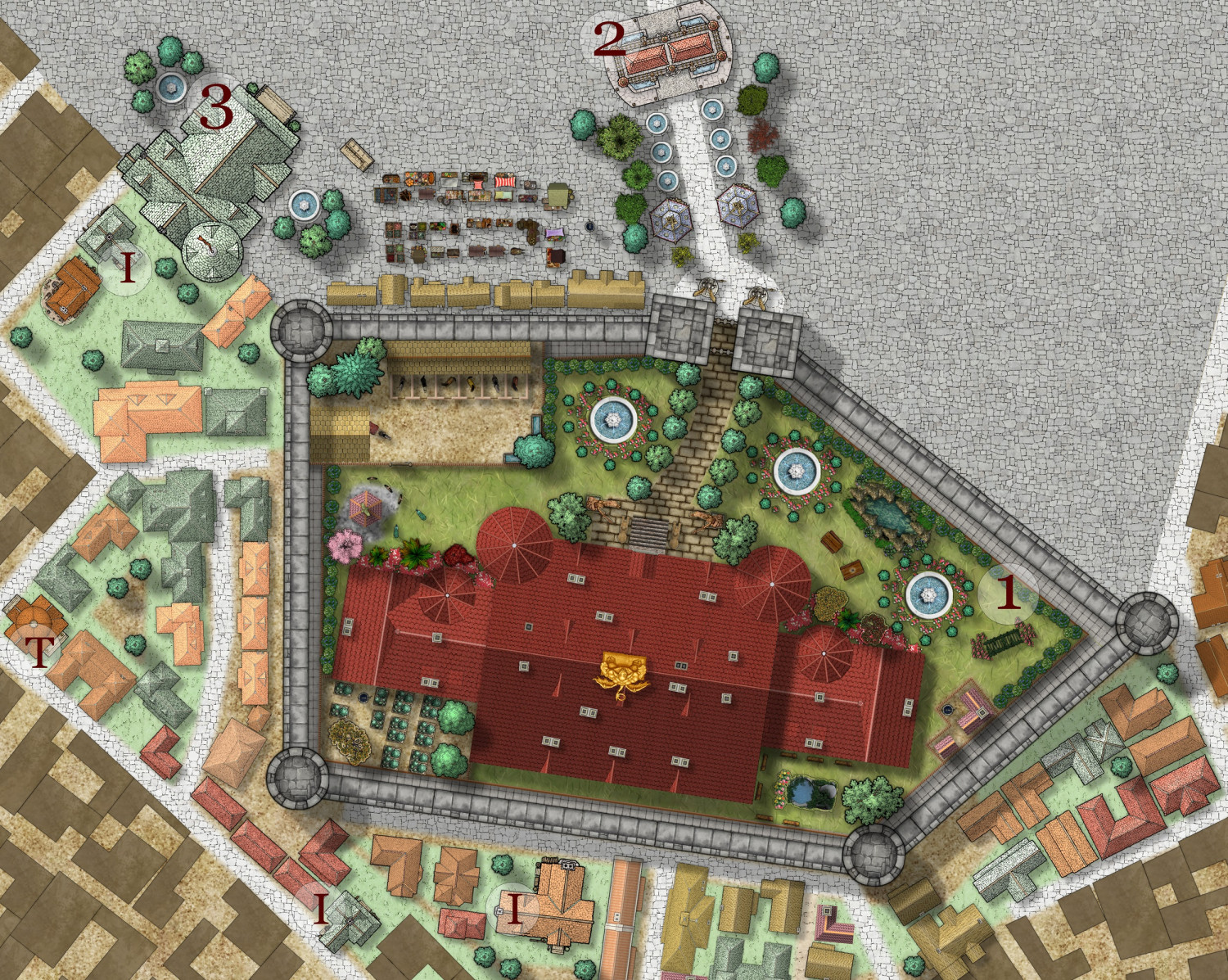
I = Inns and Taverns
T = Temples and Shrines
1 = Palace
2 = Triumphal arch
3 = City Hall


