


Quenten
Quenten
About
- Username
- Quenten
- Joined
- Visits
- 8,062
- Last Active
- Roles
- Member
- Points
- 3,090
- Birthday
- November 29, 1950
- Location
- Australia
- Real Name
- Quenten Walker
- Rank
- Mapmaker
- Badges
- 16
Latest Images


Reactions
-
Best Map Style(s) for Creating a Set of Maps from Large Scale, to Medium, and then Small
I suspect that for large continental or world maps I will be using the upcoming Birdseye style being created by sue Daniels. For regional maps, I will nearly certainly stick with Mike Schley, and also for smaller maps. This is just what I will use, and I am sure many others have many different ideas.


-
Community Atlas - Torstan Holy Head District - Redigan's Restaurant - a joint collaboration
In Torstan - what about this?

-
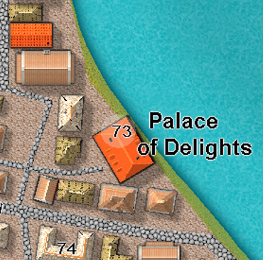
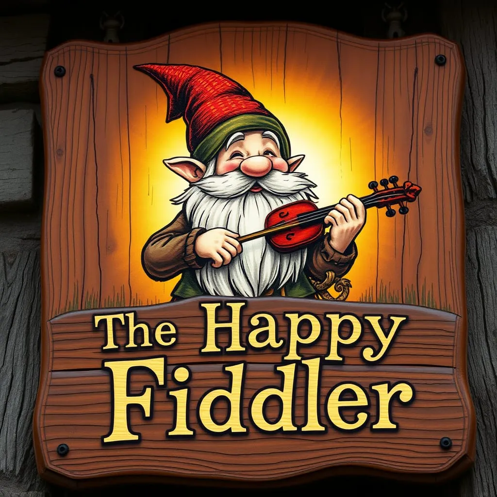
Community Atlas - Torstan Holy District - Happy Fiddler's Inn - a joint collaboration.
@Monsen, the building is now complete. Here are the FCW's of the building - Ricko has supplied the fcw's of the rooms. Alss, here is the png of the sign.

-
Birdseye Continental - style development thread
Very much want top down mountains, hills, waterfalls and cliffs.
-
IDEA: Terrain over cutout rivers
I have just tried Royal Scribe's method - and it works beautifully.

-
[WIP] Community Atlas: Snakeden Swamp, Lizard Isle, Alarius - Dedicated to JimP
Just a thought - how about also mapping in one of the areas already done by Jim, mainly on the island in the Forlorn Archipelago. He did quite a lot of regional maps there, especially on Fisher Island. And perhaps it might be a nice community effore to have others map in regional maps done by Jim. Just a thought.
-
Happy Holidays from Western Australia.
Ta. Hope you don't get too cold there. It is boiling hot here - 42C today!!! Yuk.

-
Birdseye Continental - style development thread
Definitely need red deserts - I am sure you understand as I am from australia, home of vast areas of red desert.
-
Birdseye Continental - style development thread
OMG, they are terrific. I can see an Aussie landscape coming up right away. As they say here. Good onya, mate, you little beaudy
-
WIP: Bleakmoor Harrow - Continent of Estonisch
I do like the font for this style. And this is purely a matter of personal aesthetics - but I think your large font size is too large - again, my personal taste, so don't act on it unless you feel you would like to. Perhaps the Jungle name is about right size, given the extent of the Jungle, but I feel Mount Kroom is overly prominent - but perhaps that is what you desire. Again, these are MY aesthetics, which nearly certainly won't be yours, but I offer it for you to consider.
And I find the issue of text size perhaps the most difficult to resolve - always someone wanting it bigger, so they can read it on what is a small version of the map, and people like me who don't like any one text dominating others, and who are quite happy to have smaller sizes, which becoe clear when a larger version of the map is viewed (unfortunately not on the forum pages, but available in the gallery now, thanks to Remy Monsen's recent modifications).
