Quenten
Quenten
About
- Username
- Quenten
- Joined
- Visits
- 7,167
- Last Active
- Roles
- Member
- Points
- 2,843
- Birthday
- November 29, 1950
- Location
- Australia
- Real Name
- Quenten Walker
- Rank
- Mapmaker
- Badges
- 16
Reactions
-
Watabou City REVISED (annual 157)
-
Watabou City REVISED (annual 157)
Then open Watabou city annual style. Pick the dimensions you want - get this from the scale in the generator.
Then inset the dxf file.Scale it as non visual by factor of 2.5 (not 400 - it no longer appears as a dot!). Use 0,0 as the point to scale from.
Next step - convert all from lines to paths (right click the Explode button). DO NOT FORGET THIS
Now we need to move all elements apart from the buildings to their relevant sheets and layers. I do it in this order, but it doesn't really matter which so long as you remove all elements apart from the buildings to their relevant sheets/layers.
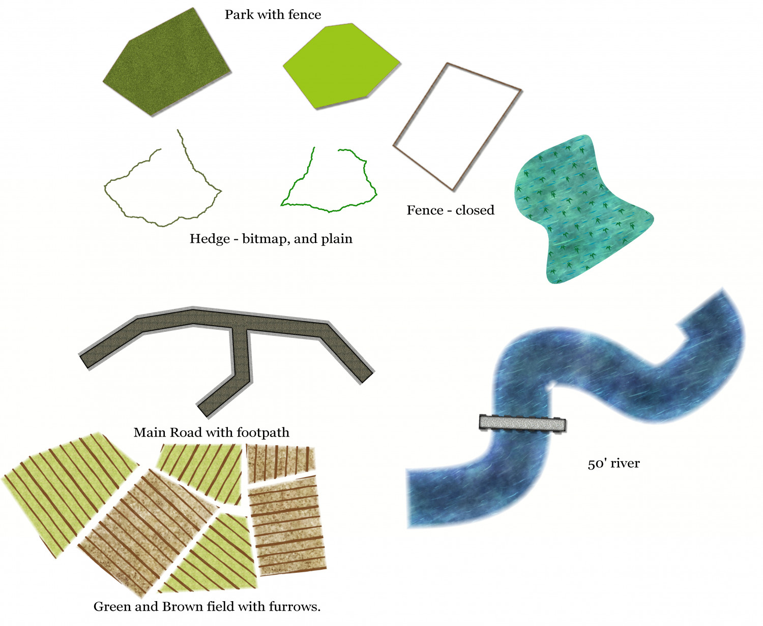
- Water: Turn Seas into closed polygon, move to sheet WATER/RIVERS, layer Water/Rivers. Use whatever fill you like. Turn River into a path of fixed width, fill whatever you like (or a actual smooth polygon, giving difereing widths along the course of the river, making it perhaps more natural, and perhaps allowing for some river islands). I do not use Change like Draw Tools for this - I got weird results (someone might like to check this out).
- Roads: Again, I turn the roads into a path of fixed width, fill pattern what I like. Again, I got weird results using the Change like Draw tools. This isn't too problematic, since there are only ever 2-6 roads. Put them on the sheet ROADS layer Roads. I actually add a ROADS PAVED sheet, with no Edge Fade effect because sometimes i want a stone road to be 'neat' at the edges.
- Walls: I do use Change Like Draw Tools for this - it works well. Make sure you select Sheet WALLS, and layer City Walls before doing this, though.
- Towers: I do these each separately (I actually hide all but the IMPORT, WALLS and TOWER and TOWER TOP sheets, just to make it easier). I do use the Draw Tools, (NOT Change like Draw Tools), but it is sometimes a bit trial and error to get the right dimensions. First, work on the Round towers: Once I have 1 tower right, I then copy that to all the other round towers, to keep the dimensions consistent (unless I deliberately want to make some bigger and even taller). Nest the square towers- usually the gate. I draw 2 towers with the distance apart from them being the width of the road, then add a WALL between them, narrower than the City Walls, to act as both a gate AND a maker to align them correctly to the walls. Again, I use the copy command to keep things consistent.
- Bridges. I make these either as a separate entity on a new BRIDGE sheet (in the map below I have used a BRIDGE sheet with a shadow effect, and a BRIDGE TOP sheet for railings, with an outer glow effect).
- Docks: I add a DOCKS Sheet, with Shadow effect, and outer glow (or just a black outline as in the map below).
- Greens: I add a sheet called PARKS, and transfer all greens to that sheet, Layer vegetation. Fill as desired.
- Fields: I transfer all furrows to the FIELDS FURROWS sheet, unless I decide to use a field fill that has furrows you can align as you wish. otherwise, follow the procedure as per the annual 157.
- Buildings: Hide all Sheets except IMPORT. Choose layer Buildings. Right click Explode button and change everything from Paths to Polys. Now change the fill to the desired fill - Watabou annual uses the Brown stone dark fill. Next add an outline to all the buildings, the press P for previous and move all the outlines to CITY BLOCK OUTLINE Sheet. I actually rename City Block to BUILDINGS, and City Block Outlines to BUILDINGS OUTLINES, and add a sheet BUILDINGS HIGH (which I transfer the large buildings to - remember to hide the outlines before you do this though!). The renaming isn't necessary, but since I like to have a different sheet for different size buildings, I prefer the name Buildings - my OCD showing! Of course, I add a Wall direction shadow to the BUILDINGS HIGH Sheet, with higher value than for the hoi polloi buildings. I find doing it this way, and NOT using the Change Like Draw Tool tool actually produces a cleaner result. But I am interested in what you people think.
- I actually change the sheet effects for the CITY BLOCK and CITY BLOCK OUTLINE as follows: The CITY BLOCK (or BUILDINGS) sheet had only the Wall shadow directional effect - delete the Glow effects, but copy the Outside Glow effect to the CITY BLOCK OUTLINE (or BUILDING OUTLINE) sheet instead.
Now I have got the following - easy to add all the other bits to the map now.
To the template for this revised annual, I would add the following sheets: PARKS, BRIDGE, BRIDGE TOP, DOCKS, BUILDINGS HIGH; and the following Layer: Cartouches. I would also change the sheet effects for the CITY BLOCK and CITY BLOCK OUTLINES as indicated above (and change the names to BUILDINGS AND BUILDINGS OUTLINE)
I will finish this map off later.
I really want comments and suggestions on this please. I would love to be able for us all to use the Watabou stuff easily again.
-
Community Atlas - Irisian City States - Menina Island
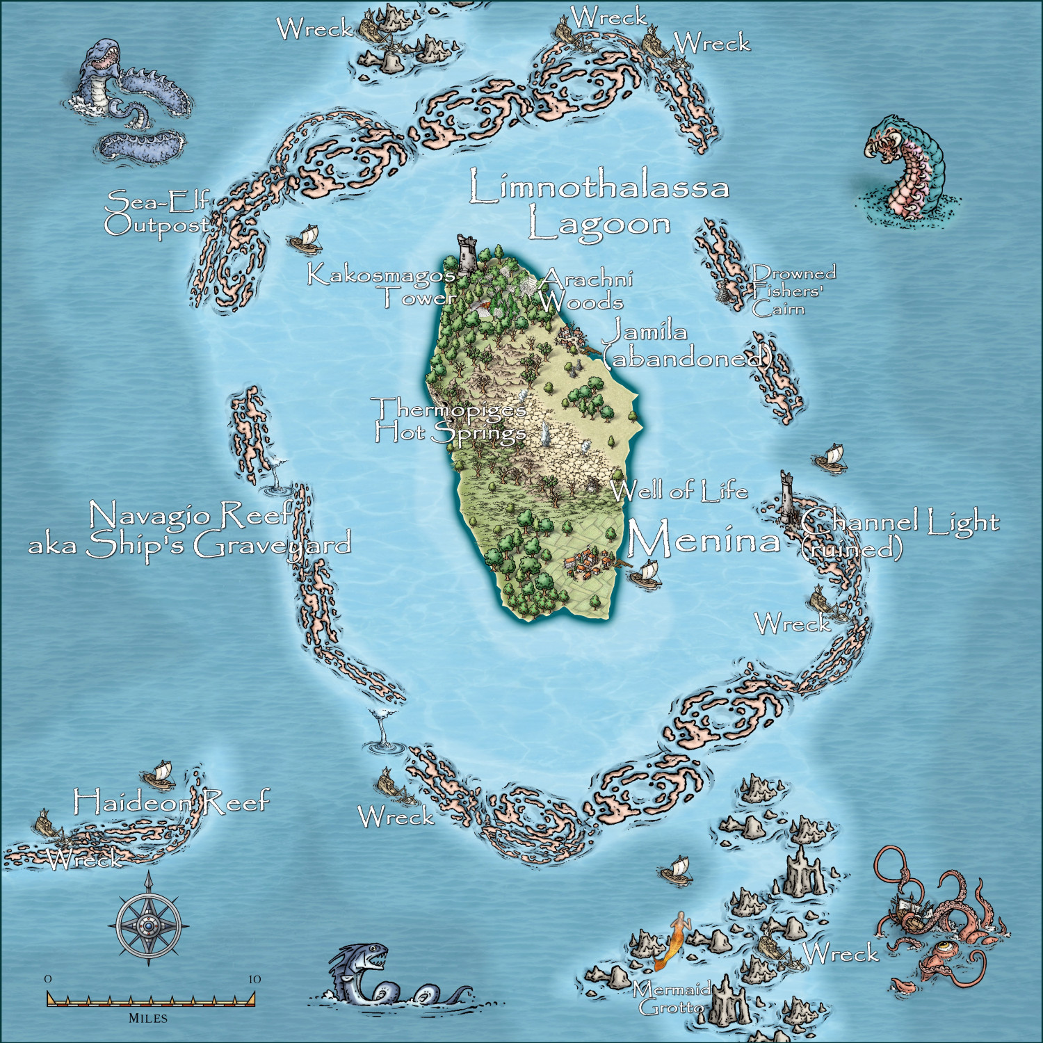
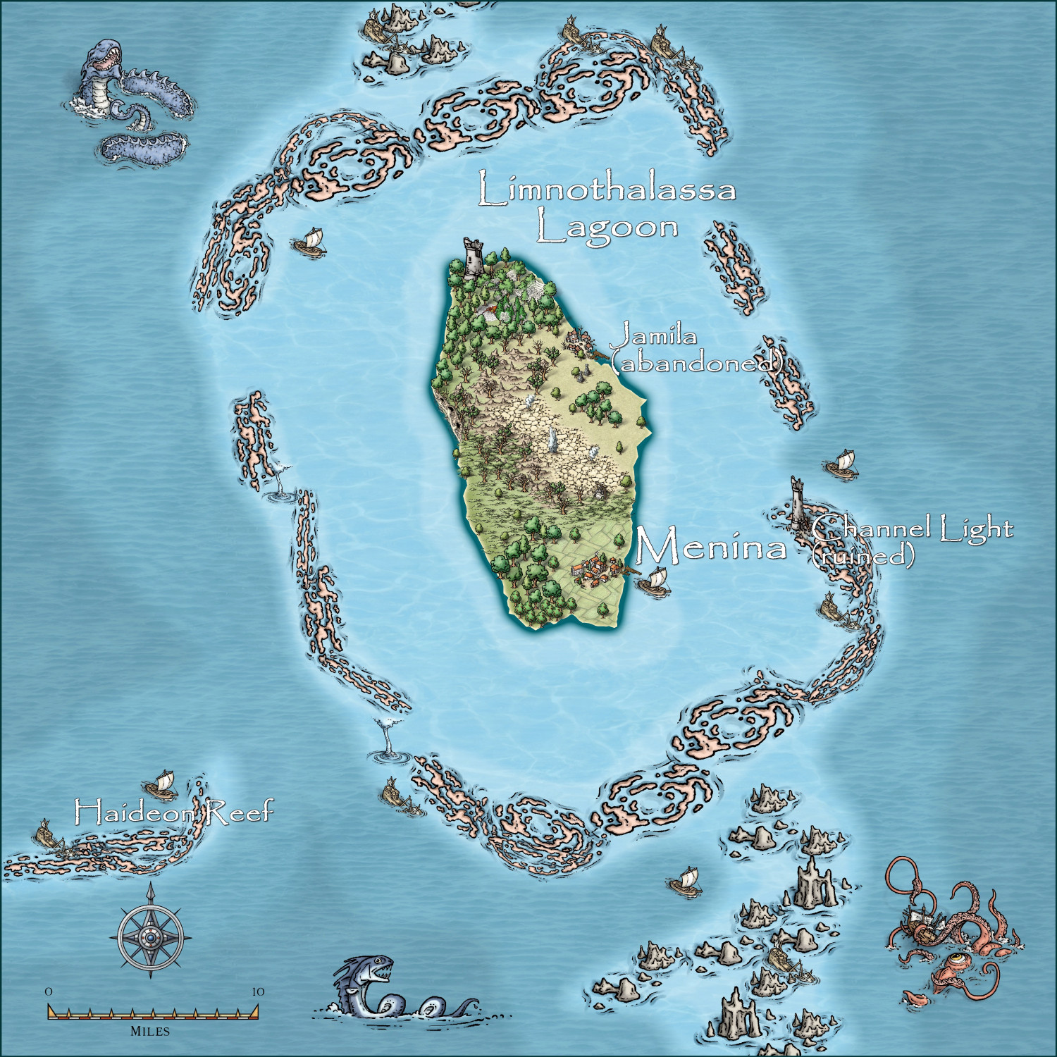
I have finished the write-up for this island, and it is ready to go to Monsen for inclusion in the Atlas, once the site of the Sea-Elf outpost is validated by @Royal Scribe .
Sites of Interest
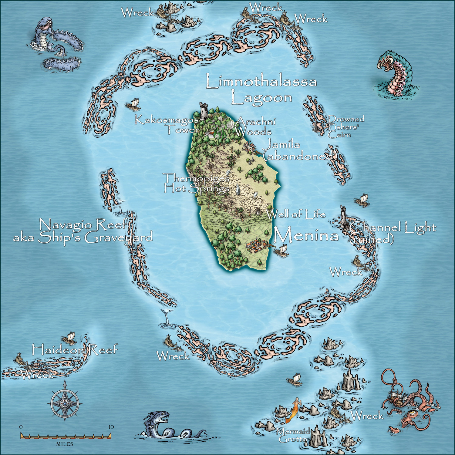
The Navagio Reef , or Ship’s Graveyard, is aptly named. Overall, there are at least 7 major shipwrecks still visible on the reef.
Menina: This small fishing village is the only populated area on the island. It numbers 526 hardy fisherfolk, whose only export is the delicious reef squid, called Jalomori. They subsist on the fruits of the sea = squid, fish, shellfish, and even the occasional seal who have a colony in the southern part of the surrounding reef. The island is rather isolated from the mainland, but there is a monthly service from Tartateos, which buys most of its exports.
Jamila (abandoned): An abandoned fishing village. The real reason for its abandonment over 20 years ago is uncertain, but horror tales of denizens from the atoll lagoon dragging all the females to the depths is the most retold cause. Certainly it may explain why at the end, there were only 15 men still living in the village. And in fact, one old man remains, swearing revenge for the loss of his wife and 2 daughters.
Kakosmagos Tower (ruins): a ruined edifice far predating any other settlement or structure on the island. Many myths about it abound – but the reality is that it is the lair of an amphibious frog-like monster family of five – who actually were the cause of the slaughter of the females from Jamila, which are the ideal medium for incubation of the eggs of the monsters. Luckily, only 25 ‘tadpoles’ have ever hatched, but in about a decade, when these slow developing and long lived horrors mature, the whole island is in terrible danger. The original purpose was the home of a family of three ‘marine biologists’ who dappled in hybridization of land and marine life forms – and the Froggies, as they are called, were born!!
Thermopiges Hot Springs: A most unusual geologic feature are these 5 hot springs, carrying heated seawater from an underground magma vent to the surface with occasional scalding geysers. In these hot pools, a family of semi-intelligent fire salamanders thrive. Whether they are a danger to humans remains to be tested.
Well of Life: This is yet another spring, but here the water is heavily laden with minerals which truly do have a healing power, though repeated drinking gives the skin a silvery hue.
Arachni Woods: This creepy forest is the home of huge spiders with very long spindly legs, and a paralyzing poison. Luckily, they prefer fish to human flesh, though on several occasions over the last decades, human children have been captured, and one even eaten by the creatures before rescue could occur. They are very difficult to catch due to their high agility, and as they mostly leave humans alone, humans mainly leave them alone.
Channel Light (ruins): an old abandoned lighthouse. As the fisherfolk know their way around very well, the lack of a light helps keep would-be pirates away. However, it has served a more sinister purpose over past decades – when lit, it promises safe passage for any approaching vessels, only for the light to be extinguished, then a false light being lit some time later, resulting in the wreck of the vessel and thus providing useful items for the fisherfolk. However, under more recent leadership at Memina, this wrecking behaviour has been stopped.
Drowned Fishers’ Cairn: This cairn represents possibly the most important spiritual focus of the island. Every person lost at sea is represented by a rock with the name and ancestry of the drowned victim, place amid ceremony on a growing mound of such rocks. Many believe this prevents the drowned spirits form haunting the island and driving away the fish and jalomori. In recent years, belief has also arisen that they are now protective spirits and those who adhere to this belief adorn the cairn with shells every full moon.
Mermaid Grotto: This reef, which is largely coral, with underwater grottos, is the home for sea-dwelling creatures – be they mermaids, undines, sea-elves, no one knows for sure, as they keep themselves hidden. They are fickle in nature – sometimes luring ships to a watery grave, hence the wrecks; sometime saving sailors from drowning. Overall, there are at least 7 major shipwrecks still visible on the reef.
Sea-Elf Outpost: See the relevant map for further notes.
-
Watabou City REVISED (annual 157)
-
Watabou City REVISED (annual 157)
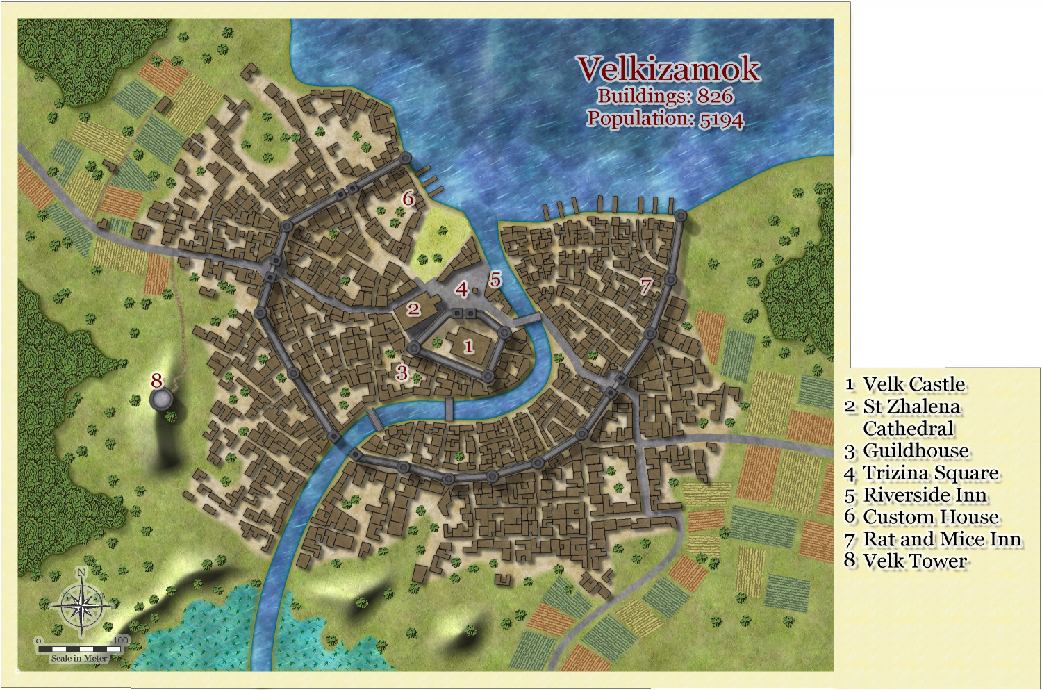
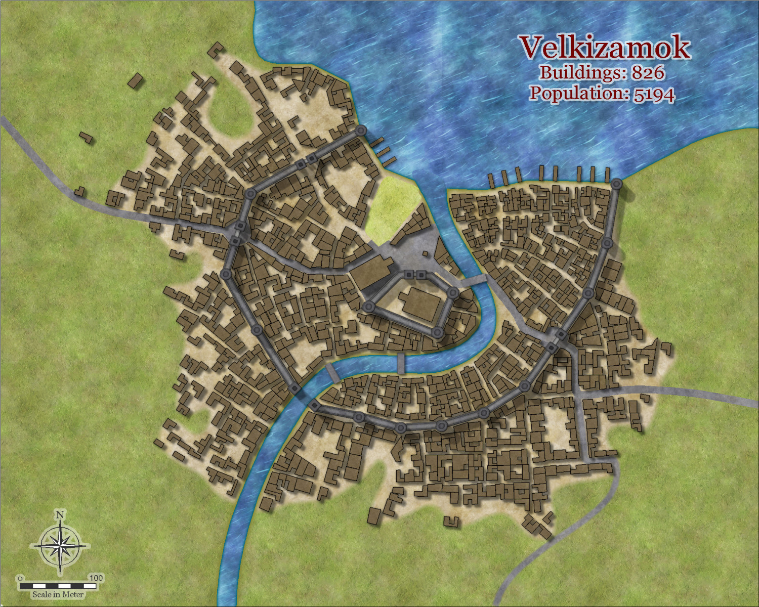
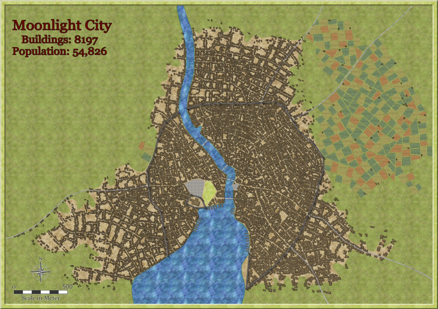
I decided to really test the system and do a large city using the method above. This took just over 60 minutes, but not so bad really for this size city. FCW included if anyone wants to use it. I haven't added anything extra to what the actual city generated, ie no trees, hills, forests, swamps, invading troops, cluster bombs etc - the sort of normal stuff any city has these days.
Larger version in gallery.
I didn't bother to use Shaded polygon by Edge on the fields - i would do so if I was going to develop this city further. Does anyone want me to - perhaps an Atlas add?
-
Community Atlas - Irisian City States - Menina Island
-
Community Atlas - Irisian City States - Menina Island
-
Community Atlas - Irisian City States - Pragites Isles
-
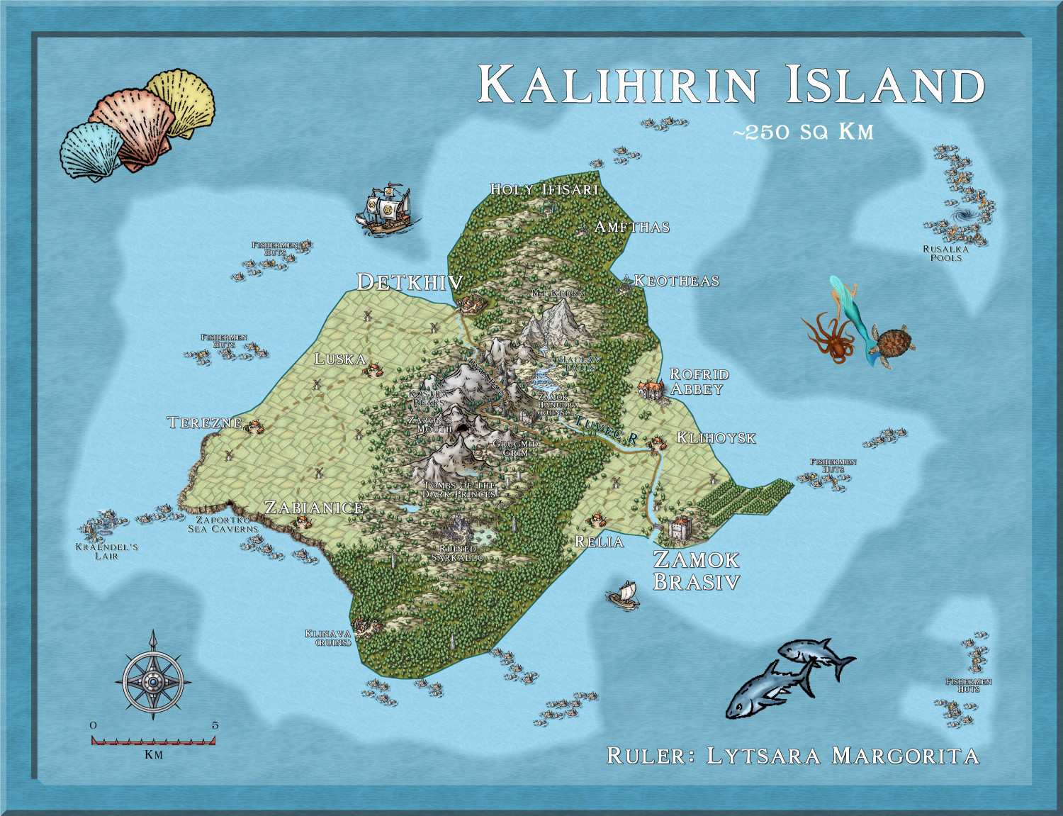
Hardin Region (Myirandios) - Isle of Kalihirin, and Isle of adventure for low level characters.
Update on the Island Of Kalihirin - it is complete. Now for the write up, then mapping each site.
The island has an area of about 255 sq km, a bit smaller than the Caribbean nation of St Kitts and Nevis, which has a population of about 50,000. So plenty of room for lots of adventure. I always worry about putting too much on a small island, but I am reassured by real world examples. I guess living in the massively big and massively underpopulated country of Australia, where a 100 km drive is considered nothing, makes me leery of putting too much on a small island, like UK or St Kitts and Nevis.
Saint Kitts and Nevis - Simple English Wikipedia, the free encyclopedia
Larger version in gallery
-
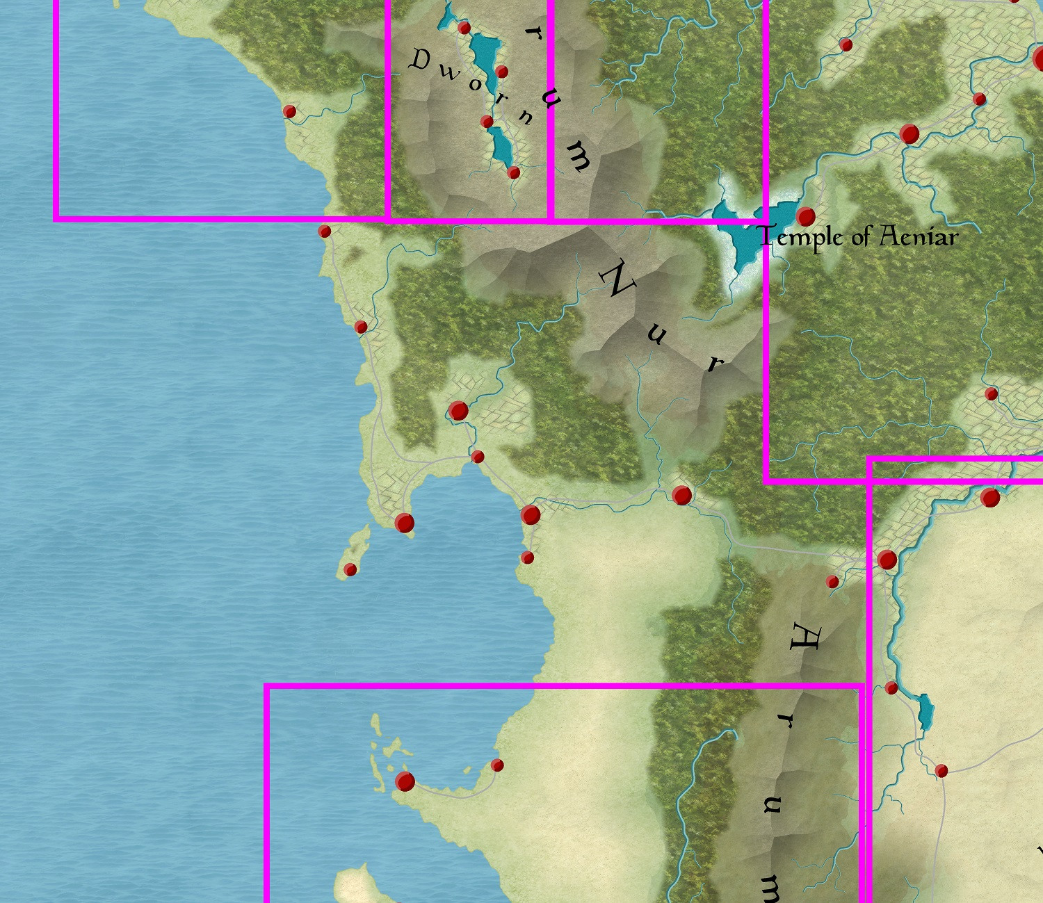
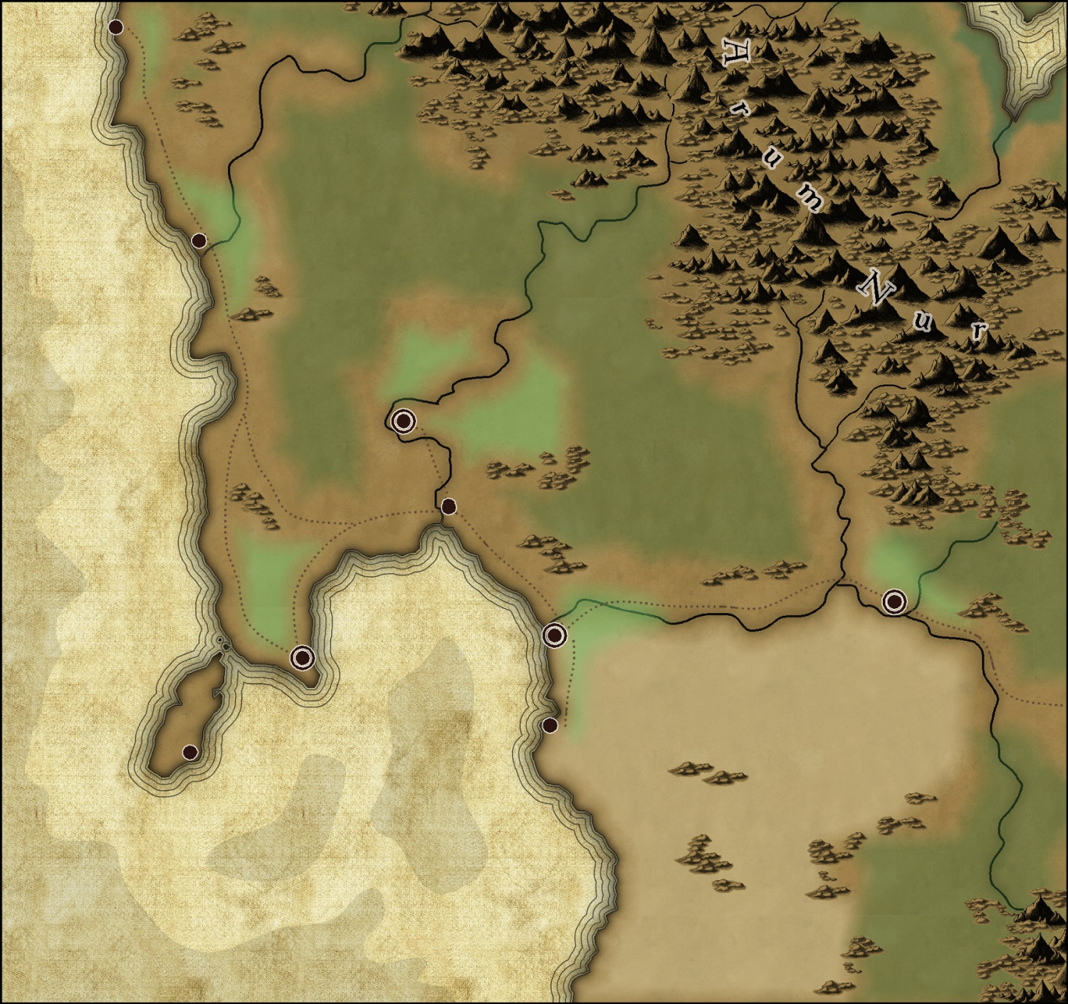
Community Atlas - Berenur - The Bucesi Nations


